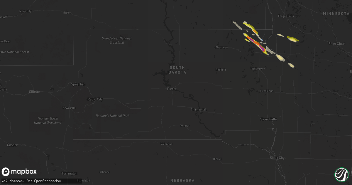
Hail Map in South Dakota on July 20, 2022
Get this storm
July 20 map
$229
one time, instant access
Download today. No call, no setup
Keep the $229
Bought the map and want the full workflow? Apply the entire $229 to a subscription within 7 days. None of it is wasted.
Every map, not just this one
This buys you this map. Subscription and you get every map we run, in the markets you choose from a few cities to whole states to nationwide. Plus real-time alerts the moment a storm fires.
Contact data
Name, contact info, occupancy, even credit band for addresses in the footprint. You go from where it hit to who to call.
Become the source they trust
Unlimited branding weather history reports on demand. You already have the documented answer ready for the property owner, and you are the one who showed up with it.
Property data and RoofTrace estimates
Pull up any address you have got, its value and the exact code rules for that jurisdiction, straight from One Click Code. Then RoofTrace estimates the squares, pitch, and roof value, priced the way you price.
Storm reports in South Dakota
South Dakota
| Date | Description |
|---|---|
| 07/20/20222:51 AM CDT | At 751 PM CDT, a severe thunderstorm was located over Clear Lake Rec Area, or 16 miles west of Sisseton, moving southeast at 45 mph. HAZARD...Ping pong ball size hail and 60 mph wind gusts. SOURCE...Radar indicated. IMPACT...People and animals outdoors will be injured. Expect hail damage to roofs, siding, windows, and vehicles. Expect wind damage to roofs, siding, and trees. This severe thunderstorm will be near... Sica Hollow State Park around 755 PM CDT. Buffalo Lakes and Piyas Lake around 800 PM CDT. Pickerel Lake Rec Area around 810 PM CDT.Other locations in the path of this severe thunderstorm includeAgency Village, Peever, Finley Heights Housing, Rudebusch Corner,Peever Flats Housing and Wilmot. |
| 07/20/20222:49 AM CDT | At 749 PM CDT, a severe thunderstorm was located over Dakota Connection & Casino, or over Sisseton, moving southeast at 45 mph. HAZARD...60 mph wind gusts and quarter size hail. SOURCE...Radar indicated. IMPACT...Hail damage to vehicles is expected. Expect wind damage to roofs, siding, and trees. This severe thunderstorm will be near... Peever, Lake Traverse Housing Units and Traverse Country Park around 800 PM CDT. Browns Valley and Peever Flats Housing around 805 PM CDT.Other locations in the path of this severe thunderstorm includeBeardsley, Yankeetown, Barry, Bonanza Grove, Lismore Colony, BigStone Lake and Big Stone Colony. |
| 07/20/20221:57 AM CDT | At 657 PM CDT, a severe thunderstorm was located over Straubville, or 61 miles south of Valley City, moving southeast at 45 mph. HAZARD...60 mph wind gusts and quarter size hail. SOURCE...Radar indicated. IMPACT...Hail damage to vehicles is expected. Expect wind damage to roofs, siding, and trees. This severe thunderstorm will be near... Cogswell around 700 PM CDT. Brampton around 705 PM CDT. Havana around 715 PM CDT. |
| 07/20/20221:29 AM CDT | At 628 PM CDT, a severe thunderstorm was located near Gwinner, or 47 miles south of Valley City, moving southeast at 35 mph. HAZARD...60 mph wind gusts and quarter size hail. SOURCE...Radar indicated. IMPACT...Hail damage to vehicles is expected. Expect wind damage to roofs, siding, and trees. This severe thunderstorm will be near... Gwinner around 635 PM CDT. Forman and Milnor around 645 PM CDT.Other locations in the path of this severe thunderstorm includeRutland, northwestern Lake Traverse Reservation, Cayuga and Hamlin. |
| 07/19/20228:41 PM CDT | A local report indicates 1.00 inch wind near 5 W CORONA |
| 07/19/20228:24 PM CDT | A local report indicates 60 MPH wind near 7 SSW PEEVER |
| 07/19/20227:56 PM CDT | Several trees down as well as power lines. |
| 07/19/20227:52 PM CDT | A local report indicates 66 MPH wind near SISSETON MUNICIPAL AIRP |
| 07/19/20227:50 PM CDT | A local report indicates 60 MPH wind near SISSETON |
| 07/19/20227:50 PM CDT | Plus pea to a few quarter size hail. |
All States Impacted by Hail Map on July 20, 2022
Cities Impacted by Hail Map on July 20, 2022
- Cogswell, ND
- Britton, SD
- Oakes, ND
- Big Stone City, SD
- Milbank, SD
- Wilmot, SD
- Corona, SD
- Lebanon, TN
- Mount Juliet, TN
- Isle Saint George, OH
- Oregon, OH
- Harbor View, OH
- Middle Bass, OH
- Toledo, OH
- Curtice, OH
- Clayhole, KY
- Berlin Center, OH
- Diamond, OH
- Warren, OH
- Youngstown, OH
- Lake Milton, OH
- Newton Falls, OH
- North Jackson, OH
- Nevada, OH
- Bucyrus, OH
- Ashcamp, KY
- Shelby Gap, KY
- Morris, MN
- Cyrus, MN
- Donnelly, MN
- Warsaw, OH
- Eastview, KY
- Parkers Lake, KY
- Burkesville, KY
- Celina, TN
- Young, AZ
- Gwinner, ND
- Stirum, ND
- Peever, SD
- Sisseton, SD
- Ravenna, OH
- Crestline, OH
- Mansfield, OH
- Rocky Ford, CO
- Mount Sherman, KY
- Dundas, MN
- Faribault, MN
- Northfield, MN
- Hilton Head Island, SC
- Cuthbert, GA
- Shellman, GA
- Mineral Wells, WV
- Walker, WV
- Elizabeth, WV
- Lamoure, ND
- Campbellsville, KY
- Grand Isle, VT
- South Hero, VT
- Herman, MN
- Wheaton, MN
- Greensburg, KY
- Gambier, OH
- Mount Vernon, OH
- Howard, OH
- Marlette, MI
- Fort Branch, IN
- Princeton, IN
- Leitchfield, KY
- Brownsville, KY
- Ashland City, TN
- Chapmansboro, TN
- Owensboro, KY
- Gays Creek, KY
- Jackson, KY
- Marion, ND
- Colorado Springs, CO
- Sandusky, MI
- Applegate, MI
- Brown City, MI
- Carsonville, MI
- Croswell, MI
- Peck, MI
- Monticello, KY
- Tiffin, OH
- Lake City, SD
- Langford, SD
- Eden, SD
- Alto, GA
- Lula, GA
- Manzanola, CO
- Olney Springs, CO
- Magnolia, KY
- Bonnieville, KY
- Bronston, KY
- Burnside, KY
- Petroleum, WV
- Munfordville, KY
- Speedwell, TN
- Whick, KY
- Lost Creek, KY
- Corbin, KY
- Monterey, TN
- Baltimore, OH
- Carroll, OH
- Pleasantville, OH
- Philpot, KY
- Utica, KY
- Reynolds Station, KY
- Whitesville, KY
- Whitesburg, KY
- Eolia, KY
- Cecilia, KY
- Glendale, KY
- Buffalo, KY
- Hodgenville, KY
- Sonora, KY
- Elizabethtown, KY
- Union Mills, NC
- Carmi, IL
- Big Clifty, KY
- Virgie, KY
- Thornton, KY
- Jackhorn, KY
- Neon, KY
- McRoberts, KY
- Millstone, KY
- Jenkins, KY
- Fordsville, KY
- Fostoria, MI
- North Branch, MI
- Otter Lake, MI
- Mayer, AZ
- Holly, MI
- Fenton, MI
- Odessa, MN
- Bellingham, MN
- Madison, MN
- Upper Sandusky, OH
- Edgeley, ND
- Jud, ND
- Dawson, MN
- Watson, MN
- Montevideo, MN
- Mount Gilead, OH
- Cardington, OH
- Marion, KY
- Crab Orchard, KY
- Brodhead, KY
- Whitley City, KY
- Goreville, IL
- Buncombe, IL
- Vienna, IL
- Reader, WV
- Pine Grove, WV
- Powellton, WV
- Montgomery, WV
- Gallagher, WV
- Monroeville, OH
- Plymouth, OH
- Republic, OH
- Attica, OH
- Bloomville, OH
- Willard, OH
- McClure, IL
- Ullin, IL
- Tamms, IL
- Jonesboro, IL
- Cairo, IL
- Maybee, MI
- Willis, MI
- Carleton, MI
- Belleville, MI
- Milan, MI
- Bowling Green, KY
- Mammoth Cave, KY
- Sweeden, KY
- Smiths Grove, KY
- Pall Mall, TN
- Albany, KY
- Williamsburg, KY
- Ocklawaha, FL
- Sparta, TN
- Palm Coast, FL
- Claire City, SD
- Forman, ND
- Havana, ND
- Veblen, SD
- Rutland, ND
- Cayuga, ND
- Lindsay, TX
- Gainesville, TX
- Muenster, TX
- Hardyville, KY
- Horse Cave, KY
- Fullerton, ND
- Norwich, OH
- Chandlersville, OH
- New Concord, OH
- Viper, KY
- Centerburg, OH
- Marengo, OH
- Rickman, TN
- Hebron, OH
- Kirkersville, OH
- Millersport, OH
- Pickerington, OH
- Reynoldsburg, OH
- Pataskala, OH
- Upton, KY
- Robbinsville, NC
- North Street, MI
- Charleston, WV
- Smilax, KY
- Southside, TN
- Sevierville, TN
- Kit Carson, CO
- McDaniels, KY
- Hudson, KY
- Westview, KY
- Yosemite, KY
- Kings Mountain, KY
- Waynesburg, KY
- Liberty, KY
- Swainsboro, GA
- Ooltewah, TN
- Port Orange, FL
- Daytona Beach, FL
- Mims, FL
- Cass City, MI
- Blissfield, OH
- Coshocton, OH
- Rocky Hill, KY
- Knob Lick, KY
- Eighty Eight, KY
- Etoile, KY
- Fountain Run, KY
- Breeding, KY
- Columbia, KY
- Edmonton, KY
- Oakland, KY
- Cub Run, KY
- Bee Spring, KY
- Austin, KY
- Lucas, KY
- Center, KY
- Jamestown, KY
- Caneyville, KY
- Park City, KY
- Mount Hermon, KY
- Clarkson, KY
- Alvaton, KY
- Glasgow, KY
- Beaumont, KY
- Summer Shade, KY
- Cave City, KY
- Tompkinsville, KY
- Gradyville, KY
- Scottsville, KY
- Morgantown, KY
- Ida, MI
- Monroe, MI
- Petersburg, MI
- Dundee, MI
- Columbiaville, MI
- Port Austin, MI
- Linden, MI
- Byron, MI
- Grand Blanc, MI
- Summit, SD
- Twin Brooks, SD
- Whipple, OH
- Canton, MN
- Wooton, KY
- Hazard, KY
- Galion, OH
- Falls Of Rough, KY
- Hardinsburg, KY
- Somerset, KY
- Corydon, KY
- Golconda, IL
- Simpson, IL
- Ozark, IL
- Woodbine, KY
- Crossville, TN
- Green Springs, OH
- Ortonville, MN
- Kent, OH
- Holland, KY
- Crawford, TN
- Marble, NC
- Murphy, NC
- Bessemer City, NC
- Bluffton, SC
- Silver City, NM
- Buckhorn, NM
- Gainesville, GA
- Hixson, TN
- Chattanooga, TN
- Twin City, GA
- Wadmalaw Island, SC
- Rossville, GA
- Fort Oglethorpe, GA
- Ringgold, GA
- Oak Ridge, TN
- Knoxville, TN
- Powell, TN
- Clinton, TN
- Pearce, AZ
- Cochise, AZ
- West Lafayette, OH
- Shorterville, AL
- Abbeville, AL
- Ellijay, GA
- Willcox, AZ
- Cookeville, TN
- Hilham, TN
- Gainesboro, TN
- Dowelltown, TN
- Canmer, KY
- Payson, AZ
- Oak Hill, FL
- Bunnell, FL
- Flagler Beach, FL
- Ormond Beach, FL
- Raywick, KY
- Calhan, CO
- Pine Top, KY
- Springfield, TN
- Henderson, KY
- Coeburn, VA
- Sequatchie, TN
- Whitwell, TN
- Shelby, NC
- Rye, CO
- Big Prairie, OH
- Shreve, OH
- Lakeville, OH
- Loudonville, OH
- Jetson, KY
- Huntsville, TN
- Pioneer, TN
- Kissimmee, FL
- Rhine, GA
- Chauncey, GA
- Eastman, GA
- Evansville, IN
- Haubstadt, IN
- Cumberland Furnace, TN
- Palmyra, TN
- Cunningham, TN
- Sherman, TX
- Whitesboro, TX
- Howe, TX
- Daufuskie Island, SC
- Saint Jo, TX
- Prescott Valley, AZ
- Heiskell, TN
- Pedro, OH
- Evergreen, NC
- Christmas, FL
- Rossford, OH
- Barbourville, KY
- Gray, KY
- Herod, IL
- Eddyville, IL
- Howard, CO
- Roundhill, KY
- Adolphus, KY
- Orlando, FL
- Dallas, NC
- Smithville, TN
- Usaf Academy, CO
- Sassafras, KY
- Vicco, KY
- Redfox, KY
- Baltic, OH
- Millersburg, OH
- Fresno, OH
- Glenmont, OH
- Killbuck, OH
- Dongola, IL
- Anna, IL
- Fort McCoy, FL
- Bradfordsville, KY
- Lebanon, KY
- Edgewater, FL
- Fredericktown, OH
- Ashley, OH
- Science Hill, KY
- Flagstaff, AZ
- Quaker City, OH
- Salesville, OH
- Lore City, OH
- White House, TN
- Cross Plains, TN
- Booneville, KY
- Strawn, TX
- Cherryville, NC
- Kings Mountain, NC
- Gillsville, GA
- Washington, GA
- Edisto Island, SC
- Bridgeport, TX
- Clyo, GA
- Springfield, GA
- Milan, GA
- Conesville, OH
- Springfield, KY
- Loretto, KY
- New Smyrna Beach, FL
- Briceville, TN
- Oliver Springs, TN
- Stonefort, IL
- Mormon Lake, AZ
- Elk Horn, KY
- Gravel Switch, KY
- Letart, WV
- West Columbia, WV
- Harrison, TN
- Starbuck, MN
- Farwell, MN
- Rockholds, KY
- Bryants Store, KY
- Pineville, KY
- Calvin, KY
- Trosper, KY
- Middlesboro, KY
- Strawberry Plains, TN
- New Market, TN
- Joelton, TN
- Whites Creek, TN
- Pleasant View, TN
- Buffalo Valley, TN
- Gordonsville, TN
- Lancaster, TN
- Hickman, TN
- Brush Creek, TN
- Alexandria, TN
- Watertown, TN
- Silver Point, TN
- New Boston, MI
- Romulus, MI
- Detroit, MI
- Lidgerwood, ND
- Marvin, SD
- Tiro, OH
- Lucas, OH
- Holmesville, OH
- Fountain, CO
- Pueblo, CO


