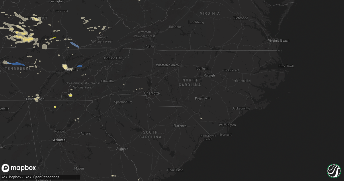
Hail Map in North Carolina on July 20, 2022
Get this storm
July 20 map
$229
one time, instant access
Download today. No call, no setup
Keep the $229
Bought the map and want the full workflow? Apply the entire $229 to a subscription within 7 days. None of it is wasted.
Every map, not just this one
This buys you this map. Subscription and you get every map we run, in the markets you choose from a few cities to whole states to nationwide. Plus real-time alerts the moment a storm fires.
Contact data
Name, contact info, occupancy, even credit band for addresses in the footprint. You go from where it hit to who to call.
Become the source they trust
Unlimited branding weather history reports on demand. You already have the documented answer ready for the property owner, and you are the one who showed up with it.
Property data and RoofTrace estimates
Pull up any address you have got, its value and the exact code rules for that jurisdiction, straight from One Click Code. Then RoofTrace estimates the squares, pitch, and roof value, priced the way you price.
Storm reports in North Carolina
North Carolina
| Date | Description |
|---|---|
| 07/20/20226:56 PM CDT | Tree down on power line causing power outage near/along old aquadale rd. |
| 07/20/20226:48 PM CDT | Multiple trees down across oakboro... Nc. |
| 07/20/20225:00 PM CDT | Powerlines down on whitaker rd. |
| 07/20/20224:18 PM CDT | A couple of trees down between forest city and bostic. |
| 07/20/20223:39 AM CDT | At 839 PM EDT, a severe thunderstorm was located 9 miles northwest of Carthage, moving east at 25 mph. HAZARD...60 mph wind gusts. SOURCE...Radar indicated. IMPACT...Expect damage to roofs, siding, and trees. Locations impacted include... Sanford, Goldston, Robbins, Gum Springs, Cumnock, Harpers Crossroads, Highfalls, Tramway and Glendon. |
| 07/20/20223:16 AM CDT | At 816 PM EDT, a severe thunderstorm was located 9 miles northeast of Ansonville, or 11 miles southwest of Troy, moving east at 35 mph. HAZARD...60 mph wind gusts. SOURCE...Radar indicated. IMPACT...Expect damage to roofs, siding, and trees. Locations impacted include... Troy, Biscoe, Mount Gilead, Ellerbe, Candor, Norman, Uwharrie Haven, Derby, Covington and Pekin. |
| 07/20/20222:52 AM CDT | At 751 PM EDT, a severe thunderstorm was located 10 miles northwest of Ansonville, or 12 miles south of Albemarle, moving southeast at 20 mph. HAZARD...60 mph wind gusts. SOURCE...Radar indicated. IMPACT...Expect damage to roofs, siding, and trees. Locations impacted include... Albemarle, Wadesboro, Ansonville, Polkton, Norwood, Oakboro, Mount Gilead, Peachland, Uwharrie Haven and Covington. |
| 07/20/202212:37 AM CDT | At 537 PM EDT, severe thunderstorms were located along a line extending from 7 miles southwest of Lincolnton to near Shelby, moving southeast at 25 mph. HAZARD...60 mph wind gusts and quarter size hail. SOURCE...Radar indicated. IMPACT...Minor hail damage to vehicles is expected. Expect wind damage to trees and power lines. Locations impacted include... Gastonia, Shelby, Kings Mountain, Mt Holly, Cherryville, Bessemer City, South Gastonia, Clover, Boiling Springs NC and Dallas. |
| 07/20/202212:12 AM CDT | At 512 PM EDT, a severe thunderstorm was located over Forest City, moving southeast at 15 mph. HAZARD...60 mph wind gusts and quarter size hail. SOURCE...Radar indicated. IMPACT...Minor hail damage to vehicles is expected. Expect wind damage to trees and power lines. Locations impacted include... Forest City, Rutherfordton, Spindale, Boiling Springs NC, Ellenboro, Lattimore, Mooresboro, Bostic, Kingstown and Cliffside. |
| 07/19/202211:15 PM CDT | At 414 PM EDT, severe thunderstorms were located along a line extending from 3 miles east of Marion to 10 miles north of Rutherfordton to 9 miles northeast of Hendersonville, moving east at 20 mph. HAZARD...60 mph wind gusts and quarter size hail. SOURCE...Radar indicated. IMPACT...Minor hail damage to vehicles is expected. Expect wind damage to trees and power lines. Locations impacted include... Forest City, Marion, Rutherfordton, Spindale, Glen Alpine, Lake Lure, Polkville, Ellenboro, Lattimore and Mooresboro. |
| 07/19/20227:43 PM CDT | Tree down near putnam-glendon rd and glendon church rd. |
| 07/19/20227:43 PM CDT | Tree down near putnam-glendon rd. |
All States Impacted by Hail Map on July 20, 2022
Cities Impacted by Hail Map on July 20, 2022
- Cogswell, ND
- Britton, SD
- Oakes, ND
- Big Stone City, SD
- Milbank, SD
- Wilmot, SD
- Corona, SD
- Lebanon, TN
- Mount Juliet, TN
- Isle Saint George, OH
- Oregon, OH
- Harbor View, OH
- Middle Bass, OH
- Toledo, OH
- Curtice, OH
- Clayhole, KY
- Berlin Center, OH
- Diamond, OH
- Warren, OH
- Youngstown, OH
- Lake Milton, OH
- Newton Falls, OH
- North Jackson, OH
- Nevada, OH
- Bucyrus, OH
- Ashcamp, KY
- Shelby Gap, KY
- Morris, MN
- Cyrus, MN
- Donnelly, MN
- Warsaw, OH
- Eastview, KY
- Parkers Lake, KY
- Burkesville, KY
- Celina, TN
- Young, AZ
- Gwinner, ND
- Stirum, ND
- Peever, SD
- Sisseton, SD
- Ravenna, OH
- Crestline, OH
- Mansfield, OH
- Rocky Ford, CO
- Mount Sherman, KY
- Dundas, MN
- Faribault, MN
- Northfield, MN
- Hilton Head Island, SC
- Cuthbert, GA
- Shellman, GA
- Mineral Wells, WV
- Walker, WV
- Elizabeth, WV
- Lamoure, ND
- Campbellsville, KY
- Grand Isle, VT
- South Hero, VT
- Herman, MN
- Wheaton, MN
- Greensburg, KY
- Gambier, OH
- Mount Vernon, OH
- Howard, OH
- Marlette, MI
- Fort Branch, IN
- Princeton, IN
- Leitchfield, KY
- Brownsville, KY
- Ashland City, TN
- Chapmansboro, TN
- Owensboro, KY
- Gays Creek, KY
- Jackson, KY
- Marion, ND
- Colorado Springs, CO
- Sandusky, MI
- Applegate, MI
- Brown City, MI
- Carsonville, MI
- Croswell, MI
- Peck, MI
- Monticello, KY
- Tiffin, OH
- Lake City, SD
- Langford, SD
- Eden, SD
- Alto, GA
- Lula, GA
- Manzanola, CO
- Olney Springs, CO
- Magnolia, KY
- Bonnieville, KY
- Bronston, KY
- Burnside, KY
- Petroleum, WV
- Munfordville, KY
- Speedwell, TN
- Whick, KY
- Lost Creek, KY
- Corbin, KY
- Monterey, TN
- Baltimore, OH
- Carroll, OH
- Pleasantville, OH
- Philpot, KY
- Utica, KY
- Reynolds Station, KY
- Whitesville, KY
- Whitesburg, KY
- Eolia, KY
- Cecilia, KY
- Glendale, KY
- Buffalo, KY
- Hodgenville, KY
- Sonora, KY
- Elizabethtown, KY
- Union Mills, NC
- Carmi, IL
- Big Clifty, KY
- Virgie, KY
- Thornton, KY
- Jackhorn, KY
- Neon, KY
- McRoberts, KY
- Millstone, KY
- Jenkins, KY
- Fordsville, KY
- Fostoria, MI
- North Branch, MI
- Otter Lake, MI
- Mayer, AZ
- Holly, MI
- Fenton, MI
- Odessa, MN
- Bellingham, MN
- Madison, MN
- Upper Sandusky, OH
- Edgeley, ND
- Jud, ND
- Dawson, MN
- Watson, MN
- Montevideo, MN
- Mount Gilead, OH
- Cardington, OH
- Marion, KY
- Crab Orchard, KY
- Brodhead, KY
- Whitley City, KY
- Goreville, IL
- Buncombe, IL
- Vienna, IL
- Reader, WV
- Pine Grove, WV
- Powellton, WV
- Montgomery, WV
- Gallagher, WV
- Monroeville, OH
- Plymouth, OH
- Republic, OH
- Attica, OH
- Bloomville, OH
- Willard, OH
- McClure, IL
- Ullin, IL
- Tamms, IL
- Jonesboro, IL
- Cairo, IL
- Maybee, MI
- Willis, MI
- Carleton, MI
- Belleville, MI
- Milan, MI
- Bowling Green, KY
- Mammoth Cave, KY
- Sweeden, KY
- Smiths Grove, KY
- Pall Mall, TN
- Albany, KY
- Williamsburg, KY
- Ocklawaha, FL
- Sparta, TN
- Palm Coast, FL
- Claire City, SD
- Forman, ND
- Havana, ND
- Veblen, SD
- Rutland, ND
- Cayuga, ND
- Lindsay, TX
- Gainesville, TX
- Muenster, TX
- Hardyville, KY
- Horse Cave, KY
- Fullerton, ND
- Norwich, OH
- Chandlersville, OH
- New Concord, OH
- Viper, KY
- Centerburg, OH
- Marengo, OH
- Rickman, TN
- Hebron, OH
- Kirkersville, OH
- Millersport, OH
- Pickerington, OH
- Reynoldsburg, OH
- Pataskala, OH
- Upton, KY
- Robbinsville, NC
- North Street, MI
- Charleston, WV
- Smilax, KY
- Southside, TN
- Sevierville, TN
- Kit Carson, CO
- McDaniels, KY
- Hudson, KY
- Westview, KY
- Yosemite, KY
- Kings Mountain, KY
- Waynesburg, KY
- Liberty, KY
- Swainsboro, GA
- Ooltewah, TN
- Port Orange, FL
- Daytona Beach, FL
- Mims, FL
- Cass City, MI
- Blissfield, OH
- Coshocton, OH
- Rocky Hill, KY
- Knob Lick, KY
- Eighty Eight, KY
- Etoile, KY
- Fountain Run, KY
- Breeding, KY
- Columbia, KY
- Edmonton, KY
- Oakland, KY
- Cub Run, KY
- Bee Spring, KY
- Austin, KY
- Lucas, KY
- Center, KY
- Jamestown, KY
- Caneyville, KY
- Park City, KY
- Mount Hermon, KY
- Clarkson, KY
- Alvaton, KY
- Glasgow, KY
- Beaumont, KY
- Summer Shade, KY
- Cave City, KY
- Tompkinsville, KY
- Gradyville, KY
- Scottsville, KY
- Morgantown, KY
- Ida, MI
- Monroe, MI
- Petersburg, MI
- Dundee, MI
- Columbiaville, MI
- Port Austin, MI
- Linden, MI
- Byron, MI
- Grand Blanc, MI
- Summit, SD
- Twin Brooks, SD
- Whipple, OH
- Canton, MN
- Wooton, KY
- Hazard, KY
- Galion, OH
- Falls Of Rough, KY
- Hardinsburg, KY
- Somerset, KY
- Corydon, KY
- Golconda, IL
- Simpson, IL
- Ozark, IL
- Woodbine, KY
- Crossville, TN
- Green Springs, OH
- Ortonville, MN
- Kent, OH
- Holland, KY
- Crawford, TN
- Marble, NC
- Murphy, NC
- Bessemer City, NC
- Bluffton, SC
- Silver City, NM
- Buckhorn, NM
- Gainesville, GA
- Hixson, TN
- Chattanooga, TN
- Twin City, GA
- Wadmalaw Island, SC
- Rossville, GA
- Fort Oglethorpe, GA
- Ringgold, GA
- Oak Ridge, TN
- Knoxville, TN
- Powell, TN
- Clinton, TN
- Pearce, AZ
- Cochise, AZ
- West Lafayette, OH
- Shorterville, AL
- Abbeville, AL
- Ellijay, GA
- Willcox, AZ
- Cookeville, TN
- Hilham, TN
- Gainesboro, TN
- Dowelltown, TN
- Canmer, KY
- Payson, AZ
- Oak Hill, FL
- Bunnell, FL
- Flagler Beach, FL
- Ormond Beach, FL
- Raywick, KY
- Calhan, CO
- Pine Top, KY
- Springfield, TN
- Henderson, KY
- Coeburn, VA
- Sequatchie, TN
- Whitwell, TN
- Shelby, NC
- Rye, CO
- Big Prairie, OH
- Shreve, OH
- Lakeville, OH
- Loudonville, OH
- Jetson, KY
- Huntsville, TN
- Pioneer, TN
- Kissimmee, FL
- Rhine, GA
- Chauncey, GA
- Eastman, GA
- Evansville, IN
- Haubstadt, IN
- Cumberland Furnace, TN
- Palmyra, TN
- Cunningham, TN
- Sherman, TX
- Whitesboro, TX
- Howe, TX
- Daufuskie Island, SC
- Saint Jo, TX
- Prescott Valley, AZ
- Heiskell, TN
- Pedro, OH
- Evergreen, NC
- Christmas, FL
- Rossford, OH
- Barbourville, KY
- Gray, KY
- Herod, IL
- Eddyville, IL
- Howard, CO
- Roundhill, KY
- Adolphus, KY
- Orlando, FL
- Dallas, NC
- Smithville, TN
- Usaf Academy, CO
- Sassafras, KY
- Vicco, KY
- Redfox, KY
- Baltic, OH
- Millersburg, OH
- Fresno, OH
- Glenmont, OH
- Killbuck, OH
- Dongola, IL
- Anna, IL
- Fort McCoy, FL
- Bradfordsville, KY
- Lebanon, KY
- Edgewater, FL
- Fredericktown, OH
- Ashley, OH
- Science Hill, KY
- Flagstaff, AZ
- Quaker City, OH
- Salesville, OH
- Lore City, OH
- White House, TN
- Cross Plains, TN
- Booneville, KY
- Strawn, TX
- Cherryville, NC
- Kings Mountain, NC
- Gillsville, GA
- Washington, GA
- Edisto Island, SC
- Bridgeport, TX
- Clyo, GA
- Springfield, GA
- Milan, GA
- Conesville, OH
- Springfield, KY
- Loretto, KY
- New Smyrna Beach, FL
- Briceville, TN
- Oliver Springs, TN
- Stonefort, IL
- Mormon Lake, AZ
- Elk Horn, KY
- Gravel Switch, KY
- Letart, WV
- West Columbia, WV
- Harrison, TN
- Starbuck, MN
- Farwell, MN
- Rockholds, KY
- Bryants Store, KY
- Pineville, KY
- Calvin, KY
- Trosper, KY
- Middlesboro, KY
- Strawberry Plains, TN
- New Market, TN
- Joelton, TN
- Whites Creek, TN
- Pleasant View, TN
- Buffalo Valley, TN
- Gordonsville, TN
- Lancaster, TN
- Hickman, TN
- Brush Creek, TN
- Alexandria, TN
- Watertown, TN
- Silver Point, TN
- New Boston, MI
- Romulus, MI
- Detroit, MI
- Lidgerwood, ND
- Marvin, SD
- Tiro, OH
- Lucas, OH
- Holmesville, OH
- Fountain, CO
- Pueblo, CO


