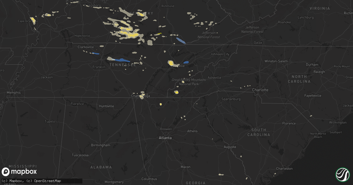
Hail Map on July 20, 2022
Get this storm
July 20 map
$229
one time, instant access
Download today. No call, no setup
Keep the $229
Bought the map and want the full workflow? Apply the entire $229 to a subscription within 7 days. None of it is wasted.
Every map, not just this one
This buys you this map. Subscription and you get every map we run, in the markets you choose from a few cities to whole states to nationwide. Plus real-time alerts the moment a storm fires.
Contact data
Name, contact info, occupancy, even credit band for addresses in the footprint. You go from where it hit to who to call.
Become the source they trust
Unlimited branding weather history reports on demand. You already have the documented answer ready for the property owner, and you are the one who showed up with it.
Property data and RoofTrace estimates
Pull up any address you have got, its value and the exact code rules for that jurisdiction, straight from One Click Code. Then RoofTrace estimates the squares, pitch, and roof value, priced the way you price.
States Impacted by Hail Map on July 20, 2022
Storm reports
Texas
| Date | Description |
|---|---|
| 07/20/20226:26 PM CDT | Reports of damage: barn blown down... Debris... And tree down. |
| 07/20/20226:12 PM CDT | 200 blk runaway bay dr has a house with major structure damage; other reports of tree damage. |
| 07/20/20226:12 PM CDT | Reports of structural damage due to winds at a taco bell in gainesville. |
| 07/20/20226:00 PM CDT | Corrects previous tstm wnd dmg report from runaway bay. 200 blk runaway bay dr has a house with major structure damage; other reports of tree damage. Happened approxima |
| 07/20/20225:43 PM CDT | Media partner relayed public report: cattle trainer blown over and large tree snapped in lindsay. Time estimated by radar. |
| 07/20/20225:36 PM CDT | Report of a house damaged by high winds on cr 1770 in the northwest portion of the county; getting reports of multiple trees down. Cr 1591... Cr 1770... Cr1785. |
| 07/20/20225:25 PM CDT | Social media report of large limbs and a few trees down just north of muenster. |
| 07/20/20225:08 PM CDT | 5 miles northeast of forestburg on the montague/cooke county line. 1.02 measured rain so far and wind gusts est 50-60 mph approximately 10 minutes ago. Small limbs down |
| 07/20/20222:27 AM CDT | At 726 PM CDT, a severe thunderstorm was located just west of Strawn, moving southwest at 10 mph. HAZARD...60 mph wind gusts and nickel size hail. SOURCE...Radar indicated. IMPACT...Expect damage to roofs, siding, and trees. Locations impacted include... Eastland, Ranger, Tiffin, Morton Valley, Olden, and Strawn. This includes Interstate 20 between mile markers 340 and 363. |
| 07/20/20221:43 AM CDT | At 643 PM CDT, a severe thunderstorm was located near Collinsville, and is nearly stationary. HAZARD...60 mph wind gusts and nickel size hail. SOURCE...Radar indicated. IMPACT...Expect damage to roofs, siding, and trees. Locations impacted include... Sherman, Whitesboro, Van Alstyne, Howe, Gunter, Knollwood, Dorchester, Southmayd, Sadler and Luella. |
| 07/20/20221:40 AM CDT | At 638 PM CDT, a severe thunderstorm was located near Metcalf Gap and Palo Pinto, moving southeast around 5 mph. HAZARD...60 mph wind gusts and nickel size hail. SOURCE...Radar indicated. IMPACT...Expect damage to roofs, siding, and trees. Locations impacted include... Mineral Wells, Gordon, Strawn, Palo Pinto, Metcalf Gap, Brad, Santo, Brazos, and Mingus. This includes Interstate 20 between mile markers 369 and 370. |
| 07/20/202212:56 AM CDT | At 556 PM CDT, a severe thunderstorm was located near Boonsville, or 10 miles southwest of Bridgeport, and is nearly stationary. HAZARD...60 mph wind gusts and nickel size hail. SOURCE...Radar indicated. IMPACT...Expect damage to roofs, siding, and trees. Locations impacted include... Bridgeport, Boonsville, Cottondale, Runaway Bay and Lake Bridgeport. |
| 07/20/202212:26 AM CDT | At 525 PM CDT, a severe thunderstorm was located near Muenster, or 11 miles west of Gainesville, moving southeast at 5 mph. HAZARD...60 mph wind gusts and nickel size hail. SOURCE...Radar indicated. IMPACT...Expect damage to roofs, siding, and trees. Locations impacted include... Gainesville, Muenster, Lindsay, Era, Leo and Valley View. This includes Interstate 35 between mile markers 482 and 501. |
| 07/19/202211:50 PM CDT | At 449 PM CDT, a severe thunderstorm was located over Muenster and is nearly stationary. HAZARD...65 mph wind gusts and quarter size hail. SOURCE...Radar indicated. IMPACT...Hail damage to vehicles is expected. Expect wind damage to roofs, siding, and trees. Locations impacted include... Muenster, Myra. |
Florida
| Date | Description |
|---|---|
| 07/20/20224:27 PM CDT | Holmes county sheriff office reported powerlines down near 2030 hwy-179. |
| 07/20/20224:27 PM CDT | Holmes county sheriff office reported downed trees on hathaway mill rd & tobe retherford rd. |
| 07/20/20222:35 PM CDT | Power lines down as a result of a tree falling. |
| 07/20/20221:45 PM CDT | Marion county fr advises of storm damage to one home near ocklawaha. Caller states that the roof over the back porch sustained damage due to thunderstorm winds. |
| 07/20/20221:12 PM CDT | Strong thunderstorm winds knocked multiple trees down in a few backyards on morning light rd. |
| 07/19/202211:53 PM CDT | At 452 PM CDT, a severe thunderstorm was located 9 miles northwest of Eglin Air Force Base, or 10 miles northeast of Niceville, moving east at 20 mph. HAZARD...60 mph wind gusts. SOURCE...Radar indicated. IMPACT...Expect damage to roofs, siding, and trees. Locations impacted include... De Funiak Springs, Eglin Air Force Base, Oakwood Hills, Pleasant Ridge, Alpine Heights, New Home, De Funiak Spring Airport, Rock Hill and Mossy Head. |
| 07/19/202211:35 PM CDT | At 434 PM CDT, a severe thunderstorm was located 8 miles south of Crestview, moving east at 25 mph. HAZARD...60 mph wind gusts. SOURCE...Radar indicated. IMPACT...Expect damage to roofs, siding, and trees. Locations impacted include... Crestview. |
| 07/19/202210:39 PM CDT | At 339 PM EDT, a severe thunderstorm was located over Port Orange, moving east at 10 mph. HAZARD...60 mph wind gusts and quarter size hail. SOURCE...Radar indicated. IMPACT...Hail damage to vehicles is expected. Expect wind damage to roofs, siding, and trees. Locations impacted include... Daytona Beach, Port Orange, New Smyrna Beach, South Daytona and Holly Hill. |
| 07/19/202210:10 PM CDT | At 309 PM CDT, a severe thunderstorm was located 10 miles west of Bonifay, moving east at 15 mph. HAZARD...60 mph wind gusts and quarter size hail. SOURCE...Radar indicated. IMPACT...Hail damage to vehicles is expected. Expect wind damage to roofs, siding, and trees. Locations impacted include... Bonifay, Ponce De Leon, Caryville, Esto, Westville, Miller Crossroads, Cerrogordo, Bethlehem, Gritney, Holland Crossroads, Ards Crossroads, Hulaw, Hickory Hill, Izagora, Baker Settlement, Poplar Head and Johnson Crossroads. |
| 07/19/20229:12 PM CDT | At 212 PM EDT, a severe thunderstorm was located over Moss Bluff, or 8 miles north of Emeralda, moving northeast at 10 mph. HAZARD...60 mph wind gusts and penny size hail. SOURCE...Radar indicated. IMPACT...Expect damage to roofs, siding, and trees. Locations impacted include... Moss Bluff. |
Colorado
| Date | Description |
|---|---|
| 07/20/20223:46 PM CDT | Mesonet station fw6605 founatin. |
| 07/19/202210:40 PM CDT | At 340 PM MDT, severe thunderstorms were located along a line extending from 18 miles southeast of Truckton to 10 miles east of Boone to 7 miles west of Fowler, moving southeast at 30 mph. HAZARD...60 mph wind gusts. SOURCE...Radar indicated. IMPACT...Expect damage to roofs, siding, and trees. Severe thunderstorms will be near... Fowler around 350 PM MDT. Olney Springs around 405 PM MDT. Manzanola around 415 PM MDT. Ordway and Crowley around 425 PM MDT. Sugar City around 430 PM MDT. Rocky Ford around 445 PM MDT. Swink and Cheraw around 455 PM MDT. La Junta around 500 PM MDT. |
| 07/19/202210:23 PM CDT | At 322 PM MDT, severe thunderstorms were located along a line extending from 24 miles south of Blende to 15 miles northeast of Walsenburg, moving east at 15 mph. HAZARD...60 mph wind gusts and quarter size hail. SOURCE...Radar indicated. IMPACT...Hail damage to vehicles is expected. Expect wind damage to roofs, siding, and trees. These severe thunderstorms will remain over mainly rural areas of northeastern Huerfano, north central Las Animas and south central Pueblo Counties. |
| 07/19/20229:44 PM CDT | At 243 PM MDT, severe thunderstorms were located along a line extending from near Fountain to Pinon, moving east at 25 mph. HAZARD...60 mph wind gusts and quarter size hail. SOURCE...Radar indicated. IMPACT...Hail damage to vehicles is expected. Expect wind damage to roofs, siding, and trees. Locations impacted include... Northeastern Pueblo, Boone, Avondale, Hanover, Pueblo Depot and Pueblo West. This also includes Highway 50 east of Pueblo. |
| 07/19/20229:12 PM CDT | At 210 PM MDT, severe thunderstorms were located along a line extending from near Fort Carson to 6 miles northeast of Penrose, moving east at 25 mph. HAZARD...60 mph wind gusts and quarter size hail. SOURCE...Radar indicated. IMPACT...Hail damage to vehicles is expected. Expect wind damage to roofs, siding, and trees. Locations impacted include... Southern Colorado Springs, Fountain, Fort Carson, Pinon and Security-Widefield. |
South Carolina
| Date | Description |
|---|---|
| 07/20/20221:00 PM CDT | Schp reported a tree down near the intersection of wild turkey trail and bubbas drive. Time determined from radar data. |
| 07/20/202212:54 PM CDT | A large oak tree was uprooted near the 500 block of jackson avenue east. |
| 07/20/202212:54 PM CDT | Schp reported a tree down near the intersection of kerrison street and marion street. Time determined from radar data. |
| 07/20/202212:52 PM CDT | The hampton county 911 call center reported a tree down on cemetery road and jackson avenue. |
| 07/19/20228:58 PM CDT | At 158 PM EDT, a severe thunderstorm was located over Almeda Intersection, moving east at 15 mph. HAZARD...60 mph wind gusts and penny size hail. SOURCE...Radar indicated. IMPACT...Expect damage to trees and powerlines. Locations impacted include: Hampton, Yemassee, Varnville, Estill, Furman, Crocketville, Lena, Grays, Hendersonville, Early Branch, Cummings, Gillisonville, McPhersonville and Almeda Intersection.This warning includes I-95 in South Carolina between mile markers 37and 50. |
Michigan
| Date | Description |
|---|---|
| 07/20/20222:32 PM CDT | A post on social media showed hail the size of quarters. Time estimated based on radar. |
| 07/20/20222:08 PM CDT | Detroit metropolitan wayne county airport wind gust |
| 07/20/20222:05 PM CDT | Power outages reported from down trees and power lines. Time estimated on radar. |
| 07/20/20221:43 PM CDT | Dipatch reported wires down southwest of lapeer. Single wire down also reported down in elba along with a power outage reproted in the city of lapeer. |
| 07/20/20221:30 PM CDT | Large tree downed - photos relayed via social media. Time estimated via radar. |
| 07/20/20221:20 PM CDT | Tuscola county central dispatch reports 6-7 trees down across southern tuscola county |
| 07/20/20221:00 PM CDT | Fire department reported several trees and wires down in and around clio and vienna townhip. Amateur radio reported similar damage in the area. |
| 07/20/202212:37 PM CDT | Dispatch reported 20 to 30 trees downed across bay city. Time estimated from radar. |
| 07/20/202212:25 AM CDT | At 525 PM EDT, a severe thunderstorm was located 7 miles west of Port Huron, moving east at 40 mph. HAZARD...60 mph wind gusts and penny size hail. SOURCE...Radar indicated. IMPACT...Expect damage to roofs, siding, and trees. This severe thunderstorm will be near... Port Huron and Lakeport around 535 PM EDT.Other locations impacted by this severe thunderstorm include FortGratiot, North Street, Avoca, Blaine, Goodells, Smiths Creek, Rubyand Wadhams.People attending Goodells County Park should seek safe shelterimmediately! |
| 07/19/202210:10 PM CDT | At 310 PM EDT, severe thunderstorms were located along a line extending from near Lum to near Dryden to near Romeo, moving northeast at 45 mph. HAZARD...60 mph wind gusts and nickel size hail. SOURCE...Radar indicated. IMPACT...Expect damage to roofs, siding, and trees. Severe thunderstorms will be near... Capac and Armada around 325 PM EDT. Yale, Memphis and Emmett around 335 PM EDT. Port Huron and Lakeport around 400 PM EDT.Other locations impacted by these severe thunderstorms include NorthStreet, Goodland Township, Lynn Township, Rattle Run, Goodells,Brockway, Smiths Creek, Wadhams, Riley Center and Fort Gratiot.People attending Goodells County Park should seek safe shelterimmediately! |
| 07/19/20229:54 PM CDT | At 254 PM EDT, severe thunderstorms were located along a line extending from near Taylor to near Ida to near Ottawa Lake, moving northeast at 35 mph. HAZARD...60 mph wind gusts and quarter size hail. SOURCE...Radar indicated. IMPACT...Hail damage to vehicles is expected. Expect wind damage to roofs, siding, and trees. Severe thunderstorms will be near... Romulus and Flat Rock around 300 PM EDT. Taylor, Monroe and Trenton around 305 PM EDT. Carleton and Wyandotte around 310 PM EDT. Temperance around 315 PM EDT. Luna Pier around 330 PM EDT. Grosse Ile around 335 PM EDT.Other locations impacted by these severe thunderstorms includeNewport, Gibraltar, Erie, New Boston, Woodland Beach, Stony Point,Bolles Harbor, Rockwood, Samaria and Ecorse. |
| 07/19/20229:50 PM CDT | At 249 PM EDT, a severe thunderstorm was located near Clifford, or near Marlette, moving east at 40 mph. HAZARD...60 mph wind gusts and nickel size hail. SOURCE...Radar indicated. IMPACT...Expect damage to roofs, siding, and trees. This severe thunderstorm will be near... Brown City around 255 PM EDT. Sandusky and Peck around 315 PM EDT. Croswell around 325 PM EDT. Carsonville and Applegate around 330 PM EDT. Port Sanilac around 340 PM EDT.Other locations impacted by this severe thunderstorm include EastDayton, Birch Beach, McGregor, Wilmot, Amador, Snover, Juhl, Elmer,Silverwood and Valley Center. |
| 07/19/20229:37 PM CDT | At 237 PM EDT, severe thunderstorms were located along a line extending from 6 miles southwest of Port Austin to 6 miles northeast of Gagetown to near Cass City, moving northeast at 50 mph. HAZARD...60 mph wind gusts and penny size hail. SOURCE...Radar indicated. IMPACT...Expect damage to roofs, siding, and trees. Severe thunderstorms will be near... Kinde around 240 PM EDT. Port Austin around 245 PM EDT. Bad Axe and Argyle around 250 PM EDT. Ubly around 255 PM EDT. Port Hope around 310 PM EDT. Harbor Beach around 315 PM EDT.Other locations impacted by these severe thunderstorms includeRedman, Parisville, Huron City, White Rock, Ivanhoe, Rapson,Grindstone City, New Greenleaf, Pinnebog and Tyre. |
| 07/19/20229:34 PM CDT | At 234 PM EDT, severe thunderstorms were located along a line extending from near Hagensville to near Posen to Lachine, moving northeast at 45 mph. HAZARD...60 mph wind gusts. SOURCE...Radar indicated. IMPACT...Expect damage to roofs, siding, and trees. Severe thunderstorms will be near... Thompsons Harbor State Park around 240 PM EDT. Presque Isle Light and Presque Isle around 245 PM EDT. |
| 07/19/20229:23 PM CDT | At 223 PM EDT, a severe thunderstorm was located over Goodrich, or near Grand Blanc, moving east at 40 mph. HAZARD...60 mph wind gusts and quarter size hail. SOURCE...Radar indicated. IMPACT...Hail damage to vehicles is expected. Expect wind damage to roofs, siding, and trees. This severe thunderstorm will be near... Hadley around 235 PM EDT. Lapeer and Metamora around 245 PM EDT. Dryden around 255 PM EDT. Imlay City, Almont and Lum around 300 PM EDT.Other locations impacted by this severe thunderstorm include Atlas,Goodland Township, Lakeville, Attica, Holly State Recreation Area,Leonard and Thornville. |
| 07/19/20228:58 PM CDT | At 158 PM EDT, a severe thunderstorm was located near Flushing, moving northeast at 40 mph. HAZARD...60 mph wind gusts and penny size hail. SOURCE...Radar indicated. IMPACT...Expect damage to roofs, siding, and trees. This severe thunderstorm will be near... Clio, Mount Morris and Crossroads Village around 205 PM EDT. Otisville around 220 PM EDT. Millington and Otter Lake around 225 PM EDT. Columbiaville around 230 PM EDT. Mayville around 240 PM EDT. North Branch and Clifford around 250 PM EDT. Kingston around 255 PM EDT.Other locations impacted by this severe thunderstorm include EastDayton, Burnside, Wilmot, Thetford Township, Kings Mill, Silverwood,Genesee and Fostoria. |
| 07/19/20228:27 PM CDT | At 126 PM EDT, a severe thunderstorm was located near Otsego Lake State Park, or near Gaylord, moving northeast at 30 mph. HAZARD...60 mph wind gusts and half dollar size hail. SOURCE...Radar indicated. IMPACT...Hail damage to vehicles is expected. Expect wind damage to roofs, siding, and trees. This severe thunderstorm will be near... Gaylord around 130 PM EDT. Vanderbilt and Sparr around 145 PM EDT.Other locations in the path of this severe thunderstorm includeEastern Corwith Township and Pickerel Lake. |
| 07/19/20228:22 PM CDT | At 121 PM EDT, a severe thunderstorm was located near Grayling, moving northeast at 30 mph. HAZARD...60 mph wind gusts and half dollar size hail. SOURCE...Radar indicated. IMPACT...Hail damage to vehicles is expected. Expect wind damage to roofs, siding, and trees. This severe thunderstorm will be near... Grayling around 135 PM EDT. Frederic and Hartwick Pines State Park around 140 PM EDT.Other locations in the path of this severe thunderstorm includeLovells. |
| 07/19/20228:06 PM CDT | At 106 PM EDT, a severe thunderstorm was located near Marion Springs, or 10 miles west of St. Charles, moving northeast at 40 mph. HAZARD...60 mph wind gusts and penny size hail. SOURCE...Radar indicated. IMPACT...Expect damage to roofs, siding, and trees. This severe thunderstorm will be near... Merrill around 115 PM EDT. St. Charles around 120 PM EDT. Bridgeport around 140 PM EDT. Saginaw and Zilwaukee around 145 PM EDT. Bay City, Essexville and Munger around 155 PM EDT.Other locations impacted by this severe thunderstorm include Brant,Nelson, Carrollton, Garfield, Arthur, Buena Vista Township, Gera,Indiantown, Swan Creek and Shiawassee National Wildlife Refuge. |
North Carolina
| Date | Description |
|---|---|
| 07/20/20226:56 PM CDT | Tree down on power line causing power outage near/along old aquadale rd. |
| 07/20/20226:48 PM CDT | Multiple trees down across oakboro... Nc. |
| 07/20/20225:00 PM CDT | Powerlines down on whitaker rd. |
| 07/20/20224:18 PM CDT | A couple of trees down between forest city and bostic. |
| 07/20/20223:39 AM CDT | At 839 PM EDT, a severe thunderstorm was located 9 miles northwest of Carthage, moving east at 25 mph. HAZARD...60 mph wind gusts. SOURCE...Radar indicated. IMPACT...Expect damage to roofs, siding, and trees. Locations impacted include... Sanford, Goldston, Robbins, Gum Springs, Cumnock, Harpers Crossroads, Highfalls, Tramway and Glendon. |
| 07/20/20223:16 AM CDT | At 816 PM EDT, a severe thunderstorm was located 9 miles northeast of Ansonville, or 11 miles southwest of Troy, moving east at 35 mph. HAZARD...60 mph wind gusts. SOURCE...Radar indicated. IMPACT...Expect damage to roofs, siding, and trees. Locations impacted include... Troy, Biscoe, Mount Gilead, Ellerbe, Candor, Norman, Uwharrie Haven, Derby, Covington and Pekin. |
| 07/20/20222:52 AM CDT | At 751 PM EDT, a severe thunderstorm was located 10 miles northwest of Ansonville, or 12 miles south of Albemarle, moving southeast at 20 mph. HAZARD...60 mph wind gusts. SOURCE...Radar indicated. IMPACT...Expect damage to roofs, siding, and trees. Locations impacted include... Albemarle, Wadesboro, Ansonville, Polkton, Norwood, Oakboro, Mount Gilead, Peachland, Uwharrie Haven and Covington. |
| 07/20/202212:37 AM CDT | At 537 PM EDT, severe thunderstorms were located along a line extending from 7 miles southwest of Lincolnton to near Shelby, moving southeast at 25 mph. HAZARD...60 mph wind gusts and quarter size hail. SOURCE...Radar indicated. IMPACT...Minor hail damage to vehicles is expected. Expect wind damage to trees and power lines. Locations impacted include... Gastonia, Shelby, Kings Mountain, Mt Holly, Cherryville, Bessemer City, South Gastonia, Clover, Boiling Springs NC and Dallas. |
| 07/20/202212:12 AM CDT | At 512 PM EDT, a severe thunderstorm was located over Forest City, moving southeast at 15 mph. HAZARD...60 mph wind gusts and quarter size hail. SOURCE...Radar indicated. IMPACT...Minor hail damage to vehicles is expected. Expect wind damage to trees and power lines. Locations impacted include... Forest City, Rutherfordton, Spindale, Boiling Springs NC, Ellenboro, Lattimore, Mooresboro, Bostic, Kingstown and Cliffside. |
| 07/19/202211:15 PM CDT | At 414 PM EDT, severe thunderstorms were located along a line extending from 3 miles east of Marion to 10 miles north of Rutherfordton to 9 miles northeast of Hendersonville, moving east at 20 mph. HAZARD...60 mph wind gusts and quarter size hail. SOURCE...Radar indicated. IMPACT...Minor hail damage to vehicles is expected. Expect wind damage to trees and power lines. Locations impacted include... Forest City, Marion, Rutherfordton, Spindale, Glen Alpine, Lake Lure, Polkville, Ellenboro, Lattimore and Mooresboro. |
| 07/19/20227:43 PM CDT | Tree down near putnam-glendon rd and glendon church rd. |
| 07/19/20227:43 PM CDT | Tree down near putnam-glendon rd. |
Minnesota
| Date | Description |
|---|---|
| 07/20/20225:04 AM CDT | At 1004 PM CDT, a severe thunderstorm was located near Morris, moving east at 45 mph. HAZARD...60 mph wind gusts and half dollar size hail. SOURCE...Radar indicated. IMPACT...Hail damage to vehicles is expected. Expect wind damage to roofs, siding, and trees. This severe thunderstorm will be near... Cyrus around 1015 PM CDT.Other locations in the path of this severe thunderstorm includeStarbuck. |
| 07/20/20223:26 AM CDT | At 826 PM CDT, a severe thunderstorm was located near Finley Heights Housing, or 16 miles south of Sisseton, moving southeast at 45 mph. HAZARD...Golf ball size hail and 60 mph wind gusts. SOURCE...Radar indicated. IMPACT...People and animals outdoors will be injured. Expect hail damage to roofs, siding, windows, and vehicles. Expect wind damage to roofs, siding, and trees. This severe thunderstorm will be near... Wilmot around 835 PM CDT. Corona around 840 PM CDT.Other locations in the path of this severe thunderstorm include TwinBrooks and Milbank. |
| 07/20/20221:35 AM CDT | Renville mesonet station measured 60mph gust. Spotter described as brief microburst with heavy rain. |
Tennessee
| Date | Description |
|---|---|
| 07/20/20223:45 AM CDT | Several trees were blown down in putnam county including one across burgess falls rd. |
| 07/20/20223:00 AM CDT | Trees were blown down. |
| 07/20/20222:50 AM CDT | A tree and several limbs were blown down. |
| 07/20/20222:30 AM CDT | Numerous trees and a few power poles were blown down across pickett county. |
| 07/20/20222:30 AM CDT | Numerous trees and some power poles were blown down across overton county. |
| 07/20/20222:30 AM CDT | More than 100 trees were blown down... Some power poles were downed... And several incidents of minor structure damage were reported. |
| 07/20/20222:05 AM CDT | The door on a pole barn was blown in and there was damage to the sheet metal roof. |
| 07/20/20221:00 AM CDT | Trees down along highway 33. |
| 07/20/202212:46 AM CDT | Nws employee reports trees down near highway 11e in jefferson county. |
| 07/20/202212:46 AM CDT | Widespread trees down around piney road in western jefferson county. |
| 07/20/202212:40 AM CDT | At 540 PM CDT, a severe thunderstorm was located near Jasper, moving southeast at 15 mph. HAZARD...60 mph wind gusts. SOURCE...Radar indicated. IMPACT...Expect damage to roofs, siding, and trees. Locations impacted include... Jasper, Whitwell, Powells Crossroads, Martin Springs, Sequatchie Cave, Haletown (guild) and Hicks Gap State Park. |
| 07/19/202211:45 PM CDT | Public reports a few trees down. |
South Dakota
| Date | Description |
|---|---|
| 07/20/20222:51 AM CDT | At 751 PM CDT, a severe thunderstorm was located over Clear Lake Rec Area, or 16 miles west of Sisseton, moving southeast at 45 mph. HAZARD...Ping pong ball size hail and 60 mph wind gusts. SOURCE...Radar indicated. IMPACT...People and animals outdoors will be injured. Expect hail damage to roofs, siding, windows, and vehicles. Expect wind damage to roofs, siding, and trees. This severe thunderstorm will be near... Sica Hollow State Park around 755 PM CDT. Buffalo Lakes and Piyas Lake around 800 PM CDT. Pickerel Lake Rec Area around 810 PM CDT.Other locations in the path of this severe thunderstorm includeAgency Village, Peever, Finley Heights Housing, Rudebusch Corner,Peever Flats Housing and Wilmot. |
| 07/20/20222:49 AM CDT | At 749 PM CDT, a severe thunderstorm was located over Dakota Connection & Casino, or over Sisseton, moving southeast at 45 mph. HAZARD...60 mph wind gusts and quarter size hail. SOURCE...Radar indicated. IMPACT...Hail damage to vehicles is expected. Expect wind damage to roofs, siding, and trees. This severe thunderstorm will be near... Peever, Lake Traverse Housing Units and Traverse Country Park around 800 PM CDT. Browns Valley and Peever Flats Housing around 805 PM CDT.Other locations in the path of this severe thunderstorm includeBeardsley, Yankeetown, Barry, Bonanza Grove, Lismore Colony, BigStone Lake and Big Stone Colony. |
| 07/20/20221:57 AM CDT | At 657 PM CDT, a severe thunderstorm was located over Straubville, or 61 miles south of Valley City, moving southeast at 45 mph. HAZARD...60 mph wind gusts and quarter size hail. SOURCE...Radar indicated. IMPACT...Hail damage to vehicles is expected. Expect wind damage to roofs, siding, and trees. This severe thunderstorm will be near... Cogswell around 700 PM CDT. Brampton around 705 PM CDT. Havana around 715 PM CDT. |
| 07/20/20221:29 AM CDT | At 628 PM CDT, a severe thunderstorm was located near Gwinner, or 47 miles south of Valley City, moving southeast at 35 mph. HAZARD...60 mph wind gusts and quarter size hail. SOURCE...Radar indicated. IMPACT...Hail damage to vehicles is expected. Expect wind damage to roofs, siding, and trees. This severe thunderstorm will be near... Gwinner around 635 PM CDT. Forman and Milnor around 645 PM CDT.Other locations in the path of this severe thunderstorm includeRutland, northwestern Lake Traverse Reservation, Cayuga and Hamlin. |
| 07/19/20228:41 PM CDT | A local report indicates 1.00 inch wind near 5 W CORONA |
| 07/19/20228:24 PM CDT | A local report indicates 60 MPH wind near 7 SSW PEEVER |
| 07/19/20227:56 PM CDT | Several trees down as well as power lines. |
| 07/19/20227:52 PM CDT | A local report indicates 66 MPH wind near SISSETON MUNICIPAL AIRP |
| 07/19/20227:50 PM CDT | Plus pea to a few quarter size hail. |
| 07/19/20227:50 PM CDT | A local report indicates 60 MPH wind near SISSETON |
West Virginia
| Date | Description |
|---|---|
| 07/20/20222:30 AM CDT | A building under construction suffered a partial collapse when temporarily supported roof trusses fell and pushed down one wall. Time of report corroborated with radar. |
| 07/20/20222:00 AM CDT | Metro911 reports one tree down on kanawha turnpike near chestnut street. Time estimated by radar. |
Alabama
| Date | Description |
|---|---|
| 07/19/202210:49 PM CDT | At 349 PM CDT, a severe thunderstorm was located near Graceville, moving east at 15 mph. HAZARD...60 mph wind gusts and quarter size hail. SOURCE...Radar indicated. IMPACT...Hail damage to vehicles is expected. Expect wind damage to roofs, siding, and trees. Locations impacted include... Graceville, Chipley, Marianna, Cottondale, Campbellton, Richter Crossroads, Jacob City, Holmes County Airport, Tendil Crossing, Cobb Crossroads, Cottondale Airport, Jacobs, Browntown, Bahoma, Ellaville and Sills. |
New York
| Date | Description |
|---|---|
| 07/20/20226:52 AM CDT | At 1152 PM EDT, a severe thunderstorm was located over Kenmore, moving northeast at 35 mph. HAZARD...60 mph wind gusts. SOURCE...Radar indicated. IMPACT...Expect damage to trees and power lines. Locations impacted include... Buffalo, Cheektowaga, West Seneca, North Tonawanda, Clarence, Lackawanna, Kenmore, Depew, Amherst and Tonawanda.This includes Interstate 90 between exits 55 and 49. |
| 07/20/20226:31 AM CDT | At 1131 PM EDT, a severe thunderstorm was located over Elma, or near Lancaster, moving northeast at 50 mph. HAZARD...60 mph wind gusts. SOURCE...Radar indicated. IMPACT...Expect damage to trees and power lines. Locations impacted include... East Aurora, Darien Lakes State Park, Elma, Marilla, Pembroke, Bennington, Alden, Attica, Oakfield and Elma Center.This includes Interstate 90 near exit 48A. |
| 07/20/20226:25 AM CDT | At 1124 PM EDT, a severe thunderstorm was located near Middleport, or near Medina, moving east at 55 mph. HAZARD...60 mph wind gusts. SOURCE...Radar indicated. IMPACT...Expect damage to trees and power lines. Locations impacted include... Medina, Albion, Middleport, Holley, Waterport, Lakeside Beach State Park, Point Breeze, Kent, Ridgeway and Shelby. |
| 07/20/20225:45 AM CDT | At 1044 PM EDT, a severe thunderstorm was located 11 miles west of Niagara Falls, moving east at 45 mph. HAZARD...60 mph wind gusts. SOURCE...Radar indicated. IMPACT...Expect damage to trees and power lines. Locations impacted include... Niagara Falls, North Tonawanda, Lockport, Grand Island, Newfane, Pendleton, Lewiston, Youngstown, Fort Niagara State Park and Sanborn. |
| 07/19/202210:39 PM CDT | Tree down blocking road. |
| 07/19/202210:34 PM CDT | Fallen tree wrapped in power lines. Tree is blocking road. |
| 07/19/202210:12 PM CDT | Tree down. |
| 07/19/20229:49 PM CDT | At 249 PM EDT, a severe thunderstorm was located over Gordon Landing, moving east at 10 mph. HAZARD...60 mph wind gusts and quarter size hail. SOURCE...Radar indicated. IMPACT...Minor hail damage to vehicles is possible. Expect wind damage to trees and powerlines. Locations impacted include... Plattsburgh, Westford, Fairfax, South Hero, Georgia, Grand Isle, Georgia Center, Milton, Essex, Colchester, St. Albans Town, Fairfield, North Hero, Young Island, Wilcox Point, Colligan Point, Mallets Bay State Park, Burton Island State Park, Hazen Point and Sand Bar State Park. |
Connecticut
| Date | Description |
|---|---|
| 07/19/202210:59 PM CDT | Tree down on road in thomaston... Ct |
Georgia
| Date | Description |
|---|---|
| 07/20/20223:21 PM CDT | A tree was reported down on marion sheffield rd near the intersection of sweet home church rd. |
| 07/20/20226:57 AM CDT | At 1156 PM EDT, a severe thunderstorm was located near Mountaintown, or 8 miles northwest of Ellijay, and is nearly stationary. HAZARD...60 mph wind gusts and quarter size hail. SOURCE...Radar indicated. IMPACT...Hail damage to vehicles is expected. Expect wind damage to roofs, siding, and trees. Locations impacted include... Ellijay, East Ellijay, Mountaintown and Tails Creek. |
| 07/19/202211:53 PM CDT | At 453 PM EDT/353 PM CDT/, a severe thunderstorm was located near Abbeville, moving east at 5 mph. HAZARD...60 mph wind gusts and nickel size hail. SOURCE...Radar indicated. IMPACT...Expect damage to roofs, siding, and trees. Locations impacted include... Abbeville, Fort Gaines, Shorterville, Walter F. George Lock And Dam, Walter F George Lake, Standleys Store, Watson Crossroads, Scottsboro Crossroads, Double Bridges, Ricks Place, Pecan, Thomas Mill Creek, Jones Crossing, Bethel, Cotton Hill, Fort Gaines-Clay Airport, Days Crossroads, Zetto, Otho and Moores Crossroads. |
| 07/19/202211:18 PM CDT | At 417 PM EDT, a severe thunderstorm was located over Five Points, or 8 miles east of Abbeville, moving northeast at 20 mph. HAZARD...60 mph wind gusts and penny size hail. SOURCE...Radar indicated. IMPACT...Expect damage to roofs, siding, and trees. Locations impacted include... McRae, Eastman, Abbeville, Helena, Milan, Rhine, Chauncey, Union, Jay Bird Springs, Five Points, Achord, Little Ocmulgee State Park and Godwinsville. |
| 07/19/202211:16 PM CDT | At 416 PM EDT, a severe thunderstorm was located near Shellman, or 10 miles north of Morgan, and is nearly stationary. HAZARD...60 mph wind gusts and quarter size hail. SOURCE...Radar indicated. IMPACT...Hail damage to vehicles is expected. Expect wind damage to roofs, siding, and trees. Locations impacted include... Dawson, Shellman, Pachitla, Herod, Clarks Mill, Dawson Municipal A/P, Graves, Fountain Bridge, Goffs Mill, Shivers Mill, Aycock Mill, Martins Crossroads and Doverel. |
| 07/19/202211:14 PM CDT | At 414 AM EDT, a severe thunderstorm was located near Reynolds at Lake Oconee, or 7 miles south of Greensboro, moving east at 10 mph. HAZARD...60 mph wind gusts and penny size hail. SOURCE...Radar indicated. IMPACT...Expect damage to roofs, siding, and trees. Locations impacted include... Greensboro, White Plains, Siloam, Reynolds at Lake Oconee, Liberty, Veazey and Carey. |
| 07/19/202210:59 PM CDT | At 359 PM EDT, a severe thunderstorm was located 4 miles south of Seneca, moving southeast at 30 mph. HAZARD...60 mph wind gusts and quarter size hail. SOURCE...Radar indicated. IMPACT...Minor hail damage to vehicles is expected. Expect wind damage to trees and power lines. Locations impacted include... Anderson, Seneca, Homeland Park, Northlake, Pendleton, Iva, Starr, Anderson Airport, Lake Hartwell and Townville. |
Iowa
| Date | Description |
|---|---|
| 07/20/20224:56 AM CDT | Delayed report. Tree damage reported at a residence. Time estimated from radar. |
Illinois
| Date | Description |
|---|---|
| 07/20/20223:36 AM CDT | At 836 PM CDT, a severe thunderstorm was located near Tamms, or 11 miles south of Jonesboro, moving southeast at 10 mph. HAZARD...60 mph wind gusts and quarter size hail. SOURCE...Radar indicated. IMPACT...Hail damage to vehicles is expected. Expect wind damage to roofs, siding, and trees. This severe thunderstorm will be near... Tamms around 850 PM CDT.This includes Interstate 57 in Illinois between Mile Markers 5 and21. |
| 07/19/20228:46 PM CDT | Large tree and several branches down. Tree nearly fell on car. Reports relayed through kfvs tv and wsil tv. Time estimated from radar. |
Ohio
| Date | Description |
|---|---|
| 07/20/20226:56 PM CDT | Delayed report - tree down on cable. |
| 07/20/20226:54 PM CDT | Delayed report - tree down. |
| 07/20/20226:07 PM CDT | Delayed report. Tree downed onto road. Time estimated via radar. |
| 07/20/20225:52 PM CDT | 2 foot diameter tree down and blocking tiffen ave in willard. Time estimated via radar. |
| 07/20/20226:34 AM CDT | At 1133 PM EDT, a severe thunderstorm was located near Bremen, or 7 miles west of Somerset, moving southeast at 30 mph. HAZARD...60 mph wind gusts. SOURCE...Radar indicated. IMPACT...Expect damage to roofs, siding, and trees. Locations impacted include... New Lexington, Somerset, Shawnee, Perry State Forest, Crooksville, Junction City, New Straitsville, Corning, Hemlock and Rendville. |
| 07/20/20226:21 AM CDT | At 1121 PM EDT, a severe thunderstorm was located over Baltimore, moving east at 30 mph. HAZARD...60 mph wind gusts. SOURCE...Radar indicated. IMPACT...Expect damage to trees and power lines. Locations impacted include... Lancaster, Canal Winchester, Baltimore, Bremen, Millersport, Pleasantville, Hide-A-Way Hills, Royalton, Lithopolis, Amanda, Thurston, Carroll, Sugar Grove, Rushville, West Rushville, Fairfield County Airport, Hideaway Hills, Clearport and North Berne. |
| 07/20/20225:49 AM CDT | At 1048 PM EDT, severe thunderstorms were located along a line extending from near Farmerstown to near Coshocton to 6 miles northwest of Frazeysburg, moving east at 40 mph. HAZARD...60 mph wind gusts. SOURCE...Radar indicated. IMPACT...Expect damage to trees and power lines, resulting in some power outages. Locations impacted include... Zanesville, Coshocton, Cambridge, Cadiz, Freeport, Newcomerstown, New Concord, Byesville, West Lafayette, North Zanesville, Dresden, and Frazeysburg. |
| 07/20/20225:19 AM CDT | At 1018 PM EDT, severe thunderstorms were located along a line extending from 6 miles southwest of Utica to near Upper Arlington, moving east at 40 mph. HAZARD...60 mph wind gusts. SOURCE...Radar indicated. IMPACT...Expect damage to trees and power lines. Locations impacted include... Columbus, Newark, Dublin, Westerville, Reynoldsburg, Upper Arlington, Gahanna, Hilliard, Worthington, Bexley, Heath, Granville, Pataskala, Johnstown, Hebron, Utica, Minerva Park, Hanover, Granville South and Marne.This includes the following Interstates... I-70 in Ohio between mile markers 91 and 103, and between milemarkers 113 and 124. I-71 in Ohio between mile markers 106 and 121. |
| 07/20/20225:04 AM CDT | At 1004 PM EDT, a severe thunderstorm was located over Canfield, or 7 miles west of Youngstown, moving east at 40 mph. HAZARD...60 mph wind gusts and penny size hail. SOURCE...Radar indicated. IMPACT...Expect damage to trees and power lines. Locations impacted include... Youngstown, Boardman, Niles, Campbell, Hubbard, Canfield, Lordstown, Hilltop, Maplewood Park, Austintown, Struthers, Girard, McDonald, Poland, Ellsworth, Lowellville, North Jackson, Churchill and Mineral Ridge. |
| 07/20/20224:54 AM CDT | At 954 PM EDT, severe thunderstorms were located along a line extending from 6 miles south of Waynesburg to near Farmerstown to near Danville, moving east at 40 mph. HAZARD...60 mph wind gusts and quarter size hail. SOURCE...Radar indicated. IMPACT...Minor hail damage to vehicles is possible. Expect wind damage to trees and power lines, resulting in some power outages. Locations impacted include... New Philadelphia, Dover, Coshocton, Uhrichsville, Cadiz, Carrollton, Wintersville, Newcomerstown, Dennison, Strasburg, West Lafayette, and Sugarcreek. |
| 07/20/20224:22 AM CDT | At 921 PM EDT, a severe thunderstorm was located over Winesburg, or 11 miles east of Millersburg, moving east at 40 mph. HAZARD...60 mph wind gusts. SOURCE...Radar indicated. IMPACT...Expect damage to trees and power lines. Locations impacted include... Berlin, Walnut Creek, Brewster, Navarre, Waynesburg, East Sparta, Wilmot, Winesburg, Farmerstown, Beach City, Baltic, Charm and Mount Hope. |
| 07/20/20224:17 AM CDT | At 917 PM EDT, a severe thunderstorm was located over Berlin, or near Millersburg, moving east at 40 mph. HAZARD...60 mph wind gusts and quarter size hail. SOURCE...Radar indicated. IMPACT...Minor hail damage to vehicles is possible. Expect wind damage to trees and power lines, resulting in some power outages. Locations impacted include... New Philadelphia, Dover, Uhrichsville, Dennison, Strasburg, Sugarcreek, Gnadenhutten, Tuscarawas, Bolivar, Baltic, Midvale, and Mineral City. |
| 07/20/20223:30 AM CDT | At 830 PM EDT, a severe thunderstorm was located over Hayesville, or 9 miles southeast of Ashland, moving east at 25 mph. HAZARD...60 mph wind gusts. SOURCE...Radar indicated. IMPACT...Expect damage to trees and power lines. Locations impacted include... Ashland, Loudonville, Hayesville, Perrysville, Jeromesville and Mohicanville. |
| 07/20/20223:18 AM CDT | At 818 PM EDT, severe thunderstorms were located along a line extending from near West Salem to near Shreve to 6 miles west of Loudonville, moving southeast at 35 mph. HAZARD...60 mph wind gusts. SOURCE...Radar indicated. IMPACT...Expect damage to trees and power lines. Locations impacted include... Wooster, Millersburg, Orrville, Berlin, Walnut Creek, Loudonville, Dalton, Shreve, Killbuck, Holmesville, Glenmont, Mount Eaton, Nashville, Winesburg, Farmerstown, Smithville, Apple Creek, Baltic, Fredericksburg and Mount Hope. |
| 07/20/20223:00 AM CDT | At 759 PM EDT, a severe thunderstorm was located near Shauck, or near Mount Gilead, moving east at 35 mph. HAZARD...60 mph wind gusts. SOURCE...Radar indicated. IMPACT...Expect damage to trees and power lines. Locations impacted include... Mount Gilead, Lexington, Loudonville, Fredericktown, Cardington, Bellville, Waterford, Butler, Caledonia, Edison, Gann, North Liberty, Iberia and Shauck. |
| 07/20/20222:53 AM CDT | At 753 PM EDT, severe thunderstorms were located along a line extending from Strongsville to Brunswick to Medina, moving east at 35 mph. HAZARD...60 mph wind gusts. SOURCE...Radar indicated. IMPACT...Expect damage to trees and power lines. Locations impacted include... Cleveland, Akron, Medina, Parma, Cuyahoga Falls, Strongsville, Brunswick, North Royalton, Kent, Solon, Hudson, Twinsburg, Streetsboro, Warrensville Heights, Macedonia, South Russell, Highland Hills, Stow, Garfield Heights and Maple Heights. |
| 07/20/20222:22 AM CDT | At 721 PM EDT, severe thunderstorms were located along a line extending from near New London to 7 miles west of Ashland to Crestline, moving east at 25 mph. HAZARD...60 mph wind gusts. SOURCE...Radar indicated. IMPACT...Expect damage to trees and power lines. Locations impacted include... Mansfield, Wooster, Ashland, Galion, Ontario, Crestline, Lodi, New London, West Salem, Hayesville, Savannah, Polk, Sullivan, Westfield Center, Lucas, Jeromesville, Bailey Lakes, Burbank, Congress and Mifflin. |
| 07/20/20221:57 AM CDT | At 657 PM EDT, a severe thunderstorm was located 8 miles north of Lakewood, or 10 miles northwest of Cleveland, moving east at 45 mph. HAZARD...60 mph wind gusts and penny size hail. SOURCE...Radar indicated. IMPACT...Expect damage to trees and power lines. Locations impacted include... Cleveland, Painesville, Willowick, Chardon, Fairport Harbor, Lakewood, Euclid, Mentor, Cleveland Heights, Westlake, Solon, Willoughby, Eastlake, Warrensville Heights, South Russell, Madison, Middlefield, Burton, Highland Hills and Timberlake. |
| 07/20/20221:28 AM CDT | At 628 PM EDT, a severe thunderstorm was located near Willard, or 16 miles southwest of Norwalk, moving east at 25 mph. HAZARD...60 mph wind gusts and penny size hail. SOURCE...Radar indicated. IMPACT...Expect damage to trees and power lines. Locations impacted include... Ashland, Shelby, Willard, New London, Plymouth, New Washington, Savannah, Chatfield, Greenwich, Attica, North Fairfield, Bailey Lakes, Rochester, Nova, Shenandoah and Olivesburg. |
| 07/20/202212:58 AM CDT | At 558 PM EDT, a severe thunderstorm was located near Green Springs, or 11 miles southeast of Fremont, moving east at 20 mph. HAZARD...60 mph wind gusts and penny size hail. SOURCE...Radar indicated. IMPACT...Expect damage to trees and power lines. Locations impacted include... Norwalk, Bellevue, Clyde, Green Springs, Milan, Northern Milan, Monroeville, Berlin Heights, Republic and Flat Rock. |
| 07/19/202210:55 PM CDT | A few large limbs reported down in and around town. |
| 07/19/202210:33 PM CDT | Reports of multiple trees down. Time est from radar. |
| 07/19/202210:21 PM CDT | At 321 PM EDT, a severe thunderstorm was located near Oregon, or near Toledo, moving east at 40 mph. HAZARD...60 mph wind gusts. SOURCE...Radar indicated. IMPACT...Expect damage to trees and power lines. Locations impacted include... Toledo, Oregon, Sylvania, Northwood, Holland, Maumee, Ottawa Hills, Harbor View, Reno Beach and Bono. |
| 07/19/202210:20 PM CDT | Large tree down near sr60 and shannon road. |
| 07/19/202210:05 PM CDT | Several power poles snapped near the 11000 block of lancaster-newark road ne. Several large tree branches also downed in the area. Time estimated by radar. |
| 07/19/202210:00 PM CDT | Two trees down on state route 60. Time estimated from radar. |
| 07/19/20229:50 PM CDT | Snapped power pole and tree damage near intersection of sr 751 and coshocton county road. Time estimated from radar. |
| 07/19/20229:47 PM CDT | Tree down on hudson ave between oak st and st clair st |
| 07/19/20229:22 PM CDT | Tree down on state route 151. Time estimated from radar. |
| 07/19/20229:10 PM CDT | Numerous trees down along pritchard ohltown road. |
| 07/19/20229:06 PM CDT | Two trees down on state route 9 near town. Time estimated from radar. |
| 07/19/20227:58 PM CDT | Video from storm chaser on twitter shows multiple trees that were snapped or had large limbs snapped off part way up along sr 83 east of shreve. Time estimated via rada |
| 07/19/20227:57 PM CDT | Centerville/county line rd closed due to downed trees and wires between route 226 and route 83. Time estimated via radar. |
| 07/19/20227:57 PM CDT | Large tree down on sr 514 south of cr 1. |
| 07/19/20227:57 PM CDT | Tree downed on road just south of shreve in northern holmes county. Time estimated via radar. |
| 07/19/20227:20 PM CDT | *delayed report* several hardwood trees downed on 6000 block of clever rd. |
| 07/19/20227:15 PM CDT | Several tree limbs and trees down. |
Arkansas
| Date | Description |
|---|---|
| 07/20/20228:25 AM CDT | Pictures relayed via twitter. Several tree limbs down and snapped. Time estimated from radar. |
North Dakota
| Date | Description |
|---|---|
| 07/20/20226:34 PM CDT | Time estimated by radar. |
| 07/20/20226:34 PM CDT | Time estimated by radar. |
| 07/20/20222:14 AM CDT | At 714 PM CDT, a severe thunderstorm was located near Kidder, or 11 miles north of Britton, moving southeast at 35 mph. HAZARD...60 mph wind gusts and quarter size hail. SOURCE...Radar indicated. IMPACT...Hail damage to vehicles is expected. Expect wind damage to roofs, siding, and trees. Locations impacted include... Hillhead, Lake City, Roy Lake Rec Area and Clear Lake Rec Area. |
| 07/20/20222:09 AM CDT | At 708 PM CDT, a severe thunderstorm was located near Rutland, or 21 miles northeast of Britton, moving southeast at 35 mph. HAZARD...60 mph wind gusts and quarter size hail. SOURCE...Radar indicated. IMPACT...Hail damage to vehicles is expected. Expect wind damage to roofs, siding, and trees. This severe thunderstorm will be near... Veblen Flats Housing and Hillhead around 720 PM CDT. Veblen around 725 PM CDT.Other locations in the path of this severe thunderstorm includeClaire City and Sisseton. |
| 07/19/20227:10 PM CDT | Wind driven hail... Up to half dolla |
| 07/19/20227:09 PM CDT | Dime to quarter sized hail fell across central brampton township. |
| 07/19/20227:07 PM CDT | A power pole was snapped in a farmyard. A nearby poleshed had metal roofing and panels blown off. Time estimated based on radar. |
Kentucky
| Date | Description |
|---|---|
| 07/20/20226:53 AM CDT | At 1152 PM EDT, a severe thunderstorm was located 7 miles southwest of Jamestown, or 15 miles west of Monticello, moving east at 40 mph. HAZARD...60 mph wind gusts. SOURCE...Radar indicated. IMPACT...Expect damage to roofs, siding, and trees. This severe thunderstorm will be near... Parnell around 1210 AM EDT.Other locations in the path of this severe thunderstorm includeMonticello, Betsey and Frazer. |
| 07/20/20226:50 AM CDT | At 1150 PM EDT, a severe thunderstorm was located over Valley Oak, or 9 miles northeast of Somerset, moving northeast at 30 mph. HAZARD...60 mph wind gusts and quarter size hail. SOURCE...Radar indicated. IMPACT...Hail damage to vehicles is expected. Expect wind damage to roofs, siding, and trees. This severe thunderstorm will be near... Bloss around 1205 AM EDT. Pongo around 1210 AM EDT.Other locations in the path of this severe thunderstorm includeLuner. |
| 07/20/20225:45 AM CDT | At 1045 PM CDT, a severe thunderstorm was located 7 miles northeast of Burkesville, moving east at 40 mph. HAZARD...60 mph wind gusts. SOURCE...Radar indicated. IMPACT...Expect damage to roofs, siding, and trees. This severe thunderstorm will remain over mainly rural areas of central Clinton, southwestern Russell and northeastern Cumberland Counties, including the following locations... Desda, Cartwright, Snow, Ida, Seventy Six, Decide, Aaron, Ribbon, Willis Creek and Narvel. |
| 07/20/20225:27 AM CDT | At 1027 PM EDT, a severe thunderstorm was located near Lebanon, moving east at 15 mph. HAZARD...60 mph wind gusts and quarter size hail. SOURCE...Radar indicated. IMPACT...Hail damage to vehicles is expected. Expect wind damage to roofs, siding, and trees. This severe thunderstorm will be near... Lebanon around 1030 PM EDT. |
| 07/20/20225:01 AM CDT | At 1001 PM EDT, a severe thunderstorm was located 7 miles west of Lebanon, moving east at 15 mph. HAZARD...60 mph wind gusts and quarter size hail. SOURCE...Radar indicated. IMPACT...Hail damage to vehicles is expected. Expect wind damage to roofs, siding, and trees. Locations impacted include... Lebanon. |
| 07/20/20224:54 AM CDT | At 954 PM EDT, a severe thunderstorm was located 11 miles east of Lebanon, moving east at 15 mph. HAZARD...60 mph wind gusts and quarter size hail. SOURCE...Radar indicated. IMPACT...Hail damage to vehicles is expected. Expect wind damage to roofs, siding, and trees. This severe thunderstorm will remain over mainly rural areas of east central Marion, southwestern Boyle and north central Casey Counties, including the following locations... Brumfield, Mitchellsburg, Parksville, Gravel Switch, Forkland, Riley, Butchertown, Penick and Aliceton. |
| 07/20/20222:19 AM CDT | Trees down along scottsville road near the county border. |
| 07/20/20221:57 AM CDT | Trees down along summershade road |
| 07/20/20221:51 AM CDT | Trees down within the city limits of burkesville. |
| 07/20/20221:17 AM CDT | State highway garage in shelbiana reported a tree blown down on ky-197 near elkhorn city. |
| 07/20/20221:06 AM CDT | The state highway department reported multiple trees blocking ky-805 in the jenkins area. |
| 07/20/20221:00 AM CDT | The state highway garage reported many trees blown down along ky-160 in the roxana area... Blocking the roadway. |
| 07/20/202212:34 AM CDT | Power line fell onto house and resulted in a fire. |
| 07/19/202211:45 PM CDT | Highway garage reported multiple trees down along highway 92 in whitley county. |
| 07/19/202211:40 PM CDT | Large limbs blown down on highway 30. Time estimated from radar. |
| 07/19/202211:38 PM CDT | Multiple large limbs were snapped off a tree in front of the kentucky transportation cabinet building at the intersection of jett dr. And ky-15. |
| 07/19/202211:37 PM CDT | Nws employee reported large redbud tree uprooted and 1 foot diameter white oak limb snapped along lakeside drive. |
| 07/19/202211:37 PM CDT | Corrects previous tstm wnd dmg report from jackson. Nws employees report roof partially blown off frontier gas building in jackson. |
| 07/19/202211:37 PM CDT | Nws employee reported large white pine uprooted in the vicinity of slones trl park rd. And park rd. |
| 07/19/202211:37 PM CDT | Nws employee reported multiple trees blown down onto a power line and the ground near the intersection of ky-15 s and highway 30 |
| 07/19/202211:35 PM CDT | Nws employees report roof partially blown off frontier gas building in jackson. |
| 07/19/202211:25 PM CDT | Corrects previous tstm wnd dmg report from 1 sw steubenville. Tree fell down on a power line... Causing local outages. Time estimated via radar. |
| 07/19/202211:15 PM CDT | Tree down on power line on colts fork road. |
| 07/19/202211:04 PM CDT | 6 trees down along south highway 127 near wolf creek dam. |
| 07/19/202210:50 PM CDT | Pulaski county emergency manager reported a roof partially blown off of an old cabin adjacent to wright lane. Multiple trees were also snapped and blown down nearby... |
| 07/19/202210:45 PM CDT | A transmitter pole was broken near 707 dahl road. |
| 07/19/202210:37 PM CDT | A barn was reported to have blown down near 401 bullock lane in eubank. The age and construction of the barn is unknown. Time estimated from radar. |
| 07/19/202210:37 PM CDT | Cocorahs station ky-pl-8 reported hail up to quarter-sized approximately 4.2 miles sse of burnside. |
| 07/19/202210:35 PM CDT | 911 dispatch reported that a tree had fallen on some powerlines on grand avenue in somerset. They reported that residents saw sparks and smelled gas after the tree fell |
| 07/19/202210:35 PM CDT | Corrects previous tstm wnd dmg report from 1 ne somerset. 911 dispatch reported that a tree had fallen on some powerlines near 307 grande avenue in somerset. They repor |
| 07/19/20229:28 PM CDT | Trees down along highway 49 near liberty road. |
Oklahoma
| Date | Description |
|---|---|
| 07/20/20221:07 AM CDT | At 607 PM CDT, a severe thunderstorm was located near Gainesville, moving southeast at 5 mph. HAZARD...60 mph wind gusts and penny size hail. SOURCE...Radar indicated. IMPACT...Expect damage to roofs, siding, and trees. Locations impacted include... Gainesville, Whitesboro, Collinsville, Callisburg, Lake Kiowa, southwestern Lake Texoma and Sadler.This includes Interstate 35 between mile markers 495 and 503. |
| 07/19/20228:40 PM CDT | Very high dewpoint/temperature spread at the surface as the line of storms moved in. |
Indiana
| Date | Description |
|---|---|
| 07/20/202212:34 AM CDT | At 534 PM CDT, a severe thunderstorm was located near Princeton, moving east at 15 mph. HAZARD...60 mph wind gusts and quarter size hail. SOURCE...Radar indicated. IMPACT...Hail damage to vehicles is expected. Expect wind damage to roofs, siding, and trees. Locations impacted include... Oakland City and Lynnville.This includes the following highways... Interstate 69 in Indiana between Mile Markers 21 and 38. Interstate 64 in Indiana between Mile Markers 28 and 44. |
New Mexico
| Date | Description |
|---|---|
| 07/19/202211:56 PM CDT | At 456 PM MDT, a severe thunderstorm was located over Riverside, moving east at 20 mph. HAZARD...60 mph wind gusts and quarter size hail. SOURCE...Radar indicated. IMPACT...Hail damage to vehicles is expected. Expect wind damage to roofs, siding, and trees. Locations impacted include... Cliff, Silver City, Mangas Springs, Oak Grove, Pinos Altos, Riverside, Gila, Mangas Valley, Bill Evans Lake, Tyrone Mine, Gila Middle Box, Little Walnut Village, Cherry Creek Campground and McMillan Campground. |
| 07/19/202210:55 PM CDT | A local report indicates 60 MPH wind near 5 W RED HILL |
| 07/19/202210:03 PM CDT | At 302 PM MDT, a severe thunderstorm was located 9 miles south of Hurley, moving southwest at 15 mph. HAZARD...60 mph wind gusts and quarter size hail. SOURCE...Radar indicated. IMPACT...Hail damage to vehicles is expected. Expect wind damage to roofs, siding, and trees. This severe thunderstorm will remain over mainly rural areas of central Grant and northwestern Luna Counties. |
| 07/19/20229:17 PM CDT | Asos station kgup gallup airport. |
| 07/19/20229:01 PM CDT | Estimated wind gust. No damage reported. |
Arizona
| Date | Description |
|---|---|
| 07/20/20226:15 PM CDT | Tree down in spring valley. Damage to roof of shed and pergola. Other damage throughout neighborhood. |
| 07/20/20226:15 PM CDT | From nws weather and hazards viewer observations: wind gust of 58 mph @4:15 pm mst. |
| 07/20/20221:00 AM CDT | At 600 PM MST, a severe thunderstorm was located 13 miles east of Pearce-Sunsites, or 19 miles southeast of Willcox, moving south at 15 mph. HAZARD...60 mph wind gusts and quarter size hail. SOURCE...Radar indicated. IMPACT...Hail damage to vehicles is expected. Expect wind damage to roofs, siding, and trees. Locations impacted include... Pearce-Sunsites, Sunizona and Kansas Settlement. |
| 07/19/202211:02 PM CDT | At 401 PM MST, a severe thunderstorm was located over Spring Valley, or 21 miles southeast of Prescott Valley, moving south at 10 mph. HAZARD...60 mph wind gusts and quarter size hail. SOURCE...Radar indicated. IMPACT...Hail damage to vehicles is expected. Expect wind damage to roofs, siding, and trees. Locations impacted include... Cordes Junction, Bumble Bee, Cordes Lakes, Mayer, Cordes, Spring Valley, Turney Gulch Group Campground and Hazlett Hollow Campground. |
| 07/19/20229:38 PM CDT | At 237 PM MST, a severe thunderstorm was located 2 miles southeast of Mormon Lake, and is nearly stationary. HAZARD...Quarter size hail. SOURCE...Radar indicated. IMPACT...Damage to vehicles is expected. Locations impacted include... Mormon Lake. |
| 07/19/20229:00 PM CDT | At 158 PM MST, a severe thunderstorm was located near Lake Mary and Lake Mary Road, or 15 miles southeast of Flagstaff, moving southeast at 5 mph. HAZARD...Quarter size hail. SOURCE...Radar indicated. IMPACT...Damage to vehicles is expected. Locations impacted include... Upper Lake Mary, Pinegrove Campground, Upper Lake Mary Boat Ramps, Lake View Campground, Ashurst Lake Campgrounds and Lower Lake Mary. |
| 07/19/20228:12 PM CDT | Crop damage due winds in excess of 60mph. |
Cities Impacted by Hail Map on July 20, 2022
- Cogswell, ND
- Britton, SD
- Oakes, ND
- Big Stone City, SD
- Milbank, SD
- Wilmot, SD
- Corona, SD
- Lebanon, TN
- Mount Juliet, TN
- Isle Saint George, OH
- Oregon, OH
- Harbor View, OH
- Middle Bass, OH
- Toledo, OH
- Curtice, OH
- Clayhole, KY
- Berlin Center, OH
- Diamond, OH
- Warren, OH
- Youngstown, OH
- Lake Milton, OH
- Newton Falls, OH
- North Jackson, OH
- Nevada, OH
- Bucyrus, OH
- Ashcamp, KY
- Shelby Gap, KY
- Morris, MN
- Cyrus, MN
- Donnelly, MN
- Warsaw, OH
- Eastview, KY
- Parkers Lake, KY
- Burkesville, KY
- Celina, TN
- Young, AZ
- Gwinner, ND
- Stirum, ND
- Peever, SD
- Sisseton, SD
- Ravenna, OH
- Crestline, OH
- Mansfield, OH
- Rocky Ford, CO
- Mount Sherman, KY
- Dundas, MN
- Faribault, MN
- Northfield, MN
- Hilton Head Island, SC
- Cuthbert, GA
- Shellman, GA
- Mineral Wells, WV
- Walker, WV
- Elizabeth, WV
- Lamoure, ND
- Campbellsville, KY
- Grand Isle, VT
- South Hero, VT
- Herman, MN
- Wheaton, MN
- Greensburg, KY
- Gambier, OH
- Mount Vernon, OH
- Howard, OH
- Marlette, MI
- Fort Branch, IN
- Princeton, IN
- Leitchfield, KY
- Brownsville, KY
- Ashland City, TN
- Chapmansboro, TN
- Owensboro, KY
- Gays Creek, KY
- Jackson, KY
- Marion, ND
- Colorado Springs, CO
- Sandusky, MI
- Applegate, MI
- Brown City, MI
- Carsonville, MI
- Croswell, MI
- Peck, MI
- Monticello, KY
- Tiffin, OH
- Lake City, SD
- Langford, SD
- Eden, SD
- Alto, GA
- Lula, GA
- Manzanola, CO
- Olney Springs, CO
- Magnolia, KY
- Bonnieville, KY
- Bronston, KY
- Burnside, KY
- Petroleum, WV
- Munfordville, KY
- Speedwell, TN
- Whick, KY
- Lost Creek, KY
- Corbin, KY
- Monterey, TN
- Baltimore, OH
- Carroll, OH
- Pleasantville, OH
- Philpot, KY
- Utica, KY
- Reynolds Station, KY
- Whitesville, KY
- Whitesburg, KY
- Eolia, KY
- Cecilia, KY
- Glendale, KY
- Buffalo, KY
- Hodgenville, KY
- Sonora, KY
- Elizabethtown, KY
- Union Mills, NC
- Carmi, IL
- Big Clifty, KY
- Virgie, KY
- Thornton, KY
- Jackhorn, KY
- Neon, KY
- McRoberts, KY
- Millstone, KY
- Jenkins, KY
- Fordsville, KY
- Fostoria, MI
- North Branch, MI
- Otter Lake, MI
- Mayer, AZ
- Holly, MI
- Fenton, MI
- Odessa, MN
- Bellingham, MN
- Madison, MN
- Upper Sandusky, OH
- Edgeley, ND
- Jud, ND
- Dawson, MN
- Watson, MN
- Montevideo, MN
- Mount Gilead, OH
- Cardington, OH
- Marion, KY
- Crab Orchard, KY
- Brodhead, KY
- Whitley City, KY
- Goreville, IL
- Buncombe, IL
- Vienna, IL
- Reader, WV
- Pine Grove, WV
- Powellton, WV
- Montgomery, WV
- Gallagher, WV
- Monroeville, OH
- Plymouth, OH
- Republic, OH
- Attica, OH
- Bloomville, OH
- Willard, OH
- McClure, IL
- Ullin, IL
- Tamms, IL
- Jonesboro, IL
- Cairo, IL
- Maybee, MI
- Willis, MI
- Carleton, MI
- Belleville, MI
- Milan, MI
- Bowling Green, KY
- Mammoth Cave, KY
- Sweeden, KY
- Smiths Grove, KY
- Pall Mall, TN
- Albany, KY
- Williamsburg, KY
- Ocklawaha, FL
- Sparta, TN
- Palm Coast, FL
- Claire City, SD
- Forman, ND
- Havana, ND
- Veblen, SD
- Rutland, ND
- Cayuga, ND
- Lindsay, TX
- Gainesville, TX
- Muenster, TX
- Hardyville, KY
- Horse Cave, KY
- Fullerton, ND
- Norwich, OH
- Chandlersville, OH
- New Concord, OH
- Viper, KY
- Centerburg, OH
- Marengo, OH
- Rickman, TN
- Hebron, OH
- Kirkersville, OH
- Millersport, OH
- Pickerington, OH
- Reynoldsburg, OH
- Pataskala, OH
- Upton, KY
- Robbinsville, NC
- North Street, MI
- Charleston, WV
- Smilax, KY
- Southside, TN
- Sevierville, TN
- Kit Carson, CO
- McDaniels, KY
- Hudson, KY
- Westview, KY
- Yosemite, KY
- Kings Mountain, KY
- Waynesburg, KY
- Liberty, KY
- Swainsboro, GA
- Ooltewah, TN
- Port Orange, FL
- Daytona Beach, FL
- Mims, FL
- Cass City, MI
- Blissfield, OH
- Coshocton, OH
- Rocky Hill, KY
- Knob Lick, KY
- Eighty Eight, KY
- Etoile, KY
- Fountain Run, KY
- Breeding, KY
- Columbia, KY
- Edmonton, KY
- Oakland, KY
- Cub Run, KY
- Bee Spring, KY
- Austin, KY
- Lucas, KY
- Center, KY
- Jamestown, KY
- Caneyville, KY
- Park City, KY
- Mount Hermon, KY
- Clarkson, KY
- Alvaton, KY
- Glasgow, KY
- Beaumont, KY
- Summer Shade, KY
- Cave City, KY
- Tompkinsville, KY
- Gradyville, KY
- Scottsville, KY
- Morgantown, KY
- Ida, MI
- Monroe, MI
- Petersburg, MI
- Dundee, MI
- Columbiaville, MI
- Port Austin, MI
- Linden, MI
- Byron, MI
- Grand Blanc, MI
- Summit, SD
- Twin Brooks, SD
- Whipple, OH
- Canton, MN
- Wooton, KY
- Hazard, KY
- Galion, OH
- Falls Of Rough, KY
- Hardinsburg, KY
- Somerset, KY
- Corydon, KY
- Golconda, IL
- Simpson, IL
- Ozark, IL
- Woodbine, KY
- Crossville, TN
- Green Springs, OH
- Ortonville, MN
- Kent, OH
- Holland, KY
- Crawford, TN
- Marble, NC
- Murphy, NC
- Bessemer City, NC
- Bluffton, SC
- Silver City, NM
- Buckhorn, NM
- Gainesville, GA
- Hixson, TN
- Chattanooga, TN
- Twin City, GA
- Wadmalaw Island, SC
- Rossville, GA
- Fort Oglethorpe, GA
- Ringgold, GA
- Oak Ridge, TN
- Knoxville, TN
- Powell, TN
- Clinton, TN
- Pearce, AZ
- Cochise, AZ
- West Lafayette, OH
- Shorterville, AL
- Abbeville, AL
- Ellijay, GA
- Willcox, AZ
- Cookeville, TN
- Hilham, TN
- Gainesboro, TN
- Dowelltown, TN
- Canmer, KY
- Payson, AZ
- Oak Hill, FL
- Bunnell, FL
- Flagler Beach, FL
- Ormond Beach, FL
- Raywick, KY
- Calhan, CO
- Pine Top, KY
- Springfield, TN
- Henderson, KY
- Coeburn, VA
- Sequatchie, TN
- Whitwell, TN
- Shelby, NC
- Rye, CO
- Big Prairie, OH
- Shreve, OH
- Lakeville, OH
- Loudonville, OH
- Jetson, KY
- Huntsville, TN
- Pioneer, TN
- Kissimmee, FL
- Rhine, GA
- Chauncey, GA
- Eastman, GA
- Evansville, IN
- Haubstadt, IN
- Cumberland Furnace, TN
- Palmyra, TN
- Cunningham, TN
- Sherman, TX
- Whitesboro, TX
- Howe, TX
- Daufuskie Island, SC
- Saint Jo, TX
- Prescott Valley, AZ
- Heiskell, TN
- Pedro, OH
- Evergreen, NC
- Christmas, FL
- Rossford, OH
- Barbourville, KY
- Gray, KY
- Herod, IL
- Eddyville, IL
- Howard, CO
- Roundhill, KY
- Adolphus, KY
- Orlando, FL
- Dallas, NC
- Smithville, TN
- Usaf Academy, CO
- Sassafras, KY
- Vicco, KY
- Redfox, KY
- Baltic, OH
- Millersburg, OH
- Fresno, OH
- Glenmont, OH
- Killbuck, OH
- Dongola, IL
- Anna, IL
- Fort McCoy, FL
- Bradfordsville, KY
- Lebanon, KY
- Edgewater, FL
- Fredericktown, OH
- Ashley, OH
- Science Hill, KY
- Flagstaff, AZ
- Quaker City, OH
- Salesville, OH
- Lore City, OH
- White House, TN
- Cross Plains, TN
- Booneville, KY
- Strawn, TX
- Cherryville, NC
- Kings Mountain, NC
- Gillsville, GA
- Washington, GA
- Edisto Island, SC
- Bridgeport, TX
- Clyo, GA
- Springfield, GA
- Milan, GA
- Conesville, OH
- Springfield, KY
- Loretto, KY
- New Smyrna Beach, FL
- Briceville, TN
- Oliver Springs, TN
- Stonefort, IL
- Mormon Lake, AZ
- Elk Horn, KY
- Gravel Switch, KY
- Letart, WV
- West Columbia, WV
- Harrison, TN
- Starbuck, MN
- Farwell, MN
- Rockholds, KY
- Bryants Store, KY
- Pineville, KY
- Calvin, KY
- Trosper, KY
- Middlesboro, KY
- Strawberry Plains, TN
- New Market, TN
- Joelton, TN
- Whites Creek, TN
- Pleasant View, TN
- Buffalo Valley, TN
- Gordonsville, TN
- Lancaster, TN
- Hickman, TN
- Brush Creek, TN
- Alexandria, TN
- Watertown, TN
- Silver Point, TN
- New Boston, MI
- Romulus, MI
- Detroit, MI
- Lidgerwood, ND
- Marvin, SD
- Tiro, OH
- Lucas, OH
- Holmesville, OH
- Fountain, CO
- Pueblo, CO