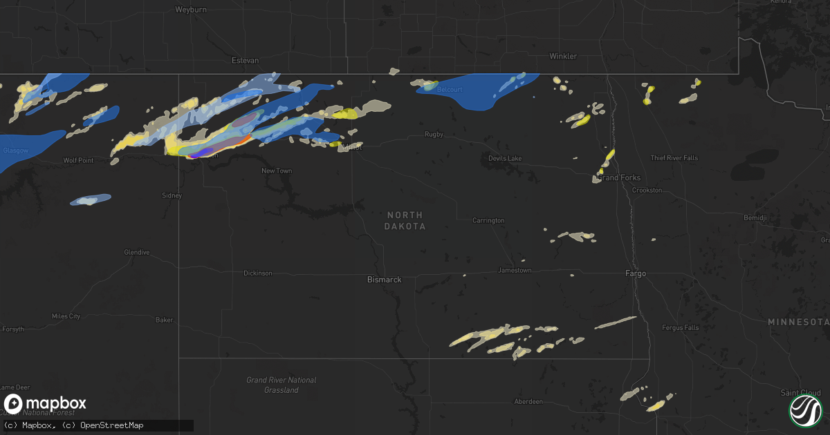
Hail Map in North Dakota on July 18, 2022
Get this storm
July 18 map
$229
one time, instant access
Download today. No call, no setup
Keep the $229
Bought the map and want the full workflow? Apply the entire $229 to a subscription within 7 days. None of it is wasted.
Every map, not just this one
This buys you this map. Subscription and you get every map we run, in the markets you choose from a few cities to whole states to nationwide. Plus real-time alerts the moment a storm fires.
Contact data
Name, contact info, occupancy, even credit band for addresses in the footprint. You go from where it hit to who to call.
Become the source they trust
Unlimited branding weather history reports on demand. You already have the documented answer ready for the property owner, and you are the one who showed up with it.
Property data and RoofTrace estimates
Pull up any address you have got, its value and the exact code rules for that jurisdiction, straight from One Click Code. Then RoofTrace estimates the squares, pitch, and roof value, priced the way you price.
Storm reports in North Dakota
North Dakota
| Date | Description |
|---|---|
| 07/18/20226:59 AM CDT | At 1158 PM CDT, a severe thunderstorm was located near Epping, or 19 miles northeast of Williston, moving east at 45 mph. HAZARD...Golf ball size hail and 70 mph wind gusts. SOURCE...Public. This storm has a history of producing golf ball size hail in Williston. IMPACT...People and animals outdoors will be injured. Expect hail damage to roofs, siding, windows, and vehicles. Expect considerable tree damage. Wind damage is also likely to mobile homes, roofs, and outbuildings. This severe thunderstorm will be near... Ray around 1205 AM CDT. Tioga around 1220 AM CDT. Powers Lake around 1240 AM CDT.Other locations impacted by this severe thunderstorm include WhiteTail Bay Recreation Area, White Earth, Mcgregor, Lewis And ClarkState Park, Spring Brook and Wheelock. |
| 07/18/20226:30 AM CDT | At 1130 PM CDT, a severe thunderstorm was located 13 miles east of Bowbells, moving northeast at 45 mph. HAZARD...70 mph wind gusts and penny size hail. SOURCE...Radar indicated. IMPACT...Expect considerable tree damage. Damage is likely to mobile homes, roofs, and outbuildings. Locations impacted include... Sherwood. |
| 07/18/20226:15 AM CDT | At 1115 PM CDT, a severe thunderstorm was located near Battleview, or 26 miles northwest of Stanley, moving northeast at 40 mph. HAZARD...Golf ball size hail and 70 mph wind gusts. SOURCE...Radar indicated. IMPACT...People and animals outdoors will be injured. Expect hail damage to roofs, siding, windows, and vehicles. Expect considerable tree damage. Wind damage is also likely to mobile homes, roofs, and outbuildings. This severe thunderstorm will be near... Powers Lake around 1125 PM CDT.Other locations in the path of this severe thunderstorm includeBowbells. |
| 07/18/20225:53 AM CDT | Nickel to quarter sized hail and very heavy rains. |
| 07/18/20225:14 AM CDT | Large 3 to 5 inch diameter tree branches broken down around town. |
| 07/18/20225:13 AM CDT | At 1010 PM CDT, a severe thunderstorm was located 5 miles northwest of Wildrose, or 14 miles south of Crosby, moving northeast at 55 mph. HAZARD...70 mph wind gusts and quarter size hail. SOURCE...Radar indicated. At 1007 PM CDT a 60 mph gust was reported 2 miles south of Alamo. IMPACT...Hail damage to vehicles is expected. Expect considerable tree damage. Wind damage is also likely to mobile homes, roofs, and outbuildings. This severe thunderstorm will be near... Noonan around 1030 PM CDT.Other locations in the path of this severe thunderstorm includeColumbus, Lignite, Portal and Flaxton. |
| 07/18/20225:00 AM CDT | One large tree blown down at the mt. Carmel rec area. |
| 07/18/20224:55 AM CDT | Awos station kd55 langdon ap nd. |
| 07/18/20224:55 AM CDT | Peak wind measured at the langdon airport /kd55/. |
| 07/18/20224:45 AM CDT | Report of tree branches down as large as 5 inches in diameter near maida via social media. Time estimated from radar. |
| 07/18/20224:40 AM CDT | Corrected location. Report of tree branches down as large as 5 inches in diameter along the canadian border near mowbray. Report posted via social media. Time estimated |
| 07/18/20224:35 AM CDT | Roofing and wall panels blown off a poleshed. Large tree branches and limbs broken down. |
| 07/18/20224:18 AM CDT | Public report of a large cottonwood tree uprooted near sarles. Report and photo posted via social media. Time estimated based on radar and nearby wind sensor reports. |
| 07/18/20224:15 AM CDT | Corrected for time. Public report of a large cottonwood tree uprooted near sarles. Report and photo posted via social media. Time estimated based on radar and nearby wi |
| 07/18/20224:15 AM CDT | Awos station k9d7 cando ap nd. |
| 07/18/20224:15 AM CDT | Peak wind measured at the cando airport /k9d7/. |
| 07/18/20224:03 AM CDT | Ndawn 10m wind gust of 70mph and 3m wind gust of 60mph |
| 07/18/20223:55 AM CDT | Awos station k06d rolla nd awos. |
| 07/18/20223:42 AM CDT | Grain bins damaged with debris blown to the north. |
| 07/18/20223:42 AM CDT | Based on information provided by the rolette county emergency manager... Including photos and in speaking with him... And radar data... It was determined that thunderst |
| 07/18/20223:40 AM CDT | A local report indicates 1.00 inch wind near 5 N WALES |
| 07/18/20223:38 AM CDT | Delayed report. Raws station tmtn8 4 sw belcourt. |
| 07/18/20222:47 AM CDT | Report from mping: half dollar |
| 07/18/20222:20 AM CDT | Hail and very strong winds. Numerous large 3 to 5 inch diameter tree branches broken down. |
| 07/18/20222:15 AM CDT | Report relayed through broadcast media. Time estimated based on radar. |
| 07/18/20221:54 AM CDT | Peak wind measured at a personal weather station. |
| 07/18/20221:30 AM CDT | Report and photo posted via social media. |
| 07/18/202212:50 AM CDT | Relayed through social media. Photo of hailstone approximately the size of a half dollar. |
| 07/18/202212:08 AM CDT | Relayed through broadcast media. Report of golf ball sized hail. |
| 07/18/202212:05 AM CDT | Mesonet station 327380 3 n ray |
| 07/17/202211:53 PM CDT | At 453 PM MDT, a severe thunderstorm was located 13 miles west of Richey, or 18 miles northeast of Circle, moving east at 55 mph. HAZARD...60 mph wind gusts and quarter size hail. SOURCE...Radar indicated. IMPACT...Hail damage to vehicles is expected. Expect wind damage to roofs, siding, and trees. Locations impacted include... Sidney, Fairview, Richey, Lambert, Savage, East Fairview, Enid, Midway, Wooley, Burns and Crane. |
| 07/17/202211:40 PM CDT | Numerous reports of large... Damaging hail from the city of williston. Public submitted photos show hail ranging generally from golf ball to tennis ball size... With a |
| 07/17/202211:37 PM CDT | Delayed report. Multiple pictures of hail measured with ruler relayed via social media. Time estimate via radar. |
| 07/17/202211:35 PM CDT | Ping pong ball sized hail falling at time of report. |
| 07/17/202211:35 PM CDT | Report from mping: quarter |
| 07/17/202211:20 PM CDT | Mesonet station 320989 1 nne bowbells |
| 07/17/202211:09 PM CDT | Us air force weather station 1.5 sw of bowbells. |
| 07/17/202211:05 PM CDT | Time estimated from radar. |
| 07/17/202210:33 PM CDT | Ndawn station measured sustained 60 mph and a gust to 79 mph. |
| 07/17/202210:23 PM CDT | Ndawn mesonet station. |
| 07/17/202210:20 PM CDT | Em and public report and pictures of significant damage in wildrose. Damage includes lots of large trees uprooted and blocking streets... Multiple open stand buildings |
| 07/17/202210:15 PM CDT | Large 6 to 10 inch diamter tree branches broken down... Barn window panes blown in... And a couple of power poles tilted across northcentral galesburg township. |
| 07/17/202210:15 PM CDT | From july 18 - based on information provided by the williams county emergency manager and area residents... Including many photos and in speaking with them... And radar |
| 07/17/202210:07 PM CDT | Gust measured from ndawn mesonet station. |
| 07/17/20229:45 PM CDT | Measured by a personal weather station. |
| 07/17/20229:44 PM CDT | Estimated 60 mph gusts with initial push of wind. Time estimated from radar. |
| 07/17/20229:13 PM CDT | Measured from ndawn station. |
All States Impacted by Hail Map on July 18, 2022
Cities Impacted by Hail Map on July 18, 2022
- Walhalla, ND
- Hays, MT
- Palermo, ND
- Stanley, ND
- Ross, ND
- Forbes, ND
- Ashley, ND
- Ellendale, ND
- Walkersville, MD
- Frederick, MD
- Ranson, WV
- Charles Town, WV
- Bunker Hill, WV
- Summit Point, WV
- Inwood, WV
- Kearneysville, WV
- Clear Brook, VA
- Newberry Springs, CA
- Peach Bottom, PA
- Nottingham, PA
- Clinton, MN
- Corona, SD
- Big Stone City, SD
- Ortonville, MN
- Oakes, ND
- Portal, ND
- Brockton, MT
- Poplar, MT
- Souris, ND
- Grand Marais, MN
- Flaxton, ND
- Kenmare, ND
- Bowbells, ND
- Minto, ND
- Middletown, MD
- Jefferson, MD
- Dunseith, ND
- Valier, MT
- Conrad, MT
- Mass City, MI
- Ewen, MI
- Rockland, MI
- White Pine, MI
- Ontonagon, MI
- Hickory Ridge, AR
- Harlem, MT
- Wildrose, ND
- Hoople, ND
- Crystal, ND
- Edinburg, ND
- Grand Portage, MN
- Trout Creek, MI
- Iron River, MI
- Peever, SD
- Veblen, SD
- Shepherdstown, WV
- Sharpsburg, MD
- Powers Lake, ND
- Columbus, ND
- Dazey, ND
- Luverne, ND
- Dumont, MN
- Butternut, WI
- Chassell, MI
- Mechanicsville, MD
- Noonan, ND
- Lancaster, MN
- Beardsley, MN
- Centreville, MD
- Max, NE
- Tappen, ND
- Minot, ND
- Glenburn, ND
- Stratton, NE
- Badger, MN
- Greenbush, MN
- Roseau, MN
- Saint Thomas, ND
- Drayton, ND
- Hinsdale, MT
- Larslan, MT
- Opheim, MT
- Richland, MT
- Peerless, MT
- Glentana, MT
- Marianna, AR
- Spiritwood, ND
- Bottineau, ND
- Burlington, ND
- Des Lacs, ND
- Surrey, ND
- Boulder Junction, WI
- Manitowish Waters, WI
- Fullerton, ND
- Bruce Crossing, MI
- Iron Belt, WI
- Shelby, MT
- Shenandoah Junction, WV
- Mohawk, MI
- Oxford, PA
- Cogswell, ND
- Forman, ND
- Leroy, AL
- Wagarville, AL
- Wales, ND
- Malta, MT
- Cut Bank, MT
- Ledger, MT
- Donnybrook, ND
- Kramer, ND
- Ray, ND
- Grenora, ND
- Homestead, MT
- Carpio, ND
- Upham, ND
- Williston, ND
- Dagmar, MT
- Zahl, ND
- Alamo, ND
- Mohall, ND
- Tioga, ND
- Medicine Lake, MT
- Mcgregor, ND
- Froid, MT
- Lansford, ND
- Epping, ND
- Crosby, ND
- Maxbass, ND
- Bainville, MT
- White Earth, ND
- Newburg, ND
- Hannah, ND
- Rocklake, ND
- Hope, ND
- Page, ND
- Galesburg, ND
- Big Sandy, MT
- Lloyd, MT
- Berthold, ND
- Leola, SD
- Zortman, MT
- Antelope, MT
- Crystal Falls, MI
- Arvilla, ND
- Emerado, ND
- Frederick, SD
- Cavalier, ND
- Scobey, MT
- Wolf Point, MT
- Flaxville, MT
- Bronx, NY
- Pelham, NY
- New Rochelle, NY
- Mercer, WI
- Lake Tomahawk, WI
- Lac Du Flambeau, WI
- Minocqua, WI
- Saint Germain, WI
- Woodruff, WI
- Phillips, WI
- Tripoli, WI
- Park Falls, WI
- Hazelhurst, WI
- Baltimore, MD
- Nottingham, MD
- Rosedale, MD
- Lamar, CO
- Wiley, CO
- Tucson, AZ
- Mill Neck, NY
- Glen Cove, NY
- Bayville, NY
- Huntington, NY
- Oyster Bay, NY
- Locust Valley, NY
- Plaza, ND
- Circle, MT
- Vida, MT
- Tunica, MS
- Harpers Ferry, WV
- Cliffside Park, NJ
- Leonia, NJ
- Edgewater, NJ
- Ridgefield, NJ
- Fort Lee, NJ
- Palisades Park, NJ
- Milnor, ND
- Langdon, ND
- Calvin, ND
- Whitetail, MT
- Park River, ND
- Halma, MN
- Lake Bronson, MN
- Hannaford, ND
- Greenville, SC
- Piedmont, SC
- Easley, SC
- Chokio, MN
- Grand Forks Afb, ND
- Mekinock, ND
- Sisseton, SD
- Arlington, AL
- Queenstown, MD
- Trinidad, CO
- Colfax, ND
- Barney, ND
- Wyndmere, ND
- Wahpeton, ND
- West Point, MS
- Starkville, MS
- Ogema, WI
- Oriska, ND
- Pageland, SC
- Jefferson, SC
- Oakland, MS
- Como, MS
- Tomahawk, WI
- Fulton, MS
- Crossville, AL
- Georgiana, AL
- Greenville, AL
- Wishek, ND
- Lanse, MI
- Antler, ND
- Conover, WI
- Eagle River, WI
- Inkster, ND
- Saltillo, MS
- Mooreville, MS
- Mantachie, MS
- Tupelo, MS
- Eureka, SD
- Herreid, SD
- McCrory, AR
- Benkelman, NE
- Hamilton, AL
- Tremont, MS
- Hackleburg, AL
- Hodges, AL
- Vina, AL
- Aberdeen, MS
- Okolona, MS
- Pelkie, MI
- Fredonia, ND
- Kulm, ND
- Berlin, ND
- Lehr, ND
- Edgeley, ND
- Daggett, CA
- Yermo, CA
- Belden, MS
- Presque Isle, WI
- Marks, MS
- Lambert, MS
- Charleston, MS
- Enid, MS
- Batesville, MS
- Saco, MT
- Whitewater, MT
- Reserve, MT
- Manvel, ND
- Oslo, MN
- Atlantic Mine, MI
- Painesdale, MI
- Irma, WI
- Rib Lake, WI
- Merrill, WI
- Brantwood, WI
- Prentice, WI
- Lake Linden, MI
- Guntown, MS
- Nisula, MI
- Baraga, MI
- Ishpeming, MI
- Toivola, MI
- Michigamme, MI
- Champion, MI
- Republic, MI
- Crenshaw, MS
- Pope, MS
- Sledge, MS
- Tutwiler, MS
- Sardis, MS
- Patagonia, AZ
- Nogales, AZ
- Marenisco, MI
- Land O'Lakes, WI
- Jackson, AL
- Senatobia, MS
- Browns Valley, MN
- Borup, MN
- Ada, MN
- Mellen, WI
- Upson, WI
- Wakefield, MI
- Watersmeet, MI
- Covington, MI
- Lamoure, ND
- Verona, ND
- Lovettsville, VA
- Coffeeville, MS
- Water Valley, MS
- Pinetop, AZ
- Columbus, MS
- Purcellville, VA
- Middleburg, VA
- Leesburg, VA
- Thomaston, AL
- Ambrose, ND
- Fortuna, ND
- Bergland, MI
- Glidden, WI
- Glenwood, MN
- Richey, MT
- Dupree, SD
- Saint John, ND
- Grafton, ND
- Sunburst, MT
- Kevin, MT
- Oilmont, MT
- Galata, MT
- Vergennes, VT
- Karlstad, MN
- Nashua, MT
- Frazer, MT
- Vandalia, MT
- Fort Peck, MT
- Glasgow, MT
- Redstone, MT
- Lignite, ND
- Sherwood, ND
- Tolley, ND
- Perth, ND
- Hansboro, ND
- Maida, ND
- Bisbee, ND
- Belcourt, ND
- Mylo, ND
- Sarles, ND
- Munich, ND
- Rolla, ND
- Egeland, ND


