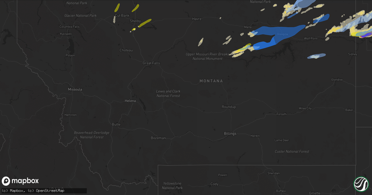
Hail Map in Montana on July 18, 2022
Get this storm
July 18 map
$229
one time, instant access
Download today. No call, no setup
Keep the $229
Bought the map and want the full workflow? Apply the entire $229 to a subscription within 7 days. None of it is wasted.
Every map, not just this one
This buys you this map. Subscription and you get every map we run, in the markets you choose from a few cities to whole states to nationwide. Plus real-time alerts the moment a storm fires.
Contact data
Name, contact info, occupancy, even credit band for addresses in the footprint. You go from where it hit to who to call.
Become the source they trust
Unlimited branding weather history reports on demand. You already have the documented answer ready for the property owner, and you are the one who showed up with it.
Property data and RoofTrace estimates
Pull up any address you have got, its value and the exact code rules for that jurisdiction, straight from One Click Code. Then RoofTrace estimates the squares, pitch, and roof value, priced the way you price.
Storm reports in Montana
Montana
| Date | Description |
|---|---|
| 07/18/20226:58 PM CDT | Shop leveled with many trees down. Winds estimated 80-100 mph. |
| 07/18/20226:53 PM CDT | The tornado touched down 5.5 miles southwest of glentana at 5:47 pm mdt... Moving to the northeast... And directly impacted the town of glentana at 5:53 pm mdt. Several |
| 07/18/20226:45 PM CDT | Estimated 70 mph wind gust... With dime sized hail and torrential rain of over an inch. |
| 07/18/20226:41 PM CDT | A local report indicates 60 MPH wind near 6 WNW LARSLAN |
| 07/18/20226:35 PM CDT | Measured 62 mph wind gust... A few small branches down. |
| 07/18/20226:24 PM CDT | Observed at glasgow asos. |
| 07/18/20226:20 PM CDT | Camper overturned in driveway and bounced against the house... With winds over 70 mph estimated. |
| 07/18/20226:20 PM CDT | Measured peak wind gust. |
| 07/18/20225:45 PM CDT | Relayed via facebook. |
| 07/18/20225:15 PM CDT | Quonset hut destroyed; broken 4.5ft diameter tree. |
| 07/18/202212:45 PM CDT | Estimated time and hail size based on phone report. |
| 07/18/20227:41 AM CDT | At 1240 PM MDT, severe thunderstorms were located along a line extending from 10 miles southeast of Shelby to 6 miles southwest of Kevin, moving northeast at 35 mph. HAZARD...60 mph wind gusts and half dollar size hail. SOURCE...Radar indicated. IMPACT...Hail damage to vehicles is expected. Expect wind damage to roofs, siding, and trees. Locations impacted include... Shelby, Sunburst, Kevin, Lothair, Sweet Grass, Oilmont, Santa Rita, Whitlash, Ferdig, Devon, Dunkirk and Galata. |
| 07/18/20227:07 AM CDT | At 1207 PM MDT, a severe thunderstorm was located 9 miles north of Conrad, moving northeast at 45 mph. HAZARD...60 mph wind gusts and half dollar size hail. SOURCE...Radar indicated. IMPACT...Hail damage to vehicles is expected. Expect wind damage to roofs, siding, and trees. Locations impacted include... Conrad, Devon, Dunkirk, Galata and Ledger. |
| 07/18/20226:31 AM CDT | At 1130 AM MDT, a severe thunderstorm was located 11 miles southwest of Cut Bank, moving north at 40 mph. HAZARD...60 mph wind gusts and half dollar size hail. SOURCE...Radar indicated. IMPACT...Hail damage to vehicles is expected. Expect wind damage to roofs, siding, and trees. Locations impacted include... Cut Bank and Santa Rita. |
| 07/18/20226:02 AM CDT | At 1101 PM CDT, severe thunderstorms were located along a line extending from 9 miles southwest of Westby to 9 miles west of Bonetrail to near Fort Union Trading Post, moving northeast at 55 mph. HAZARD...60 mph wind gusts and quarter size hail. SOURCE...Radar indicated. IMPACT...Hail damage to vehicles is expected. Expect wind damage to roofs, siding, and trees. Severe thunderstorms will be near... Bonetrail around 1110 PM CDT. Westby around 1010 PM MDT. Alkabo and Writing Rock State Historical Site around 1115 PM CDT. Williston and Fortuna around 1125 PM CDT. Alamo around 1135 PM CDT. Epping around 1140 PM CDT. Ray around 1150 PM CDT.Other locations impacted by these severe thunderstorms include Zahl,Appam, Wheelock, Hanks, Ambrose, Trenton, Spring Brook, Corinth andBlacktail Lake. |
| 07/18/20224:19 AM CDT | At 918 PM CDT, a severe thunderstorm was located 13 miles west of Bonetrail, or 25 miles northeast of Culbertson, moving northeast at 45 mph. HAZARD...70 mph wind gusts and half dollar size hail. SOURCE...Radar indicated. IMPACT...Hail damage to vehicles is expected. Expect considerable tree damage. Wind damage is also likely to mobile homes, roofs, and outbuildings. This severe thunderstorm will be near... Bonetrail around 935 PM CDT.Other locations in the path of this severe thunderstorm includeAlamo. |
| 07/18/20223:07 AM CDT | At 807 PM MDT, severe thunderstorms were located along a line extending from 7 miles southwest of Medicine Lake to near Froid to Culbertson, moving east at 50 mph. HAZARD...70 mph wind gusts and quarter size hail. SOURCE...Radar indicated. IMPACT...Hail damage to vehicles is expected. Expect considerable tree damage. Wind damage is also likely to mobile homes, roofs, and outbuildings. Locations impacted include... Culbertson, Medicine Lake, Bainville, Froid, Reserve, Mccabe, Snowden, Dagmar, Homestead, Antelope and Coalridge. |
| 07/18/20222:42 AM CDT | At 742 PM MDT, a severe thunderstorm was located 8 miles north of Brockton, or 18 miles northwest of Culbertson, moving northeast at 40 mph. HAZARD...60 mph wind gusts and quarter size hail. SOURCE...Radar indicated. IMPACT...Hail damage to vehicles is expected. Expect wind damage to roofs, siding, and trees. Locations impacted include... Medicine Lake, Froid, Reserve, Dagmar and Homestead. |
| 07/18/20221:28 AM CDT | At 628 PM MDT, severe thunderstorms were located along a line extending from 15 miles southwest of Scobey to 11 miles southwest of Bredette to 11 miles north of Wolf Point, moving east at 45 mph. HAZARD...60 mph wind gusts and penny size hail. SOURCE...Radar indicated. IMPACT...Expect damage to roofs, siding, and trees. Locations impacted include... Bredette, Redstone, Archer, Volt and Navajo. |
| 07/18/20221:24 AM CDT | At 624 PM MDT, severe thunderstorms were located along a line extending from 10 miles east of Port Of Opheim to near Peerless, moving northeast at 35 mph. HAZARD...60 mph wind gusts and penny size hail. SOURCE...Radar indicated. IMPACT...Expect damage to roofs, siding, and trees. Locations impacted include... Scobey, Richland, Port Of Scobey, Port Of Whitetail, Peerless, Whitetail, Four Buttes and West Fork. |
| 07/18/202212:29 AM CDT | At 528 PM MDT, severe thunderstorms were located along a line extending from 8 miles southwest of Opheim to near St. Marie to near Fort Peck, moving east at 65 mph. HAZARD...60 mph wind gusts and penny size hail. SOURCE...Radar indicated. IMPACT...Expect damage to roofs, siding, and trees. Locations impacted include... Wolf Point, Scobey, Poplar, Opheim, Richland, Nashua, Flaxville, St. Marie, Peerless, Port Of Whitetail, Lustre, Madoc, Bredette, Port Of Scobey, Redstone, Frazer, Whitetail, Park Grove, Four Buttes and West Fork. |
| 07/18/202212:00 AM CDT | At 459 PM MDT, a severe thunderstorm was located 24 miles northwest of Hell Creek Rec Area, or 30 miles southwest of Glasgow, moving east at 55 mph. HAZARD...70 mph wind gusts and nickel size hail. SOURCE...Radar indicated. IMPACT...Expect considerable tree damage. Damage is likely to mobile homes, roofs, and outbuildings. Locations impacted include... Fort Peck, The Pines Rec Area, Fort Peck Marina, Duck Creek Rec Area and Park Grove. |
| 07/17/202211:58 PM CDT | At 458 PM MDT, a severe thunderstorm was located 25 miles northwest of Hell Creek Rec Area, or 32 miles southwest of Glasgow, moving east at 55 mph. HAZARD...70 mph wind gusts and nickel size hail. SOURCE...Radar indicated. IMPACT...Expect considerable tree damage. Damage is likely to mobile homes, roofs, and outbuildings. This severe thunderstorm will remain over mainly rural areas of northeastern Garfield and northwestern McCone Counties. |
| 07/17/202211:29 PM CDT | At 429 PM MDT, a severe thunderstorm was located 18 miles southeast of Malta, moving east at 60 mph. HAZARD...70 mph wind gusts and nickel size hail. SOURCE...Radar indicated. IMPACT...Expect considerable tree damage. Damage is likely to mobile homes, roofs, and outbuildings. Locations impacted include... Glasgow, Nashua, Saco, Tampico, Hinsdale, St. Marie, Vandalia, Park Grove, The Bentonite Plant and Whatley. |
| 07/17/202211:11 PM CDT | At 410 AM MDT, severe thunderstorms were located along a line extending from 18 miles northeast of Sunburst to 36 miles north of Lothair to 29 miles northwest of Joplin to 21 miles north of Chester, moving east northeast at 60 mph. HAZARD...60 mph wind gusts and nickel size hail. SOURCE...Radar indicated. IMPACT...Expect damage to roofs, siding, and trees. Locations impacted include... Whitlash and Simpson. |
| 07/17/202211:05 PM CDT | At 405 PM MDT, a severe thunderstorm was located 8 miles west of Fourchette, or 21 miles southeast of Zortman, moving east at 40 mph. HAZARD...60 mph wind gusts and quarter size hail. SOURCE...Radar indicated. IMPACT...Hail damage to vehicles is expected. Expect wind damage to roofs, siding, and trees. Locations impacted include... Fourchette and Sun Prairie. |
| 07/17/202211:01 PM CDT | At 400 PM MDT, a severe thunderstorm was located 12 miles southeast of Dodson, or 14 miles southwest of Malta, moving northeast at 55 mph. HAZARD...60 mph wind gusts and nickel size hail. SOURCE...Radar indicated. IMPACT...Expect damage to roofs, siding, and trees. Locations impacted include... Malta, Whitewater, Saco, Sleeping Buffalo, Wagner, Frenchman Reservoir and Bowdoin. |
| 07/17/202210:25 PM CDT | At 323 AM MDT, severe thunderstorms were located along a line extending from 31 miles west of Sunburst to 7 miles east of Cut Bank, moving northeast at 55 mph. HAZARD...80 mph wind gusts and quarter size hail. SOURCE...Radar indicated. IMPACT...Flying debris will be dangerous to those caught without shelter. Mobile homes will be heavily damaged. Expect considerable damage to roofs, windows, and vehicles. Extensive tree damage and power outages are likely. Locations impacted include... Sunburst, Kevin, Ferdig, Oilmont, Santa Rita and Whitlash. |
| 07/17/202210:05 PM CDT | At 305 AM MDT, severe thunderstorms were located along a line extending from 35 miles north of North Browning to near Cut Bank, moving northeast at 55 mph. HAZARD...70 mph wind gusts and quarter size hail. SOURCE...Radar indicated. IMPACT...Hail damage to vehicles is expected. Expect considerable tree damage. Wind damage is also likely to mobile homes, roofs, and outbuildings. Locations impacted include... Cut Bank, Sunburst, Kevin, Sweet Grass, Oilmont, Santa Rita and Ferdig. |
| 07/17/20229:25 PM CDT | At 224 AM MDT, a severe thunderstorm was located near East Glacier Park, or 39 miles west of Cut Bank, moving northeast at 45 mph. HAZARD...60 mph wind gusts and quarter size hail. SOURCE...Radar indicated. IMPACT...Hail damage to vehicles is expected. Expect wind damage to roofs, siding, and trees. Locations impacted include... Cut Bank, Browning, East Glacier Park Village, South Browning, North Browning, East Glacier Park, Kiowa and Starr School. |
| 07/17/20229:15 PM CDT | Estimated 50-60 mph winds with pea-sized hail. |
| 07/17/20228:00 PM CDT | Linear wind damage reported in the vicinity... Including at least 15 power poles snapped. |
| 07/17/20227:35 PM CDT | Multiple yard items blown around with estimated wind gusts up to 70 mph. |
All States Impacted by Hail Map on July 18, 2022
Cities Impacted by Hail Map on July 18, 2022
- Walhalla, ND
- Hays, MT
- Palermo, ND
- Stanley, ND
- Ross, ND
- Forbes, ND
- Ashley, ND
- Ellendale, ND
- Walkersville, MD
- Frederick, MD
- Ranson, WV
- Charles Town, WV
- Bunker Hill, WV
- Summit Point, WV
- Inwood, WV
- Kearneysville, WV
- Clear Brook, VA
- Newberry Springs, CA
- Peach Bottom, PA
- Nottingham, PA
- Clinton, MN
- Corona, SD
- Big Stone City, SD
- Ortonville, MN
- Oakes, ND
- Portal, ND
- Brockton, MT
- Poplar, MT
- Souris, ND
- Grand Marais, MN
- Flaxton, ND
- Kenmare, ND
- Bowbells, ND
- Minto, ND
- Middletown, MD
- Jefferson, MD
- Dunseith, ND
- Valier, MT
- Conrad, MT
- Mass City, MI
- Ewen, MI
- Rockland, MI
- White Pine, MI
- Ontonagon, MI
- Hickory Ridge, AR
- Harlem, MT
- Wildrose, ND
- Hoople, ND
- Crystal, ND
- Edinburg, ND
- Grand Portage, MN
- Trout Creek, MI
- Iron River, MI
- Peever, SD
- Veblen, SD
- Shepherdstown, WV
- Sharpsburg, MD
- Powers Lake, ND
- Columbus, ND
- Dazey, ND
- Luverne, ND
- Dumont, MN
- Butternut, WI
- Chassell, MI
- Mechanicsville, MD
- Noonan, ND
- Lancaster, MN
- Beardsley, MN
- Centreville, MD
- Max, NE
- Tappen, ND
- Minot, ND
- Glenburn, ND
- Stratton, NE
- Badger, MN
- Greenbush, MN
- Roseau, MN
- Saint Thomas, ND
- Drayton, ND
- Hinsdale, MT
- Larslan, MT
- Opheim, MT
- Richland, MT
- Peerless, MT
- Glentana, MT
- Marianna, AR
- Spiritwood, ND
- Bottineau, ND
- Burlington, ND
- Des Lacs, ND
- Surrey, ND
- Boulder Junction, WI
- Manitowish Waters, WI
- Fullerton, ND
- Bruce Crossing, MI
- Iron Belt, WI
- Shelby, MT
- Shenandoah Junction, WV
- Mohawk, MI
- Oxford, PA
- Cogswell, ND
- Forman, ND
- Leroy, AL
- Wagarville, AL
- Wales, ND
- Malta, MT
- Cut Bank, MT
- Ledger, MT
- Donnybrook, ND
- Kramer, ND
- Ray, ND
- Grenora, ND
- Homestead, MT
- Carpio, ND
- Upham, ND
- Williston, ND
- Dagmar, MT
- Zahl, ND
- Alamo, ND
- Mohall, ND
- Tioga, ND
- Medicine Lake, MT
- Mcgregor, ND
- Froid, MT
- Lansford, ND
- Epping, ND
- Crosby, ND
- Maxbass, ND
- Bainville, MT
- White Earth, ND
- Newburg, ND
- Hannah, ND
- Rocklake, ND
- Hope, ND
- Page, ND
- Galesburg, ND
- Big Sandy, MT
- Lloyd, MT
- Berthold, ND
- Leola, SD
- Zortman, MT
- Antelope, MT
- Crystal Falls, MI
- Arvilla, ND
- Emerado, ND
- Frederick, SD
- Cavalier, ND
- Scobey, MT
- Wolf Point, MT
- Flaxville, MT
- Bronx, NY
- Pelham, NY
- New Rochelle, NY
- Mercer, WI
- Lake Tomahawk, WI
- Lac Du Flambeau, WI
- Minocqua, WI
- Saint Germain, WI
- Woodruff, WI
- Phillips, WI
- Tripoli, WI
- Park Falls, WI
- Hazelhurst, WI
- Baltimore, MD
- Nottingham, MD
- Rosedale, MD
- Lamar, CO
- Wiley, CO
- Tucson, AZ
- Mill Neck, NY
- Glen Cove, NY
- Bayville, NY
- Huntington, NY
- Oyster Bay, NY
- Locust Valley, NY
- Plaza, ND
- Circle, MT
- Vida, MT
- Tunica, MS
- Harpers Ferry, WV
- Cliffside Park, NJ
- Leonia, NJ
- Edgewater, NJ
- Ridgefield, NJ
- Fort Lee, NJ
- Palisades Park, NJ
- Milnor, ND
- Langdon, ND
- Calvin, ND
- Whitetail, MT
- Park River, ND
- Halma, MN
- Lake Bronson, MN
- Hannaford, ND
- Greenville, SC
- Piedmont, SC
- Easley, SC
- Chokio, MN
- Grand Forks Afb, ND
- Mekinock, ND
- Sisseton, SD
- Arlington, AL
- Queenstown, MD
- Trinidad, CO
- Colfax, ND
- Barney, ND
- Wyndmere, ND
- Wahpeton, ND
- West Point, MS
- Starkville, MS
- Ogema, WI
- Oriska, ND
- Pageland, SC
- Jefferson, SC
- Oakland, MS
- Como, MS
- Tomahawk, WI
- Fulton, MS
- Crossville, AL
- Georgiana, AL
- Greenville, AL
- Wishek, ND
- Lanse, MI
- Antler, ND
- Conover, WI
- Eagle River, WI
- Inkster, ND
- Saltillo, MS
- Mooreville, MS
- Mantachie, MS
- Tupelo, MS
- Eureka, SD
- Herreid, SD
- McCrory, AR
- Benkelman, NE
- Hamilton, AL
- Tremont, MS
- Hackleburg, AL
- Hodges, AL
- Vina, AL
- Aberdeen, MS
- Okolona, MS
- Pelkie, MI
- Fredonia, ND
- Kulm, ND
- Berlin, ND
- Lehr, ND
- Edgeley, ND
- Daggett, CA
- Yermo, CA
- Belden, MS
- Presque Isle, WI
- Marks, MS
- Lambert, MS
- Charleston, MS
- Enid, MS
- Batesville, MS
- Saco, MT
- Whitewater, MT
- Reserve, MT
- Manvel, ND
- Oslo, MN
- Atlantic Mine, MI
- Painesdale, MI
- Irma, WI
- Rib Lake, WI
- Merrill, WI
- Brantwood, WI
- Prentice, WI
- Lake Linden, MI
- Guntown, MS
- Nisula, MI
- Baraga, MI
- Ishpeming, MI
- Toivola, MI
- Michigamme, MI
- Champion, MI
- Republic, MI
- Crenshaw, MS
- Pope, MS
- Sledge, MS
- Tutwiler, MS
- Sardis, MS
- Patagonia, AZ
- Nogales, AZ
- Marenisco, MI
- Land O'Lakes, WI
- Jackson, AL
- Senatobia, MS
- Browns Valley, MN
- Borup, MN
- Ada, MN
- Mellen, WI
- Upson, WI
- Wakefield, MI
- Watersmeet, MI
- Covington, MI
- Lamoure, ND
- Verona, ND
- Lovettsville, VA
- Coffeeville, MS
- Water Valley, MS
- Pinetop, AZ
- Columbus, MS
- Purcellville, VA
- Middleburg, VA
- Leesburg, VA
- Thomaston, AL
- Ambrose, ND
- Fortuna, ND
- Bergland, MI
- Glidden, WI
- Glenwood, MN
- Richey, MT
- Dupree, SD
- Saint John, ND
- Grafton, ND
- Sunburst, MT
- Kevin, MT
- Oilmont, MT
- Galata, MT
- Vergennes, VT
- Karlstad, MN
- Nashua, MT
- Frazer, MT
- Vandalia, MT
- Fort Peck, MT
- Glasgow, MT
- Redstone, MT
- Lignite, ND
- Sherwood, ND
- Tolley, ND
- Perth, ND
- Hansboro, ND
- Maida, ND
- Bisbee, ND
- Belcourt, ND
- Mylo, ND
- Sarles, ND
- Munich, ND
- Rolla, ND
- Egeland, ND


