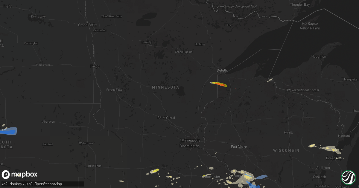
Hail Map in Minnesota on July 18, 2019
Get this storm
July 18 map
$229
one time, instant access
Download today. No call, no setup
Keep the $229
Bought the map and want the full workflow? Apply the entire $229 to a subscription within 7 days. None of it is wasted.
Every map, not just this one
This buys you this map. Subscription and you get every map we run, in the markets you choose from a few cities to whole states to nationwide. Plus real-time alerts the moment a storm fires.
Contact data
Name, contact info, occupancy, even credit band for addresses in the footprint. You go from where it hit to who to call.
Become the source they trust
Unlimited branding weather history reports on demand. You already have the documented answer ready for the property owner, and you are the one who showed up with it.
Property data and RoofTrace estimates
Pull up any address you have got, its value and the exact code rules for that jurisdiction, straight from One Click Code. Then RoofTrace estimates the squares, pitch, and roof value, priced the way you price.
Storm reports in Minnesota
Minnesota
| Date | Description |
|---|---|
| 07/18/20195:00 AM CDT | At 1000 PM CDT, a severe thunderstorm was located over Good Thunder, or 10 miles south of Mankato, moving east at 20 mph. HAZARD...Ping pong ball size hail and 60 mph wind gusts. SOURCE...Radar indicated. IMPACT...People and animals outdoors will be injured. Expect hail damage to roofs, siding, windows, and vehicles. Expect wind damage to roofs, siding, and trees. This severe thunderstorm will be near... Mapleton around 1015 PM CDT. St. Clair around 1030 PM CDT. Pemberton around 1040 PM CDT. |
| 07/18/20192:32 AM CDT | At 732 PM CDT, a severe thunderstorm was located near Comfrey, or 19 miles southwest of New Ulm, moving east at 35 mph. HAZARD...60 mph wind gusts and nickel size hail. SOURCE...Radar indicated. IMPACT...Expect damage to roofs, siding, and trees. This severe thunderstorm will be near... Hanska around 755 PM CDT. New Ulm around 800 PM CDT.Other locations impacted by this severe thunderstorm includeSveadahl, New Ulm Airport, Darfur, Searles and La Salle.This includes U.S. Highway 14 between mile markers 97 and 103. |
| 07/18/20192:19 AM CDT | At 719 PM CDT, a severe thunderstorm was located over Nerstrand, or 11 miles southeast of Northfield, moving northeast at 40 mph. HAZARD...60 mph wind gusts and half dollar size hail. SOURCE...Radar indicated. IMPACT...Hail damage to vehicles is expected. Expect wind damage to roofs, siding, and trees. This severe thunderstorm will be near... Stanton around 730 PM CDT. Cannon Falls around 740 PM CDT.Other locations impacted by this severe thunderstorm include Wastedo,Hader, Lake Byllesby and Bombay. |
| 07/18/201912:59 AM CDT | At 558 PM CDT, a severe thunderstorm was located near Mapleton, or 21 miles south of Mankato, moving northeast at 25 mph. HAZARD...60 mph wind gusts and quarter size hail. SOURCE...Radar indicated. IMPACT...Hail damage to vehicles is expected. Expect wind damage to roofs, siding, and trees. Locations impacted include... Mapleton, Minnesota Lake, Pemberton and Waldorf. |
| 07/17/201911:50 PM CDT | At 449 AM CDT, a severe thunderstorm was located near Lake Hassel, or 24 miles southeast of Morris, moving east at 45 mph. HAZARD...Ping pong ball size hail. SOURCE...Radar indicated. IMPACT...People and animals outdoors will be injured. Expect damage to roofs, siding, windows, and vehicles. Locations impacted include... Lake Hassel, Norway Lake, Gilchrist, Sunburg and Swift Falls. |
| 07/17/201911:28 PM CDT | At 427 AM CDT, a severe thunderstorm was located over Savage, or 16 miles south of Minneapolis, moving northeast at 45 mph. HAZARD...Quarter size hail. SOURCE...Trained weather spotters. IMPACT...Damage to vehicles is expected. Locations impacted include... Bloomington, Eagan, Burnsville, Lakeville, Apple Valley, Shakopee, Inver Grove Heights, Savage, Prior Lake, Rosemount, West St. Paul and Mendota Heights. |
| 07/17/201910:33 PM CDT | Brief ef0 with damage to home and nearby trees. |
| 07/17/20198:54 PM CDT | At 154 AM CDT, a severe thunderstorm was located 12 miles northwest of Hovland, or 19 miles northeast of Grand Marais, moving east at 40 mph. HAZARD...60 mph wind gusts and quarter size hail. SOURCE...Radar indicated. IMPACT...Hail damage to vehicles is expected. Expect wind damage to roofs, siding, and trees. Locations impacted include... Grand Portage, Pine Lake, Tom Lake, Swamp Lake, North Fowl Lake, Grand Portage Reservation, and Grand Portage State Park. |
All States Impacted by Hail Map on July 18, 2019
Cities Impacted by Hail Map on July 18, 2019
- Meadow, SD
- Buffalo, SD
- Ludlow, SD
- Cazenovia, WI
- Lilesville, NC
- Kenyon, MN
- Wells, MN
- Cuthbert, GA
- Shellman, GA
- Estill, SC
- Varnville, SC
- Avera, GA
- South Boardman, MI
- Fife Lake, MI
- Marshalltown, IA
- Gladbrook, IA
- Sheridan, IL
- Earlville, IL
- Utica, IL
- Mendota, IL
- Serena, IL
- Ottawa, IL
- Peru, IL
- Troy Grove, IL
- La Salle, IL
- Nashville, NC
- Saint James, MN
- Alzada, MT
- Capitol, MT
- Reva, SD
- Newell, SD
- Belle Fourche, SD
- Mud Butte, SD
- Hammond, MT
- Foxboro, WI
- Gaston, NC
- Blakely, GA
- Hanska, MN
- Metter, GA
- Fort Stewart, GA
- Meigs, GA
- Solon Springs, WI
- Barnum, MN
- Superior, WI
- Holyoke, MN
- Abbeville, AL
- Shorterville, AL
- Loris, SC
- Hampton, SC
- Apopka, FL
- Longwood, FL
- Gresham, WI
- Albany, GA
- Reinbeck, IA
- Abrams, WI
- Faith, SD
- Luxemburg, WI
- Kewaunee, WI
- Alden, IA
- Iowa Falls, IA
- Tabor City, NC
- Viola, WI
- La Farge, WI
- Lawrenceville, VA
- Dupree, SD
- Isabel, SD
- McIntosh, SD
- McLaughlin, SD
- Trail City, SD
- Lodgepole, SD
- Watauga, SD
- Keldron, SD
- Morristown, SD
- Lemmon, SD
- Columbia, AL
- Newville, AL
- Eagle Butte, SD
- Saluda, SC
- Johnston, SC
- Ward, SC
- Camp Crook, SD
- Williams, IA
- Plain, WI
- Hillpoint, WI
- Ekalaka, MT
- Baker, MT
- Okabena, MN
- Brewster, MN
- Lime Springs, IA
- Richland Center, WI
- Hillsboro, WI
- Littleton, NC
- New Ulm, MN
- Sleepy Eye, MN
- Comfrey, MN
- Selby, SD
- Altura, MN
- Rollingstone, MN
- Washington, GA
- Lincolnton, GA
- Duncombe, IA
- Midland City, AL
- Headland, AL
- Kite, GA
- Broadus, MT
- Kasson, MN
- Dodge Center, MN
- Mantorville, MN
- Madison, WI
- Sun Prairie, WI
- Sobieski, WI
- Oconto Falls, WI
- Krakow, WI
- Pulaski, WI
- Otter, MT
- Battleboro, NC
- Roebuck, SC
- Fort Gaines, GA
- Lantry, SD
- Midville, GA
- Swainsboro, GA
- Bartow, GA
- Wadley, GA
- Pinewood, SC
- Summerton, SC
- Saint Stephen, SC
- Stratford, IA
- Adams, MN
- Bison, SD
- McIntire, IA
- Chester, IA
- Riceville, IA
- Claxton, GA
- Soldiers Grove, WI
- Viroqua, WI
- Peterson, MN
- Lanesboro, MN
- Slayton, MN
- Iona, MN
- Chandler, MN
- Kenly, NC
- Smithfield, NC
- Princeton, NC
- Selma, NC
- Pine Level, NC
- Clayton, NC
- Garnett, SC
- Waverly, GA
- West Salem, WI
- Bangor, WI
- Galesville, WI
- Holmen, WI
- Ettrick, WI
- Mindoro, WI
- Melrose, WI
- Baraboo, WI
- Ralph, SD
- Doerun, GA
- Moultrie, GA
- Chaseburg, WI
- La Crosse, WI
- Cashton, WI
- Stoddard, WI
- Westby, WI
- Rockland, WI
- Coon Valley, WI
- Sparta, WI
- Battle Ground, IN
- Brookston, IN
- Merrimac, WI
- Johnsonville, SC
- Naples, FL
- Dawson, GA
- Lyons, GA
- Collins, GA
- Cobbtown, GA
- Maiden Rock, WI
- Hamilton, GA
- Arcadia, WI
- Fountain City, WI
- New Lisbon, WI
- Browns Summit, NC
- Greensboro, NC
- Winona, MN
- Waynesville, GA
- Coleman, GA
- Jesup, GA
- Townsend, GA
- Round O, SC
- Saxon, WI
- Lodi, WI
- Cottageville, SC
- Dakota, MN
- La Crescent, MN
- Poynette, WI
- Manning, SC
- Chatfield, MN
- Cottage Grove, WI
- Deerfield, WI
- Marshall, WI
- West Lafayette, IN
- Rochester, MN
- Oronoco, MN
- Byron, MN
- Leopolis, WI
- Bowler, WI
- Shawano, WI
- Lower Brule, SD
- Ontario, WI
- Norwalk, WI
- Wanamingo, MN
- Brownsville, MN
- Hokah, MN
- Walterboro, SC
- Cloudcroft, NM
- Greeleyville, SC
- Minnesota City, MN
- Tarrytown, GA
- Statesboro, GA
- Brooklet, GA
- Aynor, SC
- Conway, SC
- Galivants Ferry, SC
- Inman, SC
- Traphill, NC
- Twin City, GA
- Little Suamico, WI
- Register, GA
- Good Thunder, MN
- North Freedom, WI
- Lime Ridge, WI
- Loganville, WI
- Reedsburg, WI
- Rock Springs, WI
- La Valle, WI
- Winter Park, FL
- Casselberry, FL
- Winter Springs, FL
- Leesburg, GA
- Mapleton, MN
- New Zion, SC
- Kingstree, SC
- Timber Lake, SD
- Waseca, MN
- Camden, SC
- Middleton, WI
- Waunakee, WI
- Prospect Heights, IL
- Webb, AL
- Ashford, AL
- Norway, SC
- Hartsfield, GA
- Grand Junction, IA
- Sandy Hook, KY
- Tilleda, WI
- Rushford, MN
- Onalaska, WI
- Dodge, WI
- Trempealeau, WI
- Caledonia, MN
- Lewiston, MN
- Utica, MN
- Houston, MN
- Gettysburg, SD
- Kingsley, MI
- Wakpala, SD
- Prairie Du Sac, WI
- Lakefield, MN
- Dover, MN
- Halifax, NC
- Jackson, NC
- Garysburg, NC
- Grand Ridge, IL
- Marseilles, IL
- Dane, WI
- Turbeville, SC
- Libertyville, IL
- Grayslake, IL
- Gurnee, IL
- Sullivan, WI
- Ogden, IA
- Webster City, IA
- Kamrar, IA
- Stanhope, IA
- Jewell, IA
- Elkmont, AL
- Prospect, TN
- Pine Island, MN
- Zumbro Falls, MN
- Mazeppa, MN
- Stacyville, IA
- Osage, IA
- Bronwood, GA
- Rhame, ND
- Pulaski, TN
- Cecil, WI
- Green Sea, SC
- Green Bay, WI
- Waterloo, WI
- Pineville, SC
- Cross, SC
- Truman, MN
- Lugoff, SC
- Pulaski, GA
- Saint Ansgar, IA
- Boyes, MT
- Minnesota Lake, MN
- Saint Charles, MN
- Garden City, MN
- Pemberton, MN
- Janesville, MN
- Spartanburg, SC
- Honor, MI
- Ocoee, FL
- Orlando, FL
- Delavan, MN
- Easton, MN
- Ridgeway, SC
- Bonita Springs, FL
- Lake City, MI
- Brussels, WI
- Eutawville, SC
- Lake Mills, WI
- Gresham, SC
- Darfur, MN
- Moore, SC
- Wrightsville, GA
- Adrian, GA
- Wadesboro, NC
- Rockmart, GA
- Aragon, GA
- New Providence, IA
- Bonduel, WI
- Oconto, WI
- Green Valley, WI
- Suamico, WI
- New Franken, WI
- Gordon, WI
- Fort Thompson, SD
- Denmark, SC
- Olar, SC
- Valentines, VA
- Norman Park, GA
- Batesburg, SC
- Radcliffe, IA
- Windermere, FL
- Winter Garden, FL
- Genoa, WI
- Maria Stein, OH
- Madelia, MN
- Blackville, SC
- Ellsworth, WI
- Verona, WI
- Lake Mary, FL
- Manton, MI
- Fairmont, MN
- Worthington, MN
- Elroy, WI
- Wonewoc, WI
- Johnson Creek, WI
- Orangeburg, SC
- Dothan, AL
- Aiken, SC
- Monetta, SC
- Lyndon Station, WI
- Wisconsin Dells, WI
- Climax, GA
- Empire, MI
- Mankato, MN
- Lincolnshire, IL
- Lake Forest, IL
- South Range, WI
- Van Wert, OH
- Convoy, OH
- Yorkshire, OH
- Piqua, OH
- Fort Loramie, OH
- Houston, OH
- Osgood, OH
- New Weston, OH
- Saint Henry, OH
- Sidney, OH
- Fairfield, OH
- Hamilton, OH
- Hilliard, OH
- Plain City, OH
- West Jefferson, OH
- Ashland, OH
- Greenwich, OH
- New London, OH
- Shiloh, OH
- Nova, OH
- Crooks, SD
- Ridgeview, SD
- Whitehorse, SD
- Java, SD
- Hoven, SD
- Tolstoy, SD
- De Mossville, KY
- Falmouth, KY
- Grawn, MI
- Traverse City, MI
- Benzonia, MI
- Thompsonville, MI
- Buckley, MI
- Beulah, MI
- Interlochen, MI
- Dexter, MI
- Chelsea, MI
- Ann Arbor, MI
- Tomah, WI
- Windsor, WI
- Deforest, WI
- Morrisonville, WI
- Arlington, WI
- Sauk City, WI
- Spring Green, WI
- Lexington, NC
- Graham, NC
- Burlington, NC
- Raleigh, NC
- Pikeville, NC
- Goldsboro, NC
- Sunset, SC
- Salem, SC
- Lyman, SC
- Greer, SC
- Campobello, SC
- Prosperity, SC
- Newberry, SC
- Swansea, SC
- Gaston, SC


