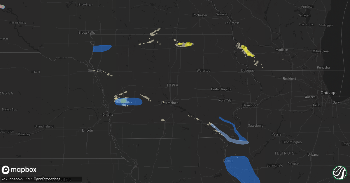
Hail Map in Iowa on July 17, 2019
Get this storm
July 17 map
$229
one time, instant access
Download today. No call, no setup
Keep the $229
Bought the map and want the full workflow? Apply the entire $229 to a subscription within 7 days. None of it is wasted.
Every map, not just this one
This buys you this map. Subscription and you get every map we run, in the markets you choose from a few cities to whole states to nationwide. Plus real-time alerts the moment a storm fires.
Contact data
Name, contact info, occupancy, even credit band for addresses in the footprint. You go from where it hit to who to call.
Become the source they trust
Unlimited branding weather history reports on demand. You already have the documented answer ready for the property owner, and you are the one who showed up with it.
Property data and RoofTrace estimates
Pull up any address you have got, its value and the exact code rules for that jurisdiction, straight from One Click Code. Then RoofTrace estimates the squares, pitch, and roof value, priced the way you price.
Storm reports in Iowa
Iowa
| Date | Description |
|---|---|
| 07/17/20193:43 PM CDT | A local report indicates 58 MPH wind near 1 S BURLINGTON REGIONAL |
| 07/17/20193:05 PM CDT | No damage... Observed in an open area. |
| 07/17/20193:00 PM CDT | Roof damage to the gregory manufacturing co north of montrose. Picture received via social media. Time estimated from radar. |
| 07/17/20192:42 PM CDT | Large... 14-inch tree limb fell on house. Debris like garbage cans flying around. |
| 07/17/20192:40 PM CDT | Tool shed roof blown off. Wind estimate was 60-70 mph. Time estimated from radar. |
| 07/17/20192:25 PM CDT | Several large trees uprooted or split in half... Around 15-18 inches in diameter. Several carports also damaged. |
| 07/17/20192:25 PM CDT | Power poles down in the area and no power at the residence. Four inch diameter tree branches broken and corn was blown down. |
| 07/17/20192:12 PM CDT | Wayland fire chief reports that numerous trees were down in wayland. A few structures had their roofs ripped off and a horse barn was destroyed in the area. |
| 07/17/201910:35 AM CDT | Trees and power lines blown down. Wind speeds estimated at 60 mph. |
| 07/17/201910:34 AM CDT | Public relayed report from personal weather station of gusts of 58+ mph. |
| 07/17/201910:15 AM CDT | Time estimated. |
| 07/17/201910:08 AM CDT | A local report indicates 1.00 inch wind near HARLAN |
| 07/17/201910:08 AM CDT | A local report indicates 70 MPH wind near HARLAN |
| 07/17/201910:00 AM CDT | Tree limbs blown down. |
| 07/17/20199:58 AM CDT | Crops laid over along county road f58. Time estimated. |
| 07/17/20199:55 AM CDT | 10-20 trees blown onto builds... Roads... And cars. Fire hall damaged. 3 grain bins destroyed. Machine shed destroyed. Winds estimated at 70 mph. |
| 07/17/20198:15 AM CDT | Pea-sized hail... And a few tree branches down. |
| 07/17/20197:55 AM CDT | Medium tree knocked over. |
| 07/17/20197:39 AM CDT | At 1239 PM CDT, a severe thunderstorm was located over Lakeside Casino, or over Osceola, moving southeast at 35 mph. HAZARD...60 mph wind gusts and quarter size hail. SOURCE...Radar indicated. IMPACT...Hail damage to vehicles is expected. Expect wind damage to roofs, siding, and trees. Locations impacted include... Osceola, Chariton, Lakeside Casino, Russell, Humeston, Lucas, Garden Grove, Woodburn, Weldon, Derby, Le Roy, Red Haw Lake State Park and Chariton Municipal Airport.This includes Interstate 35 between mile markers 27 and 42. |
| 07/17/20197:15 AM CDT | Truck blown over west of town. |
| 07/17/20197:10 AM CDT | Large trees downed by wind gusts. |
| 07/17/20197:06 AM CDT | Machine shed doors blown in... And backwall blown out with debris going out into the field. |
| 07/17/20197:05 AM CDT | 3 powerline poles blown over. |
| 07/17/20196:43 AM CDT | At 1143 PM CDT, a severe thunderstorm was located near Lost Island Lake, or 8 miles northwest of Emmetsburg, moving northeast at 30 mph. HAZARD...60 mph wind gusts and quarter size hail. SOURCE...Radar indicated. IMPACT...Hail damage to vehicles is expected. Expect wind damage to roofs, siding, and trees. Locations impacted include... Emmetsburg, Swan Lake, Five Island Lake, Ingham Lake, High Lake, Lost Island Lake, Armstrong, Graettinger, Ruthven, Ringsted, Fenton, Lone Rock, Kearney State Park, Lost Island Lake State Park and Wolden County Park. |
| 07/17/20196:38 AM CDT | At 1137 PM CDT, a severe thunderstorm was located near Eagle Lake, or 8 miles southwest of Forest City, moving northeast at 30 mph. HAZARD...60 mph wind gusts and quarter size hail. SOURCE...Radar indicated. IMPACT...Hail damage to vehicles is expected. Expect wind damage to roofs, siding, and trees. Locations impacted include... Forest City, Lake Mills, Rice Lake, Eagle Lake, Fertile, Leland, Crystal Lake, Woden, Hanlontown, Joice, Miller, Hayfield, Pilot Knob State Park, Lake Mills Municipal Airport, Forest City Municipal Airport, Rice Lake State Park and Eagle Lake State Park.This includes Interstate 35 between mile markers 200 and 206. |
| 07/17/20195:55 AM CDT | At 1053 AM CDT, severe thunderstorms were located along a line extending from 6 miles east of Audubon to 11 miles southwest of Guthrie Center to 10 miles east of Atlantic, moving east at 40 mph. HAZARD...60 mph wind gusts and quarter size hail. SOURCE...Public. Storm has a history of damaging winds, including reported trees down back in Portsmouth in Shelby County. IMPACT...Hail damage to vehicles is expected. Expect wind damage to roofs, siding, and trees. Locations impacted include... Guthrie Center, Lake Panorama, Anita, Adair, Fontanelle, Casey, Menlo, Wiota, Lake Anita State Park, Springbrook State Park, Anita Municipal Airport and Nodaway Park.This includes Interstate 80 between mile markers 66 and 88. |
| 07/17/20195:44 AM CDT | At 1044 AM CDT, a severe thunderstorm was located over Guthrie Center, moving east at 35 mph. HAZARD...60 mph wind gusts and quarter size hail. SOURCE...Radar indicated. IMPACT...Hail damage to vehicles is expected. Expect wind damage to roofs, siding, and trees. Locations impacted include... Adel, Guthrie Center, Dallas Center, Panora, De Soto, Lake Panorama, Redfield, Bayard, Diamondhead Lake, Minburn, Yale, Linden, Lakin Slough Game Management Area and Springbrook State Park.This includes Interstate 80 between mile markers 105 and 112. |
| 07/17/20195:35 AM CDT | At 1035 AM CDT, severe thunderstorms were located along a line extending from 7 miles east of Irwin to 8 miles east of Walnut, moving east at 30 mph. HAZARD...60 mph wind gusts and quarter size hail. SOURCE...Radar indicated. IMPACT...Hail damage to vehicles is expected. Expect wind damage to roofs, siding, and trees. Locations impacted include... Elk Horn Creek Recreation Area. |
| 07/17/20195:29 AM CDT | At 1028 AM CDT, severe thunderstorms were located along a line extending from 5 miles southeast of Irwin to 4 miles northeast of Walnut, moving east at 30 mph. HAZARD...60 mph wind gusts and quarter size hail. SOURCE...Radar indicated. IMPACT...Hail damage to vehicles is expected. Expect wind damage to roofs, siding, and trees. Locations impacted include... Elk Horn Creek Recreation Area. |
| 07/17/20195:16 AM CDT | At 1015 AM CDT, severe thunderstorms were located along a line extending from near Eagle Grove to near Webster City to 11 miles east of Gowrie, moving east at 45 mph. HAZARD...60 mph wind gusts and penny size hail. SOURCE...Radar indicated, and automated weather stations. IMPACT...Expect damage to roofs, siding, and trees. Locations impacted include... Ames, Webster City, Nevada, Iowa Falls, Eldora, Eagle Grove, Story City, Ackley, Roland, Jewell Junction, Gilbert, Big Wall Lake, Hubbard, Dayton, Alden, Stratford, Zearing, Radcliffe, Dows and Ellsworth.This includes Interstate 35 between mile markers 116 and 159. |
| 07/17/20195:11 AM CDT | At 1010 AM CDT, severe thunderstorms were located along a line extending from near Irwin to 7 miles east of Harlan to near Walnut, moving east at 35 mph. HAZARD...60 mph wind gusts and quarter size hail. SOURCE...Public has reported wind gusts to 50 mph. IMPACT...Hail damage to vehicles is expected. Expect wind damage to roofs, siding, and trees. Locations impacted include... Atlantic, Audubon, Anita, Exira, Adair, Elk Horn, Kimballton, Brayton, Marne, Wiota, Gray, Lake Anita State Park, Audubon County Airport, Atlantic Municipal Airport and Anita Municipal Airport.This includes Interstate 80 between mile markers 50 and 81. |
| 07/17/20194:51 AM CDT | At 951 AM CDT, severe thunderstorms were located along a line extending from 4 miles northwest of Earling to Persia, moving east at 25 mph. HAZARD...60 mph wind gusts and quarter size hail. SOURCE...Radar indicated. IMPACT...Hail damage to vehicles is expected. Expect wind damage to roofs, siding, and trees. Locations impacted include... Harlan, Avoca, Shelby, Earling, Irwin, Persia, Defiance, Panama, Portsmouth, Westphalia, Tennant, Kirkman, Prairie Rose State Park, Manteno Recreation Area, Nishna Bend Recreation Area and Elk Horn Creek Recreation Area. |
| 07/17/20193:29 AM CDT | At 829 AM CDT, a severe thunderstorm was located near Battle Creek, or 8 miles west of Ida Grove, moving east at 50 mph. HAZARD...60 mph wind gusts and penny size hail. SOURCE...Radar indicated. IMPACT...Expect damage to roofs, siding, and trees. This severe thunderstorm will be near... Ida Grove around 840 AM CDT. Arthur around 845 AM CDT. |
| 07/17/20193:01 AM CDT | At 800 AM CDT, a severe thunderstorm was located near Moville, or 18 miles east of Sioux City, moving east at 55 mph. HAZARD...60 mph wind gusts and penny size hail. SOURCE...Radar indicated. IMPACT...Expect damage to roofs, siding, and trees. This severe thunderstorm will be near... Anthon and Pierson around 810 AM CDT. Correctionville around 815 AM CDT. Cushing around 820 AM CDT. Battle Creek around 825 AM CDT. Holstein around 830 AM CDT.Other locations impacted by this severe thunderstorm include Bronson. |
| 07/17/20192:27 AM CDT | At 726 AM CDT, severe thunderstorms were located along a line extending from near Doon to near Orange City to near Merrill, moving east at 50 mph. HAZARD...70 mph wind gusts. SOURCE...Radar indicated. IMPACT...Expect considerable tree damage. Damage is likely to mobile homes, roofs, and outbuildings. Severe thunderstorms will be near... George and Hospers around 735 AM CDT. Boyden, Granville and Matlock around 740 AM CDT. Sheldon, Paullina and Ashton around 750 AM CDT. Primghar and Archer around 755 AM CDT. Sanborn, Sutherland and Melvin around 800 AM CDT. Hartley around 810 AM CDT. Everly and Royal around 815 AM CDT.Other locations impacted by these severe thunderstorms includeCalumet and Moneta. |
| 07/16/201910:27 PM CDT | At 326 PM CDT, severe thunderstorms were located along a line extending from near Carman to near Carthage to 6 miles east of Canton, moving east at 45 mph. HAZARD...60 mph wind gusts and penny size hail. SOURCE...Radar indicated. Trained spotters have reported 50 to 60 mph winds with these storms. IMPACT...Expect damage to roofs, siding, and trees. Locations impacted include... Macomb, Carthage, Bushnell, Hamilton, Colchester, La Harpe, Dallas City, Stronghurst, Avon, Blandinsville, Augusta, Bowen, Industry, Good Hope, Prairie City, Carman, Terre Haute, Bardolph, West Point and Ferris. |
| 07/16/20199:44 PM CDT | At 244 PM CDT, severe thunderstorms were located along a line extending from near Winfield to near Morning Sun to near New London, moving southeast at 30 mph. HAZARD...60 mph wind gusts and quarter size hail. SOURCE...Radar indicated. IMPACT...Hail damage to vehicles is expected. Expect wind damage to roofs, siding, and trees. Locations impacted include... Burlington, Mount Pleasant, Wapello, Oquawka, West Burlington, New London, Mediapolis, Danville, Stronghurst, Morning Sun, Biggsville, Gladstone, Rozetta, Oakville, Mount Union, Gulf Port, Toolesboro, Kossuth, Bald Bluff and Media. |
| 07/16/20198:58 PM CDT | At 158 PM CDT, severe thunderstorms were located along a line extending from near Lancaster to 6 miles east of Unionville, moving southeast at 45 mph. HAZARD...60 mph wind gusts and penny size hail. SOURCE...Radar indicated. IMPACT...Expect damage to roofs, siding, and trees. Locations impacted include... Unionville, Lancaster, Queen City, Greentop, Downing, Glenwood, Worthington and Livonia. |
All States Impacted by Hail Map on July 17, 2019
Cities Impacted by Hail Map on July 17, 2019
- Ottumwa, IA
- Eddyville, IA
- Alberta, MN
- Eldon, IA
- Batavia, IA
- Linton, ND
- Alpine, TX
- Dunlap, IA
- Woodbine, IA
- Marathon, TX
- Fennimore, WI
- Eastman, WI
- Avoca, IA
- Shelby, IA
- Saint Anthony, ND
- Gillette, WY
- Sundance, WY
- Beulah, WY
- Spearfish, SD
- Aladdin, WY
- Granada, MN
- Swea City, IA
- Elmore, MN
- Blue Earth, MN
- Ledyard, IA
- Bronson, FL
- Hillsboro, IA
- Keosauqua, IA
- Bonaparte, IA
- Stockport, IA
- Hebron, ND
- Rudd, IA
- Osage, IA
- Nora Springs, IA
- Rozet, WY
- Manly, IA
- Mason City, IA
- Fort Pierre, SD
- Pierre, SD
- Moorcroft, WY
- Belle Plaine, MN
- Jordan, MN
- New Prague, MN
- Briggsdale, CO
- Pine River, MN
- Lusk, WY
- Lance Creek, WY
- Belfield, ND
- Dickinson, ND
- Northfield, MN
- Solen, ND
- Mandan, ND
- Bottineau, ND
- Osceola, IA
- Murray, IA
- Truro, IA
- Glenwood, MN
- Lakeville, MN
- Prior Lake, MN
- Savage, MN
- Burnsville, MN
- New Leipzig, ND
- Flasher, ND
- Long Valley, SD
- Weldona, CO
- Orchard, CO
- Wanblee, SD
- Elk Horn, IA
- Exira, IA
- Audubon, IA
- Pine Ridge, SD
- Kyle, SD
- Warrenton, MO
- Foristell, MO
- Wright City, MO
- Marthasville, MO
- Shields, ND
- Carson, ND
- Woodman, WI
- Boscobel, WI
- Bismarck, ND
- Maxbass, ND
- Newburg, ND
- Upham, ND
- Sturgis, SD
- Piedmont, SD
- Deadwood, SD
- Winter Haven, FL
- Polk City, FL
- Lakeland, FL
- Auburndale, FL
- Richardton, ND
- Gladstone, ND
- Taylor, ND
- Sherwood, ND
- Harrison, NE
- Whitney, NE
- Crawford, NE
- Chadron, NE
- Mott, ND
- Hayes, VA
- Washington, MO
- Wibaux, MT
- Starbuck, MN
- Benson, MN
- Platteville, WI
- Belmont, WI
- Farmington, MN
- Persia, IA
- Portsmouth, IA
- Harlan, IA
- Kirkman, IA
- Panama, IA
- New Virginia, IA
- Kadoka, SD
- Woden, IA
- Titonka, IA
- Moville, IA
- Saint Paul, MN
- Watford City, ND
- Arnegard, ND
- Fort Yates, ND
- Selfridge, ND
- Earling, IA
- Defiance, IA
- Sioux City, IA
- Elgin, ND
- Alpine, NJ
- Norwood, NJ
- Bayard, IA
- Fort Meade, SD
- Whitewood, SD
- Stitzer, WI
- Big Falls, MN
- Effie, MN
- Coon Rapids, IA
- Livingston, WI
- New Salem, ND
- Savage, MT
- Laddonia, MO
- Martinsburg, MO
- Walnut, IA
- Dunseith, ND
- Kramer, ND
- Graettinger, IA
- Clontarf, MN
- Hancock, MN
- Hastings, MN
- Rosemount, MN
- Medora, ND
- West Des Moines, IA
- Carlsbad, NM
- Webster, FL
- Beach, ND
- Mount Hope, WI
- Elko New Market, MN
- Anthon, IA
- Danbury, IA
- Lawton, IA
- Morriston, FL
- Williston, FL
- Farmington, IA
- Donnellson, IA
- Birmingham, IA
- Manilla, IA
- Emmons, MN
- Kiester, MN
- Scarville, IA
- Backus, MN
- Brooklyn, WI
- Evansville, WI
- Midland, SD
- Karval, CO
- Hugo, CO
- Irwin, IA
- Nokesville, VA
- Fairfield, IA
- Catlett, VA
- Fallon, MT
- Lonsdale, MN
- Webster, MN
- Montgomery, MN
- North Sioux City, SD
- Morris, MN
- Orchard, IA
- Altoona, FL
- Burke, SD
- Panora, IA
- Marfa, TX
- Brooten, MN
- Crane, MT
- Bussey, IA
- Inver Grove Heights, MN
- Atwood, KS
- Strasburg, ND
- Camp Point, IL
- Northome, MN
- Hildreth, NE
- Thompson, IA
- Bristow, VA
- Sentinel Butte, ND
- Mentone, TX
- Lancaster, WI
- Mineral Point, WI
- Cuba City, WI
- Darlington, WI
- Ellis, KS
- Yonkers, NY
- Libertyville, IA
- Fenton, IA
- Ringsted, IA
- Bancroft, IA
- Lone Rock, IA
- Logan, IA
- Catharine, KS
- Glendive, MT
- Wauzeka, WI
- Prairie Du Chien, WI
- Steuben, WI
- Staples, MN
- Gratiot, WI
- Clear Lake, IA
- Plymouth, IA
- Rock Falls, IA
- Floyd, IA
- Rewey, WI
- Hanlontown, IA
- Joice, IA
- Cylinder, IA
- Guthrie Center, IA
- Brooksville, FL
- Kensett, IA
- Waukee, IA
- Urbandale, IA
- Clive, IA
- Bowling Green, FL
- Souris, ND
- Grover, CO
- Kabetogama, MN
- International Falls, MN
- Littlefork, MN
- Orr, MN
- Lewes, DE
- Georgetown, DE
- Milton, DE
- Harbeson, DE
- Carman, IL
- West Burlington, IA
- Morning Sun, IA
- Colchester, IL
- Burlington, IA
- Winfield, IA
- Blandinsville, IL
- Yarmouth, IA
- Wayland, IA
- Sperry, IA
- Brighton, IA
- Mount Union, IA
- Lomax, IL
- Macomb, IL
- Mount Pleasant, IA
- La Harpe, IL
- Dallas City, IL
- Washington, IA
- Sciota, IL
- Mediapolis, IA
- Montrose, IA
- Fort Madison, IA
- Niota, IL
- Keokuk, IA
- West Point, IA
- Nauvoo, IL
- Hamilton, IL
- Carthage, IL
- Tennessee, IL
- Perry, IL
- Eldred, IL
- Wrights, IL
- Hannibal, MO
- Dow, IL
- Jerseyville, IL
- Baylis, IL
- Batchtown, IL
- Medora, IL
- Rockbridge, IL
- Kinderhook, IL
- Elsberry, MO
- Chambersburg, IL
- Carrollton, IL
- Kane, IL
- Saint Charles, MO
- Pleasant Hill, IL
- Payson, IL
- Palmyra, MO
- Meredosia, IL
- Hardin, IL
- Pearl, IL
- Clarksville, MO
- New London, MO
- Foley, MO
- Mount Sterling, IL
- Kampsville, IL
- Patterson, IL
- Versailles, IL
- Brighton, IL
- Griggsville, IL
- Quincy, IL
- Hamburg, IL
- Plainville, IL
- Taylor, MO
- Greenfield, IL
- Coatsburg, IL
- Fieldon, IL
- Roodhouse, IL
- Hillview, IL
- Mendon, IL
- New Canton, IL
- Hull, IL
- Louisiana, MO
- Winchester, IL
- Timewell, IL
- Frankford, MO
- Milton, IL
- Nebo, IL
- Pittsfield, IL
- Annada, MO
- Grafton, IL
- White Hall, IL
- Brussels, IL
- Barry, IL
- Elsah, IL
- Paloma, IL
- Clayton, IL
- Maywood, MO
- Portage Des Sioux, MO
- Fowler, IL
- Ashburn, MO
- Godfrey, IL
- Bluffs, IL
- Rockport, IL
- Liberty, IL
- New Salem, IL
- Lexington, VA
- Douglas, WY
- Edgemont, SD
- Harrold, SD
- Sioux Center, IA
- Alton, IA
- Hospers, IA
- Rock Valley, IA
- Ireton, IA
- Hull, IA
- Alcester, SD
- Boyden, IA
- Sheldon, IA
- Hudson, SD
- Orange City, IA
- Maurice, IA
- Hawarden, IA
- Atlantic, IA
- Kimballton, IA
- Adair, IA
- Anita, IA
- Hamlin, IA
- Marne, IA
- Brayton, IA
- Douglassville, PA
- Lancaster, PA
- Ronks, PA
- Gordonville, PA
- Terre Hill, PA
- Manchester, MD
- Narvon, PA
- Hanover, PA
- Felton, PA
- Smoketown, PA
- Kinzers, PA
- Morgantown, PA
- Glen Rock, PA
- Dallastown, PA
- Elverson, PA
- Shrewsbury, PA
- Spring Grove, PA
- Seven Valleys, PA
- New Freedom, PA
- Willow Street, PA
- East Earl, PA
- Intercourse, PA
- York, PA
- Pottstown, PA
- Boyertown, PA
- Wrightsville, PA
- Airville, PA
- Windsor, PA
- Pequea, PA
- Westminster, MD
- Bird In Hand, PA
- Brogue, PA
- Washington Boro, PA
- Conestoga, PA
- Birdsboro, PA
- Leola, PA
- Red Lion, PA
- Glenville, PA
- Stewartstown, PA
- Strasburg, PA
- Gap, PA
- Mohnton, PA
- Millersville, PA
- New Holland, PA
- Honey Brook, PA
- Paradise, PA
- New Providence, PA
- Parkesburg, PA
- Quarryville, PA
- Coatesville, PA
- Christiana, PA
- Downingtown, PA
- Thorndale, PA
- West Chester, PA
- Kennett Square, PA
- Gilbertville, MA
- Barre, MA
- Petersham, MA
- Hardwick, MA
- Hubbardston, MA
- Westminster, MA
- Lee, MA
- West Stockbridge, MA
- Lenox Dale, MA
- Becket, MA
- Stockbridge, MA
- Richmond, MA
- Lenox, MA
- Old Chatham, NY
- East Chatham, NY
- Nassau, NY
- Canaan, NY
- Malden Bridge, NY
- Valatie, NY
- Wingate, MD
- Crocheron, MD
- Crapo, MD
- Nanticoke, MD
- Hebron, MD
- Bivalve, MD
- Quantico, MD
- Tyaskin, MD
- Eden, MD
- Vienna, MD
- Salisbury, MD
- Toddville, MD
- Fruitland, MD
- Sunburg, MN
- Murdock, MN
- Dupree, SD
- Gettysburg, SD
- Eagle Butte, SD
- Selby, SD
- Charlottesville, VA
- Stanardsville, VA
- Free Union, VA
- Dyke, VA
- Ruckersville, VA
- Earlysville, VA
- Crozet, VA
- Catharpin, VA
- Clifton, VA
- Fairfax, VA
- Haymarket, VA
- Manassas, VA
- Chantilly, VA
- Centreville, VA
- Gainesville, VA
- Warrenton, VA
- Silver Spring, MD
- Hyattsville, MD
- Bethesda, MD
- Cabin John, MD
- Kensington, MD
- Takoma Park, MD
- Chevy Chase, MD
- Glen Echo, MD
- Washington, DC
- Alexandria, VA
- Fort Belvoir, VA
- Dumfries, VA
- Springfield, VA
- Occoquan, VA
- Woodbridge, VA
- Lorton, VA
- Ashburn, VA
- Perryville, MD
- Barnesville, MD
- North East, MD
- Fork, MD
- Woodbine, MD
- Reisterstown, MD
- Leesburg, VA
- Clarksville, MD
- Abingdon, MD
- Perryman, MD
- Fallston, MD
- Derwood, MD
- Forest Hill, MD
- Darlington, MD
- Street, MD
- Olney, MD
- Kingsville, MD
- Nottingham, MD
- Upper Falls, MD
- Havre De Grace, MD
- Boyds, MD
- Aberdeen, MD
- Randallstown, MD
- Clarksburg, MD
- Joppa, MD
- Sparks Glencoe, MD
- Colora, MD
- Phoenix, MD
- Poolesville, MD
- Aberdeen Proving Ground, MD
- Montgomery Village, MD
- Beallsville, MD
- Hunt Valley, MD
- Cooksville, MD
- Parkville, MD
- Conowingo, MD
- Lutherville Timonium, MD
- Pikesville, MD
- Adamstown, MD
- Hydes, MD
- Cockeysville, MD
- Belcamp, MD
- Marriottsville, MD
- Perry Point, MD
- Ellicott City, MD
- Churchville, MD
- Glenwood, MD
- Damascus, MD
- Jarrettsville, MD
- Baltimore, MD
- Windsor Mill, MD
- Mount Airy, MD
- Bel Air, MD
- Owings Mills, MD
- West Friendship, MD
- Edgewood, MD
- Perry Hall, MD
- Dayton, MD
- Dickerson, MD
- Gaithersburg, MD
- Glen Arm, MD
- Glenelg, MD
- Germantown, MD
- Baldwin, MD
- Woodstock, MD
- Towson, MD
- White Marsh, MD
- Sykesville, MD
- Stevenson, MD
- Sterling, VA
- Monkton, MD
- Gwynn Oak, MD
- Port Deposit, MD
- Rising Sun, MD
- Brookeville, MD


