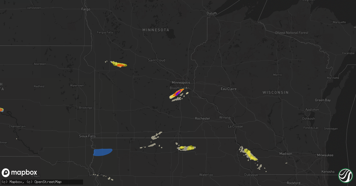
Hail Map on July 17, 2019
Get this storm
July 17 map
$229
one time, instant access
Download today. No call, no setup
Keep the $229
Bought the map and want the full workflow? Apply the entire $229 to a subscription within 7 days. None of it is wasted.
Every map, not just this one
This buys you this map. Subscription and you get every map we run, in the markets you choose from a few cities to whole states to nationwide. Plus real-time alerts the moment a storm fires.
Contact data
Name, contact info, occupancy, even credit band for addresses in the footprint. You go from where it hit to who to call.
Become the source they trust
Unlimited branding weather history reports on demand. You already have the documented answer ready for the property owner, and you are the one who showed up with it.
Property data and RoofTrace estimates
Pull up any address you have got, its value and the exact code rules for that jurisdiction, straight from One Click Code. Then RoofTrace estimates the squares, pitch, and roof value, priced the way you price.
States Impacted by Hail Map on July 17, 2019
Storm reports
Maine
| Date | Description |
|---|---|
| 07/17/20193:10 AM CDT | At 810 PM EDT, a severe thunderstorm was located near Ellsworth, moving southeast at 25 mph. HAZARD...60 mph wind gusts. SOURCE...Radar indicated. IMPACT...Expect damage to trees and power lines. Locations impacted include... Ellsworth, Bar Harbor, Steuben, Hancock, Franklin, Gouldsboro, Lamoine, Trenton, Surry, Sullivan, Winter Harbor and Sorrento. |
South Carolina
| Date | Description |
|---|---|
| 07/17/20196:30 PM CDT | South carolina highway patrol reported a tree down on davison road just north of highway 17. |
| 07/17/20196:12 PM CDT | Charleston county 911 reported a tree down on highway 162 near the intersection with highway 174. Highway 162 had to be closed for a time due to the tree in the roadway |
| 07/17/20195:51 PM CDT | South carolina highway patrol reported a tree down on hope plantation lane near highway 17. |
| 07/17/20193:18 PM CDT | Schp reported a tree down at fews chapel rd and hwy 14 |
| 07/17/20193:13 PM CDT | Tree and utility lines downed near fowler rd and highway 101. |
| 07/17/20193:13 PM CDT | Schp reported a tree down at 385 w mcelhaney rd |
| 07/17/20193:11 PM CDT | Schp reported a tree down at n tigerville rd and highway 11 |
| 07/17/20193:05 PM CDT | Tree down along highway 414 near meadow fork rd. |
| 07/17/20193:00 PM CDT | A picture of a tree blown down by thunderstorm outflow winds was relayed by local broadcast media. The tree was down at a home on garris avenue. |
| 07/17/20192:53 PM CDT | Sc highway patrol reports tree down near intersection of talley road and highway 414. |
| 07/17/20191:52 PM CDT | Sc highway patrol reports a tree down near intersection of highway 107 and highway 28. |
| 07/17/20193:35 AM CDT | At 835 PM EDT, severe thunderstorms were located along a line extending from near Walterboro to 22 miles southwest of Givhans Ferry State Park to 9 miles northeast of Yemassee, moving east at 15 mph. HAZARD...60 mph wind gusts and penny size hail. SOURCE...Radar indicated. IMPACT...Expect damage to trees and powerlines. Locations impacted include... Walterboro, Cottageville, Hendersonville, Round O, Green Pond, Ashepoo and Ritter.This warning includes I-95 in South Carolina between mile markers 47and 63. |
| 07/17/20191:33 AM CDT | At 633 PM EDT, a severe thunderstorm was located 17 miles southeast of Walterboro, moving east at 15 mph. HAZARD...60 mph wind gusts and quarter size hail. SOURCE...Radar indicated. IMPACT...Minor hail damage to vehicles is possible. Expect wind damage to trees and powerlines. Locations impacted include... Hollywood, Ravenel, Seabrook Island, Meggett, Rockville, Delemar Crossroads, Yonges Island and Adams Run. |
| 07/17/201912:39 AM CDT | At 538 PM EDT, a severe thunderstorm was located 7 miles east of Danielsville, or near Comer, moving east at 50 mph. HAZARD...60 mph wind gusts. SOURCE...Radar indicated. IMPACT...Expect damage to trees and power lines. Locations impacted include... Elberton, Bowman, Middleton, Russell State Park, Lake Russell, Dewy Rose, Rock Branch, Sweet City and Ruckersville. |
| 07/16/201911:56 PM CDT | At 455 PM EDT, a severe thunderstorm was located over Bucksville, or near Red Hill, moving east at 10 mph. HAZARD...60 mph wind gusts and quarter size hail. SOURCE...Radar indicated. IMPACT...Minor hail damage to vehicles is possible. Expect wind damage to trees and power lines. Locations impacted include... Myrtle Beach, Surfside Beach, Myrtle Beach Airport, Socastee, Garden City, Murrells Inlet, Red Hill, Burgess, Bucksville, Bucksport, Dongola, Forestbrook, Yauhannah and Waccamaw Community Hospital. |
| 07/16/201911:01 PM CDT | At 401 PM EDT, a severe thunderstorm was located 10 miles north of Greenville Downtown, or near Travelers Rest, moving east at 30 mph. HAZARD...60 mph wind gusts and penny size hail. SOURCE...Radar indicated. IMPACT...Expect damage to trees and power lines. Locations impacted include... Travelers Rest, Lyman, Paris Mountain State Park, Tigerville, Lake Robinson, Furman University, Gowensville, Greer, Wellford and Slater-Marietta. |
| 07/16/20197:39 PM CDT | South carolina highway patrol reported tree down on independent lane near dallas lane. |
| 07/16/20197:39 PM CDT | South carolina highway patrol reported a tree down estates drive near the intersection with lemon road. |
| 07/16/20197:19 PM CDT | South carolina highway patrol reported tree down on cavanaugh road near black creek road. |
Tennessee
| Date | Description |
|---|---|
| 07/17/20194:57 AM CDT | At 956 PM CDT, severe thunderstorms were located along a line extending from near Dover to near Tennessee Ridge to 10 miles east of Springville, moving southeast at 35 mph. This storm does have a history of producing damaging wind gusts. HAZARD...60 mph wind gusts. SOURCE...Radar indicated. IMPACT...Expect damage to roofs, siding, and trees. Locations impacted include... Waverly, Erin, McEwen, Tennessee Ridge, Hurricane Mills, Vanleer, Cumberland City, Slayden, Houston County Airport and Indian Mound. |
| 07/17/20193:47 AM CDT | At 847 PM CDT, a severe thunderstorm was located near Benton, moving southeast at 40 mph. HAZARD...60 mph wind gusts and penny size hail. SOURCE...Radar indicated. IMPACT...Expect damage to roofs, siding, and trees. Locations impacted include... Murray, Benton, Hardin, Aurora, New Concord and Kirksey. This includes Interstate 24 in Kentucky near Mile Marker 29. |
North Carolina
| Date | Description |
|---|---|
| 07/17/20196:48 PM CDT | Trees down on powerlines on smith rd. |
| 07/17/20194:31 PM CDT | Suspected downburst winds downed numerous trees along cleveland road... With at least six impacting structures along hazelnut lane...brazil nut lane...and lee trace dri |
| 07/17/20194:30 PM CDT | Tree down on house on lee trace dr. |
| 07/17/20192:33 PM CDT | Tree down on house. Time estimated by radar. |
| 07/17/20196:40 AM CDT | At 1140 PM EDT, a severe thunderstorm was located 7 miles east of Angier, or 14 miles west of Smithfield, moving east at 25 mph. HAZARD...60 mph wind gusts. SOURCE...Radar indicated. IMPACT...Expect damage to roofs, siding, and trees. Locations impacted include... Smithfield, Clayton, Selma, Four Oaks, Pine Level, Coats Crossroads and Flowers. |
| 07/17/20193:15 AM CDT | At 814 PM EDT, a severe thunderstorm was located over Maury, or 7 miles south of Farmville, moving northeast at 30 mph. HAZARD...60 mph wind gusts and penny size hail. SOURCE...Radar indicated. IMPACT...Expect damage to roofs, siding, and trees. Locations impacted include... Greenville, Winterville, Ayden, Farmville, Snow Hill, Bell Arthur, House, Black Jack, Ormondsville, Maury, Roundtree, Lizzie, East Carolina University, Pitt Greenville Airport, Dowdy Ficklen Stadium, Simpson, Hookerton and Castoria. |
| 07/17/20192:46 AM CDT | At 745 PM EDT, a severe thunderstorm was located near Jason, or 9 miles north of La Grange, moving northeast at 30 mph. HAZARD...60 mph wind gusts. SOURCE...Radar indicated. IMPACT...Expect damage to roofs, siding, and trees. Locations impacted include... Ayden, Farmville, Grifton, Snow Hill, Bell Arthur, Ormondsville, Maury, Institute, Jason, Roundtree, Lizzie, Hookerton, Castoria, Shine, Fort Run VFD and Bull Head VFD. |
| 07/16/201911:24 PM CDT | At 424 PM EDT, a severe thunderstorm was located over Lillington, moving east at 30 mph. HAZARD...60 mph wind gusts. SOURCE...Radar indicated. IMPACT...Expect damage to roofs, siding, and trees. Locations impacted include... Lillington, Dunn, Erwin, Raven Rock State Park and Buies Creek. |
| 07/16/201911:00 PM CDT | Trees were reported down on power lines along wilsons mills road. |
| 07/16/201910:58 PM CDT | Tree down at 159 strickland rd. |
| 07/16/201910:56 PM CDT | Tree down on little creek church rd. |
| 07/16/201910:56 PM CDT | Tree down on cooper branch rd... Just south of business us-70 and the us-70 bypass. |
| 07/16/201910:56 PM CDT | Roof of a shed came off on steel bridge rd. |
| 07/16/201910:56 PM CDT | Tree down at w olive rd and us-70 w. |
| 07/16/201910:55 PM CDT | Trees were reported down on power lines near the intersection of twin acres road and knights bridge dr. |
| 07/16/201910:50 PM CDT | Tree down at 93 spaniel ln. |
| 07/16/201910:47 PM CDT | Tree down on i-40 at mile-marker 317. |
| 07/16/201910:42 PM CDT | Tree down at cleveland rd and n shiloh rd. |
| 07/16/201910:40 PM CDT | Tree down at nc-50 n and old lee rd. |
| 07/16/201910:39 PM CDT | At 338 PM EDT, a severe thunderstorm was located 10 miles northeast of Pickens, or 4 miles east of Table Rock State Park, moving east at 30 mph. HAZARD...60 mph wind gusts. SOURCE...Radar indicated. IMPACT...Expect damage to trees and power lines. Locations impacted include... Slater-Marietta, Tigerville, Lake Robinson, Pleasant Ridge State Park, Jones Gap State Park, North Saluda Reservoir, Cleveland, Glassy Mountain and Caesars Head State Park. |
Colorado
| Date | Description |
|---|---|
| 07/17/201912:57 AM CDT | At 557 PM MDT, a severe thunderstorm was located 5 miles southwest of Ruleton, moving east at 15 mph. HAZARD...60 mph wind gusts and penny size hail. SOURCE...Radar indicated. IMPACT...Expect damage to roofs, siding, and trees. Locations impacted include... Goodland, Kanorado and Ruleton. This includes Interstate 70 in Kansas between mile markers 0 and 25. |
| 07/16/201911:19 PM CDT | At 418 PM MDT, a severe thunderstorm was located near Briggsdale, or 29 miles northeast of Greeley, moving east at 35 mph. HAZARD...Quarter size hail. SOURCE...Radar indicated. IMPACT...Damage to vehicles is expected. Locations impacted include... Briggsdale, New Raymer and Keota. |
| 07/16/20199:59 PM CDT | At 258 PM MDT, a severe thunderstorm was located 5 miles northwest of Boyero, or 24 miles southwest of Flagler, moving east at 35 mph. HAZARD...Quarter size hail. SOURCE...Radar indicated. IMPACT...Damage to vehicles is expected. Locations impacted include... Boyero. |
Maryland
| Date | Description |
|---|---|
| 07/17/20196:20 PM CDT | Tree down near intersection of routes 291 and 301. Time estimated from radar. |
| 07/17/20196:03 PM CDT | Downed utility on md-276 both directions at md-222. Road closed. Time estimated from radar. |
| 07/17/20196:00 PM CDT | Numerous trees down in rising sun. Time estimated from radar. |
| 07/17/20196:00 PM CDT | Tree down in chestertown. Time estimated from radar. |
| 07/17/20195:35 PM CDT | Multiple trees and powerlines down in the aberdeen area. |
| 07/17/20195:31 PM CDT | Tree down at the intersection of flintville rd. And broad creek rd. |
| 07/17/20195:30 PM CDT | Tree down at the intersection of flintville rd. And broad creek rd. |
| 07/17/20195:22 PM CDT | Tree down on wire at the intersection of state route 136 and trappe rd. |
| 07/17/20195:20 PM CDT | Numerous |
| 07/17/20195:19 PM CDT | Tree down onto residence on saddleback way |
| 07/17/20195:14 PM CDT | Multiple reports of trees down in narrettsville |
| 07/17/20195:14 PM CDT | Several trees down in the forest hill area. |
| 07/17/20195:09 PM CDT | Tree down at the 5400 block of muddy creek rd. |
| 07/17/20195:09 PM CDT | Large tree downed... Approximately 40 inches in diameter and 78 feet tall. |
| 07/17/20195:09 PM CDT | Multiple reports of trees down... Some on power lines... In edgewater |
| 07/17/20195:07 PM CDT | Tree down near the intersection of east cold spring lane and marble hall road. |
| 07/17/20195:02 PM CDT | Multiple reports of trees down... Some on power lines... In lothian |
| 07/17/20195:00 PM CDT | Large tree down blocking three lanes of inner loop 695/baltimore beltway at greenspring. |
| 07/17/20195:00 PM CDT | Large trees down on tintern court. |
| 07/17/20195:00 PM CDT | Multiple trees down near the intersection of greenspring ave. And kelly ave. In lutherville. |
| 07/17/20194:46 PM CDT | Several trees down in forest hill |
| 07/17/20194:46 PM CDT | Tree down on steed road. |
| 07/17/20194:46 PM CDT | Tree down at east-west highway and rosemary hills dr. |
| 07/17/20194:46 PM CDT | Tree down on a car between new hampshire ave and 4th ave. |
| 07/17/20194:46 PM CDT | Tree down blocking two lanes of md-410. |
| 07/17/20194:45 PM CDT | Roof and siding blown off of an apartment complex on garrison view rd. |
| 07/17/20194:45 PM CDT | Roof and siding blown off of an apartment complex on garrison view rd. |
| 07/17/20194:37 PM CDT | *** 1 inj *** tree branch fell on a person. Person taken to a hospital. |
| 07/17/20194:37 PM CDT | Tree on a house |
| 07/17/20194:32 PM CDT | Tree down on poplar ave. Between 4th ave. And new hampshire ave. |
| 07/17/20194:32 PM CDT | Multiple trees down along liberty rd. East of eldersburg |
| 07/17/20194:28 PM CDT | A couple of trees down near sykesville |
| 07/17/20194:28 PM CDT | Multiple trees down near the intersection of s. Tannery rd. And gorsech rd. |
| 07/17/20194:23 PM CDT | Large tree down across the road |
| 07/17/20194:19 PM CDT | Multiple trees down in the nanjemoy area... Especially near the intersection of sandy point rd. And jacksontown rd. |
| 07/17/20194:18 PM CDT | Tree down across the road |
| 07/17/20194:18 PM CDT | Tree down onto wires |
| 07/17/20194:15 PM CDT | Multiple trees down in the area between poolesville... Dickerson... And beallsville. |
| 07/17/20194:14 PM CDT | Tree down on study rd. |
| 07/17/20194:14 PM CDT | Tree down near the 13600 russett rd. |
| 07/17/20194:09 PM CDT | Tree and wires down blocking road |
| 07/17/20194:00 PM CDT | Tree down on the road |
| 07/17/20193:56 PM CDT | Multiple wires down on germantown rd. In germantown |
| 07/17/20193:48 PM CDT | Tree down at residence |
| 07/17/20194:13 AM CDT | At 913 PM EDT, a severe thunderstorm was located over Onancock, or 14 miles north of Exmore, moving east at 35 mph. HAZARD...60 mph wind gusts. SOURCE...Radar indicated. IMPACT...Expect damage to trees and powerlines. This severe thunderstorm will be near, Parksley around 925 PM EDT.Other locations impacted by this severe thunderstorm includeHorntown, Harborton, Melfa, Mappsville, Greenbackville, Saxis,Accomac, Wallops Island, Temperanceville and Nelsonia. |
| 07/17/20193:54 AM CDT | At 853 PM EDT, a severe thunderstorm was located near Milton, or near Georgetown, moving east at 20 mph. HAZARD...60 mph wind gusts. SOURCE...Radar indicated. IMPACT...Damage to roofs, siding, trees, and power lines is possible. Locations impacted include... Millsboro, Lewes, Milton, Selbyville, Dagsboro, Millville, Henlopen Acres, Long Neck, Ocean View, Frankford, South Bethany and Dewey Beach. |
| 07/17/20193:46 AM CDT | At 845 PM EDT, a severe thunderstorm was located over Salisbury, moving east at 35 mph. HAZARD...60 mph wind gusts and penny size hail. SOURCE...Radar indicated. IMPACT...Expect damage to trees and powerlines. This severe thunderstorm will be near, Parsonsburg around 850 PM EDT. Berlin around 915 PM EDT. Ocean Pines around 920 PM EDT. Cape Isle Of Wight around 925 PM EDT. Ocean City around 930 PM EDT.Other locations impacted by this severe thunderstorm include Bishop,West Ocean City, Ocean City Municipality, Salisbury-Wicomico,Chesapeake Heights, Bishopville, Pittsville, Powellville, Showell andWhaleyville. |
| 07/17/20193:30 AM CDT | At 829 PM EDT, a severe thunderstorm was located near Sharptown, or 10 miles northwest of Salisbury, moving northeast at 25 mph. HAZARD...60 mph wind gusts. SOURCE...Radar indicated. IMPACT...Damage to roofs, siding, trees, and power lines is possible. Locations impacted include... Georgetown, Seaford, Millsboro, Laurel, Delmar, Sycamore, Gumboro, Blades and Bethel. |
| 07/17/20192:15 AM CDT | At 715 PM EDT, severe thunderstorms were located along a line extending from near Elverson to near Glasgow, moving northeast at 30 mph. HAZARD...70 mph wind gusts. SOURCE...Radar indicated. IMPACT...Expect considerable tree damage. Damage is likely to mobile homes, roofs, and outbuildings. Locations impacted include... Wilmington, Newark, West Chester, Elkton, Calvert, Norristown, Chester, Pottstown, Phoenixville, West Norriton, East Norriton, Pennsville, Coatesville, Westtown, Carneys Point, Downingtown, Folcroft, Swarthmore, Elsmere and Paulsboro. |
| 07/17/20191:35 AM CDT | At 634 PM EDT, severe thunderstorms were located along a line extending from Millersville to near Havre De Grace, moving northeast at 40 mph. HAZARD...60 mph wind gusts. SOURCE...Radar indicated. IMPACT...Damage to roofs, siding, trees, and power lines is possible. Locations impacted include... Wilmington, Newark, West Chester, Elkton, Calvert, Coatesville, Westtown, Carneys Point, Downingtown, Elsmere, Kennett Square, New Castle, Penns Grove, Oxford, Parkesburg, North East, West Grove, Rising Sun, Honey Brook and Elverson. |
| 07/17/20191:31 AM CDT | At 631 PM EDT, severe thunderstorms were located along a line extending from near Delta to 6 miles southwest of Octoraro to near Perryman, moving east at 40 mph. HAZARD...60 mph wind gusts. SOURCE...Radar indicated. IMPACT...Damaging winds will cause some trees and large branches to fall. This could injure those outdoors, as well as damage homes and vehicles. Roadways may become blocked by downed trees. Localized power outages are possible. Unsecured light objects may become projectiles. Locations impacted include... Aberdeen, Havre De Grace, Aberdeen Proving Ground, Riverside, Perryman, Darlington, Cardiff, Churchville, Carsins, Scarboro, Belcamp, Whiteford and Harford Furnace. |
| 07/17/20191:12 AM CDT | At 611 PM EDT, severe thunderstorms were located along a line extending from near Royalton to near Marietta to near Yorkana to near Brogue to Delta, moving northeast at 35 mph. HAZARD...60 mph wind gusts and penny size hail. SOURCE...Radar indicated. IMPACT...Expect damage to trees, roofs, and siding. Severe thunderstorms will be near... Mount Joy, Wakefield, Shenks Ferry, Holtwood and Safe Harbor around 620 PM EDT. Millersville, Lancaster, East Petersburg, Willow Street, Hershey, Salunga-Landisville, Lawn, Mountville and Campbelltown around 630 PM EDT. Lititz, Manheim, Annville, Palmyra, Timber Hills, Mount Gretna Heights, Smithville and Quarryville around 640 PM EDT. Cornwall, Akron, Lebanon, Brickerville, Paradise, Lebanon South, Quentin, Leola, Strasburg and Avon around 650 PM EDT.Other locations impacted by these severe thunderstorms include York Haven, Three Mile Island, Bowmansville, Peach Bottom, Mount Goodville and Schoeneck.This includes The Pennsylvania Turnpike from mile markers 252 to 291. |
| 07/17/20191:08 AM CDT | At 608 PM EDT, a severe thunderstorm was located over South Gate, or over Severn, moving northeast at 40 mph. HAZARD...60 mph wind gusts. SOURCE...Radar indicated. IMPACT...Damaging winds will cause some trees and large branches to fall. This could injure those outdoors, as well as damage homes and vehicles. Roadways may become blocked by downed trees. Localized power outages are possible. Unsecured light objects may become projectiles. Locations impacted include... Baltimore, Severn, Crofton, Middle River, Elkridge, Riviera Beach, Baltimore-Washington Airport, Fort Smallwood State Park, Bodkin Point, Millers Island, North Point State Park, Sparrows Point, Back River, Glen Burnie, Dundalk, Catonsville, Essex, Severna Park, Odenton and Pasadena. |
| 07/17/201912:46 AM CDT | At 546 PM EDT, severe thunderstorms were located along a line extending from near Gamber to Owings Mills to Woodlawn, moving northeast at 35 mph. HAZARD...60 mph wind gusts. SOURCE...Radar indicated. IMPACT...Damaging winds will cause some trees and large branches to fall. This could injure those outdoors, as well as damage homes and vehicles. Roadways may become blocked by downed trees. Localized power outages are possible. Unsecured light objects may become projectiles. Locations impacted include... Baltimore, Pikesville, Cockeysville, Aberdeen, Havre De Grace, Aberdeen Proving Ground, Towson, Bel Air South, Woodlawn, Randallstown, Parkville, Owings Mills, Bel Air North, Carney, Milford Mill, Perry Hall, Reisterstown, Lochearn, Rossville and Mays Chapel. |
| 07/17/201912:16 AM CDT | At 515 PM EDT, severe thunderstorms were located along a line extending from Bonneauville to near Pennville to near Hampstead, moving northeast at 35 mph. HAZARD...60 mph wind gusts. SOURCE...Radar indicated. IMPACT...Expect damage to trees, roofs, and siding. Locations impacted include... York, Hanover, Weigelstown, Parkville, Red Lion, Spry, Dallastown, Shiloh, East York, Stonybrook-Wilshire, West York, Littlestown, Shrewsbury, Codorus, Grantley, Valley Green, Tyler Run-Queens Gate, McSherrystown, Manchester and Hallam.This includes Interstate 83 from mile markers 0 to 33. |
| 07/17/201912:12 AM CDT | At 512 PM EDT, a severe thunderstorm was located over Damascus, moving northeast at 40 mph. HAZARD...60 mph wind gusts. SOURCE...Radar indicated. IMPACT...Damaging winds will cause some trees and large branches to fall. This could injure those outdoors, as well as damage homes and vehicles. Roadways may become blocked by downed trees. Localized power outages are possible. Unsecured light objects may become projectiles. Locations impacted include... Olney, Pikesville, Damascus, Historic Ellicott City, Ellicott City, Woodlawn, Randallstown, Montgomery Village, Owings Mills, Eldersburg, Milford Mill, Reisterstown, Lochearn, Redland, Mount Airy, Sykesville, Oakland, Gamber, Garrison and Laytonsville. |
| 07/17/201912:08 AM CDT | At 508 PM EDT, severe thunderstorms were located along a line extending from near Lake Ridge to near Stafford, moving northeast at 35 mph. HAZARD...60 mph wind gusts. SOURCE...Radar indicated. IMPACT...Damaging winds will cause some trees and large branches to fall. This could injure those outdoors, as well as damage homes and vehicles. Roadways may become blocked by downed trees. Localized power outages are possible. Unsecured light objects may become projectiles. Locations impacted include... Arlington, Alexandria, Dale City, Annandale, Springfield, Fort Hunt, Groveton, Huntington, La Plata, Fort Belvoir, Woodbridge, Quantico, Lake Ridge, Burke, Lincolnia, Montclair, Lorton, Franconia, Hybla Valley and Newington. |
| 07/16/201911:43 PM CDT | At 442 PM EDT, a severe thunderstorm was located over Lansdowne, moving east at 35 mph. HAZARD...60 mph wind gusts. SOURCE...Radar indicated. IMPACT...Damaging winds will cause some trees and large branches to fall. This could injure those outdoors, as well as damage homes and vehicles. Roadways may become blocked by downed trees. Localized power outages are possible. Unsecured light objects may become projectiles. Locations impacted include... Germantown, Rockville, Gaithersburg, Reston, Leesburg, Herndon, Damascus, Broadlands, Lansdowne, Lowes Island, Brambleton, Poolesville, Aspen Hill, Potomac, North Bethesda, Ashburn, Montgomery Village, Sterling, North Potomac and Redland. |
| 07/16/201911:12 PM CDT | At 411 PM EDT, a severe thunderstorm was located near Delaplane, or 16 miles east of Front Royal, moving east at 35 mph. HAZARD...60 mph wind gusts. SOURCE...Radar indicated. IMPACT...Damaging winds will cause some trees and large branches to fall. This could injure those outdoors, as well as damage homes and vehicles. Roadways may become blocked by downed trees. Localized power outages are possible. Unsecured light objects may become projectiles. Locations impacted include... Leesburg, South Riding, Broadlands, Lansdowne, Brambleton, Ashburn, Sterling, Countryside, Purcellville, Middleburg, Round Hill, Arcola, Delaplane, Oatlands, Bluemont, Belmont, Marshall, Hamilton, Gleedsville and Waterford. |
| 07/16/20198:15 PM CDT | Trees down on cathell rd. |
| 07/16/20197:45 PM CDT | Updates previous tstm wnd dmg report from salisbury. Multiple trees and powerlines down in salisbury... Including four reports of trees down on houses. |
| 07/16/20197:18 PM CDT | Multiple trees and powerlines down in the aberdeen area |
| 07/16/20197:08 PM CDT | Two trees down. |
| 07/16/20197:05 PM CDT | A local report indicates 59 MPH wind near 16 ESE COVE POINT |
Wisconsin
| Date | Description |
|---|---|
| 07/17/20191:30 PM CDT | A tree 10 inch in diameter snapped. Several large branches down. A few ornamental trees down. |
| 07/17/20193:45 AM CDT | Estimated report location between boscobel and woodman. |
Alabama
| Date | Description |
|---|---|
| 07/17/201912:30 PM CDT | Trees down near the railroad tracks and finley island rd. In decatur. |
| 07/17/20197:47 AM CDT | Few trees down in the scott bridge area. Tim estimated from radar. |
| 07/17/20192:45 AM CDT | At 745 AM CDT, a severe thunderstorm was located near Belgreen, or 13 miles east of Red Bay, moving east at 25 mph. HAZARD...60 mph wind gusts. SOURCE...Radar indicated. IMPACT...Expect damage to roofs, siding, and trees. Locations impacted include... Russellville, Phil Campbell, Belgreen, Hodges, Cedar Creek Reservoir, Atwood, Tharptown, Duketon, Rockwood and Newburg. |
Delaware
| Date | Description |
|---|---|
| 07/17/20196:44 PM CDT | Trees and wires down in south dover. Time estimated from radar. |
| 07/17/20196:40 PM CDT | Several reports of trees and wires down near wyoming and camden. Time estimated from radar. |
| 07/17/20193:19 AM CDT | At 819 PM EDT, severe thunderstorms were located along a line extending from near Sharptown to 7 miles north of Deal Island, moving east at 25 mph. HAZARD...60 mph wind gusts and penny size hail. SOURCE...Radar indicated. IMPACT...Expect damage to trees and powerlines. Severe thunderstorms will be near, Hebron and Sharptown around 825 PM EDT. Delmar around 835 PM EDT. Salisbury, Fruitland and Salisbury University around 900 PM EDT.Other locations impacted by these severe thunderstorms includeGalestown, Green Hill, Catchpenny, Wetipquin, Trinity, Royal Oak,Eden, Crocheron, Allen and Whitehaven. |
| 07/17/20192:44 AM CDT | At 744 PM EDT, severe thunderstorms were located along a line extending from near Woodland Beach to near Dover, moving northeast at 45 mph. HAZARD...60 mph wind gusts. SOURCE...Radar indicated. IMPACT...Damage to roofs, siding, trees, and power lines is possible. Locations impacted include... Vineland, Dover, Millville, Bridgeton, Cumberland, Smyrna, Buena, Laurel Lake, Clayton, Estell Manor, Newfield, Cheswold, Greenwich, Shiloh, Corbin City, Newport, Woodland Beach, Dorothy, Newport Meadows and Bricksboro. |
| 07/17/20192:17 AM CDT | At 717 PM EDT, a severe thunderstorm was located over Greensboro, or 14 miles southeast of Centerville, moving northeast at 40 mph. HAZARD...70 mph wind gusts. SOURCE...Radar indicated. IMPACT...Expect considerable tree damage. Damage is likely to mobile homes, roofs, and outbuildings. Locations impacted include... Dover, Milford, Denton, Harrington, Camden, Greensboro, Oakland, Ridgely, Bowers, Goldsboro, Woodside, Viola, Rising Sun-Lebanon, Jumptown, Hazlettville, Dover Base Housing, Sandtown, Andrewsville, Rising Sun and Big Stone Beach. |
| 07/17/20191:44 AM CDT | At 644 PM EDT, severe thunderstorms were located along a line extending from near Perryman to near Centreville, moving east at 40 mph. HAZARD...60 mph wind gusts. SOURCE...Radar indicated. IMPACT...Damage to roofs, siding, trees, and power lines is possible. Locations impacted include... Dover, Middletown, Centerville, Smyrna, Chestertown, Centreville, Clayton, Delaware City, Cheswold, Church Hill, Cecilton, Millington, Sudlersville, Betterton, Hartly, Old Town, Bohemias Mills, Morgnec, Delaney Corner and Crumpton. |
| 07/16/20197:55 PM CDT | Numerous trees down in a long corridor between georgetown and lewes. Radar indicated strong downburst or microburst signature. Time estimated from radar. |
Arizona
| Date | Description |
|---|---|
| 07/17/20196:30 PM CDT | Corrects previous tstm wnd dmg report from 1 ssw nogales. Multiple trees down near intersection of western ave and n bautista st. |
| 07/17/20191:28 AM CDT | At 627 PM MST, a severe thunderstorm was located 16 miles south of Pearce-Sunsites, or 22 miles northeast of Bisbee, and is nearly stationary or slowly moving to the west. HAZARD...60 mph wind gusts and quarter size hail. SOURCE...Radar indicated. IMPACT...Hail damage to vehicles is expected. Expect wind damage to roofs, siding, and trees. Locations impacted include... Elfrida.This includes Route 191 between mile markers 21 and 30. |
| 07/17/201912:10 AM CDT | At 509 PM MST, a severe thunderstorm was located over Hereford, or 11 miles southeast of Sierra Vista, and is nearly stationary. HAZARD...60 mph wind gusts and quarter size hail. SOURCE...Radar indicated. IMPACT...Hail damage to vehicles is expected. Expect wind damage to roofs, siding, and trees. Locations impacted include... Sierra Vista, Hereford, Palominas and Coronado National Memorial. This includes Route 92 between mile markers 329 and 340. |
| 07/16/201911:10 PM CDT | At 409 PM MST, a severe thunderstorm was located near Nogales, and is moving slowly west. HAZARD...60 mph wind gusts and nickel size hail. SOURCE...Radar indicated. IMPACT...Expect damage to roofs, siding, and trees. Locations impacted include... Nogales, Nogales International Airport, Patagonia Lake State Park and Kino Springs.This includes the following highways... Interstate 19 between mile markers 1 and 8. Route 82 between mile markers 1 and 14. |
| 07/16/20197:56 PM CDT | Multiple trees down near intersection of western ave and n bautista st. |
Kansas
| Date | Description |
|---|---|
| 07/17/20193:26 AM CDT | At 825 PM CDT, severe thunderstorms were located along a line extending from 12 miles northwest of Modoc to 17 miles south of Leoti to near Kendall, moving east at 25 mph. HAZARD...60 mph wind gusts. SOURCE...Radar indicated. IMPACT...Expect damage to roofs, siding, and trees. Locations impacted include... Scott City, Lakin, Holcomb, Deerfield, Friend, Scott State Lake, Modoc and Shallow Water. |
Illinois
| Date | Description |
|---|---|
| 07/17/20196:40 PM CDT | Power lines down along south market street in waterloo. Time estimated from radar. |
| 07/17/20196:12 PM CDT | Minor roof damage to a house. Time estimated from radar. |
| 07/17/20196:10 PM CDT | Tree limbs blown down. Shingles blown of several homes. |
| 07/17/20194:34 PM CDT | Tree down north of town near 41 and the railroad tracks. |
| 07/17/20194:32 PM CDT | A local report indicates 1.00 inch wind near BEARDSTOWN |
| 07/17/20194:25 PM CDT | Trees down... Estimated 60-70 mph wind gusts. |
| 07/17/20194:20 PM CDT | A local report indicates 60 MPH wind near 1 SE MACOMB |
| 07/17/20194:19 PM CDT | Few downed limbs. |
| 07/17/20194:14 PM CDT | Barn roof destroyed. Windows blown out of a tractor. Shingles ripped off a roof. Time estimated from radar. |
| 07/17/20194:12 PM CDT | Corrects previous tstm wnd dmg report from 3 nnw perry. Minor roof damage to a house. Time estimated from radar. |
| 07/17/20194:04 PM CDT | Delayed report and time estimated from radar. Corn flattened in a field. |
| 07/17/20193:59 PM CDT | Delayed report with time estimated from radar. 2 20 inch plus diameter trees down. Corn flattened on the south side of state route 9 and continuing broadly south for mi |
| 07/17/20193:45 PM CDT | Large tree snapped and fell onto a garage. |
| 07/17/20193:07 PM CDT | Delayed report. Time estimated from radar. Numerous trees and power lines down in nauvoo. Mobile home destroyed. |
| 07/17/20193:05 PM CDT | 2-inch trees down in several spots nearby. |
| 07/17/20193:06 AM CDT | At 806 PM CDT, severe thunderstorms were located along a line extending from 6 miles southwest of Helm to near Thompsonville, moving east at 35 mph. Law enforcement reports numerous trees and power lines downed throughout Jefferson county with these storms, so take cover now! HAZARD...60 mph wind gusts. SOURCE...Law enforcement. IMPACT...Expect damage to roofs, siding, and trees. Locations impacted include... Carmi, Fairfield, Mcleansboro, Norris City, Wayne City, Cisne, Enfield, Dahlgren, Jeffersonville, Sims, Mill Shoals, Broughton, Springerton, Mount Erie, Keenes, Johnsonville, Golden Gate, Macedonia, Belle Prairie City and Burnt Prairie.This includes Interstate 64 in Illinois between Mile Markers 92 and121. |
| 07/17/20192:37 AM CDT | At 736 PM CDT, a severe thunderstorm was located over Sesser, or near Rend Lake Area, moving east at 40 mph. A spotter reported trees bending with estimated 45 to 50 mph winds as the storm was hitting Sesser, and the storm is strengthening. HAZARD...60 mph wind gusts and penny size hail. SOURCE...Trained weather spotters. IMPACT...Expect damage to roofs, siding, and trees. Locations impacted include... Benton, Christopher, Rend Lake Area, Mount Vernon, Sesser, Woodlawn, Bluford, Valier, West City, Ina, North City, Dix, Waltonville, Bonnie, Belle Rive, Ewing and Nason.This includes the following highways... Interstate 57 in Illinois between Mile Markers 72 and 105. Interstate 64 in Illinois between Mile Markers 63 and 90. |
| 07/17/20191:37 AM CDT | At 637 PM CDT, severe thunderstorms were located along a line extending from near New Athens to near De Soto, moving south at 35 mph. HAZARD...60 mph wind gusts. SOURCE...Radar indicated. IMPACT...Expect damage to roofs, siding, and trees. Locations impacted include... Arnold, Festus, Waterloo, Columbia, De Soto, Pevely, Crystal City, Red Bud, Herculaneum, Hillsboro, Barnhart, Cedar Hill, Oakville, Antonia, Mehlville, Lemay, Valmeyer, Olympian Village, Cedar Hill Lakes and Fountain.This includes Interstate 55 in Missouri between exits 170 and 191. This also includes Washington State Park, Mastodon Historic Site,Sandy Creek Covered Bridge Historic Site, and Gov. Dunklin's GraveHistoric Site. |
| 07/17/20191:10 AM CDT | At 610 PM CDT, severe thunderstorms were located along a line extending from near Perryville to Bollinger Mill State Historic Site, moving east at 35 mph. HAZARD...60 mph wind gusts and penny size hail. SOURCE...Radar indicated. IMPACT...Expect damage to roofs, siding, and trees. Locations impacted include... Cape Girardeau, Jackson, Chester, Perryville, Bollinger Mill State Historic Site, Trail Of Tears State Park, Altenburg, Millersville, Burfordville, Daisy, Frohna, Oak Ridge, Pocahontas, Longtown, Old Appleton and Lithium.This includes Interstate 55 between Mile Markers 100 and 131. |
| 07/17/20191:01 AM CDT | At 601 PM CDT, severe thunderstorms were located along a line extending from Overland to near Beaufort, moving southeast at 65 mph. HAZARD...60 mph wind gusts. SOURCE...Radar indicated. IMPACT...Expect damage to roofs, siding, and trees. Locations impacted include... St. Louis, O'Fallon, St. Charles, St. Peters, Chesterfield, Wildwood, University City, Ballwin, Kirkwood, Maryland Heights, Webster Groves, Arnold, Manchester, Creve Coeur, Overland, Clayton, Washington, Crestwood, Festus and Dardenne Prairie.This includes the following highways... Interstate 44 in Missouri between exits 247 and 277. Interstate 55 in Missouri between exits 170 and 191. Interstate 70 in Missouri between exits 222 and 231.This also includes Babler Memorial State Park, Washington State Park,Route 66 State Park, Castlewood State Park, Mastodon Historic Site,Sandy Creek Covered Bridge Historic Site, Gov. Dunklin's GraveHistoric Site, First Missouri State Capitol Historic Site, andRobertsville State Park. |
| 07/16/201911:29 PM CDT | At 428 PM CDT, severe thunderstorms were located along a line extending from near Little Swan Lake to near Adair to Vermont, moving southeast at 25 mph. HAZARD...60 mph wind gusts. SOURCE...Trained weather spotters. IMPACT...Expect damage to roofs, siding, and trees. Locations impacted include... Macomb, Bushnell, Industry, Good Hope, Prairie City, Bardolph, Sciota, Western Illinois University, Adair, Little Swan Lake, New Philadelphia, Walnut Grove, Pennington Point, Macomb Municipal Airport, Doddsville, Scottsburg, Spring Lake, Swan Creek, Youngstown and Prairie City Airport. |
| 07/16/201911:14 PM CDT | At 414 PM CDT, severe thunderstorms were located along a line extending from near Rushville to 6 miles northwest of Naples to 7 miles northeast of Frankford, moving southeast at 45 mph. HAZARD...60 mph wind gusts and quarter size hail. SOURCE...Radar indicated. IMPACT...Hail damage to vehicles is expected. Expect wind damage to roofs, siding, and trees. Locations impacted include... Jacksonville, Beardstown, Virginia, Winchester, Alexander, Ashland, Waverly, Meredosia, Bluff Springs, Bluffs, Franklin, Murrayville, Woodson, Chapin, Arenzville, Manchester, Alsey, Naples, Exeter and Literberry.This includes Interstate 72 between mile markers 43 and 79. |
| 07/16/201911:11 PM CDT | At 411 PM CDT, severe thunderstorms were located along a line extending from 6 miles east of Mount Sterling to near Griggsville to Spaulding, moving southeast at 55 mph. HAZARD...60 mph wind gusts and penny size hail. SOURCE...Radar indicated. IMPACT...Expect damage to roofs, siding, and trees. Locations impacted include... Hannibal, Bowling Green, Pittsfield, Louisiana, White Hall, Carrollton, Mount Sterling, Roodhouse, Barry, Griggsville, Greenfield, New London, Hardin, Pleasant Hill, Atlas, Eolia, Clarksville, Athensville, Frankford and Pike.This includes Interstate 72 between exits 10 and 35. |
| 07/16/201910:36 PM CDT | At 336 PM CDT, severe thunderstorms were located along a line extending from near Bowen to near Mendon to near Quincy, moving southeast at 40 mph. HAZARD...60 mph wind gusts and penny size hail. SOURCE...Radar indicated. IMPACT...Expect damage to roofs, siding, and trees. Locations impacted include... Quincy, Pittsfield, Quincy Regional Airport, Mount Sterling, Barry, Griggsville, Camp Point, Payson, Mendon, Clayton, Golden, Fall Creek, Beverly, Buckhorn, Adams, La Grange, Kingston, Burton, Liberty and Versailles.This includes the following highways... Interstate 172 between exits 2 and 19. Interstate 72 between exits 4 and 35.This also includes Siloam Springs State Park. |
| 07/16/201910:32 PM CDT | At 332 PM CDT, severe thunderstorms were located along a line extending from near Biggsville to near Colmar to near Quincy, moving southeast at 45 mph. HAZARD...60 mph wind gusts and quarter size hail. SOURCE...Radar indicated. IMPACT...Hail damage to vehicles is expected. Expect wind damage to roofs, siding, and trees. Locations impacted include... Beardstown, Rushville, Lewistown, Cuba, Astoria, Avon, Vermont, St. David, Ipava, Littleton, Browning, Table Grove, Dunfermline, Bernadotte, Smithfield, Bryant, Frederick, Huntsville, Marietta and Ellisville. |
| 07/16/20199:58 PM CDT | At 258 PM CDT, severe thunderstorms were located along a line extending from near Fort Madison to near St. Francisville to 8 miles south of Kahoka, moving southeast at 45 mph. HAZARD...60 mph wind gusts and penny size hail. SOURCE...Radar indicated. IMPACT...Expect damage to roofs, siding, and trees. Locations impacted include... Canton, La Grange, La Belle, Lewistown, Ewing, Maywood, Steffenville, Ursa, Lima, Monticello and Meyer.This also includes Wakonda State Park. |
| 07/16/20198:29 PM CDT | Several trees down along highway 242 at county road 1650 north. Time estimated. |
| 07/16/20198:04 PM CDT | Numerous reports of tree limbs down and damage to power lines across jefferson county. |
| 07/16/20197:55 PM CDT | Tree limbs down on cars and power line damage. Time estimated. |
Georgia
| Date | Description |
|---|---|
| 07/17/20194:42 PM CDT | A tree was reported near the intersection of hwy 29 on mama b drive in danielsville ga. |
| 07/17/20194:00 PM CDT | Trees reported down along highway 53 sw of bogart ga. |
| 07/17/20193:54 PM CDT | A tree was reported down on the 1400 block of georgia club dr... S of statham. |
| 07/17/20193:48 PM CDT | Structural damage and trees reported down on the 1100 block of baxter court... Ssw of statham ga. |
| 07/17/20193:42 PM CDT | Trees were reported down near the intersection of smith chapel rd and manning gin rd se of bethleham ga. |
| 07/17/20193:36 PM CDT | A tree was reported down near the intersection of lays dr and broad st ne of winder ga. |
| 07/17/20193:36 PM CDT | Trees reported down along turk rd wsw of bethleham ga. |
| 07/17/20193:35 PM CDT | A tree fell on a powerline near the intersection of shadow lake dr sw and diamond bliff sw in liburn ga. |
| 07/17/20193:30 PM CDT | Two trees were down were reported down along newcastly way sw of snellville ga. |
| 07/17/20193:25 PM CDT | Pine tree reported down near the intersection of lawrenceville hwy and bethesda church rd. |
| 07/17/20193:04 PM CDT | Powerlines reported down along pro dr nw of norcross ga. |
| 07/17/20191:35 AM CDT | At 635 PM EDT, a severe thunderstorm was located near Bellinger Hill Area, moving east at 15 mph. HAZARD...60 mph wind gusts and quarter size hail. SOURCE...Radar indicated. IMPACT...Minor hail damage to vehicles is possible. Expect wind damage to trees and powerlines. Locations impacted include... Hilton Head Island, Bluffton, Bellinger Hill Area, Hardeeville, Calawassie Island, Hilton Head Airport, Pritchardville and Forest Beach.This warning includes I-95 in South Carolina between mile markers 3and 7. |
| 07/17/201912:28 AM CDT | At 525 PM EDT, the leading edge of line of severe thunderstorms were located from near Ila to Colbert to near Smithonia, moving east at 40 mph. HAZARD...60 mph wind gusts. SOURCE...Radar indicated. IMPACT...Expect damage to roofs, siding, and trees. Locations impacted include... Danielsville, Nicholson, Comer, Winterville, Colbert, Ila, Carlton, Hull, Athens-Clarke County, Diamond Hill, Smithonia, Sandy Creek Recreation Area, Barretts Mill, Paoli, Dunlap, Neese, Watson Mill Bridge State Park, Vesta and Point Peter. |
| 07/16/201911:44 PM CDT | At 443 PM EDT, severe thunderstorms were located along a line extending from near Winder to near Bogart to Good Hope, moving east at 45 mph. HAZARD...60 mph wind gusts. SOURCE...Radar indicated. IMPACT...Expect damage to roofs, siding, and trees. Locations impacted include... Winder, Watkinsville, Danielsville, Athens, Statham, Arcade, Nicholson, Comer, Winterville, Bogart, Crawford, North High Shoals, Bethlehem, Colbert, Arnoldsville, Ila, Carlton, Bishop, Hull and Whitehall. |
| 07/16/201911:21 PM CDT | At 421 PM EDT, a severe thunderstorm was located about 3 miles southeast of Snellville, or 9 miles south of Lawrenceville, moving east at 25 mph. HAZARD...60 mph wind gusts. SOURCE...Radar indicated. IMPACT...Expect damage to roofs, siding, and trees. Locations impacted include... Lawrenceville, Winder, Monroe, Snellville, Loganville, Auburn, Dacula, Grayson, Bethlehem, Between, Carl, Fort Yargo State Park, Bold Springs, Windsor, Harbin, Nicholasville, Youth, Pannell, Rosebud and Campton. |
| 07/16/201910:55 PM CDT | At 354 PM EDT, a severe thunderstorm was located near Hilliard, moving west at 10 mph. HAZARD...60 mph wind gusts. SOURCE...Radar indicated. IMPACT...Expect damage to roofs, siding, and trees. Locations impacted include... Hilliard. |
New York
| Date | Description |
|---|---|
| 07/17/20196:40 PM CDT | Tree split in half on 66th avenue and saunders street with time estimated by radar |
| 07/17/20192:48 PM CDT | Trees down. |
| 07/17/20192:40 PM CDT | Trees on wires. |
| 07/17/20192:38 PM CDT | Trees down and snapped on bristol road. |
| 07/17/20192:37 PM CDT | Trees down and snapped on colane road. |
| 07/17/20192:25 PM CDT | Route 203 closed in the town of nassau between evelyn drive and smith road due to downed poles and wires. |
| 07/17/20192:20 PM CDT | Tree down near the trinity luther church |
| 07/17/20193:50 AM CDT | At 850 PM EDT, a severe thunderstorm was located over East Brunswick, or near New Brunswick, moving northeast at 40 mph. HAZARD...60 mph wind gusts and quarter size hail. SOURCE...Radar indicated. IMPACT...Minor damage to vehicles is possible. Wind damage to roofs, siding, trees, and power lines is possible. Locations impacted include... New Brunswick, Perth Amboy, Somerville, Somerset, Edison, Old Bridge, East Brunswick, South Brunswick, Sayreville, North Brunswick, Carteret, Middlesex, Bound Brook, Manville, Keansburg, Matawan, Jamesburg, Cranbury, Millstone and Brownville. |
| 07/17/20193:37 AM CDT | At 836 PM EDT, severe thunderstorms were located along a line extending from Port Chester to near Glen Cove to Port Washington, moving east at 30 mph. HAZARD...60 mph wind gusts. SOURCE...Radar indicated. IMPACT...Expect damage to trees and power lines. Severe thunderstorms will be near... Bayville around 845 PM EDT. Oyster Bay around 850 PM EDT. Syosset and Woodbury around 855 PM EDT. Huntington and Cold Spring Harbor around 900 PM EDT. Huntington Station and Centerport around 905 PM EDT. Northport around 910 PM EDT. Commack and Hauppauge around 915 PM EDT. |
| 07/17/20193:16 AM CDT | At 816 PM EDT, a severe thunderstorm was located over Park Slope, or over Flatbush, moving east at 35 mph. HAZARD...60 mph wind gusts. SOURCE...Radar indicated. IMPACT...Expect damage to trees and power lines. This severe thunderstorm will be near... Flatbush and Crown Heights around 820 PM EDT. Canarsie and Sheepshead Bay around 825 PM EDT. Howard Beach and Ozone Park around 830 PM EDT. Rockaway Beach and Kennedy Airport around 835 PM EDT. Valley Stream and Woodmere around 840 PM EDT. Atlantic Beach around 845 PM EDT. Long Beach and Oceanside around 850 PM EDT. |
| 07/16/20198:37 PM CDT | At 137 PM EDT, a severe thunderstorm was located 8 miles northeast of Willowemoc, or 16 miles northeast of Liberty, moving east at 30 mph. HAZARD...60 mph wind gusts and quarter size hail. SOURCE...Radar indicated. IMPACT...Hail damage to vehicles is expected. Expect wind damage to roofs, siding, and trees. Locations impacted include... Kingston, Saugerties, Hurley, Woodstock, Woodland Valley Campground, West Shokan, Kenneth L Wilson Campground, Lake Katrine, West Hurley, Saugerties South, Mount Tremper, Olivebridge, Port Ewen, Tillson, Phoenicia, Rosendale, Marbletown, Veteran, Centerville and Denning. |
| 07/16/20197:41 PM CDT | Oyster bay branch long island railroad service was suspended between locust valley and oyster bay due to downed trees across the tracks east of locust valley. |
| 07/16/20197:33 PM CDT | Trees and wires down on duck pond road. |
| 07/16/20197:30 PM CDT | Several trees down across the area... Including central ave at tuckahoe rd... Amackassin terrace at eastview ave... 1020 warburton ave... And 331 somerville place |
| 07/16/20197:15 PM CDT | Large tree down on steinway street. |
| 07/16/20197:09 PM CDT | *** 1 inj *** a tree limb fell on a car on west 46th street at 8th avenue. One person was taken to the hospital with injuries. |
Massachusetts
| Date | Description |
|---|---|
| 07/17/20194:54 PM CDT | Power lines down on willis street |
| 07/17/20194:40 PM CDT | Trees down on colburn street |
| 07/17/20194:39 PM CDT | Tree down on house on east street extension |
| 07/17/20194:35 PM CDT | Tree down on mendon streetnear mendon town line |
| 07/17/20194:33 PM CDT | Large tree down blocking road on conant road and summer street |
| 07/17/20194:32 PM CDT | Large tree down south street near main street |
| 07/17/20194:30 PM CDT | Trees and wires down on lakeside ave |
| 07/17/20194:19 PM CDT | Tree down on granite street |
| 07/17/20194:18 PM CDT | Tree down on east foxboro street by harding street |
| 07/17/20194:15 PM CDT | Large pine ree down blocking road o pheasant ave |
| 07/17/20194:08 PM CDT | Large tree down on power lines |
| 07/17/20194:03 PM CDT | Tree down blocking road on school street |
| 07/17/20194:02 PM CDT | Multiple trees down on chestnut street and on conlyn avenue |
| 07/17/20194:02 PM CDT | Large tree down on power lines at pulaski drive |
| 07/17/20194:00 PM CDT | Large limb down on marchant street and tree down on granite street near marchant street. Large branch down on haven avenue at mount locust avenue. |
| 07/17/20193:58 PM CDT | Trees down on wires at summer... Pleasent streets and on king philip drive |
| 07/17/20193:56 PM CDT | Multiple trees down across town |
| 07/17/20193:53 PM CDT | Trees down on lincoln street at teejay lane. Tree down at goodard at washington street |
| 07/17/20193:53 PM CDT | Multiple trees down across town |
| 07/17/20193:10 PM CDT | Multiple trees down on east street and orchard street |
| 07/17/20192:55 PM CDT | Tree down on power lines on ashland street |
| 07/17/20192:50 PM CDT | Tree down blocking one lane on clinton street. Tree down blocking one lane of travel on cross street. Wires down across west main street on the driveway. |
| 07/17/20192:37 PM CDT | Large trees down on upton road. Also at bowman street at coach road blocking road |
| 07/17/20191:45 PM CDT | Trees on wires |
| 07/17/20191:40 PM CDT | Telephone pole down on wires. |
| 07/17/20191:33 PM CDT | Multiple trees down across town |
| 07/17/20191:30 PM CDT | Power lines down on spring hill road... Tree down on barre road cutoff. |
| 07/17/20191:33 AM CDT | At 633 PM EDT, severe thunderstorms were located along a line extending from 14 miles northwest of Truro to 7 miles northwest of Provincetown to 7 miles east of Duxbury, moving east at 45 mph. HAZARD...60 mph wind gusts. SOURCE...Radar indicated. IMPACT...Expect damage to trees and power lines. Severe thunderstorms will be near... Provincetown around 640 PM EDT. Truro around 645 PM EDT. Wellfleet around 715 PM EDT. Eastham around 720 PM EDT. |
| 07/17/201912:38 AM CDT | At 537 PM EDT, a severe thunderstorm was located over Medfield. Another severe thunderstorm was over Milford and Mendon. Both storms were moving east at 40mph. HAZARD...60 mph wind gusts. SOURCE...Radar indicated. IMPACT...Expect damage to trees and power lines. Locations impacted include... Boston, Quincy, Randolph, Franklin, Norwood, Milford, Milton, Dedham, Walpole, Canton, Sharon, Bellingham, Westwood, Holliston, Medway, Medfield, Norfolk, Wrentham, Blackstone and Millis. |
| 07/17/201912:34 AM CDT | At 533 PM EDT, a severe thunderstorm was located over Milton, moving northeast at 40 mph. Radar indicated wind gusts of 60 mph with this storm. HAZARD...60 mph wind gusts. SOURCE...Radar indicated. IMPACT...Expect damage to trees and power lines. Locations impacted include... Quincy, Weymouth, Braintree, Randolph, Milton, Hingham, Hull and Cohasset. |
| 07/17/201912:19 AM CDT | At 517 PM EDT, severe thunderstorms were located along a line extending from near Weston to Framingham to Hopkinton, moving east at 60 mph. The core of strongest winds should pass through Wellesley, Newton, Brookline, and Boston. TAKE COVER NOW! HAZARD...60 mph wind gusts. SOURCE...Radar indicated. IMPACT...Expect damage to trees and power lines. Severe thunderstorms will be near... Somerville, Arlington, Lexington, Belmont and Lincoln around 525 PM EDT. Newton, Waltham, Malden, Watertown and Melrose around 530 PM EDT. Cambridge, Brookline, Needham, Dedham and Westwood around 535 PM EDT. Boston, Medford, Everett, Chelsea and Swampscott around 540 PM EDT. Quincy, Lynn, Revere, Milton, Saugus, Winthrop and Nahant around 545 PM EDT. |
| 07/17/201912:04 AM CDT | At 504 PM EDT, a severe thunderstorm was located over Northbridge, or 9 miles southwest of Milford, moving east at 35 mph. HAZARD...60 mph wind gusts. SOURCE...Radar indicated. IMPACT...Expect damage to trees and power lines. Locations impacted include... Newton, Natick, Franklin, Needham, Norwood, Milford, Wellesley, Dedham, Walpole, Canton, Sharon, Bellingham, Northbridge, Hopkinton, Westwood, Holliston, Uxbridge, Medway, Medfield and Norfolk. |
| 07/16/201911:50 PM CDT | At 449 PM EDT, a severe thunderstorm was located near Rockport, or 7 miles northeast of Gloucester, moving east at 30 mph. HAZARD...60 mph wind gusts. SOURCE...Radar indicated. IMPACT...Expect damage to trees and power lines. Locations impacted include... Gloucester and Rockport. |
| 07/16/201911:49 PM CDT | At 448 PM EDT, severe thunderstorms were located along a line extending from Scituate to Rockland, moving east at 35 mph. HAZARD...60 mph wind gusts. SOURCE...Radar indicated. IMPACT...Expect damage to trees and power lines. Locations impacted include... Marshfield, Scituate, Pembroke, Rockland, Abington, Hanover, Norwell and Cohasset. |
| 07/16/201911:42 PM CDT | At 442 PM EDT, severe thunderstorms were located along a line extending from near Lancaster to near West Boylston to East Brookfield, moving east at 40 mph. HAZARD...60 mph wind gusts. SOURCE...Radar indicated. IMPACT...Expect damage to trees and power lines. Locations impacted include... Worcester, Framingham, Waltham, Leominster, Billerica, Marlborough, Shrewsbury, Chelmsford, Andover, Lexington, Tewksbury, Burlington, Wilmington, Westford, Acton, Hudson, Westborough, Grafton, Concord and Sudbury. |
| 07/16/201911:03 PM CDT | At 403 PM EDT, a severe thunderstorm was located near Belchertown, or near Amherst, moving east at 40 mph. HAZARD...60 mph wind gusts. SOURCE...Radar indicated. IMPACT...Expect damage to trees and power lines. Locations impacted include... Worcester, Chicopee, Amherst, Shrewsbury, Ludlow, Westborough, Grafton, South Hadley, Holden, Auburn, Belchertown, Northborough, Millbury, Palmer, Spencer, Leicester, Ware, Rutland, West Boylston and Granby. |
| 07/16/201910:59 PM CDT | At 359 PM EDT, a severe thunderstorm was located over Milton, moving east at 15 mph. HAZARD...60 mph wind gusts. SOURCE...Radar indicated. IMPACT...Expect damage to trees and power lines. Locations impacted include... Boston, Quincy, Newton, Brookline, Weymouth, Braintree, Randolph, Needham, Norwood, Milton, Dedham, Hingham, Canton, Scituate, Winthrop, Westwood, Norwell, Hull and Cohasset. |
| 07/16/201910:56 PM CDT | At 355 PM EDT, a severe thunderstorm was located over New Salem, or 10 miles northeast of Amherst, moving east at 40 mph. HAZARD...60 mph wind gusts. SOURCE...Radar indicated. IMPACT...Expect damage to trees and power lines. This severe thunderstorm will be near... Hardwick around 405 PM EDT. Petersham around 415 PM EDT. Barre around 420 PM EDT. Hubbardston around 425 PM EDT. Holden, West Boylston and Princeton around 435 PM EDT. Fitchburg around 440 PM EDT. Leominster, Clinton, Sterling and Boylston around 445 PM EDT. Lancaster, Harvard, Bolton and Berlin around 450 PM EDT. |
| 07/16/201910:53 PM CDT | At 353 PM EDT, a severe thunderstorm was located over Sherborn, or near Natick, moving east at 25 mph. HAZARD...60 mph wind gusts and penny size hail. SOURCE...Radar indicated. IMPACT...Expect damage to trees and power lines. This severe thunderstorm will be near... Dover around 405 PM EDT. Walpole and Medfield around 410 PM EDT. Needham around 415 PM EDT. Norwood, Dedham, Sharon and Westwood around 420 PM EDT. Canton around 430 PM EDT. Randolph, Milton, Stoughton and Avon around 435 PM EDT. Braintree around 440 PM EDT. Quincy and Holbrook around 445 PM EDT. |
| 07/16/201910:19 PM CDT | At 319 PM EDT, a severe thunderstorm was located near Nassau, moving east at 30 mph. HAZARD...60 mph wind gusts and quarter size hail. SOURCE...Radar indicated. IMPACT...Hail damage to vehicles is expected. Expect wind damage to roofs, siding, and trees. Locations impacted include... Pittsfield, East Greenbush, Chatham, Nassau, Lee, Lenox, Stephentown, New Lebanon, Valatie, Becket, Castleton-On-Hudson, Kinderhook, Hancock, Berkshire, Dalton, Lanesborough, Hinsdale, Canaan, Richmond and West Stockbridge. |
| 07/16/20199:59 PM CDT | At 259 PM EDT, a severe thunderstorm was located over Worcester, moving east at 30 mph. HAZARD...60 mph wind gusts and quarter size hail. SOURCE...Radar indicated. IMPACT...Hail damage to vehicles is possible. Expect damage to trees and power lines. This severe thunderstorm will be near... Shrewsbury and Grafton around 310 PM EDT. Northborough around 315 PM EDT. Upton around 320 PM EDT. Westborough and Hopkinton around 325 PM EDT. Milford and Southborough around 330 PM EDT. Framingham, Ashland and Holliston around 335 PM EDT. Franklin, Medway and Sherborn around 340 PM EDT. Natick, Millis and Dover around 345 PM EDT. |
| 07/16/20199:44 PM CDT | At 244 PM EDT, severe thunderstorms were located along a line extending from 7 miles east of Pittsfield to near Becket to near Lee, moving east at 30 mph. HAZARD...60 mph wind gusts and penny size hail. SOURCE...Radar indicated. IMPACT...Expect damage to trees and power lines. Severe thunderstorms will be near... Chester and Middlefield around 305 PM EDT. Worthington around 310 PM EDT. Chesterfield around 315 PM EDT. Huntington and Blandford around 320 PM EDT. Montgomery around 325 PM EDT. Southampton, Russell and Westhampton around 335 PM EDT. Northampton and Easthampton around 340 PM EDT. Westfield and Holyoke around 345 PM EDT. |
| 07/16/20199:06 PM CDT | At 205 PM EDT, a severe thunderstorm was located over Hardwick, or 12 miles east of Amherst, moving northeast at 25 mph. HAZARD...60 mph wind gusts and quarter size hail. SOURCE...Radar indicated. IMPACT...Expect damage to trees and power lines. This severe thunderstorm will be near... West Brookfield and Hardwick around 215 PM EDT. New Braintree around 225 PM EDT. Rutland, Barre, Oakham and Petersham around 235 PM EDT. Paxton and Hubbardston around 245 PM EDT. Fitchburg, Holden, Sterling, West Boylston and Princeton around 300 PM EDT. |
| 07/16/20198:59 PM CDT | At 159 PM EDT, a severe thunderstorm was located near Nassau, moving east at 25 mph. HAZARD...60 mph wind gusts and quarter size hail. SOURCE...Radar indicated. IMPACT...Hail damage to vehicles is expected. Expect wind damage to roofs, siding, and trees. Locations impacted include... Pittsfield, Nassau, Adams, Lenox, Cheshire, Stephentown, New Lebanon, Becket, Hancock, Savoy, New Ashford, Berkshire, Dalton, Lanesborough, Hinsdale, Canaan, Richmond, Windsor, Peru and East Nassau. |
District of Columbia
| Date | Description |
|---|---|
| 07/17/20194:25 PM CDT | Tree down on power lines at 43rd st. Nw and yuma st. |
| 07/17/201912:35 AM CDT | At 534 PM EDT, severe thunderstorms were located along a line extending from Huntington to 6 miles east of Quantico, moving northeast at 40 mph. HAZARD...60 mph wind gusts. SOURCE...Radar indicated. IMPACT...Damaging winds will cause some trees and large branches to fall. This could injure those outdoors, as well as damage homes and vehicles. Roadways may become blocked by downed trees. Localized power outages are possible. Unsecured light objects may become projectiles. Locations impacted include... Arlington, Alexandria, Waldorf, Bowie, Clinton, Fort Washington, Fort Hunt, Groveton, Forestville, Huntington, Largo, Coral Hills, Bladensburg, La Plata, National Harbor, Upper Marlboro, Nationals Park, Fedex Field, Gallaudet University and Reagan National Airport. |
| 07/17/201912:23 AM CDT | At 523 PM EDT, a severe thunderstorm was located over American Legion Bridge, moving northeast at 40 mph. HAZARD...60 mph wind gusts. SOURCE...Radar indicated. IMPACT...Damaging winds will cause some trees and large branches to fall. This could injure those outdoors, as well as damage homes and vehicles. Roadways may become blocked by downed trees. Localized power outages are possible. Unsecured light objects may become projectiles. Locations impacted include... Arlington, Columbia, Rockville, Bethesda, Gaithersburg, Bowie, Severn, Annandale, Olney, College Park, Crofton, Greenbelt, Langley Park, Beltsville, Vienna, Elkridge, Falls Church, Bladensburg, Pimmit Hills and Mclean. |
West Virginia
| Date | Description |
|---|---|
| 07/16/20199:46 PM CDT | Tree down one half mile up stone valley road. |
| 07/16/20198:00 PM CDT | Tree fell on a fence by oes trailers. |
Connecticut
| Date | Description |
|---|---|
| 07/17/20194:51 PM CDT | Trout broook road near farmington ave north closed due to flooding |
| 07/17/20194:11 PM CDT | Several trees down on judd street. |
| 07/17/20194:05 PM CDT | Numerous reports of trees and wires down around town. |
| 07/17/20194:05 PM CDT | Tree down on north benson road. |
| 07/17/20193:13 PM CDT | Tree down on wires on grieb trail near the intersection with martin trail. |
| 07/17/20192:15 PM CDT | 58 mph wind gust recorded on a personal weather station at a home on branford harbor. |
| 07/17/20191:55 PM CDT | Tree down on car on sunnyside drive. |
| 07/16/201911:27 PM CDT | At 427 PM EDT, a severe thunderstorm was located over Bridgeport, moving northeast at 20 mph. HAZARD...60 mph wind gusts. SOURCE...Radar indicated. IMPACT...Expect damage to trees and power lines. This severe thunderstorm will be near... Bridgeport around 430 PM EDT. Trumbull around 440 PM EDT. Stratford around 450 PM EDT. Milford around 455 PM EDT. Orange around 510 PM EDT. New Haven and Branford around 515 PM EDT. |
| 07/16/201910:45 PM CDT | At 344 PM EDT, a severe thunderstorm was located over Prospect, or near Naugatuck, moving northeast at 30 mph. Another severe thunderstorm was located farther east. HAZARD...60 mph wind gusts. SOURCE...Radar indicated. IMPACT...Expect damage to trees and power lines. This severe thunderstorm will be near... Wallingford around 355 PM EDT. North Branford around 400 PM EDT. Durham and Middlefield around 405 PM EDT. Meriden around 410 PM EDT. Middletown around 415 PM EDT. Cromwell around 425 PM EDT. East Hampton and Portland around 430 PM EDT. |
Iowa
| Date | Description |
|---|---|
| 07/17/20193:43 PM CDT | A local report indicates 58 MPH wind near 1 S BURLINGTON REGIONAL |
| 07/17/20193:05 PM CDT | No damage... Observed in an open area. |
| 07/17/20193:00 PM CDT | Roof damage to the gregory manufacturing co north of montrose. Picture received via social media. Time estimated from radar. |
| 07/17/20192:42 PM CDT | Large... 14-inch tree limb fell on house. Debris like garbage cans flying around. |
| 07/17/20192:40 PM CDT | Tool shed roof blown off. Wind estimate was 60-70 mph. Time estimated from radar. |
| 07/17/20192:25 PM CDT | Several large trees uprooted or split in half... Around 15-18 inches in diameter. Several carports also damaged. |
| 07/17/20192:25 PM CDT | Power poles down in the area and no power at the residence. Four inch diameter tree branches broken and corn was blown down. |
| 07/17/20192:12 PM CDT | Wayland fire chief reports that numerous trees were down in wayland. A few structures had their roofs ripped off and a horse barn was destroyed in the area. |
| 07/17/201910:35 AM CDT | Trees and power lines blown down. Wind speeds estimated at 60 mph. |
| 07/17/201910:34 AM CDT | Public relayed report from personal weather station of gusts of 58+ mph. |
| 07/17/201910:15 AM CDT | Time estimated. |
| 07/17/201910:08 AM CDT | A local report indicates 1.00 inch wind near HARLAN |
| 07/17/201910:08 AM CDT | A local report indicates 70 MPH wind near HARLAN |
| 07/17/201910:00 AM CDT | Tree limbs blown down. |
| 07/17/20199:58 AM CDT | Crops laid over along county road f58. Time estimated. |
| 07/17/20199:55 AM CDT | 10-20 trees blown onto builds... Roads... And cars. Fire hall damaged. 3 grain bins destroyed. Machine shed destroyed. Winds estimated at 70 mph. |
| 07/17/20198:15 AM CDT | Pea-sized hail... And a few tree branches down. |
| 07/17/20197:55 AM CDT | Medium tree knocked over. |
| 07/17/20197:39 AM CDT | At 1239 PM CDT, a severe thunderstorm was located over Lakeside Casino, or over Osceola, moving southeast at 35 mph. HAZARD...60 mph wind gusts and quarter size hail. SOURCE...Radar indicated. IMPACT...Hail damage to vehicles is expected. Expect wind damage to roofs, siding, and trees. Locations impacted include... Osceola, Chariton, Lakeside Casino, Russell, Humeston, Lucas, Garden Grove, Woodburn, Weldon, Derby, Le Roy, Red Haw Lake State Park and Chariton Municipal Airport.This includes Interstate 35 between mile markers 27 and 42. |
| 07/17/20197:15 AM CDT | Truck blown over west of town. |
| 07/17/20197:10 AM CDT | Large trees downed by wind gusts. |
| 07/17/20197:06 AM CDT | Machine shed doors blown in... And backwall blown out with debris going out into the field. |
| 07/17/20197:05 AM CDT | 3 powerline poles blown over. |
| 07/17/20196:43 AM CDT | At 1143 PM CDT, a severe thunderstorm was located near Lost Island Lake, or 8 miles northwest of Emmetsburg, moving northeast at 30 mph. HAZARD...60 mph wind gusts and quarter size hail. SOURCE...Radar indicated. IMPACT...Hail damage to vehicles is expected. Expect wind damage to roofs, siding, and trees. Locations impacted include... Emmetsburg, Swan Lake, Five Island Lake, Ingham Lake, High Lake, Lost Island Lake, Armstrong, Graettinger, Ruthven, Ringsted, Fenton, Lone Rock, Kearney State Park, Lost Island Lake State Park and Wolden County Park. |
| 07/17/20196:38 AM CDT | At 1137 PM CDT, a severe thunderstorm was located near Eagle Lake, or 8 miles southwest of Forest City, moving northeast at 30 mph. HAZARD...60 mph wind gusts and quarter size hail. SOURCE...Radar indicated. IMPACT...Hail damage to vehicles is expected. Expect wind damage to roofs, siding, and trees. Locations impacted include... Forest City, Lake Mills, Rice Lake, Eagle Lake, Fertile, Leland, Crystal Lake, Woden, Hanlontown, Joice, Miller, Hayfield, Pilot Knob State Park, Lake Mills Municipal Airport, Forest City Municipal Airport, Rice Lake State Park and Eagle Lake State Park.This includes Interstate 35 between mile markers 200 and 206. |
| 07/17/20195:55 AM CDT | At 1053 AM CDT, severe thunderstorms were located along a line extending from 6 miles east of Audubon to 11 miles southwest of Guthrie Center to 10 miles east of Atlantic, moving east at 40 mph. HAZARD...60 mph wind gusts and quarter size hail. SOURCE...Public. Storm has a history of damaging winds, including reported trees down back in Portsmouth in Shelby County. IMPACT...Hail damage to vehicles is expected. Expect wind damage to roofs, siding, and trees. Locations impacted include... Guthrie Center, Lake Panorama, Anita, Adair, Fontanelle, Casey, Menlo, Wiota, Lake Anita State Park, Springbrook State Park, Anita Municipal Airport and Nodaway Park.This includes Interstate 80 between mile markers 66 and 88. |
| 07/17/20195:44 AM CDT | At 1044 AM CDT, a severe thunderstorm was located over Guthrie Center, moving east at 35 mph. HAZARD...60 mph wind gusts and quarter size hail. SOURCE...Radar indicated. IMPACT...Hail damage to vehicles is expected. Expect wind damage to roofs, siding, and trees. Locations impacted include... Adel, Guthrie Center, Dallas Center, Panora, De Soto, Lake Panorama, Redfield, Bayard, Diamondhead Lake, Minburn, Yale, Linden, Lakin Slough Game Management Area and Springbrook State Park.This includes Interstate 80 between mile markers 105 and 112. |
| 07/17/20195:35 AM CDT | At 1035 AM CDT, severe thunderstorms were located along a line extending from 7 miles east of Irwin to 8 miles east of Walnut, moving east at 30 mph. HAZARD...60 mph wind gusts and quarter size hail. SOURCE...Radar indicated. IMPACT...Hail damage to vehicles is expected. Expect wind damage to roofs, siding, and trees. Locations impacted include... Elk Horn Creek Recreation Area. |
| 07/17/20195:29 AM CDT | At 1028 AM CDT, severe thunderstorms were located along a line extending from 5 miles southeast of Irwin to 4 miles northeast of Walnut, moving east at 30 mph. HAZARD...60 mph wind gusts and quarter size hail. SOURCE...Radar indicated. IMPACT...Hail damage to vehicles is expected. Expect wind damage to roofs, siding, and trees. Locations impacted include... Elk Horn Creek Recreation Area. |
| 07/17/20195:16 AM CDT | At 1015 AM CDT, severe thunderstorms were located along a line extending from near Eagle Grove to near Webster City to 11 miles east of Gowrie, moving east at 45 mph. HAZARD...60 mph wind gusts and penny size hail. SOURCE...Radar indicated, and automated weather stations. IMPACT...Expect damage to roofs, siding, and trees. Locations impacted include... Ames, Webster City, Nevada, Iowa Falls, Eldora, Eagle Grove, Story City, Ackley, Roland, Jewell Junction, Gilbert, Big Wall Lake, Hubbard, Dayton, Alden, Stratford, Zearing, Radcliffe, Dows and Ellsworth.This includes Interstate 35 between mile markers 116 and 159. |
| 07/17/20195:11 AM CDT | At 1010 AM CDT, severe thunderstorms were located along a line extending from near Irwin to 7 miles east of Harlan to near Walnut, moving east at 35 mph. HAZARD...60 mph wind gusts and quarter size hail. SOURCE...Public has reported wind gusts to 50 mph. IMPACT...Hail damage to vehicles is expected. Expect wind damage to roofs, siding, and trees. Locations impacted include... Atlantic, Audubon, Anita, Exira, Adair, Elk Horn, Kimballton, Brayton, Marne, Wiota, Gray, Lake Anita State Park, Audubon County Airport, Atlantic Municipal Airport and Anita Municipal Airport.This includes Interstate 80 between mile markers 50 and 81. |
| 07/17/20194:51 AM CDT | At 951 AM CDT, severe thunderstorms were located along a line extending from 4 miles northwest of Earling to Persia, moving east at 25 mph. HAZARD...60 mph wind gusts and quarter size hail. SOURCE...Radar indicated. IMPACT...Hail damage to vehicles is expected. Expect wind damage to roofs, siding, and trees. Locations impacted include... Harlan, Avoca, Shelby, Earling, Irwin, Persia, Defiance, Panama, Portsmouth, Westphalia, Tennant, Kirkman, Prairie Rose State Park, Manteno Recreation Area, Nishna Bend Recreation Area and Elk Horn Creek Recreation Area. |
| 07/17/20193:29 AM CDT | At 829 AM CDT, a severe thunderstorm was located near Battle Creek, or 8 miles west of Ida Grove, moving east at 50 mph. HAZARD...60 mph wind gusts and penny size hail. SOURCE...Radar indicated. IMPACT...Expect damage to roofs, siding, and trees. This severe thunderstorm will be near... Ida Grove around 840 AM CDT. Arthur around 845 AM CDT. |
| 07/17/20193:01 AM CDT | At 800 AM CDT, a severe thunderstorm was located near Moville, or 18 miles east of Sioux City, moving east at 55 mph. HAZARD...60 mph wind gusts and penny size hail. SOURCE...Radar indicated. IMPACT...Expect damage to roofs, siding, and trees. This severe thunderstorm will be near... Anthon and Pierson around 810 AM CDT. Correctionville around 815 AM CDT. Cushing around 820 AM CDT. Battle Creek around 825 AM CDT. Holstein around 830 AM CDT.Other locations impacted by this severe thunderstorm include Bronson. |
| 07/17/20192:27 AM CDT | At 726 AM CDT, severe thunderstorms were located along a line extending from near Doon to near Orange City to near Merrill, moving east at 50 mph. HAZARD...70 mph wind gusts. SOURCE...Radar indicated. IMPACT...Expect considerable tree damage. Damage is likely to mobile homes, roofs, and outbuildings. Severe thunderstorms will be near... George and Hospers around 735 AM CDT. Boyden, Granville and Matlock around 740 AM CDT. Sheldon, Paullina and Ashton around 750 AM CDT. Primghar and Archer around 755 AM CDT. Sanborn, Sutherland and Melvin around 800 AM CDT. Hartley around 810 AM CDT. Everly and Royal around 815 AM CDT.Other locations impacted by these severe thunderstorms includeCalumet and Moneta. |
| 07/16/201910:27 PM CDT | At 326 PM CDT, severe thunderstorms were located along a line extending from near Carman to near Carthage to 6 miles east of Canton, moving east at 45 mph. HAZARD...60 mph wind gusts and penny size hail. SOURCE...Radar indicated. Trained spotters have reported 50 to 60 mph winds with these storms. IMPACT...Expect damage to roofs, siding, and trees. Locations impacted include... Macomb, Carthage, Bushnell, Hamilton, Colchester, La Harpe, Dallas City, Stronghurst, Avon, Blandinsville, Augusta, Bowen, Industry, Good Hope, Prairie City, Carman, Terre Haute, Bardolph, West Point and Ferris. |
| 07/16/20199:44 PM CDT | At 244 PM CDT, severe thunderstorms were located along a line extending from near Winfield to near Morning Sun to near New London, moving southeast at 30 mph. HAZARD...60 mph wind gusts and quarter size hail. SOURCE...Radar indicated. IMPACT...Hail damage to vehicles is expected. Expect wind damage to roofs, siding, and trees. Locations impacted include... Burlington, Mount Pleasant, Wapello, Oquawka, West Burlington, New London, Mediapolis, Danville, Stronghurst, Morning Sun, Biggsville, Gladstone, Rozetta, Oakville, Mount Union, Gulf Port, Toolesboro, Kossuth, Bald Bluff and Media. |
| 07/16/20198:58 PM CDT | At 158 PM CDT, severe thunderstorms were located along a line extending from near Lancaster to 6 miles east of Unionville, moving southeast at 45 mph. HAZARD...60 mph wind gusts and penny size hail. SOURCE...Radar indicated. IMPACT...Expect damage to roofs, siding, and trees. Locations impacted include... Unionville, Lancaster, Queen City, Greentop, Downing, Glenwood, Worthington and Livonia. |
Florida
| Date | Description |
|---|---|
| 07/17/20193:00 PM CDT | Fire department reports multiple trees down in eastern levy county around cr 326. |
| 07/17/20192:00 PM CDT | Lightning struck a palm tree at whisper ridge dr off of sr 16. Tree is not on fire. Time of event estimated with radar. |
| 07/17/20193:30 AM CDT | At 830 PM EDT, a severe thunderstorm was located over Ruskin, or 12 miles east of Downtown Saint Petersburg, and is nearly stationary. HAZARD...60 mph wind gusts. SOURCE...Radar indicated. IMPACT...Expect damage to roofs, siding, and trees. Locations impacted include... Greater Sun Center, Ruskin, Little Manatee River State Park, Wimauma, Sun City Center and Gibsonton. |
| 07/17/20191:50 AM CDT | At 648 PM EDT, a severe thunderstorm was located near Port Charlotte, moving west at 20 mph. A wind gusts of 55 mph was recently measured at Punta Gorda Airport. HAZARD...60 mph wind gusts and penny size hail. SOURCE...Radar indicated. IMPACT...Expect damage to roofs, siding, and trees. Locations impacted include... North Port, Punta Gorda, Port Charlotte, Charlotte County Airport, Lake Suzy, Solana, Harbour Heights, Charlotte Park, Cleveland, Fort Ogden, Charlotte Harbor and Murdock. |
| 07/17/201912:15 AM CDT | At 515 PM EDT, a severe thunderstorm was located 9 miles southwest of Ocala Airport, or 11 miles southeast of Rainbow Lakes Estates, moving north at 5 mph. HAZARD...60 mph wind gusts. SOURCE...Radar indicated. IMPACT...Expect damage to roofs, siding, and trees. Locations impacted include... Rainbow Lakes Estates, Ocala Airport, Dunnellon and Romeo. |
| 07/16/201910:50 PM CDT | At 350 PM EDT, a severe thunderstorm was located 10 miles west of Williston Highlands, or 10 miles south of Bronson, moving southeast at 15 mph. HAZARD...60 mph wind gusts and penny size hail. SOURCE...Radar indicated. IMPACT...Expect damage to roofs, siding, and trees. Locations impacted include... Williston Highlands and Otter Creek. |
| 07/16/20198:50 PM CDT | At 150 PM EDT, a severe thunderstorm was located near Baymeadows, or near Mandarin, and is nearly stationary. HAZARD...60 mph wind gusts and quarter size hail. SOURCE...Radar indicated. IMPACT...Hail damage to vehicles is expected. Expect wind damage to roofs, siding, and trees. Locations impacted include... Orange Park, Mandarin, Fruit Cove, Nas Jax, Baymeadows, Bayard, Switzerland and Bellair-Meadowbrook Terrace. |
South Dakota
| Date | Description |
|---|---|
| 07/17/20196:23 AM CDT | At 1122 PM CDT, a severe thunderstorm was located over Degrey Rec Area, or 18 miles southeast of Pierre, moving east at 40 mph. HAZARD...Ping pong ball size hail and 60 mph wind gusts. SOURCE...Radar indicated. IMPACT...People and animals outdoors will be injured. Expect hail damage to roofs, siding, windows, and vehicles. Expect wind damage to roofs, siding, and trees. Locations impacted include... Stephan, Rousseau, Canning, Degrey Rec Area, West Bend Rec Area and Lake Sharpe. |
| 07/17/20196:14 AM CDT | At 1114 PM MDT, a severe thunderstorm was located near Rockyford, or 30 miles north of Pine Ridge, moving east at 40 mph. HAZARD...Half dollar size hail. SOURCE...Radar indicated. IMPACT...Damage to vehicles is expected. Locations impacted include... Kyle, Rockyford and Sharps Corner. |
| 07/17/20195:57 AM CDT | At 1056 PM CDT/956 PM MDT/, a severe thunderstorm was located near Swiftbird, or 22 miles west of Gettysburg, moving east at 50 mph. HAZARD...60 mph wind gusts and nickel size hail. SOURCE...Radar indicated. IMPACT...Expect damage to roofs, siding, and trees. Locations impacted include... Gettysburg, Hoven, Lebanon, Tiospaye Topa School, Swiftbird Day School, Swiftbird, Whitlocks Bay Rec Area, Gorman, Lake Oahe and Laplant. |
| 07/17/20195:52 AM CDT | At 1052 PM CDT/952 PM MDT/, a severe thunderstorm was located over Fort Pierre, moving east at 35 mph. HAZARD...60 mph wind gusts and quarter size hail. SOURCE...Radar indicated. IMPACT...Hail damage to vehicles is expected. Expect wind damage to roofs, siding, and trees. Locations impacted include... Pierre, Fort Pierre, Rousseau, Canning and Lake Sharpe. |
| 07/17/20195:32 AM CDT | At 1032 PM CDT/932 PM MDT/, a severe thunderstorm was located 12 miles northwest of Little Bend Rec Area, or 21 miles southeast of Eagle Butte, moving northeast at 55 mph. HAZARD...60 mph wind gusts and quarter size hail. SOURCE...Radar indicated. IMPACT...Hail damage to vehicles is expected. Expect wind damage to roofs, siding, and trees. Locations impacted include... Swiftbird Day School and Lake Oahe. |
| 07/17/20193:27 AM CDT | At 825 PM MDT, a severe thunderstorm was located 5 miles north of Howes, or 22 miles south of Faith, moving east at 45 mph. HAZARD...60 mph wind gusts and quarter size hail. SOURCE...Trained weather spotters. IMPACT...Hail damage to vehicles is expected. Expect wind damage to roofs, siding, and trees. Locations impacted include... Plainview, Marcus, South Eagle Butte, Howes, Red Scaffold, Intersection of Highway 63 and BIA Road 8, Intersection of Cherry Creek and Sunnybrook Roads and Takini School. |
| 07/17/20193:21 AM CDT | At 821 PM MDT, a severe thunderstorm was located 4 miles east of Kadoka, moving east at 30 mph. HAZARD...Quarter size hail. SOURCE...Radar indicated. IMPACT...Damage to vehicles is expected. Locations impacted include... Kadoka and Belvidere. This includes Interstate 90 in South Dakota between Mile Markers 145and 174. |
| 07/17/20193:15 AM CDT | At 815 PM MDT, a severe thunderstorm was located 10 miles west of Ottumwa, or 11 miles northeast of Philip, moving east at 25 mph. HAZARD...Quarter size hail. SOURCE...Radar indicated. IMPACT...Damage to vehicles is expected. Locations impacted include... Philip, Midland, Billsburg, Ottumwa, Grindstone Butte and Nowlin. |
| 07/17/20192:42 AM CDT | At 742 PM MDT, a severe thunderstorm was located 5 miles north of Hereford, or 31 miles east of Sturgis, moving east at 35 mph. HAZARD...60 mph wind gusts and half dollar size hail. SOURCE...Radar indicated. IMPACT...Hail damage to vehicles is expected. Expect wind damage to roofs, siding, and trees. Locations impacted include... Union Center, Plainview, Enning, Elm Springs, Fairpoint, Marcus, Howes, Stoneville, White Owl, Hereford and Red Owl. |
| 07/17/20192:30 AM CDT | At 728 PM CDT, a severe thunderstorm was located 5 miles southeast of Fort Yates, moving east at 55 mph. HAZARD...60 mph wind gusts and half dollar size hail. SOURCE...Radar indicated. IMPACT...Hail damage to vehicles is expected. Expect wind damage to roofs, siding, and trees. This severe thunderstorm will be near... Westfield around 745 PM CDT.Other locations impacted by this severe thunderstorm include CattailRecreation Area. |
| 07/17/20192:13 AM CDT | At 713 PM MDT, a severe thunderstorm was located 6 miles southeast of Bear Butte State Park, or 10 miles east of Sturgis, moving east at 15 mph. HAZARD...Ping pong ball size hail and 60 mph wind gusts. SOURCE...Radar indicated. IMPACT...People and animals outdoors will be injured. Expect hail damage to roofs, siding, windows, and vehicles. Expect wind damage to roofs, siding, and trees. Locations impacted include... Hereford, Owl Butte and Bear Butte State Park. |
| 07/17/20191:54 AM CDT | At 653 AM CDT, severe thunderstorms were located along a line extending from near Canton to near Elk Point, moving east at 55 mph. HAZARD...70 mph wind gusts and quarter size hail. SOURCE...Radar indicated. IMPACT...Hail damage to vehicles is expected. Expect considerable tree damage. Wind damage is also likely to mobile homes, roofs, and outbuildings. Severe thunderstorms will be near... Fairview around 700 AM CDT. Inwood around 705 AM CDT. Alvord around 710 AM CDT. Rock Valley and Doon around 715 AM CDT. Hull, Hinton and Merrill around 720 AM CDT. Boyden and Matlock around 730 AM CDT. Kingsley and Hospers around 735 AM CDT. Sheldon around 740 AM CDT.Other locations impacted by these severe thunderstorms include Oyens,Chatsworth, Brunsville and Westfield. |
| 07/17/20191:44 AM CDT | At 644 PM MDT, a severe thunderstorm was located 5 miles west of Tilford, or 6 miles south of Sturgis, moving east at 35 mph. HAZARD...Ping pong ball size hail and 60 mph wind gusts. SOURCE...Satellite, lightning, and radar indicated. IMPACT...People and animals outdoors will be injured. Expect hail damage to roofs, siding, windows, and vehicles. Expect wind damage to roofs, siding, and trees. Locations impacted include... Sturgis, Ellsworth Air Force Base, northern Box Elder, Black Hawk, Summerset, Nemo, Piedmont, Brownsville, Tilford, Galena, Dalton Lake, Apple Springs and Fort Meade.This includes Interstate 90 in South Dakota between Mile Markers 26and 53. |
| 07/17/20191:13 AM CDT | At 612 AM CDT, a severe thunderstorm was located over Bloomfield, or 19 miles southwest of Lewis And Clark State Recreation Area, moving east at 30 mph. HAZARD...60 mph wind gusts and quarter size hail. SOURCE...Radar indicated. IMPACT...Hail damage to vehicles is expected. Expect wind damage to roofs, siding, and trees. Locations impacted include... Hartington, Bloomfield, Wausa, Coleridge, Santee, Wynot, Crofton, Pleasant Valley, Fordyce, St. Helena, Obert, Lindy, Lewis And Clark State Recreation Area, Brooky Bottom, Gavins Point Dam And Campgrounds and St. Helena Boat Dock. |
| 07/17/20191:10 AM CDT | Large ash tree broken at trunk... Many large tree branches down... Single damage to roof. Time estimated. |
| 07/17/201912:54 AM CDT | An at least 6 inch diameter tree limb was reported snapped via social media. |
| 07/17/201912:17 AM CDT | At 517 PM MDT, a severe thunderstorm was located near Cook Lake, or 11 miles north of Sundance, moving east at 25 mph. HAZARD...60 mph wind gusts and half dollar size hail. SOURCE...Satellite and lightning indicated. IMPACT...Hail damage to vehicles is expected. Expect wind damage to roofs, siding, and trees. Locations impacted include... Sundance, Beulah, Alva, Aladdin, Warren Peak, Bear Lodge Campground and Cook Lake.This includes Interstate 90 in Wyoming between Mile Markers 186 and207. |
| 07/17/201912:03 AM CDT | At 503 AM CDT, a severe thunderstorm was located over Marty, or 8 miles southeast of Pickstown, moving east at 45 mph. HAZARD...65 mph wind gusts and quarter size hail. SOURCE...Radar indicated. IMPACT...Hail damage to vehicles is expected. Expect wind damage to roofs, siding, and trees. Locations impacted include... Niobrara, Santee, Crofton, Verdel, Lewis And Clark State Recreation Area and Lindy. |
| 07/16/201911:38 PM CDT | A local report indicates 67 MPH wind near 4 SE AKASKA |
| 07/16/201911:32 PM CDT | At 432 AM CDT, severe thunderstorms were located along a line extending from near White Lake to 6 miles northeast of St. Charles, moving east at 40 mph. HAZARD...70 mph wind gusts and quarter size hail. SOURCE...Radar indicated. IMPACT...Hail damage to vehicles is expected. Expect considerable tree damage. Wind damage is also likely to mobile homes, roofs, and outbuildings. Severe thunderstorms will be near... Plankinton around 445 AM CDT. Stickney around 450 AM CDT. Geddes around 455 AM CDT. Lake Andes around 500 AM CDT.Other locations impacted by these severe thunderstorms includeFairfax. |
| 07/16/201911:23 PM CDT | Corrects previous lsr for time of observation. |
| 07/16/201911:09 PM CDT | At 408 AM CDT, severe thunderstorms were located along a line extending from 8 miles southwest of Kimball to 10 miles southeast of Iona, moving east at 20 mph. HAZARD...Ping pong ball size hail and 60 mph wind gusts. SOURCE...Radar indicated. IMPACT...People and animals outdoors will be injured. Expect hail damage to roofs, siding, windows, and vehicles. Expect wind damage to roofs, siding, and trees. Severe thunderstorms will be near... Kimball around 435 AM CDT. Grass Ranch Colony around 440 AM CDT. Platte and White Lake around 500 AM CDT.Other locations impacted by these severe thunderstorms includePukwana. |
| 07/16/201911:01 PM CDT | A local report indicates 64 MPH wind near 2 ENE PIERRE |
| 07/16/20199:15 PM CDT | At 215 AM CDT, severe thunderstorms were located along a line extending from 7 miles west of Hillsview to near Bowdle to Tolstoy, moving east at 45 mph. HAZARD...60 mph wind gusts. SOURCE...Radar indicated. IMPACT...Expect damage to roofs, siding, and trees. Locations impacted include... Ipswich, Bowdle, Leola, Hoven, Roscoe, Hosmer, Tolstoy, Onaka, Loyalton, Plainview Colony, Pembrook Colony, Deerfield Colony and Cravens Corner. |
| 07/16/20199:10 PM CDT | A local report indicates 65 MPH wind near 2 ENE WHITE OWL |
| 07/16/20198:36 PM CDT | At 135 AM CDT/1235 AM MDT/, a severe thunderstorm was located near New Everets Resort, or 13 miles southwest of Selby, moving east at 55 mph. HAZARD...60 mph wind gusts and penny size hail. SOURCE...Radar indicated. IMPACT...Expect damage to roofs, siding, and trees. Locations impacted include... Selby, Bowdle, Hoven, Java, Glenham, Akaska, Tolstoy, Lowry, New Everets Resort, Blackfoot, Promise, Swiftbird Day School, Swan Creek Rec Area, Lake Hiddenwood Rec Area, Lake Oahe and Swiftbird. |
| 07/16/20198:10 PM CDT | A local report indicates 2.50 inch wind near TILFORD |
| 07/16/20198:08 PM CDT | At 107 AM CDT, a severe thunderstorm was located 7 miles southwest of Seneca, or 18 miles east of Gettysburg, moving northeast at 30 mph. HAZARD...60 mph wind gusts and quarter size hail. SOURCE...Radar indicated. IMPACT...Hail damage to vehicles is expected. Expect wind damage to roofs, siding, and trees. Locations impacted include... Seneca, Burkmere and Brentwood Colony. |
| 07/16/20198:07 PM CDT | At 106 AM CDT, severe thunderstorms were located along a line extending from near Vayland to 10 miles northeast of Kimball, moving east at 35 mph. HAZARD...60 mph wind gusts. SOURCE...Radar indicated. IMPACT...Expect damage to roofs, siding, and trees. Locations impacted include... Gann Valley, Pleasant Valley Country Church, Rosehill Dam, Miller Dale Colony and Sunshine Bible Academy. |
| 07/16/20198:02 PM CDT | 40-50 mph winds and heavy rain |
| 07/16/20198:00 PM CDT | A local report indicates 60 MPH wind near 1 SSE STURGIS |
| 07/16/20197:30 PM CDT | A local report indicates 1.00 inch wind near 3 ESE DWTN SPEARFISH |
| 07/16/20197:15 PM CDT | A local report indicates 3.00 inch wind near 9 W DWTN SPEARFISH |
| 07/16/20197:00 PM CDT | A local report indicates 1.25 inch wind near 9 W DWTN SPEARFISH |
Minnesota
| Date | Description |
|---|---|
| 07/17/20196:49 PM CDT | Bleachers damaged at fairgrounds in littlefork. Tree down on a powerline in littlefork. Time estimated by radar. |
| 07/17/20196:49 PM CDT | Trees down along highway 65 near littlefork and trees down knocking down powerlines in littlefork. Time estimated by radar. |
| 07/17/20196:20 PM CDT | Mndot road weather station station mn026 brichdale mn-11 mile post 157. |
| 07/17/20196:20 PM CDT | Numerous large tree branches broken down along the rainy river. |
| 07/17/20196:00 PM CDT | Law enforcement reported a funnel cloud that touched down briefly on county road 14 near county road 31 heading east towards bigfork. Location estimated by radar. |
| 07/17/20196:34 AM CDT | At 1133 PM CDT, a severe thunderstorm was located over eastern Boundary Waters Canoe Area Wilderness, or 26 miles west of Gunflint Lake, moving east at 40 mph. HAZARD...70 mph wind gusts and quarter size hail. SOURCE...Radar indicated. IMPACT...Hail damage to vehicles is expected. Expect considerable tree damage. Wind damage is also likely to mobile homes, roofs, and outbuildings. Locations impacted include... Gunflint Lake, Eagle Mountain, Boundary Waters Canoe Area Wilderness North of the Gunflint Trail, Snowbank Lake, Eastern Boundary Waters Canoe Area Wilderness, Little Saganaga Lake, Basswood Lake, Ensign Lake, Bearskin Lake, Kekekabic Lake, Alice Lake, Phoebe Lake, North Lake, Kawishiwi Lake, Disappointment Lake, Lake Three, Gabimichigami Lake, Hudson Lake, Brule Lake, and Cherokee Lake. |
| 07/17/20194:56 AM CDT | At 956 PM CDT, severe thunderstorms were located along a line extending from Boundary Waters Canoe Area Wilderness, to 6 miles northeast of Burntside Lake, moving east at 25 mph. HAZARD...60 mph wind gusts and half dollar size hail. SOURCE...Radar indicated. IMPACT...Hail damage to vehicles is expected. Expect wind damage to roofs, siding, and trees. Severe thunderstorms will be near... Fall Lake around 1020 PM CDT. Basswood Lake around 1040 PM CDT. Snowbank Lake around 1055 PM CDT. Saganaga Lake around 1100 PM CDT.Other locations impacted by these severe thunderstorms include EnsignLake, Kekekabic Lake, Disappointment Lake, Thomas Lake, High Lake,Knife Lake, Fourtown Lake and Crooked Lake. |
| 07/17/20194:35 AM CDT | Reported via twitter with pictures. |
| 07/17/20194:30 AM CDT | A local report indicates 1.25 inch wind near SAVAGE |
| 07/17/20194:25 AM CDT | Time estimated from radar. Report via twitter with picture+ruler. |
| 07/17/20194:25 AM CDT | A local report indicates 1.75 inch wind near 1 SSW PRIOR LAKE |
| 07/17/20194:21 AM CDT | Hail started at 4:21am and lasted until 4:33am. |
| 07/17/20194:13 AM CDT | At 912 PM CDT, a severe thunderstorm was located over the western part of the Boundary Waters Canoe Area Wilderness, or 21 miles northeast of Lake Vermilion, moving east at 30 mph. HAZARD...70 mph wind gusts and quarter size hail. SOURCE...Radar indicated. IMPACT...Hail damage to vehicles is expected. Expect considerable tree damage. Locations impacted include... Basswood Lake, Lake Agnes, Crooked Lake, Loon Lake, and Lac la Croix. |
| 07/17/20194:01 AM CDT | At 901 PM CDT, severe thunderstorms were located along a line extending from 8 miles east of Voyageurs National Park, to 6 miles southeast of Kabetogama, moving east at 25 mph. HAZARD...70 mph wind gusts and penny size hail. SOURCE...Radar indicated. IMPACT...Expect considerable tree damage. Damage is likely to mobile homes, roofs, and outbuildings. Locations impacted include... Voyageurs National Park, Kabetogama Lake, Crane lake, and Sand Point Lake. |
| 07/17/20193:18 AM CDT | At 817 PM CDT, a severe thunderstorm was located near Rainy Lake West, or 15 miles east of International Falls, moving east at 60 mph. HAZARD...70 mph wind gusts and penny size hail. SOURCE...Radar indicated. IMPACT...Expect considerable tree damage. Damage is likely to mobile homes, roofs, and outbuildings. Locations impacted include... Rainy Lake, Kabetogama Lake, Voyageurs National Park, Kettle Falls, and Island View. |
| 07/17/20193:10 AM CDT | At 809 PM CDT, a severe thunderstorm was located 8 miles west of Ash Lake, or 27 miles southeast of International Falls, moving northeast at 35 mph. HAZARD...Golf ball size hail and 60 mph wind gusts. SOURCE...Radar indicated. IMPACT...People and animals outdoors will be injured. Expect hail damage to roofs, siding, windows, and vehicles. Expect wind damage to roofs, siding, and trees. Locations impacted include... Voyageurs National Park, Kabetogama Lake, Bois Forte Reservation, and Highway 53 between Ash lake and Kabetogama. |
| 07/17/20192:45 AM CDT | At 744 PM CDT, a severe thunderstorm was located 7 miles southwest of Pelican Lake, or 29 miles west of Lake Vermilion, moving east at 30 mph. HAZARD...Ping pong ball size hail and 60 mph wind gusts. SOURCE...Radar indicated. IMPACT...People and animals outdoors will be injured. Expect hail damage to roofs, siding, windows, and vehicles. Expect wind damage to roofs, siding, and trees. Locations impacted include... Orr, Gheen, Pelican Lake, Cusson, Greaney, and Bois Forte Reservation. |
| 07/17/20192:15 AM CDT | At 715 PM CDT, a severe thunderstorm was located 3 miles north of Togo, moving east at 30 mph. HAZARD...60 mph wind gusts and quarter size hail. SOURCE...Radar indicated. IMPACT...Hail damage to vehicles is expected. Expect wind damage to roofs, siding, and trees. Locations impacted include... Orr, Gheen, Pelican Lake, Celina, Greaney, Bois Forte Reservation, and Highway 53 between Cook and Orr. |
| 07/17/20191:24 AM CDT | At 624 PM CDT, a severe thunderstorm was located 17 miles south of Baudette, moving east at 35 mph. HAZARD...60 mph wind gusts and quarter size hail. SOURCE...Radar indicated. IMPACT...Hail damage to vehicles is expected. Expect wind damage to roofs, siding, and trees. Locations impacted include... Birchdale, Loman, Manitou, Indus, and Franz Jevne State Park. |
| 07/17/20191:11 AM CDT | At 611 PM CDT, a severe thunderstorm was located near Carp, or 57 miles southeast of Roseau, moving east at 30 mph. HAZARD...60 mph wind gusts and quarter size hail. SOURCE...Radar indicated. IMPACT...Hail damage to vehicles is expected. Expect wind damage to roofs, siding, and trees. This severe thunderstorm will remain over mainly rural areas of southeastern Lake of the Woods County. |
| 07/17/20191:07 AM CDT | At 607 PM CDT, a severe thunderstorm was located 7 miles northwest of Big Falls, or 35 miles southwest of International Falls, moving northeast at 25 mph. HAZARD...60 mph wind gusts and quarter size hail. SOURCE...Radar indicated. IMPACT...Hail damage to vehicles is expected. Expect wind damage to roofs, siding, and trees. Locations impacted include... Littlefork, Big Falls, and Grand Falls. |
| 07/17/201912:27 AM CDT | At 526 PM CDT, a severe thunderstorm was located 10 miles south of Baudette, moving east at 20 mph. HAZARD...60 mph wind gusts and penny size hail. SOURCE...Radar indicated. IMPACT...Expect damage to roofs, siding, and trees. Locations impacted include... Birchdale, Manitou, Indus, and Franz Jevne State Park. |
| 07/17/201912:26 AM CDT | At 526 PM CDT, a severe thunderstorm was located just north of Alvwood, or 37 miles northeast of Bemidji, moving northeast at 20 mph. HAZARD...60 mph wind gusts and nickel size hail. SOURCE...Radar indicated. IMPACT...Expect damage to roofs, siding, and trees. Locations impacted include... Northome, Alvwood, and Orth. |
| 07/17/201912:06 AM CDT | At 505 PM CDT, a severe thunderstorm was located over Carp, moving east at 25 mph. HAZARD...60 mph wind gusts and quarter size hail. SOURCE...Radar indicated. IMPACT...Hail damage to vehicles is expected. Expect wind damage to roofs, siding, and trees. This severe thunderstorm will remain over mainly rural areas of southeastern Lake of the Woods County. |
| 07/16/201910:37 PM CDT | At 337 PM CDT, a severe thunderstorm was located near Gates Corner, or 32 miles southeast of Roseau, moving northeast at 20 mph. HAZARD...60 mph wind gusts and quarter size hail. SOURCE...Radar indicated. IMPACT...Hail damage to vehicles is expected. Expect wind damage to roofs, siding, and trees. This severe thunderstorm will be near... Gates Corner around 355 PM CDT. Norris Camp around 430 PM CDT. |
| 07/16/20198:33 PM CDT | Tree damage with the damage path approximately 200 yards wide for about a mile. Downed trees ranged in diameter from 6 inches to 3 feet. Trees fell in different directi |
| 07/16/20198:10 PM CDT | Small debris lofted by tornado with funnel seen. Tornado headed east towards elbow lake. |
| 07/16/20198:07 PM CDT | A trained spotter reported a storm with heavy rotation and a tornado on the ground just south of orr... Near us highway 53. |
| 07/16/20197:45 PM CDT | 5 pine and popple trees that were about 2 feet in diameter knocked down due to straight line winds. |
Wyoming
| Date | Description |
|---|---|
| 07/17/20196:59 PM CDT | A local report indicates 2.50 inch wind near 2 S BEULAH |
| 07/17/20196:28 PM CDT | A local report indicates 1.75 inch wind near 6 SE DWTN GILLETTE |
| 07/17/20196:23 PM CDT | A local report indicates 1.00 inch wind near 7 NE LANCE CREEK |
| 07/17/20196:20 PM CDT | Duration 10 minutes. Window damaged. |
| 07/17/20196:15 PM CDT | A local report indicates 1.75 inch wind near 1 ESE DWTN GILLETTE |
| 07/17/20196:15 PM CDT | A local report indicates 2.00 inch wind near DWTN GILLETTE |
| 07/17/20196:10 PM CDT | A local report indicates 2.25 inch wind near 3 SSE DWTN GILLETTE |
| 07/17/20196:02 PM CDT | A local report indicates 1.50 inch wind near 1 S DWTN GILLETTE |
| 07/17/20196:00 PM CDT | Power pole snapped at the base from strong winds. Also had several reports of tennis ball sized hail throughout the northeast portion of gillette causing extensive dama |
| 07/17/20195:56 PM CDT | A local report indicates 1.75 inch wind near 1 N DWTN GILLETTE |
| 07/17/20195:56 PM CDT | Mostly pea size but a few quarter size hail. |
| 07/17/20195:34 PM CDT | A local report indicates 2.00 inch wind near 11 NNW DWTN GILLETTE |
| 07/17/20191:40 AM CDT | At 639 PM MDT, a severe thunderstorm was located 4 miles south of Inyan Kara Mountain, or 17 miles south of Sundance, moving east at 35 mph. HAZARD...60 mph wind gusts and quarter size hail. SOURCE...Radar indicated. IMPACT...Hail damage to vehicles is expected. Expect wind damage to roofs, siding, and trees. Locations impacted include... Four Corners, Buckhorn, Inyan Kara Mountain and Mallo Camp. |
| 07/17/201912:59 AM CDT | At 558 PM MDT, a severe thunderstorm was located 4 miles southwest of Crow Peak, or 9 miles southwest of Spearfish, moving east at 25 mph. HAZARD...Two inch hail and 60 mph wind gusts. SOURCE...Radar indicated. IMPACT...People and animals outdoors will be injured. Expect hail damage to roofs, siding, windows, and vehicles. Expect wind damage to roofs, siding, and trees. Locations impacted include... Spearfish, northwestern Sturgis, Lead, Deadwood, Whitewood, Central City, Beulah, Brownsville, Cheyenne Crossing, Galena, Iron Creek Lake, Apple Springs, Roughlock Falls, Cement Ridge Lookout, Savoy, Bridal Veil Falls, Crow Peak, Terry Peak and Spearfish Canyon.This includes... Interstate 90 in South Dakota between Mile Markers 1 and 29. Interstate 90 in Wyoming between Mile Markers 190 and 207. |
| 07/17/201912:50 AM CDT | At 550 PM MDT, a severe thunderstorm was located 5 miles east of Moorcroft, or 25 miles southwest of Sundance, moving east at 25 mph. HAZARD...Golf ball size hail and 60 mph wind gusts. SOURCE...Satellite and lightning indicated. IMPACT...People and animals outdoors will be injured. Expect hail damage to roofs, siding, windows, and vehicles. Expect wind damage to roofs, siding, and trees. Locations impacted include... Sundance, Upton, Moorcroft, Pine Haven, Osage, Inyan Kara Mountain and Keyhole Reservoir.This includes Interstate 90 in Wyoming between Mile Markers 150 and187. |
| 07/17/201912:40 AM CDT | At 539 PM MDT, a severe thunderstorm was located 12 miles south of Redbird, or 22 miles northeast of Lusk, moving east at 30 mph. HAZARD...Two inch hail and 60 mph wind gusts. SOURCE...Radar indicated. IMPACT...People and animals outdoors will be injured. Expect hail damage to roofs, siding, windows, and vehicles. Expect wind damage to roofs, siding, and trees. This severe thunderstorm will remain over mainly rural areas of northwestern Sioux and east central Niobrara Counties. |
| 07/17/201912:06 AM CDT | At 506 PM MDT, a severe thunderstorm was located 9 miles north of Lance Creek, or 28 miles north of Lusk, moving east at 30 mph. HAZARD...Ping pong ball size hail and 60 mph wind gusts. SOURCE...Radar indicated. IMPACT...People and animals outdoors will be injured. Expect hail damage to roofs, siding, windows, and vehicles. Expect wind damage to roofs, siding, and trees. Locations impacted include... Redbird and Lance Creek. |
| 07/17/201912:05 AM CDT | At 504 PM MDT, a severe thunderstorm was located 6 miles northeast of Camplex Event Facility, or 8 miles northeast of Gillette, moving east at 25 mph. HAZARD...Golf ball size hail and 60 mph wind gusts. SOURCE...Public. IMPACT...People and animals outdoors will be injured. Expect hail damage to roofs, siding, windows, and vehicles. Expect wind damage to roofs, siding, and trees. Hail may accumulate on roadways causing hazardous travel. Locations impacted include... Gillette, Moorcroft, Pine Haven, Rozet, Camplex Event Facility, Keyhole Reservoir and Gillette Airport.This includes Interstate 90 in Wyoming between Mile Markers 124 and160. |
| 07/16/201911:52 PM CDT | At 451 PM MDT, a severe thunderstorm was located near Camplex Event Facility, or 3 miles north of Gillette, moving east at 20 mph. HAZARD...60 mph wind gusts and half dollar size hail. SOURCE...Satellite, lightning, and radar indicated. IMPACT...Hail damage to vehicles is expected. Expect wind damage to roofs, siding, and trees. Locations impacted include... Gillette, Rozet, Camplex Event Facility, and Gillette Airport. This includes Interstate 90 in Wyoming between Mile Markers 120 and151. |
| 07/16/201911:32 PM CDT | At 432 PM MDT, a severe thunderstorm was located 14 miles southeast of Dull Center, or 38 miles north of Lusk, moving east at 25 mph. HAZARD...Ping pong ball size hail and 60 mph wind gusts. SOURCE...Radar indicated. IMPACT...People and animals outdoors will be injured. Expect hail damage to roofs, siding, windows, and vehicles. Expect wind damage to roofs, siding, and trees. Locations impacted include... Redbird. |
| 07/16/201911:14 PM CDT | At 414 PM MDT, a severe thunderstorm was located 9 miles northeast of Gillette Airport, or 12 miles north of Gillette, moving east at 20 mph. HAZARD...60 mph wind gusts and half dollar size hail. SOURCE...Radar indicated. IMPACT...Hail damage to vehicles is expected. Expect wind damage to roofs, siding, and trees. Locations impacted include... Gillette Airport. |
| 07/16/20197:52 PM CDT | A local report indicates a tornado near 1 WSW FOUR CORNERS |
| 07/16/20197:05 PM CDT | Confirmed tornado on the ground. Broken branches. Four to five homes without power. Ping pong ball size hail and heavy rain. |
| 07/16/20197:00 PM CDT | Tree limbs up to 3-4 inches in diameter broken during tornado warned storm |
Nebraska
| Date | Description |
|---|---|
| 07/17/20194:06 AM CDT | At 905 PM CDT, a severe thunderstorm was located near Upland, or 26 miles southeast of Holdrege, moving east at 50 mph. HAZARD...60 mph wind gusts. SOURCE...Radar indicated. IMPACT...Expect damage to roofs, siding, and trees. Locations impacted include... Blue Hill, Campbell, Bladen, Upland, Ayr and Rosemont. |
| 07/17/20192:27 AM CDT | At 726 PM MDT, a severe thunderstorm was located near Chadron Campground, or 10 miles southwest of Chadron, moving east at 30 mph. HAZARD...70 mph wind gusts and ping pong ball size hail. SOURCE...Radar indicated. IMPACT...People and animals outdoors will be injured. Expect hail damage to roofs, siding, windows, and vehicles. Expect considerable tree damage. Wind damage is also likely to mobile homes, roofs, and outbuildings. Locations impacted include... Red Cloud Campground, Chadron Campground and Chadron St Park. |
| 07/17/20191:55 AM CDT | At 655 PM MDT, a severe thunderstorm was located 8 miles southwest of Provo, or 14 miles southwest of Edgemont, moving east at 40 mph. HAZARD...Ping pong ball size hail and 60 mph wind gusts. SOURCE...Radar indicated. IMPACT...People and animals outdoors will be injured. Expect hail damage to roofs, siding, windows, and vehicles. Expect wind damage to roofs, siding, and trees. Locations impacted include... Oelrichs, Provo, Ardmore and Rumford. |
| 07/17/20191:45 AM CDT | At 645 PM MDT, a severe thunderstorm was located 8 miles north of Fort Robinson Campground, or 26 miles west of Chadron, moving southeast at 40 mph. HAZARD...70 mph wind gusts and ping pong ball size hail. SOURCE...Radar indicated. IMPACT...People and animals outdoors will be injured. Expect hail damage to roofs, siding, windows, and vehicles. Expect considerable tree damage. Wind damage is also likely to mobile homes, roofs, and outbuildings. Locations impacted include... Chadron, Crawford, Fort Robinson Campground, Chadron Campground, Whitney Lake, Red Cloud Campground, Chadron Airport, Whitney and Chadron St Park. |
| 07/17/20191:17 AM CDT | At 616 AM CDT, severe thunderstorms were located along a line extending from Monroe to Yankton, moving east at 40 mph. These are very dangerous storms. HAZARD...80 mph wind gusts and quarter size hail. SOURCE...Trained weather spotters. IMPACT...Flying debris will be dangerous to those caught without shelter. Mobile homes will be heavily damaged. Expect considerable damage to roofs, windows, and vehicles. Extensive tree damage and power outages are likely. Severe thunderstorms will be near... Parker around 625 AM CDT. Volin around 630 AM CDT. Chancellor around 635 AM CDT. Meckling around 640 AM CDT. Tea around 645 AM CDT. Vermillion around 650 AM CDT. Harrisburg around 655 AM CDT. Union Grove State Park around 700 AM CDT.Other locations impacted by these severe thunderstorms includeGayville and St. Helena Boat Dock. |
| 07/17/201912:55 AM CDT | At 555 PM MDT, a severe thunderstorm was located 16 miles west of Montrose, or 24 miles southwest of Edgemont, moving east at 40 mph. HAZARD...Ping pong ball size hail and 60 mph wind gusts. SOURCE...Radar indicated. IMPACT...People and animals outdoors will be injured. Expect hail damage to roofs, siding, windows, and vehicles. Expect wind damage to roofs, siding, and trees. This severe thunderstorm will remain over mainly rural areas of southwestern Fall River County. |
| 07/17/201912:27 AM CDT | At 525 AM CDT, severe thunderstorms were located along a line extending from near Alexandria to 11 miles northwest of Niobrara, moving east at 40 mph. These are very dangerous storms. HAZARD...80 mph wind gusts and quarter size hail. SOURCE...Trained weather spotters. IMPACT...Flying debris will be dangerous to those caught without shelter. Mobile homes will be heavily damaged. Expect considerable damage to roofs, windows, and vehicles. Extensive tree damage and power outages are likely. Severe thunderstorms will be near... Alexandria around 530 AM CDT. Springfield, Emery and Clayton around 545 AM CDT. Bridgewater around 555 AM CDT. Dolton around 605 AM CDT. Canistota around 610 AM CDT. Marion and Monroe around 615 AM CDT. Parker around 625 AM CDT. Chancellor around 630 AM CDT.Other locations impacted by these severe thunderstorms includeGayville, Lesterville and Olivet. |
| 07/16/201911:51 PM CDT | At 451 AM CDT, severe thunderstorms were located along a line extending from near Stickney to 7 miles northwest of Gross, moving east at 45 mph. HAZARD...70 mph wind gusts and quarter size hail. SOURCE...Radar indicated. IMPACT...Hail damage to vehicles is expected. Expect considerable tree damage. Wind damage is also likely to mobile homes, roofs, and outbuildings. Severe thunderstorms will be near... Pickstown around 500 AM CDT. Marty around 510 AM CDT. Wagner around 515 AM CDT. Ethan and Dimock around 520 AM CDT. Dante around 525 AM CDT. Avon around 530 AM CDT. |
| 07/16/20198:40 PM CDT | Nickel to half dollar size hail. |
| 07/16/20198:35 PM CDT | A local report indicates 1.00 inch wind near 9 SW CHADRON |
| 07/16/20197:25 PM CDT | Confirmed tornado on the ground. |
North Dakota
| Date | Description |
|---|---|
| 07/17/20195:05 PM CDT | Hail lasted a few minutes and was mostly pea size. |
| 07/17/20194:21 AM CDT | At 921 PM CDT, a severe thunderstorm was located near Fish Creek Dam, or 18 miles southwest of Mandan, moving east at 35 mph. HAZARD...60 mph wind gusts and quarter size hail. SOURCE...Radar indicated. IMPACT...Hail damage to vehicles is expected. Expect wind damage to roofs, siding, and trees. This severe thunderstorm will be near... St. Anthony around 945 PM CDT. |
| 07/17/20193:14 AM CDT | At 814 PM CDT, a severe thunderstorm was located 5 miles east of Bottineau, moving northeast at 35 mph. HAZARD...Golf ball size hail and 70 mph wind gusts. SOURCE...Radar indicated. IMPACT...People and animals outdoors will be injured. Expect hail damage to roofs, siding, windows, and vehicles. Expect considerable tree damage. Wind damage is also likely to mobile homes, roofs, and outbuildings. This severe thunderstorm will be near... International Peace Garden around 840 PM CDT. |
| 07/17/20192:34 AM CDT | At 734 PM CDT/634 PM MDT/, a severe thunderstorm was located over Taylor, or 16 miles east of Dickinson, moving east at 30 mph. HAZARD...70 mph wind gusts and half dollar size hail. SOURCE...Radar indicated. IMPACT...Hail damage to vehicles is expected. Expect considerable tree damage. Wind damage is also likely to mobile homes, roofs, and outbuildings. This severe thunderstorm will be near... Richardton around 645 PM MDT. Hebron around 810 PM CDT. |
| 07/17/20192:33 AM CDT | At 733 PM CDT, a severe thunderstorm was located 5 miles east of Newburg, or 17 miles southwest of Bottineau, moving northeast at 35 mph. HAZARD...60 mph wind gusts and quarter size hail. SOURCE...Radar indicated. IMPACT...Hail damage to vehicles is expected. Expect wind damage to roofs, siding, and trees. This severe thunderstorm will be near... Bottineau around 805 PM CDT.Other locations impacted by this severe thunderstorm include Carbury,Russell and Kramer. |
| 07/17/20191:17 AM CDT | At 615 PM CDT/515 PM MDT/, a severe thunderstorm was located 14 miles north of Mcintosh, or 23 miles west of Selfridge, moving east at 20 mph. HAZARD...60 mph wind gusts and half dollar size hail. SOURCE...Radar indicated. IMPACT...Hail damage to vehicles is expected. Expect wind damage to roofs, siding, and trees. This severe thunderstorm will be near... Selfridge around 715 PM CDT.Other locations impacted by this severe thunderstorm includePorcupine. |
| 07/17/201912:38 AM CDT | At 537 PM MDT, a severe thunderstorm was located 6 miles north of Belfield, or 19 miles west of Dickinson, moving east at 35 mph. HAZARD...60 mph wind gusts and quarter size hail. SOURCE...Radar indicated. IMPACT...Hail damage to vehicles is expected. Expect wind damage to roofs, siding, and trees. This severe thunderstorm will be near... South Heart around 555 PM MDT. Dickinson around 615 PM MDT. Gladstone around 630 PM MDT.Other locations impacted by this severe thunderstorm include NewHradec and Dickinson Regional Airport. |
| 07/16/201910:56 PM CDT | At 356 PM MDT, a severe thunderstorm was located 7 miles southeast of Mott, moving east at 20 mph. HAZARD...60 mph wind gusts and quarter size hail. SOURCE...Radar indicated. IMPACT...Hail damage to vehicles is expected. Expect wind damage to roofs, siding, and trees. This severe thunderstorm will be near... New Leipzig around 425 PM MDT.Other locations impacted by this severe thunderstorm include Burt andBentley. |
| 07/16/20199:54 PM CDT | A local report indicates 1.50 inch wind near SAINT ANTHONY |
| 07/16/20199:54 PM CDT | A local report indicates 1.50 inch wind near 1 SE SAINT ANTHONY |
| 07/16/20198:06 PM CDT | In addition to the golf ball sized hail... Winds 60 to 70 mph were also occurring. |
| 07/16/20197:38 PM CDT | Straight line winds estimated 70 mph. |
| 07/16/20197:35 PM CDT | Time estimated based on radar. |
| 07/16/20197:33 PM CDT | Nd atmospheric resource board observer report. Leaves stripped off of trees. Small branches broken in gusty wind - no speed estimate. Hail lasted about 5 minutes. |
| 07/16/20197:30 PM CDT | Hail lasted a few minutes with the largest stones quarter size. Spotter said social media video on the storm was posted. |
| 07/16/20197:30 PM CDT | Hail was piled up 6 inches high. |
| 07/16/20197:30 PM CDT | A local report indicates 1.25 inch wind near 3 NE RUSSELL |
| 07/16/20197:20 PM CDT | Late report for wednesday evening storms. |
| 07/16/20197:17 PM CDT | Quarter sized hail from severe thunderstorm. |
| 07/16/20197:10 PM CDT | This is about a mile north of i-94 and about a mile east of nd highway 22. Also had a lot of pea size hail. |
| 07/16/20197:00 PM CDT | Hail lasted a few minutes. Time of event uncertain so radar used to estimate it. |
Pennsylvania
| Date | Description |
|---|---|
| 07/17/20196:55 PM CDT | Poles and wires down. Time estimated from radar. |
| 07/17/20196:46 PM CDT | Poles and wires down on wollaston rd at w street rd. |
| 07/17/20196:45 PM CDT | Wires down. |
| 07/17/20196:27 PM CDT | Tree down and blocking the road on kurtz mill rd at morgantown rd. Time estimated from radar. |
| 07/17/20196:21 PM CDT | Trees and wires down. Time estimated from radar. |
| 07/17/20196:20 PM CDT | Poles and wires down on fisherville rd at n bailey rd. Time estimated from radar. |
| 07/17/20196:17 PM CDT | Report of power poles and wires blown down onto cars near timacula rd at route 372. Time estimated from radar. |
| 07/17/20196:15 PM CDT | Poles and wires down on birdell rd at gooseberry ln. Time estimated from radar. |
| 07/17/20196:03 PM CDT | Tree down on wires. Time estimated from radar. |
| 07/17/20195:56 PM CDT | Multiple trees down on hess rd in upper leacock township. |
| 07/17/20195:53 PM CDT | *** 2 inj *** several people knocked down and a couple vehicles flipped at a factory near the intersection of s custer ave and w jackson st. |
| 07/17/20195:32 PM CDT | Multiple trees down in west lampeter township including at route 222 and east 741 and on beaver valley pike at village rd. |
| 07/17/20195:25 PM CDT | Multiple trees down in and around manor township including at the intersection of river rd and pittsburg hill rd and the intersection of shultz rd and north st. |
| 07/17/20194:58 PM CDT | Wires down on center street |
| 07/17/20194:51 PM CDT | Wires down on blooming grove drive |
| 07/17/20194:40 PM CDT | Wires down on utz drive |
| 07/17/20193:15 AM CDT | At 814 PM EDT, severe thunderstorms were located along a line extending from Dublin to near Buena, moving northeast at 30 mph. HAZARD...60 mph wind gusts. SOURCE...Radar indicated. IMPACT...Damage to roofs, siding, trees, and power lines is possible. Locations impacted include... Philadelphia, Trenton, Camden, Gloucester City, Cherry Hill, Bensalem, Evesham, Mount Laurel, Ewing, Norristown, Willingboro, Deptford, Voorhees, Medford, West Deptford, Glassboro, Lindenwold, Lansdale, West Norriton and Hammonton.People attending Burlington County Farm Fair should seek safe shelterimmediately! |
| 07/17/20191:51 AM CDT | At 650 PM EDT, severe thunderstorms were located along a line extending from Lebanon South to Gap, moving northeast at 40 mph. HAZARD...60 mph wind gusts and penny size hail. SOURCE...Radar indicated. IMPACT...Damage to roofs, siding, trees, and power lines is possible. Locations impacted include... Reading, Pottstown, Wyomissing, Birdsboro, Kutztown, Hamburg, Fleetwood, Sinking Spring, Laureldale, East Greenville, Womelsdorf, Wernersville, Newmanstown, Topton, Leesport, Shoemakersville, Elverson, Bally, Bernville and Bechtelsville. |
| 07/17/20191:39 AM CDT | At 639 PM EDT, severe thunderstorms were located along a line extending from Branchville to near Five Points to near Hope, moving east at 40 mph. HAZARD...60 mph wind gusts and penny size hail. SOURCE...Radar indicated. IMPACT...Damage to roofs, siding, trees, and power lines is possible. Locations impacted include... Newton, Dover, Hopatcong, Kinnelon, Hackettstown, Butler, Wharton, Rockaway, Blairstown, Mount Arlington, Franklin, Mountain Lakes, Stanhope, Riverdale, Hamburg, Netcong, Ogdensburg, Sussex, Hope and Victory Gardens. |
| 07/16/201911:53 PM CDT | At 453 PM EDT, a severe thunderstorm was located near Taneytown, or 8 miles southeast of Emmitsburg, moving northeast at 40 mph. HAZARD...60 mph wind gusts. SOURCE...Radar indicated. IMPACT...Damaging winds will cause some trees and large branches to fall. This could injure those outdoors, as well as damage homes and vehicles. Roadways may become blocked by downed trees. Localized power outages are possible. Unsecured light objects may become projectiles. Locations impacted include... Westminster, Taneytown, Hampstead, Manchester, New Windsor, Union Bridge, Harney, Lineboro, New Midway, Ladiesburg, Rocky Ridge, Linwood, Detour, Uniontown, Millers, Greenmount, Keysville and Keymar. |
| 07/16/20199:00 PM CDT | At 159 PM EDT, a severe thunderstorm was located over Valley-Hi, moving east northeast at 30 mph. HAZARD...60 mph wind gusts. SOURCE...Radar indicated. IMPACT...Expect damage to trees, roofs, and siding. This severe thunderstorm will be near... Wells Tannery around 200 PM EDT. Sideling Hill Rest Area, Waterfall and Saluvia around 210 PM EDT. Fort Littleton around 220 PM EDT.Other locations impacted by this severe thunderstorm include ShadeGap.This includes the following Interstates... Interstate 70 near mile marker 147. The Pennsylvania Turnpike from mile markers 163 to 186. |
| 07/16/20198:57 PM CDT | At 157 PM EDT, a severe thunderstorm was located over Flatbrookville, or 11 miles west of Newton, moving east at 15 mph. HAZARD...60 mph wind gusts and penny size hail. SOURCE...Radar indicated. IMPACT...Damage to roofs, siding, trees, and power lines is possible. Locations impacted include... Newton, Franklin, Ogdensburg, Sussex, Branchville, Flatbrookville, Five Points, Pellettown, Crandon Lakes and Millbrook. |
| 07/16/20197:41 PM CDT | Downed tree on pa-32. Time estimated from radar. |
| 07/16/20197:01 PM CDT | Measured gust to 58mph. |
Texas
| Date | Description |
|---|---|
| 07/17/20196:39 PM CDT | Measured on west texas mesonet. Also saw 0.8 inches of rain in 20 minutes. |
| 07/17/20194:25 PM CDT | Estimated hail size from picture on social media. |
| 07/17/20191:49 AM CDT | At 649 PM CDT, a severe thunderstorm was located near Castolon, or 15 miles east of Lajitas, and is nearly stationary. HAZARD...60 mph wind gusts and nickel size hail. SOURCE...Mesonet weather station. IMPACT...Expect damage to roofs, siding, and trees. Locations impacted include... Castolon, Study Butte and Big Bend National Park. |
| 07/16/201910:55 PM CDT | At 355 PM CDT, a severe thunderstorm was located near Alpine, and is nearly stationary. HAZARD...60 mph wind gusts and quarter size hail. SOURCE...Radar indicated. IMPACT...Hail damage to vehicles is expected. Expect wind damage to roofs, siding, and trees. Locations impacted include... Alpine and Alpine-Casparis Municipal Airport. |
Rhode Island
| Date | Description |
|---|---|
| 07/17/20193:41 PM CDT | Tree and wires down blocking sherman farm road... Trees and wires down on roosevelt ave |
| 07/16/201911:38 PM CDT | At 438 PM EDT, a severe thunderstorm was located over North Smithfield, or near Woonsocket, moving east at 45 mph. HAZARD...60 mph wind gusts. SOURCE...Radar indicated. IMPACT...Expect damage to trees and power lines. This severe thunderstorm will be near... Lincoln around 445 PM EDT. Cumberland, Bellingham, Wrentham and Plainville around 450 PM EDT. Franklin and North Attleborough around 455 PM EDT. Attleboro and Norfolk around 500 PM EDT. Mansfield and Foxborough around 505 PM EDT. Norton and Sharon around 510 PM EDT. Stoughton, Easton, Canton, West Bridgewater and Avon around 515 PM EDT. Brockton, Randolph, East Bridgewater and Holbrook around 520 PM EDT. |
Virginia
| Date | Description |
|---|---|
| 07/17/20196:53 PM CDT | Multiple trees down. |
| 07/17/20196:42 PM CDT | Large oak tree down on power line. |
| 07/17/20194:35 PM CDT | About a half dozen reports of trees and wires down throughout the mount vernon area. |
| 07/17/20194:32 PM CDT | Multiple trees down in the franconia area. |
| 07/17/20194:28 PM CDT | Tree down on the george washington pkwy. After tulane dr. |
| 07/17/20194:26 PM CDT | A local report indicates 60 MPH wind near 2 E WOODBRIDGE |
| 07/17/20194:23 PM CDT | Multiple reports of trees down throughout mclean. |
| 07/17/20194:23 PM CDT | Multiple trees reported down in the west springfield area. |
| 07/17/20194:17 PM CDT | Tree down blocking 3700 block of prosperity avenue. |
| 07/17/20194:15 PM CDT | Several trees down alongside va-267 dulles toll road between wolf trap and reston. |
| 07/17/20194:14 PM CDT | Multiple trees reported down in the fair oaks area. |
| 07/17/20194:12 PM CDT | Multiple trees down |
| 07/17/20194:04 PM CDT | 14000 block of conference center drive partially blocked due to downed tree. |
| 07/17/20194:00 PM CDT | Lee highway at white post road partially blocked due to downed tree. |
| 07/17/20193:57 PM CDT | Downed tree blocking roadway in the 15000 block of compton road. |
| 07/17/20193:55 PM CDT | Compton road at bull run post office road partially blocked due to downed tree. |
| 07/17/20193:40 PM CDT | Tree down on old dumfries road. |
| 07/17/20193:38 PM CDT | Tree down on blue ridge dr. |
| 07/17/20193:36 PM CDT | Tree down on route 7 east before route 15. |
| 07/17/20193:36 PM CDT | Multiple trees down in the warrenton area |
| 07/17/20193:31 PM CDT | Large branches down on freemans ford road. |
| 07/17/20193:19 PM CDT | Tree down on st. Louis rd. |
| 07/17/20192:50 PM CDT | Two reports of trees down in chester gap. |
| 07/17/20192:32 PM CDT | Tree down near the intersection of thomfordson ln. And advance mills rd. |
| 07/17/20192:30 PM CDT | Tree down at the intersection of markwood rd. And flintrock way. |
| 07/17/20192:30 PM CDT | Tree down at the intersection of markwood rd. And buck mountain rd. |
| 07/17/20192:26 PM CDT | Multiple trees down in the hickory ridge farm neighborhood. |
| 07/17/20192:14 PM CDT | Multiple reports of trees down in crozette. |
| 07/17/20191:10 PM CDT | Emergency management reports approximately 50 to 60 large trees down on the campus of vmi and washington and lee university likely due to a wet microburst. Time from ra |
| 07/17/20196:29 AM CDT | At 1128 PM EDT, a severe thunderstorm was located 7 miles southwest of Nassawadox, or 9 miles northeast of Cape Charles, moving east at 30 mph. HAZARD...60 mph wind gusts. SOURCE...Radar indicated. IMPACT...Expect damage to trees and powerlines. This severe thunderstorm will be near, Nassawadox around 1140 PM EDT. Willis Wharf around 1145 PM EDT.Other locations impacted by this severe thunderstorm includeBirdsnest, Jamesville, Silver Beach, Eastville, Wachapreague,Machipongo, Wardtown, Franktown, Simpkins and Locustville. |
| 07/17/20194:59 AM CDT | At 958 PM EDT, severe thunderstorms were located along a line extending from 7 miles southeast of Bavon to 9 miles southwest of Cape Charles to Grand View, moving east at 30 mph. HAZARD...60 mph wind gusts. SOURCE...Radar indicated. IMPACT...Expect damage to trees and powerlines. Locations impacted include... Cape Charles, Cheriton, Bay View, Eastville, Capeville, Kiptopeke State Park, Simpkins, Townsend, Oyster, Cheapside, Kiptopeke, Plantation and Dalbys. |
| 07/17/20194:29 AM CDT | At 927 PM EDT, a severe thunderstorm was located over Dinwiddie, moving northeast at 40 mph. HAZARD...60 mph wind gusts. SOURCE...Radar indicated. IMPACT...Expect damage to trees and powerlines. Locations impacted include... Petersburg, Dinwiddie, Hopewell, Colonial Heights, Charles City, Fort Lee, Virginia State University, Chester, Prince George, Burrowsville, Garysville, Dewitt, Matoaca, Sutherland, Ettrick, Jordans Point, Taylors Corner, Wayside, Birchett Estate and Addison. |
| 07/17/20194:27 AM CDT | At 927 PM EDT, a severe thunderstorm was located near Langley AFB, moving east at 35 mph. HAZARD...60 mph wind gusts. SOURCE...Radar indicated. IMPACT...Expect damage to trees and powerlines. This severe thunderstorm will be near, Hampton around 930 PM EDT. Grand View around 935 PM EDT.Other locations impacted by this severe thunderstorm include Dare,Fox Hill, Langley View, Messick, Hornsbyville, Harris Grove and PlumTree Island Refuge. |
| 07/17/20194:20 AM CDT | At 919 PM EDT, severe thunderstorms were located along a line extending from 10 miles west of Nassawadox to 8 miles northwest of Cheriton to near Cape Charles, moving northeast at 30 mph. HAZARD...60 mph wind gusts. SOURCE...Radar indicated. IMPACT...Expect damage to trees and powerlines. Severe thunderstorms will be near, Nassawadox around 940 PM EDT. Exmore and Willis Wharf around 950 PM EDT.Other locations impacted by these severe thunderstorms includeBirdsnest, Melfa, Jamesville, Silver Beach, Eastville, Wachapreague,Machipongo, Wardtown, Franktown and Simpkins. |
| 07/17/20192:53 AM CDT | At 753 PM EDT, a severe thunderstorm was located over Surry, moving northeast at 35 mph. HAZARD...60 mph wind gusts and penny size hail. SOURCE...Radar indicated. IMPACT...Expect damage to trees and powerlines. This severe thunderstorm will be near, Scotland around 805 PM EDT. Jamestown around 810 PM EDT. Williamsburg, College Of William And Mary and Kings Point around 815 PM EDT. Queens Lake, Carver Gardens, York Terrace, Busch Gardens, Grove and Lee Hall around 820 PM EDT. Newport News around 825 PM EDT.Other locations impacted by this severe thunderstorm include Carsley,Chippokes State Park, Lackey, Water Country U.S.A., Camp Peary,Spring Grove, Bacons Castle, Newport News Golf Course, Poolesvilleand Governors Land. |
| 07/16/201911:48 PM CDT | At 448 PM EDT, a severe thunderstorm was located near Haymarket, or 7 miles southwest of South Riding, moving northeast at 35 mph. HAZARD...60 mph wind gusts. SOURCE...Radar indicated. IMPACT...Damaging winds will cause some trees and large branches to fall. This could injure those outdoors, as well as damage homes and vehicles. Roadways may become blocked by downed trees. Localized power outages are possible. Unsecured light objects may become projectiles. Locations impacted include... Centreville, Reston, Annandale, South Riding, Herndon, Fairfax, Vienna, Mantua, Dulles International Airport, Linton Hall, Oakton, Chantilly, Tysons Corner, Wolf Trap, Great Falls, Merrifield, Bull Run, Haymarket, Arcola and I66 and I495 Interchange. |
| 07/16/201911:20 PM CDT | At 419 PM EDT, a severe thunderstorm was located near Culpeper, moving northeast at 35 mph. HAZARD...60 mph wind gusts. SOURCE...Radar indicated. IMPACT...Damaging winds will cause some trees and large branches to fall. This could injure those outdoors, as well as damage homes and vehicles. Roadways may become blocked by downed trees. Localized power outages are possible. Unsecured light objects may become projectiles. Locations impacted include... Culpeper, Warrenton, Linton Hall, Bealeton, Haymarket, Gainesville, New Baltimore, Nokesville, Opal, Remington, Catlett, Calverton, Midland, Elkwood, Catalpa, Brandy Station, Broken Hill, Casanova, Jeffersonton and Turnbull. |
| 07/16/201911:00 PM CDT | Corrects previous tstm wnd dmg report from 2 ne wardtown. Time is radar estimated. Trees down on occohannock neck road off of us-13. Numerous power outages reported in |
| 07/16/201910:40 PM CDT | At 339 PM EDT, a severe thunderstorm was located 7 miles southwest of Front Royal, moving northeast at 35 mph. HAZARD...60 mph wind gusts. SOURCE...Radar indicated. IMPACT...Damaging winds will cause some trees and large branches to fall. This could injure those outdoors, as well as damage homes and vehicles. Roadways may become blocked by downed trees. Localized power outages are possible. Unsecured light objects may become projectiles. Locations impacted include... Front Royal, Hume, Delaplane, Linden, Marshall, Chester Gap, Huntly, Arco, Howellsville, Riverton, Karo, Glen Echo, Bentonville, Blue Mountain, Markham, Browntown, Ashville, Paris and Riverside. |
| 07/16/201910:18 PM CDT | At 318 PM EDT, a severe thunderstorm was located near Free Union, or 8 miles northwest of Charlottesville, moving northeast at 35 mph. HAZARD...60 mph wind gusts. SOURCE...Radar indicated. IMPACT...Damaging winds will cause some trees and large branches to fall. This could injure those outdoors, as well as damage homes and vehicles. Roadways may become blocked by downed trees. Localized power outages are possible. Unsecured light objects may become projectiles. Locations impacted include... Madison, Crozet, Free Union, Hollymead, Ruckersville, Ivy, Quinque, Eheart, Barboursville, Montpelier Station, Newtown, Montford, Old Somerset, Amicus, Somerset, Madison Run, Pratts, Earlysville, Rochelle and Aroda. |
| 07/16/20199:54 PM CDT | At 253 PM EDT, a severe thunderstorm was located near Sherando, or near Waynesboro, moving northeast at 25 mph. HAZARD...60 mph wind gusts. SOURCE...Radar indicated. IMPACT...Damaging winds will cause some trees and large branches to fall. This could injure those outdoors, as well as damage homes and vehicles. Roadways may become blocked by downed trees. Localized power outages are possible. Unsecured light objects may become projectiles. Locations impacted include... Waynesboro, Crozet, Grottoes, Crimora, Sherando, Afton, Lyndhurst, Nellysford, Greenwood, Yancey Mills, Greenfield, Afton Mountain and White Hall. |
| 07/16/20198:40 PM CDT | Tree down at rhodes lane and sandy ford rd. Time estimated by radar. |
| 07/16/20198:38 PM CDT | Tree down on boydton plank rd. |
| 07/16/20198:35 PM CDT | Tree down on hopeland road. |
| 07/16/20198:35 PM CDT | Three trees downed near the intersection of seaside road and treherneville drive. |
| 07/16/20198:30 PM CDT | Tree down on nash rd. Time estimated by radar. |
| 07/16/20197:23 PM CDT | Trees fell on several structures on railroad st. |
| 07/16/20197:20 PM CDT | Tree down on a structure. |
| 07/16/20197:17 PM CDT | Trees down on pocahontas trail us route 60. Time estimated from radar. |
Kentucky
| Date | Description |
|---|---|
| 07/17/20194:30 AM CDT | At 930 PM CDT, a severe thunderstorm was located 7 miles northeast of Paris, moving southeast at 40 mph. HAZARD...60 mph wind gusts. SOURCE...Radar indicated. IMPACT...Expect damage to roofs, siding, and trees. Locations impacted include... Paris, Camden, Paris Landing State Park, Springville, Puryear, Big Sandy, Haigler Ridge, Foundry Hill, Manleyville, Old Springville, Crossland, Buchanan, India, Mill Creek, Sunnyside, Spring Creek, Porter Court, Conyersville, Pine Hill and Whitlock. |
| 07/17/20194:10 AM CDT | At 908 PM CDT, severe thunderstorms were located along a line extending from near Land Between The Lakes Area to 7 miles south of Murray, moving east at 35 mph. These storms do have a history of producing wind damage in Kentucky. HAZARD...60 mph wind gusts. SOURCE...Radar indicated. IMPACT...Expect damage to roofs, siding, and trees. Locations impacted include... Dover, Big Rock, Houston County Airport and Land Between The Lakes. |
| 07/17/20193:26 AM CDT | At 826 PM CDT, a severe thunderstorm was located 7 miles south of Lone Oak, moving east at 30 mph. HAZARD...60 mph wind gusts. SOURCE...Radar indicated. IMPACT...Expect damage to roofs, siding, and trees. Locations impacted include... Paducah, Mayfield, Benton, Lone Oak, Reidland, Lowes, Brewers and Symsonia.This includes the following highways... Interstate 24 in Kentucky between Mile Markers 7 and 28. Interstate 69 in Kentucky between Mile Markers 25 and 51. |
| 07/17/20192:19 AM CDT | At 718 PM CDT, a severe thunderstorm was located over Dongola, or 7 miles southeast of Anna, moving east at 35 mph. HAZARD...60 mph wind gusts. SOURCE...Radar indicated. IMPACT...Expect damage to roofs, siding, and trees. Locations impacted include... Goreville, Mounds, Dongola, Mound City, Karnak, Ullin, Olmsted, Cypress, New Grand Chain, Pulaski, Buncombe, Belknap and Mill Creek.This includes the following highways... Interstate 24 in Illinois between Mile Markers 2 and 4. Interstate 57 in Illinois between Mile Markers 5 and 42. |
| 07/17/20191:57 AM CDT | At 656 PM CDT, a severe thunderstorm was located over Oran, moving east at 35 mph. Spotters reported 45 to 50 mph winds with this storm as it moved through Delta. This is a very water logged area, so even with winds just shy of 60 mph, trees and power lines could be downed. HAZARD...60 mph wind gusts and penny size hail. SOURCE...Trained weather spotters. IMPACT...Expect damage to roofs, siding, and trees. Locations impacted include... Cape Girardeau, Sikeston, Scott City, Chaffee, Cairo, Oran, Miner, Benton, Morley, Tamms, Kelso, Delta, Gordonville, Dutchtown, Hay-Wood City, Horseshoe Lake Conservation Area, Olive Branch, Thebes, Vanduser and Blodgett.This includes the following highways... Interstate 57 in Illinois between Mile Markers 1 and 4. Interstate 57 in Missouri between Mile Markers 18 and 21. Interstate 55 between Mile Markers 67 and 99. |
| 07/16/20198:52 PM CDT | Tree and limbs down on slickback road. Time estimated. |
| 07/16/20198:28 PM CDT | Tree down and large limbs down near old mayfield road and hopewell road. |
New Jersey
| Date | Description |
|---|---|
| 07/17/20196:56 PM CDT | Downed tree closing 1 or 2 lanes of us-130 northbound at nj-44. Time estimated from radar. |
| 07/17/20196:55 PM CDT | Mping report of 3 inch tree limbs or power poles broken. |
| 07/17/20196:45 PM CDT | Tree down on bellair road and west end avenue... Knocking out power. |
| 07/17/20196:45 PM CDT | Tree down blocking ackerman avenue near the train overpass. |
| 07/17/20196:05 PM CDT | Tree down on n shore rd. Time estimated from radar. |
| 07/17/20195:55 PM CDT | Tree limbs down at the fairway valley golf club. |
| 07/17/20195:50 PM CDT | Tree down in hampton twp. Time estimated from radar. |
| 07/17/20194:19 AM CDT | At 918 PM EDT, severe thunderstorms were located along a line extending from Brownville to near Seaside Heights, moving northeast at 40 mph. HAZARD...60 mph wind gusts. SOURCE...Radar indicated. IMPACT...Damage to roofs, siding, trees, and power lines is possible. Locations impacted include... Toms River, Long Branch, Asbury Park, Lakewood, Middletown, Old Bridge, Jackson, Howell, Marlboro, Manalapan, Tinton Falls, Holmdel, Red Bank, Beachwood, Matawan, Jamesburg, Manasquan, Highlands, Point Pleasant Beach and Seaside Heights. |
| 07/17/20193:00 AM CDT | At 759 PM EDT, severe thunderstorms were located along a line extending from near New City to near Pearl River to Paramus, moving east at 35 mph. HAZARD...60 mph wind gusts. SOURCE...Radar indicated. IMPACT...Expect damage to trees and power lines. Severe thunderstorms will be near... Nyack and Tappan around 805 PM EDT. Orangeburg and Upper Nyack around 810 PM EDT. Yonkers and Tarrytown around 815 PM EDT. Bronxville and Hawthorne around 820 PM EDT. New Rochelle and White Plains around 825 PM EDT. Harrison around 830 PM EDT. Port Chester and Rye around 835 PM EDT. Stamford around 840 PM EDT. |
| 07/16/20198:43 PM CDT | Trees and wires down in oceanport. Time estimated from radar. |
| 07/16/20198:32 PM CDT | Delayed report: a number of trees down in oakhurst. Broadcast media crew on scene reporting. Time of event estimated from radar. |
| 07/16/20198:25 PM CDT | Delayed report. Tree damage at hominy hill golf club. Time estimated from radar. |
| 07/16/20198:22 PM CDT | Several trees and power lines down in freehold. Time estimated from radar. |
| 07/16/20197:55 PM CDT | Downed tree blocking a lane on us-1 northbound at raymond rd. Time estimated from radar. |
| 07/16/20197:50 PM CDT | Tree down and blocking all lanes of nj-27 southbound south of cr-605. Time estimated from radar. |
| 07/16/20197:40 PM CDT | Tree down and blocking a lane of nj-31 northbound near cr-636. Time estimated from radar. |
| 07/16/20197:35 PM CDT | Delayed report. Multiple downed trees and poles including a 60 foot sycamore snapped. Time estimated from radar. |
| 07/16/20197:25 PM CDT | Several very large tree branches down in willingboro. |
| 07/16/20197:25 PM CDT | Tree down on a car on schraalenburgh road between demarest avenue and union street. |
| 07/16/20197:16 PM CDT | Tree down on a car on haddon ave at zane ave. Time estimated from radar. |
| 07/16/20197:11 PM CDT | Downed tree on nj-42 southbound exit ramp to college dr. Ramp closed. Time estimated from radar. |
| 07/16/20197:09 PM CDT | Mping report of 3 inch tree limbs or power poles broken. |
| 07/16/20197:00 PM CDT | Several reports of wires down across the county. Time estimated. |
| 07/16/20197:00 PM CDT | Large tree down on center avenue north of lake street. |
Missouri
| Date | Description |
|---|---|
| 07/17/20196:37 PM CDT | Four inch diameter tree snapped at the intersection of us 61 and y highway. |
| 07/17/20196:25 PM CDT | Large tree and wires down. Time estimated from radar. |
| 07/17/20196:08 PM CDT | Trees down across the town of pacific. |
| 07/17/20196:01 PM CDT | Large tree down. |
| 07/17/20196:00 PM CDT | Wires down. |
| 07/17/20195:50 PM CDT | Medium tree uprooted. Time estimated from radar. |
| 07/17/20195:48 PM CDT | Large limb down. |
| 07/17/20195:41 PM CDT | Large limbs down on highway 51. Time estimated. |
| 07/17/20195:35 PM CDT | Large tree down in st. Charles on 6th street. Time estimated from radar. |
| 07/17/20194:55 PM CDT | 3 inch diameter tree limbs snapped and power lines blown down... Estimated 60 mph wind gusts. |
| 07/17/20194:10 PM CDT | Large tree |
| 07/17/20194:09 PM CDT | Several trees and power lines blown down. |
| 07/17/20192:55 PM CDT | Delayed report. Several trees down in roadways in bible grove per sheriffs office. |
| 07/17/20192:19 PM CDT | Caseys gas station plastic sign blown out of its holding. Other light objects thrown around. |
| 07/17/20192:51 AM CDT | At 750 PM CDT, a severe thunderstorm was located near Karnak, or 8 miles north of La Center, moving southeast at 15 mph. HAZARD...60 mph wind gusts. SOURCE...Radar indicated. IMPACT...Expect damage to roofs, siding, and trees. Locations impacted include... Paducah, Metropolis, La Center, Wickliffe, Barlow, Barkley Regional Airport, West Paducah, Lovelaceville, Kevil, Joppa and Blandville.This includes the following highways... Interstate 24 in Kentucky between Mile Markers 1 and 4. Interstate 24 in Illinois between Mile Markers 27 and 38. |
| 07/17/20192:40 AM CDT | At 740 PM CDT, a severe thunderstorm was located near Belle, or 15 miles south of Linn, moving south at 15 mph. HAZARD...60 mph wind gusts and quarter size hail. SOURCE...Radar indicated. IMPACT...Hail damage to vehicles is expected. Expect wind damage to roofs, siding, and trees. Locations impacted include... Belle... Vienna... Vichy... |
| 07/17/20191:41 AM CDT | At 640 PM CDT, a severe thunderstorm was located near Trail Of Tears State Park, moving east at 30 mph. Trained spotters reported this storm just snapped a tree as it moved just north of Jackson, Missouri. HAZARD...60 mph wind gusts and penny size hail. SOURCE...Radar indicated. IMPACT...Expect damage to roofs, siding, and trees. Locations impacted include... Anna, Jonesboro, Cobden, Ware, Makanda and Alto Pass. |
| 07/17/201912:43 AM CDT | At 543 PM CDT, a severe thunderstorm was located near Alliance, or 12 miles southwest of Perryville, moving east at 35 mph. HAZARD...60 mph wind gusts and penny size hail. SOURCE...Radar indicated. IMPACT...Expect damage to roofs, siding, and trees. Locations impacted include... Perryville, Alliance, Daisy, Sedgewickville, Longtown and Silver Lake.This includes Interstate 55 between Mile Markers 119 and 133. |
| 07/17/201912:30 AM CDT | At 530 PM CDT, a severe thunderstorm was located near Doolittle, or 7 miles northwest of Rolla, moving east at 20 mph. HAZARD...60 mph wind gusts and penny size hail. SOURCE...Radar indicated. IMPACT...Expect damage to roofs, siding, and trees. Locations impacted include... Rolla... St. James... Doolittle... Newburg... Northwye... Jerome... Vichy... This includes Interstate 44 between mile markers 174 and 179, andbetween mile markers 184 and 197. |
| 07/17/201912:27 AM CDT | At 526 PM CDT, severe thunderstorms were located along a line extending from near Carlinville to near Orchard Farms, moving southeast at 45 mph. HAZARD...60 mph wind gusts. SOURCE...Trained weather spotters reported damage across northeast Missouri and western Illinois with this line of storms. IMPACT...Expect damage to roofs, siding, and trees. Locations impacted include... St. Louis, St. Charles, Florissant, Belleville, University City, Granite City, O'Fallon, Alton, Maryland Heights, East St. Louis, Hazelwood, Collinsville, Edwardsville, Ferguson, Godfrey, Creve Coeur, Fairview Heights, Overland, Clayton and Cahokia.This includes the following highways... Interstate 70 in Illinois between exits 21 and 45. Interstate 55 in Illinois between exits 23 and 44. Interstate 64 in Illinois between exits 9 and 12. Interstate 70 in Missouri near exit 231.This also includes Scott Joplin Historic Site, Confluence State Park,First Missouri State Capitol Historic Site, Pere Marquette StatePark, Beaver Dam State Park, and Horseshoe Lake State Park. |
| 07/17/201912:25 AM CDT | At 525 PM CDT, a severe thunderstorm was located near Marquand, or 8 miles west of Marble Hill, moving east at 40 mph. HAZARD...60 mph wind gusts and penny size hail. SOURCE...Radar indicated. IMPACT...Expect damage to roofs, siding, and trees. Locations impacted include... Marble Hill, Patton, Leopold, Grassy and Glenallen. |
| 07/16/201911:51 PM CDT | At 451 PM CDT, severe thunderstorms were located along a line extending from near Roodhouse to 7 miles northeast of Elsberry to near Eolia, moving southeast at 45 mph. HAZARD...60 mph wind gusts and penny size hail. SOURCE...Radar indicated. IMPACT...Expect damage to roofs, siding, and trees. Locations impacted include... O'Fallon, St. Charles, St. Peters, Alton, Hazelwood, Godfrey, Jerseyville, Carlinville, Cottleville, White Hall, Elsberry, St. Paul, Carrollton, Brighton, Bunker Hill, Winfield, Greenfield, Hardin, Palmyra and Grafton.This includes Interstate 70 in Missouri between exits 217 and 227. This also includes Pere Marquette State Park and Beaver Dam StatePark. |
| 07/16/20199:40 PM CDT | At 239 PM CDT, severe thunderstorms were located along a line extending from Pilot Grove to near Croton to South Gorin, moving east at 50 mph. HAZARD...60 mph wind gusts and penny size hail. SOURCE...Radar indicated. IMPACT...Expect damage to roofs, siding, and trees. Locations impacted include... Burlington, Fort Madison, Keokuk, Mount Pleasant, Carthage, Kahoka, Nauvoo, West Burlington, Hamilton, New London, Warsaw, La Harpe, West Point, Dallas City, Danville, Donnellson, Montrose, Stronghurst, Blandinsville and Wayland. |
| 07/16/20199:02 PM CDT | At 202 PM CDT, severe thunderstorms were located along a line extending from 6 miles northwest of Queen City to near Leando, moving southeast at 45 mph. HAZARD...60 mph wind gusts and penny size hail. SOURCE...Radar indicated. IMPACT...Expect damage to roofs, siding, and trees. Locations impacted include... Kahoka, Memphis, Wyaconda, Rutledge, Luray, South Gorin, Granger, Greensburg, Crawford, Arbela, Hitt, Chambersburg, Ashton, Heath Memorial Conservation Area, Prospect Grove, Scotland County Fairgrounds, Fairmont, Azen, Medill and Anson. |
| 07/16/20198:50 PM CDT | At 149 PM CDT, severe thunderstorms were located along a line extending from 8 miles north of Brighton to Bloomfield, moving southeast at 40 mph. HAZARD...60 mph wind gusts and quarter size hail. SOURCE...Radar indicated. IMPACT...Hail damage to vehicles is expected. Expect wind damage to roofs, siding, and trees. Locations impacted include... Fairfield, Mount Pleasant, Keosauqua, New London, Wayland, West Point, Donnellson, Brighton, Richland, Batavia, Birmingham, Milton, Bonaparte, Salem, Libertyville, Stockport, Lockridge, Maharishi Vedic City, Olds and Cantril. |
| 07/16/20197:00 PM CDT | Large limbs down. Time estimated from radar. |
Cities Impacted by Hail Map on July 17, 2019
- Ottumwa, IA
- Eddyville, IA
- Alberta, MN
- Eldon, IA
- Batavia, IA
- Linton, ND
- Alpine, TX
- Dunlap, IA
- Woodbine, IA
- Marathon, TX
- Fennimore, WI
- Eastman, WI
- Avoca, IA
- Shelby, IA
- Saint Anthony, ND
- Gillette, WY
- Sundance, WY
- Beulah, WY
- Spearfish, SD
- Aladdin, WY
- Granada, MN
- Swea City, IA
- Elmore, MN
- Blue Earth, MN
- Ledyard, IA
- Bronson, FL
- Hillsboro, IA
- Keosauqua, IA
- Bonaparte, IA
- Stockport, IA
- Hebron, ND
- Rudd, IA
- Osage, IA
- Nora Springs, IA
- Rozet, WY
- Manly, IA
- Mason City, IA
- Fort Pierre, SD
- Pierre, SD
- Moorcroft, WY
- Belle Plaine, MN
- Jordan, MN
- New Prague, MN
- Briggsdale, CO
- Pine River, MN
- Lusk, WY
- Lance Creek, WY
- Belfield, ND
- Dickinson, ND
- Northfield, MN
- Solen, ND
- Mandan, ND
- Bottineau, ND
- Osceola, IA
- Murray, IA
- Truro, IA
- Glenwood, MN
- Lakeville, MN
- Prior Lake, MN
- Savage, MN
- Burnsville, MN
- New Leipzig, ND
- Flasher, ND
- Long Valley, SD
- Weldona, CO
- Orchard, CO
- Wanblee, SD
- Elk Horn, IA
- Exira, IA
- Audubon, IA
- Pine Ridge, SD
- Kyle, SD
- Warrenton, MO
- Foristell, MO
- Wright City, MO
- Marthasville, MO
- Shields, ND
- Carson, ND
- Woodman, WI
- Boscobel, WI
- Bismarck, ND
- Maxbass, ND
- Newburg, ND
- Upham, ND
- Sturgis, SD
- Piedmont, SD
- Deadwood, SD
- Winter Haven, FL
- Polk City, FL
- Lakeland, FL
- Auburndale, FL
- Richardton, ND
- Gladstone, ND
- Taylor, ND
- Sherwood, ND
- Harrison, NE
- Whitney, NE
- Crawford, NE
- Chadron, NE
- Mott, ND
- Hayes, VA
- Washington, MO
- Wibaux, MT
- Starbuck, MN
- Benson, MN
- Platteville, WI
- Belmont, WI
- Farmington, MN
- Persia, IA
- Portsmouth, IA
- Harlan, IA
- Kirkman, IA
- Panama, IA
- New Virginia, IA
- Kadoka, SD
- Woden, IA
- Titonka, IA
- Moville, IA
- Saint Paul, MN
- Watford City, ND
- Arnegard, ND
- Fort Yates, ND
- Selfridge, ND
- Earling, IA
- Defiance, IA
- Sioux City, IA
- Elgin, ND
- Alpine, NJ
- Norwood, NJ
- Bayard, IA
- Fort Meade, SD
- Whitewood, SD
- Stitzer, WI
- Big Falls, MN
- Effie, MN
- Coon Rapids, IA
- Livingston, WI
- New Salem, ND
- Savage, MT
- Laddonia, MO
- Martinsburg, MO
- Walnut, IA
- Dunseith, ND
- Kramer, ND
- Graettinger, IA
- Clontarf, MN
- Hancock, MN
- Hastings, MN
- Rosemount, MN
- Medora, ND
- West Des Moines, IA
- Carlsbad, NM
- Webster, FL
- Beach, ND
- Mount Hope, WI
- Elko New Market, MN
- Anthon, IA
- Danbury, IA
- Lawton, IA
- Morriston, FL
- Williston, FL
- Farmington, IA
- Donnellson, IA
- Birmingham, IA
- Manilla, IA
- Emmons, MN
- Kiester, MN
- Scarville, IA
- Backus, MN
- Brooklyn, WI
- Evansville, WI
- Midland, SD
- Karval, CO
- Hugo, CO
- Irwin, IA
- Nokesville, VA
- Fairfield, IA
- Catlett, VA
- Fallon, MT
- Lonsdale, MN
- Webster, MN
- Montgomery, MN
- North Sioux City, SD
- Morris, MN
- Orchard, IA
- Altoona, FL
- Burke, SD
- Panora, IA
- Marfa, TX
- Brooten, MN
- Crane, MT
- Bussey, IA
- Inver Grove Heights, MN
- Atwood, KS
- Strasburg, ND
- Camp Point, IL
- Northome, MN
- Hildreth, NE
- Thompson, IA
- Bristow, VA
- Sentinel Butte, ND
- Mentone, TX
- Lancaster, WI
- Mineral Point, WI
- Cuba City, WI
- Darlington, WI
- Ellis, KS
- Yonkers, NY
- Libertyville, IA
- Fenton, IA
- Ringsted, IA
- Bancroft, IA
- Lone Rock, IA
- Logan, IA
- Catharine, KS
- Glendive, MT
- Wauzeka, WI
- Prairie Du Chien, WI
- Steuben, WI
- Staples, MN
- Gratiot, WI
- Clear Lake, IA
- Plymouth, IA
- Rock Falls, IA
- Floyd, IA
- Rewey, WI
- Hanlontown, IA
- Joice, IA
- Cylinder, IA
- Guthrie Center, IA
- Brooksville, FL
- Kensett, IA
- Waukee, IA
- Urbandale, IA
- Clive, IA
- Bowling Green, FL
- Souris, ND
- Grover, CO
- Kabetogama, MN
- International Falls, MN
- Littlefork, MN
- Orr, MN
- Lewes, DE
- Georgetown, DE
- Milton, DE
- Harbeson, DE
- Carman, IL
- West Burlington, IA
- Morning Sun, IA
- Colchester, IL
- Burlington, IA
- Winfield, IA
- Blandinsville, IL
- Yarmouth, IA
- Wayland, IA
- Sperry, IA
- Brighton, IA
- Mount Union, IA
- Lomax, IL
- Macomb, IL
- Mount Pleasant, IA
- La Harpe, IL
- Dallas City, IL
- Washington, IA
- Sciota, IL
- Mediapolis, IA
- Montrose, IA
- Fort Madison, IA
- Niota, IL
- Keokuk, IA
- West Point, IA
- Nauvoo, IL
- Hamilton, IL
- Carthage, IL
- Tennessee, IL
- Perry, IL
- Eldred, IL
- Wrights, IL
- Hannibal, MO
- Dow, IL
- Jerseyville, IL
- Baylis, IL
- Batchtown, IL
- Medora, IL
- Rockbridge, IL
- Kinderhook, IL
- Elsberry, MO
- Chambersburg, IL
- Carrollton, IL
- Kane, IL
- Saint Charles, MO
- Pleasant Hill, IL
- Payson, IL
- Palmyra, MO
- Meredosia, IL
- Hardin, IL
- Pearl, IL
- Clarksville, MO
- New London, MO
- Foley, MO
- Mount Sterling, IL
- Kampsville, IL
- Patterson, IL
- Versailles, IL
- Brighton, IL
- Griggsville, IL
- Quincy, IL
- Hamburg, IL
- Plainville, IL
- Taylor, MO
- Greenfield, IL
- Coatsburg, IL
- Fieldon, IL
- Roodhouse, IL
- Hillview, IL
- Mendon, IL
- New Canton, IL
- Hull, IL
- Louisiana, MO
- Winchester, IL
- Timewell, IL
- Frankford, MO
- Milton, IL
- Nebo, IL
- Pittsfield, IL
- Annada, MO
- Grafton, IL
- White Hall, IL
- Brussels, IL
- Barry, IL
- Elsah, IL
- Paloma, IL
- Clayton, IL
- Maywood, MO
- Portage Des Sioux, MO
- Fowler, IL
- Ashburn, MO
- Godfrey, IL
- Bluffs, IL
- Rockport, IL
- Liberty, IL
- New Salem, IL
- Lexington, VA
- Douglas, WY
- Edgemont, SD
- Harrold, SD
- Sioux Center, IA
- Alton, IA
- Hospers, IA
- Rock Valley, IA
- Ireton, IA
- Hull, IA
- Alcester, SD
- Boyden, IA
- Sheldon, IA
- Hudson, SD
- Orange City, IA
- Maurice, IA
- Hawarden, IA
- Atlantic, IA
- Kimballton, IA
- Adair, IA
- Anita, IA
- Hamlin, IA
- Marne, IA
- Brayton, IA
- Douglassville, PA
- Lancaster, PA
- Ronks, PA
- Gordonville, PA
- Terre Hill, PA
- Manchester, MD
- Narvon, PA
- Hanover, PA
- Felton, PA
- Smoketown, PA
- Kinzers, PA
- Morgantown, PA
- Glen Rock, PA
- Dallastown, PA
- Elverson, PA
- Shrewsbury, PA
- Spring Grove, PA
- Seven Valleys, PA
- New Freedom, PA
- Willow Street, PA
- East Earl, PA
- Intercourse, PA
- York, PA
- Pottstown, PA
- Boyertown, PA
- Wrightsville, PA
- Airville, PA
- Windsor, PA
- Pequea, PA
- Westminster, MD
- Bird In Hand, PA
- Brogue, PA
- Washington Boro, PA
- Conestoga, PA
- Birdsboro, PA
- Leola, PA
- Red Lion, PA
- Glenville, PA
- Stewartstown, PA
- Strasburg, PA
- Gap, PA
- Mohnton, PA
- Millersville, PA
- New Holland, PA
- Honey Brook, PA
- Paradise, PA
- New Providence, PA
- Parkesburg, PA
- Quarryville, PA
- Coatesville, PA
- Christiana, PA
- Downingtown, PA
- Thorndale, PA
- West Chester, PA
- Kennett Square, PA
- Gilbertville, MA
- Barre, MA
- Petersham, MA
- Hardwick, MA
- Hubbardston, MA
- Westminster, MA
- Lee, MA
- West Stockbridge, MA
- Lenox Dale, MA
- Becket, MA
- Stockbridge, MA
- Richmond, MA
- Lenox, MA
- Old Chatham, NY
- East Chatham, NY
- Nassau, NY
- Canaan, NY
- Malden Bridge, NY
- Valatie, NY
- Wingate, MD
- Crocheron, MD
- Crapo, MD
- Nanticoke, MD
- Hebron, MD
- Bivalve, MD
- Quantico, MD
- Tyaskin, MD
- Eden, MD
- Vienna, MD
- Salisbury, MD
- Toddville, MD
- Fruitland, MD
- Sunburg, MN
- Murdock, MN
- Dupree, SD
- Gettysburg, SD
- Eagle Butte, SD
- Selby, SD
- Charlottesville, VA
- Stanardsville, VA
- Free Union, VA
- Dyke, VA
- Ruckersville, VA
- Earlysville, VA
- Crozet, VA
- Catharpin, VA
- Clifton, VA
- Fairfax, VA
- Haymarket, VA
- Manassas, VA
- Chantilly, VA
- Centreville, VA
- Gainesville, VA
- Warrenton, VA
- Silver Spring, MD
- Hyattsville, MD
- Bethesda, MD
- Cabin John, MD
- Kensington, MD
- Takoma Park, MD
- Chevy Chase, MD
- Glen Echo, MD
- Washington, DC
- Alexandria, VA
- Fort Belvoir, VA
- Dumfries, VA
- Springfield, VA
- Occoquan, VA
- Woodbridge, VA
- Lorton, VA
- Ashburn, VA
- Perryville, MD
- Barnesville, MD
- North East, MD
- Fork, MD
- Woodbine, MD
- Reisterstown, MD
- Leesburg, VA
- Clarksville, MD
- Abingdon, MD
- Perryman, MD
- Fallston, MD
- Derwood, MD
- Forest Hill, MD
- Darlington, MD
- Street, MD
- Olney, MD
- Kingsville, MD
- Nottingham, MD
- Upper Falls, MD
- Havre De Grace, MD
- Boyds, MD
- Aberdeen, MD
- Randallstown, MD
- Clarksburg, MD
- Joppa, MD
- Sparks Glencoe, MD
- Colora, MD
- Phoenix, MD
- Poolesville, MD
- Aberdeen Proving Ground, MD
- Montgomery Village, MD
- Beallsville, MD
- Hunt Valley, MD
- Cooksville, MD
- Parkville, MD
- Conowingo, MD
- Lutherville Timonium, MD
- Pikesville, MD
- Adamstown, MD
- Hydes, MD
- Cockeysville, MD
- Belcamp, MD
- Marriottsville, MD
- Perry Point, MD
- Ellicott City, MD
- Churchville, MD
- Glenwood, MD
- Damascus, MD
- Jarrettsville, MD
- Baltimore, MD
- Windsor Mill, MD
- Mount Airy, MD
- Bel Air, MD
- Owings Mills, MD
- West Friendship, MD
- Edgewood, MD
- Perry Hall, MD
- Dayton, MD
- Dickerson, MD
- Gaithersburg, MD
- Glen Arm, MD
- Glenelg, MD
- Germantown, MD
- Baldwin, MD
- Woodstock, MD
- Towson, MD
- White Marsh, MD
- Sykesville, MD
- Stevenson, MD
- Sterling, VA
- Monkton, MD
- Gwynn Oak, MD
- Port Deposit, MD
- Rising Sun, MD
- Brookeville, MD