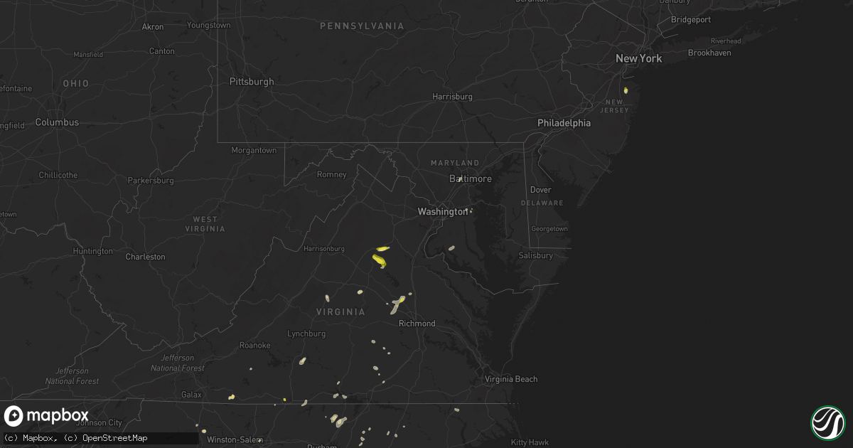
Hail Map in Maryland on July 16, 2022
Get this storm
July 16 map
$229
one time, instant access
Download today. No call, no setup
Keep the $229
Bought the map and want the full workflow? Apply the entire $229 to a subscription within 7 days. None of it is wasted.
Every map, not just this one
This buys you this map. Subscription and you get every map we run, in the markets you choose from a few cities to whole states to nationwide. Plus real-time alerts the moment a storm fires.
Contact data
Name, contact info, occupancy, even credit band for addresses in the footprint. You go from where it hit to who to call.
Become the source they trust
Unlimited branding weather history reports on demand. You already have the documented answer ready for the property owner, and you are the one who showed up with it.
Property data and RoofTrace estimates
Pull up any address you have got, its value and the exact code rules for that jurisdiction, straight from One Click Code. Then RoofTrace estimates the squares, pitch, and roof value, priced the way you price.
Storm reports in Maryland
Maryland
| Date | Description |
|---|---|
| 07/16/20224:38 PM CDT | Several trees and wires blew down around dentsville. |
| 07/16/20224:35 PM CDT | A tree blew down near dubois rd and morris farm rd. |
| 07/16/20224:05 PM CDT | Several trees and wires blew down blocking roads between edgewater and harwood. |
| 07/16/20222:54 PM CDT | Trees blew down onto wires bringing down a pole on river road in herald harbor. |
| 07/16/20222:23 PM CDT | A tree blew down on patuxent hwy eastbound |
| 07/16/20221:51 PM CDT | Several trees and wires blew down in the pikesville area. |
| 07/16/202212:36 AM CDT | At 536 PM EDT, a severe thunderstorm was located 7 miles southeast of La Plata, moving northeast at 20 mph. HAZARD...65 mph wind gusts and quarter size hail. SOURCE...Radar indicated. IMPACT...Damaging winds will cause some trees and large branches to fall. This could injure those outdoors, as well as damage homes and vehicles. Roadways may become blocked by downed trees. Localized power outages are possible. Unsecured light objects may become projectiles. Locations impacted include... Waldorf, La Plata, Prince Frederick, Hallowing Point, Golden Beach, Saint Charles, Wicomico, Huntingtown, Hughesville, Baden, Mechanicsville, Charlotte Hall, Aquasco, Bryantown, Benedict, Eagle Harbor, Barstow and Dentsville. |
| 07/15/202211:50 PM CDT | At 450 PM EDT, a severe thunderstorm was located over Londontowne, or near Mayo, moving southeast at 5 mph. HAZARD...60 mph wind gusts. SOURCE...Radar indicated. IMPACT...Damaging winds will cause some trees and large branches to fall. This could injure those outdoors, as well as damage homes and vehicles. Roadways may become blocked by downed trees. Localized power outages are possible. Unsecured light objects may become projectiles. Locations impacted include... Annapolis, Mayo, Shady Side, Deale, Naval Academy, Rhode River, South River, Parole, Londontowne, Edgewater, Riva, Galesville, Highland Beach, Harwood, Hillsmere Shores, West River, Lothian, Davidsonville, Navy-Marine Corps Stadium and Eastport. |
| 07/15/202210:46 PM CDT | At 346 PM EDT, a severe thunderstorm was located near Bowling Green, moving northeast at 20 mph. HAZARD...60 mph wind gusts and quarter size hail. SOURCE...Radar indicated. IMPACT...Minor damage to vehicles is possible. Expect wind damage to trees and powerlines. Locations impacted include... Colonial Beach, Bowling Green, Milford, Port Royal, Loretto, Leedstown, Fort A.p. Hill, Rappahannock Academy, Lerty, Sparta, Hustle, Potomac Beach, Rollins Fork, Elevon, Oak Grove, Supply, Peeds, Central Point, Foneswood and Chance. |
| 07/15/202210:15 PM CDT | At 315 PM EDT, a severe thunderstorm was located over Odenton, or over Crofton, moving east at 10 mph. HAZARD...60 mph wind gusts. SOURCE...Radar indicated. IMPACT...Damaging winds will cause some trees and large branches to fall. This could injure those outdoors, as well as damage homes and vehicles. Roadways may become blocked by downed trees. Localized power outages are possible. Unsecured light objects may become projectiles. Locations impacted include... Severn, Crofton, Glen Burnie, Severna Park, Odenton, Arnold, Fort Meade, Millersville, South Gate, Gambrills, Herald Harbor, Crownsville and Sherwood Forest. |
| 07/15/20229:43 PM CDT | At 242 PM EDT, severe thunderstorms were located along a line extending from near Owings Mills to Catonsville, moving northeast at 25 mph. HAZARD...60 mph wind gusts. SOURCE...Radar indicated. IMPACT...Damaging winds will cause some trees and large branches to fall. This could injure those outdoors, as well as damage homes and vehicles. Roadways may become blocked by downed trees. Localized power outages are possible. Unsecured light objects may become projectiles. Locations impacted include... Baltimore, Pikesville, Cockeysville, Towson, Catonsville, Woodlawn, Randallstown, Parkville, Owings Mills, Carney, Milford Mill, Perry Hall, Reisterstown, Lochearn, Rossville, Mays Chapel, Timonium, White Marsh, Fallston and Hampton. |
All States Impacted by Hail Map on July 16, 2022
Cities Impacted by Hail Map on July 16, 2022
- Burwell, NE
- Hugo, CO
- Atkinson, NE
- Stuart, NE
- Ellendale, ND
- Loup City, NE
- North Loup, NE
- Ord, NE
- Ashton, NE
- Buffalo Gap, SD
- Hot Springs, SD
- Farnam, NE
- Edgeley, ND
- Verona, ND
- Hazard, NE
- Ravenna, NE
- Rockville, NE
- Oran, MO
- Fredericktown, MO
- Glenallen, MO
- Zalma, MO
- Marble Hill, MO
- Advance, MO
- Greenville, MO
- Marquand, MO
- Montpelier, ND
- Louisburg, NC
- Edgewater, MD
- Davidsonville, MD
- Harwood, MD
- Cozad, NE
- Lexington, NE
- Eddyville, NE
- Fullerton, ND
- Battle Lake, MN
- Clitherall, MN
- Callaway, NE
- Gothenburg, NE
- Morganville, NJ
- Colts Neck, NJ
- Marlboro, NJ
- Holmdel, NJ
- Greensburg, IN
- Hendley, NE
- Beaver City, NE
- Shelbyville, IN
- Wilsons, VA
- Blackstone, VA
- Purdum, NE
- Buffalo Junction, VA
- Clarksville, VA
- Mason City, NE
- Kingman, IN
- Nelson, VA
- Virgilina, VA
- Broken Bow, NE
- Sumner, NE
- Oconto, NE
- Wild Horse, CO
- Karval, CO
- Kit Carson, CO
- Saint Francis, KS
- Bowling Green, IN
- Centerpoint, IN
- Poland, IN
- Overton, NE
- Peridot, AZ
- Colorado Springs, CO
- Brownsburg, IN
- Indianapolis, IN
- Avon, IN
- Sells, AZ
- Clearwater, NE
- La Fontaine, IN
- Wabash, IN
- Vona, CO
- Inman, NE
- Naper, NE
- Oneill, NE
- Page, NE
- Mills, NE
- Ewing, NE
- Carmel, IN
- Zionsville, IN
- Nogales, AZ
- Rio Rico, AZ
- Tumacacori, AZ
- Oxford, NE
- Cambridge, NE
- Holbrook, NE
- Arapahoe, NE
- Stamford, NE
- Eustis, NE
- Edison, NE
- Catonsville, MD
- Ellicott City, MD
- Whiteland, IN
- Needham, IN
- Boggstown, IN
- Franklin, IN
- Fairland, IN
- Westfield, IN
- Greentown, IN
- Windfall, IN
- Sargent, NE
- Eads, CO
- Ramah, CO
- Rush, CO
- Oral, SD
- Lamoure, ND
- Robbins, NC
- Eagle Springs, NC
- Georgetown, MS
- Hazlehurst, MS
- Tonopah, AZ
- Vail, AZ
- Tucson, AZ
- Marion, IN
- Boonville, NC
- Yadkinville, NC
- Hillsboro, IN
- State Road, NC
- Elkin, NC
- Brodnax, VA
- Miami, AZ
- Concord, NC
- Greensboro, NC
- Globe, AZ
- Faber, VA
- Lovingston, VA
- Pleasanton, NE
- Shelton, NE
- Riverdale, NE
- Gibbon, NE
- Kearney, NE
- Boelus, NE
- Farwell, NE
- Elba, NE
- Saint Paul, NE
- Miller, NE
- Cairo, NE
- Dannebrog, NE
- Scotia, NE
- Grand Island, NE
- Wolbach, NE
- Sheridan Lake, CO
- Merna, NE
- Wood River, NE
- Sonoita, AZ
- Henning, MN
- Oxford, NC
- Kenesaw, NE
- Juniata, NE
- Amherst, NE
- Rothsay, MN
- Trinidad, CO
- Green Valley, AZ
- Amado, AZ
- Culpeper, VA
- Litchfield, NE
- Oilville, VA
- Crozier, VA
- Syracuse, KS
- Troy, VA
- Palmyra, VA
- Stuart, VA
- Ansley, NE
- Young, AZ
- San Manuel, AZ
- West Baden Springs, IN
- Shipman, VA
- Nellysford, VA
- Vass, NC
- Dunning, NE
- Saint Libory, NE
- Kenbridge, VA
- Long Island, VA
- Hurt, VA
- Gladys, VA
- Lowry, MN
- Glenwood, MN
- Cicero, IN
- Madison, IN
- Lisbon, ND
- Faison, NC
- Red Oak, VA
- Rougemont, NC
- Westerville, NE
- Alda, NE
- Lakeland, FL
- Mulberry, FL
- Milton, NC
- Alton, VA
- West Terre Haute, IN
- Wilsonville, NE
- Enfield, NC
- Whitakers, NC
- Anselmo, NE
- Rye, CO
- Bumpass, VA
- Manakin Sabot, VA
- Montpelier, VA
- Beaverdam, VA
- Maidens, VA
- Rockville, VA
- Rapidan, VA
- Unionville, VA
- Locust Dale, VA
- Orange, VA
- Moorefield, NE
- Marienthal, KS
- Salisbury, NC
- Spencer, NC
- Lakin, KS
- Doswell, VA
- Ruther Glen, VA
- Arnold, NE
- Brazil, IN
- Corning, KS
- Centralia, KS
- Pelican Rapids, MN
- Chesterfield, SC
- Patrick, SC
- Danville, VA
- Eden, NC
- Thibodaux, LA
- Elm Creek, NE
- Converse, IN
- Chambers, AZ
- Doniphan, NE
- Greeley, NE
- Elyria, NE
- Swayzee, IN
- La Plata, MD
- Charlotte Hall, MD
- Milroy, IN
- Waldron, IN
- Saint Paul, IN
- Des Allemands, LA
- Paradis, LA
- Holly, CO
- Fort Mcdowell, AZ
- Seagrove, NC
- Raeford, NC
- Eure, NC
- Gates, NC
- Mineral, VA
- Gum Spring, VA
- Sandy Hook, VA
- Brandy Station, VA
- Elkwood, VA
- Stevensburg, VA
- Dennison, IL
- Amelia Court House, VA
- Snow Camp, NC
- Burlington, NC
- Jetersville, VA
- Deerfield, KS
- Brady, NE
- Joes, CO
- Clinton, NC
- Spring Grove, PA
- York, PA
- Seven Valleys, PA
- Mitchells, VA
- Rhoadesville, VA
- Greenup, IL
- Casey, IL
- Callaway, VA
- Dundas, VA
- Roxboro, NC
- Roseland, NE
- Heartwell, NE
- Minden, NE
- Holstein, NE
- Ong, NE
- Hastings, NE
- Belleville, KS
- Harvard, NE
- Inland, NE
- Byron, NE
- Deshler, NE
- Superior, NE
- Red Cloud, NE
- Oak, NE
- Fairfield, NE
- Deweese, NE
- Guide Rock, NE
- Trumbull, NE
- Edgar, NE
- Nelson, NE
- Lawrence, NE
- Glenvil, NE
- Davenport, NE
- Ruskin, NE
- Hebron, NE
- Clay Center, NE
- Republic, KS
- Giltner, NE
- Hardy, NE
- Blue Hill, NE
- Ayr, NE
- Saronville, NE
- Chester, NE
- Bladen, NE
- Leopold, MO
- Whitewater, MO
- Sahuarita, AZ
- Saint Hilaire, MN
- Red Lake Falls, MN
- Orchard, NE
- Ericson, NE


