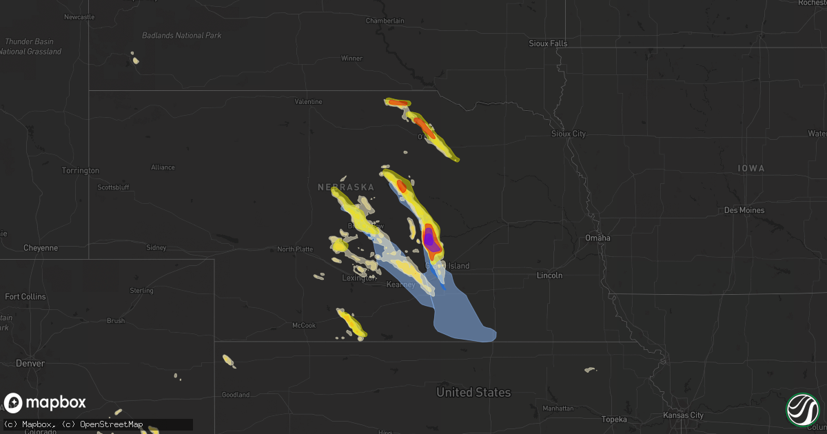
Hail Map on July 16, 2022
Get this storm
July 16 map
$229
one time, instant access
Download today. No call, no setup
Keep the $229
Bought the map and want the full workflow? Apply the entire $229 to a subscription within 7 days. None of it is wasted.
Every map, not just this one
This buys you this map. Subscription and you get every map we run, in the markets you choose from a few cities to whole states to nationwide. Plus real-time alerts the moment a storm fires.
Contact data
Name, contact info, occupancy, even credit band for addresses in the footprint. You go from where it hit to who to call.
Become the source they trust
Unlimited branding weather history reports on demand. You already have the documented answer ready for the property owner, and you are the one who showed up with it.
Property data and RoofTrace estimates
Pull up any address you have got, its value and the exact code rules for that jurisdiction, straight from One Click Code. Then RoofTrace estimates the squares, pitch, and roof value, priced the way you price.
States Impacted by Hail Map on July 16, 2022
Storm reports
Maryland
| Date | Description |
|---|---|
| 07/16/20224:38 PM CDT | Several trees and wires blew down around dentsville. |
| 07/16/20224:35 PM CDT | A tree blew down near dubois rd and morris farm rd. |
| 07/16/20224:05 PM CDT | Several trees and wires blew down blocking roads between edgewater and harwood. |
| 07/16/20222:54 PM CDT | Trees blew down onto wires bringing down a pole on river road in herald harbor. |
| 07/16/20222:23 PM CDT | A tree blew down on patuxent hwy eastbound |
| 07/16/20221:51 PM CDT | Several trees and wires blew down in the pikesville area. |
| 07/16/202212:36 AM CDT | At 536 PM EDT, a severe thunderstorm was located 7 miles southeast of La Plata, moving northeast at 20 mph. HAZARD...65 mph wind gusts and quarter size hail. SOURCE...Radar indicated. IMPACT...Damaging winds will cause some trees and large branches to fall. This could injure those outdoors, as well as damage homes and vehicles. Roadways may become blocked by downed trees. Localized power outages are possible. Unsecured light objects may become projectiles. Locations impacted include... Waldorf, La Plata, Prince Frederick, Hallowing Point, Golden Beach, Saint Charles, Wicomico, Huntingtown, Hughesville, Baden, Mechanicsville, Charlotte Hall, Aquasco, Bryantown, Benedict, Eagle Harbor, Barstow and Dentsville. |
| 07/15/202211:50 PM CDT | At 450 PM EDT, a severe thunderstorm was located over Londontowne, or near Mayo, moving southeast at 5 mph. HAZARD...60 mph wind gusts. SOURCE...Radar indicated. IMPACT...Damaging winds will cause some trees and large branches to fall. This could injure those outdoors, as well as damage homes and vehicles. Roadways may become blocked by downed trees. Localized power outages are possible. Unsecured light objects may become projectiles. Locations impacted include... Annapolis, Mayo, Shady Side, Deale, Naval Academy, Rhode River, South River, Parole, Londontowne, Edgewater, Riva, Galesville, Highland Beach, Harwood, Hillsmere Shores, West River, Lothian, Davidsonville, Navy-Marine Corps Stadium and Eastport. |
| 07/15/202210:46 PM CDT | At 346 PM EDT, a severe thunderstorm was located near Bowling Green, moving northeast at 20 mph. HAZARD...60 mph wind gusts and quarter size hail. SOURCE...Radar indicated. IMPACT...Minor damage to vehicles is possible. Expect wind damage to trees and powerlines. Locations impacted include... Colonial Beach, Bowling Green, Milford, Port Royal, Loretto, Leedstown, Fort A.p. Hill, Rappahannock Academy, Lerty, Sparta, Hustle, Potomac Beach, Rollins Fork, Elevon, Oak Grove, Supply, Peeds, Central Point, Foneswood and Chance. |
| 07/15/202210:15 PM CDT | At 315 PM EDT, a severe thunderstorm was located over Odenton, or over Crofton, moving east at 10 mph. HAZARD...60 mph wind gusts. SOURCE...Radar indicated. IMPACT...Damaging winds will cause some trees and large branches to fall. This could injure those outdoors, as well as damage homes and vehicles. Roadways may become blocked by downed trees. Localized power outages are possible. Unsecured light objects may become projectiles. Locations impacted include... Severn, Crofton, Glen Burnie, Severna Park, Odenton, Arnold, Fort Meade, Millersville, South Gate, Gambrills, Herald Harbor, Crownsville and Sherwood Forest. |
| 07/15/20229:43 PM CDT | At 242 PM EDT, severe thunderstorms were located along a line extending from near Owings Mills to Catonsville, moving northeast at 25 mph. HAZARD...60 mph wind gusts. SOURCE...Radar indicated. IMPACT...Damaging winds will cause some trees and large branches to fall. This could injure those outdoors, as well as damage homes and vehicles. Roadways may become blocked by downed trees. Localized power outages are possible. Unsecured light objects may become projectiles. Locations impacted include... Baltimore, Pikesville, Cockeysville, Towson, Catonsville, Woodlawn, Randallstown, Parkville, Owings Mills, Carney, Milford Mill, Perry Hall, Reisterstown, Lochearn, Rossville, Mays Chapel, Timonium, White Marsh, Fallston and Hampton. |
Colorado
| Date | Description |
|---|---|
| 07/16/20226:15 PM CDT | Corrects previous tstm wnd dmg report from 8 s wild horse. Delayed report received via social media. Possible wind driven hail damage to siding on a house reported alon |
| 07/16/20221:03 AM CDT | At 603 PM MDT, a severe thunderstorm was located 7 miles north of Chivington, or 22 miles southwest of Cheyenne Wells, moving east at 15 mph. HAZARD...60 mph wind gusts and half dollar size hail. SOURCE...Radar indicated. IMPACT...Hail damage to vehicles is expected. Expect wind damage to roofs, siding, and trees. Locations impacted include... Sheridan Lake, Chivington and Brandon. |
| 07/15/20228:13 PM CDT | At 113 PM MDT, a severe thunderstorm was located near Trinidad, moving east at 15 mph. HAZARD...60 mph wind gusts and quarter size hail. SOURCE...Radar indicated. IMPACT...Hail damage to vehicles is expected. Expect wind damage to roofs, siding, and trees. Locations impacted include... Trinidad and Hoehne. |
Minnesota
| Date | Description |
|---|---|
| 07/16/20224:45 PM CDT | A few nickel to quarter size hail in very heavy rain and frequent loud thunder. |
| 07/16/20224:27 PM CDT | Trees down on power lines. Local power outages. |
| 07/16/20224:09 PM CDT | Public reports 6-10 inch tree branches down in rothsay mn. |
| 07/16/20223:35 PM CDT | Peak wind measured by a mndot rwis station located along interstate 94. Large 6 to 10 inch branches broken down in and around rothsay. |
| 07/16/20223:35 PM CDT | Rothsay rwis gusted to 60mph. |
| 07/16/202212:51 AM CDT | At 551 PM CDT, a severe thunderstorm was located near Hazel, or 10 miles southeast of Thief River Falls, moving southeast at 15 mph. HAZARD...60 mph wind gusts and quarter size hail. SOURCE...Radar indicated. IMPACT...Hail damage to vehicles is expected. Expect wind damage to roofs, siding, and trees. This severe thunderstorm will be near... Plummer around 610 PM CDT.Other locations in the path of this severe thunderstorm includeBrooks and Oklee. |
| 07/15/202211:36 PM CDT | At 436 PM CDT, a severe thunderstorm was located near Hazel, or 11 miles south of Thief River Falls, moving east at 10 mph. HAZARD...60 mph wind gusts and quarter size hail. SOURCE...Radar indicated. IMPACT...Hail damage to vehicles is expected. Expect wind damage to roofs, siding, and trees. Locations impacted include... Hazel and Plummer. |
| 07/15/202211:13 PM CDT | At 412 PM CDT, a severe thunderstorm was located near Henning, or 26 miles east of Fergus Falls, and is nearly stationary. HAZARD...60 mph wind gusts and quarter size hail. SOURCE...Radar indicated. IMPACT...Hail damage to vehicles is expected. Expect wind damage to roofs, siding, and trees. Locations impacted include... Ottertail and Henning.This includes Interstate 94 in Minnesota between mile markers 48 and52. |
Arizona
| Date | Description |
|---|---|
| 07/16/20226:52 PM CDT | Public reported 1 inch hail near the intersection of pantano rd and escalante rd. |
| 07/16/20226:49 PM CDT | Photo on twitter at golf links and wilmot. |
| 07/16/20226:47 PM CDT | Near ironwood east of craycroft. |
| 07/16/20226:37 PM CDT | Near drexel and houghton. |
| 07/16/20226:35 PM CDT | Spotter reported measured 1.5 inch hail near the intersection of bilby rd and houghton rd. |
| 07/16/20226:33 PM CDT | Measured 1 inch hail near the i |
| 07/16/20226:33 PM CDT | Measured 1 inch hail near the intersection of houghton rd and poorman rd. |
| 07/16/20226:31 PM CDT | Near bilby and houghton. |
| 07/16/20226:10 PM CDT | A local report indicates 1.00 inch wind near 15 ESE TUCSON |
| 07/16/20224:35 PM CDT | 1.5 inches measured by a caliber measuring tool. |
| 07/16/20224:30 PM CDT | Mostly dime size hail with some quarter size hail for a few minutes. |
| 07/16/20224:20 PM CDT | Reported by trained spotter. |
| 07/16/20226:16 AM CDT | At 1113 PM PDT/1113 PM MST/, a severe thunderstorm was located 9 miles east of Buckskin Mountain Park, or 9 miles east of Parker Dam, moving northwest at 45 mph. HAZARD...60 mph wind gusts. SOURCE...Radar indicated. IMPACT...Expect damage to roofs and trees. Locations impacted include... Lake Havasu City, Parker Dam, Three Dunes Campground, Cattail Cove State Park and Black Meadow Landing Campground. |
| 07/16/20223:32 AM CDT | At 832 PM MST, a severe thunderstorm was located near Liberty, or near Buckeye, moving west at 20 mph. HAZARD...60 mph wind gusts. SOURCE...Radar indicated. IMPACT...Expect damage to roofs, siding, and trees. Locations impacted include... Goodyear, Buckeye, Palo Verde, Perryville, Liberty, Estrella Mountain Ranch, Palo Verde Nuclear Generation Station, Hassayampa and Arlington.This includes the following highways...AZ Interstate 10 between mile markers 100 and 126.AZ Route 85 between mile markers 143 and 154.AZ Route 303 near mile marker 105. |
| 07/16/20223:15 AM CDT | At 814 PM MST, a severe thunderstorm was located near Santa Rosa, or 24 miles north of Sells, moving west at 20 mph. HAZARD...60 mph wind gusts and quarter size hail. SOURCE...Radar indicated. IMPACT...Hail damage to vehicles is expected. Expect wind damage to roofs, siding, and trees. Locations impacted include... Santa Rosa, Covered Wells, Palo Verde Stand, Ak Chin, Mountain Village, San Luis and Santa Rosa School. |
| 07/16/20222:47 AM CDT | At 747 PM MST, a severe thunderstorm was located over Surprise, moving west at 15 mph. HAZARD...60 mph wind gusts. SOURCE...Radar indicated. IMPACT...Expect damage to roofs, siding, and trees. Locations impacted include... Surprise, El Mirage, Youngtown, Wittmann, Sun City West, Sun City, Waddell, Surprise Stadium, White Tank Mountain Park, Beardsley and Vistancia.This includes the following highways...US Highway 60 between mile markers 125 and 148.AZ Route 74 between mile markers 4 and 12.AZ Route 303 between mile markers 112 and 129. |
| 07/16/20222:45 AM CDT | At 744 PM MST, severe thunderstorms were located along a line extending from North Mountain Park to Downtown Phoenix to South Mountain Park, moving west at 20 mph. HAZARD...60 mph wind gusts. SOURCE...Radar indicated. IMPACT...Expect damage to roofs, siding, and trees. Locations impacted include... Phoenix, Glendale, Paradise Valley, Tolleson, Laveen, Piestewa Peak Park, North Mountain Park, South Phoenix, Arizona State Fairgrounds, South Mountain Park, Downtown Phoenix, Metro Center Mall, Sky Harbor Airport and Downtown Glendale.This includes the following highways...AZ Interstate 10 between mile markers 135 and 152.AZ Interstate 17 between mile markers 195 and 209.AZ Route 51 between mile markers 1 and 8. |
| 07/16/20222:43 AM CDT | At 742 PM MST, a severe thunderstorm was located 11 miles south of Hickiwan, or 28 miles southeast of Ajo, moving west at 30 mph. HAZARD...60 mph wind gusts, quarter size hail, and blowing dust. SOURCE...Radar indicated. IMPACT...Hail damage to vehicles is expected. Expect wind damage to roofs, siding, and trees. Locations impacted include... Gu Vo, Hickiwan, Organ Pipe Cactus National Monument, San Simon, Why, Charco 27, Gunsight, Kuakatch and San Simon West. |
| 07/16/20221:57 AM CDT | At 657 PM MST, a severe thunderstorm was located 12 miles east of Pisinemo, or 14 miles northwest of Sells, moving west at 25 mph. HAZARD...60 mph wind gusts and quarter size hail. SOURCE...Radar indicated. IMPACT...Hail damage to vehicles is expected. Expect wind damage to roofs, siding, and trees. Locations impacted include... Pisinemo, Covered Wells, Ali Chugk, San Simon, Santa Cruz, Mountain Village, Kots Kug, Kupk and Papago Farms. |
| 07/16/20221:48 AM CDT | At 647 PM MST, a severe thunderstorm was located near Saddlebrooke, or 8 miles northwest of Catalina, moving southwest at 25 mph. HAZARD...60 mph wind gusts and quarter size hail. SOURCE...Radar indicated. IMPACT...Hail damage to vehicles is expected. Expect wind damage to roofs, siding, and trees. Locations impacted include... Marana, Saddlebrooke, Dove Mountain and Oracle Junction. |
| 07/16/20221:43 AM CDT | At 642 PM MST, a severe thunderstorm was located 14 miles northwest of Three Points, or 23 miles southwest of Marana, moving west at 20 mph. HAZARD...60 mph wind gusts and quarter size hail. SOURCE...Radar indicated. IMPACT...Hail damage to vehicles is expected. Expect wind damage to roofs, siding, and trees. Locations impacted include... Queens Well. |
| 07/16/20221:09 AM CDT | At 608 PM MST, a severe thunderstorm was located 9 miles northwest of Sells, moving west at 25 mph. HAZARD...60 mph wind gusts and quarter size hail. SOURCE...Radar indicated. IMPACT...Hail damage to vehicles is expected. Expect wind damage to roofs, siding, and trees. Locations impacted include... Pisinemo, Gu Oidak, No:ligk, Santa Cruz, Mountain Village and Kupk. |
| 07/16/20221:04 AM CDT | At 604 PM MST, a severe thunderstorm was located over Three Points, or 21 miles northwest of Sahuarita, moving west at 20 mph. HAZARD...60 mph wind gusts and quarter size hail. SOURCE...Radar indicated. IMPACT...Hail damage to vehicles is expected. Expect wind damage to roofs, siding, and trees. Locations impacted include... Three Points, Kitt Peak, Tucson Estates, San Pedro and Pan Tak. |
| 07/16/202212:55 AM CDT | At 555 PM MST, a severe thunderstorm was located near Usery Mountain Park, or near East Mesa, moving southwest at 30 mph. HAZARD...60 mph wind gusts. SOURCE...Radar indicated. IMPACT...Expect damage to roofs, siding, and trees. Locations impacted include... Mesa, Chandler, Gilbert, Apache Junction, Fountain Hills, Gold Canyon, East Mesa, Queen Creek, Granite Reef Dam, Gold Camp, Falcon Field Airport, Lost Dutchman State Park, Goldfield, Usery Mountain Park and San Tan Village Mall.This includes the following highways...US Highway 60 between mile markers 178 and 204.AZ Route 87 between mile markers 166 and 197.AZ Route 202 between mile markers 12 and 47. |
| 07/16/202212:38 AM CDT | At 538 PM MST, a severe thunderstorm was located 10 miles east of Mammoth, moving west at 15 mph. HAZARD...60 mph wind gusts and quarter size hail. SOURCE...Radar indicated. IMPACT...Hail damage to vehicles is expected. Expect wind damage to roofs, siding, and trees. Locations impacted include... Oracle, Mammoth, San Manuel, Dudleyville and Aravaipa Canyon Wilderness. |
| 07/16/202212:36 AM CDT | At 536 PM MST, a severe thunderstorm was located over Canyon Lake, or 11 miles northeast of Apache Junction, moving southwest at 30 mph. HAZARD...60 mph wind gusts. SOURCE...Radar indicated. IMPACT...Expect damage to roofs, siding, and trees. Locations impacted include... Mesa, Apache Junction, Saguaro Lake, Canyon Lake, Superstition Mountains, Lost Dutchman State Park, Goldfield, Usery Mountain Park, Salt River Tubing Recreation Area and Tortilla Flat.This includes US Highway 60 between mile markers 193 and 198. |
| 07/16/202212:28 AM CDT | At 528 PM MST, a severe thunderstorm was located over Green Valley, moving west at 25 mph. HAZARD...Ping pong ball size hail and 60 mph wind gusts. SOURCE...Radar indicated. IMPACT...People and animals outdoors will be injured. Expect hail damage to roofs, siding, windows, and vehicles. Expect wind damage to roofs, siding, and trees. Locations impacted include... Sahuarita, Green Valley, Amado and Arivaca Junction. |
| 07/15/202211:45 PM CDT | At 444 PM MST, a severe thunderstorm was located 8 miles southeast of Green Valley, moving west at 20 mph. HAZARD...60 mph wind gusts and quarter size hail. SOURCE...Radar indicated. IMPACT...Hail damage to vehicles is expected. Expect wind damage to roofs, siding, and trees. This severe thunderstorm will be near... Sahuarita, Green Valley and Tubac around 455 PM MST.Other locations impacted by this severe thunderstorm include MaderaCanyon, Amado and Arivaca Junction. |
| 07/15/202211:28 PM CDT | At 428 PM MST, a severe thunderstorm was located near Davis-Monthan Air Force Base, moving west at 25 mph. HAZARD...60 mph wind gusts and quarter size hail. SOURCE...Trained weather spotters. IMPACT...Hail damage to vehicles is expected. Expect wind damage to roofs, siding, and trees. Locations impacted include... Tucson, Davis-Monthan Air Force Base, Casas Adobes, Drexel Heights, Flowing Wells, South Tucson, Pascua Pueblo Yaqui Reservation, Valencia West, Tucson International Airport, Catalina Foothills, Saguaro National Park East, Summit, Tucson Estates, Rita Ranch and San Xavier Mission. |
| 07/15/202211:20 PM CDT | Power lines down and debris on harquahala valley rd near i-10 exit 81. Time estimated from radar. |
| 07/15/202211:06 PM CDT | At 406 PM MST, a severe thunderstorm was located near Sonoita, or 20 miles southeast of Green Valley, moving west at 20 mph. HAZARD...60 mph wind gusts and quarter size hail. SOURCE...Radar indicated. IMPACT...Hail damage to vehicles is expected. Expect wind damage to roofs, siding, and trees. Locations impacted include... Sonoita and Madera Canyon. |
| 07/15/202210:55 PM CDT | At 355 PM MST, a severe thunderstorm was located over Cutter, or 10 miles east of Globe, moving south at 5 mph. HAZARD...60 mph wind gusts and quarter size hail. SOURCE...Radar indicated. IMPACT...Hail damage to vehicles is expected. Expect wind damage to roofs, siding, and trees. Locations impacted include... Cutter.This includes AZ Route 70 between mile markers 258 and 266. |
| 07/15/202210:47 PM CDT | At 347 PM MST, a severe thunderstorm was located near Globe, moving southwest at 15 mph. HAZARD...60 mph wind gusts and quarter size hail. SOURCE...Radar indicated. IMPACT...Hail damage to vehicles is expected. Expect wind damage to roofs, siding, and trees. Locations impacted include... Globe, Miami, Central Heights-Midland City, Claypool, Top-Of-The-World and Inspiration.This includes the following highways...US Highway 60 between mile markers 237 and 260.AZ Route 70 between mile markers 253 and 258.AZ Route 77 between mile markers 159 and 170. |
| 07/15/202210:46 PM CDT | At 346 PM MST, a severe thunderstorm was located near Vail, or 16 miles west of Benson, moving west at 25 mph. HAZARD...60 mph wind gusts and quarter size hail. SOURCE...Radar indicated. IMPACT...Hail damage to vehicles is expected. Expect wind damage to roofs, siding, and trees. Locations impacted include... Tucson, Vail, East Sahuarita, Corona De Tucson, Saguaro National Park East and Rita Ranch. |
| 07/15/202210:45 PM CDT | Delayed report -- solar panels peeled off roofs and large trees 1-2 ft downed. Additional tree damage and downed power lines... Photos from buckeye pd twitter acct. |
| 07/15/202210:43 PM CDT | ***delayed report*** video shows roof torn off of bales hay farm & ranch feed store in buckeye. Timing estimated from radar. |
| 07/15/202210:21 PM CDT | At 321 PM MST, a severe thunderstorm was located 9 miles southeast of Arivaca, or 14 miles southwest of Tubac, moving west at 10 mph. HAZARD...60 mph wind gusts and quarter size hail. SOURCE...Radar indicated. IMPACT...Hail damage to vehicles is expected. Expect wind damage to roofs, siding, and trees. Locations impacted include... Arivaca, Ruby and Arivaca Lake. |
| 07/15/202210:20 PM CDT | At 319 PM MST, a severe thunderstorm was located just north of Crown King and is moving southwest at 10 mph. HAZARD...60 mph wind gusts and nickel size hail. SOURCE...Radar indicated. IMPACT...Expect damage to roofs, siding, and trees. This severe thunderstorm will remain over mainly rural areas of Yavapai County. |
| 07/15/202210:19 PM CDT | At 318 PM MST, a severe thunderstorm was located 12 miles north of Cutter, or 13 miles northeast of Globe, moving west at 10 mph. HAZARD...60 mph wind gusts and nickel size hail. SOURCE...Radar indicated. IMPACT...Expect damage to roofs, siding, and trees. This severe thunderstorm will remain over mainly rural areas of Gila County.This includes US Highway 60 between mile markers 257 and 269. |
| 07/15/20229:42 PM CDT | Corrects previous non-tstm wnd gst report from sky harbor airport. Asos station kphx phoenix... Winds measured at 61 mph. |
| 07/15/20228:54 PM CDT | At 154 PM MST, a severe thunderstorm was located near Nogales, moving west at 15 mph. HAZARD...60 mph wind gusts and quarter size hail. SOURCE...Radar indicated. IMPACT...Hail damage to vehicles is expected. Expect wind damage to roofs, siding, and trees. Locations impacted include... Nogales, Rio Rico, Nogales International Airport, Tumacacori and Pena Blanca Lake. |
| 07/15/20228:30 PM CDT | Mesonet station srp20 at bartlett lake measured winds at 60 mph. |
| 07/15/20228:22 PM CDT | Corrects previous tstm wnd gst report from 4 ne east mesa. Roof tiles blown from a house due to winds measured at 65 mph by a home weather station. |
| 07/15/20227:47 PM CDT | Mping report. |
| 07/15/20227:46 PM CDT | Palo verdes and mesquite trees down on i-19 frontage road. Branches 6in in diameter and larger snapped off and blocking road. |
| 07/15/20227:25 PM CDT | Spotter reported 1 inch hail in green valley. |
| 07/15/20227:25 PM CDT | Corrects previous hail report from 2 s green valley. Mping report. |
| 07/15/20227:25 PM CDT | Public report received of hail between half dollar and ping pong ball size hail near the intersection of continental rd and interstate 19 in green valley. |
| 07/15/20227:25 PM CDT | Public report received of a highway sign blown over at the continental road exit off interstate 19. |
| 07/15/20227:25 PM CDT | Corrects previous tstm wnd dmg report from 2 sse green valley. Palo verdes and mesquite trees down on i-19 frontage road. Branches 6in in diameter and larger snapped of |
| 07/15/20227:20 PM CDT | A local report indicates 1.00 inch wind near 1 SE GREEN VALLEY |
Kansas
| Date | Description |
|---|---|
| 07/16/20226:26 AM CDT | At 1126 PM CDT, severe thunderstorms were located along a line extending from Hollenberg to 6 miles northeast of Washington to 3 miles northwest of Linn, moving southeast at 40 mph. HAZARD...60 mph wind gusts. SOURCE...Radar indicated. IMPACT...Expect damage to roofs, siding, and trees. Locations impacted include... Marysville, Washington, Hanover, Waterville, Greenleaf, Barnes, Morrowville, Hollenberg and Bremen. |
| 07/16/20225:22 AM CDT | At 1022 PM CDT, severe thunderstorms were located along a line extending from near Deshler to 6 miles northwest of Chester to 3 miles west of Byron, moving southeast at 50 mph. HAZARD...60 mph wind gusts. SOURCE...Radar indicated. IMPACT...Expect damage to roofs, siding, and trees. Locations impacted include... Munden and Narka. |
| 07/16/20224:35 AM CDT | At 935 PM CDT/835 PM MDT/, a severe thunderstorm was located 15 miles north of Kendall, moving east at 15 mph. HAZARD...60 mph wind gusts and penny size hail. SOURCE...Radar indicated. IMPACT...Expect damage to roofs, siding, and trees. This severe thunderstorm will remain over mainly rural areas of northeastern Hamilton and northern Kearny Counties. |
| 07/16/20224:06 AM CDT | At 906 PM CDT/806 PM MDT/, a severe thunderstorm was located near Syracuse, moving east at 15 mph. HAZARD...70 mph wind gusts and penny size hail. SOURCE...Radar indicated. IMPACT...Expect considerable tree damage. Damage is likely to mobile homes, roofs, and outbuildings. This severe thunderstorm will remain over mainly rural areas of northeastern Hamilton and northwestern Kearny Counties. |
| 07/16/20223:10 AM CDT | At 810 PM CDT, a severe thunderstorm was located over Hollinger, or 23 miles north of Norton, moving southeast at 30 mph. HAZARD...60 mph wind gusts and quarter size hail. SOURCE...Radar indicated. IMPACT...Hail damage to vehicles is expected. Expect wind damage to roofs, siding, and trees. This severe thunderstorm will be near... Stamford around 825 PM CDT. |
| 07/16/20221:27 AM CDT | At 626 PM MDT, a severe thunderstorm was located near Brandon, or 21 miles south of Cheyenne Wells, moving east at 25 mph. HAZARD...60 mph wind gusts and half dollar size hail. SOURCE...Radar indicated. IMPACT...Hail damage to vehicles is expected. Expect wind damage to roofs, siding, and trees. Locations impacted include... Sheridan Lake, Chivington, Brandon and Towner. |
| 07/15/202210:33 PM CDT | Asos station kgck garden city. |
| 07/15/202210:14 PM CDT | Mesonet station k36k kearny county airport. |
| 07/15/20228:55 PM CDT | This corrects previous report from awos station k3k3 in syracuse to include damage information. 2 miles of power lines were blown down along k-27 north of syracuse. |
| 07/15/20228:55 PM CDT | Delayed report received of 2.5 inch diameter branches snapped off of trees at location. Time is radar estimated. |
| 07/15/20228:55 PM CDT | Awos station k3k3 syracuse. |
Ohio
| Date | Description |
|---|---|
| 07/16/20222:08 AM CDT | Delayed report -- several pockets of downed/snapped trees on the western side of steubenville... Oh. Time approx from radar. |
Nebraska
| Date | Description |
|---|---|
| 07/16/20226:54 PM CDT | A local report indicates 74 MPH wind near ORD AIRPORT |
| 07/16/20226:51 PM CDT | A local report indicates 59 MPH wind near 3 NNW ORD |
| 07/16/20226:35 PM CDT | Winds estimated 50 to 60 mph with hail |
| 07/16/20226:30 PM CDT | A local report indicates 1.75 inch wind near 7 ENE BURWELL |
| 07/16/20226:25 PM CDT | Audience member said trees are blocking streets in town. |
| 07/16/20226:15 PM CDT | A local report indicates 1.25 inch wind near 9 N BURWELL |
| 07/16/20225:50 PM CDT | A local report indicates 1.00 inch wind near 13 N BURWELL |
| 07/16/20222:42 PM CDT | Delayed report of lots of tree damage. |
| 07/16/20222:00 PM CDT | 8-12 inch tree branches down. |
| 07/16/20221:54 PM CDT | A local report indicates 1.00 inch wind near 5 E ONEILL |
| 07/16/20226:50 AM CDT | At 1150 AM CDT, a severe thunderstorm was located 8 miles southwest of Naper, or 23 miles west of Spencer, moving east at 20 mph. HAZARD...60 mph wind gusts and half dollar size hail. SOURCE...Radar indicated. IMPACT...Hail damage to vehicles is expected. Expect wind damage to roofs, siding, and trees. Locations impacted include... Butte, Dustin, Anoka, Parshall Bridge State Wildlife Management Area and Hull Lake State Wildlife Management Area.This includes Highway 12 between mile markers 103 and 120. |
| 07/16/20224:41 AM CDT | At 940 PM CDT, severe thunderstorms were located along a line extending from near Harvard to near Deweese to near Blue Hill, moving southeast at 50 mph. HAZARD...60 mph wind gusts and penny size hail. SOURCE...Radar indicated. IMPACT...Expect damage to roofs, siding, and trees. Severe thunderstorms will be near... Fairfield, Lawrence, Deweese and Rosemont around 945 PM CDT. Red Cloud and Cowles around 950 PM CDT. Nelson and Guide Rock around 1000 PM CDT.Other locations in the path of these severe thunderstorms includeEdgar, Nora, Bostwick, Superior, Ruskin, Ong, Davenport, Hardy andOak. |
| 07/16/20224:10 AM CDT | At 909 PM CDT, a severe thunderstorm was located near Prosser, or 9 miles northwest of Hastings, moving southeast at 40 mph. THIS IS A DESTRUCTIVE STORM FOR Hastings. HAZARD...80 mph wind gusts and quarter size hail. SOURCE...Trained weather spotters. IMPACT...Flying debris will be dangerous to those caught without shelter. Mobile homes will be heavily damaged. Expect considerable damage to roofs, windows, and vehicles. Extensive tree damage and power outages are likely. This severe thunderstorm will be near... Hansen around 915 PM CDT. Hastings and Juniata around 920 PM CDT.Other locations in the path of this severe thunderstorm includeGlenvil, Ayr and Deweese. |
| 07/16/20223:59 AM CDT | At 858 PM CDT, severe thunderstorms were located along a line extending from 7 miles south of Gibbon to near Heartwell to near Minden to 7 miles northeast of Axtell to 7 miles southwest of Kearney, moving southeast at 45 mph. HAZARD...70 mph wind gusts and quarter size hail. SOURCE...Mesonet observation of 64 mph at Kearney. IMPACT...Hail damage to vehicles is expected. Expect considerable tree damage. Wind damage is also likely to mobile homes, roofs, and outbuildings. Severe thunderstorms will be near... Minden and Heartwell around 905 PM CDT. Norman around 910 PM CDT.Other locations in the path of these severe thunderstorms includeHolstein, Hildreth, Upland, Campbell and Bladen. |
| 07/16/20223:51 AM CDT | At 851 PM CDT, a severe thunderstorm was located over Cairo, or 12 miles northwest of Grand Island, moving south at 35 mph. HAZARD...Golf ball size hail and 70 mph wind gusts. SOURCE...Radar indicated. IMPACT...People and animals outdoors will be injured. Expect hail damage to roofs, siding, windows, and vehicles. Expect considerable tree damage. Wind damage is also likely to mobile homes, roofs, and outbuildings. This severe thunderstorm will be near... Wood River and Alda around 910 PM CDT.Other locations in the path of this severe thunderstorm includeDoniphan, Hastings, Prosser and Hansen.This includes Interstate 80 between mile markers 293 and 317. |
| 07/16/20223:44 AM CDT | At 844 PM CDT, a severe thunderstorm was located over Eddyville, or 15 miles north of Lexington, moving southeast at 30 mph. HAZARD...60 mph wind gusts and quarter size hail. SOURCE...Radar indicated. IMPACT...Hail damage to vehicles is expected. Expect wind damage to roofs, siding, and trees. This severe thunderstorm will be near... Sumner around 900 PM CDT.This includes Interstate 80 near mile marker 254. |
| 07/16/20223:33 AM CDT | At 833 PM CDT, severe thunderstorms were located along a line extending from Ravenna to 8 miles southeast of Pleasanton to near Riverdale to near Miller, moving southeast at 45 mph. HAZARD...70 mph wind gusts and quarter size hail. SOURCE...Radar indicated. IMPACT...Hail damage to vehicles is expected. Expect considerable tree damage. Wind damage is also likely to mobile homes, roofs, and outbuildings. Severe thunderstorms will be near... Ravenna and Poole around 840 PM CDT. Elm Creek around 845 PM CDT. Gibbon around 850 PM CDT.Other locations in the path of these severe thunderstorms includeShelton, Odessa and Kearney.This includes Interstate 80 between mile markers 255 and 292. |
| 07/16/20223:07 AM CDT | At 806 PM CDT, severe thunderstorms were located along a line extending from near Loup City to near Ashton to near Cushing, moving south at 25 mph. HAZARD...60 mph wind gusts and half dollar size hail. SOURCE...Emergency management reported 60 mph winds at Sherman Reservoir. IMPACT...Hail damage to vehicles is expected. Expect wind damage to roofs, siding, and trees. Severe thunderstorms will be near... Elba around 810 PM CDT. Cushing around 815 PM CDT. St. Paul and Farwell around 820 PM CDT.Other locations in the path of these severe thunderstorms includeRockville, Dannebrog, Boelus and St. Libory. |
| 07/16/20222:56 AM CDT | At 755 PM CDT, a severe thunderstorm was located 8 miles southwest of Mason City, or 23 miles southeast of Broken Bow, moving southeast at 35 mph. HAZARD...70 mph wind gusts and quarter size hail. SOURCE...Radar indicated. IMPACT...Hail damage to vehicles is expected. Expect considerable tree damage. Wind damage is also likely to mobile homes, roofs, and outbuildings. This severe thunderstorm will be near... Miller around 815 PM CDT.Other locations in the path of this severe thunderstorm includePleasanton, Amherst and Riverdale. |
| 07/16/20222:55 AM CDT | At 755 PM CDT, a severe thunderstorm was located 11 miles southwest of Callaway, or 26 miles southwest of Broken Bow, moving southeast at 10 mph. HAZARD...70 mph wind gusts and ping pong ball size hail. SOURCE...Radar indicated. IMPACT...People and animals outdoors will be injured. Expect hail damage to roofs, siding, windows, and vehicles. Expect considerable tree damage. Wind damage is also likely to mobile homes, roofs, and outbuildings. Locations impacted include... Oconto, Etna, Lodi and Pressey State Wildlife Management Area. |
| 07/16/20222:52 AM CDT | At 752 PM CDT, a severe thunderstorm was located 10 miles southwest of Callaway, or 26 miles southwest of Broken Bow, moving southeast at 15 mph. HAZARD...70 mph wind gusts and quarter size hail. SOURCE...Radar indicated. IMPACT...Hail damage to vehicles is expected. Expect considerable tree damage. Wind damage is also likely to mobile homes, roofs, and outbuildings. This severe thunderstorm will remain over mainly rural areas of northeastern Dawson County. |
| 07/16/20222:40 AM CDT | At 739 PM CDT, a severe thunderstorm was located near Berwyn, or 7 miles southeast of Broken Bow, moving southeast at 35 mph. THIS IS A DESTRUCTIVE STORM FOR BERWYN, ANSLEY AND MASON CITY. HAZARD...90 mph wind gusts and quarter size hail. SOURCE...Public. At 725 PM...90 MPH WIND GUST WAS RECORDED AT BROKEN BOW AIRPORT.. IMPACT...You are in a life-threatening situation. Flying debris may be deadly to those caught without shelter. Mobile homes will be heavily damaged or destroyed. Homes and businesses will have substantial roof and window damage. Expect extensive tree damage and power outages. Locations impacted include... Ansley, Mason City, Berwyn, Buckeye, Block Hill Basin, Burr Oak, Gavin Siding, Intersection of Highway 183 and Cumro Road and Cumro.This includes the following highways... Highway 183 between mile markers 73 and 96. Highway 2 between mile markers 288 and 307. Highway 92 between mile markers 300 and 305. |
| 07/16/20222:34 AM CDT | At 734 PM CDT, a severe thunderstorm was located over Holbrook, or 32 miles west of Holdrege, moving southeast at 20 mph. HAZARD...60 mph wind gusts and half dollar size hail. SOURCE...Radar indicated. IMPACT...Hail damage to vehicles is expected. Expect wind damage to roofs, siding, and trees. This severe thunderstorm will be near... Arapahoe around 740 PM CDT.Other locations in the path of this severe thunderstorm includeEdison, Hendley, Beaver City and Hollinger. |
| 07/16/20222:15 AM CDT | At 715 PM CDT, a severe thunderstorm was located near Callaway, or 23 miles southwest of Broken Bow, moving east at 25 mph. HAZARD...60 mph wind gusts and penny size hail. SOURCE...Radar indicated. IMPACT...Expect damage to roofs, siding, and trees. Locations impacted include... Callaway, Oconto, Lodi and Pressey State Wildlife Management Area. |
| 07/16/20222:15 AM CDT | At 714 PM CDT, a severe thunderstorm was located near North Loup, or 10 miles east of Ord, moving southeast at 25 mph. HAZARD...70 mph wind gusts and half dollar size hail. SOURCE...Mesonet observation of 68 mph at Ord. IMPACT...Hail damage to vehicles is expected. Expect considerable tree damage. Wind damage is also likely to mobile homes, roofs, and outbuildings. This severe thunderstorm will be near... North Loup around 720 PM CDT. Scotia around 730 PM CDT.Other locations in the path of this severe thunderstorm includeCotesfield. |
| 07/16/20222:09 AM CDT | At 709 PM CDT, a severe thunderstorm was located near Victoria Springs State Recreation Area, or 12 miles northwest of Broken Bow, moving southeast at 30 mph. THIS IS A DESTRUCTIVE STORM FOR MERNA AND BROKEN BOW. HAZARD...90 mph wind gusts. SOURCE...Law enforcement. IMPACT...You are in a life-threatening situation. Flying debris may be deadly to those caught without shelter. Mobile homes will be heavily damaged or destroyed. Homes and businesses will have substantial roof and window damage. Expect extensive tree damage and power outages. Locations impacted include... Broken Bow, Merna, Berwyn and Victoria Springs State Recreation Area.This includes the following highways... Highway 2 between mile markers 260 and 288. Highway 92 between mile markers 269 and 273. |
| 07/16/20221:28 AM CDT | At 628 PM CDT, severe thunderstorms were located along a line extending from 11 miles east of Brewster to 6 miles southwest of Dunning, moving southeast at 20 mph. HAZARD...70 mph wind gusts and penny size hail. SOURCE...Public. IMPACT...Expect considerable tree damage. Damage is likely to mobile homes, roofs, and outbuildings. Locations impacted include... Taylor, Sargent, Merna, Anselmo, Victoria Springs State Recreation Area, Lillian, Milburn, Milburn Diversion Dam State Wildlife Management Area, Round Valley, Almeria Meadow State Wildlife Management Area, Walworth, Linscott, Big Oak Canyon, Almeria, Divide Hill and Gates.This includes the following highways... Highway 183 between mile markers 108 and 127. Highway 2 between mile markers 239 and 273. Highway 92 between mile markers 259 and 273. |
| 07/16/20221:21 AM CDT | At 620 PM CDT, a severe thunderstorm was located near Burwell, moving southeast at 25 mph. HAZARD...60 mph wind gusts and half dollar size hail. SOURCE...Radar indicated. IMPACT...Hail damage to vehicles is expected. Expect wind damage to roofs, siding, and trees. This severe thunderstorm will be near... Fort Hartsuff State Park around 640 PM CDT.Other locations in the path of this severe thunderstorm includeElyria, Ord and North Loup. |
| 07/16/20221:16 AM CDT | At 615 PM CDT, a severe thunderstorm was located 7 miles northeast of Burwell, moving southeast at 20 mph. HAZARD...60 mph wind gusts and half dollar size hail. SOURCE...Trained weather spotters. IMPACT...Hail damage to vehicles is expected. Expect wind damage to roofs, siding, and trees. Locations impacted include... Burwell, Deverre, Homestead Knolls Campground and Virginia Smith Dam. |
| 07/16/202212:37 AM CDT | At 537 PM CDT, a severe thunderstorm was located 10 miles north of Calamus Reservoir State Recreation Area, or 17 miles north of Burwell, moving east at 15 mph. HAZARD...Ping pong ball size hail and 60 mph wind gusts. SOURCE...Radar indicated. IMPACT...People and animals outdoors will be injured. Expect hail damage to roofs, siding, windows, and vehicles. Expect wind damage to roofs, siding, and trees. Locations impacted include... Deverre, Sunfish Lake, Valley View Flat Campground, Carson Lake and Hannamon Bayou Campground. |
| 07/15/202210:39 PM CDT | A local report indicates 62 MPH wind near 1 SSE DAVENPORT |
| 07/15/202210:04 PM CDT | A local report indicates 67 MPH wind near 1 N NELSON |
| 07/15/202210:01 PM CDT | Tree branches down a long with power outages. |
| 07/15/20229:49 PM CDT | Trees down in fairfield and power is out also. |
| 07/15/20229:49 PM CDT | Trees down in fairfield. |
| 07/15/20229:49 PM CDT | Tree branches down and power is out in town. |
| 07/15/20229:46 PM CDT | A local report indicates 58 MPH wind near 2 N HASTINGS |
| 07/15/20229:37 PM CDT | 60-70 mph estimated. |
| 07/15/20229:29 PM CDT | At 228 PM CDT, a severe thunderstorm was located over Ewing, or 17 miles northwest of Neligh, moving southeast at 30 mph. HAZARD...60 mph wind gusts and quarter size hail. SOURCE...Radar indicated. IMPACT...Hail damage to vehicles is expected. Expect wind damage to roofs, siding, and trees. This severe thunderstorm will be near... Clearwater around 245 PM CDT.Other locations in the path of this severe thunderstorm includeNeligh and Oakdale. |
| 07/15/20229:26 PM CDT | Tree branches down along with power outage. |
| 07/15/20229:26 PM CDT | Power is out along with tree branches down in town. |
| 07/15/20229:24 PM CDT | A local report indicates 58 MPH wind near HASTINGS AIRPORT |
| 07/15/20228:55 PM CDT | At 153 PM CDT, a severe thunderstorm was located near near O'Neill, moving southeast at 20 mph. HAZARD...60 mph wind gusts and quarter size hail. SOURCE...Radar indicated. IMPACT...Hail damage to vehicles is expected. Expect wind damage to roofs, siding, and trees. Locations impacted include... O'Neill, Ewing, Page, Inman and Knievels Corner. This includes the following highways... Highway 20 between mile markers 309 and 328. Highway 281 between mile markers 172 and 182. |
| 07/15/20228:54 PM CDT | Storm chaser reports 70-80 mph and possible brief tornado 3-4 se of cairo. |
| 07/15/20228:52 PM CDT | Delayed report from saturday evening. Nerain observer commented that they had golf ball size hail. Time estimated from radar. |
| 07/15/20228:51 PM CDT | A local report indicates 64 MPH wind near 3 SW KEARNEY |
| 07/15/20228:23 PM CDT | Nws employee reported hail on the ground in farwell. Time is estimated from radar data. |
| 07/15/20228:23 PM CDT | Follow-up to previous report. The area from farwell to west of dannebrog has a 3-mile wide... 8 to 9 mile long path of widespread crop damage and other structural damag |
| 07/15/20228:14 PM CDT | At 114 PM CDT, a severe thunderstorm was located 8 miles north of O'Neill, moving southeast at 20 mph. HAZARD...60 mph wind gusts and quarter size hail. SOURCE...Radar indicated. IMPACT...Hail damage to vehicles is expected. Expect wind damage to roofs, siding, and trees. Locations impacted include... O'Neill, Page, Inman, Emmet, Opportunity, Midway and Scottville.This includes the following highways... Highway 20 between mile markers 300 and 321. Highway 281 between mile markers 169 and 203. |
| 07/15/20228:11 PM CDT | A local report indicates 1.00 inch wind near ANSLEY |
| 07/15/20228:06 PM CDT | Corrects previous hail report from 5 ene ashton. 7 miles west of elba. Report via facebook. Time estimated from radar. |
| 07/15/20228:04 PM CDT | 60 mph wind gust estimated at sherman reservoir. |
| 07/15/20228:03 PM CDT | Pea size hail also |
| 07/15/20228:00 PM CDT | Report via twitter. |
| 07/15/20227:51 PM CDT | Many tree limbs down in broken bow with several streets blocked. |
| 07/15/20227:36 PM CDT | Corrects previous tstm wnd dmg report from 2 ene holbrook. Roof off two car garage destroyed. Outbuilding destroyed at farmstead 4 w of arapahoe. Half dollar hail also |
| 07/15/20227:36 PM CDT | Roof off two car garage destroyed. Outbuilding destroyed at farmstead 4 w of arapahoe. Half dollar hail also reported with this storm. Delayed report from storm spotter |
| 07/15/20227:35 PM CDT | Large tree limbs down. Estimated 60 mph wind gusts. |
| 07/15/20227:30 PM CDT | Multiple trees downed or uprooted. Gas lines broken. Corn crop stripped. |
| 07/15/20227:28 PM CDT | Report via facebook. Multiple small tree limbs down and electricity out too. |
| 07/15/20227:25 PM CDT | Broken bow airport |
| 07/15/20227:18 PM CDT | A local report indicates 68 MPH wind near 2 N BROKEN BOW |
| 07/15/20227:07 PM CDT | Emergency manager said deputies estimated 90 mph winds along highway 2. Multiple trees are down. |
| 07/15/20227:00 PM CDT | A local report indicates 67 MPH wind near 5 S ANSELMO |
Virginia
| Date | Description |
|---|---|
| 07/16/20225:57 PM CDT | A tree blew down on stagebridge rd. |
| 07/16/20225:05 PM CDT | Trees blew down near va-729 eggbornsville road. |
| 07/16/20225:03 PM CDT | Numerous trees blew down near the intersection of va-628 clifton road and barclay lane/jackson's quarters road. |
| 07/16/20224:54 PM CDT | Several trees blew down near and along clarks mountain rd. |
| 07/16/20224:50 PM CDT | Several trees blew down along va-614 locust dale road in rapidan. |
| 07/16/20224:45 PM CDT | Numerous trees blew down along va-614 locust dale road. |
| 07/16/20224:08 PM CDT | Several trees down on n boston road. Time estimated. |
| 07/16/20224:06 PM CDT | Several trees down on the 1700 block of union mills road west of troy. Time estimated. |
| 07/16/20223:45 PM CDT | Trees down. Time estimated from radar data. |
| 07/16/20223:30 PM CDT | Trees down in buffalo junction. Time estimated from radar. |
| 07/16/20223:30 PM CDT | Trees down causing power outages just north of purdy. Time estimated. |
| 07/16/20223:26 PM CDT | Trees and lines blew down near the 11000 block of millbank rd. |
| 07/16/20223:24 PM CDT | Tree down on i-85 at mm25... Which is just southeast of alberta. Time estimated. |
| 07/16/20223:20 PM CDT | Cluster of around 150 power outages near port royal likely caused by storm. Time estimated. |
| 07/16/20223:18 PM CDT | One power line down along seven oak drive due to thunderstorm winds. |
| 07/16/20223:13 PM CDT | One power line down at the intersection of north main street and moore street due to thunderstorm winds. |
| 07/16/20223:06 PM CDT | One power line down along ponderosa road due to thunderstorm winds. |
| 07/16/20222:52 PM CDT | Hundreds of power outages just east of ruther glen likely caused by storm. |
| 07/16/20222:37 PM CDT | One tree down along the 1000 block of piney grove road due to thunderstorm winds. |
| 07/16/20222:34 PM CDT | One tree down due to thunderstorm winds along walnut creek road. |
| 07/16/20222:34 PM CDT | One tree down along the 1000 block of storys creek road due to thunderstorm winds. |
| 07/16/20222:34 PM CDT | One tree down along owen walker road due to thunderstorm winds. |
| 07/16/20222:31 PM CDT | One tree down along west parker road due to thunderstorm winds. |
| 07/16/20222:30 PM CDT | Trees and power lines down causing hundreds of power outages southeast of beaverdam. Time estimated. |
| 07/16/20222:23 PM CDT | One tree down in the saxe area due to thunderstorm winds. |
| 07/16/20222:23 PM CDT | Quarter size hail observed in danville city. Report via mping. |
| 07/16/20222:21 PM CDT | One tree down in the randolph area due to thunderstorm winds. |
| 07/16/20222:21 PM CDT | Quarter size hail observed north of danville. Report via mping. |
| 07/16/20222:14 PM CDT | Report relayed by 911 center. |
| 07/16/20222:14 PM CDT | Multiple trees and power lines down in and around montpelier. Time estimated. |
| 07/16/20222:09 PM CDT | One tree down along berry hill road due to thunderstorm winds. |
| 07/16/20221:52 PM CDT | Tree down on fairground road. Time estimated. |
| 07/16/20221:45 PM CDT | Tree down on hobbs mill road. Time estimated. |
| 07/16/202212:56 PM CDT | Corrects previous tstm wnd dmg report from 2 wsw wylliesburg. Multiple trees down along kings cross road due to thunderstorm wins. |
| 07/16/202212:53 PM CDT | Corrects previous tstm wnd dmg report from 2 wsw wylliesburg. Multiple trees down along kings cross road due to thunderstorm wins. |
| 07/16/202212:53 PM CDT | Multiple trees down along kings cross road due to thunderstorm wins. |
| 07/16/202212:35 PM CDT | Multiple trees and power lines down along wyatt miles road due to thunderstorm winds. |
| 07/16/202212:33 PM CDT | Multiple trees and power lines down along tabor road due to thunderstorm winds. |
| 07/16/202212:20 PM CDT | One tree down along the 800 block of railroad lane due to thunderstorm winds. |
| 07/16/202212:14 PM CDT | One tree down along cedar tree road due to thunderstorm winds. |
| 07/16/20223:18 AM CDT | At 818 PM EDT, severe thunderstorms were located along a line extending from 9 miles southeast of Gwynn to 6 miles northwest of Cheriton to near Cape Charles, moving northeast at 20 mph. HAZARD...60 mph wind gusts. SOURCE...Radar indicated. IMPACT...Expect damage to trees and powerlines. Severe thunderstorms will be near... Bay View around 835 PM EDT. Cheriton around 840 PM EDT. Exmore, Nassawadox and Willis Wharf around 900 PM EDT.Other locations impacted by these severe thunderstorms includeSimpkins, Birdsnest, Oyster, Jamesville, Silver Beach, Eastville,Plantation, Machipongo, Wardtown and Franktown. |
| 07/16/20222:12 AM CDT | At 712 PM EDT, a severe thunderstorm was located near Ferrum, and is nearly stationary. HAZARD...60 mph wind gusts and quarter size hail. SOURCE...Radar indicated. IMPACT...Hail damage to vehicles is expected. Expect wind damage to roofs, siding, and trees. Locations impacted include... Rocky Mount... and Ferrum. |
| 07/16/20221:32 AM CDT | At 632 PM EDT, a severe thunderstorm was located near Wintergreen, or 13 miles south of Waynesboro, and is nearly stationary. HAZARD...60 mph wind gusts and quarter size hail. SOURCE...Radar indicated. IMPACT...Damaging winds will cause some trees and large branches to fall. This could injure those outdoors, as well as damage homes and vehicles. Roadways may become blocked by downed trees. Localized power outages are possible. Unsecured light objects may become projectiles. Locations impacted include... Schuyler, Wintergreen, Nellysford, Esmont, Lovingston, Greenfield, Damon, Covesville, Rockfish and Faber. |
| 07/16/202212:59 AM CDT | At 559 PM EDT, a severe thunderstorm was located 9 miles east of Orange, moving southeast at 25 mph. HAZARD...70 mph wind gusts and quarter size hail. SOURCE...Radar indicated. IMPACT...Damaging winds will cause some trees and large branches to fall. This could injure those outdoors, as well as damage homes and vehicles. Roadways may become blocked by downed trees. Localized power outages are possible. Unsecured light objects may become projectiles. Locations impacted include... Spotsylvania, Mine Run, Rhoadesville, Brokenburg, Parker, Everona, Verdiersville, Locust Grove, Alsop, Gold Dale, Thornhill, Nasons, Logan, Lahore, Glenora, Post Oak, Unionville and Rapidan. |
| 07/16/202212:58 AM CDT | At 558 PM EDT, a severe thunderstorm was located over Culpeper, moving northeast at 20 mph. HAZARD...65 mph wind gusts and half dollar size hail. SOURCE...Radar indicated. IMPACT...Damaging winds will cause some trees and large branches to fall. This could injure those outdoors, as well as damage homes and vehicles. Roadways may become blocked by downed trees. Localized power outages are possible. Unsecured light objects may become projectiles. Locations impacted include... Culpeper, Bealeton, Opal, Remington, Midland, Elkwood, Catalpa, Stevensburg, Brandy Station, Lois, Winston, Lignum, Morrisville, Alanthus, Goldvein and Sumerduck. |
| 07/16/202212:38 AM CDT | At 538 PM EDT, a severe thunderstorm was located 7 miles southwest of Culpeper, moving southeast at 10 mph. HAZARD...60 mph wind gusts and quarter size hail. SOURCE...Radar indicated. IMPACT...Damaging winds will cause some trees and large branches to fall. This could injure those outdoors, as well as damage homes and vehicles. Roadways may become blocked by downed trees. Localized power outages are possible. Unsecured light objects may become projectiles. Locations impacted include... Culpeper, Madison, Brightwood, Raccoon Ford, Rapidan, Oakpark, Everona, Nasons, Winston, Mitchells, Reva, Fordsville, Twymans Mill, Leon, Unionville and Locust Dale. |
| 07/15/202211:59 PM CDT | At 459 PM EDT, a severe thunderstorm was located over Lake Monticello, moving northeast at 5 mph. HAZARD...60 mph wind gusts and penny size hail. SOURCE...Radar indicated. IMPACT...Expect damage to trees and powerlines. This severe thunderstorm will be near... Troy around 545 PM EDT.Other locations impacted by this severe thunderstorm include Nahor,Bybee, Zion Crossroads, Cunningham, Union Mills and Wildwood. |
| 07/15/202211:53 PM CDT | At 452 PM EDT, a severe thunderstorm was located over Dahlgren, moving northeast at 20 mph. HAZARD...60 mph wind gusts. SOURCE...Radar indicated. IMPACT...Damaging winds will cause some trees and large branches to fall. This could injure those outdoors, as well as damage homes and vehicles. Roadways may become blocked by downed trees. Localized power outages are possible. Unsecured light objects may become projectiles. Locations impacted include... Waldorf, La Plata, Dahlgren, Nanjemoy Creek, Popes Creek, Hallowing Point, Port Tobacco River, Golden Beach, Saint Charles, Wicomico, Hughesville, Mechanicsville, Charlotte Hall, Cobb Island, Bryantown, Benedict, Rock Point, Port Tobacco Village, Issue and Tompkinsville. |
| 07/15/202211:16 PM CDT | At 416 PM EDT, a severe thunderstorm was located near Alberta, or near Lawrenceville, moving east at 20 mph. HAZARD...60 mph wind gusts and penny size hail. SOURCE...Radar indicated. IMPACT...Expect damage to trees and powerlines. This severe thunderstorm will be near... Radium around 455 PM EDT. Purdy and Jarratt around 500 PM EDT.Other locations impacted by this severe thunderstorm include Cochran,Grizzard, Bufford Crossroads, Dolphin, Pleasant Shade, FieldsCrossroads, Warfield, Emporia Reservoir, Huske and Cowie Corner. |
| 07/15/202210:14 PM CDT | At 314 PM EDT, a severe thunderstorm was located over Montpelier, or 11 miles northwest of Randolph Macon College, moving northeast at 25 mph. HAZARD...60 mph wind gusts and quarter size hail. SOURCE...Radar indicated. IMPACT...Minor damage to vehicles is possible. Expect wind damage to trees and powerlines. This severe thunderstorm will be near... Ladysmith around 345 PM EDT.Other locations impacted by this severe thunderstorm includeChilesburg, Golansville, Oliver, Gum Tree, Coatesville, Hewlett,Goodall, Doswell, Mabelton and Penola. |
| 07/15/202210:13 PM CDT | At 312 PM EDT, a severe thunderstorm was located over Milton, or 10 miles east of Providence, moving east at 15 mph. HAZARD...60 mph wind gusts and quarter size hail. SOURCE...Radar indicated. IMPACT...Hail damage to vehicles is expected. Expect wind damage to roofs, siding, and trees. Locations impacted include... Turbeville... Milton... Cluster Springs... Semora... Alton... and Hyco Lake. |
| 07/15/20229:44 PM CDT | At 244 PM EDT, a severe thunderstorm was located over Oilville, or 8 miles east of Goochland, moving northeast at 25 mph. HAZARD...60 mph wind gusts and penny size hail. SOURCE...Radar indicated. IMPACT...Expect damage to trees and powerlines. This severe thunderstorm will be near... Wyndham around 255 PM EDT. Montpelier around 300 PM EDT. Ashland and Randolph Macon College around 315 PM EDT.Other locations impacted by this severe thunderstorm includeRockville, Dabneys, Gilman, Crozier, Vontay, Coatesville, JohnsonsSprings, Goodall, Mabelton and Short Pump. |
| 07/15/20229:42 PM CDT | At 242 PM EDT, a severe thunderstorm was located near Mannboro, moving east at 15 mph. HAZARD...60 mph wind gusts and penny size hail. SOURCE...Radar indicated. IMPACT...Expect damage to trees and powerlines. This severe thunderstorm will be near... Sutherland around 325 PM EDT.Other locations impacted by this severe thunderstorm include CenterStar, Petersburg Airport, Church Road, Five Forks, Burgess, Walkers,Hebron, Ammon and Ford. |
| 07/15/20229:28 PM CDT | At 228 PM EDT, a severe thunderstorm was located near Kenbridge, moving east at 5 mph. HAZARD...60 mph wind gusts and penny size hail. SOURCE...Radar indicated. IMPACT...Expect damage to trees and powerlines. This severe thunderstorm will be near... Dundas around 240 PM EDT. Blackstone and Fort Pickett around 315 PM EDT.Other locations impacted by this severe thunderstorm include LafoonCorner, Danieltown, Irby, Barrows Store, Murdocks, Forkland,Blackstone Airport and Dominy Corner. |
| 07/15/20228:56 PM CDT | At 155 PM EDT, a severe thunderstorm was located over Wylliesburg, or near Redoak, moving northeast at 20 mph. HAZARD...60 mph wind gusts and quarter size hail. SOURCE...Radar indicated. IMPACT...Hail damage to vehicles is expected. Expect wind damage to roofs, siding, and trees. Locations impacted include... Keysville... Redoak... Wylliesburg... and Fort Mitchell. |
| 07/15/20228:37 PM CDT | At 137 PM EDT, a severe thunderstorm was located near Andersonville, or 10 miles south of Buckingham, moving north at 10 mph. HAZARD...60 mph wind gusts. SOURCE...Radar indicated. IMPACT...Expect damage to roofs, siding, and trees. Locations impacted include... Buckingham... Dillwyn... Toga... Sheppards... and Andersonville. |
| 07/15/20228:32 PM CDT | At 131 PM EDT, a cluster of severe thunderstorms was located between Altavista, Hodges, and Long Island, moving east at 10 mph. HAZARD...60 mph wind gusts and quarter size hail. SOURCE...Radar indicated. IMPACT...Hail damage to vehicles is expected. Expect wind damage to roofs, siding, and trees. Locations impacted include... Altavista... Hurt... Hodges... Gladys... Long Island... Straightstone... and Cody. |
| 07/15/20228:12 PM CDT | At 111 PM EDT, a severe thunderstorm was located over Evergreen, or near Appomattox, moving northeast at 15 mph. HAZARD...60 mph wind gusts and quarter size hail. SOURCE...Radar indicated. IMPACT...Hail damage to vehicles is expected. Expect wind damage to roofs, siding, and trees. Locations impacted include... Appomattox... Pamplin City... Hixburg... Appomattox National Historic Park... and Evergreen. |
| 07/15/20227:27 PM CDT | Nearly 150 power outages in and around eastville likely caused by storm. Time estimated. |
Kentucky
| Date | Description |
|---|---|
| 07/16/20225:10 AM CDT | Numerous trees down in kuttawa... S |
| 07/16/20225:10 AM CDT | Extensive damage from a microburst occurred in kuttawa harbor. Numerous boats and docks damaged in the harbor. Damage estimated at $2 to $3 million. Time estimated from |
| 07/16/20225:10 AM CDT | Numerous trees down in kuttawa... Some 2 to 3 feet in diameter. Time estimated from radar. |
New Jersey
| Date | Description |
|---|---|
| 07/16/20223:23 PM CDT | Wires down reported in colts neck... Nj. Time estimated via radar. |
| 07/16/20223:20 PM CDT | Tree down through a deck left some damage via social media. Time estimated via radar. |
| 07/16/20223:01 PM CDT | Wires down in marlboro... Nj. Time estimated via radar. |
| 07/16/20223:00 PM CDT | Social media video of hail and strong winds. Quarter size hail was estimated from the person who sent report in. Time estimated via radar. |
| 07/16/20222:59 PM CDT | Trees on wires near mccampbell road in holmdel. Time estimated via radar. |
| 07/15/202210:57 PM CDT | At 357 PM EDT, a severe thunderstorm was located over Holmdel, or 10 miles west of Long Branch, moving southeast at 10 mph. HAZARD...60 mph wind gusts and quarter size hail. SOURCE...Radar indicated. IMPACT...Minor damage to vehicles is possible. Wind damage to roofs, siding, trees, and power lines is possible. Locations impacted include... Long Branch, Asbury Park, Middletown, Howell, Marlboro, Tinton Falls, Holmdel, Red Bank, Farmingdale, East Freehold, Elberon, Collingwood Park, Lincroft, Morganville, Navesink, Eatontown, Freehold, West Long Branch, Rumson and Little Silver.This includes Garden State Parkway between mile markers 100 and 117. |
Indiana
| Date | Description |
|---|---|
| 07/16/202212:15 AM CDT | Tree limbs downed. |
Missouri
| Date | Description |
|---|---|
| 07/16/20225:21 AM CDT | At 1020 PM CDT, a severe thunderstorm was located near Leopold, or near Advance, moving east at 25 mph. HAZARD...60 mph wind gusts and half dollar size hail. SOURCE...Radar indicated. IMPACT...Hail damage to vehicles is expected. Expect wind damage to roofs, siding, and trees. This severe thunderstorm will be near... Delta around 1040 PM CDT.Other locations in the path of this severe thunderstorm includeChaffee, Oran and Morley. |
| 07/16/20224:54 AM CDT | At 954 PM CDT, a severe thunderstorm was located over Grassy, or 8 miles southwest of Marble Hill, moving east at 25 mph. HAZARD...60 mph wind gusts and quarter size hail. SOURCE...Radar indicated. IMPACT...Hail damage to vehicles is expected. Expect wind damage to roofs, siding, and trees. This severe thunderstorm will be near... Marble Hill around 1005 PM CDT.Other locations in the path of this severe thunderstorm includeLeopold. |
| 07/16/20224:30 AM CDT | At 930 PM CDT, a severe thunderstorm was located over Buckhorn, or 15 miles east of Sam A. Baker State Park, moving southeast at 25 mph. HAZARD...60 mph wind gusts and penny size hail. SOURCE...Radar indicated. IMPACT...Expect damage to roofs, siding, and trees. This severe thunderstorm will be near... Cascade around 935 PM CDT.Other locations in the path of this severe thunderstorm includeGrassy. |
| 07/16/20224:24 AM CDT | At 923 PM CDT, a severe thunderstorm was located over mainly rural areas of southeast Madison County, moving southeast at 30 mph. HAZARD...60 mph wind gusts and quarter size hail. SOURCE...Radar indicated. IMPACT...Hail damage to vehicles is expected. Expect wind damage to roofs, siding, and trees. This severe thunderstorm will remain over mainly rural areas of southeastern Madison County in southeastern Missouri. |
| 07/16/20224:04 AM CDT | At 904 PM CDT, a severe thunderstorm was located near Hunter, or 13 miles north of Doniphan, moving east at 25 mph. HAZARD...60 mph wind gusts. SOURCE...Radar indicated. IMPACT...Expect damage to roofs, siding, and trees. Locations impacted include... Budapest. |
| 07/16/20223:55 AM CDT | Delayed report from storms from sunday evening. Received a picture of a large tree that was uprooted near falcon missouri. |
| 07/15/202210:30 PM CDT | Tree and power lines down on county road 307 |
| 07/15/202210:17 PM CDT | Canopy blown away. |
| 07/15/20228:12 PM CDT | Trees and powerlines down on county road 125 south of u.s. Highway 60 and west of state route c. Large tree blocking another part of state route c... Plus other tree da |
Montana
| Date | Description |
|---|---|
| 07/16/20225:47 PM CDT | Mesonet station brrm8 brenner raws station elevation: 6630 ft. |
Louisiana
| Date | Description |
|---|---|
| 07/16/202212:35 AM CDT | At 534 PM CDT, a severe thunderstorm was located near Thibodaux, moving west at 35 mph. HAZARD...60 mph wind gusts and nickel size hail. SOURCE...Radar indicated. IMPACT...Expect damage to roofs, siding, and trees. Locations impacted include... Thibodaux, Lockport, Mathews, Schriever, Paradis, Gray, Des Allemands, South Vacherie, North Vacherie, Raceland, Chackbay, Bayou Gauche, Labadieville, Supreme, Boutte and Bayou Cane. |
Nevada
| Date | Description |
|---|---|
| 07/16/20226:40 PM CDT | A thunderstorm wind gust of 62 mph was measured at allegiant stadium at 440 pm. |
| 07/15/202211:31 PM CDT | At 430 PM PDT, a severe thunderstorm was located over Mountains Edge, moving east at 40 mph. HAZARD...60 mph wind gusts. SOURCE...Radar indicated. IMPACT...Expect wind damage to roofs and trees. Locations impacted include... Las Vegas, Henderson, Boulder City, Southern Highlands, Anthem, Mountains Edge, The Strip, Spring Valley, Green Valley, Enterprise, East Las Vegas, Sam Boyd Stadium, Paradise, Blue Diamond, Lake Las Vegas, Summerlin, Sloan, Railroad Pass, Seven Hills and Silverado Ranch.This includes Interstate 15 in Nevada near mile marker 25. |
| 07/15/20229:54 PM CDT | Station tonopah airport |
North Carolina
| Date | Description |
|---|---|
| 07/16/20225:23 PM CDT | A tree was reported down along i-95 northbound... Between exit 168 and 171. Time estimated by radar. |
| 07/16/20225:10 PM CDT | A tree was reported down near the intersection of nc highway 48 and ringwood rd. Time estimated by radar. |
| 07/16/20225:08 PM CDT | A tree was reported down near the intersection of white oak rd and fishing creek rd. Time estimated by radar. |
| 07/16/20225:05 PM CDT | A tree was reported down across the roadway along porter rd in hollister. Time estimated by radar. |
| 07/16/20225:04 PM CDT | A tree was reported down along nc highway 43 northwest of hollister. Time estimated by radar. |
| 07/16/20224:13 PM CDT | A large tree was reported down near the intersection of oxford rd and yowland rd in the town of henderson. |
| 07/16/20224:10 PM CDT | Power lines were reported down near the intersection of hicksboro rd and stagecoach rd. |
| 07/16/20224:08 PM CDT | Reports of numerous trees down in granville coun |
| 07/16/20224:08 PM CDT | Reports of numerous trees down in granville county. |
| 07/16/20223:55 PM CDT | A tree was reported down near the intersection of ivey day rd and goshen st in oxford. Time estimated by radar. |
| 07/16/20223:55 PM CDT | A tree was reported down near the intersection of roxboro rd and college st. Time estimated by radar. |
| 07/16/20223:52 PM CDT | A tree was reported down near the intersection of sunset rd and hebron rd. Time estimated by radar. |
| 07/16/20223:46 PM CDT | A tree was reported down near the intersection of joe pruitt rd and corwall rd. Time estimated by radar. |
| 07/16/20222:49 PM CDT | A tree was reported down near the intersection of mill creek rd and lee st. |
| 07/16/20221:15 PM CDT | Large tree fell on a car. |
| 07/16/202212:39 PM CDT | Numerous trees down with some on power lines in the granite quarry and salisbury area. |
| 07/16/20223:05 AM CDT | At 805 PM EDT, severe thunderstorms were located along a line extending from near Ryland to 6 miles northwest of Westover to near Williamston, moving east at 25 mph. HAZARD...60 mph wind gusts. SOURCE...Radar indicated. IMPACT...Expect damage to trees and powerlines. Severe thunderstorms will be near... Colerain, Harrellsville and Rockyhock around 810 PM EDT. Ryland and Tyner around 815 PM EDT. Cape Colony around 825 PM EDT. Belvidere around 830 PM EDT. Winfall around 835 PM EDT. Snug Harbor and Burgess around 845 PM EDT.Other locations impacted by these severe thunderstorms include GoosePond, Gliden, Drummond Point, Newsome Store, Arrowhead Beach, Peach,Saint Johns, Mount Gould, Hancock and Nicanor. |
| 07/16/202212:49 AM CDT | At 548 PM EDT, a severe thunderstorm was located 11 miles northeast of Louisburg, moving northeast at 30 mph. HAZARD...60 mph wind gusts. SOURCE...Radar indicated. IMPACT...Expect damage to roofs, siding, and trees. Locations impacted include... Roanoke Rapids, Henderson, Warrenton, Halifax, Littleton, Enfield, Weldon, Castalia, Macon and Centerville. |
| 07/16/202212:14 AM CDT | At 512 PM EDT, a severe thunderstorm was located near Louisburg, moving northeast at 25 mph. HAZARD...60 mph wind gusts. SOURCE...Radar indicated. IMPACT...Expect damage to roofs, siding, and trees. Locations impacted include... Louisburg, Bunn, Centerville and Ingleside. |
| 07/15/202211:54 PM CDT | At 454 PM EDT, a severe thunderstorm was located over Oxford, moving northeast at 25 mph. HAZARD...60 mph wind gusts and penny size hail. SOURCE...Radar indicated. IMPACT...Expect damage to roofs, siding, and trees. Locations impacted include... Henderson, Oxford, Norlina, Kittrell, Stovall, Middleburg, Gillburg, Steele Creek Marina & Campground, Kerr Lake and South Henderson. |
| 07/15/202211:22 PM CDT | At 421 PM EDT, a severe thunderstorm was located near Clarksville, or 11 miles south of Chase City, moving east at 25 mph. HAZARD...60 mph wind gusts and penny size hail. SOURCE...Radar indicated. IMPACT...Expect damage to trees and powerlines. This severe thunderstorm will be near... Boydton around 440 PM EDT.Other locations impacted by this severe thunderstorm include Nelson,Rogers Corner, Richardson, Beechwood, Buffalo Junction, Keats, John HKerr Dam, Finchley, Eppes Fork and John H Kerr Reservoir. |
| 07/15/202211:05 PM CDT | At 405 PM EDT, a severe thunderstorm was located near Dryburg, or 7 miles east of South Boston, moving east at 10 mph. HAZARD...60 mph wind gusts and quarter size hail. SOURCE...Radar indicated. IMPACT...Hail damage to vehicles is expected. Expect wind damage to roofs, siding, and trees. Locations impacted include... South Boston... Halifax... Scottsburg... Hitesburg... Cluster Springs... Staunton River State Park... and Dryburg. |
| 07/15/202210:26 PM CDT | At 325 PM EDT, a severe thunderstorm was located near Graham, moving northeast at 25 mph. HAZARD...60 mph wind gusts and quarter size hail. SOURCE...Radar indicated. IMPACT...Hail damage to vehicles is expected. Expect wind damage to roofs, siding, and trees. Locations impacted include... Chapel Hill, Burlington, Graham, Hillsborough, Carrboro, Mebane, Liberty, Haw River, Swepsonville and Alamance. |
| 07/15/202210:19 PM CDT | At 318 PM EDT, a severe thunderstorm was located over Danville, and is nearly stationary. HAZARD...60 mph wind gusts and quarter size hail. SOURCE...Radar indicated. IMPACT...Hail damage to vehicles is expected. Expect wind damage to roofs, siding, and trees. Locations impacted include... Danville... Blairs... Providence... Gatewood... Ringgold... and Westover Hills. |
| 07/15/202210:06 PM CDT | At 305 PM EDT, a severe thunderstorm was located over Mayfield, moving east at 10 mph. HAZARD...60 mph wind gusts and quarter size hail. SOURCE...Radar indicated. IMPACT...Hail damage to vehicles is expected. Expect wind damage to roofs, siding, and trees. Locations impacted include... Eden... Mayfield... Oregon Hill... Harrisons Crossroads... Draper... Pelham... and Cascade. |
| 07/15/20229:37 PM CDT | At 237 PM EDT, a severe thunderstorm was located 9 miles southeast of Downtown Concord, or 4 miles north of Midland, moving southeast at 20 mph. HAZARD...60 mph wind gusts and quarter size hail. SOURCE...Radar indicated. IMPACT...Minor hail damage to vehicles is expected. Expect wind damage to trees and power lines. Locations impacted include... Midland, New Salem, Mt Pleasant, Harrisburg and Downtown Concord. |
| 07/15/20228:31 PM CDT | At 131 PM EDT, a severe thunderstorm was located 4 miles southeast of Salisbury, or over Granite Quarry, moving southeast at 10 mph. HAZARD...60 mph wind gusts and quarter size hail. SOURCE...Radar indicated. IMPACT...Minor hail damage to vehicles is expected. Expect wind damage to trees and power lines. Locations impacted include... Salisbury, China Grove, Granite Quarry, Rockwell, Faith, Gold Hill, High Rock, High Rock Lake and Spencer. |
| 07/15/20227:08 PM CDT | Tree down near intersection of greens cross road and old hwy 17. Time estimated. |
Cities Impacted by Hail Map on July 16, 2022
- Burwell, NE
- Hugo, CO
- Atkinson, NE
- Stuart, NE
- Ellendale, ND
- Loup City, NE
- North Loup, NE
- Ord, NE
- Ashton, NE
- Buffalo Gap, SD
- Hot Springs, SD
- Farnam, NE
- Edgeley, ND
- Verona, ND
- Hazard, NE
- Ravenna, NE
- Rockville, NE
- Oran, MO
- Fredericktown, MO
- Glenallen, MO
- Zalma, MO
- Marble Hill, MO
- Advance, MO
- Greenville, MO
- Marquand, MO
- Montpelier, ND
- Louisburg, NC
- Edgewater, MD
- Davidsonville, MD
- Harwood, MD
- Cozad, NE
- Lexington, NE
- Eddyville, NE
- Fullerton, ND
- Battle Lake, MN
- Clitherall, MN
- Callaway, NE
- Gothenburg, NE
- Morganville, NJ
- Colts Neck, NJ
- Marlboro, NJ
- Holmdel, NJ
- Greensburg, IN
- Hendley, NE
- Beaver City, NE
- Shelbyville, IN
- Wilsons, VA
- Blackstone, VA
- Purdum, NE
- Buffalo Junction, VA
- Clarksville, VA
- Mason City, NE
- Kingman, IN
- Nelson, VA
- Virgilina, VA
- Broken Bow, NE
- Sumner, NE
- Oconto, NE
- Wild Horse, CO
- Karval, CO
- Kit Carson, CO
- Saint Francis, KS
- Bowling Green, IN
- Centerpoint, IN
- Poland, IN
- Overton, NE
- Peridot, AZ
- Colorado Springs, CO
- Brownsburg, IN
- Indianapolis, IN
- Avon, IN
- Sells, AZ
- Clearwater, NE
- La Fontaine, IN
- Wabash, IN
- Vona, CO
- Inman, NE
- Naper, NE
- Oneill, NE
- Page, NE
- Mills, NE
- Ewing, NE
- Carmel, IN
- Zionsville, IN
- Nogales, AZ
- Rio Rico, AZ
- Tumacacori, AZ
- Oxford, NE
- Cambridge, NE
- Holbrook, NE
- Arapahoe, NE
- Stamford, NE
- Eustis, NE
- Edison, NE
- Catonsville, MD
- Ellicott City, MD
- Whiteland, IN
- Needham, IN
- Boggstown, IN
- Franklin, IN
- Fairland, IN
- Westfield, IN
- Greentown, IN
- Windfall, IN
- Sargent, NE
- Eads, CO
- Ramah, CO
- Rush, CO
- Oral, SD
- Lamoure, ND
- Robbins, NC
- Eagle Springs, NC
- Georgetown, MS
- Hazlehurst, MS
- Tonopah, AZ
- Vail, AZ
- Tucson, AZ
- Marion, IN
- Boonville, NC
- Yadkinville, NC
- Hillsboro, IN
- State Road, NC
- Elkin, NC
- Brodnax, VA
- Miami, AZ
- Concord, NC
- Greensboro, NC
- Globe, AZ
- Faber, VA
- Lovingston, VA
- Pleasanton, NE
- Shelton, NE
- Riverdale, NE
- Gibbon, NE
- Kearney, NE
- Boelus, NE
- Farwell, NE
- Elba, NE
- Saint Paul, NE
- Miller, NE
- Cairo, NE
- Dannebrog, NE
- Scotia, NE
- Grand Island, NE
- Wolbach, NE
- Sheridan Lake, CO
- Merna, NE
- Wood River, NE
- Sonoita, AZ
- Henning, MN
- Oxford, NC
- Kenesaw, NE
- Juniata, NE
- Amherst, NE
- Rothsay, MN
- Trinidad, CO
- Green Valley, AZ
- Amado, AZ
- Culpeper, VA
- Litchfield, NE
- Oilville, VA
- Crozier, VA
- Syracuse, KS
- Troy, VA
- Palmyra, VA
- Stuart, VA
- Ansley, NE
- Young, AZ
- San Manuel, AZ
- West Baden Springs, IN
- Shipman, VA
- Nellysford, VA
- Vass, NC
- Dunning, NE
- Saint Libory, NE
- Kenbridge, VA
- Long Island, VA
- Hurt, VA
- Gladys, VA
- Lowry, MN
- Glenwood, MN
- Cicero, IN
- Madison, IN
- Lisbon, ND
- Faison, NC
- Red Oak, VA
- Rougemont, NC
- Westerville, NE
- Alda, NE
- Lakeland, FL
- Mulberry, FL
- Milton, NC
- Alton, VA
- West Terre Haute, IN
- Wilsonville, NE
- Enfield, NC
- Whitakers, NC
- Anselmo, NE
- Rye, CO
- Bumpass, VA
- Manakin Sabot, VA
- Montpelier, VA
- Beaverdam, VA
- Maidens, VA
- Rockville, VA
- Rapidan, VA
- Unionville, VA
- Locust Dale, VA
- Orange, VA
- Moorefield, NE
- Marienthal, KS
- Salisbury, NC
- Spencer, NC
- Lakin, KS
- Doswell, VA
- Ruther Glen, VA
- Arnold, NE
- Brazil, IN
- Corning, KS
- Centralia, KS
- Pelican Rapids, MN
- Chesterfield, SC
- Patrick, SC
- Danville, VA
- Eden, NC
- Thibodaux, LA
- Elm Creek, NE
- Converse, IN
- Chambers, AZ
- Doniphan, NE
- Greeley, NE
- Elyria, NE
- Swayzee, IN
- La Plata, MD
- Charlotte Hall, MD
- Milroy, IN
- Waldron, IN
- Saint Paul, IN
- Des Allemands, LA
- Paradis, LA
- Holly, CO
- Fort Mcdowell, AZ
- Seagrove, NC
- Raeford, NC
- Eure, NC
- Gates, NC
- Mineral, VA
- Gum Spring, VA
- Sandy Hook, VA
- Brandy Station, VA
- Elkwood, VA
- Stevensburg, VA
- Dennison, IL
- Amelia Court House, VA
- Snow Camp, NC
- Burlington, NC
- Jetersville, VA
- Deerfield, KS
- Brady, NE
- Joes, CO
- Clinton, NC
- Spring Grove, PA
- York, PA
- Seven Valleys, PA
- Mitchells, VA
- Rhoadesville, VA
- Greenup, IL
- Casey, IL
- Callaway, VA
- Dundas, VA
- Roxboro, NC
- Roseland, NE
- Heartwell, NE
- Minden, NE
- Holstein, NE
- Ong, NE
- Hastings, NE
- Belleville, KS
- Harvard, NE
- Inland, NE
- Byron, NE
- Deshler, NE
- Superior, NE
- Red Cloud, NE
- Oak, NE
- Fairfield, NE
- Deweese, NE
- Guide Rock, NE
- Trumbull, NE
- Edgar, NE
- Nelson, NE
- Lawrence, NE
- Glenvil, NE
- Davenport, NE
- Ruskin, NE
- Hebron, NE
- Clay Center, NE
- Republic, KS
- Giltner, NE
- Hardy, NE
- Blue Hill, NE
- Ayr, NE
- Saronville, NE
- Chester, NE
- Bladen, NE
- Leopold, MO
- Whitewater, MO
- Sahuarita, AZ
- Saint Hilaire, MN
- Red Lake Falls, MN
- Orchard, NE
- Ericson, NE