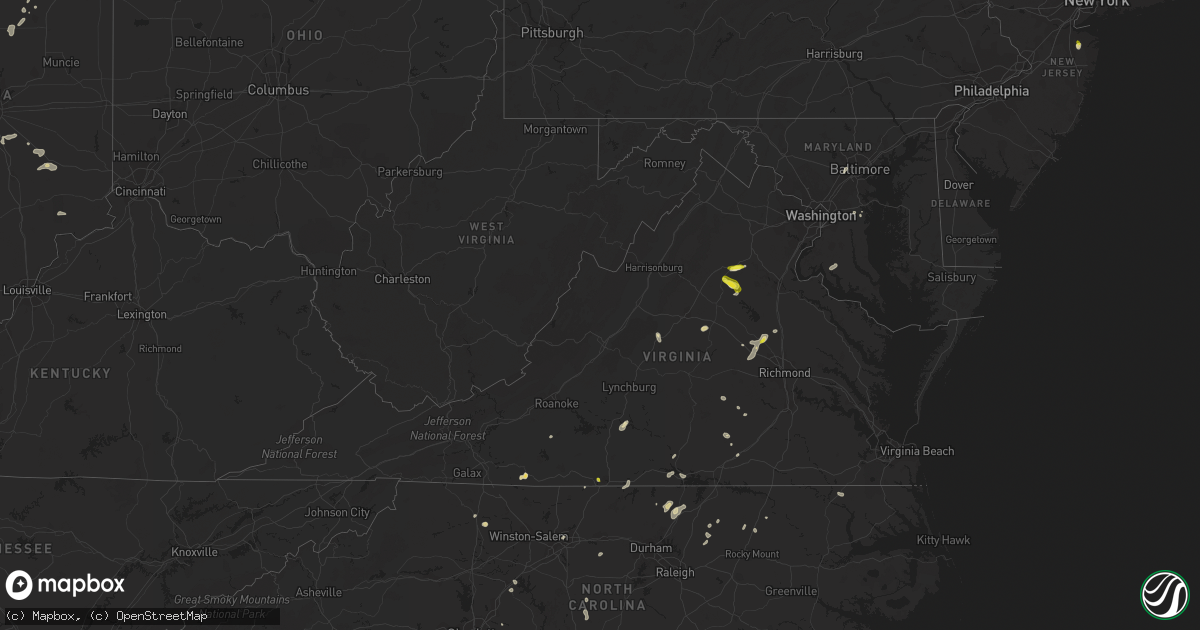
Hail Map in Virginia on July 16, 2022
Get this storm
July 16 map
$229
one time, instant access
Download today. No call, no setup
Keep the $229
Bought the map and want the full workflow? Apply the entire $229 to a subscription within 7 days. None of it is wasted.
Every map, not just this one
This buys you this map. Subscription and you get every map we run, in the markets you choose from a few cities to whole states to nationwide. Plus real-time alerts the moment a storm fires.
Contact data
Name, contact info, occupancy, even credit band for addresses in the footprint. You go from where it hit to who to call.
Become the source they trust
Unlimited branding weather history reports on demand. You already have the documented answer ready for the property owner, and you are the one who showed up with it.
Property data and RoofTrace estimates
Pull up any address you have got, its value and the exact code rules for that jurisdiction, straight from One Click Code. Then RoofTrace estimates the squares, pitch, and roof value, priced the way you price.
Storm reports in Virginia
Virginia
| Date | Description |
|---|---|
| 07/16/20225:57 PM CDT | A tree blew down on stagebridge rd. |
| 07/16/20225:05 PM CDT | Trees blew down near va-729 eggbornsville road. |
| 07/16/20225:03 PM CDT | Numerous trees blew down near the intersection of va-628 clifton road and barclay lane/jackson's quarters road. |
| 07/16/20224:54 PM CDT | Several trees blew down near and along clarks mountain rd. |
| 07/16/20224:50 PM CDT | Several trees blew down along va-614 locust dale road in rapidan. |
| 07/16/20224:45 PM CDT | Numerous trees blew down along va-614 locust dale road. |
| 07/16/20224:08 PM CDT | Several trees down on n boston road. Time estimated. |
| 07/16/20224:06 PM CDT | Several trees down on the 1700 block of union mills road west of troy. Time estimated. |
| 07/16/20223:45 PM CDT | Trees down. Time estimated from radar data. |
| 07/16/20223:30 PM CDT | Trees down causing power outages just north of purdy. Time estimated. |
| 07/16/20223:30 PM CDT | Trees down in buffalo junction. Time estimated from radar. |
| 07/16/20223:26 PM CDT | Trees and lines blew down near the 11000 block of millbank rd. |
| 07/16/20223:24 PM CDT | Tree down on i-85 at mm25... Which is just southeast of alberta. Time estimated. |
| 07/16/20223:20 PM CDT | Cluster of around 150 power outages near port royal likely caused by storm. Time estimated. |
| 07/16/20223:18 PM CDT | One power line down along seven oak drive due to thunderstorm winds. |
| 07/16/20223:13 PM CDT | One power line down at the intersection of north main street and moore street due to thunderstorm winds. |
| 07/16/20223:06 PM CDT | One power line down along ponderosa road due to thunderstorm winds. |
| 07/16/20222:52 PM CDT | Hundreds of power outages just east of ruther glen likely caused by storm. |
| 07/16/20222:37 PM CDT | One tree down along the 1000 block of piney grove road due to thunderstorm winds. |
| 07/16/20222:34 PM CDT | One tree down along the 1000 block of storys creek road due to thunderstorm winds. |
| 07/16/20222:34 PM CDT | One tree down due to thunderstorm winds along walnut creek road. |
| 07/16/20222:34 PM CDT | One tree down along owen walker road due to thunderstorm winds. |
| 07/16/20222:31 PM CDT | One tree down along west parker road due to thunderstorm winds. |
| 07/16/20222:30 PM CDT | Trees and power lines down causing hundreds of power outages southeast of beaverdam. Time estimated. |
| 07/16/20222:23 PM CDT | One tree down in the saxe area due to thunderstorm winds. |
| 07/16/20222:23 PM CDT | Quarter size hail observed in danville city. Report via mping. |
| 07/16/20222:21 PM CDT | One tree down in the randolph area due to thunderstorm winds. |
| 07/16/20222:21 PM CDT | Quarter size hail observed north of danville. Report via mping. |
| 07/16/20222:14 PM CDT | Multiple trees and power lines down in and around montpelier. Time estimated. |
| 07/16/20222:14 PM CDT | Report relayed by 911 center. |
| 07/16/20222:09 PM CDT | One tree down along berry hill road due to thunderstorm winds. |
| 07/16/20221:52 PM CDT | Tree down on fairground road. Time estimated. |
| 07/16/20221:45 PM CDT | Tree down on hobbs mill road. Time estimated. |
| 07/16/202212:56 PM CDT | Corrects previous tstm wnd dmg report from 2 wsw wylliesburg. Multiple trees down along kings cross road due to thunderstorm wins. |
| 07/16/202212:53 PM CDT | Corrects previous tstm wnd dmg report from 2 wsw wylliesburg. Multiple trees down along kings cross road due to thunderstorm wins. |
| 07/16/202212:53 PM CDT | Multiple trees down along kings cross road due to thunderstorm wins. |
| 07/16/202212:35 PM CDT | Multiple trees and power lines down along wyatt miles road due to thunderstorm winds. |
| 07/16/202212:33 PM CDT | Multiple trees and power lines down along tabor road due to thunderstorm winds. |
| 07/16/202212:20 PM CDT | One tree down along the 800 block of railroad lane due to thunderstorm winds. |
| 07/16/202212:14 PM CDT | One tree down along cedar tree road due to thunderstorm winds. |
| 07/16/20223:18 AM CDT | At 818 PM EDT, severe thunderstorms were located along a line extending from 9 miles southeast of Gwynn to 6 miles northwest of Cheriton to near Cape Charles, moving northeast at 20 mph. HAZARD...60 mph wind gusts. SOURCE...Radar indicated. IMPACT...Expect damage to trees and powerlines. Severe thunderstorms will be near... Bay View around 835 PM EDT. Cheriton around 840 PM EDT. Exmore, Nassawadox and Willis Wharf around 900 PM EDT.Other locations impacted by these severe thunderstorms includeSimpkins, Birdsnest, Oyster, Jamesville, Silver Beach, Eastville,Plantation, Machipongo, Wardtown and Franktown. |
| 07/16/20222:12 AM CDT | At 712 PM EDT, a severe thunderstorm was located near Ferrum, and is nearly stationary. HAZARD...60 mph wind gusts and quarter size hail. SOURCE...Radar indicated. IMPACT...Hail damage to vehicles is expected. Expect wind damage to roofs, siding, and trees. Locations impacted include... Rocky Mount... and Ferrum. |
| 07/16/20221:32 AM CDT | At 632 PM EDT, a severe thunderstorm was located near Wintergreen, or 13 miles south of Waynesboro, and is nearly stationary. HAZARD...60 mph wind gusts and quarter size hail. SOURCE...Radar indicated. IMPACT...Damaging winds will cause some trees and large branches to fall. This could injure those outdoors, as well as damage homes and vehicles. Roadways may become blocked by downed trees. Localized power outages are possible. Unsecured light objects may become projectiles. Locations impacted include... Schuyler, Wintergreen, Nellysford, Esmont, Lovingston, Greenfield, Damon, Covesville, Rockfish and Faber. |
| 07/16/202212:59 AM CDT | At 559 PM EDT, a severe thunderstorm was located 9 miles east of Orange, moving southeast at 25 mph. HAZARD...70 mph wind gusts and quarter size hail. SOURCE...Radar indicated. IMPACT...Damaging winds will cause some trees and large branches to fall. This could injure those outdoors, as well as damage homes and vehicles. Roadways may become blocked by downed trees. Localized power outages are possible. Unsecured light objects may become projectiles. Locations impacted include... Spotsylvania, Mine Run, Rhoadesville, Brokenburg, Parker, Everona, Verdiersville, Locust Grove, Alsop, Gold Dale, Thornhill, Nasons, Logan, Lahore, Glenora, Post Oak, Unionville and Rapidan. |
| 07/16/202212:58 AM CDT | At 558 PM EDT, a severe thunderstorm was located over Culpeper, moving northeast at 20 mph. HAZARD...65 mph wind gusts and half dollar size hail. SOURCE...Radar indicated. IMPACT...Damaging winds will cause some trees and large branches to fall. This could injure those outdoors, as well as damage homes and vehicles. Roadways may become blocked by downed trees. Localized power outages are possible. Unsecured light objects may become projectiles. Locations impacted include... Culpeper, Bealeton, Opal, Remington, Midland, Elkwood, Catalpa, Stevensburg, Brandy Station, Lois, Winston, Lignum, Morrisville, Alanthus, Goldvein and Sumerduck. |
| 07/16/202212:38 AM CDT | At 538 PM EDT, a severe thunderstorm was located 7 miles southwest of Culpeper, moving southeast at 10 mph. HAZARD...60 mph wind gusts and quarter size hail. SOURCE...Radar indicated. IMPACT...Damaging winds will cause some trees and large branches to fall. This could injure those outdoors, as well as damage homes and vehicles. Roadways may become blocked by downed trees. Localized power outages are possible. Unsecured light objects may become projectiles. Locations impacted include... Culpeper, Madison, Brightwood, Raccoon Ford, Rapidan, Oakpark, Everona, Nasons, Winston, Mitchells, Reva, Fordsville, Twymans Mill, Leon, Unionville and Locust Dale. |
| 07/15/202211:59 PM CDT | At 459 PM EDT, a severe thunderstorm was located over Lake Monticello, moving northeast at 5 mph. HAZARD...60 mph wind gusts and penny size hail. SOURCE...Radar indicated. IMPACT...Expect damage to trees and powerlines. This severe thunderstorm will be near... Troy around 545 PM EDT.Other locations impacted by this severe thunderstorm include Nahor,Bybee, Zion Crossroads, Cunningham, Union Mills and Wildwood. |
| 07/15/202211:53 PM CDT | At 452 PM EDT, a severe thunderstorm was located over Dahlgren, moving northeast at 20 mph. HAZARD...60 mph wind gusts. SOURCE...Radar indicated. IMPACT...Damaging winds will cause some trees and large branches to fall. This could injure those outdoors, as well as damage homes and vehicles. Roadways may become blocked by downed trees. Localized power outages are possible. Unsecured light objects may become projectiles. Locations impacted include... Waldorf, La Plata, Dahlgren, Nanjemoy Creek, Popes Creek, Hallowing Point, Port Tobacco River, Golden Beach, Saint Charles, Wicomico, Hughesville, Mechanicsville, Charlotte Hall, Cobb Island, Bryantown, Benedict, Rock Point, Port Tobacco Village, Issue and Tompkinsville. |
| 07/15/202211:16 PM CDT | At 416 PM EDT, a severe thunderstorm was located near Alberta, or near Lawrenceville, moving east at 20 mph. HAZARD...60 mph wind gusts and penny size hail. SOURCE...Radar indicated. IMPACT...Expect damage to trees and powerlines. This severe thunderstorm will be near... Radium around 455 PM EDT. Purdy and Jarratt around 500 PM EDT.Other locations impacted by this severe thunderstorm include Cochran,Grizzard, Bufford Crossroads, Dolphin, Pleasant Shade, FieldsCrossroads, Warfield, Emporia Reservoir, Huske and Cowie Corner. |
| 07/15/202210:14 PM CDT | At 314 PM EDT, a severe thunderstorm was located over Montpelier, or 11 miles northwest of Randolph Macon College, moving northeast at 25 mph. HAZARD...60 mph wind gusts and quarter size hail. SOURCE...Radar indicated. IMPACT...Minor damage to vehicles is possible. Expect wind damage to trees and powerlines. This severe thunderstorm will be near... Ladysmith around 345 PM EDT.Other locations impacted by this severe thunderstorm includeChilesburg, Golansville, Oliver, Gum Tree, Coatesville, Hewlett,Goodall, Doswell, Mabelton and Penola. |
| 07/15/202210:13 PM CDT | At 312 PM EDT, a severe thunderstorm was located over Milton, or 10 miles east of Providence, moving east at 15 mph. HAZARD...60 mph wind gusts and quarter size hail. SOURCE...Radar indicated. IMPACT...Hail damage to vehicles is expected. Expect wind damage to roofs, siding, and trees. Locations impacted include... Turbeville... Milton... Cluster Springs... Semora... Alton... and Hyco Lake. |
| 07/15/20229:44 PM CDT | At 244 PM EDT, a severe thunderstorm was located over Oilville, or 8 miles east of Goochland, moving northeast at 25 mph. HAZARD...60 mph wind gusts and penny size hail. SOURCE...Radar indicated. IMPACT...Expect damage to trees and powerlines. This severe thunderstorm will be near... Wyndham around 255 PM EDT. Montpelier around 300 PM EDT. Ashland and Randolph Macon College around 315 PM EDT.Other locations impacted by this severe thunderstorm includeRockville, Dabneys, Gilman, Crozier, Vontay, Coatesville, JohnsonsSprings, Goodall, Mabelton and Short Pump. |
| 07/15/20229:42 PM CDT | At 242 PM EDT, a severe thunderstorm was located near Mannboro, moving east at 15 mph. HAZARD...60 mph wind gusts and penny size hail. SOURCE...Radar indicated. IMPACT...Expect damage to trees and powerlines. This severe thunderstorm will be near... Sutherland around 325 PM EDT.Other locations impacted by this severe thunderstorm include CenterStar, Petersburg Airport, Church Road, Five Forks, Burgess, Walkers,Hebron, Ammon and Ford. |
| 07/15/20229:28 PM CDT | At 228 PM EDT, a severe thunderstorm was located near Kenbridge, moving east at 5 mph. HAZARD...60 mph wind gusts and penny size hail. SOURCE...Radar indicated. IMPACT...Expect damage to trees and powerlines. This severe thunderstorm will be near... Dundas around 240 PM EDT. Blackstone and Fort Pickett around 315 PM EDT.Other locations impacted by this severe thunderstorm include LafoonCorner, Danieltown, Irby, Barrows Store, Murdocks, Forkland,Blackstone Airport and Dominy Corner. |
| 07/15/20228:56 PM CDT | At 155 PM EDT, a severe thunderstorm was located over Wylliesburg, or near Redoak, moving northeast at 20 mph. HAZARD...60 mph wind gusts and quarter size hail. SOURCE...Radar indicated. IMPACT...Hail damage to vehicles is expected. Expect wind damage to roofs, siding, and trees. Locations impacted include... Keysville... Redoak... Wylliesburg... and Fort Mitchell. |
| 07/15/20228:37 PM CDT | At 137 PM EDT, a severe thunderstorm was located near Andersonville, or 10 miles south of Buckingham, moving north at 10 mph. HAZARD...60 mph wind gusts. SOURCE...Radar indicated. IMPACT...Expect damage to roofs, siding, and trees. Locations impacted include... Buckingham... Dillwyn... Toga... Sheppards... and Andersonville. |
| 07/15/20228:32 PM CDT | At 131 PM EDT, a cluster of severe thunderstorms was located between Altavista, Hodges, and Long Island, moving east at 10 mph. HAZARD...60 mph wind gusts and quarter size hail. SOURCE...Radar indicated. IMPACT...Hail damage to vehicles is expected. Expect wind damage to roofs, siding, and trees. Locations impacted include... Altavista... Hurt... Hodges... Gladys... Long Island... Straightstone... and Cody. |
| 07/15/20228:12 PM CDT | At 111 PM EDT, a severe thunderstorm was located over Evergreen, or near Appomattox, moving northeast at 15 mph. HAZARD...60 mph wind gusts and quarter size hail. SOURCE...Radar indicated. IMPACT...Hail damage to vehicles is expected. Expect wind damage to roofs, siding, and trees. Locations impacted include... Appomattox... Pamplin City... Hixburg... Appomattox National Historic Park... and Evergreen. |
| 07/15/20227:27 PM CDT | Nearly 150 power outages in and around eastville likely caused by storm. Time estimated. |
All States Impacted by Hail Map on July 16, 2022
Cities Impacted by Hail Map on July 16, 2022
- Burwell, NE
- Hugo, CO
- Atkinson, NE
- Stuart, NE
- Ellendale, ND
- Loup City, NE
- North Loup, NE
- Ord, NE
- Ashton, NE
- Buffalo Gap, SD
- Hot Springs, SD
- Farnam, NE
- Edgeley, ND
- Verona, ND
- Hazard, NE
- Ravenna, NE
- Rockville, NE
- Oran, MO
- Fredericktown, MO
- Glenallen, MO
- Zalma, MO
- Marble Hill, MO
- Advance, MO
- Greenville, MO
- Marquand, MO
- Montpelier, ND
- Louisburg, NC
- Edgewater, MD
- Davidsonville, MD
- Harwood, MD
- Cozad, NE
- Lexington, NE
- Eddyville, NE
- Fullerton, ND
- Battle Lake, MN
- Clitherall, MN
- Callaway, NE
- Gothenburg, NE
- Morganville, NJ
- Colts Neck, NJ
- Marlboro, NJ
- Holmdel, NJ
- Greensburg, IN
- Hendley, NE
- Beaver City, NE
- Shelbyville, IN
- Wilsons, VA
- Blackstone, VA
- Purdum, NE
- Buffalo Junction, VA
- Clarksville, VA
- Mason City, NE
- Kingman, IN
- Nelson, VA
- Virgilina, VA
- Broken Bow, NE
- Sumner, NE
- Oconto, NE
- Wild Horse, CO
- Karval, CO
- Kit Carson, CO
- Saint Francis, KS
- Bowling Green, IN
- Centerpoint, IN
- Poland, IN
- Overton, NE
- Peridot, AZ
- Colorado Springs, CO
- Brownsburg, IN
- Indianapolis, IN
- Avon, IN
- Sells, AZ
- Clearwater, NE
- La Fontaine, IN
- Wabash, IN
- Vona, CO
- Inman, NE
- Naper, NE
- Oneill, NE
- Page, NE
- Mills, NE
- Ewing, NE
- Carmel, IN
- Zionsville, IN
- Nogales, AZ
- Rio Rico, AZ
- Tumacacori, AZ
- Oxford, NE
- Cambridge, NE
- Holbrook, NE
- Arapahoe, NE
- Stamford, NE
- Eustis, NE
- Edison, NE
- Catonsville, MD
- Ellicott City, MD
- Whiteland, IN
- Needham, IN
- Boggstown, IN
- Franklin, IN
- Fairland, IN
- Westfield, IN
- Greentown, IN
- Windfall, IN
- Sargent, NE
- Eads, CO
- Ramah, CO
- Rush, CO
- Oral, SD
- Lamoure, ND
- Robbins, NC
- Eagle Springs, NC
- Georgetown, MS
- Hazlehurst, MS
- Tonopah, AZ
- Vail, AZ
- Tucson, AZ
- Marion, IN
- Boonville, NC
- Yadkinville, NC
- Hillsboro, IN
- State Road, NC
- Elkin, NC
- Brodnax, VA
- Miami, AZ
- Concord, NC
- Greensboro, NC
- Globe, AZ
- Faber, VA
- Lovingston, VA
- Pleasanton, NE
- Shelton, NE
- Riverdale, NE
- Gibbon, NE
- Kearney, NE
- Boelus, NE
- Farwell, NE
- Elba, NE
- Saint Paul, NE
- Miller, NE
- Cairo, NE
- Dannebrog, NE
- Scotia, NE
- Grand Island, NE
- Wolbach, NE
- Sheridan Lake, CO
- Merna, NE
- Wood River, NE
- Sonoita, AZ
- Henning, MN
- Oxford, NC
- Kenesaw, NE
- Juniata, NE
- Amherst, NE
- Rothsay, MN
- Trinidad, CO
- Green Valley, AZ
- Amado, AZ
- Culpeper, VA
- Litchfield, NE
- Oilville, VA
- Crozier, VA
- Syracuse, KS
- Troy, VA
- Palmyra, VA
- Stuart, VA
- Ansley, NE
- Young, AZ
- San Manuel, AZ
- West Baden Springs, IN
- Shipman, VA
- Nellysford, VA
- Vass, NC
- Dunning, NE
- Saint Libory, NE
- Kenbridge, VA
- Long Island, VA
- Hurt, VA
- Gladys, VA
- Lowry, MN
- Glenwood, MN
- Cicero, IN
- Madison, IN
- Lisbon, ND
- Faison, NC
- Red Oak, VA
- Rougemont, NC
- Westerville, NE
- Alda, NE
- Lakeland, FL
- Mulberry, FL
- Milton, NC
- Alton, VA
- West Terre Haute, IN
- Wilsonville, NE
- Enfield, NC
- Whitakers, NC
- Anselmo, NE
- Rye, CO
- Bumpass, VA
- Manakin Sabot, VA
- Montpelier, VA
- Beaverdam, VA
- Maidens, VA
- Rockville, VA
- Rapidan, VA
- Unionville, VA
- Locust Dale, VA
- Orange, VA
- Moorefield, NE
- Marienthal, KS
- Salisbury, NC
- Spencer, NC
- Lakin, KS
- Doswell, VA
- Ruther Glen, VA
- Arnold, NE
- Brazil, IN
- Corning, KS
- Centralia, KS
- Pelican Rapids, MN
- Chesterfield, SC
- Patrick, SC
- Danville, VA
- Eden, NC
- Thibodaux, LA
- Elm Creek, NE
- Converse, IN
- Chambers, AZ
- Doniphan, NE
- Greeley, NE
- Elyria, NE
- Swayzee, IN
- La Plata, MD
- Charlotte Hall, MD
- Milroy, IN
- Waldron, IN
- Saint Paul, IN
- Des Allemands, LA
- Paradis, LA
- Holly, CO
- Fort Mcdowell, AZ
- Seagrove, NC
- Raeford, NC
- Eure, NC
- Gates, NC
- Mineral, VA
- Gum Spring, VA
- Sandy Hook, VA
- Brandy Station, VA
- Elkwood, VA
- Stevensburg, VA
- Dennison, IL
- Amelia Court House, VA
- Snow Camp, NC
- Burlington, NC
- Jetersville, VA
- Deerfield, KS
- Brady, NE
- Joes, CO
- Clinton, NC
- Spring Grove, PA
- York, PA
- Seven Valleys, PA
- Mitchells, VA
- Rhoadesville, VA
- Greenup, IL
- Casey, IL
- Callaway, VA
- Dundas, VA
- Roxboro, NC
- Roseland, NE
- Heartwell, NE
- Minden, NE
- Holstein, NE
- Ong, NE
- Hastings, NE
- Belleville, KS
- Harvard, NE
- Inland, NE
- Byron, NE
- Deshler, NE
- Superior, NE
- Red Cloud, NE
- Oak, NE
- Fairfield, NE
- Deweese, NE
- Guide Rock, NE
- Trumbull, NE
- Edgar, NE
- Nelson, NE
- Lawrence, NE
- Glenvil, NE
- Davenport, NE
- Ruskin, NE
- Hebron, NE
- Clay Center, NE
- Republic, KS
- Giltner, NE
- Hardy, NE
- Blue Hill, NE
- Ayr, NE
- Saronville, NE
- Chester, NE
- Bladen, NE
- Leopold, MO
- Whitewater, MO
- Sahuarita, AZ
- Saint Hilaire, MN
- Red Lake Falls, MN
- Orchard, NE
- Ericson, NE


