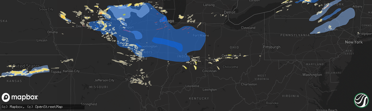
Hail Map in Indiana on July 15, 2024
The weather event in Indiana on July 15, 2024 includes Hail, Wind, and Tornado maps. 29 states and 2,623 cities were impacted and suffered possible damage. The total estimated number of properties impacted is 6,935.
Want more than just the map?
Turn this storm into a full workflow.
- Owner + property data so you know who to knock
- OnDemand branded weather history reports to win the "did we even have hail?" argument
- RoofTrace estimate so reps stop guessing numbers at the door
Bought this map? Upgrade within 7 days and we'll credit the $230. (10-15 min setup call)
Hail
Wind
Tornado
6,935
Estimated number of impacted properties by a 1.00" hail or larger0
Estimated number of impacted properties by a 1.75" hail or larger0
Estimated number of impacted properties by a 2.50" hail or largerStorm reports in Indiana
Indiana
| Date | Description |
|---|---|
| 07/15/20245:46 PM CDT | A local report indicates 1.00 inch wind near 2 WSW Greensburg |
| 07/15/20245:46 PM CDT | A local report indicates 1.00 inch wind near Nashville |
| 07/15/20245:45 PM CDT | Time estimated. |
| 07/15/20245:22 PM CDT | A local report indicates 1.00 inch wind near 2 W Beanblossom |
| 07/15/20244:39 PM CDT | A local report indicates 1.00 inch wind near 2 S Arlington |
| 07/15/20243:52 AM CDT | Photos on twitter of numerous large branches down and a couple trees down near cree lake. Time estimated from radar. |
| 07/15/202412:30 AM CDT | Emergency manager reports a tree downed over road near 800 e and 100 n east of logansport indiana in cass county. |
| 07/15/202412:22 AM CDT | Emergency manager reports tree blown down on east side of huntington... Indiana on grayston avenue in huntington county. |
| 07/15/202412:18 AM CDT | Photo on twitter shows large tree down onto a covered porch. Porch roof collapsed. Time estimated from radar. Location approximate. |
| 07/15/202412:18 AM CDT | *** 1 inj *** state police reported a semi-truck driver with injury when tree fell onto the cab of the truck near auburn in de kalb county in indiana. |
| 07/15/202412:18 AM CDT | *** 1 inj *** corrects location of previous tstm wnd dmg report from 1 wnw auburn. State police reported a semi-truck driver with injury when tree fell onto the cab of |
| 07/15/202412:17 AM CDT | Emergency manager reports a tree blown down into a house in northwest whitley county indiana no injuries reported at this time. |
| 07/15/202412:16 AM CDT | Emergency manager reports tree down at country road 250 e and 125 n... Northeast of logansport indiana in cass county. |
| 07/15/202412:15 AM CDT | Multiple reports of power lines down in indianapolis. |
| 07/15/202412:15 AM CDT | A tree was reported down across the street in angola by local law enforcement. Tree is on joe wheeler street... Between broad st. And w. Maumee. Unknown diameter. Repor |
| 07/15/202412:15 AM CDT | Local fire department reports tree down on cr 600 w and cr 100 n west of angola. |
| 07/15/202412:15 AM CDT | Power lines down on fox lake road southwest of angola. Time estimated via radar. |
| 07/15/202412:10 AM CDT | Trained spotter reports 62 mph gust at saint joe center rd and wheelock rd on the northeast side of fort wayne. |
| 07/15/202412:09 AM CDT | Trained spotter reports tree down at the intersection of clinton rd and washington center rd. Estimated 50 mph wind gusts. |
| 07/15/202412:08 AM CDT | Broadcast media relays report from dispatch of a large tree uprooted on smith street. Time estimated via radar. |
| 07/15/202412:08 AM CDT | Broadcast media relays dispatch report of tree limbs and powerlines down on randalia & delaware in fort wayne. Time estimated via radar. |
| 07/15/202412:08 AM CDT | Delayed report of large tree limbs downed at a residence. Time estimated from radar. |
| 07/15/202412:05 AM CDT | Trained spotter reports a tree down on s. Calhoun and tillman roads in fort wayne... Tree across the road. Healthy tree 10-12 in diameter. Time estimated from radar. |
| 07/15/202412:04 AM CDT | Asos station kind indianapolis. |
| 07/15/202412:03 AM CDT | Broadcast media relayed photos of tree limbs and powerlines down at the intersection of w state and sherman in fort wayne. Time estimated via radar. |
| 07/15/202412:00 AM CDT | At least one large tree down with multiple large branches down throughout the nearby area. Time estimated from radar. |
| 07/15/202412:00 AM CDT | Delayed report. Power line downed near a residence. Time estimated from radar. |
| 07/14/202411:58 PM CDT | Delayed report of large tree limbs downed on north side of kendallville. Time estimated from radar. |
| 07/14/202411:58 PM CDT | Delayed report of large tree limbs down near illinois road between scott and hadley roads. Time estimated from radar. |
| 07/14/202411:55 PM CDT | Tree down on 300w in lancaster. Time estimated via radar. |
| 07/14/202411:52 PM CDT | Tree reported down on east side of town on grayston avenue. Time estimated via radar. |
| 07/14/202411:52 PM CDT | Emergency manager reports tree and power lines down at 600 e and logansport road east of logansport... Indiana in cass county. |
| 07/14/202411:49 PM CDT | Emergency manager reports multiple trees downed near high street at roselawn and at 22 street in logansport indiana in cass county. |
| 07/14/202411:44 PM CDT | Delayed report. Tree snapped. |
| 07/14/202411:44 PM CDT | Tree into house confirmed by on-scene fire personnel. 2500 west block of 700 north columbia city. Unknown if any injuries. |
| 07/14/202411:40 PM CDT | Delayed report. Approximately 2 mile path of downed trees and tree limbs with a barn also damged. |
| 07/14/202411:40 PM CDT | Emergency manager reports tree downed at grace street between depot and main street in walton... Indiana in cass county. |
| 07/14/202411:40 PM CDT | Semi blown over on us 31. Time estimated from radar. |
| 07/14/202411:40 PM CDT | Tree on house. Time estimated. |
| 07/14/202411:39 PM CDT | Fire department enroute to reports of a tree into a house in northwestern whitley county. No reported injuries at this time. |
| 07/14/202411:39 PM CDT | Report from mping: 1-inch tree limbs broken; shingles blown off. |
| 07/14/202411:39 PM CDT | Large tree down in wabash onto powerlines... Narrowly missing a house. Time estimated via radar. |
| 07/14/202411:35 PM CDT | Tree down on home in loon lake. No injuries reported. Time estimated via radar. |
| 07/14/202411:35 PM CDT | Delayed report. Numerous reports of trees uprooted or snapped with downed powerlines towards the southwest portions of the county. |
| 07/14/202411:33 PM CDT | A local report indicates 67 MPH wind near 3 SW Lincoln |
| 07/14/202411:31 PM CDT | Tree down on grace st between depot and main street. Reported by emergency manager. Time estimated via radar. |
| 07/14/202411:30 PM CDT | Powerlines down and several power flashes observed in peru... In. |
| 07/14/202411:30 PM CDT | Powerlines down in peru. Time estimated from radar. |
| 07/14/202411:29 PM CDT | Emergency manager reports tree down at lake street in warsaw indiana and loss of power over east warsaw indiana in kosciusko county. |
| 07/14/202411:29 PM CDT | Multiple trees down and one fell across the channel blocking the water way... Per public report on x/twitter. Time estimated via radar. |
| 07/14/202411:29 PM CDT | Several large trees uprooted on ogden point rd on lake wawasee. Also damage to a few boat lifts on the lake. Time estimated from radar. |
| 07/14/202411:27 PM CDT | Large tree down on a house south of pierceton. |
| 07/14/202411:26 PM CDT | Photo on twitter of a large barn with one wall collapsed and a partial roof collapse. Trusses still standing on one-quarter of the roof. Barn door in photo is open... O |
| 07/14/202411:25 PM CDT | Elkhart fire department reports damage from southdale st. To main st. Between east lusher ave. And east hively ave in southern elkhart. Possible tornado damage. Time es |
| 07/14/202411:23 PM CDT | Report from emergency manager of large tree limb blown down near the center of royal center... Indiana in cass county. |
| 07/14/202411:23 PM CDT | Corrects time of previous tstm wnd dmg report from 2 wnw benton. Trees and powerlines down near the goshen municipal airport. Several reports on social media. Time esti |
| 07/14/202411:23 PM CDT | Report of twitter of numerous trees and limbs down in the brookside mobile home park. Time estimated from radar. |
| 07/14/202411:22 PM CDT | Several trees down near the kroger on the south side of elkhart. Time estimated via radar. |
| 07/14/202411:22 PM CDT | Delayed report. Several trees snapped. |
| 07/14/202411:21 PM CDT | A survey of damage confirmed a brief ef1 tornado... Embedded within an area of straightline wind damage. The tornado touched down southeast of hawthorne elementary scho |
| 07/14/202411:21 PM CDT | Large tree limb down. Time estimated from radar. |
| 07/14/202411:20 PM CDT | Delayed report of large tree limbs down on syracuse webster road. Time estimated from radar. |
| 07/14/202411:20 PM CDT | Tree down just north of the intersection of county road 250 e and 125 n. Time estimated via radar. |
| 07/14/202411:19 PM CDT | A local report indicates 59 MPH wind near 1 SW Burket |
| 07/14/202411:18 PM CDT | A local report indicates 71 MPH wind near 1 NNW Athens |
| 07/14/202411:18 PM CDT | Tree down and powerlines down at county road 600 e and logansport road. Time estimated by radar. |
| 07/14/202411:18 PM CDT | Emergency manager reports tree down on high st at roselawn and 22nd streets. Time estimated via radar. |
| 07/14/202411:17 PM CDT | 1225 s and 800 e tree down blocking roadway per emergency manager. Time estimated via radar. |
| 07/14/202411:15 PM CDT | Loss of siding on a home in mishawaka. Photo and time provided in a facebook report. |
| 07/14/202411:15 PM CDT | Trees and powerlines down near the goshen municipal airport. Several reports on social media. Time estimated via radar. |
| 07/14/202411:13 PM CDT | Three large evergreen trees down and power outages reported. Time estimated from radar. |
| 07/14/202411:13 PM CDT | Delayed report of a large tree downed at a residence. Time estimated from radar. |
| 07/14/202411:13 PM CDT | Tree uprooted on east 11th street in mishawaka. Time estimated via radar. |
| 07/14/202411:11 PM CDT | Large tree down onto home in nappanee. No reported injuries at this time. Time estimated via radar. |
| 07/14/202411:09 PM CDT | A survey of damage confirmed a brief tornado... Embedded within a larger area of damaging winds. The tornado touched down southwest of the intersection of 19th rd and b |
| 07/14/202411:08 PM CDT | Large tree limbs down west of nappanee. Time estimated via radar. |
| 07/14/202411:02 PM CDT | Tree down blocking in 17 near the plymouth golf course. Time estimated via radar. |
| 07/14/202411:02 PM CDT | Tree down on 20th street between ironwood and hickory. Time estimated via radar. |
| 07/14/202411:02 PM CDT | Large tree and smaller limbs down at ironwood road and 20c. Time estimated via radar. |
| 07/14/202411:00 PM CDT | Large limbs down on kenilworth rd in argos. Time estimated from radar. |
| 07/14/202410:59 PM CDT | A couple of trees snapped. |
| 07/14/202410:58 PM CDT | Delayed report of large tree limbs downed. Time estimated from radar. |
| 07/14/202410:55 PM CDT | Emergency manager reports four trees down with power lines on nutmeg just south of menominee elementary in plymouth. Time estimated via radar. |
| 07/14/202410:55 PM CDT | Corrects previous tstm wnd dmg report from 1 ssw la paz. Downed powerlines on us 6 in la paz. Time estimated via radar. Indot reports all lanes are blocked and closed u |
| 07/14/202410:52 PM CDT | Police reports large tree down and blocking tamarack road near new carlisle. Time estimated from radar. |
| 07/14/202410:51 PM CDT | Delayed report. Drone photos received of tree damage. |
| 07/14/202410:51 PM CDT | Asos station klaf w. Lafayette - purdue univ. Arpt. |
| 07/14/202410:44 PM CDT | Large tree down and blocking e hutchinson rd in winamac. Time estimated from radar. |
| 07/14/202410:42 PM CDT | Trained spotter reports damage on the northwest side of la porte in the vicinity of johnson rd and cr 300 n. Trees and powerlines down. Possible tornado damage. Time es |
| 07/14/202410:40 PM CDT | Reports of numerous small to medium sized branches down southwest of la porte. Time estimated via radar. |
| 07/14/202410:40 PM CDT | Corrects time of previous tstm wnd dmg report from cdt to edt from 3 se waterford. Large tree down on a car |
| 07/14/202410:40 PM CDT | Powerlines down in waterford with power outages being reported. Time estimated from radar. |
| 07/14/202410:30 PM CDT | Photo of large tree down onto car |
| 07/14/202410:21 PM CDT | Multiple trees and power lines down throughout town. |
| 07/14/202410:20 PM CDT | 6 inch diameter tree snapped on valpo campus. Time estimated based on radar. |
| 07/14/202410:19 PM CDT | A local report indicates 63 MPH wind near Valparaiso |
| 07/14/202410:18 PM CDT | Trees down on power lines on union street. |
| 07/14/202410:18 PM CDT | A local report indicates 62 MPH wind near 1 SE Kentland |
| 07/14/202410:18 PM CDT | Trees and limbs reported down on and around valparaiso university campus. Time estimated by radar. |
| 07/14/202410:18 PM CDT | Multiple large trees downed causing damage to houses and vehicles around napoleon and chicago streets. Chicago street impassable in area. Time estimated by radar. |
| 07/14/202410:15 PM CDT | A local report indicates 76 MPH wind near 2 N Kouts |
| 07/14/202410:13 PM CDT | Public report of large tree branch downed southwest of valparaiso. Relayed via mping. Time estimated by radar. |
| 07/14/202410:10 PM CDT | Public report of large tree branch broken east of lakes of the four seasons. Relayed via mping. Time estimated by radar. |
| 07/14/202410:09 PM CDT | Large tree down in town. |
| 07/14/202410:04 PM CDT | Public works reports numerous trees and powerlines down throughout town... Most south of us 231. |
| 07/14/202410:03 PM CDT | Power pole reported down. |
| 07/14/202410:02 PM CDT | Report of large tree limbs down. |
| 07/14/202410:02 PM CDT | Multiple trees down in area. |
| 07/14/202410:00 PM CDT | Numerous trees and powerlines down within crown point. Most damage south of us 231. Relayed via munster public works. Time estimated based on radar. |
| 07/14/202410:00 PM CDT | Widespread damage primarily between lake street and broadway... Us hwy 231 to 125th ave. Many branches and trees down... Some with diameters larger than 10 inches. Time |
| 07/14/202410:00 PM CDT | Public report of large tree branch broken in east chicago. Relayed via mping. Time estimated by radar. |
| 07/14/20249:59 PM CDT | Restaurant sign knocked over... Roughly 24-36 inches set in concrete. Damage to sidewalk. Time estimated by radar. |
| 07/14/20249:58 PM CDT | Trees uprooted in washington park. Time estimated by radar. |
| 07/14/20249:58 PM CDT | Multiple public reports of tree damage in griffith. Relayed via mping. Time estimated by radar. |
| 07/14/20249:56 PM CDT | *** 1 fatal *** lake county em reports tree fell on residence near cedar lake. One occupant killed. Time estimated by radar. |
| 07/14/20249:40 PM CDT | Large tree down on a car |
All States Impacted by Hail Map on July 15, 2024
Cities Impacted by Hail Map on July 15, 2024
- Murdock, MN
- Montevideo, MN
- Maynard, MN
- Kerkhoven, MN
- Springfield, MN
- Raymond, MN
- Clara City, MN
- Sleepy Eye, MN
- Comfrey, MN
- Morgan, MN
- Canistota, SD
- Prinsburg, MN
- Willmar, MN
- Lake Lillian, MN
- Renville, MN
- Blomkest, MN
- Montrose, SD
- Saint James, MN
- Danube, MN
- Olivia, MN
- Bird Island, MN
- Hector, MN
- Fairfax, MN
- Lewisville, MN
- Truman, MN
- Winnebago, MN
- Westfield, NY
- Ripley, NY
- Portland, NY
- Fredonia, NY
- Brocton, NY
- Mantee, MS
- Woodland, MS
- Buffalo, NY
- Grand Island, NY
- Tonawanda, NY
- East Amherst, NY
- Clarence, NY
- Clarence Center, NY
- Gilbertown, AL
- Pheba, MS
- Cedarbluff, MS
- Eupora, MS
- Gainesville, FL
- Ackerman, MS
- Society Hill, SC
- Cheraw, SC
- West Warren, MA
- Ware, MA
- Palmer, MA
- Warren, MA
- Silver Creek, NY
- Jesup, GA
- Greenfield, IN
- Angola, NY
- Eden, NY
- Hamburg, NY
- Arlington, IN
- Carthage, IN
- Columbus, MS
- Starkville, MS
- Arcanum, OH
- Citra, FL
- Buena Vista, GA
- Hazlehurst, GA
- New Palestine, IN
- Fountaintown, IN
- Lake City, FL
- Belchertown, MA
- Granby, MA
- Ludlow, MA
- Gowanda, NY
- Collins, NY
- Morristown, IN
- West Falls, NY
- East Aurora, NY
- Orchard Park, NY
- Boston, NY
- Colden, NY
- Riceboro, GA
- Cassadaga, NY
- Somerville, OH
- Hamilton, OH
- Rushville, IN
- Louisville, MS
- Elma, NY
- Alden, NY
- Lancaster, NY
- Depew, NY
- Reynolds, GA
- Fort Valley, GA
- Darien, GA
- Townsend, GA
- Ocala, FL
- Anthony, FL
- South Wales, NY
- Saint Matthews, SC
- Middletown, OH
- Brunswick, GA
- Dayton, OH
- Napoleonville, LA
- Trenton, OH
- Attica, NY
- Warsaw, NY
- Dale, NY
- Wyoming, NY
- East Bethany, NY
- Reform, AL
- Butler, GA
- Connersville, IN
- Glenwood, IN
- Port Wentworth, GA
- Pooler, GA
- Savannah, GA
- Gwynneville, IN
- Bloomingdale, GA
- Springville, NY
- Valdosta, GA
- Cattaraugus, NY
- Xenia, OH
- Alpha, OH
- Yellow Springs, OH
- Holland, NY
- Green Pond, SC
- Marshville, NC
- Mount Kisco, NY
- Bedford Hills, NY
- Katonah, NY
- Pavilion, NY
- Byron, GA
- Warner Robins, GA
- Centerville, GA
- Clewiston, FL
- Alexander, NY
- Franklin, OH
- Fairborn, OH
- Bellbrook, OH
- Linwood, NY
- Le Roy, NY
- Caledonia, NY
- Spring Valley, OH
- Cedarville, OH
- Springfield, OH
- South Charleston, OH
- Bedford, NY
- Eaton, OH
- Cuthbert, GA
- Kiron, IA
- Ida Grove, IA
- Bowman, SC
- Cameron, SC
- Schleswig, IA
- South Solon, OH
- Geneseo, NY
- Avon, NY
- Rush, NY
- Honeoye Falls, NY
- Lima, NY
- Bloomfield, NY
- Canandaigua, NY
- West Bloomfield, NY
- Ionia, NY
- Victor, NY
- Saint Augustine, FL
- Livonia, NY
- Lakeville, NY
- Americus, GA
- Odebolt, IA
- Deloit, IA
- Denison, IA
- Kingman, AZ
- New Iberia, LA
- Loreauville, LA
- Dows, IA
- Ridgeland, SC
- Pineland, SC
- Knightstown, IN
- Shelbyville, IN
- Yemassee, SC
- Early Branch, SC
- Brookville, OH
- Lewisburg, OH
- West Alexandria, OH
- Tillman, SC
- Wilberforce, OH
- Farmington, NY
- Shortsville, NY
- Palmyra, NY
- London, OH
- Mount Sterling, OH
- Lehigh, IA
- Vail, IA
- Westside, IA
- Traer, IA
- Stamford, CT
- Coosawhatchie, SC
- Loris, SC
- Lewisville, IN
- Falmouth, IN
- Reinbeck, IA
- Buckingham, IA
- Franklin, GA
- Saint Martinville, LA
- Spiceland, IN
- Shirley, IN
- Charlottesville, IN
- Jeffersonville, OH
- Macedon, NY
- Manchester, NY
- Clifton Springs, NY
- Fort Washakie, WY
- Lander, WY
- Arapahoe, WY
- Riverton, WY
- Hudson, WY
- Darien, CT
- Grove City, OH
- Orient, OH
- Plains, GA
- Lumpkin, GA
- New Castle, IN
- Alden, IA
- Arcadia, IA
- Nevada, IA
- Miamisburg, OH
- Atlanta, GA
- Decatur, GA
- Stratford, IA
- Manning, IA
- Manilla, IA
- La Porte City, IA
- Dysart, IA
- Arthur, IA
- Lagrange, GA
- Lumberton, NC
- Aplington, IA
- Parkersburg, IA
- Westminster, CO
- Broomfield, CO
- Templeton, IA
- Clyo, GA
- Jacksonville, GA
- Milan, GA
- Roanoke, AL
- Duluth, GA
- Hemingway, SC
- Nesmith, SC
- Lake City, SC
- Breaux Bridge, LA
- Conway, SC
- Callender, IA
- Forkland, AL
- Greensboro, AL
- Gallion, AL
- Garnett, SC
- Milton, IN
- Galloway, OH
- West Jefferson, OH
- Stanley, NY
- Newark, NY
- Phelps, NY
- Geneva, NY
- Waterloo, NY
- Seneca Falls, NY
- Lyons, NY
- Clyde, NY
- Cuba, AL
- Gowrie, IA
- Somers, IA
- Pataskala, OH
- Etna, OH
- Toomsuba, MS
- New Hartford, IA
- Shell Rock, IA
- Allison, IA
- Webster City, IA
- Wall Lake, IA
- Audubon, IA
- Dedham, IA
- Breda, IA
- Carroll, IA
- Iowa Falls, IA
- Lafayette, LA
- Kingstree, SC
- Bladenboro, NC
- Duncombe, IA
- New Windsor, MD
- Westminster, MD
- Tar Heel, NC
- Straughn, IN
- Andrews, SC
- Hudson, IA
- Mount Auburn, IA
- Fort Dodge, IA
- Steamboat Rock, IA
- Stanhope, IA
- Coon Rapids, IA
- Bayard, IA
- Jeffrey City, WY
- Milroy, IN
- Trout Creek, MI
- Iron River, MI
- Dayton, IA
- Millersport, OH
- Kirkersville, OH
- Hebron, OH
- Broussard, LA
- Eldora, IA
- Finksburg, MD
- Hampstead, MD
- Flagstaff, AZ
- Clifton, AZ
- San Carlos, AZ
- Rhine, GA
- Adrian, GA
- Garrison, IA
- Vinton, IA
- Watton, MI
- Upperco, MD
- Daggett, MI
- Vulcan, MI
- White Oak, NC
- Hogansville, GA
- Jesup, IA
- Lake, MS
- Forest, MS
- Columbus, OH
- Hilliard, OH
- Savannah, NY
- Cayuga, NY
- Montezuma, NY
- Port Byron, NY
- Red Creek, NY
- Cato, NY
- Auburn, NY
- Elbridge, NY
- Weedsport, NY
- Jordan, NY
- Lawrenceville, PA
- Middlebury Center, PA
- Nelson, PA
- Ulysses, PA
- Knoxville, PA
- Westfield, PA
- Corning, NY
- Lindley, NY
- Painted Post, NY
- Addison, NY
- Osceola, PA
- Harrison Valley, PA
- Tioga, PA
- Elkland, PA
- Mansfield, PA
- Sabinsville, PA
- Wellsboro, PA
- Woodhull, NY
- Big Flats, NY
- Pine City, NY
- Horseheads, NY
- Millerton, PA
- Elmira, NY
- Columbia Cross Roads, PA
- Wellsburg, NY
- Gillett, PA
- Breesport, NY
- Pine Valley, NY
- Lowman, NY
- Erin, NY
- Waterloo, IA
- Cedar Falls, IA
- Carney, MI
- Estill, SC
- Iron Mountain, MI
- Eatonton, GA
- Lockbourne, OH
- Crystal Falls, MI
- Grundy Center, IA
- Wellsburg, IA
- Westfield, MA
- Manilla, IN
- Homer, IN
- Fairland, IN
- Prescott, AZ
- Arnaudville, LA
- Arlington, GA
- Hingham, MA
- Midland, OH
- Blanchester, OH
- Lake View, IA
- Wilson, MI
- Stephenson, MI
- Martville, NY
- Baldwinsville, NY
- Fulton, NY
- Hannibal, NY
- Memphis, NY
- Phoenix, NY
- Warners, NY
- Pennellville, NY
- Camillus, NY
- Liverpool, NY
- Cicero, NY
- Syracuse, NY
- Clay, NY
- Chemung, NY
- Spencer, NY
- Ithaca, NY
- Newfield, NY
- Van Etten, NY
- Cayuta, NY
- Brooktondale, NY
- Willseyville, NY
- Lockwood, NY
- Bark River, MI
- Pilot Mound, IA
- Yarnell, AZ
- Martinsville, IN
- Cohasset, MA
- Hull, MA
- Marenisco, MI
- Bergland, MI
- Mooresboro, NC
- Heath, OH
- Glenford, OH
- Thornville, OH
- Weymouth, MA
- East Weymouth, MA
- Aiken, SC
- Ashburn, GA
- Paton, IA
- Boxholm, IA
- Ogden, IA
- Walker, LA
- Denham Springs, LA
- Gilbertville, IA
- Owego, NY
- Barton, NY
- Waverly, NY
- Sayre, PA
- Candor, NY
- Independence, IA
- Brandon, IA
- Jersey Shore, PA
- Williamsport, PA
- Montgomery, PA
- Linden, PA
- Trout Run, PA
- Cogan Station, PA
- Montoursville, PA
- Hughesville, PA
- Muncy, PA
- Forksville, PA
- New Albany, PA
- Hillsgrove, PA
- Muncy Valley, PA
- Shunk, PA
- Eagles Mere, PA
- Dushore, PA
- Canton, PA
- Laporte, PA
- Unityville, PA
- Lairdsville, PA
- Rowley, IA
- Walker, IA
- Urbana, IA
- Center Point, IA
- Morgantown, IN
- Nashville, IN
- Ewen, MI
- Canal Winchester, OH
- Groveport, OH
- Ashville, OH
- Monticello, GA
- Colo, IA
- State Center, IA
- Towanda, PA
- Troy, PA
- Ulster, PA
- Dana, IA
- Boone, IA
- Williams, IA
- Harcourt, IA
- Carroll, OH
- Lancaster, OH
- Baltimore, OH
- Pickerington, OH
- Hillsboro, GA
- Thurston, OH
- Pleasantville, OH
- Indianapolis, IN
- Clarksville, OH
- Brewerton, NY
- Central Square, NY
- Constantia, NY
- West Monroe, NY
- Lisle, NY
- Newark Valley, NY
- Richford, NY
- Slaterville Springs, NY
- Berkshire, NY
- Dryden, NY
- Harford, NY
- Freeville, NY
- Marathon, NY
- Cortland, NY
- Homer, NY
- McGraw, NY
- Lopez, PA
- Mildred, PA
- Republic, MI
- Cleveland, NY
- Bernhards Bay, NY
- Williamstown, NY
- Tully, NY
- Truxton, NY
- Cincinnatus, NY
- Willet, NY
- Wyalusing, PA
- Laceyville, PA
- Sugar Run, PA
- Meshoppen, PA
- Tunkhannock, PA
- Mehoopany, PA
- Rome, PA
- Warren Center, PA
- Le Raysville, PA
- Little Meadows, PA
- Lynchburg, OH
- Greensburg, IN
- Ontario, NY
- Walworth, NY
- Radcliffe, IA
- Greenwood, IN
- Waldron, IN
- Palo, IA
- Appling, GA
- Aurora, IA
- Shellsburg, IA
- Hazleton, IA
- Urbandale, IA
- Windsor Heights, IA
- Des Moines, IA
- Parish, NY
- Camden, NY
- De Ruyter, NY
- McDonough, NY
- Pitcher, NY
- South Otselic, NY
- North Pitcher, NY
- Apalachin, NY
- Montrose, PA
- Springville, PA
- Strawberry Point, IA
- Lamont, IA
- Winthrop, IA
- Stanley, IA
- Oelwein, IA
- Fairbank, IA
- Dunkerton, IA
- Dundee, IA
- Fairfax, IA
- Alburnett, IA
- Van Horne, IA
- Newhall, IA
- Robins, IA
- Central City, IA
- Masonville, IA
- Toddville, IA
- Coggon, IA
- Quasqueton, IA
- Hiawatha, IA
- Cedar Rapids, IA
- Swisher, IA
- Marion, IA
- Atkins, IA
- Norway, IA
- Guttenberg, IA
- Dyersville, IA
- Worthington, IA
- Edgewood, IA
- Earlville, IA
- Hopkinton, IA
- Ely, IA
- Prairieburg, IA
- Holy Cross, IA
- Farley, IA
- Colesburg, IA
- Delhi, IA
- New Vienna, IA
- Springville, IA
- Delaware, IA
- Manchester, IA
- Luxemburg, IA
- Ryan, IA
- Monticello, IA
- Greeley, IA
- Anamosa, IA
- Nineveh, IN
- Westdale, NY
- Altmar, NY
- Redfield, NY
- Saint Paul, IN
- Flat Rock, IN
- Panora, IA
- Guthrie Center, IA
- Athens, PA
- Elizabethtown, NC
- Ames, IA
- Wysox, PA
- Milan, PA
- Zanesville, OH
- Hubbard, IA
- Willcox, AZ
- Damascus, GA
- Benton, PA
- Cuba City, WI
- Platteville, WI
- Toledo, IA
- Hillsboro, OH
- Aurora, NY
- Romulus, NY
- Ovid, NY
- Gilbert, IA
- Dike, IA
- Whiteland, IN
- Chelsea, IA
- Gladbrook, IA
- Lincoln, IA
- Elberon, IA
- Vining, IA
- Belle Plaine, IA
- Albany, GA
- Clarksville, IA
- Sherrill, IA
- Langworthy, IA
- Durango, IA
- Potosi, WI
- Martelle, IA
- Cascade, IA
- Dickeyville, WI
- Dubuque, IA
- Mount Vernon, IA
- Peosta, IA
- Epworth, IA
- Garber, IA
- North Buena Vista, IA
- Cassville, WI
- Morley, IA
- Center Junction, IA
- Zwingle, IA
- Olin, IA
- Wyoming, IA
- Mechanicsville, IA
- Onslow, IA
- Bernard, IA
- Hazel Green, WI
- Kieler, WI
- Lisbon, IA
- Solon, IA
- Alcova, WY
- Casper, WY
- Mills, WY
- Evansville, WY
- Erieville, NY
- South Plymouth, NY
- Smyrna, NY
- Georgetown, NY
- Sherburne, NY
- Plymouth, NY
- Hamilton, NY
- Earlville, NY
- Eaton, NY
- New Woodstock, NY
- Bouckville, NY
- Madison, NY
- Hubbardsville, NY
- Morrisville, NY
- Waterville, NY
- Vestal, NY
- Endicott, NY
- Harford, PA
- Kingsley, PA
- Factoryville, PA
- Hop Bottom, PA
- New Milford, PA
- Nicholson, PA
- Madrid, IA
- Kelley, IA
- Slater, IA
- Tama, IA
- Casey, IA
- Newton, GA
- Yale, IA
- Lincoln, AL
- Darlington, WI
- Belmont, WI
- Mineral Point, WI
- Granger, IA
- Woodward, IA
- Lake Park, GA
- Story City, IA
- Naples, NY
- Rushville, NY
- Chandlersville, OH
- Morrison, IA
- Keystone, IA
- Watkins, IA
- Walford, IA
- Glenrock, WY
- West Winfield, NY
- West Edmeston, NY
- Brookfield, NY
- Oriskany Falls, NY
- North Brookfield, NY
- Leonardsville, NY
- Cassville, NY
- Bridgewater, NY
- Sauquoit, NY
- North Liberty, IA
- Tiffin, IA
- Oxford, IA
- Lowville, NY
- Constableville, NY
- Richland, NY
- Lorraine, NY
- Marion, NY
- South Wayne, WI
- Argyle, WI
- Huxley, IA
- Maxwell, IA
- Johnston, IA
- Polk City, IA
- Dallas Center, IA
- Grimes, IA
- Blakely, GA
- Menlo, IA
- Cochise, AZ
- Grand Junction, IA
- Sheldahl, IA
- Clutier, IA
- New Concord, OH
- Pearce, AZ
- Clinton, WI
- Sharon, WI
- Washington, GA
- Kellogg, IA
- Hartwick, IA
- Middle Amana, IA
- Homestead, IA
- Newton, IA
- Malcom, IA
- Williamsburg, IA
- South Amana, IA
- Amana, IA
- Marengo, IA
- Gilman, IA
- Grinnell, IA
- Baxter, IA
- Laurel, IA
- Conroy, IA
- Brooklyn, IA
- Ladora, IA
- Victor, IA
- Mingo, IA
- Ira, IA
- Colfax, IA
- Deep River, IA
- Montezuma, IA
- Prairie City, IA
- Monroe, IA
- Pella, IA
- Guernsey, IA
- Otley, IA
- Lynnville, IA
- Killduff, IA
- Sully, IA
- Searsboro, IA
- Reasnor, IA
- New Sharon, IA
- Blairstown, IA
- Luzerne, IA
- Clarence, IA
- Oxford Junction, IA
- La Motte, IA
- Delmar, IA
- Lost Nation, IA
- Maquoketa, IA
- Andrew, IA
- Bellevue, IA
- Spragueville, IA
- Monmouth, IA
- Baldwin, IA
- East Dubuque, IL
- Benton, WI
- Galena, IL
- Shullsburg, WI
- Preston, IA
- Scales Mound, IL
- Lowden, IA
- Wheatland, IA
- Hanover, IL
- Charlotte, IA
- Stanwood, IA
- Savanna, IL
- Millville, PA
- Sweet Valley, PA
- Shickshinny, PA
- Harveys Lake, PA
- Old Forge, PA
- Duryea, PA
- Pittston, PA
- Dalton, PA
- Kingston, PA
- Taylor, PA
- Moosic, PA
- Hunlock Creek, PA
- Wyoming, PA
- Dallas, PA
- Falls, PA
- Noxen, PA
- Shavertown, PA
- Clarks Summit, PA
- Archbald, PA
- Fleetville, PA
- Lenoxville, PA
- Union Dale, PA
- Scranton, PA
- Jermyn, PA
- Forest City, PA
- Lake Ariel, PA
- Olyphant, PA
- Jessup, PA
- Moscow, PA
- Waymart, PA
- Carbondale, PA
- Waverly, PA
- Honesdale, PA
- Peckville, PA
- Susquehanna, PA
- Hawley, PA
- Prompton, PA
- South Gibson, PA
- Pleasant Mount, PA
- Herrick Center, PA
- Thompson, PA
- Jackson, PA
- Blanchardville, WI
- Monticello, WI
- New Glarus, WI
- Richfield Springs, NY
- Clayville, NY
- Ilion, NY
- Frankfort, NY
- Bondurant, IA
- Shelby, NC
- Lawndale, NC
- Bargersville, IN
- Sierra Vista, AZ
- Hereford, AZ
- Winterville, GA
- Saint David, AZ
- Mitchellville, IA
- Luther, IA
- Ankeny, IA
- Monroe, WI
- Mullins, SC
- Galivants Ferry, SC
- Nichols, SC
- Liscomb, IA
- Union Springs, NY
- Elliott, IA
- Red Oak, IA
- Gibson, IA
- Rose Hill, IA
- Barnes City, IA
- Leighton, IA
- North English, IA
- Webster, IA
- Oskaloosa, IA
- Delta, IA
- Keswick, IA
- Millersburg, IA
- Parnell, IA
- What Cheer, IA
- Hedrick, IA
- South English, IA
- Sigourney, IA
- Harper, IA
- Hayesville, IA
- Hills, IA
- Kalona, IA
- Iowa City, IA
- Washington, IA
- Lone Tree, IA
- Atalissa, IA
- West Branch, IA
- Nichols, IA
- Riverside, IA
- West Liberty, IA
- West Chester, IA
- Wellman, IA
- Ainsworth, IA
- Keota, IA
- Ollie, IA
- Grand Mound, IA
- Calamus, IA
- Coralville, IA
- Moscow, IA
- Wilton, IA
- Tipton, IA
- Bennett, IA
- Stockton, IL
- Miles, IA
- Apple River, IL
- Elizabeth, IL
- Gratiot, WI
- Warren, IL
- Lena, IL
- Nora, IL
- Westport, IN
- Bryant, IA
- Sabula, IA
- Jacksonville, AL
- Young, AZ
- Louisville, GA
- Garland, NC
- Franklin, IN
- Model, CO
- Runnells, IA
- Altoona, IA
- Pleasant Hill, IA
- Copenhagen, NY
- Mohawk, NY
- Herkimer, NY
- Little Falls, NY
- Jordanville, NY
- Friendsville, PA
- Brackney, PA
- Binghamton, NY
- Windsor, NY
- Kirkwood, NY
- Conklin, NY
- Johnson City, NY
- Port Crane, NY
- Harpursville, NY
- Afton, NY
- Ouaquaga, NY
- Packwood, IA
- Richland, IA
- Martinsburg, IA
- Brighton, IA
- Columbus Junction, IA
- Fruitland, IA
- Crawfordsville, IA
- De Witt, IA
- Donahue, IA
- Muscatine, IA
- Welton, IA
- Walcott, IA
- Stockton, IA
- Dixon, IA
- Durant, IA
- New Liberty, IA
- Conesville, IA
- Blue Grass, IA
- Letts, IA
- Wayland, IA
- Illinois City, IL
- Long Grove, IA
- Goose Lake, IA
- Clinton, IA
- Eldridge, IA
- Davenport, IA
- Teeds Grove, IA
- Mount Carroll, IL
- Lanark, IL
- Woodford, WI
- Shannon, IL
- Winslow, IL
- Pearl City, IL
- Browntown, WI
- Kent, IL
- Walton, NY
- Milanville, PA
- Fishs Eddy, NY
- East Branch, NY
- Equinunk, PA
- Starlight, PA
- Damascus, PA
- Preston Park, PA
- Long Eddy, NY
- Hancock, NY
- Lake Como, PA
- Beach Lake, PA
- Tyler Hill, PA
- Lakewood, PA
- Starrucca, PA
- Downsville, NY
- Narrowsburg, NY
- Hankins, NY
- Cochecton, NY
- Lake Huntington, NY
- Hortonville, NY
- Roscoe, NY
- Callicoon, NY
- Fremont Center, NY
- Youngsville, NY
- Ferndale, NY
- Ellenville, NY
- Kiamesha Lake, NY
- North Branch, NY
- Napanoch, NY
- Swan Lake, NY
- South Fallsburg, NY
- Smallwood, NY
- Liberty, NY
- Eldred, NY
- Claryville, NY
- Parksville, NY
- Monticello, NY
- Bethel, NY
- Neversink, NY
- Livingston Manor, NY
- Mongaup Valley, NY
- Loch Sheldrake, NY
- Kenoza Lake, NY
- White Sulphur Springs, NY
- Harris, NY
- White Lake, NY
- Grahamsville, NY
- Woodridge, NY
- Fallsburg, NY
- Jeffersonville, NY
- Hurleyville, NY
- Woodbourne, NY
- Delancey, NY
- Delhi, NY
- Andes, NY
- Hamden, NY
- Arkville, NY
- Bloomville, NY
- Margaretville, NY
- Bovina Center, NY
- Orangeville, IL
- Freeport, IL
- McConnell, IL
- Sidney, NY
- Unadilla, NY
- Mount Upton, NY
- Deposit, NY
- Nineveh, NY
- Bainbridge, NY
- South New Berlin, NY
- Masonville, NY
- Franklin, NY
- Wells Bridge, NY
- Oneonta, NY
- Sidney Center, NY
- Otego, NY
- Wrens, GA
- Bisbee, AZ
- Belleville, WI
- Albany, WI
- Brooklyn, WI
- Knoxville, IA
- Harrells, NC
- Patagonia, AZ
- Swan, IA
- Locke, NY
- Genoa, NY
- Reynolds, IL
- Milan, IL
- Morris, NY
- West Oneonta, NY
- Laurens, NY
- Maryland, NY
- Mediapolis, IA
- Columbus City, IA
- Grandview, IA
- Mount Pleasant, IA
- Winfield, IA
- Wapello, IA
- New Boston, IL
- Morning Sun, IA
- Olds, IA
- Sperry, IA
- Mount Union, IA
- Yarmouth, IA
- Keithsburg, IL
- Oakville, IA
- Aledo, IL
- Seaton, IL
- Joy, IL
- Andalusia, IL
- Buffalo, IA
- Taylor Ridge, IL
- Rock Island, IL
- Montpelier, IA
- Sherrard, IL
- South Kortright, NY
- Halcottsville, NY
- Roxbury, NY
- New Kingston, NY
- Fleischmanns, NY
- Hobart, NY
- Denver, NY
- Stamford, NY
- Big Indian, NY
- Pine Hill, NY
- Williams Bay, WI
- Shadyside, OH
- Jacobsburg, OH
- Jacksonville, FL
- Lake Geneva, WI
- Folkston, GA
- Fairfield, IA
- Round Lake, IL
- Grayslake, IL
- Lake Villa, IL
- Ottumwa, IA
- Agency, IA
- Batavia, IA
- Needham, IN
- Moravia, NY
- Fargo, GA
- Brodhead, WI
- Cedarville, IL
- Juda, WI
- Dakota, IL
- Evansville, WI
- Lynn Center, IL
- West Shokan, NY
- Phoenicia, NY
- Woodstock, NY
- Boiceville, NY
- West Kill, NY
- Mount Tremper, NY
- Chichester, NY
- Lanesville, NY
- Bearsville, NY
- Hunter, NY
- Lake Hill, NY
- Willow, NY
- Glenford, NY
- Prattsville, NY
- Grand Gorge, NY
- Shandaken, NY
- West Hurley, NY
- Olivebridge, NY
- Saugerties, NY
- Shokan, NY
- Jewett, NY
- Cornwallville, NY
- Oak Hill, NY
- East Durham, NY
- Round Top, NY
- Haines Falls, NY
- Medusa, NY
- Elka Park, NY
- Tannersville, NY
- Preston Hollow, NY
- East Jewett, NY
- Middleburgh, NY
- Hensonville, NY
- Windham, NY
- Acra, NY
- Ashland, NY
- Maplecrest, NY
- Durham, NY
- Gilboa, NY
- North Blenheim, NY
- Palenville, NY
- West Fulton, NY
- Fultonham, NY
- Jefferson, NY
- Chana, IL
- Oregon, IL
- Mount Morris, IL
- Baileyville, IL
- Forreston, IL
- Rock City, IL
- German Valley, IL
- Byron, IL
- Stillman Valley, IL
- Rockford, IL
- Davis, IL
- Pecatonica, IL
- Leaf River, IL
- Ridott, IL
- Winnebago, IL
- Polo, IL
- Libertyville, IL
- Wadsworth, IL
- Gurnee, IL
- Waukegan, IL
- Poulan, GA
- Libertyville, IA
- Lockridge, IA
- Eldon, IA
- Broxton, GA
- Wray, GA
- Sylvester, GA
- Berne, NY
- Purling, NY
- Surprise, NY
- Leeds, NY
- Greenville, NY
- Rensselaerville, NY
- Cairo, NY
- Earlton, NY
- Freehold, NY
- Westerlo, NY
- Catskill, NY
- South Cairo, NY
- Jakin, GA
- Norwich, OH
- Benson, AZ
- Livermore, CO
- Colquitt, GA
- Burlington, WI
- Genoa City, WI
- Orfordville, WI
- Shirland, IL
- Durand, IL
- Janesville, WI
- Rockton, IL
- Footville, WI
- Beloit, WI
- South Beloit, IL
- Chadwick, IL
- Thomson, IL
- Milledgeville, IL
- Edgerton, WI
- Cambridge, IL
- Orion, IL
- Andover, IL
- Galva, IL
- Kewanee, IL
- Bishop Hill, IL
- Danville, IA
- Oquawka, IL
- West Burlington, IA
- Burlington, IA
- Viola, IL
- New London, IA
- Cameron, IL
- Gerlaw, IL
- Biggsville, IL
- Alexis, IL
- North Henderson, IL
- New Windsor, IL
- Galesburg, IL
- Little York, IL
- Gladstone, IL
- Kirkwood, IL
- Monmouth, IL
- Ophiem, IL
- Alpha, IL
- Osco, IL
- Matherville, IL
- Oneida, IL
- Altona, IL
- Henderson, IL
- Coal Valley, IL
- Rio, IL
- Wataga, IL
- Woodhull, IL
- Geneseo, IL
- Colona, IL
- Hampton, IL
- Morrison, IL
- Camanche, IA
- Port Byron, IL
- Woosung, IL
- Rock Falls, IL
- Cordova, IL
- Bettendorf, IA
- Lyndon, IL
- East Moline, IL
- Moline, IL
- Atkinson, IL
- Carbon Cliff, IL
- Harmon, IL
- Fenton, IL
- Princeton, IA
- Rapids City, IL
- Silvis, IL
- Hillsdale, IL
- McCausland, IA
- Pleasant Valley, IA
- Dixon, IL
- Fulton, IL
- Erie, IL
- Sterling, IL
- Albany, IL
- Tampico, IL
- Low Moor, IA
- Le Claire, IA
- Ashton, IL
- Franklin Grove, IL
- Prophetstown, IL
- Glen Wild, NY
- Mountain Dale, NY
- Greenfield Park, NY
- Salem, WI
- Sumner, GA
- Sedona, AZ
- Leary, GA
- Stockport, IA
- Birmingham, IA
- Tombstone, AZ
- Zion, IL
- Doerun, GA
- Leesville, SC
- North Chicago, IL
- Wilkinson, IN
- Brimfield, IL
- La Fayette, IL
- Toulon, IL
- Princeville, IL
- Neponset, IL
- Speer, IL
- Laura, IL
- Davis Junction, IL
- Roscoe, IL
- Machesney Park, IL
- Loves Park, IL
- Afton, WI
- Cherry Valley, IL
- Belvidere, IL
- Esmond, IL
- Rochelle, IL
- Clare, IL
- Holcomb, IL
- Lindenwood, IL
- Caledonia, IL
- Malta, IL
- Monroe Center, IL
- Kirkland, IL
- Dekalb, IL
- Sycamore, IL
- Kingston, IL
- Steward, IL
- Eldena, IL
- Amboy, IL
- Milton, WI
- Poplar Grove, IL
- Carman, IL
- Stronghurst, IL
- Niota, IL
- Lomax, IL
- Dallas City, IL
- Wever, IA
- Smithshire, IL
- Media, IL
- Raritan, IL
- Berwick, IL
- Avon, IL
- Blandinsville, IL
- Abingdon, IL
- Saint Augustine, IL
- Sciota, IL
- La Harpe, IL
- Bushnell, IL
- Roseville, IL
- Good Hope, IL
- Prairie City, IL
- Dahinda, IL
- East Galesburg, IL
- Knoxville, IL
- Elmwood, IL
- Victoria, IL
- Maquon, IL
- Ellisville, IL
- Fairview, IL
- Williamsfield, IL
- London Mills, IL
- Gilson, IL
- Yates City, IL
- Wyoming, IL
- Mineral, IL
- La Moille, IL
- Deer Grove, IL
- Wyanet, IL
- Sheffield, IL
- Sublette, IL
- New Bedford, IL
- Ohio, IL
- Hooppole, IL
- Walnut, IL
- Annawan, IL
- Manlius, IL
- Compton, IL
- Paw Paw, IL
- Shabbona, IL
- Lee, IL
- West Brooklyn, IL
- Mountain Top, PA
- Klingerstown, PA
- Moorefield, WV
- Drums, PA
- Chambersburg, PA
- Riverton, WV
- Shermans Dale, PA
- Mercersburg, PA
- Halifax, PA
- Lykens, PA
- Wilburton, PA
- Shippensburg, PA
- Paw Paw, WV
- Sacramento, PA
- Sugarloaf, PA
- Newville, PA
- Greencastle, PA
- Spring Glen, PA
- Carlisle, PA
- Ashland, PA
- Augusta, WV
- Wilkes Barre, PA
- Hegins, PA
- Petersburg, WV
- Marysville, PA
- Duncannon, PA
- Shamokin, PA
- Berkeley Springs, WV
- Pitman, PA
- Slanesville, WV
- Bear Creek, PA
- Catawissa, PA
- Zion Grove, PA
- Cooks, MI
- Rapid River, MI
- Manistique, MI
- Garden, MI
- Bristol, WI
- Silver Lake, WI
- Trevor, WI
- Fort Huachuca, AZ
- Great Lakes, IL
- Kenosha, WI
- Donalsonville, GA
- Fort Atkinson, WI
- Rio Rico, AZ
- Jackson, AL
- Nogales, AZ
- Dunlap, IL
- Bradford, IL
- Edelstein, IL
- Sparland, IL
- Henry, IL
- Buda, IL
- Chillicothe, IL
- Tiskilwa, IL
- Farmington, IL
- Edwards, IL
- Putnam, IL
- Colchester, IL
- Macomb, IL
- Carthage, IL
- Table Grove, IL
- Vermont, IL
- Tennessee, IL
- Ipava, IL
- Trivoli, IL
- Adair, IL
- Hanna City, IL
- Norris, IL
- Smithfield, IL
- Marietta, IL
- Bardolph, IL
- Canton, IL
- Cuba, IL
- Lewistown, IL
- Peoria, IL
- Dover, IL
- Arlington, IL
- Van Orin, IL
- Mendota, IL
- Malden, IL
- Princeton, IL
- Waterman, IL
- Earlville, IL
- Darien, WI
- Garden Prairie, IL
- Capron, IL
- Whitewater, WI
- Avalon, WI
- Marengo, IL
- Genoa, IL
- Delavan, WI
- Cortland, IL
- Bay Springs, MS
- Payson, AZ
- Gaithersburg, MD
- Potomac, MD
- Thomson, GA
- Great Falls, VA
- Sterling, VA
- Baconton, GA
- Ty Ty, GA
- Keosauqua, IA
- Bonaparte, IA
- Hillsboro, IA
- East Troy, WI
- Atmore, AL
- Armonk, NY
- West Point, IA
- Fort Madison, IA
- Aynor, SC
- Richland, GA
- Elkhorn, WI
- Rayle, GA
- Salem, IA
- Donnellson, IA
- Saint Paul, IA
- Glasford, IL
- Mossville, IL
- Saint David, IL
- Mapleton, IL
- Havana, IL
- Astoria, IL
- Bryant, IL
- Liverpool, IL
- Eureka, IL
- Carlock, IL
- Washington, IL
- Forest City, IL
- Lowpoint, IL
- East Peoria, IL
- Deer Creek, IL
- Green Valley, IL
- Congerville, IL
- Morton, IL
- Mackinaw, IL
- Metamora, IL
- Goodfield, IL
- Peoria Heights, IL
- Minier, IL
- Kingston Mines, IL
- Creve Coeur, IL
- Manito, IL
- South Pekin, IL
- Pekin, IL
- Tremont, IL
- Delavan, IL
- Groveland, IL
- Hopedale, IL
- Topeka, IL
- Danvers, IL
- Tonica, IL
- Grand Ridge, IL
- Seneca, IL
- Newark, IL
- Mark, IL
- Ottawa, IL
- Hennepin, IL
- Granville, IL
- Spring Valley, IL
- Oglesby, IL
- Toluca, IL
- Cornell, IL
- Roanoke, IL
- Magnolia, IL
- Bureau, IL
- Ancona, IL
- Rutland, IL
- Blackstone, IL
- Bloomington, IL
- El Paso, IL
- Flanagan, IL
- Hudson, IL
- Benson, IL
- Standard, IL
- Dana, IL
- Ransom, IL
- Cedar Point, IL
- Long Point, IL
- Lacon, IL
- Varna, IL
- Lostant, IL
- Marseilles, IL
- Dalzell, IL
- Morris, IL
- Minonk, IL
- Secor, IL
- La Salle, IL
- McNabb, IL
- Leonore, IL
- Streator, IL
- Washburn, IL
- La Rose, IL
- Wenona, IL
- Peru, IL
- Utica, IL
- Leland, IL
- Cherry, IL
- Seatonville, IL
- Triumph, IL
- Sheridan, IL
- Somonauk, IL
- Troy Grove, IL
- Wedron, IL
- Depue, IL
- Ladd, IL
- Serena, IL
- Sandwich, IL
- Elburn, IL
- Saint Charles, IL
- Woodstock, IL
- Crystal Lake, IL
- Sugar Grove, IL
- Millbrook, IL
- Harvard, IL
- Gilberts, IL
- Aurora, IL
- Millington, IL
- Big Rock, IL
- Hebron, IL
- Hampshire, IL
- Batavia, IL
- Geneva, IL
- Elgin, IL
- Union, IL
- Bristol, IL
- Hinckley, IL
- Fontana, WI
- Plano, IL
- Burlington, IL
- Wasco, IL
- Maple Park, IL
- Huntley, IL
- Yorkville, IL
- Montgomery, IL
- Walworth, WI
- North Aurora, IL
- Safford, AZ
- Stevensville, MI
- Pleasant Prairie, WI
- Antioch, IL
- Mukwonago, WI
- Sonoita, AZ
- Eagle, WI
- Oswego, IL
- Baroda, MI
- Bridgman, MI
- Saint Joseph, MI
- Tifton, GA
- Bradenton, FL
- Swanton, VT
- Highgate Center, VT
- Uriah, AL
- Mchenry, IL
- Channahon, IL
- Elwood, IL
- Manhattan, IL
- Atlanta, IL
- Oakford, IL
- Hartsburg, IL
- Kilbourne, IL
- Mason City, IL
- Emden, IL
- Cantrall, IL
- Lincoln, IL
- Armington, IL
- New Holland, IL
- Elkhart, IL
- Greenview, IL
- Williamsville, IL
- Stanford, IL
- Sherman, IL
- Petersburg, IL
- Springfield, IL
- Easton, IL
- Athens, IL
- San Jose, IL
- Bath, IL
- Middletown, IL
- Buffalo, IL
- Lawndale, IL
- McLean, IL
- Dawson, IL
- Riverton, IL
- Mount Pulaski, IL
- Dewitt, IL
- Verona, IL
- Maroa, IL
- Shirley, IL
- Chestnut, IL
- Wapella, IL
- Graymont, IL
- Kenney, IL
- Farmer City, IL
- Pontiac, IL
- Lexington, IL
- Kinsman, IL
- Fairbury, IL
- Towanda, IL
- Heyworth, IL
- Arrowsmith, IL
- Latham, IL
- Odell, IL
- Le Roy, IL
- Downs, IL
- Illiopolis, IL
- Colfax, IL
- Dwight, IL
- Waynesville, IL
- Beason, IL
- Chenoa, IL
- Normal, IL
- Cooksville, IL
- Gridley, IL
- Ellsworth, IL
- Clinton, IL
- Rock Hill, SC
- North Augusta, SC
- Augusta, GA
- Benton Harbor, MI
- Custer, SD
- Sodus, MI
- Tribune, KS
- Brewton, AL
- Gibson City, IL
- Chatsworth, IL
- Bellflower, IL
- Sibley, IL
- Cullom, IL
- Gardner, IL
- Cabery, IL
- Mazon, IL
- Saunemin, IL
- Anchor, IL
- Cropsey, IL
- Saybrook, IL
- Strawn, IL
- Forrest, IL
- Emington, IL
- Niles, MI
- Edwardsburg, MI
- Island Lake, IL
- Carpentersville, IL
- Mooseheart, IL
- Cary, IL
- Dundee, IL
- Roselle, IL
- Wauconda, IL
- Arlington Heights, IL
- Fox River Grove, IL
- Rolling Meadows, IL
- Palatine, IL
- Wayne, IL
- Algonquin, IL
- Lake Zurich, IL
- Barrington, IL
- West Chicago, IL
- Schaumburg, IL
- Lake In The Hills, IL
- South Elgin, IL
- Hanover Park, IL
- Prospect Heights, IL
- Bartlett, IL
- Wheeling, IL
- Streamwood, IL
- Buffalo Grove, IL
- Wonder Lake, IL
- Hoffman Estates, IL
- Ringwood, IL
- Hermosa, SD
- Richmond, IL
- Justice, IL
- Bridgeview, IL
- Chicago, IL
- Matteson, IL
- Frankfort, IL
- Flossmoor, IL
- Country Club Hills, IL
- Homewood, IL
- Glenwood, IL
- Thornton, IL
- Lake Forest, IL
- Sheridan Lake, CO
- Cassopolis, MI
- Union, MI
- Lincolnshire, IL
- Addison, IL
- Warrenville, IL
- Niles, IL
- Northbrook, IL
- Vernon Hills, IL
- Carol Stream, IL
- Glencoe, IL
- Glenview, IL
- Highland Park, IL
- Medinah, IL
- Wood Dale, IL
- Itasca, IL
- Deerfield, IL
- Mundelein, IL
- Mount Prospect, IL
- Des Plaines, IL
- Elk Grove Village, IL
- Winnetka, IL
- Bloomingdale, IL
- Glendale Heights, IL
- Lemont, IL
- Park Ridge, IL
- Plainfield, IL
- Bellwood, IL
- Westmont, IL
- Hines, IL
- Franklin Park, IL
- Willowbrook, IL
- Oak Brook, IL
- La Grange, IL
- Hinsdale, IL
- Riverside, IL
- Skokie, IL
- Wilmette, IL
- Stone Park, IL
- Broadview, IL
- Villa Park, IL
- Lombard, IL
- Bolingbrook, IL
- Cicero, IL
- Elmwood Park, IL
- Berkeley, IL
- Kenilworth, IL
- Elmhurst, IL
- Western Springs, IL
- Glen Ellyn, IL
- Berwyn, IL
- Melrose Park, IL
- Wheaton, IL
- Hillside, IL
- Woodridge, IL
- Winfield, IL
- Schiller Park, IL
- Bensenville, IL
- Evanston, IL
- Darien, IL
- Naperville, IL
- La Grange Park, IL
- Lisle, IL
- Romeoville, IL
- Forest Park, IL
- Westchester, IL
- Maywood, IL
- Morton Grove, IL
- Lincolnwood, IL
- Harwood Heights, IL
- River Forest, IL
- Clarendon Hills, IL
- Golf, IL
- Brookfield, IL
- Downers Grove, IL
- River Grove, IL
- Lyons, IL
- Minooka, IL
- Oak Park, IL
- Buckingham, IL
- Markham, IL
- Oak Forest, IL
- Hazel Crest, IL
- Willow Springs, IL
- Braceville, IL
- Hometown, IL
- Posen, IL
- Summit Argo, IL
- Peotone, IL
- Palos Park, IL
- Piper City, IL
- Herscher, IL
- Midlothian, IL
- South Wilmington, IL
- Palos Heights, IL
- Alsip, IL
- Chicago Ridge, IL
- Wilmington, IL
- Hickory Hills, IL
- New Lenox, IL
- Shorewood, IL
- Worth, IL
- Clifton, IL
- Crestwood, IL
- Braidwood, IL
- Bonfield, IL
- Harvey, IL
- Mokena, IL
- Richton Park, IL
- Union Hill, IL
- Robbins, IL
- University Park, IL
- Burbank, IL
- Essex, IL
- Kankakee, IL
- Campus, IL
- Blue Island, IL
- Joliet, IL
- Olympia Fields, IL
- Manteno, IL
- Palos Hills, IL
- Riverdale, IL
- Evergreen Park, IL
- Reddick, IL
- Lockport, IL
- Kempton, IL
- Crest Hill, IL
- Oak Lawn, IL
- Bourbonnais, IL
- Orland Park, IL
- Monee, IL
- Coal City, IL
- Tinley Park, IL
- Homer Glen, IL
- Melvin, IL
- Thawville, IL
- Chebanse, IL
- Chicago Heights, IL
- Crescent City, IL
- Bradley, IL
- Roberts, IL
- Onarga, IL
- Grant Park, IL
- Milford, IL
- Steger, IL
- Elliott, IL
- Momence, IL
- Crete, IL
- Aroma Park, IL
- Pembroke Township, IL
- Paxton, IL
- Ashkum, IL
- Gilman, IL
- Buckley, IL
- Watseka, IL
- South Holland, IL
- Martinton, IL
- Park Forest, IL
- Beecher, IL
- Loda, IL
- Saint Anne, IL
- Foosland, IL
- Papineau, IL
- Danforth, IL
- Cissna Park, IL
- De Land, IL
- Weldon, IL
- Champaign, IL
- Argenta, IL
- Lane, IL
- Fisher, IL
- Seymour, IL
- Dewey, IL
- Monticello, IL
- Warrensburg, IL
- Thomasboro, IL
- Rantoul, IL
- Ludlow, IL
- Mansfield, IL
- White Heath, IL
- Mahomet, IL
- Cisco, IL
- Rankin, IL
- Fairburn, SD
- Granger, IN
- White Pigeon, MI
- Constantine, MI
- Jones, MI
- Vandalia, MI
- Dolton, IL
- Lowell, IN
- Whiting, IN
- Valparaiso, IN
- Hebron, IN
- Lake Station, IN
- Griffith, IN
- East Chicago, IN
- Highland, IN
- Thayer, IN
- Calumet City, IL
- Dyer, IN
- Iroquois, IL
- Demotte, IN
- Munster, IN
- Saint John, IN
- Gary, IN
- Beaverville, IL
- Merrillville, IN
- Lansing, IL
- Fair Oaks, IN
- Lake Village, IN
- Shelby, IN
- Cedar Lake, IN
- Morocco, IN
- Hammond, IN
- Schneider, IN
- Hobart, IN
- Schererville, IN
- Donovan, IL
- Crown Point, IN
- Sheldon, IL
- Cerro Gordo, IL
- Niantic, IL
- Harristown, IL
- Forsyth, IL
- Oreana, IL
- Decatur, IL
- Milmine, IL
- Middlebury, IN
- Decatur, MI
- Dowagiac, MI
- Bridgeport, NE
- Eau Claire, MI
- Lawton, MI
- Harbor Springs, MI
- Lawrence, MI
- Little River, AL
- Southern Pines, NC
- Wolcottville, IN
- Lagrange, IN
- Marcellus, MI
- Rome City, IN
- Oshkosh, NE
- Eufaula, AL
- Abbeville, AL
- Clopton, AL
- Portage, IN
- Sadorus, IL
- Tolono, IL
- Bement, IL
- Ivesdale, IL
- Bondville, IL
- Kentland, IN
- Collison, IL
- Armstrong, IL
- Sidney, IL
- Royal, IL
- Potomac, IL
- Wellington, IL
- Ambia, IN
- Fithian, IL
- Williamsport, IN
- Philo, IL
- Urbana, IL
- Gifford, IL
- Hoopeston, IL
- Alvin, IL
- Ogden, IL
- Stockland, IL
- Saint Joseph, IL
- Savoy, IL
- Earl Park, IN
- Boswell, IN
- Henning, IL
- Danville, IL
- Penfield, IL
- Brook, IN
- Oakwood, IL
- Homer, IL
- Fowler, IN
- Rossville, IL
- Goodland, IN
- Mount Ayr, IN
- Rensselaer, IN
- Ellsworth, NE
- Hay Springs, NE
- Rushville, OH
- Three Rivers, MI
- Centreville, MI
- Mattawan, MI
- Howe, IN
- Callahan, FL
- Pine Ridge, SD
- Schoolcraft, MI
- Kalamazoo, MI
- Hilliard, FL
- Longview, IL
- Kingman, IN
- Perrysville, IN
- Fairmount, IL
- Ridge Farm, IL
- Dana, IN
- West Lebanon, IN
- Oxford, IN
- Metcalf, IL
- Pine Village, IN
- Hillsdale, IN
- Westville, IL
- Chrisman, IL
- Broadlands, IL
- Clinton, IN
- Newman, IL
- Pesotum, IL
- Tilton, IL
- Catlin, IL
- Attica, IN
- Bismarck, IL
- Tuscola, IL
- Georgetown, IL
- Hume, IL
- Allerton, IL
- Villa Grove, IL
- Sidell, IL
- Montezuma, IN
- Cayuga, IN
- Veedersburg, IN
- State Line, IN
- Muncie, IL
- Indianola, IL
- Remington, IN
- Covington, IN
- Orland, IN
- Bronson, MI
- Brocton, IL
- Waveland, IN
- Crawfordsville, IN
- Mecca, IN
- Delphi, IN
- Battle Ground, IN
- Monticello, IN
- Romney, IN
- Newtown, IN
- Otterbein, IN
- Murdock, IL
- Boone Grove, IN
- Buck Creek, IN
- Westpoint, IN
- New Richmond, IN
- Bloomingdale, IN
- Kouts, IN
- Francesville, IN
- Wingate, IN
- Lafayette, IN
- Waynetown, IN
- Templeton, IN
- Atwood, IL
- Hillsboro, IN
- Clarks Hill, IN
- Rockville, IN
- Rossville, IN
- Mellott, IN
- Camargo, IL
- Chalmers, IN
- Alamo, IN
- Marshall, IN
- Mulberry, IN
- Monon, IN
- West Lafayette, IN
- Dayton, IN
- Paris, IL
- Hammond, IL
- Reynolds, IN
- Brookston, IN
- Linden, IN
- Wolcott, IN
- Darlington, IN
- Wheatfield, IN
- Frankfort, IN
- Medaryville, IN
- Flora, IN
- Bringhurst, IN
- Cutler, IN
- Burnettsville, IN
- Star City, IN
- Buffalo, IN
- La Crosse, IN
- Winamac, IN
- Yeoman, IN
- North Judson, IN
- Idaville, IN
- Royal Center, IN
- Wanatah, IN
- San Pierre, IN
- Plymouth, IN
- Grovertown, IN
- Walkerton, IN
- Bremen, IN
- Kingsland, GA
- Sells, AZ
- Arapahoe, CO
- Yulee, FL
- Weskan, KS
- Zionsville, IN
- Westfield, IN
- Hillsboro, WI
- Nappanee, IN
- Pirtleville, AZ
- Morgan, GA
- Powhatan Point, OH
- Syracuse, IN
- Tippecanoe, IN
- Mentone, IN
- Etna Green, IN
- Colfax, IN
- Lucerne, IN
- Argos, IN
- Ora, IN
- Monterey, IN
- Knox, IN
- Bourbon, IN
- Culver, IN
- Rochester, IN
- Warsaw, IN
- Akron, IN
- Atwood, IN
- Kewanna, IN
- Hanna, IN
- Logansport, IN
- Camden, IN
- Amboy, IN
- Larwill, IN
- Columbia City, IN
- Arcola, IN
- Churubusco, IN
- Peru, IN
- Fort Wayne, IN
- New Waverly, IN
- Laketon, IN
- Miami, IN
- Galveston, IN
- Mexico, IN
- Macy, IN
- North Manchester, IN
- Yoder, IN
- Russiaville, IN
- Burket, IN
- Kokomo, IN
- Onward, IN
- Twelve Mile, IN
- Liberty Mills, IN
- Roann, IN
- Huntington, IN
- Young America, IN
- Leo, IN
- Burlington, IN
- Walton, IN
- Urbana, IN
- Bunker Hill, IN
- Harlan, IN
- Servia, IN
- Winona Lake, IN
- Grabill, IN
- Grissom Arb, IN
- South Whitley, IN
- Roanoke, IN
- Pierceton, IN
- Denver, IN
- Andrews, IN
- Silver Lake, IN
- New Haven, IN
- Woodburn, IN
- Claypool, IN
- Lagro, IN
- Wabash, IN
- Danville, IN
- Gas City, IN
- Lebanon, IN
- Advance, IN
- Fillmore, IN
- Kirklin, IN
- Decatur, IN
- Warren, IN
- Marion, IN
- North Salem, IN
- Maxwell, IN
- Gaston, IN
- Mooresville, IN
- Jonesboro, IN
- Sheridan, IN
- Atlanta, IN
- Carbon, IN
- Markle, IN
- Greencastle, IN
- Beech Grove, IN
- Carmel, IN
- Coatesville, IN
- Brazil, IN
- Hoagland, IN
- Lizton, IN
- Windfall, IN
- Uniondale, IN
- Anderson, IN
- Fortville, IN
- Goldsmith, IN
- Pendleton, IN
- Hartford City, IN
- Camby, IN
- Kempton, IN
- Fowlerton, IN
- Cicero, IN
- Plainfield, IN
- Russellville, IN
- Mccordsville, IN
- Van Buren, IN
- Forest, IN
- Summitville, IN
- Clayton, IN
- Whitestown, IN
- Ingalls, IN
- Sweetser, IN
- Avon, IN
- Tipton, IN
- Rosedale, IN
- Bluffton, IN
- Liberty Center, IN
- Bainbridge, IN
- Alexandria, IN
- Fishers, IN
- Arcadia, IN
- West Newton, IN
- Swayzee, IN
- Lapel, IN
- Roachdale, IN
- Elwood, IN
- Bridgeton, IN
- La Fontaine, IN
- Stilesville, IN
- Jamestown, IN
- New Market, IN
- Frankton, IN
- Zanesville, IN
- Montpelier, IN
- Fairmount, IN
- Ladoga, IN
- Pittsboro, IN
- Michigantown, IN
- Poneto, IN
- Converse, IN
- Brownsburg, IN
- Matthews, IN
- Amo, IN
- Ossian, IN
- Greentown, IN
- Thorntown, IN
- New Ross, IN
- Upland, IN
- Sharpsville, IN
- Noblesville, IN
- Berne, IN
- Middletown, IN
- Keystone, IN
- Albany, IN
- Redkey, IN
- Eaton, IN
- Ridgeville, IN
- Dunkirk, IN
- Markleville, IN
- Selma, IN
- Muncie, IN
- Monroeville, IN
- Bryant, IN
- Daleville, IN
- Craigville, IN
- Geneva, IN
- Portland, IN
- Monroe, IN
- Parker City, IN
- Yorktown, IN
- Pennville, IN
- Petroleum, IN
- Payne, OH
- Millersburg, IN
- Auburn, IN
- Cromwell, IN
- Elkhart, IN
- North Liberty, IN
- North Webster, IN
- Garrett, IN
- Laotto, IN
- Milford, IN
- Mishawaka, IN
- Huntertown, IN
- Albion, IN
- New Paris, IN
- Kimmell, IN
- Springport, IN
- Goshen, IN
- Spencerville, IN
- Leesburg, IN
- South Bend, IN
- Lakeville, IN
- Wakarusa, IN
- Farmland, IN
- Avilla, IN
- Ligonier, IN
- Hamlet, IN
- Douglas, AZ
- Sharon Springs, KS
- Grass Lake, MI
- Jackson, MI
- Brooklyn, MI
- Dighton, KS
- Manchester, MI
- Milan, MI
- Winona, KS
- Beeler, KS
- Ypsilanti, MI
- Willis, MI
- Saline, MI
- Ann Arbor, MI
- Gove, KS
- Utica, KS
- Ashland, IL
- Virginia, IL
- Flat Rock, MI
- New Boston, MI
- Tallula, IL
- Belleville, MI
- Carleton, MI
- West Terre Haute, IN
- Golden, IL
- Ransom, KS
- Quinter, KS
- Park, KS
- Collyer, KS
- Healy, KS
- La Prairie, IL
- Timewell, IL
- Winchester, IL
- Clayton, IL
- Camp Point, IL
- Arnold, KS
- Ness City, KS
- Rochester, IL
- Marshall, IL
- Edinburg, IL
- Pleasant Plains, IL
- Wakeeney, KS
- Ellis, KS
- Mendon, IL
- Mount Sterling, IL
- Loraine, IL
- Arkansas City, KS
- Jacksonville, IL
- Barry, IL
- Hollenberg, KS
- Hays, KS
- Beardstown, IL
- Rushville, IL
- Alexander, IL
- Chandlerville, IL
- Pittsfield, IL
- Victoria, KS
- Gorham, KS
- New Berlin, IL
- Catharine, KS
- Berrien Springs, MI
- Spring Grove, IL
- New Canton, IL
- Kinderhook, IL
- Griggsville, IL
- New London, MO
- Walker, KS
- Russell, KS
- Paradise, KS
- Gillespie, IL
- Natoma, KS
- Hannibal, MO
- Edwardsville, IL
- Bunker Hill, KS
- Waldo, KS
- Milton, IL
- Pearl, IL
- Luray, KS
- Chatham, IL
- Rockport, IL
- Alhambra, IL
- Worden, IL
- Hillsboro, IL
- Butler, IL
- Irving, IL
- Nokomis, IL
- Mount Olive, IL
- Lucas, KS
- Dorrance, KS
- Taylor Springs, IL
- Coffeen, IL
- Roodhouse, IL
- White Hall, IL
- Greenfield, IL
- Hillview, IL
- Murrayville, IL
- Greenville, IL
- Franklin, IL
- Woodston, KS
- Mulberry Grove, IL
- Donnellson, IL
- Sorento, IL
- Granite City, IL
- Stockton, KS
- Plainville, KS
- Shobonier, IL
- Keyesport, IL
- Sylvan Grove, KS
- Marine, IL
- Highland, IL
- Trenton, IL
- Barnard, KS
- Lincoln, KS
- Brookville, KS
- Wilson, KS
- Tescott, KS
- Salina, KS
- Ellsworth, KS
- Beverly, KS
- Pocahontas, IL
- Collinsville, IL
- Alton, KS
- Caseyville, IL
- O'Fallon, IL
- Lebanon, IL
- Fairview Heights, IL
- Belleville, IL
- Patoka, IL
- Vernon, IL
- Minneapolis, KS
- Osborne, KS
- Freeburg, IL
- Alma, IL
- Kite, GA
- Germantown, IL
- Palmyra, MO
- Mascoutah, IL
- New Baden, IL
- Monroe City, MO
- Bartelso, IL
- Scott Air Force Base, IL
- Hull, IL
- Albers, IL
- Okawville, IL
- Aviston, IL
- Addieville, IL
- Bennington, KS
- New Cambria, KS
- Nashville, IL
- Texico, IL
- Iuka, IL
- Kell, IL
- Dix, IL
- Hunnewell, MO
- Hoyleton, IL
- Solomon, KS
- New Cambria, MO
- Venice, IL
- Saint Louis, MO
- Madison, IL
- Longford, KS
- Abilene, KS
- Clay Center, KS
- Carlyle, IL
- Richview, IL
- East Saint Louis, IL
- Woodlawn, IL
- Ashley, IL
- Mount Vernon, IL
- Ramsey, IL
- Pleasant Hill, IL
- Wakefield, KS
- Talmage, KS
- Chapman, KS
- Junction City, KS
- Riley, KS
- Milford, KS
- Troy, KS
- Callao, MO
- Bevier, MO
- Lancaster, KS
- Opdyke, IL
- Atchison, KS
- Bluford, IL
- Belle Rive, IL
- Vandalia, IL
- East Carondelet, IL
- Dupo, IL
- De Kalb, MO
- Saint Joseph, MO
- Rushville, MO
- Macon, MO
- Atlanta, MO
- Saint Charles, MO
- Breese, IL
- Wathena, KS
- Nebo, IL
- Manhattan, KS
- Fort Riley, KS
- Alta Vista, KS
- Ogden, KS
- Delia, KS
- Mayetta, KS
- Millstadt, IL
- Olsburg, KS
- Agency, MO
- Faucett, MO
- Anabel, MO
- Wrights, IL
- Saint George, KS
- Wamego, KS
- Alma, KS
- Hoyt, KS
- Dupree, SD
- Waltonville, IL
- Columbia, IL
- Meriden, KS
- Roxana, IL
- South Roxana, IL
- Riverside, AL
- Saint Jacob, IL
- Easton, MO
- Westmoreland, KS
- Leonardville, KS
- McFarland, KS
- Belvue, KS
- Paxico, KS
- Onaga, KS
- Lonedell, MO
- Ballwin, MO
- Gower, MO
- Valley Falls, KS
- Ozawkie, KS
- Richwoods, MO
- Glen Carbon, IL
- Stewartsville, MO
- Plattsburg, MO


