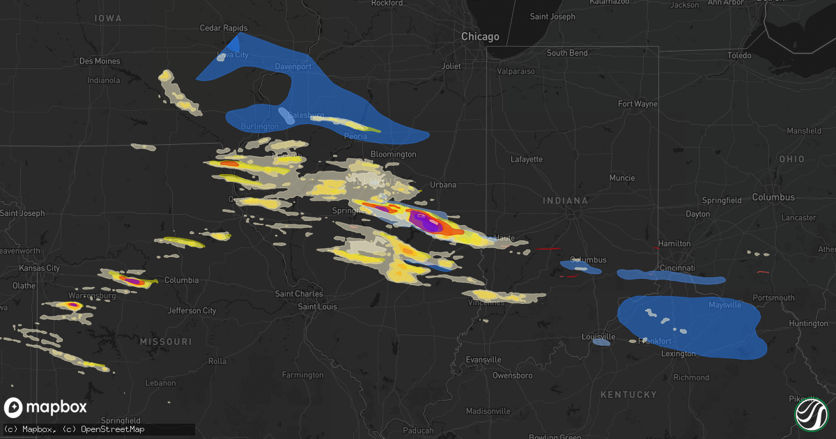
Hail Map on June 17, 2026
Get this storm
June 17 map
$229
one time, instant access
Download today. No call, no setup
Keep the $229
Bought the map and want the full workflow? Apply the entire $229 to a subscription within 7 days. None of it is wasted.
Every map, not just this one
This buys you this map. Subscription and you get every map we run, in the markets you choose from a few cities to whole states to nationwide. Plus real-time alerts the moment a storm fires.
Contact data
Name, contact info, occupancy, even credit band for addresses in the footprint. You go from where it hit to who to call.
Become the source they trust
Unlimited branding weather history reports on demand. You already have the documented answer ready for the property owner, and you are the one who showed up with it.
Property data and RoofTrace estimates
Pull up any address you have got, its value and the exact code rules for that jurisdiction, straight from One Click Code. Then RoofTrace estimates the squares, pitch, and roof value, priced the way you price.
States Impacted by Hail Map on June 17, 2026
Storm reports
Missouri
| Date | Description |
|---|---|
| 06/17/20266:36 PM CDT | Social media report of small tree limbs down near rich hill. Time estimated from radar. |
| 06/17/20266:33 PM CDT | Several power poles downed on route 127 near route aa. Damage to a residence also reported. Time estimated from radar. |
| 06/17/20266:29 PM CDT | Downed tree near the intersection of route 127 and route y. Time estimated from radar. |
| 06/17/20265:58 PM CDT | Report of 2 inch hail. Time estimated from radar. |
| 06/17/20265:21 PM CDT | Downed wires and power outages near old palestine road. Time estimated from radar. |
| 06/17/20265:04 PM CDT | Utility company reports power outages. Time estimated from radar. |
| 06/17/20265:01 PM CDT | Social media report. Time and location estimated from radar. |
| 06/17/20265:00 PM CDT | Several trees and power lines down south and southwest of nelson. Time estimated from radar. |
| 06/17/20264:57 PM CDT | Utility company reports power outages. Time estimated from radar. |
| 06/17/20264:35 PM CDT | Utility company reports power outages. Time estimated from radar. |
| 06/17/20264:34 PM CDT | Utility company reports power outages. Time estimated from radar. |
| 06/17/20264:14 PM CDT | Report from mping: quarter |
| 06/17/20264:12 PM CDT | Downed wires near reed street. Time estimated from radar. |
| 06/17/20264:10 PM CDT | Fire dept reports power outages due to trees on power lines. Time estimated from radar. |
| 06/17/20263:45 PM CDT | A local report indicates 1.75 inch wind near 3 SE Wayland |
| 06/16/20268:25 PM CDT | Trees down on highway v and o in flemington. |
West Virginia
| Date | Description |
|---|---|
| 06/17/20266:59 AM CDT | Over 1700 residents without power due to tree damage. There are several concentrated areas of outages. Time estimated based on radar. |
| 06/17/20266:55 AM CDT | Tree in roadway on us-119 |
| 06/17/20266:55 AM CDT | Over 316 residents without power due to tree damage. Time estimated based on radar. |
| 06/17/20266:55 AM CDT | Tree down along crosier road. |
| 06/17/20266:50 AM CDT | Over 1400 residents without power due to tree damage in several concentrated areas. Time estimated based on radar. |
| 06/17/20266:50 AM CDT | Multiple trees down in dailey area with at least one on a structure. |
| 06/17/20266:50 AM CDT | At least 386 residents without power due to tree damage. Time estimated based on radar. |
| 06/17/20266:50 AM CDT | Multiple trees down including some on structures. |
| 06/17/20266:50 AM CDT | Small branches down. |
| 06/17/20266:49 AM CDT | Trees down along route 219. |
| 06/17/20266:45 AM CDT | Trees down blocking little italy camp road. |
| 06/17/20266:42 AM CDT | 726 residents without power due to tree damage. Time estimated based on radar. |
| 06/17/20266:40 AM CDT | Over 500 residents without power due to tree contact. Numerous smaller areas of outages in the vicinity. Time estimated based on radar. |
| 06/17/20266:40 AM CDT | Tree in roadway on us-119 |
| 06/17/20266:40 AM CDT | 600+ residents without power from tree damage. Multiple concentrated areas of outages noted. Times estimated based on radar. |
| 06/17/20266:38 AM CDT | 526 residents without power due to tree damage. Time estimated based on radar. |
| 06/17/20266:38 AM CDT | Multiple reports of trees and/or lines down in the buckhannon and tallmansville areas. Time is estimated by radar. |
| 06/17/20266:38 AM CDT | Tree in roadway on cr-9/1 |
| 06/17/20266:38 AM CDT | 970 residents without power due to tree damage. Time estimated based on radar. |
| 06/17/20266:35 AM CDT | At least 1200 residents without power due to tree damage. There are two concentrated areas of outages. Time estimated based on radar. |
| 06/17/20266:30 AM CDT | Multiple trees and power lines down in dingess community. |
| 06/17/20266:30 AM CDT | Over 2000 residents without power due to tree damage. Times estimated based on radar. There are two concentrated areas of outages. |
| 06/17/20266:30 AM CDT | Multiple trees down in and around rock cave with one reported down on a house. |
| 06/17/20266:28 AM CDT | Tree on power lines on cr-11/2 |
| 06/17/20266:28 AM CDT | Tree on power lines on wv-4 at mile marker 20.85. |
| 06/17/20266:25 AM CDT | Additional trees down near kermit. |
| 06/17/20266:25 AM CDT | Siding damage to a mobile home in burnsville. |
| 06/17/20266:25 AM CDT | Multiple trees and power lines down including johnny hollow road and coal river road. Media reports of wall cloud as well in this area. |
| 06/17/20266:25 AM CDT | Tree on power lines on wv-4/rock cliff ln. |
| 06/17/20266:25 AM CDT | 1081 residents without power due to tree damage. There is a noticeable swath of concentrated power outages. Times estimated based on radar. |
| 06/17/20266:25 AM CDT | 236 residents without power from tree damage. Time estimated based on radar. |
| 06/17/20266:20 AM CDT | Tree fell on a house. |
| 06/17/20266:20 AM CDT | Several trees down northern end of county including fishing camp rd and country club estates. |
| 06/17/20266:20 AM CDT | Trees down west end of county including audra road near belington... Hickory corner rd near philippi and camp run rd near flemington. |
| 06/17/20266:20 AM CDT | At least 500 residents without power in a concentrated area due to tree damage. Time estimated based on radar. |
| 06/17/20266:15 AM CDT | Tree in roadway on us 119 |
| 06/17/20266:15 AM CDT | Multiple trees down between grafton and independence. |
| 06/17/20266:10 AM CDT | Several trees down in glenville and sand fork areas. |
| 06/17/20266:07 AM CDT | Tree on power lines on wv-4/rock cliff ln. |
| 06/17/20266:07 AM CDT | Tree on power lines on cr-11/2 |
| 06/17/20266:05 AM CDT | Multiple trees down across whitman... Holden and cora via cora fire dept. |
| 06/17/20266:03 AM CDT | Over 2200 residents without power in several concentrated areas due to wind damage. Time estimated based on radar. |
| 06/17/20266:00 AM CDT | Several trees down in and around clarksburg/bridgeport. |
| 06/17/20266:00 AM CDT | Multiple trees down including camden and weston. |
| 06/17/20266:00 AM CDT | Tree down blocking kanawha turnpike at the 4600 block. |
| 06/17/20266:00 AM CDT | Tree in roadway on cr-9 |
| 06/17/20265:55 AM CDT | Multiple trees down across southern part of county. |
| 06/17/20265:55 AM CDT | Numerous reports of trees down with one fence damaged as well. Verified through social media photos. |
| 06/17/20265:53 AM CDT | Several areas of power outages due to tree damage. 300+ residents without power. |
| 06/17/20265:50 AM CDT | Several trees down in and near julian... Including on camp creek rd and johns hollow rd. |
| 06/17/20265:40 AM CDT | Several trees down in northern mingo county including stonecoal rd... Low gap hollow rd... Jennies creek rd... And messenger branch. |
| 06/17/20265:40 AM CDT | Tree and power lines down on spencer rd. |
| 06/17/20265:35 AM CDT | Several trees down near ravenswood including kenwood ln and pt pleasant rd. |
| 06/17/20265:30 AM CDT | Multiple trees down including mt altro... Jack burlingam rd and schoolhouse run. |
| 06/17/20265:00 AM CDT | One tree down and an unanchored shed flipped over. |
| 06/17/20264:43 AM CDT | A tree was reported down over powerlines. |
| 06/17/20264:10 AM CDT | Multiple large tree branches down with one large tree uprooted. |
| 06/17/20263:40 AM CDT | Several trees down on western end of county... Including twin oaks rd and staunton turnpike. |
| 06/17/20263:35 AM CDT | Tree down blocking one lane on staunton turnpike near bear run in petroleum. Time estimated from radar. |
New Mexico
| Date | Description |
|---|---|
| 06/17/20266:31 PM CDT | Asos station kdmn deming asos. |
| 06/16/20268:25 PM CDT | Mesonet station nm008 lordsburg playa i10 mp7 |
| 06/16/20267:35 PM CDT | Awos station ksvc grant county airport awos. |
Louisiana
| Date | Description |
|---|---|
| 06/17/20266:28 AM CDT | Report of powerlines... Building... And tree damage between airline and earhart around l and a rd. |
| 06/17/20266:08 AM CDT | The lakefront airport knew measured a thunderstorm wind gust of 58 knots or 67 mph. |
| 06/17/20266:00 AM CDT | Multiple broadcast media reported power flashes across metairie area. Possible tornado. |
| 06/17/20265:50 AM CDT | Trained spotter reported minor sign... Powerline and tree damage near the lakefront from possible tornado. |
| 06/17/20265:46 AM CDT | Large tree limb downed by thunderstorm winds... Possible tornado... In lakeview area. |
| 06/17/20265:45 AM CDT | Trained spotter reported minor sign... Powerline and tree damage over portions of metairie from possible tornado. |
| 06/17/20265:40 AM CDT | Trained spotter reported minor sign... Powerline and tree damage from possible tornado crossing the mississippi river near waggaman. |
| 06/17/20265:35 AM CDT | Report of destroyed mobile home in avondale. |
| 06/17/20264:45 AM CDT | Emergency management reported tree damage near coronado drive and santa cruz court. |
| 06/17/20264:28 AM CDT | Roof damage to a home on evelyn avenue on the east side of houma. |
| 06/17/20264:00 AM CDT | Emergency management reported significant tree damage near the intersection of grand bayou road and old farm lane. |
Iowa
| Date | Description |
|---|---|
| 06/17/20265:25 PM CDT | Tree limbs down up to 5 1/2 inch in diameter. |
| 06/17/20269:05 AM CDT | A brief ef1 tornado uniquely tracked across three states. This developed just in lee county... Iowa... With peak winds of 105 mph... And tracked southeast through clark |
| 06/17/20268:21 AM CDT | A local report indicates 58 MPH wind near 1 SE Burlington Regiona |
| 06/17/20268:18 AM CDT | A local report indicates 62 MPH wind near 3 NW Kingston |
| 06/17/20268:15 AM CDT | Awning blown off mobile home. Still had 45 to 50 mph winds 10 minutes later. |
| 06/17/20268:14 AM CDT | Trees down with one on a home. Time estimated from radar. |
| 06/17/20268:08 AM CDT | 4 inch diameter branch down. Time estimated on radar. |
| 06/17/20268:07 AM CDT | Trees and power lines down... Time estimated from radar. |
| 06/17/20268:05 AM CDT | Tree down on house along with many powerlines down. |
| 06/17/20268:02 AM CDT | Corrects previous tstm wnd gst report from 3 nw kingston. |
| 06/17/20268:00 AM CDT | Utility poles and power lines down... Time estimated from radar. |
| 06/17/20268:00 AM CDT | Multiple power lines down in town... Tree down on a house. |
| 06/17/20267:40 AM CDT | A local report indicates 60 MPH wind near Lowden |
| 06/17/20267:24 AM CDT | Roof off of a machine shed with large trees down at the location. |
| 06/17/20267:23 AM CDT | A brief ef1 tornado... With peak winds of 90 mph... Developed just south of pekin... Ia... Impacting areas from pekin community schools east-southeast towards linby... |
| 06/17/20267:15 AM CDT | Estimated wind gust. Torrential rainfall also occurring at time of report. |
| 06/17/20267:14 AM CDT | A local report indicates 64 MPH wind near 1 N North Liberty |
| 06/17/20267:11 AM CDT | A local report indicates 70 MPH wind near 2 NW North Liberty |
| 06/17/20267:11 AM CDT | Firework sales tent collapsed. |
| 06/17/20267:05 AM CDT | Large tree down with limbs 6 to 8 inches in diameter. |
| 06/17/20267:04 AM CDT | Tree fell and damaged fence on washington ave. |
| 06/17/20267:04 AM CDT | A local report indicates 60 MPH wind near 2 NW North Liberty |
| 06/17/20267:01 AM CDT | A local report indicates 78 MPH wind near Cedar Rapids Municipali |
| 06/17/20267:01 AM CDT | Tree snapped at location. |
South Dakota
| Date | Description |
|---|---|
| 06/17/20265:11 PM CDT | Mesonet station 320 sd rwis irene. |
| 06/17/20264:44 PM CDT | Mesonet station 163 sd rwis freeman. |
| 06/17/20264:31 PM CDT | Mesonet station 322 sd rwis stanley corner. |
| 06/17/20263:40 PM CDT | Mesonet station 6 sd rwis forestburg. |
| 06/17/20263:19 PM CDT | Corrects previous non-tstm wnd gst report from 3 e cavour. Mesonet station 211 sd rwis cavour. |
Minnesota
| Date | Description |
|---|---|
| 06/17/20265:15 PM CDT | Mesonet station mn006 i-90 - beaver creek mp 4. |
Wisconsin
| Date | Description |
|---|---|
| 06/17/20266:47 PM CDT | A local report indicates 60 MPH wind near 2 S Blue Mounds |
| 06/17/20266:39 PM CDT | A local report indicates 68 MPH wind near 5 NW Hollandale |
| 06/17/20266:32 PM CDT | Nws storm survey confirms an ef-1 tornado near ridgeway with max winds speeds near 105 mph. |
| 06/17/20266:23 PM CDT | Structural damage reported by emergency manager around the ridgeway area. Time estimated by radar. |
| 06/17/20266:03 PM CDT | Report of multiple trees down with at least one tree snapped at the base along with several other split or large branches down. Also home satellite dish ripped off the |
| 06/17/20265:39 PM CDT | Small sheds and trees down in boscobel. Potential tornado damage. Time estimated from radar. |
| 06/17/20265:17 PM CDT | Report of 4 power poles snapped in vicinity of a radar tornadic debris signature. |
| 06/16/20267:10 PM CDT | Nws storm survey confirms a tornado rated ef-1 in belleville... Wi with max wind speeds of 110mph. The path was 2.75 miles long and 300 yards wide. Tornado began west o |
| 06/16/20267:09 PM CDT | Reports of damage to multiple structures and trees on the north side of belleville... Wi. Time estimated based on radar. |
| 06/16/20267:04 PM CDT | A local report indicates 65 MPH wind near 1 SSW Paoli |
Arizona
| Date | Description |
|---|---|
| 06/17/20266:20 PM CDT | Corrects previous tstm wnd dmg report from 4 wsw tucson. 8 power poles reported down. |
| 06/17/20266:20 PM CDT | Power pole damage reported. |
| 06/17/20266:20 PM CDT | 4 to 5 power poles reported down. |
Kansas
| Date | Description |
|---|---|
| 06/17/20266:58 AM CDT | Report via social media. |
| 06/17/20266:41 AM CDT | Photo on social media and relayed from news media. |
| 06/17/20266:15 AM CDT | Public reported via media. |
Alabama
| Date | Description |
|---|---|
| 06/17/20264:15 PM CDT | Video of a tornado touchdown in enterprise lofting debris around 4:15 cdt. Path most likely through a wooded area with no structural damage reported so far. |
| 06/17/20261:30 PM CDT | Video of a tornado around 1:30 pm cdt. Tds on radar was most apparent from 1:36 pm to 1:39 pm cdt. Tornado likely dissipated near |
| 06/17/20261:20 PM CDT | Dale county 911 call center reported a tree down along county road 404. Timing estimated by radar. |
| 06/17/20261:20 PM CDT | Dale county 911 call center reported a tree down along will logan road. Timing estimated by radar. |
Indiana
| Date | Description |
|---|---|
| 06/17/202611:43 AM CDT | A large tree split in half and fell on a home. |
| 06/17/20268:25 AM CDT | Late report of thunderstorm winds damaged at least 4 residences with partial collapses to 2 homes near county road 100 south but no injuries. Possible tornado. Time est |
| 06/17/20266:32 AM CDT | Reports of trees down along west main street near the scott and jefferson county line. |
| 06/17/20263:09 AM CDT | Tree debris blocking roadway. Delayed report. Time estimated from radar. |
| 06/17/20263:09 AM CDT | Trees down. Delayed report. Time estimated by radar. |
| 06/17/20262:59 AM CDT | Portions of a roof of a two story residential home were blown off. |
| 06/17/20262:39 AM CDT | Trees down. Delayed report. Time estimated by radar. |
| 06/17/20262:38 AM CDT | Trees down off of e hwy 150. Delayed report. Time estimated from radar. |
| 06/17/20262:37 AM CDT | Trees downed by thunderstorm winds. Delayed report. Time estimated by radar. |
| 06/17/20262:24 AM CDT | Time estimated by radar: large tree split in hanover college. |
| 06/17/20262:17 AM CDT | Trees down. Delayed report. Time estimated by radar. |
| 06/17/20262:15 AM CDT | Time estimated by radar: rv blown onto its side. |
| 06/17/20262:02 AM CDT | Tree down at the intersection of south becks mill road and west mitchell road. |
| 06/17/20261:53 AM CDT | Trees down. Delayed report. Time estimated from radar. |
| 06/17/20261:25 AM CDT | Tree damage across the county... No specific areas noted. |
| 06/17/20261:20 AM CDT | Power lines downed. Time estimated from radar. |
| 06/17/202612:18 AM CDT | Tree down with partial road blockage. |
| 06/17/202612:15 AM CDT | Limb fell on side of house also causing a gas leak. |
| 06/17/202612:00 AM CDT | Power lines downed. Uncertain exactly which storm caused the damage. |
| 06/16/202611:09 PM CDT | Damage on w county road 840 n and n county road 425 w including structural and tree damage...a house was flipped over. Time derived from radar. |
| 06/16/202611:09 PM CDT | Damage occurred on w county road 840 n and n county road 425 w that includes structural and tree damage. A house was flipped over. Time is estimated from radar. |
| 06/16/202611:07 PM CDT | Several trees were blown down by thunderstorm winds. Time estimated from radar. |
| 06/16/202611:07 PM CDT | Damage of an unspecified nature. Time is estimated from radar. |
| 06/16/202610:56 PM CDT | Several utility poles snapped and wires downed. |
| 06/16/202610:40 PM CDT | Late report of thunderstorm winds downing trees into power lines at us highway 231 and county club road. Highway closed in both directions. Time estimated from radar. |
| 06/16/202610:40 PM CDT | Late report of thunderstorm winds downed multiple trees in owen county. Time estimated from radar. |
| 06/16/202610:35 PM CDT | Pictures showing several snapped tree limbs east of sr 3 north of north vernon. |
| 06/16/202610:20 PM CDT | Large tree snapped near sr 159. |
| 06/16/20269:55 PM CDT | Trees and power lines downed. |
| 06/16/20269:50 PM CDT | Several tree limbs snapped in town. |
| 06/16/20269:25 PM CDT | Large tree uprooted... Several limbs snapped. |
| 06/16/20269:06 PM CDT | Trees damage from thunderstorm winds. Time is estimated from radar. |
| 06/16/20268:54 PM CDT | Corrects previous non-tstm wnd dmg report from 7 sse paragon. Reports of damage to vehicles on i-69 near hindustan. |
| 06/16/20268:51 PM CDT | *** 1 inj *** details are unavailable. Time estimated from radar. |
| 06/16/20268:48 PM CDT | Fifteen-inch diameter tree and shingle damage in downtown gosport. |
| 06/16/20268:36 PM CDT | Trees were blown down by thunderstorm winds. Location is a rough approximation. Time is based from radar. |
| 06/16/20268:22 PM CDT | A local report indicates 60 MPH wind near Terre Haute |
| 06/16/20268:07 PM CDT | An ef-1 tornado with path length of 6.64 miles and a path width of 300 yards began at this location. The peak winds were 110 mph with the tornado impacting several home |
| 06/16/20267:50 PM CDT | Large tree downed on meridian line road. |
| 06/16/20267:40 PM CDT | Trees were blown down by thunderstorm winds. Rough approximation of location. Time of occurrence is based on radar. |
Kentucky
| Date | Description |
|---|---|
| 06/17/20266:50 AM CDT | Tree down blocking the entire street. |
| 06/17/20266:13 AM CDT | A tree was reported to have been blown down onto ky 302 in the van lear community. The event time is radar estimated. |
| 06/17/20266:13 AM CDT | A tree was reported to have been blown down in inez. The event time is radar estimated. |
| 06/17/20266:10 AM CDT | A tree was reported to have been blown down onto hurricane branch in the boons camp community. The event time is radar estimated. |
| 06/17/20266:09 AM CDT | Trees were reported to have been down along ky 40 in the tomahawk area. The event time is radar estimated. |
| 06/17/20266:09 AM CDT | A tree was reported to have been blown down onto ky 825 in the oil springs area. The event time is radar estimated. |
| 06/17/20266:07 AM CDT | A tree was reported to have been blown down on ky 581 in tutor key. The event time is radar estimated. |
| 06/17/20265:57 AM CDT | A tree was reported to have been blown down onto ky 172 in flatgap. The event time is radar estimated. |
| 06/17/20265:51 AM CDT | A tree was blown down onto ky 946 just east of intersection with ky 1010. The event time is radar estimated. |
| 06/17/20265:43 AM CDT | Tree down over roadway. Delayed report. Time estimated by radar. |
| 06/17/20265:40 AM CDT | Tree blocking both lanes of moore ln. Delayed report. Time estimated from radar. |
| 06/17/20265:39 AM CDT | A large tree limb was down blocking ky 946 at the intersection with ky 746. The event time is radar estimated. |
| 06/17/20265:38 AM CDT | A tree was reported to have been blown down in warfield. The event time is radar estimated. |
| 06/17/20265:37 AM CDT | A tree was reported to have been blown down onto artville road in the wellington vicinity. |
| 06/17/20265:30 AM CDT | A tree was reported down in the rothwell hill area along us 460. The event time is radar estimated. |
| 06/17/20265:25 AM CDT | Cad report...trees down in front of location on the street... Hit over car blocking two lanes. |
| 06/17/20265:19 AM CDT | Tree in the roadway over fort bramlett rd. Delayed report. Time estimated from radar. |
| 06/17/20265:18 AM CDT | Tree over roadway blocking one lane. Delayed report. Time estimated from radar. |
| 06/17/20265:06 AM CDT | Tree down off of ky 39 at black bridge. Delayed report. Time estimated via radar. |
| 06/17/20265:04 AM CDT | *** 1 inj *** corrects previous tstm wnd dmg report from 1 s nicholasville. Roof collapsed at ollies bargain outlet due to heavy rain. Delayed report. Time estimated fr |
| 06/17/20265:04 AM CDT | *** 1 inj *** roof collapsed at ollies bargain outlet. Delayed report. Time estimated from radar. |
| 06/17/20264:59 AM CDT | Tree down on house. Delayed report. Time estimated via radar. |
| 06/17/20264:59 AM CDT | Tree down on car. Delayed report. Time estimated via radar. |
| 06/17/20264:56 AM CDT | Tree down on keene versailles road near clear creek. Delayed report. Time estimated by radar. |
| 06/17/20264:56 AM CDT | Tree down on powerlines and blocking roadway. Delayed report. Time estimated via radar. |
| 06/17/20264:50 AM CDT | Tree down on roadway. |
| 06/17/20264:47 AM CDT | Tree down. Delayed report. Time estimated from radar. |
| 06/17/20264:45 AM CDT | Several trees down in central part of county including allcorn rd and brushy rd. |
| 06/17/20264:45 AM CDT | Tree down across hwy 784. |
| 06/17/20264:41 AM CDT | Time estimated by radar: tree down blocking both lanes of cummings rd. |
| 06/17/20264:41 AM CDT | Social media photo shows damaged outbuilding. Delayed report. Time estimated from radar. |
| 06/17/20264:40 AM CDT | Time estimated by radar: multiple reports of tree down partially blocking roadways. |
| 06/17/20264:38 AM CDT | Trees were reported down on ky 519 near or just north of the morgan county line. The event time is radar estimated. |
| 06/17/20264:35 AM CDT | 1062 residents without power due to tree contact. Time estimated based on radar. |
| 06/17/20264:33 AM CDT | Tree down on state highway 8 near quincy blocking the entire roadway. Time estimated from radar. |
| 06/17/20264:27 AM CDT | Trees were reported down on fraley road and other locations in the salt lick vicinity. The event time is radar estimated. |
| 06/17/20264:27 AM CDT | Multiple trees were blown down onto and in areas near ky 519 between morehead and clearfield. Portions of ky 519 were closed due to debris. The event time is radar esti |
| 06/17/20264:26 AM CDT | Trees were reported to have been blown down along us 60 near the rowan and bath county line. The event time is radar estimated. |
| 06/17/20264:25 AM CDT | Trees were reported to have been blown down down on sour springs road. The event time is radar estimated. |
| 06/17/20264:23 AM CDT | Tree fell down into a person |
| 06/17/20264:20 AM CDT | Tree down on the exit ramp at the intersection of i-64 and cannons lane. |
| 06/17/20264:20 AM CDT | Time estimated by radar: tree blocking street... Into neighbors yard. |
| 06/17/20264:20 AM CDT | Time estimated by radar: tree down blocking a neighborhood road in friendly hills. |
| 06/17/20264:20 AM CDT | Trees were reported to have been blown down in owingsville. The event time is radar estimated. |
| 06/17/20264:18 AM CDT | Multiple reports of tree limbs and powerlines down north of us-60. |
| 06/17/20264:18 AM CDT | A tree was reported to have been blown down at 1700 grassy lick road blocking the entire roadway. The event time is radar estimated. |
| 06/17/20264:15 AM CDT | Cad report...tree fallen on line... Line completely down on road. |
| 06/17/20264:15 AM CDT | Tree downed by thunderstorm winds. Delayed report. Time estimated from radar. |
| 06/17/20264:11 AM CDT | A local report indicates 62 MPH wind near 1 N Louisville Int'l Ai |
| 06/17/20264:10 AM CDT | Time estimated by radar: trees down blocking all lanes. |
| 06/17/20264:10 AM CDT | Asos station klou louisville bowmn. |
| 06/17/20264:09 AM CDT | Corrects time from previous tstm wnd dmg report from 2 nw shelbyville. Trees downed from thunderstorm winds. Delayed report. Time estimated from radar. |
| 06/17/20264:09 AM CDT | Trees downed by thunderstorm winds. Delayed report. Time estimated from radar. |
| 06/17/20264:09 AM CDT | Tree down blocking road in the 300 block of plum street. Time estimate from radar. |
| 06/17/20264:08 AM CDT | Tree down in roadway near west 2nd street and germantown road. Time estimated from radar. |
| 06/17/20264:08 AM CDT | Roof and window damage to the businesses between tucker drive and ky highway 9 outside of maysville. Time estimated from radar. |
| 06/17/20264:08 AM CDT | Tree down on road at 1150 fleming road. Time estimate from radar. |
| 06/17/20264:08 AM CDT | Trees and power lines down in roadway in the 8000 block of orangeburg road. |
| 06/17/20264:05 AM CDT | Multiple trees down across escondida road. Time estimated from radar. |
| 06/17/20264:05 AM CDT | Time estimated by radar: tree down on street blocking traffic. |
| 06/17/20264:02 AM CDT | Structural damage and multiple trees down by east maple leaf road and wal-mart way. |
| 06/17/20264:02 AM CDT | Tree fallen on roof. Report from person stated their living room is gone and looks like the kitchen is about to fall in. No one injured. |
| 06/17/20264:02 AM CDT | Tree fell onto a home. |
| 06/17/20263:57 AM CDT | Multiple trees snapped and fell in the area. |
| 06/17/20263:55 AM CDT | Cad report...tree pulled wire down in front of location. |
| 06/17/20263:55 AM CDT | Corrects previous tstm wnd dmg report from 1 sw prospect for correct time. West of intersection wires completely down obstructing the road. |
| 06/17/20263:53 AM CDT | Tree fell blocking entire roadway near the mojave trail and wanda lee trail intersection. |
| 06/17/20263:52 AM CDT | A tree was reported to have been blown down onto ewing road in the fairview community. The event time is radar estimated. |
| 06/17/20263:50 AM CDT | Public report of roof damage to manufacturing building. |
| 06/17/20263:48 AM CDT | Time estimated by radar: tree down blocking part of the road and a manhole cover off the hole. |
| 06/17/20263:47 AM CDT | Time estimated by radar: tree down across the road on s 43rd st between elliott ave and west broadway. Tree is also on top of a vehicle. |
| 06/17/20263:45 AM CDT | Multiple large trees were snapped at their trunks and numerous branches were downed at a property off of chaney road. |
| 06/17/20263:41 AM CDT | Time estimated by radar: tree blocking tyler ln. Multiple reports of trees down nearby as well. |
| 06/17/20263:40 AM CDT | Power lines/ wires down. |
| 06/17/20263:37 AM CDT | Social media photo of a large tree branch downed. Delayed report. Time estimated by radar. |
| 06/17/20263:23 AM CDT | At least 10 to 15 large trees were either snapped or uprooted within the williamstown cemetery grounds. |
| 06/17/20263:22 AM CDT | Numerous large tree branches were snapped at the cherry hill pointe mobile home park. Additionally... Several residences sustained home damage like siding damage or bro |
| 06/17/20263:22 AM CDT | Roof uplift and cinderblock walls damaged to body shop in the 500 block of waterworks road near williamstown. Time estimated from radar. |
| 06/17/20263:22 AM CDT | At least 20 trees were downed along ridgelea drive with snapped limbs. |
| 06/17/20263:22 AM CDT | At least 20 trees were snapped at their trunks or had large limbs ripped off of them all down falmouth street just past the cemetery. |
| 06/17/20263:22 AM CDT | Trees down. Roof damage to multiple structures. |
| 06/17/20263:20 AM CDT | Trees down... Power lines down... Minor damage to homes. Time taken from the caller. |
| 06/17/20263:10 AM CDT | Measured by the shelby county north mesonet station. |
| 06/17/20263:02 AM CDT | Awos site k8gk gallatin county airport. |
| 06/17/20262:57 AM CDT | Tree limb down and blocking roadway. Delayed report. Time estimated from radar. |
| 06/17/20262:56 AM CDT | Time estimated by radar: tree down blocking a roadway along rollington road. |
| 06/17/20262:54 AM CDT | Trees down on port royal road. Time estimated from radar. |
| 06/17/20262:50 AM CDT | Kentucky mesonet site crrl. |
| 06/17/20262:43 AM CDT | Power poles damaged with widespread tree damage. Power pole damage concentrated in the 2500 to 2700 block of highland avenue. Time estimated from radar. |
| 06/17/20262:42 AM CDT | Tree blown down. Time estimated via radar data. |
| 06/17/20262:42 AM CDT | Damage throughout carrollton... Including downed trees and a snapped power pole. |
| 06/16/202611:42 PM CDT | A tree was downed onto a residential home. Tornado possible. |
| 06/16/202611:41 PM CDT | Multiple trees downed along with several large tree limbs. Tornado possible. |
| 06/16/202611:40 PM CDT | A roof sustained damage. Tornado possible. |
| 06/16/202611:40 PM CDT | A roof sustained damage. Tornado possible. |
| 06/16/202611:40 PM CDT | A large tree was downed and struck an apartment building... Causing moderate structural damage. Tornado possible. |
| 06/16/202611:39 PM CDT | Damage to the siding on a commercial building was reported. |
Illinois
| Date | Description |
|---|---|
| 06/17/20266:58 PM CDT | Significant tree damage... Lines down... And building damage at coles county fairgrounds. Time estimated by radar. |
| 06/17/20266:56 PM CDT | Siding torn off and partial roofing removed from apartment building with many tree limbs down. Time estimated by radar. |
| 06/17/20266:56 PM CDT | Mobile homes destroyed and flipped. Time estimated by radar. |
| 06/17/20266:51 PM CDT | Report from mping: baseball |
| 06/17/20266:49 PM CDT | A local report indicates 2.75 inch wind near 2 SW Humboldt |
| 06/17/20266:47 PM CDT | A tree on power line... With tree currently on fire. |
| 06/17/20266:47 PM CDT | Route 10 between weldon springs and taft road closed due to power lines down. |
| 06/17/20266:46 PM CDT | Relayed via social media. |
| 06/17/20266:45 PM CDT | A tornado touched down east of mattoon and tracked ese into the northwest side charleston. |
| 06/17/20266:44 PM CDT | Report from mping: ping pong ball |
| 06/17/20266:44 PM CDT | Relayed via social media. |
| 06/17/20266:40 PM CDT | *** 1 inj *** semi flipped over on southbound i-57 at mile marker 191. Semi truck driver injured. |
| 06/17/20266:35 PM CDT | A local report indicates 2.00 inch wind near Chesterville |
| 06/17/20266:28 PM CDT | A local report indicates 1.75 inch wind near Arthur |
| 06/17/20266:25 PM CDT | A local report indicates 3.00 inch wind near 1 SE Arthur |
| 06/17/20266:20 PM CDT | Wind driven tennis ball size hail put holes in siding and broke windows. |
| 06/17/20266:20 PM CDT | Turkey barn partially lost roof. Chimney was damaged on house. Trees blown down. |
| 06/17/20266:19 PM CDT | Report from mping: golf ball |
| 06/17/20266:18 PM CDT | Photo of 3 inch diameter jagged hailstone with ruler along with corn damaged from the large hail on farmland between lovington and arthur. |
| 06/17/20266:17 PM CDT | Delayed report. Tree damage reported in ashmore. Trees fell on roofs. One garage pushed off foundation... But garage was not anchored. Time estimated. |
| 06/17/20266:17 PM CDT | Photos showing metal grain bin blown into corn field and some tree limbs blown down. |
| 06/17/20266:02 PM CDT | Delayed report. 6 large two foot diameter trees blown down or uprooted. Shingles peeled off roof. Time estimated from radar. |
| 06/17/20266:00 PM CDT | Numerous powerlines blown down across macon county. |
| 06/17/20266:00 PM CDT | A local report indicates 78 MPH wind near Decatur Airport |
| 06/17/20265:58 PM CDT | Report from mping: quarter |
| 06/17/20265:53 PM CDT | A local report indicates 1.00 inch wind near 1 W Decatur |
| 06/17/20265:52 PM CDT | Tree damage and some siding off homes. |
| 06/17/20265:51 PM CDT | A local report indicates 1.00 inch wind near Decatur Airport |
| 06/17/20265:45 PM CDT | Golf ball size hail near route 48 outside of boody. |
| 06/17/20265:15 PM CDT | 10 trees snapped. |
| 06/17/20265:15 PM CDT | Power poles snapped off near the ground near highway 51 south of walker road. |
| 06/17/20265:10 PM CDT | Powerline line blown down at shadow ridge in decatur. |
| 06/17/20265:10 PM CDT | Ping pong size hail. |
| 06/17/20265:08 PM CDT | Corrects previous hail report from boody. Photo of ping pong size hail with a ruler. Time estimated from radar. |
| 06/17/20265:08 PM CDT | Corrects previous hail report from boody. Golf ball size hail near route 48 outside of boody. Time estimated from radar. |
| 06/17/20265:03 PM CDT | Powerline down at 1209 west park with tree down on wire. |
| 06/17/20265:02 PM CDT | Sheet metal blown into a field near niantic. |
| 06/17/20265:02 PM CDT | A local report indicates 2.00 inch wind near 2 SE Niantic |
| 06/17/20265:00 PM CDT | Shed destroyed by high winds. |
| 06/17/20264:55 PM CDT | Corrects previous hail report from illiopolis. Golf ball size hail. Time estimated from radar. |
| 06/17/20264:53 PM CDT | Corrects previous hail report from 1 w illiopolis. Report from mping: golf ball |
| 06/17/20264:50 PM CDT | Report from mping: golf ball |
| 06/17/20264:50 PM CDT | Photos of transmission poles blown down at prairie center and drive in roads. |
| 06/17/20264:47 PM CDT | Golf ball size hail. |
| 06/17/20264:46 PM CDT | Power poles and trees blown down on highway 36 est of dawson. |
| 06/17/20264:45 PM CDT | Photo of ping pong size hail with a ruler. |
| 06/17/20264:38 PM CDT | Large oak tree split with part falling on a property fence. |
| 06/17/20264:19 PM CDT | A local report indicates 1.00 inch wind near Adair |
| 06/17/20264:15 PM CDT | Photo of ameren roof damage at 6th and sheridan streets in petersburg. |
| 06/17/20264:15 PM CDT | Photos of wind damage at hand of fate brewery building in petersburg. |
| 06/17/20263:50 PM CDT | Two power poles snapped along highway 10 and weldon springs road east of clinton. Powerline hanging down. |
| 06/17/20263:48 PM CDT | Time estimated from radar. |
| 06/17/20263:44 PM CDT | Power pole snapped at 106 n locust street in wapella. |
| 06/17/20263:30 PM CDT | Multiple trees blown down and blocking roads in waynesville. |
| 06/17/20263:17 PM CDT | Quarter size hail. |
| 06/17/20263:13 PM CDT | Quarter size hail. |
| 06/17/20263:08 PM CDT | Large tree blown down over road at 1419 hickory point in germantown hills. |
| 06/17/20262:57 PM CDT | Quarter size hail. |
| 06/17/202610:28 AM CDT | Semi rollover reported near the city of chenoa. |
| 06/17/202610:15 AM CDT | Transmission pole snapped and hanging wires over roadway at n 2380 e rd.... Just south of e 900 n rd. |
| 06/17/202610:13 AM CDT | Wind gust observation from personal weather station...relayed through broadcast media. |
| 06/17/202610:06 AM CDT | Eight power poles snapped in half at county road 2800 east. |
| 06/17/202610:05 AM CDT | Multiple semis and campers rolled over on i-39 in el paso area... Most off the roadway. |
| 06/17/202610:05 AM CDT | Semi rollover on i-39. |
| 06/17/20269:59 AM CDT | Large tree limbs down. |
| 06/17/20269:50 AM CDT | Measured at the emergency operations center. |
| 06/17/20269:45 AM CDT | Two transmission line poles broke off and blocking the road on north middletown ave and hubly st. |
| 06/17/20269:40 AM CDT | Powerlines down throughout the city. |
| 06/17/20269:40 AM CDT | Tree down on a house on n. Hanover st. |
| 06/17/20269:38 AM CDT | Top of utility pole snapped off with wires dangling at behrends ave. And hillman st. |
| 06/17/20269:37 AM CDT | 12 inch diameter tree limb down. |
| 06/17/20269:23 AM CDT | Tree down on il-29...south of cedar hills dr. |
| 06/17/20269:20 AM CDT | Large tree branches were blown down. |
| 06/17/20269:19 AM CDT | Relayed through emergency management. |
| 06/17/20269:15 AM CDT | Twelve power poles were snapped along a 0.6 mile stretch of 1700 east. |
| 06/17/20269:15 AM CDT | Relayed through emergency management. |
| 06/17/20269:11 AM CDT | Relayed through emergency management. |
| 06/17/20269:11 AM CDT | Report of a tree down. |
| 06/17/20269:08 AM CDT | Trees down in town. |
| 06/17/20268:57 AM CDT | Delayed report: multiple trees snapped or uprooted. Roof was torn off an outbuilding. Sheet metal from an outbuilding was wrapped around a tree. Time estimated from rad |
| 06/17/20268:55 AM CDT | Damage to funeral home and power outage reported. |
| 06/17/20268:43 AM CDT | Spotter reports widespread tree damage across northern warren county with many whole trees down and large branches down. |
| 06/17/20268:39 AM CDT | A local report indicates 73 MPH wind near 1 ESE Cambridge |
| 06/17/20268:37 AM CDT | Tree on powerline at east knox rd. And day st. Power outage reported. |
| 06/17/20268:35 AM CDT | Derailment of a few train cars by the wind. |
| 06/17/20268:30 AM CDT | Widespread winds of 80 to 100 mph occurred across warren county... Starting near little york and tracking southeast through ormonde. Through this stretch... Widespread |
| 06/17/20268:30 AM CDT | Roof off building downtown. |
| 06/17/20268:28 AM CDT | A local report indicates 60 MPH wind near 1 NNE New Windsor |
| 06/17/20268:25 AM CDT | A short-lived ef-1 tornado developed in monmouth illinois and tracked southeast through town for 1.3 miles... With estimated maximum winds of 100 mph. Along the tornado |
| 06/17/20268:23 AM CDT | A local report indicates 60 MPH wind near Biggsville |
| 06/17/20268:22 AM CDT | Tree tops snapped at the location. |
| 06/17/20268:21 AM CDT | A local report indicates 58 MPH wind near 1 SSE Rozetta |
| 06/17/20268:19 AM CDT | Widespread winds of 80 to 100 mph occurred across warren county... Starting near little york... Where 14 utility poles on the south side of little york were downed and |
| 06/17/20268:15 AM CDT | A local report indicates 69 MPH wind near Moline Quad-City Airpor |
| 06/17/20268:14 AM CDT | A local report indicates 60 MPH wind near 1 S Moline |
| 06/17/20268:13 AM CDT | A local report indicates 61 MPH wind near Moline Quad-City Airpor |
| 06/17/20268:10 AM CDT | Several large trees uprooted... Some over 2 ft in diameter. Likely 80 mph or higher wind gusts based on degree of damage. |
| 06/17/20267:36 AM CDT | Roof damage to multiple buildings in downtown marshall on archer st. Report received from facebook. |
| 06/16/20269:42 PM CDT | Report from mping: quarter |
| 06/16/20269:12 PM CDT | Large trees uprooted with large tree limbs blown down near county market grocery store. |
| 06/16/20268:22 PM CDT | Homes damaged from a tornado southwest of montrose. |
| 06/16/20268:10 PM CDT | Hail ranging from nickel to half dollar sized along with strong winds. Time and location estimated. |
| 06/16/20268:08 PM CDT | A local report indicates a tornado near 1.5 NW Dieterich |
| 06/16/20268:07 PM CDT | A local report indicates a tornado near 3 ESE Shumway |
| 06/16/20268:00 PM CDT | Several power lines and trees down across town. |
| 06/16/20267:34 PM CDT | Delayed report. Businesses with roof blown off in downtown marshall near rt 1 and archer ave. Time estimated from radar. |
| 06/16/20267:15 PM CDT | About a mile or more of powerlines down along il16 from ashmore eastbound... As well as several downed trees and snapped power poles and branches. |
| 06/16/20267:08 PM CDT | Some damage to meridian elementary school in blue mound. |
| 06/16/20267:06 PM CDT | Photos showing damage to property at ashmore estates along with tree damage. |
| 06/16/20267:03 PM CDT | Trees and powerlines blown down on route 104 between taylorville and kincaid. |
| 06/16/20267:00 PM CDT | A local report indicates 1.75 inch wind near Charleston |
Ohio
| Date | Description |
|---|---|
| 06/17/20265:51 AM CDT | Several trees down on power lines. |
| 06/17/20265:05 AM CDT | Multiple trees down across the northern end of the county including pedro and willowood. |
| 06/17/20265:00 AM CDT | Scattered trees down around the county with the most widespread damage in the oak hill community where some trees were reported down on houses and approximately 1000 cu |
| 06/17/20264:55 AM CDT | Trees down in and near ironton. |
| 06/17/20264:35 AM CDT | Upwards of 500 residents without power due to tree damage. Several areas exists in the vicinity with additional outages. Time estimated based on radar. |
| 06/17/20264:35 AM CDT | Numerous areas of outages in a concentrated area due to storm damage. Time estimated based on radar. |
| 06/17/20264:33 AM CDT | Occupied vehicle in high water at crosscreek general store on route 50 in richland township. |
| 06/17/20264:19 AM CDT | Trees down. |
| 06/17/20264:15 AM CDT | Trees down. |
| 06/17/20264:10 AM CDT | Swath of concentrated power outages from tree damage. Time estimated based on radar. |
| 06/17/20263:50 AM CDT | Kessinger school road closed due to downed powerlines. |
| 06/17/20263:15 AM CDT | Large trees down and barn damage in the 7800 block of chenoweth fork road. Time estimated from radar. |
| 06/17/20262:24 AM CDT | Tree in westbound lane reported as blocking both lanes... U.s. Route 50 at dow lake. Time estimated from radar. |
| 06/16/202611:29 PM CDT | Delayed report of a tree down. |
| 06/16/202610:59 PM CDT | Large tree blown down on south myrtle street. Delayed report and time was estimated by radar. |
| 06/16/202610:53 PM CDT | Delayed report of a downed tree. |
| 06/16/202610:45 PM CDT | Power lines and pole blown down on weis road. Delayed report and time was estimated by radar. |
| 06/16/202610:36 PM CDT | Multiple trees down. |
| 06/16/20269:45 PM CDT | Multiple trees downed. Some fell onto power lines and reportedly smashed three cars. Near the intersection of columbus grove rd and tom fett rd. Tree in photo sent appe |
| 06/16/20269:15 PM CDT | Large tree snapped. |
Texas
| Date | Description |
|---|---|
| 06/16/20267:36 PM CDT | Asos station kbif biggs field awos. |
| 06/16/20267:33 PM CDT | Asos station kelp el paso international airport. |
Cities Impacted by Hail Map on June 17, 2026
- Iowa City, IA
- Oxford, IA
- New Sharon, IA
- Kalona, IA
- Riverside, IA
- Ainsworth, IA
- North Liberty, IA
- West Branch, IA
- West Liberty, IA
- Mount Vernon, IA
- Tiffin, IA
- Lone Tree, IA
- Washington, IA
- Coralville, IA
- West Chester, IA
- Hills, IA
- Wellman, IA
- Ely, IA
- Nichols, IA
- Solon, IA
- Keota, IA
- Harper, IA
- South English, IA
- Parnell, IA
- Williamsburg, IA
- North English, IA
- Lisbon, IA
- Rose Hill, IA
- Oskaloosa, IA
- Barnes City, IA
- Wilton, IA
- Tipton, IA
- Mechanicsville, IA
- Atalissa, IA
- Stockton, IA
- Moscow, IA
- Durant, IA
- Muscatine, IA
- Bennett, IA
- Fremont, IA
- Cedar, IA
- Delta, IA
- Eddyville, IA
- Hedrick, IA
- Ottumwa, IA
- Kirkville, IA
- Niota, IL
- Dallas City, IL
- Stanwood, IA
- Clarence, IA
- Batavia, IA
- Agency, IA
- La Harpe, IL
- Lomax, IL
- Blandinsville, IL
- Dixon, IA
- New Liberty, IA
- Walcott, IA
- Davenport, IA
- Good Hope, IL
- Sciota, IL
- Fairfield, IA
- Eldon, IA
- Libertyville, IA
- Bettendorf, IA
- Eldridge, IA
- Silvis, IL
- East Moline, IL
- Blue Grass, IA
- Coal Valley, IL
- Rock Island, IL
- Moline, IL
- Milan, IL
- Taylor Ridge, IL
- Buffalo, IA
- Lowden, IA
- Donahue, IA
- Princeton, IA
- Wheatland, IA
- Calamus, IA
- Le Claire, IA
- Hampton, IL
- Grand Mound, IA
- Pleasant Valley, IA
- Long Grove, IA
- McCausland, IA
- Montpelier, IA
- Andalusia, IL
- Avon, IL
- Bushnell, IL
- Prairie City, IL
- Roseville, IL
- Macomb, IL
- Mediapolis, IA
- Sperry, IA
- Yarmouth, IA
- Burlington, IA
- Morning Sun, IA
- Oakville, IA
- Little York, IL
- Seaton, IL
- Oquawka, IL
- Monmouth, IL
- Mount Pleasant, IA
- New London, IA
- Mount Union, IA
- Danville, IA
- West Point, IA
- West Burlington, IA
- Middletown, IA
- Wever, IA
- Salem, IA
- Fort Madison, IA
- Gladstone, IL
- Denmark, IA
- Stronghurst, IL
- Carman, IL
- Biggsville, IL
- Aledo, IL
- Reynolds, IL
- Alexis, IL
- Sherrard, IL
- Viola, IL
- Port Byron, IL
- Rapids City, IL
- New Windsor, IL
- Osco, IL
- Colona, IL
- North Henderson, IL
- Carbon Cliff, IL
- Orion, IL
- Woodhull, IL
- Matherville, IL
- Oneida, IL
- Rio, IL
- Lynn Center, IL
- Ophiem, IL
- Alpha, IL
- Galesburg, IL
- Gerlaw, IL
- Kirkwood, IL
- Media, IL
- Henderson, IL
- Wataga, IL
- Cameron, IL
- Smithshire, IL
- Ellisville, IL
- Colchester, IL
- Tennessee, IL
- Raritan, IL
- Plymouth, IL
- Adair, IL
- Industry, IL
- Bardolph, IL
- Kahoka, MO
- Wayland, MO
- Farmington, IA
- Argyle, IA
- Liberty, IL
- Canton, IL
- University Park, IA
- Hillsdale, IL
- Geneseo, IL
- Cambridge, IL
- East Galesburg, IL
- Knoxville, IL
- Andover, IL
- Bradford, IL
- Neponset, IL
- La Fayette, IL
- Annawan, IL
- Sheffield, IL
- Kewanee, IL
- Galva, IL
- Dahinda, IL
- Toulon, IL
- Altona, IL
- Victoria, IL
- Bishop Hill, IL
- Buda, IL
- Atkinson, IL
- Wyoming, IL
- Gilson, IL
- Williamsfield, IL
- Speer, IL
- Laura, IL
- Princeville, IL
- Edelstein, IL
- Brimfield, IL
- Elmwood, IL
- Browning, IL
- Packwood, IA
- Unionville, MO
- Seymour, IA
- Cincinnati, IA
- Warsaw, IL
- Sparland, IL
- Chillicothe, IL
- Henry, IL
- Putnam, IL
- Carthage, IL
- Basco, IL
- Livonia, MO
- Bowen, IL
- Augusta, IL
- Edwards, IL
- Peoria, IL
- Dunlap, IL
- Hanna City, IL
- Morton, IL
- Washington, IL
- Mossville, IL
- Metamora, IL
- East Peoria, IL
- Peoria Heights, IL
- Creve Coeur, IL
- Maquon, IL
- Yates City, IL
- Trivoli, IL
- Toluca, IL
- Lowpoint, IL
- Washburn, IL
- Varna, IL
- Lacon, IL
- Minonk, IL
- Roanoke, IL
- Eureka, IL
- La Rose, IL
- El Paso, IL
- Benson, IL
- Secor, IL
- Hudson, IL
- Deer Creek, IL
- Carlock, IL
- Congerville, IL
- Goodfield, IL
- Lexington, IL
- Chenoa, IL
- Flanagan, IL
- Gridley, IL
- Towanda, IL
- Roodhouse, IL
- La Prairie, IL
- Quincy, IL
- Mendon, IL
- Fairbury, IL
- Colfax, IL
- Pontiac, IL
- Forrest, IL
- Cropsey, IL
- Virden, IL
- Girard, IL
- Loraine, IL
- Camp Point, IL
- Timewell, IL
- Clayton, IL
- Golden, IL
- Huntsville, IL
- Camden, IL
- Mount Sterling, IL
- Littleton, IL
- Rushville, IL
- Frederick, IL
- Farmersville, IL
- Waggoner, IL
- Nokomis, IL
- Raymond, IL
- Witt, IL
- Oconee, IL
- Irving, IL
- Butler, IL
- Hillsboro, IL
- Ramsey, IL
- Ozark, AL
- Delavan, IL
- Green Valley, IL
- San Jose, IL
- Forest City, IL
- Manito, IL
- Topeka, IL
- Coatsburg, IL
- Armington, IL
- Emden, IL
- Revere, MO
- Downs, IL
- Heyworth, IL
- Atlanta, IL
- Montrose, IA
- Keokuk, IA
- Hopedale, IL
- Hartsburg, IL
- McLean, IL
- Wyaconda, MO
- Saint Patrick, MO
- Gorin, MO
- Shirley, IL
- Hamilton, IL
- Waynesville, IL
- Minier, IL
- Alexandria, MO
- Mason City, IL
- Wapella, IL
- Havana, IL
- Kenney, IL
- Clinton, IL
- Beardstown, IL
- Virginia, IL
- Lincoln, IL
- Beason, IL
- Huntsville, MO
- Moberly, MO
- Maroa, IL
- Argenta, IL
- Chandlerville, IL
- Clifton Hill, MO
- Elvaston, IL
- Salisbury, MO
- Bath, IL
- Easton, IL
- Kilbourne, IL
- Farmer City, IL
- Dewitt, IL
- Greenview, IL
- Petersburg, IL
- Oakford, IL
- Freeman, MO
- Cleveland, MO
- Nauvoo, IL
- West Point, IL
- Sutter, IL
- Weldon, IL
- Lane, IL
- Peculiar, MO
- Harrisonville, MO
- De Land, IL
- Monticello, IL
- Cisco, IL
- Table Grove, IL
- Vermont, IL
- Tallula, IL
- Ashland, IL
- Elkhart, IL
- New Holland, IL
- Middletown, IL
- Champaign, IL
- Alma, MO
- Ursa, IL
- Madison, MO
- Enterprise, AL
- Canton, MO
- Clark, MO
- Blackburn, MO
- Monticello, MO
- Williamstown, MO
- Sahuarita, AZ
- Athens, IL
- Garden City, MO
- Urbana, IL
- Savoy, IL
- Sweet Springs, MO
- Corder, MO
- Concordia, MO
- Williamsville, IL
- Sherman, IL
- Cantrall, IL
- Paris, MO
- Woonsocket, SD
- Howard, SD
- Fulton, SD
- Alexandria, SD
- Artesian, SD
- Fedora, SD
- Letcher, SD
- Mitchell, SD
- Spencer, SD
- Emery, SD
- Canova, SD
- Salem, SD
- Bridgewater, SD
- Mount Pulaski, IL
- Humboldt, SD
- Montrose, SD
- Hartford, SD
- Canistota, SD
- Latham, IL
- Springfield, IL
- Buffalo, IL
- Riverton, IL
- Dawson, IL
- Mechanicsburg, IL
- Winfred, SD
- Marshall, MO
- Centerview, MO
- Warrensburg, MO
- Warrensburg, IL
- Paloma, IL
- Sioux Falls, SD
- Colton, SD
- Renner, SD
- Crooks, SD
- Fowler, IL
- Payson, IL
- Elgin, AZ
- Houstonia, MO
- Archie, MO
- Drexel, MO
- Garnett, KS
- Chestnut, IL
- Liverpool, IL
- Astoria, IL
- Baltic, SD
- Harrisburg, SD
- Marion, SD
- Worthing, SD
- Parker, SD
- Garretson, SD
- Monroe, SD
- Lennox, SD
- Larchwood, IA
- Canton, SD
- Brandon, SD
- Tea, SD
- Valley Springs, SD
- Chancellor, SD
- Illiopolis, IL
- Niantic, IL
- Decatur, IL
- Mount Auburn, IL
- Harristown, IL
- Thompson, MO
- Centralia, MO
- Nelson, MO
- Knob Noster, MO
- La Cygne, KS
- Blue Mound, IL
- Taylor, MO
- Adrian, MO
- Green Valley, AZ
- Oreana, IL
- Rochester, IL
- Edinburg, IL
- Armstrong, MO
- Freeman, SD
- Viborg, SD
- Hurley, SD
- Davis, SD
- Centerville, SD
- Beresford, SD
- Macon, IL
- Boody, IL
- Waterville, IA
- Harpers Ferry, IA
- Hughesville, MO
- Blackwater, MO
- Pilot Grove, MO
- Eastman, WI
- Boonville, MO
- Mt Zion, IL
- Dalton City, IL
- Baylis, IL
- Higbee, MO
- Fayette, MO
- La Monte, MO
- Centerville, KS
- Creighton, MO
- Urich, MO
- Higginsville, MO
- Palmyra, MO
- Cerro Gordo, IL
- Milmine, IL
- Loxahatchee, FL
- Philadelphia, MO
- Steuben, WI
- Hawarden, IA
- Fairview, SD
- Hudson, SD
- Alcester, SD
- Rock Valley, IA
- Inwood, IA
- Versailles, IL
- Holliday, MO
- Mound City, KS
- Lewistown, IL
- Moweaqua, IL
- Chambersburg, IL
- Amoret, MO
- Butler, MO
- Amsterdam, MO
- Belle Glade, FL
- Sedalia, MO
- Beaver Creek, MN
- Luverne, MN
- Hills, MN
- Magnolia, MN
- Ellsworth, MN
- Sibley, IA
- Kanaranzi, MN
- Little Rock, IA
- Adrian, MN
- Steen, MN
- Rushmore, MN
- Rock Rapids, IA
- Ireton, IA
- Alton, IA
- Sioux Center, IA
- Orange City, IA
- Maurice, IA
- Le Mars, IA
- Bunceton, MO
- East Lynne, MO
- Pleasant Hill, MO
- Stoutsville, MO
- Perry, MO
- Yates Center, KS
- Virgil, KS
- Lawndale, IL
- Monroe City, MO
- Griggsville, IL
- Perry, IL
- Smithfield, IL
- Sullivan, IL
- Bethany, IL
- Bluffs, IL
- Lovington, IL
- Meredosia, IL
- Clinton, MO
- Blairstown, MO
- Center, MO
- Holden, MO
- Patagonia, AZ
- Pleasanton, KS
- Hull, IL
- Santa Fe, MO
- Sonoita, AZ
- La Place, IL
- Chilhowee, MO
- Cleghorn, IA
- Remsen, IA
- Marcus, IA
- Granville, IA
- Hammond, IL
- Winchester, IL
- Jacksonville, IL
- Casa Grande, AZ
- Fontana, KS
- Parker, KS
- Pittsfield, IL
- Chapin, IL
- Leeton, MO
- Ocheyedan, IA
- Arthur, IL
- Atwood, IL
- Tuscola, IL
- Arcola, IL
- Humboldt, IL
- Foster, MO
- Rich Hill, MO
- Hume, MO
- Mattoon, IL
- Aurelia, IA
- Meriden, IA
- Cherokee, IA
- Quimby, IA
- Tucson, AZ
- Murrayville, IL
- Charleston, IL
- Green Ridge, MO
- Loami, IL
- Waverly, IL
- Alexander, IL
- Toronto, KS
- Hindsboro, IL
- Camargo, IL
- Oakland, IL
- Dodgeville, WI
- Highland, WI
- Ridgeway, WI
- Hollandale, WI
- Barneveld, WI
- Mineral Point, WI
- New Glarus, WI
- Belleville, WI
- Verona, WI
- Mount Horeb, WI
- Blue Mounds, WI
- Blanchardville, WI
- Lerna, IL
- Ashmore, IL
- Nebo, IL
- Rockville, MO
- Schell City, MO
- Auburn, IL
- Chatham, IL
- Divernon, IL
- Glenarm, IL
- Pawnee, IL
- Pearl, IL
- New London, MO
- Hannibal, MO
- Harvel, IL
- Morrisonville, IL
- Kansas, IL
- Westfield, IL
- Martinsville, IL
- Marshall, IL
- Kampsville, IL
- Stoughton, WI
- Albany, WI
- Brooklyn, WI
- Evansville, WI
- Janesville, WI
- Oregon, WI
- Edgerton, WI
- Monticello, WI
- Taylorville, IL
- Kincaid, IL
- Bulpitt, IL
- Tovey, IL
- Palmer, IL
- Owaneco, IL
- Fredonia, KS
- Chanute, KS
- Barry, IL
- Kinderhook, IL
- Paris, IL
- Dennison, IL
- Casey, IL
- Pleasant Hill, IL
- Pana, IL
- Bement, IL
- Erie, KS
- Harwood, MO
- New Salem, IL
- Assumption, IL
- Rosamond, IL
- Cowden, IL
- Lakewood, IL
- Shelbyville, IL
- Herrick, IL
- Tower Hill, IL
- El Dorado Springs, MO
- Greenfield, IL
- Chesterfield, IL
- Hettick, IL
- Palmyra, IL
- Carlinville, IL
- Milton, WI
- Mode, IL
- Stewardson, IL
- Strasburg, IL
- Osceola, MO
- Collins, MO
- Beecher City, IL
- New Canton, IL
- West Terre Haute, IN
- Litchfield, IL
- Nilwood, IL
- Richards, MO
- Gillespie, IL
- Shumway, IL
- Terre Haute, IN
- Sigel, IL
- Neoga, IL
- Effingham, IL
- Teutopolis, IL
- Nogales, AZ
- Walker, MO
- Riley, IN
- Cory, IN
- Brazil, IN
- Beloit, WI
- Avalon, WI
- Clinton, WI
- Fillmore, IL
- Bingham, IL
- South Beloit, IL
- Montrose, IL
- Weaubleau, MO
- Centerpoint, IN
- Bowling Green, IN
- Poland, IN
- Humansville, MO
- Harvard, IL
- Capron, IL
- Poplar Grove, IL
- Sharon, WI
- Walworth, WI
- Caledonia, IL
- Delavan, WI
- Darien, WI
- Williams Bay, WI
- Fontana, WI
- Hidalgo, IL
- Greenup, IL
- Jewett, IL
- Newton, IL
- Yale, IL
- Flemington, MO
- Newman, IL
- Forsyth, IL
- Wheatland, MO
- Spencer, IN
- Gosport, IN
- Ellettsville, IN
- Bloomington, IN
- Martinsville, IN
- Farmersburg, IN
- Pimento, IN
- Lewis, IN
- Brownstown, IL
- Clay City, IN
- Lake Geneva, WI
- Saint Elmo, IL
- Altamont, IL
- Ohlman, IL
- Watson, IL
- Freedom, IN
- Brocton, IL
- Coal City, IN
- Stonington, IL
- Dieterich, IL
- Pesotum, IL
- Sadorus, IL
- Nashville, IN
- Freetown, IN
- Columbus, IN
- Seymour, IN
- Coffeen, IL
- Scipio, IN
- Elizabethtown, IN
- North Vernon, IN
- Jonesville, IN
- Farina, IL
- Edgewood, IL
- Mason, IL
- Vandalia, IL
- Grovespring, MO
- Toledo, IL
- Louisville, IL
- Oblong, IL
- Wheeler, IL
- Willow Hill, IL
- Norman, IN
- Holton, IN
- Moores Hill, IN
- Cross Plains, IN
- Madison, IN
- Aurora, IN
- Rising Sun, IN
- Versailles, IN
- Dillsboro, IN
- Milan, IN
- Wauzeka, WI
- Boscobel, WI
- Union, KY
- Burlington, KY
- Petersburg, KY
- Sumner, IL
- Bridgeport, IL
- Florence, KY
- Independence, KY
- Ft Mitchell, KY
- Newport, KY
- Latonia, KY
- Erlanger, KY
- Walton, KY
- Alexandria, KY
- Flat Rock, IL
- Lawrenceville, IL
- Bicknell, IN
- Bruceville, IN
- Oaktown, IN
- Vincennes, IN
- Hebron, KY
- Covington, KY
- New Richmond, OH
- Hamersville, OH
- Amelia, OH
- Moscow, OH
- California, KY
- Bethel, OH
- Melbourne, KY
- Wheatland, IN
- Ragsdale, IN
- Sardinia, OH
- Georgetown, OH
- Montgomery, IN
- Washington, IN
- Plainville, IN
- Robinson, IL
- West Liberty, IL
- Sainte Marie, IL
- Loogootee, IN
- Odon, IN
- Hepler, KS
- Crane, IN
- Edwardsport, IN
- Shoals, IN
- Palestine, IL
- Williams, IN
- Mitchell, IN
- Lockport, LA
- South Salem, OH
- Bainbridge, OH
- Cannelburg, IN
- Greenfield, OH
- Chillicothe, OH
- Waverly, OH
- El Paso, TX
- Fort Bliss, TX
- Hazleton, IN
- Patoka, IN
- Cutler, OH
- Worthville, KY
- Owenton, KY
- New Liberty, KY
- Jonesville, KY
- Corinth, KY
- Georgetown, KY
- Sadieville, KY
- Cynthiana, KY
- Half Way, MO
- Shelbyville, KY
- Bagdad, KY
- Frankfort, KY
- Houma, LA
- Luling, LA
- Boutte, LA
- Vevay, IN
- Carrollton, KY
- Milton, KY
- Ghent, KY
- Sanders, KY
- Sparta, KY
- Sulphur, KY
- Bedford, KY
- Westport, KY
- Hanover, IN
- New Castle, KY
- La Grange, KY
- Pendleton, KY
- New Washington, IN
- Turners Station, KY
- Bethlehem, IN
- Smithfield, KY
- Campbellsburg, KY
- Eminence, KY
- Bethlehem, KY
- Sharpsburg, KY
- Pleasureville, KY
- Brooksville, KY
- Millersburg, KY
- Berry, KY
- Wallingford, KY
- Mayslick, KY
- Falmouth, KY
- Williamstown, KY
- Flemingsburg, KY
- Hillsboro, KY
- Dry Ridge, KY
- Paris, KY
- Morehead, KY
- Germantown, KY
- Glencoe, KY
- Mount Olivet, KY
- Lockport, KY
- Ewing, KY
- Moorefield, KY
- Owingsville, KY
- Carlisle, KY
- Perry Park, KY
- Stamping Ground, KY
- Winchester, KY
- Frenchburg, KY
- Mount Sterling, KY
- Means, KY
- Midway, KY
- Olive Hill, KY
- North Middletown, KY
- Olympia, KY
- Versailles, KY
- Sandy Hook, KY
- Elkfork, KY
- Salt Lick, KY
- Hope, KY
- Lexington, KY
- Wellington, KY
- Clearfield, KY
- West Liberty, KY
- Isonville, KY
- Jeffersonville, KY
- New Orleans, LA
- Oxford, KS
- South Haven, KS
- Geuda Springs, KS
- Manchester, OK
- Winfield, KS
- Arkansas City, KS
- Medford, OK
- Bluff City, KS
- Udall, KS
- El Dorado, KS
- Washington, LA
- Bunkie, LA
- Caldwell, KS
- Slidell, LA
- Maple City, KS
- Wichita, KS
- Neosho Falls, KS
- Piqua, KS
- Douglass, KS
- Atlanta, KS
- Rosalia, KS
- Cassoday, KS
- Towanda, KS
- Donnellson, IL
- Louisville, KY
- Piketon, OH
- Warsaw, KY
- De Mossville, KY
- Crittenden, KY
- Butler, KY
- Aberdeen, OH
- Dover, KY
- Ripley, OH
- Maysville, KY
- Augusta, KY
- Foster, KY
- Manchester, OH
- Tollesboro, KY
- Vanceburg, KY
- Stout, OH
- Garrison, KY
- Emerson, KY
- Westwego, LA
- Muscoda, WI
- Grayslake, IL
- Metairie, LA
- Cedar Grove, IN
- West Harrison, IN
- Berwick, IL
- Abingdon, IL
- Pleasant Plains, IL
- Austin, IN
- Scottsburg, IN
- Lexington, IN
- Deputy, IN