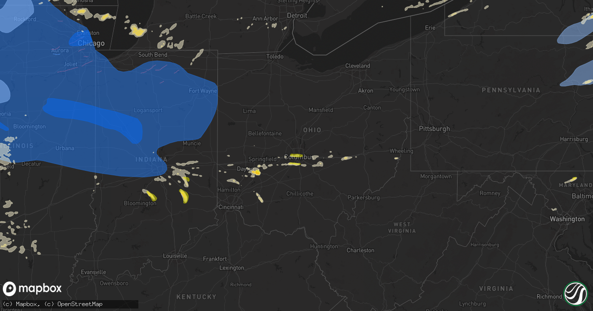
Hail Map on July 15, 2024
Get this storm
July 15 map
$229
one time, instant access
Download today. No call, no setup
Keep the $229
Bought the map and want the full workflow? Apply the entire $229 to a subscription within 7 days. None of it is wasted.
Every map, not just this one
This buys you this map. Subscription and you get every map we run, in the markets you choose from a few cities to whole states to nationwide. Plus real-time alerts the moment a storm fires.
Contact data
Name, contact info, occupancy, even credit band for addresses in the footprint. You go from where it hit to who to call.
Become the source they trust
Unlimited branding weather history reports on demand. You already have the documented answer ready for the property owner, and you are the one who showed up with it.
Property data and RoofTrace estimates
Pull up any address you have got, its value and the exact code rules for that jurisdiction, straight from One Click Code. Then RoofTrace estimates the squares, pitch, and roof value, priced the way you price.
States Impacted by Hail Map on July 15, 2024
Storm reports
Kansas
| Date | Description |
|---|---|
| 07/15/20246:50 AM CDT | Power is out across the town. |
| 07/15/20246:36 AM CDT | 60-70 mph wind gusts. |
| 07/15/20246:15 AM CDT | A local report indicates 70 MPH wind near 6 NNE Chapman |
| 07/15/20246:15 AM CDT | 60-70 mph wind gusts. |
| 07/15/20246:14 AM CDT | Estimated gusts of 65-70 mph. |
| 07/15/20246:08 AM CDT | A local report indicates 60 MPH wind near 5 SSE Milford |
| 07/15/20245:59 AM CDT | Delayed report. Tree down on third street in clay center. Time estimated from radar. |
| 07/15/20245:58 AM CDT | Trained spotter estimating 60-70 mph wind gusts. Time estimated from radar. |
| 07/15/20245:36 AM CDT | 6 inch tree limb down in longford. Time estimated from radar. |
| 07/15/20245:17 AM CDT | Measured by a home weather station. |
| 07/15/20245:14 AM CDT | Picture came in of a tree around a foot in diameter snapped in minneapolis. |
| 07/15/20245:01 AM CDT | A local report indicates 58 MPH wind near 2 SW Salina |
| 07/15/20244:33 AM CDT | A local report indicates 80 MPH wind near Lincoln |
| 07/15/20244:28 AM CDT | A local report indicates 70 MPH wind near Lincoln |
| 07/15/20244:20 AM CDT | A local report indicates 67 MPH wind near 7 SW Sylvan Grove |
| 07/15/20244:08 AM CDT | Power lines down and power poles snapped in russell. Time estimated on radar. |
| 07/15/20244:08 AM CDT | A local report indicates 93 MPH wind near 3 NNE Bunker Hill |
| 07/15/20244:08 AM CDT | Two campers rolled over. Time based on radar. |
| 07/15/20244:08 AM CDT | Power poles snapped. Time based on radar. |
| 07/15/20243:54 AM CDT | A local report indicates 85 MPH wind near Russell Airport |
| 07/15/20243:46 AM CDT | A local report indicates 76 MPH wind near Russell Airport |
| 07/15/20243:41 AM CDT | Corrects previous tstm wnd gst report from 1 ne russell airport. |
| 07/15/20243:40 AM CDT | A local report indicates 65 MPH wind near 5 NNE Gorham |
| 07/15/20243:39 AM CDT | A local report indicates 62 MPH wind near 4 W Russell |
| 07/15/20243:23 AM CDT | Mesonet station up853 walker |
| 07/15/20243:22 AM CDT | 2-foot diameter trees down in town. Time estimated from radar. |
| 07/15/20243:15 AM CDT | Awos station khys hays regional airport awos site. |
| 07/15/20242:56 AM CDT | Awos station khys hays regional airport awos site. |
| 07/15/20242:36 AM CDT | A local report indicates 68 MPH wind near 1 ESE Riga |
| 07/15/20242:26 AM CDT | A local report indicates 88 MPH wind near 3 SW Cedar Bluff |
| 07/15/20242:08 AM CDT | A local report indicates 72 MPH wind near Ransom |
Wisconsin
| Date | Description |
|---|---|
| 07/15/20246:59 PM CDT | A local report indicates 1.50 inch wind near 2 SE Belleville |
| 07/15/20246:50 PM CDT | A local report indicates 1.25 inch wind near 3 SW Belleville |
| 07/15/20246:30 PM CDT | A local report indicates 1.25 inch wind near 4 NE Argyle |
| 07/15/20246:30 PM CDT | Branches down and a shed blown over in benton. |
| 07/15/20246:28 PM CDT | A local report indicates 72 MPH wind near Hazel Green |
| 07/15/20246:17 PM CDT | Roof peeled off bar in town. |
| 07/15/20246:14 PM CDT | A brief ef-1 tornado in kieler produced tree and structural damage near county road h. The tornado lasted for 1 minute. |
| 07/14/20248:20 PM CDT | Law enforcement reports scattered trees down across rock county. |
| 07/14/20247:46 PM CDT | Measured via privately owned anemometer. |
| 07/14/20247:40 PM CDT | Measured via privately owned anemometer. |
| 07/14/20247:30 PM CDT | Law enforcement reports scattered trees down across green county. |
| 07/14/20247:30 PM CDT | Law enforcement reports lots of trees down between albany and brodhead. |
| 07/14/20247:25 PM CDT | Wind gust measured via privately owned anemometer. |
| 07/14/20247:20 PM CDT | Law enforcement reports some trees down near martintown. |
Arizona
| Date | Description |
|---|---|
| 07/14/20249:32 PM CDT | Ksad asos thunderstorm wind gust to 59 mph. |
| 07/14/20247:55 PM CDT | Wind gust measured at 58 mph. |
South Dakota
| Date | Description |
|---|---|
| 07/14/20249:18 PM CDT | Mping report |
| 07/14/20249:16 PM CDT | Mping report |
| 07/14/20249:15 PM CDT | A local report indicates 1.50 inch wind near Custer |
| 07/14/20249:15 PM CDT | Peas to quarters. 0.28 inches rain. Time estimated from radar. |
| 07/14/20249:12 PM CDT | Nickel to quarter size hail. 0.41 inches rain. |
| 07/14/20249:12 PM CDT | Nickel to quarter size hail. |
| 07/14/20249:12 PM CDT | A local report indicates 1.00 inch wind near 2 WSW Custer |
Vermont
| Date | Description |
|---|---|
| 07/14/20249:00 PM CDT | Public reports two downed trees in highgate center and dime sized hail. Radar shows downburst signature. Time estimated by radar. |
Pennsylvania
| Date | Description |
|---|---|
| 07/15/20246:45 PM CDT | Trees down across schuman rd... Rock run rd and callicoon rd. Time estimated by radar. |
| 07/15/20246:44 PM CDT | Tree down across the braman road and hancock hwy. Equinunk... Pa. Time estimated by radar. |
| 07/15/20246:40 PM CDT | Report from mping: trees uprooted or snapped; roof blown off. |
| 07/15/20246:40 PM CDT | Severe wind... Estimate 70mph. Took down half of the large pear tree in our yard. |
| 07/15/20246:38 PM CDT | Tree down blocking loretta drive. |
| 07/15/20246:34 PM CDT | Roof came off building and on power lines |
| 07/15/20246:34 PM CDT | Wires down. |
| 07/15/20246:32 PM CDT | Trees down. |
| 07/15/20246:30 PM CDT | Report from mping: 3-inch tree limbs broken; power poles broken. |
| 07/15/20246:26 PM CDT | Large tree down blocking road |
| 07/15/20246:24 PM CDT | Tree down on damascus road blocking southbound lane. |
| 07/15/20246:16 PM CDT | Report from mping: trees uprooted or snapped; roof blown off. |
| 07/15/20246:14 PM CDT | Trees down |
| 07/15/20246:06 PM CDT | Tree down blocking road |
| 07/15/20246:04 PM CDT | Trees down |
| 07/15/20246:02 PM CDT | Tree down blocking road |
| 07/15/20246:02 PM CDT | Trees down |
| 07/15/20245:55 PM CDT | Multiple trees and wires down... With some poles down as well in the vicinity of benton. |
| 07/15/20245:52 PM CDT | Multiple trees and wires between waller and jamison city. |
| 07/15/20245:51 PM CDT | Multiple trees and wires down in sugarloaf township with several roads blocked. |
| 07/15/20245:49 PM CDT | Downed and uprooted trees... Tree reported on roof. Time estimated based off radar. |
| 07/15/20245:33 PM CDT | Wires down. Time estimated from radar. |
| 07/15/20245:30 PM CDT | Trees down. |
| 07/15/20245:27 PM CDT | Trees and wires down on ulster road. Time estimated from radar. |
| 07/15/20245:25 PM CDT | Trees and wires down. Time estimated from radar. |
| 07/15/20245:25 PM CDT | Trees and wires down. Time estimated from radar. |
| 07/15/20245:16 PM CDT | Multiple trees and wires down in the 7300 block of route 87 blocking one lane of the roadway. |
| 07/15/20245:13 PM CDT | Multiple trees down near the intersection of church street and state route 154. |
| 07/15/20245:05 PM CDT | Tree on house. |
| 07/15/20245:03 PM CDT | Multiple trees and wires down across loyalsock township. |
| 07/15/20245:00 PM CDT | Trees and wires down on brague road. Time estimated from radar. |
| 07/15/20245:00 PM CDT | Tree down on house. |
| 07/15/20245:00 PM CDT | Tree on house. |
| 07/15/20244:55 PM CDT | Tree down on house. |
| 07/15/20244:52 PM CDT | Trees down on rt 14... Time estimated from radar. |
| 07/15/20244:52 PM CDT | Measured peak gust. |
| 07/15/20244:47 PM CDT | Multiple large trees down with one crushing a football team shed. Metal bleachers knocked over and pushed 20 to 30 feet. |
| 07/15/20244:41 PM CDT | Tree down onto a residence in jackson township. |
| 07/15/20244:40 PM CDT | Tree on wires on cold watertown rd. |
| 07/15/20244:28 PM CDT | Multiple trees and wires down. |
| 07/15/20244:20 PM CDT | Multiple trees and wires down in and around middlebury center. |
| 07/15/20244:19 PM CDT | Multiple trees snapped and uprooted east of wellsboro. |
| 07/15/20244:13 PM CDT | Multiple trees down near the intersection leon brown road and monkey run road. |
| 07/15/20244:13 PM CDT | Tree down into a residence with multiple trees and wires down around osceola township. |
| 07/15/20244:01 PM CDT | Multiple trees and wires down. |
| 07/15/20243:51 PM CDT | Multiple trees and wires down in lower windsor township. |
| 07/15/20243:50 PM CDT | Tree down near intersection of phoenix and hoppe roads. |
| 07/15/20243:23 PM CDT | Multiple trees and wires down in york. |
| 07/15/20242:56 PM CDT | Multiple trees and wires down blocking both lanes of route 255 near the intersection of route 948. |
| 07/15/20242:55 PM CDT | Tree down into a residence in weedville. |
| 07/15/20242:52 PM CDT | Multiple trees and wires down throughout saint marys. |
| 07/15/20242:40 PM CDT | Trees down on mountain run road. |
| 07/15/20242:35 PM CDT | Large tree limbs down in the vicinity of treasure lake with some smaller trees knocked down. |
| 07/15/20242:24 PM CDT | Trees down and wires down. |
| 07/15/20242:11 PM CDT | Trees down and wires down. |
| 07/15/20241:54 PM CDT | Trees and wires down. |
| 07/15/20241:48 PM CDT | Tree down on highway 66 near mechanicsville road. |
| 07/15/20241:41 PM CDT | Trees and wires down. |
| 07/15/20241:04 PM CDT | Large tree down on mcquistion rd. Time estimated based on radar. |
| 07/14/20249:02 PM CDT | Trees on powerlines on front street. |
| 07/14/20248:52 PM CDT | Tree down across roadway. |
| 07/14/20247:18 PM CDT | At least 10 trees down with tops sheared. Time estimated by radar. |
| 07/14/20247:05 PM CDT | Trees down in the vicnity of manor... Pa. |
| 07/14/20247:05 PM CDT | Corrected lsr: trees down in the vicnity of manor... Pa. |
| 07/14/20247:00 PM CDT | Trees and lines down. |
Wyoming
| Date | Description |
|---|---|
| 07/15/20246:18 PM CDT | Peak wind gusts of 58 mph at 518 pm and 59 mph at 520 pm measured at twenty mile hill wydot mesonet sensor. |
| 07/15/20245:56 PM CDT | Peak wind gust at hat six wydot mesonet sensor on the east side of casper. |
| 07/15/20245:56 PM CDT | Peak wind gust at scenic drive wydot mesonet sensor. |
| 07/15/20245:55 PM CDT | Public report of estimated peak wind gust in bar nunn. |
| 07/15/20245:20 PM CDT | Peak wind gust at fales rock raws. Time estimated from radar and other observation reports. |
| 07/15/20245:02 PM CDT | Peak wind gust at hiland wydot mesonet station. |
| 07/15/20243:40 PM CDT | Peak wind gusts of 59 to 66 mph between 230 and 240 pm mdt northeast of lander near wyoming highway 789. |
| 07/15/20243:40 PM CDT | Peak wind gusts of 59 to 66 mph between 230 and 240 pm mdt northeast of lander near wyoming highway 789. |
| 07/15/20243:32 PM CDT | Peak wind gust at sharpnose raws. |
| 07/15/20243:32 PM CDT | Peak wind gust at sharpnose raws. |
| 07/15/20243:30 PM CDT | Peak wind gust in the area of baldwin creek. |
| 07/15/20243:30 PM CDT | Peak wind gust in the area of baldwin creek. |
| 07/15/20243:25 PM CDT | Peak wind gust at hunt field. |
| 07/15/20243:25 PM CDT | Peak wind gust at hunt field. |
| 07/15/20243:20 PM CDT | Peak wind gust along the north fork popo agie river. |
| 07/15/20243:20 PM CDT | Peak wind gust along the north fork popo agie river. |
| 07/14/20248:04 PM CDT | Corrects previous non-tstm wnd gst report from 1 sse bordeaux. Mesonet station kbrx 1.4 s bordeaux |
| 07/14/20248:04 PM CDT | Corrects previous non-tstm wnd gst report from 1 sse bordeaux. Meson |
| 07/14/20247:56 PM CDT | Wydot sensor at bordeaux. |
Alabama
| Date | Description |
|---|---|
| 07/15/20245:31 PM CDT | A tree was downed on depot street in riverside. |
Virginia
| Date | Description |
|---|---|
| 07/15/20245:08 PM CDT | Tree down near gordon rd and harrison rd |
| 07/15/20245:08 PM CDT | Tree down near intersection of chancellor rd and old plank rd |
| 07/15/20245:08 PM CDT | Few trees down near intersection of gordon rd and chancellor rd |
| 07/15/20244:40 PM CDT | Several trees down near intersection of rt 3 and rt 20 in the lake of the woods and locust grove areas. |
| 07/15/20244:28 PM CDT | 4 to 5 large trees down near intersection of elys frd rd and fields mill rd |
| 07/15/20244:19 PM CDT | Large tree branch down across walker road... Blocking the roadway... In great falls. Time estimated from radar. |
| 07/15/20244:10 PM CDT | Large tree down near intersection of mt. Dumpling rd and stevensburg rd |
| 07/15/20244:10 PM CDT | Multiple trees down along berry hill road. |
| 07/15/20244:00 PM CDT | A weather sensor at the george washington university virginia campus measured a 58 mph gust |
| 07/15/20244:00 PM CDT | Several reports of trees and powerlines down in and around the waterford... Va area of loudoun county. |
| 07/15/20244:00 PM CDT | Several reports of large limbs and trees down in and around leesburg... Va of loudoun county. |
| 07/15/20243:55 PM CDT | 5 large trees down and several powerlines down in waterford... Va |
| 07/15/20243:51 PM CDT | Trained spotter reported multiple branches and a couple trees down near landsdowne |
| 07/15/20243:50 PM CDT | Several 8 inch diameter limbs down partially blocking fieldstone dr near battlefield pkwy ne |
| 07/15/20243:42 PM CDT | Tree down near intersection of n. King street and james monroe highway. |
| 07/15/20243:33 PM CDT | Rappahannock 911 center reported a few trees down in the southern part of county... Along sperryville pike and f t valley road. |
| 07/15/20243:32 PM CDT | Tree down near 37300 block of charlestown pike. |
| 07/15/20243:30 PM CDT | Tempest mesonet at hillsboro road measured a peak wind gust of 50kt/58mph. |
| 07/15/20243:28 PM CDT | Tree down near intersection of clarkes gap road and hurley lane. |
| 07/15/20243:20 PM CDT | Large tree limbs downed onto traffic signal and power lines at intersection of route 9 and va 287. |
| 07/15/20243:19 PM CDT | Fauquier 911 center reported large tree down onto communications line along 10700th block of bears den road in marshall. |
| 07/15/20243:14 PM CDT | Trained spotter called to report 10-20 trees down on their farm. They oberved about 2-3 minutes of very intense wind that started at 4:14 pm. |
| 07/15/20243:12 PM CDT | Rappahannock 911 center reports a few trees down in the eastern part of county... Along south poes road and richmond road. |
Nebraska
| Date | Description |
|---|---|
| 07/14/202410:26 PM CDT | Awos station kaia 4 ese alliance. |
South Carolina
| Date | Description |
|---|---|
| 07/15/20246:46 PM CDT | Public report with photo of medium sized tree down near the lake murray dam. |
| 07/15/20246:31 PM CDT | Nws employee reported a tree down at olde barnwell and emmanuel church road. |
| 07/15/20246:28 PM CDT | Sc highway patrol reported trees down in roadway along beechwood drive. |
| 07/15/20246:25 PM CDT | Sc highway patrol reported tree down in roadway at windwill and lewie road. |
| 07/15/20246:20 PM CDT | Trained spotter report with pictures of multiple trees down... Uprooted... And power poles broken at priceville and windwill road north of gilbert. |
| 07/15/20244:54 PM CDT | Pictures of a large downed tree was shared via social media. Time was estimated via radar. |
| 07/15/20244:24 PM CDT | Multiple large limbs were reported down near the homewood... Sc area... Some of them making contact with electrical wires. Horry electric cooperative reports over 200 o |
| 07/15/20244:10 PM CDT | Trees down on mt carmel rd |
| 07/15/20243:45 PM CDT | Downed power lines along island rd. Time estimated by radar. |
| 07/15/20243:39 PM CDT | A 911 call center relayed a report of a tree down near the intersection of big branch rd and cat branch rd. |
| 07/15/20243:24 PM CDT | Multiple large limbs were reported down near the homewood... Sc area... Some of them making contact with electrical wires. Horry electric cooperative reports over 200 o |
| 07/15/20243:21 PM CDT | A 911 call center relayed a report of a tree down along hoover plantation dr near cotton hill rd. |
| 07/15/20242:43 PM CDT | Reported a tree down near the intersection of stiffmire road and old number six highway. |
| 07/15/20242:41 PM CDT | A 911 call center relayed a report of a tree down along bennetts point rd and octavia lane. |
| 07/15/20242:36 PM CDT | Reported a tree down at the intersection of hemlock road and colonel thompson hwy... Hwy. 601. |
| 07/15/20242:28 PM CDT | A 911 call center reported a tree down along ritter rd between possom corner rd and blue house lane. |
| 07/15/20242:28 PM CDT | Reported a tree and power line down at the intersection of bridge street and sikes road. |
| 07/15/20241:40 PM CDT | Reported through social media of large hail in the cash community just south of cheraw... Sc. |
| 07/15/20241:39 PM CDT | Reported a tree down near the intersection of hwy. 52 and bethel church road at the cemetery. They also reported several limbs down along with dime size hail. |
| 07/14/20248:45 PM CDT | Several trees and power lines down in the eastern part of the county. |
| 07/14/20248:17 PM CDT | Aiken county dispatch reported a large tree fell on a building in the 300 block of edgefield road in north augusta. |
| 07/14/20247:18 PM CDT | Sc highway patrol reported a downed tree blocking roadway at belvedere-clearwater road and irene street. |
| 07/14/20247:15 PM CDT | Sc highway patrol reported a tree down in along loner road near blythewood. |
Oregon
| Date | Description |
|---|---|
| 07/15/20246:30 PM CDT | Emergency management reports tree branches of 2 inches in diameter falling from trees. |
| 07/14/20247:43 PM CDT | Tree down. Damage to deck. |
| 07/14/20247:42 PM CDT | Incident meteorologist at the salt creek fire reports small tree branches down at the school and tents damaged and blown away from winds at the incident command post. |
| 07/14/20247:42 PM CDT | Corrects previous tstm wnd dmg report from 1 nnw eagle point. Incident meteorologist at the salt creek fire reports small tree branches |
| 07/14/20247:40 PM CDT | Tree down. Damage to city park equipment. |
| 07/14/20247:30 PM CDT | There were 17-20 instances of trees down into powerlines with a couple of trees down into houses. No injuries reported. There is a report of a person trapped in a car d |
Massachusetts
| Date | Description |
|---|---|
| 07/15/20245:20 PM CDT | Several reports of downed trees and wires. Relayed by amateur radio. |
| 07/15/20245:20 PM CDT | In cohasset... A tree was down on wires on north main st. On hull st there was a tree down. A tree was down on black rock rd and sawyer st. |
| 07/15/20242:52 PM CDT | In belchertown... A tree was down on springfield rd. Relayed by amateur radio. |
| 07/15/20242:25 PM CDT | In belchertown... A tree was down across ware rd |
| 07/15/20241:32 PM CDT | Trees and wires down on west warren rd... Maple st... And south st. Relayed by amateur radio. |
District of Columbia
| Date | Description |
|---|---|
| 07/15/20244:48 PM CDT | Multiple reports of trees down on 33rd street nw... Between tennyson street and stephenson place. |
| 07/15/20244:47 PM CDT | A tree down onto wires and a porch near the 5700 block of nevada ave nw. Time estimated from radar. |
| 07/15/20244:47 PM CDT | Large tree down near intersection of livingston street nw and 39th odds alley nw. |
| 07/15/20244:45 PM CDT | Large tree down along a road in rock creek park. |
| 07/15/20244:43 PM CDT | Large limb on power line. |
Missouri
| Date | Description |
|---|---|
| 07/15/20246:53 AM CDT | Downed tree limbs and wires near poage road. Time estimated from radar. |
| 07/15/20246:53 AM CDT | Downed wires near 145th road. Time estimated from radar. |
| 07/15/20246:39 AM CDT | Downed wires north of route 116. Time estimated from radar. |
| 07/15/20246:32 AM CDT | Downed wires near junior drive. Time estimated from radar. |
| 07/15/20245:15 AM CDT | Sent via nwschat with picture... Time reported from 911 call center. |
Ohio
| Date | Description |
|---|---|
| 07/15/20246:57 PM CDT | Tree down on webb heights road. |
| 07/15/20246:53 PM CDT | Tree down on wegee road. |
| 07/15/20245:49 PM CDT | Tree and power lines down |
| 07/15/20245:47 PM CDT | Multiple trees and wires down in and throughout cambridge. |
| 07/15/20245:45 PM CDT | Tree down on holmes road; report via mping. |
| 07/15/20245:44 PM CDT | Tree into lines. |
| 07/15/20245:42 PM CDT | Tree down on harper ave. |
| 07/15/20245:40 PM CDT | Tree reported down covering most of lemon hill road. Time estimated by radar. |
| 07/15/20245:22 PM CDT | Trees and power lines down along east pike. |
| 07/15/20245:19 PM CDT | Tree into power lines on lewis road. |
| 07/15/20245:18 PM CDT | Tree down on fulton street. |
| 07/15/20245:14 PM CDT | Tree down on kopchak road. |
| 07/15/20245:10 PM CDT | County 911 received two reports of trees down in new lexington. |
| 07/15/20245:10 PM CDT | Power company reports power outage due to tree damage west of crooksville. |
| 07/15/20245:08 PM CDT | Tree down on hoover ave. |
| 07/15/20244:55 PM CDT | County 911 received five reports of trees down in somerset. |
| 07/15/20244:52 PM CDT | Trees down across sr664 - time estimated by radar. |
| 07/15/20244:50 PM CDT | County 911 received three reports of trees down in thornville. |
| 07/15/20244:49 PM CDT | Numerous trees down near thornport - time estimated from radar. |
| 07/15/20244:47 PM CDT | Large tree down - time estimated by radar. |
| 07/15/20244:20 PM CDT | Numerous trees down - time estimated from radar. |
| 07/15/20244:15 PM CDT | Report from mping: quarter |
| 07/15/20244:11 PM CDT | Penny to quarter size hail. |
| 07/15/20244:08 PM CDT | A local report indicates 1.00 inch wind near 2 N Downtown Columbus |
| 07/15/20244:03 PM CDT | Small to medium tree branches down. |
| 07/15/20243:55 PM CDT | Time estimated. |
| 07/15/20243:55 PM CDT | Numerous trees down - time estimated. |
| 07/15/20243:20 PM CDT | A local report indicates 1.00 inch wind near Choctaw Lake |
| 07/15/20242:59 PM CDT | Trees down on wilberforce-clifton rd and also jones rd - time estimated by radar. |
| 07/15/20242:51 PM CDT | Via broadcast media. |
| 07/15/20242:30 PM CDT | Time estimated. |
| 07/15/20242:28 PM CDT | Tree branches down on wires. |
| 07/15/20242:22 PM CDT | One tree down on elk creek rd - time estimated from radar. |
| 07/15/20249:42 AM CDT | A large tree has fallen on a house... Causing structural damage. |
| 07/15/202412:47 AM CDT | Tree down on fife rd. |
| 07/15/202412:40 AM CDT | Delayed report of tree down on us route 127 just south of van wert. Time estimated from radar. |
Illinois
| Date | Description |
|---|---|
| 07/15/20246:56 PM CDT | A local report indicates 84 MPH wind near 3 N Stockton |
| 07/15/20246:45 PM CDT | Large tree branches down... Garden corn flattened. Delayed report. |
| 07/15/20246:44 PM CDT | Estimated winds of 60 mph at the leading edge of the line... With low visibility. |
| 07/15/20246:30 PM CDT | Estimated 80 mph winds with damage to well build slide at this location. |
| 07/15/202410:13 AM CDT | Delayed report of a 13 inch tree branch down on the corner of crescent and hemlock in champaign. |
| 07/15/20243:39 AM CDT | Several tree branches were blown down... Including one that fell onto a house. |
| 07/14/202410:45 PM CDT | Report from mping: 3-inch tree limbs broken; power poles broken. |
| 07/14/202410:44 PM CDT | Report from mping: 1-inch tree limbs broken; shingles blown off. |
| 07/14/202410:43 PM CDT | Portions of i-55 shut down between channahon and lorenzo due to debris and power lines down. |
| 07/14/202410:43 PM CDT | Corrects previous tstm wnd dmg report from 2 se channahon. Portions of i-55 shut down between channahon and lorenzo due to debris and power lines down. |
| 07/14/202410:42 PM CDT | Numerous reports of power lines and trees down in vermilion county. |
| 07/14/202410:36 PM CDT | Report from mping: 3-inch tree limbs broken; power poles broken. |
| 07/14/202410:35 PM CDT | Several tree branches down. Social media report. Time estimated from radar. |
| 07/14/202410:30 PM CDT | Several large tree branches were blown down. |
| 07/14/202410:25 PM CDT | Corn flattened along douglas-coles county line. Social media report. Time estimated. |
| 07/14/202410:25 PM CDT | Tree branches broken. Part of fence blown down from high winds. |
| 07/14/202410:22 PM CDT | Report from mping: 1-inch tree limbs broken; shingles blown off. |
| 07/14/202410:20 PM CDT | Large tree branches down. Social media report. Time estimated from radar. |
| 07/14/202410:15 PM CDT | Numerous large trees and tree branches were blown down... Including some on cars and roofs. |
| 07/14/202410:15 PM CDT | Corrects previous tstm wnd dmg report from 2 nw savoy. Report from mping: 3-inch tree limbs broken; power poles broken. |
| 07/14/202410:15 PM CDT | Large tree branch down. Social media report. Time estimated from radar. |
| 07/14/202410:13 PM CDT | Delayed report. Considerable tree damage... Including an estimated 12 to 24 inch diameter tree limb down onto a house producing structural damage. |
| 07/14/202410:13 PM CDT | Corrects previous tstm wnd dmg report from 2 ssw champaign. Delayed report of a 13 inch tree branch down on the corner of crescent and hemlock in champaign. |
| 07/14/202410:12 PM CDT | Report from mping: 3-inch tree limbs broken; power poles broken. |
| 07/14/202410:12 PM CDT | Delayed report. Tree limb down blocking brownfield road. |
| 07/14/202410:11 PM CDT | Multiple reports of tree damage in the blue island and midlothian areas. Relayed via mping. |
| 07/14/202410:08 PM CDT | A local report indicates 60 MPH wind near 3 S Bement |
| 07/14/202410:06 PM CDT | Report from mping: 1-inch tree limbs broken; shingles blown off. |
| 07/14/202410:05 PM CDT | Tree branches up to 8 inch diameter blown down from near frederick to sheldon's grove area and along il route 100. |
| 07/14/202410:04 PM CDT | A large tree was blown onto a garage on west church street in champaign. |
| 07/14/202410:04 PM CDT | Peak wind gust 62 mph from the northwest at champaign airport. |
| 07/14/202410:04 PM CDT | Large tree limbs down at hemlock and crescent drive. Limbs down on harrington dr. Power outage on mattis ave and sangamon dr. Photos on social media. |
| 07/14/20249:59 PM CDT | Delayed report. Several tree limbs blown down. |
| 07/14/20249:59 PM CDT | Report from mping: 1-inch tree limbs broken; shingles blown off. |
| 07/14/20249:58 PM CDT | Tree branches blown down. |
| 07/14/20249:56 PM CDT | Measured at personal weather station kilchica996. |
| 07/14/20249:54 PM CDT | A local report indicates 70 MPH wind near 1 N Douglas - Chicago |
| 07/14/20249:52 PM CDT | Trained spotter reports damage to shingles and trees on the north side of lansing. Multiple large branches broken and a pine tree uprooted. Time estimated by radar. |
| 07/14/20249:52 PM CDT | Tree damage in logan square community area of chicago. Relayed via mping. Time estimated by radar. |
| 07/14/20249:51 PM CDT | Numerous trees down across town. Roofing material removed from residence. Power pole snapped. Time estimated by radar. |
| 07/14/20249:51 PM CDT | Large tree branch downed onto car in the west loop area of chicago. Time estimated by radar. |
| 07/14/20249:50 PM CDT | Social media images posted of tree damage in ukranian village along superior between western and rockwell including a large tree uprooted that landed on the hood of a c |
| 07/14/20249:50 PM CDT | Two large trees down on riverbend blvd. Delayed report from 7/15. |
| 07/14/20249:48 PM CDT | Large tree reported on a house. |
| 07/14/20249:47 PM CDT | Measured at personal weather station kilcrete19. |
| 07/14/20249:46 PM CDT | Public report of uprooted tree west of grant park. Relayed via mping. Time estimated by radar. |
| 07/14/20249:45 PM CDT | Large tree branches blown down near a house. Photo on social media. |
| 07/14/20249:45 PM CDT | Report from mping: 3-inch tree limbs broken; power poles broken. |
| 07/14/20249:45 PM CDT | Report of roof blown off a home in crestwood... Il. Time estimated via radar. |
| 07/14/20249:44 PM CDT | Public report of broken 5-inch tree branch. Time estimated by radar. |
| 07/14/20249:44 PM CDT | Corrects previous report from 1 nw norridge. Public report of broken 5-inch tree branch. Time estimated by radar. |
| 07/14/20249:44 PM CDT | 2-4 inch tree limbs reported down. |
| 07/14/20249:43 PM CDT | Numerous tree limbs downed... Varying from 8-12 inch diameter. Minor house damage to fascia... Roof... And chimney. |
| 07/14/20249:42 PM CDT | Local media sent in a user photo of a large tree knocked over in their yard. No specific location shared other than in oak park. Time estimated by radar. |
| 07/14/20249:42 PM CDT | Public report of tree branches downed west of country club hills. Strongest winds lasted approximately 45 seconds. Time estimated by radar. |
| 07/14/20249:42 PM CDT | Minor tree damage reported around the big oaks neighborhood. Time estimated by radar. |
| 07/14/20249:42 PM CDT | Trees limbs reported down across town. Time estimated by radar. |
| 07/14/20249:42 PM CDT | A local report indicates 75 MPH wind near O'Hare Airport |
| 07/14/20249:42 PM CDT | Report of tree tops broken off 12 inch diameter. |
| 07/14/20249:41 PM CDT | 30 inch tree down. |
| 07/14/20249:41 PM CDT | Public report of large tree branch broken east of manteno. Relayed via mping. Time estimated by radar. |
| 07/14/20249:40 PM CDT | Damage to outbuilding/garage at 107 n west street with boards and rocks blown down street. |
| 07/14/20249:40 PM CDT | Tree down blocking rt. 54. Time estimated. |
| 07/14/20249:38 PM CDT | Public report of tree branch downed near orland hills. Relayed via mping. Time estimated by radar. |
| 07/14/20249:38 PM CDT | Trees reported down through town. |
| 07/14/20249:38 PM CDT | A local report indicates 80 MPH wind near Piper City |
| 07/14/20249:38 PM CDT | Powerlines down east of waynesville along jim town road. |
| 07/14/20249:36 PM CDT | Report of partial garage collapse. |
| 07/14/20249:36 PM CDT | Bellwood em reports partial garage collapse on 25th street in broadview. |
| 07/14/20249:36 PM CDT | Public report of an 8-inch diameter tree limb broken. Time estimated by radar. |
| 07/14/20249:36 PM CDT | Measured at an ambient personal weather station. |
| 07/14/20249:35 PM CDT | Corrects previous tstm wnd dmg report from piper city. Trees and limbs reported down across town. |
| 07/14/20249:35 PM CDT | Public report of large tree branch broken east of mokena. Relayed via mping. Time estimated by radar. |
| 07/14/20249:35 PM CDT | Multiple reports of tree damage near elk grove village. Relayed via mping. |
| 07/14/20249:34 PM CDT | Measured at a personal weather station. |
| 07/14/20249:33 PM CDT | Report from mping: 3-inch tree limbs broken; power poles broken. |
| 07/14/20249:31 PM CDT | 2-foot diameter tree snapped near state street and new avenue north of lockport. Tree landed on power lines and a house. Time estimated by radar. |
| 07/14/20249:30 PM CDT | Hanover township em reports widespread damage to power lines and trees in bartlett and streamwood. Time estimated by radar. |
| 07/14/20249:29 PM CDT | A couple structures damaged and multiple trees downed in ranch oaks neighborhood. |
| 07/14/20249:28 PM CDT | Portions of roof removed from storage facility near baker and eastern roads. Time estimated by radar. |
| 07/14/20249:28 PM CDT | Multiple reports of trees down on homes on s locust street. |
| 07/14/20249:28 PM CDT | Power lines down in town. |
| 07/14/20249:27 PM CDT | Multiple trees uprooted in area. |
| 07/14/20249:27 PM CDT | Public report of multiple tree branches broken and power lines downed near ardmore avenue and kenilworth avenue in villa park. Time estimated by radar. |
| 07/14/20249:25 PM CDT | A local report indicates 62 MPH wind near Le Roy |
| 07/14/20249:25 PM CDT | Public report of possible tree damage in downers grove. Relayed via mping. Time estimated by radar. |
| 07/14/20249:25 PM CDT | Large branch downed near arlington drive and kingston drive in romeoville. Time estimated by radar. |
| 07/14/20249:25 PM CDT | Public report of large branch broken in ingalls park. Time estimated by radar. Relayed via mping. |
| 07/14/20249:24 PM CDT | Joliet police report numerous power lines and tree branches downed across joliet. Time estimated by radar. |
| 07/14/20249:24 PM CDT | Several 20 inch diameter trees down with power lines also down. |
| 07/14/20249:24 PM CDT | Public report of uprooted tree near boughton road and schmidt road in bolingbrook. Time estimated by radar. Relayed by mping. |
| 07/14/20249:21 PM CDT | Multiple trees damaged and power poles snapped. Time estimated by radar. |
| 07/14/20249:18 PM CDT | Central il airport in bloominton measured wind gust of 72 mph out of the wnw. |
| 07/14/20249:17 PM CDT | Report from mping: 1-inch tree limbs broken; shingles blown off. |
| 07/14/20249:17 PM CDT | Public report of possible tree damage near gaylord road and frontier lane in the crest hill and joliet areas. Time estimated from radar. Relayed via mping. |
| 07/14/20249:17 PM CDT | Public report of possible tree damage near bartlett. Relayed via mping. |
| 07/14/20249:16 PM CDT | Measured at personal weather station kilnaper225. |
| 07/14/20249:16 PM CDT | Possible tree damage in north naperville. Relayed via mping. Time estimated by radar. |
| 07/14/20249:16 PM CDT | High tension line down in dresden lock area. |
| 07/14/20249:15 PM CDT | Public report of possible tree damage near algonquin. Relayed via mping. Time estimated by radar. |
| 07/14/20249:15 PM CDT | Public report of large tree branch downed west of channahon. Relayed via mping. Time estimated by radar. |
| 07/14/20249:15 PM CDT | Large tree downed into power lines... Road blocked at talbot and rt56. Time estimated by radar. |
| 07/14/20249:15 PM CDT | Possible tree damage southwest of minooka. Time estimated by radar. Relayed via mping. |
| 07/14/20249:13 PM CDT | Report from mping: 3-inch tree limbs broken; power poles broken. |
| 07/14/20249:13 PM CDT | 52 kt gust measured by kdpa asos. |
| 07/14/20249:12 PM CDT | Large tree limbs blown down on morris street half mile north of miller park. |
| 07/14/20249:11 PM CDT | Public report of damage to shingles... Trees... And fences near arbeiter road and wildspring parkway in west joliet. Time estimated by radar. |
| 07/14/20249:11 PM CDT | Corrects previous tstm wnd gst report from cuba. Report from mping: 3-inch tree limbs broken; power poles broken. |
| 07/14/20249:11 PM CDT | Report from mping: 3-inch tree limbs broken; power poles broken. |
| 07/14/20249:08 PM CDT | Multiple reports received of possible tree damage just north of morris near i-55. Relayed via mping. Time estimated by radar. |
| 07/14/20249:07 PM CDT | Measured at an ambient personal weather station. |
| 07/14/20249:07 PM CDT | Public report of possible tree damage in streator. Relayed via mping. Time estimated by radar. |
| 07/14/20249:04 PM CDT | 5-6 inch trees down. |
| 07/14/20249:04 PM CDT | Roof damage to multiple homes near southbury boulevard and lakeshore drive in oswego. Time estimated by radar. |
| 07/14/20249:02 PM CDT | Public report of possible tree damage west of north aurora. Time estimated by radar. Relayed via mping. |
| 07/14/20249:02 PM CDT | Public report of possible tree damage on the southwest side of oswego. Relayed via mping. Time estimated by radar. |
| 07/14/20249:02 PM CDT | Report from mping: 3-inch tree limbs broken; power poles broken. |
| 07/14/20249:01 PM CDT | Trees and power lines down in area with minor house and vehicle damage. Time estimated by radar. |
| 07/14/20248:59 PM CDT | Measured at an ambient personal weather station. |
| 07/14/20248:59 PM CDT | 18 inch tree limbs blown down at 307 west pine street. |
| 07/14/20248:58 PM CDT | Public report of large branch downed west of st charles. Time estimated by radar. Relayed via mping. |
| 07/14/20248:57 PM CDT | Asos measured 61 kt gust at aurora municipal airport |
| 07/14/20248:56 PM CDT | Report from mping: 3-inch tree limbs broken; power poles broken. Estimated time by radar. |
| 07/14/20248:55 PM CDT | Public report of 64 mph wind gust north of lily lake. Report also indicates multiple large branches downed near il-47 and empire road. Additional public reports of tree |
| 07/14/20248:55 PM CDT | Mulitple highway signs blown down along i-39. Numerous trees damaged from high winds. |
| 07/14/20248:53 PM CDT | Public report of tree snapped in sugar grove. Time estimated by radar. |
| 07/14/20248:52 PM CDT | Estimated wind gust 75 mph. |
| 07/14/20248:51 PM CDT | Public report of possible tree damage southeast of big rock. Time estimated by radar. Relayed via mping. |
| 07/14/20248:50 PM CDT | Debris falling form sky at wash blacktop and robinson. |
| 07/14/20248:50 PM CDT | A local report indicates 60 MPH wind near 1 SW Varna |
| 07/14/20248:50 PM CDT | Corrects previous tstm wnd gst report from 3 e toluca. Mesonet station dvi03891 toluca. |
| 07/14/20248:50 PM CDT | Trees blown down blocking traffic between goofy ridge and bishop. |
| 07/14/20248:50 PM CDT | Tree damage on kentuckian road from high wind gusts. |
| 07/14/20248:48 PM CDT | Delayed report. Large tree branch down onto power lines. |
| 07/14/20248:46 PM CDT | As gust front moved through. |
| 07/14/20248:46 PM CDT | Multiple very large trees blown down on jackson street from high school to mcclallen park. |
| 07/14/20248:46 PM CDT | Measured 61 mph wind gust. |
| 07/14/20248:45 PM CDT | Some shingles and siding blown off neigbhors house. Funnel cloud sighted. |
| 07/14/20248:45 PM CDT | Tree limbs down and fence destroyed. Social media report. Time estimated from radar. |
| 07/14/20248:45 PM CDT | Time estimated from radar. |
| 07/14/20248:45 PM CDT | Delayed report. 6 to 7 inch diameter tree limbs broken. |
| 07/14/20248:45 PM CDT | Large tree blown down on a car. Delayed report. |
| 07/14/20248:45 PM CDT | A local report indicates 70 MPH wind near Henry |
| 07/14/20248:45 PM CDT | Several trees were blown down and a power pole was snapped in half near low point-washburn elementary. |
| 07/14/20248:45 PM CDT | Large tree branches were blown down near south market street and logan street. |
| 07/14/20248:43 PM CDT | Several trees blown down near high school and from jackson street north to tennessee street. |
| 07/14/20248:41 PM CDT | A local report indicates 78 MPH wind near 1 N South Pekin |
| 07/14/20248:41 PM CDT | Tree blocking illinois 18 just east of the illinois river bridge. Time estimated by using radar. |
| 07/14/20248:40 PM CDT | Four to 6 inch tree limbs blown down with power hits on north grand blvd. |
| 07/14/20248:40 PM CDT | Weather station at the henry marina measured an 80 mph wind gust. |
| 07/14/20248:40 PM CDT | Power flashes from high winds. |
| 07/14/20248:39 PM CDT | Numerous large tree branches were blown down. |
| 07/14/20248:39 PM CDT | Several trees were blown down... Including one that fell onto a house. |
| 07/14/20248:39 PM CDT | 5 inch trees snapped off along il 18 east of the il river. Downed power lines with trees blown down. Minor flooding. |
| 07/14/20248:39 PM CDT | Numerous trees were blown down... Including one that fell onto a garage. |
| 07/14/20248:38 PM CDT | Report from mping: 3-inch tree limbs broken; power poles broken. |
| 07/14/20248:38 PM CDT | 8 inch tree limbs blowns donw on a house between pekin and groveland at 4200 block sheridan. |
| 07/14/20248:37 PM CDT | Estimated wind gust 60 to 65 mph in north pekin. |
| 07/14/20248:37 PM CDT | Tree blown down on jefferson street. |
| 07/14/20248:36 PM CDT | Several large tree branches were blown down in riverfront park. |
| 07/14/20248:36 PM CDT | Nws damage survey determined a tornado developed se of east peoria and progressed through morton toward makinaw before dissipating. Tornado was on the ground for 12.39 |
| 07/14/20248:36 PM CDT | Delayed report. Large oak tree blown down onto fairview avenue blocking the road. |
| 07/14/20248:35 PM CDT | Report from mping: trees uprooted or snapped; roof blown off. Time estimated from radar. |
| 07/14/20248:35 PM CDT | Large tree down across spoon river overflow bridge. Time estimated from radar. |
| 07/14/20248:35 PM CDT | Tree blocking southport road near fire station. Social media report. Time estimated. |
| 07/14/20248:35 PM CDT | Delayed report. Five trees blown down in hopewell including one onto a house. Swop report. |
| 07/14/20248:35 PM CDT | Public report of possible tree damage near earlville. Relayed via mping. Time estimated by radar. |
| 07/14/20248:35 PM CDT | Report from mping: 1-inch tree limbs broken; shingles blown off. Time estimated by radar. |
| 07/14/20248:34 PM CDT | Possible tree damage northeast of sycamore. Relayed via mping. Time estimated by radar. |
| 07/14/20248:33 PM CDT | Corrects previous tstm wnd dmg report from 1 e chillicothe. Trees blown down and blocking route 26 near woodford and marshall county line. |
| 07/14/20248:33 PM CDT | Trees blown down and blocking routhe 29 near woodford and marshall county line. |
| 07/14/20248:32 PM CDT | A local report indicates 60 MPH wind near 3 N Sycamore |
| 07/14/20248:32 PM CDT | Delayed report. Tree blown onto house. |
| 07/14/20248:31 PM CDT | Lewistown emergency manager estimated 60 mph wind gust. |
| 07/14/20248:30 PM CDT | Estimated wind gust 60 mph. |
| 07/14/20248:30 PM CDT | Tree and power line down across us-136. |
| 07/14/20248:30 PM CDT | Wind gusting 60 to 70 mph from lewistown esda. |
| 07/14/20248:28 PM CDT | Report from mping: 1-inch tree limbs broken; shingles blown off. |
| 07/14/20248:28 PM CDT | A local report indicates 58 MPH wind near 2 NW Sycamore |
| 07/14/20248:27 PM CDT | Report from mping: 1-inch tree limbs broken; shingles blown off. |
| 07/14/20248:25 PM CDT | Significant damage to siding on house on crimson road in dunlap. Weather station measured wind gust 111 mph. |
| 07/14/20248:25 PM CDT | Measured wind gust 105 mph. Half of corn crib destroyed. |
| 07/14/20248:22 PM CDT | Report from mping: 1-inch tree limbs broken; shingles blown off. |
| 07/14/20248:22 PM CDT | A local report indicates 58 MPH wind near Trivoli |
| 07/14/20248:22 PM CDT | Estimated 65 mph wind gust with 4-6 inch tree limbs blown down and power outages. |
| 07/14/20248:20 PM CDT | Public report of large branch broken near lee. Time estimated by radar. Relayed via mping. |
| 07/14/20248:16 PM CDT | Winnebago em reports large tree branches downed along mulford road southwest of cherry valley. Time estimated by radar. |
| 07/14/20248:15 PM CDT | A local report indicates 71 MPH wind near Elmwood |
| 07/14/20248:15 PM CDT | Small outbuilding destroyed. Social media report. |
| 07/14/20248:13 PM CDT | Delayed report. Trees and power poles blown down. |
| 07/14/20248:12 PM CDT | Winnebago em reports trees uprooted near us-20 and main street. Time estimated by radar. |
| 07/14/20248:12 PM CDT | A local report indicates 64 MPH wind near Rockford Airport |
| 07/14/20248:11 PM CDT | Il-2. Closed due to numerous large branches downed onto roadway. Time estimated by radar. |
| 07/14/20248:09 PM CDT | Trees uprooted around apartments near sandy hollow road and hampton ridge drive in rockford... Il. Time estimated by radar. |
| 07/14/20248:06 PM CDT | Public report of possible tree damage near roscoe. Relayed via mping. Time estimated by radar. |
| 07/14/20248:05 PM CDT | Reports of numerous trees downed. |
| 07/14/20248:05 PM CDT | Trees downed on meridian road. |
| 07/14/20248:05 PM CDT | Report from mping: 3-inch tree limbs broken; power poles broken. |
| 07/14/20248:05 PM CDT | Trees and power lines downed. |
| 07/14/20248:02 PM CDT | The city of kewanee experienced significant winds throughout a large portion of the city... With a concentrated area of convergent damage consistent with a high end ef1 |
| 07/14/20248:01 PM CDT | Trees and power lines down. |
| 07/14/20248:00 PM CDT | A local report indicates 60 MPH wind near 1 W Dallas City |
| 07/14/20248:00 PM CDT | Public report of 101 mph gust west of davis junction measured on anemometer. Report also indicates widespread tree damage vicinity. |
| 07/14/20248:00 PM CDT | Widespread tree damage in galva. 4 to 5 powerlines down. Us 34 blocked due to tree limbs on road. 3 homes have tree limbs on them... And one has a broken window and roo |
| 07/14/20248:00 PM CDT | A partial roof collapse from a house in kewanee... Illinois. Possible tornado damage. Information came from social media. Time estimated by radar. |
| 07/14/20248:00 PM CDT | Widespread tree damage throughout galva. 4-5 power lines down... Plus several electrical services pulled from houses. Us 34 is still blocked due to power lines too low |
| 07/14/20247:59 PM CDT | Trees down across prairie road near fitzgerald road. Time estimated by radar. |
| 07/14/20247:58 PM CDT | Corn belt energy reported extensive tree and power line damage in the oak run area. Time estimated from radar. |
| 07/14/20247:58 PM CDT | Delayed report. Tree down across moline rd. |
| 07/14/20247:55 PM CDT | Extensive tree and power line damage across the southern half of galesburg. Time estimated from radar. |
| 07/14/20247:55 PM CDT | Lots of damage in town... Estimated winds between 80-100 mph. |
| 07/14/20247:47 PM CDT | Public report of quarter size hail in beach park. Relayed via mping. Time estimated by radar. |
| 07/14/20247:47 PM CDT | Multiple public reports of possible tree damage southeast of durand. Relayed via mping. Time estimated by radar. |
| 07/14/20247:46 PM CDT | Photo shared on social media of a power pole down near the prarie view golf course on german church road. Time estimated by radar. |
| 07/14/20247:42 PM CDT | Power pole down on highway 94. |
| 07/14/20247:40 PM CDT | Large branches downed by the winds... Along with a car port that was blown into the side of a house. |
| 07/14/20247:37 PM CDT | Delayed report. Report from mping: 3-inch tree limbs broken; power poles broken. |
| 07/14/20247:35 PM CDT | Time and location estimated by radar and phone call received of a possible tornado... With a second possible as well. Damage is unknown at this time. |
| 07/14/20247:34 PM CDT | Delayed report. Report from mping: 3-inch tree limbs broken; power poles broken. |
| 07/14/20247:33 PM CDT | Multiple downed trees. Time estimated using radar. |
| 07/14/20247:32 PM CDT | Large section of tree downed on 37th avenue and archer. |
| 07/14/20247:32 PM CDT | In neighborhood... Large tree sections in yard from a tree at least 25 feet across the street. Several large pieces of roofing materials in yard. Home with a tree throu |
| 07/14/20247:30 PM CDT | Public report of possible tree damage in forreston. Time estimated by radar. Relayed via mping. |
| 07/14/20247:30 PM CDT | Damage to a farm in swedona. Noted that two barns were lost and 2 grain bins. Possible tornado. |
| 07/14/20247:30 PM CDT | Asos. |
| 07/14/20247:30 PM CDT | Delayed report of several large trees that were either split by the wind or had large branches downed. Also... Seems like a large metal outbuilding was destroyed by the |
| 07/14/20247:30 PM CDT | Social media image received of a large tree that was snapped... With multiple large branches downed by the winds. |
| 07/14/20247:28 PM CDT | A local report indicates 60 MPH wind near 1 SSW Rock Island |
| 07/14/20247:26 PM CDT | Several power outages... Tree limbs down... And gutters blown off houses. Time estimated from radar. |
| 07/14/20247:25 PM CDT | A local report indicates 93 MPH wind near Lena |
| 07/14/20247:25 PM CDT | Tree reported down. Time estimated from radar data. |
| 07/14/20247:20 PM CDT | Social media report of a large tree and powerlines downed by the thunderstorm winds. |
| 07/14/20247:18 PM CDT | Received a photo of a large section of a tree snapped by the wind... Which fell on a vehicle. |
| 07/14/20247:17 PM CDT | This tornado track was in close proximity to the towns of taylor ridge... Reynolds... Preemption... Sherrard... Swedona... And andover. Two large grain elevator bins we |
| 07/14/20247:05 PM CDT | Photo received on social media of a large tree limb that was downed by the winds... Nearly falling on a garage in town. |
| 07/14/20247:05 PM CDT | Large tree reported down on power line. |
| 07/14/20247:00 PM CDT | Tree uprooted by the thunderstorm winds. |
| 07/14/20247:00 PM CDT | Several tree branches down of various diameter down once that is 1 foot and a half. |
North Carolina
| Date | Description |
|---|---|
| 07/15/20246:05 PM CDT | Several trees down... Mostly in the lawndale area. |
| 07/15/20245:07 PM CDT | Several very large limbs and one old tree down. |
| 07/15/20245:00 PM CDT | Tree down on power line. Time estimated from radar. |
| 07/15/20242:49 PM CDT | Pope army airfield. |
Michigan
| Date | Description |
|---|---|
| 07/15/20246:50 PM CDT | Large diameter poplar tree downed along the escanaba river road in ewing township or west of rock. |
| 07/15/20245:45 PM CDT | Areas of large branches down... A tree fell on a rv... Power poles tilted approx 30 degrees... And power outage lasting approximately 3 hours. Time estimated from radar |
| 07/15/20245:40 PM CDT | Tweet that tree branches approximately adult male arm size were down along with heavy rain. Time estimated from radar. |
| 07/15/20245:00 PM CDT | Corrects previous hail report from carney. Fb message |
| 07/15/202412:47 AM CDT | Several large tree limbs snapped. |
| 07/14/202411:50 PM CDT | Tree down in jackson. Time estimated via radar. |
| 07/14/202411:24 PM CDT | Delayed report. A few trees down near south main street. Time estimated from radar. |
| 07/14/202411:18 PM CDT | Delayed report of multiple trees down at meyer broadway county park. Time estimated from radar. |
| 07/14/202410:45 PM CDT | Tree uprooted and partially rotted trunk snapped. Time estimated. |
| 07/14/202410:28 PM CDT | Power outages reported. Time estimated by radar. |
| 07/14/20249:35 PM CDT | Trained spotter estimates wind gusts to 50 mph with several medium to large tree limbs down in the watervliet area. One large tree limb onto powerlines. Time estimated |
Indiana
| Date | Description |
|---|---|
| 07/15/20245:46 PM CDT | A local report indicates 1.00 inch wind near Nashville |
| 07/15/20245:46 PM CDT | A local report indicates 1.00 inch wind near 2 WSW Greensburg |
| 07/15/20245:45 PM CDT | Time estimated. |
| 07/15/20245:22 PM CDT | A local report indicates 1.00 inch wind near 2 W Beanblossom |
| 07/15/20244:39 PM CDT | A local report indicates 1.00 inch wind near 2 S Arlington |
| 07/15/20243:52 AM CDT | Photos on twitter of numerous large branches down and a couple trees down near cree lake. Time estimated from radar. |
| 07/15/202412:30 AM CDT | Emergency manager reports a tree downed over road near 800 e and 100 n east of logansport indiana in cass county. |
| 07/15/202412:22 AM CDT | Emergency manager reports tree blown down on east side of huntington... Indiana on grayston avenue in huntington county. |
| 07/15/202412:18 AM CDT | *** 1 inj *** corrects location of previous tstm wnd dmg report from 1 wnw auburn. State police reported a semi-truck driver with injury when tree fell onto the cab of |
| 07/15/202412:18 AM CDT | *** 1 inj *** state police reported a semi-truck driver with injury when tree fell onto the cab of the truck near auburn in de kalb county in indiana. |
| 07/15/202412:18 AM CDT | Photo on twitter shows large tree down onto a covered porch. Porch roof collapsed. Time estimated from radar. Location approximate. |
| 07/15/202412:17 AM CDT | Emergency manager reports a tree blown down into a house in northwest whitley county indiana no injuries reported at this time. |
| 07/15/202412:16 AM CDT | Emergency manager reports tree down at country road 250 e and 125 n... Northeast of logansport indiana in cass county. |
| 07/15/202412:15 AM CDT | A tree was reported down across the street in angola by local law enforcement. Tree is on joe wheeler street... Between broad st. And w. Maumee. Unknown diameter. Repor |
| 07/15/202412:15 AM CDT | Multiple reports of power lines down in indianapolis. |
| 07/15/202412:15 AM CDT | Local fire department reports tree down on cr 600 w and cr 100 n west of angola. |
| 07/15/202412:15 AM CDT | Power lines down on fox lake road southwest of angola. Time estimated via radar. |
| 07/15/202412:10 AM CDT | Trained spotter reports 62 mph gust at saint joe center rd and wheelock rd on the northeast side of fort wayne. |
| 07/15/202412:09 AM CDT | Trained spotter reports tree down at the intersection of clinton rd and washington center rd. Estimated 50 mph wind gusts. |
| 07/15/202412:08 AM CDT | Delayed report of large tree limbs downed at a residence. Time estimated from radar. |
| 07/15/202412:08 AM CDT | Broadcast media relays report from dispatch of a large tree uprooted on smith street. Time estimated via radar. |
| 07/15/202412:08 AM CDT | Broadcast media relays dispatch report of tree limbs and powerlines down on randalia & delaware in fort wayne. Time estimated via radar. |
| 07/15/202412:05 AM CDT | Trained spotter reports a tree down on s. Calhoun and tillman roads in fort wayne... Tree across the road. Healthy tree 10-12 in diameter. Time estimated from radar. |
| 07/15/202412:04 AM CDT | Asos station kind indianapolis. |
| 07/15/202412:03 AM CDT | Broadcast media relayed photos of tree limbs and powerlines down at the intersection of w state and sherman in fort wayne. Time estimated via radar. |
| 07/15/202412:00 AM CDT | At least one large tree down with multiple large branches down throughout the nearby area. Time estimated from radar. |
| 07/15/202412:00 AM CDT | Delayed report. Power line downed near a residence. Time estimated from radar. |
| 07/14/202411:58 PM CDT | Delayed report of large tree limbs downed on north side of kendallville. Time estimated from radar. |
| 07/14/202411:58 PM CDT | Delayed report of large tree limbs down near illinois road between scott and hadley roads. Time estimated from radar. |
| 07/14/202411:55 PM CDT | Tree down on 300w in lancaster. Time estimated via radar. |
| 07/14/202411:52 PM CDT | Emergency manager reports tree and power lines down at 600 e and logansport road east of logansport... Indiana in cass county. |
| 07/14/202411:52 PM CDT | Tree reported down on east side of town on grayston avenue. Time estimated via radar. |
| 07/14/202411:49 PM CDT | Emergency manager reports multiple trees downed near high street at roselawn and at 22 street in logansport indiana in cass county. |
| 07/14/202411:44 PM CDT | Tree into house confirmed by on-scene fire personnel. 2500 west block of 700 north columbia city. Unknown if any injuries. |
| 07/14/202411:44 PM CDT | Delayed report. Tree snapped. |
| 07/14/202411:40 PM CDT | Emergency manager reports tree downed at grace street between depot and main street in walton... Indiana in cass county. |
| 07/14/202411:40 PM CDT | Semi blown over on us 31. Time estimated from radar. |
| 07/14/202411:40 PM CDT | Tree on house. Time estimated. |
| 07/14/202411:40 PM CDT | Delayed report. Approximately 2 mile path of downed trees and tree limbs with a barn also damged. |
| 07/14/202411:39 PM CDT | Large tree down in wabash onto powerlines... Narrowly missing a house. Time estimated via radar. |
| 07/14/202411:39 PM CDT | Fire department enroute to reports of a tree into a house in northwestern whitley county. No reported injuries at this time. |
| 07/14/202411:39 PM CDT | Report from mping: 1-inch tree limbs broken; shingles blown off. |
| 07/14/202411:35 PM CDT | Tree down on home in loon lake. No injuries reported. Time estimated via radar. |
| 07/14/202411:35 PM CDT | Delayed report. Numerous reports of trees uprooted or snapped with downed powerlines towards the southwest portions of the county. |
| 07/14/202411:33 PM CDT | A local report indicates 67 MPH wind near 3 SW Lincoln |
| 07/14/202411:31 PM CDT | Tree down on grace st between depot and main street. Reported by emergency manager. Time estimated via radar. |
| 07/14/202411:30 PM CDT | Powerlines down and several power flashes observed in peru... In. |
| 07/14/202411:30 PM CDT | Powerlines down in peru. Time estimated from radar. |
| 07/14/202411:29 PM CDT | Several large trees uprooted on ogden point rd on lake wawasee. Also damage to a few boat lifts on the lake. Time estimated from radar. |
| 07/14/202411:29 PM CDT | Emergency manager reports tree down at lake street in warsaw indiana and loss of power over east warsaw indiana in kosciusko county. |
| 07/14/202411:29 PM CDT | Multiple trees down and one fell across the channel blocking the water way... Per public report on x/twitter. Time estimated via radar. |
| 07/14/202411:27 PM CDT | Large tree down on a house south of pierceton. |
| 07/14/202411:26 PM CDT | Photo on twitter of a large barn with one wall collapsed and a partial roof collapse. Trusses still standing on one-quarter of the roof. Barn door in photo is open... O |
| 07/14/202411:25 PM CDT | Elkhart fire department reports damage from southdale st. To main st. Between east lusher ave. And east hively ave in southern elkhart. Possible tornado damage. Time es |
| 07/14/202411:23 PM CDT | Report from emergency manager of large tree limb blown down near the center of royal center... Indiana in cass county. |
| 07/14/202411:23 PM CDT | Corrects time of previous tstm wnd dmg report from 2 wnw benton. Trees and powerlines down near the goshen municipal airport. Several reports on social media. Time esti |
| 07/14/202411:23 PM CDT | Report of twitter of numerous trees and limbs down in the brookside mobile home park. Time estimated from radar. |
| 07/14/202411:22 PM CDT | Several trees down near the kroger on the south side of elkhart. Time estimated via radar. |
| 07/14/202411:22 PM CDT | Delayed report. Several trees snapped. |
| 07/14/202411:21 PM CDT | A survey of damage confirmed a brief ef1 tornado... Embedded within an area of straightline wind damage. The tornado touched down southeast of hawthorne elementary scho |
| 07/14/202411:21 PM CDT | Large tree limb down. Time estimated from radar. |
| 07/14/202411:20 PM CDT | Delayed report of large tree limbs down on syracuse webster road. Time estimated from radar. |
| 07/14/202411:20 PM CDT | Tree down just north of the intersection of county road 250 e and 125 n. Time estimated via radar. |
| 07/14/202411:19 PM CDT | A local report indicates 59 MPH wind near 1 SW Burket |
| 07/14/202411:18 PM CDT | Emergency manager reports tree down on high st at roselawn and 22nd streets. Time estimated via radar. |
| 07/14/202411:18 PM CDT | A local report indicates 71 MPH wind near 1 NNW Athens |
| 07/14/202411:18 PM CDT | Tree down and powerlines down at county road 600 e and logansport road. Time estimated by radar. |
| 07/14/202411:17 PM CDT | 1225 s and 800 e tree down blocking roadway per emergency manager. Time estimated via radar. |
| 07/14/202411:15 PM CDT | Trees and powerlines down near the goshen municipal airport. Several reports on social media. Time estimated via radar. |
| 07/14/202411:15 PM CDT | Loss of siding on a home in mishawaka. Photo and time provided in a facebook report. |
| 07/14/202411:13 PM CDT | Three large evergreen trees down and power outages reported. Time estimated from radar. |
| 07/14/202411:13 PM CDT | Delayed report of a large tree downed at a residence. Time estimated from radar. |
| 07/14/202411:13 PM CDT | Tree uprooted on east 11th street in mishawaka. Time estimated via radar. |
| 07/14/202411:11 PM CDT | Large tree down onto home in nappanee. No reported injuries at this time. Time estimated via radar. |
| 07/14/202411:09 PM CDT | A survey of damage confirmed a brief tornado... Embedded within a larger area of damaging winds. The tornado touched down southwest of the intersection of 19th rd and b |
| 07/14/202411:08 PM CDT | Large tree limbs down west of nappanee. Time estimated via radar. |
| 07/14/202411:02 PM CDT | Tree down on 20th street between ironwood and hickory. Time estimated via radar. |
| 07/14/202411:02 PM CDT | Large tree and smaller limbs down at ironwood road and 20c. Time estimated via radar. |
| 07/14/202411:02 PM CDT | Tree down blocking in 17 near the plymouth golf course. Time estimated via radar. |
| 07/14/202411:00 PM CDT | Large limbs down on kenilworth rd in argos. Time estimated from radar. |
| 07/14/202410:59 PM CDT | A couple of trees snapped. |
| 07/14/202410:58 PM CDT | Delayed report of large tree limbs downed. Time estimated from radar. |
| 07/14/202410:55 PM CDT | Emergency manager reports four trees down with power lines on nutmeg just south of menominee elementary in plymouth. Time estimated via radar. |
| 07/14/202410:55 PM CDT | Corrects previous tstm wnd dmg report from 1 ssw la paz. Downed powerlines on us 6 in la paz. Time estimated via radar. Indot reports all lanes are blocked and closed u |
| 07/14/202410:52 PM CDT | Police reports large tree down and blocking tamarack road near new carlisle. Time estimated from radar. |
| 07/14/202410:51 PM CDT | Asos station klaf w. Lafayette - purdue univ. Arpt. |
| 07/14/202410:51 PM CDT | Delayed report. Drone photos received of tree damage. |
| 07/14/202410:44 PM CDT | Large tree down and blocking e hutchinson rd in winamac. Time estimated from radar. |
| 07/14/202410:42 PM CDT | Trained spotter reports damage on the northwest side of la porte in the vicinity of johnson rd and cr 300 n. Trees and powerlines down. Possible tornado damage. Time es |
| 07/14/202410:40 PM CDT | Corrects time of previous tstm wnd dmg report from cdt to edt from 3 se waterford. Large tree down on a car |
| 07/14/202410:40 PM CDT | Reports of numerous small to medium sized branches down southwest of la porte. Time estimated via radar. |
| 07/14/202410:40 PM CDT | Powerlines down in waterford with power outages being reported. Time estimated from radar. |
| 07/14/202410:30 PM CDT | Photo of large tree down onto car |
| 07/14/202410:21 PM CDT | Multiple trees and power lines down throughout town. |
| 07/14/202410:20 PM CDT | 6 inch diameter tree snapped on valpo campus. Time estimated based on radar. |
| 07/14/202410:19 PM CDT | A local report indicates 63 MPH wind near Valparaiso |
| 07/14/202410:18 PM CDT | Multiple large trees downed causing damage to houses and vehicles around napoleon and chicago streets. Chicago street impassable in area. Time estimated by radar. |
| 07/14/202410:18 PM CDT | Trees down on power lines on union street. |
| 07/14/202410:18 PM CDT | A local report indicates 62 MPH wind near 1 SE Kentland |
| 07/14/202410:18 PM CDT | Trees and limbs reported down on and around valparaiso university campus. Time estimated by radar. |
| 07/14/202410:15 PM CDT | A local report indicates 76 MPH wind near 2 N Kouts |
| 07/14/202410:13 PM CDT | Public report of large tree branch downed southwest of valparaiso. Relayed via mping. Time estimated by radar. |
| 07/14/202410:10 PM CDT | Public report of large tree branch broken east of lakes of the four seasons. Relayed via mping. Time estimated by radar. |
| 07/14/202410:09 PM CDT | Large tree down in town. |
| 07/14/202410:04 PM CDT | Public works reports numerous trees and powerlines down throughout town... Most south of us 231. |
| 07/14/202410:03 PM CDT | Power pole reported down. |
| 07/14/202410:02 PM CDT | Report of large tree limbs down. |
| 07/14/202410:02 PM CDT | Multiple trees down in area. |
| 07/14/202410:00 PM CDT | Public report of large tree branch broken in east chicago. Relayed via mping. Time estimated by radar. |
| 07/14/202410:00 PM CDT | Widespread damage primarily between lake street and broadway... Us hwy 231 to 125th ave. Many branches and trees down... Some with diameters larger than 10 inches. Time |
| 07/14/202410:00 PM CDT | Numerous trees and powerlines down within crown point. Most damage south of us 231. Relayed via munster public works. Time estimated based on radar. |
| 07/14/20249:59 PM CDT | Restaurant sign knocked over... Roughly 24-36 inches set in concrete. Damage to sidewalk. Time estimated by radar. |
| 07/14/20249:58 PM CDT | Multiple public reports of tree damage in griffith. Relayed via mping. Time estimated by radar. |
| 07/14/20249:58 PM CDT | Trees uprooted in washington park. Time estimated by radar. |
| 07/14/20249:56 PM CDT | *** 1 fatal *** lake county em reports tree fell on residence near cedar lake. One occupant killed. Time estimated by radar. |
| 07/14/20249:40 PM CDT | Large tree down on a car |
Georgia
| Date | Description |
|---|---|
| 07/15/20246:37 PM CDT | Tree down near highway 270 per colquitt county east of doerun. |
| 07/15/20246:10 PM CDT | Dozen trees down along eades rd close to benton rd. |
| 07/15/20245:42 PM CDT | Some power poles down east of blakely. Resulting damage also caused a fire. |
| 07/15/20245:28 PM CDT | Columbia county dispatch reported numerous trees and powerlines down near crawford place road and cobbham road. |
| 07/15/20245:28 PM CDT | Columbia county dispatch reported multiple trees down near ray owens road and cobbham road. |
| 07/15/20245:28 PM CDT | Columbia county dispatch reported trees and powerlines down at dozer road and cobbham road. |
| 07/15/20245:27 PM CDT | Columbia county dispatch reported trees down on powerlines at misletoe and cobbham road. |
| 07/15/20245:27 PM CDT | Columbia county dispatch reported trees and powerlines down along marshall road. |
| 07/15/20245:05 PM CDT | Multiple trees as well as power lines were reported down in the area of glenwood springs road at halls road. |
| 07/15/20244:47 PM CDT | Power poles knocked down e-se of folkston. Over 1000 electric customers were reported without power. |
| 07/15/20244:45 PM CDT | 61 mph wind gust measured by the uga mesonet station in eatonton. |
| 07/15/20244:10 PM CDT | Corrects previous tstm wnd dmg report from 3 wnw lawrenceville. Tree down on powerlines at duluth highway and christiana drive. |
| 07/15/20243:41 PM CDT | A tree was downed across 5 notch road near patterson lane. |
| 07/15/20243:22 PM CDT | Tree down on roadway at old norcross road and oakland road. |
| 07/15/20243:00 PM CDT | Sporadic oak trees reported down throughout the county. |
| 07/15/20242:47 PM CDT | Chatham county warning point reported a tree down on vehicle on the 4500 block of ogeechee road. |
| 07/15/20242:44 PM CDT | A 911 call center relayed a report of a tree down along the 100 block of buckhalter rd. |
| 07/15/20242:44 PM CDT | A tree was downed onto power lines on oak street near the intersection with the fall line freeway. |
| 07/15/20242:36 PM CDT | Two wooden power poles were broken along burnett road near the peach and crawford county line. |
New York
| Date | Description |
|---|---|
| 07/15/20246:59 PM CDT | Extensive damage in the village of walton. 3 trees into houses... Fire department is cut off from their station by numerous poles snapped off. Areas include prospect st |
| 07/15/20246:59 PM CDT | Several reports of trees and wires down throughout herkimer. |
| 07/15/20246:59 PM CDT | Multiple large tree lmibs 4-6 inch in diameter on folts st. In herkimer. |
| 07/15/20246:57 PM CDT | Tree down blocking road. |
| 07/15/20246:55 PM CDT | Multiple trees down blocking nys route 5 westbound. Time estimated from radar. |
| 07/15/20246:51 PM CDT | Multiple trees down on elizabethtown rd. Time estimated from radar. |
| 07/15/20246:51 PM CDT | Trees down over cemetery road. |
| 07/15/20246:44 PM CDT | Report of a tree down on a home. Unknown occupancy at this time. Time estimated by radar. |
| 07/15/20246:44 PM CDT | Numerous trees down sporadically throughout the town of hancock. Time estimated by radar. |
| 07/15/20246:42 PM CDT | Tree down over dutch valley road. |
| 07/15/20246:32 PM CDT | Trees and wires down on county highway 18. |
| 07/15/20246:30 PM CDT | Tree and powerlines down on progy road in silver lake township. |
| 07/15/20246:26 PM CDT | Multiple trees and wires down along state route 26. |
| 07/15/20246:20 PM CDT | Trees down kirkwood road. Time estimated from radar. |
| 07/15/20246:16 PM CDT | Tree fall on trailer home. |
| 07/15/20246:14 PM CDT | Large tree uprooted on spring street. Time estimated from radar. |
| 07/15/20246:12 PM CDT | Wires down in yard on charleston avenue. Time estimated from radar. |
| 07/15/20246:12 PM CDT | Wires down. |
| 07/15/20246:10 PM CDT | Trees and wires down at west main street & greene street. |
| 07/15/20246:10 PM CDT | Trees and wires down on north main street. |
| 07/15/20246:08 PM CDT | Numerous trees down. |
| 07/15/20246:06 PM CDT | Wires down on judd road. |
| 07/15/20246:06 PM CDT | Tree and wires down on south lebanon road. |
| 07/15/20246:06 PM CDT | Trees and wires down on lebanon road. |
| 07/15/20246:04 PM CDT | Very high winds during thunderstorm. Large tree down |
| 07/15/20246:04 PM CDT | Tree and wires down on main street in vestal. Time estimated from radar. |
| 07/15/20246:04 PM CDT | Large uprooted tree... Multiple smaller trees and branches down. Picture from social media. |
| 07/15/20246:02 PM CDT | Trees and wires down on mariposa road. |
| 07/15/20246:02 PM CDT | Tree and wires down on tracy creek road. Time estimated from radar. |
| 07/15/20246:00 PM CDT | Multiple trees snapped approx 3ft off the ground. Branches and covering yard. |
| 07/15/20245:59 PM CDT | Trees down in campville. Time estimated from radar. |
| 07/15/20245:59 PM CDT | Power pole down across state highway 26. |
| 07/15/20245:53 PM CDT | Report of roof blown off. |
| 07/15/20245:53 PM CDT | A microburst occurred in south otselic in chenango county ny on the evening of july 15... 2024. Estimated peak wind was 80 mph. The majority of damage was tree damage. |
| 07/15/20245:52 PM CDT | Tree down on utility pole on route 41. |
| 07/15/20245:52 PM CDT | Trees and wires down on springer road. |
| 07/15/20245:47 PM CDT | Tree down on brown road. |
| 07/15/20245:41 PM CDT | Tree down across conrad road. |
| 07/15/20245:40 PM CDT | Multiple trees and wires down across town. |
| 07/15/20245:39 PM CDT | Multiple reports of trees and wires down along route 81 southbound from cortland ny. |
| 07/15/20245:35 PM CDT | Tree down near adventure center. |
| 07/15/20245:35 PM CDT | Barn blown into roadway. |
| 07/15/20245:33 PM CDT | Tree down across route 392. |
| 07/15/20245:31 PM CDT | Tree down on michigan hill road. |
| 07/15/20245:31 PM CDT | Tree and wires down... Blocking roadway. |
| 07/15/20245:30 PM CDT | Mesonet station ew2485 slaterville springs. |
| 07/15/20245:29 PM CDT | Wires down on daisy hollow road. |
| 07/15/20245:25 PM CDT | Tree down in north syracuse... Downed power line. Carlton drive. |
| 07/15/20245:25 PM CDT | An ef-0 tornado touched down near daisy hollow drive in virgil ny. The tornado tracked east northeast along babcock hollow road... Passed near greek peak resort... And |
| 07/15/20245:22 PM CDT | 4 large trees down on property along telephone rd. |
| 07/15/20245:21 PM CDT | Trees down on bailor road. Power also out in the area. |
| 07/15/20245:19 PM CDT | Tree down on bear road. |
| 07/15/20245:19 PM CDT | Tree fallen on car on campbell road. |
| 07/15/20245:19 PM CDT | Trees and wires down on carlton road. |
| 07/15/20245:17 PM CDT | Tree blocking oswego road. |
| 07/15/20245:15 PM CDT | Tree and wires down. |
| 07/15/20245:09 PM CDT | Tree down. |
| 07/15/20245:09 PM CDT | Trees and wires down on otisco valley road in amber. Time estimated from radar. |
| 07/15/20245:09 PM CDT | Wires down... Tree on fire. |
| 07/15/20245:05 PM CDT | Burdett nysm station recorded 66 mph at 605 pm. |
| 07/15/20245:05 PM CDT | Mesonet station burd burdett. |
| 07/15/20245:04 PM CDT | Trees down on east lake road. Time estimated from radar. |
| 07/15/20245:02 PM CDT | Tree down on shamrock road. Time estimated from radar. |
| 07/15/20245:02 PM CDT | Multiple trees down on rose hill road... Reported on social media. |
| 07/15/20245:00 PM CDT | Tree down blocking road |
| 07/15/20244:55 PM CDT | Large tree down on a carport. |
| 07/15/20244:55 PM CDT | Trees and wires down in the town of cato. |
| 07/15/20244:55 PM CDT | Tree and wires down on white road. |
| 07/15/20244:55 PM CDT | Trees down |
| 07/15/20244:55 PM CDT | Tree and telephone pole fallen on car on eibert road/rose hill road. |
| 07/15/20244:55 PM CDT | Wires down on rose hill road. |
| 07/15/20244:54 PM CDT | Significant tree damage... Including snapped trees. Trees on several mobile homes... Including 6-8 mobile homes that are likely destroyed. No injuries. |
| 07/15/20244:53 PM CDT | Kelm asos. |
| 07/15/20244:52 PM CDT | Tree down over shamrock road. |
| 07/15/20244:52 PM CDT | Trees and wires down on otisco valley road. |
| 07/15/20244:51 PM CDT | Trees and wires down in the town of port byron. |
| 07/15/20244:48 PM CDT | Tree down on lina place. |
| 07/15/20244:48 PM CDT | Trees and wires down in the town of conquest. |
| 07/15/20244:45 PM CDT | Report from mping: trees uprooted or snapped; roof blown off. Time adjusted based on radar. |
| 07/15/20244:39 PM CDT | Widespread tree damage in hornby. Time estimated from radar. |
| 07/15/20244:39 PM CDT | Tree down on powerlines on princeton avenue. Time estimated from radar. |
| 07/15/20244:39 PM CDT | Multiple trees down in corning. Time estimated from radar. |
| 07/15/20244:39 PM CDT | Power lines down on road |
| 07/15/20244:37 PM CDT | Power line down - brush fire |
| 07/15/20244:35 PM CDT | Multiple trees... Wires... And power poles down. |
| 07/15/20244:35 PM CDT | Trees down on power lines |
| 07/15/20244:34 PM CDT | 12 inch diameter branch down in street. Healthy maple 40ft tall broken in half in neighbors yard. |
| 07/15/20244:33 PM CDT | Roof ripped off of a house on east lamoka avenue. Time estimated from radar. |
| 07/15/20244:31 PM CDT | Trees and wires down |
| 07/15/20244:31 PM CDT | Widespread tree damage in campbell. Time estimated from radar. |
| 07/15/20244:30 PM CDT | Power line down blocking street |
| 07/15/20244:30 PM CDT | Widespread tree damage in erwins. Time estimated from radar. |
| 07/15/20244:30 PM CDT | Widespread tree damage in bath. Time estimated from radar. |
| 07/15/20244:30 PM CDT | Multiple reports of trees and wires down in bath. Time estimated from radar. |
| 07/15/20244:27 PM CDT | Multiple reports of trees and wires down in lindley. Time estimated from radar. |
| 07/15/20244:27 PM CDT | Tree down over benjamin road. |
| 07/15/20244:25 PM CDT | Wires down over road. |
| 07/15/20244:24 PM CDT | Widespread tree damage in addison. Time estimated from radar. |
| 07/15/20244:24 PM CDT | Trees down |
| 07/15/20244:22 PM CDT | Trees and wires down on franklin rd in marion. |
| 07/15/20244:22 PM CDT | Multiple reports of trees and wires down in tuscarora. Time estimated from radar. |
| 07/15/20244:20 PM CDT | Trees and wires down on sherwood road and main street. |
| 07/15/20244:18 PM CDT | Tree down over lower lake road. |
| 07/15/20244:16 PM CDT | Trees and wires down on lake road. |
| 07/15/20244:16 PM CDT | Tree down on main street. |
| 07/15/20244:16 PM CDT | Multiple reports of trees and wires down in woodhull. Time estimated from radar. |
| 07/15/20244:16 PM CDT | Widespread tree damage in woodhull. Time estimated from radar. |
| 07/15/20244:07 PM CDT | Tree down. |
| 07/15/20244:05 PM CDT | Trees and large limbs down on the corner of south street and south dayton avenue. |
| 07/15/20244:00 PM CDT | Report from mping: 3-inch tree limbs broken; power poles broken. |
| 07/15/20243:56 PM CDT | Windows in house blown in and multiple trees down. |
| 07/15/20243:48 PM CDT | A local report indicates 3.00 inch wind near 4 E Victor |
| 07/15/20243:48 PM CDT | A local report indicates 2.50 inch wind near 4 E Victor |
| 07/15/20243:48 PM CDT | Multiple trees down. |
| 07/15/20243:48 PM CDT | A weak... Short-tracked ef-0 was documented ahead of an incoming gust front. The track length was 0.7 miles. Maximum width was 75 yards. Maximum wind was 75 mph. |
| 07/15/20243:48 PM CDT | Tree fell on motorhome trailer. |
| 07/15/20243:45 PM CDT | A local report indicates 1.75 inch wind near Canandaigua |
| 07/15/20243:45 PM CDT | Multiple trees in roadway. |
| 07/15/20243:42 PM CDT | Tree and wires down. |
| 07/15/20243:42 PM CDT | Tree and wires down. |
| 07/15/20243:42 PM CDT | Tree fell blocking roadway. |
| 07/15/20243:42 PM CDT | Trees and powerlines down in bushnells basin. |
| 07/15/20243:40 PM CDT | Tree fell blocking roadway. |
| 07/15/20243:40 PM CDT | A local report indicates 1.00 inch wind near Victor |
| 07/15/20243:40 PM CDT | Tree down blocking dryer rd. |
| 07/15/20243:40 PM CDT | Tree fell blocking roadway. |
| 07/15/20243:34 PM CDT | Multiple trees down. |
| 07/15/20243:30 PM CDT | Powerlines down on west bloomfield rd. |
| 07/15/20243:28 PM CDT | Several trees down and damage to a garage. Time estimated from radar. |
| 07/15/20243:25 PM CDT | Utility pole snapped. |
| 07/15/20243:25 PM CDT | Multiple trees down. |
| 07/15/20243:25 PM CDT | Multiple trees down. |
| 07/15/20243:22 PM CDT | Trees and large limbs down between decker road and vanzandt road in livonia. |
| 07/15/20243:20 PM CDT | Multiple trees and wires down. |
| 07/15/20243:19 PM CDT | Tree down blocking roadway. |
| 07/15/20243:15 PM CDT | Tree down on west lake road. Time estimated from radar. |
| 07/15/20243:15 PM CDT | Power lines down. Time estimated from radar. |
| 07/15/20243:12 PM CDT | Multiple trees and wires down on old post road. Time estimated from radar. |
| 07/15/20243:11 PM CDT | Trees and wires down making road impassable. |
| 07/15/20243:08 PM CDT | Tree and wires down. |
| 07/15/20243:06 PM CDT | Trees and wires down on guard hill rd. Time estimated from radar. |
| 07/15/20243:05 PM CDT | Tree down on 684 northbound north of exit 4. Right lane blocked. |
| 07/15/20243:01 PM CDT | Trees down on rock gate farm road. Time estimated from radar. |
| 07/15/20242:57 PM CDT | Trees and wires down. |
| 07/15/20242:56 PM CDT | Trees down on wires at the taconic correctional facility. Times estimated by radar. |
| 07/15/20242:54 PM CDT | 3 to 4 trees down in arcade. One downed tree took out the service line to a house. Time estimated from radar. |
| 07/15/20242:52 PM CDT | Trees and wires down. |
| 07/15/20242:52 PM CDT | Large tree down on a deck... With extensive damage to the deck. |
| 07/15/20242:52 PM CDT | Tree down. |
| 07/15/20242:50 PM CDT | Trees down in the town of yorkshire. Time estimated from radar. |
| 07/15/20242:46 PM CDT | Trees down on wende rd. |
| 07/15/20242:08 PM CDT | Multiple trees and wires down. |
| 07/15/20242:07 PM CDT | Numerous trees down in alden. One fell on a house on broadway. |
| 07/15/20241:56 PM CDT | Power pole snapped; trees and wires down. |
| 07/15/202412:30 PM CDT | Large tree down intersection of west avenue and bird avenue. |
| 07/15/202412:24 PM CDT | A local report indicates 1.00 inch wind near 2 S Kenmore |
| 07/15/202412:24 PM CDT | Report from mping: half dollar |
| 07/15/202412:20 PM CDT | A local report indicates 1.00 inch wind near 2 SW Kenmore |
| 07/15/202412:20 PM CDT | A local report indicates 1.00 inch wind near 3 NW Buffalo |
| 07/15/20244:33 AM CDT | Trees down at a residence off county route 402 in westerlo. |
| 07/14/20249:00 PM CDT | Tree down. |
| 07/14/20248:50 PM CDT | Trees and powerlines down. Time estimated from radar. |
| 07/14/20248:15 PM CDT | Few trees down in cairo. Time estimated. |
| 07/14/20248:13 PM CDT | A tree was downed on new york route 213 eastbound at mountain road near high falls. Time estimated. |
| 07/14/20248:05 PM CDT | Trees down in windham area. Time estimated. |
| 07/14/20248:03 PM CDT | Multiple reports of trees down in and near ellenville. |
| 07/14/20247:36 PM CDT | Trees and wires down on claryville road and frost valley road. Time estimated from radar. |
| 07/14/20247:34 PM CDT | Trees and wires down riverside drive. |
| 07/14/20247:32 PM CDT | Trees and wires down. Time estimated from radar. |
| 07/14/20247:31 PM CDT | Trees and wires down. Time estimated from radar. |
| 07/14/20247:31 PM CDT | Trees and wires down on myers road. Time estimated from radar. |
| 07/14/20247:30 PM CDT | Mesonet station wbou woodbourne. |
| 07/14/20247:27 PM CDT | Trees and wires down on discovery ridge road. Time estimated from radar. |
| 07/14/20247:20 PM CDT | Tree down. Time estimated from radar. |
| 07/14/20247:17 PM CDT | Trees and wires down over county route 16. |
| 07/14/20247:13 PM CDT | Two trees down with occupied car between them. Time estimated from radar. |
| 07/14/20247:02 PM CDT | Multiple trees down on folts st. Time estimated from radar. |
Colorado
| Date | Description |
|---|---|
| 07/15/20245:30 PM CDT | A local report indicates 60 MPH wind near 1 NE Sugar City |
| 07/14/20248:31 PM CDT | A local report indicates 61 MPH wind near 17 NW Two Buttes |
California
| Date | Description |
|---|---|
| 07/15/20244:38 PM CDT | Asos reports a 59 mph wind gust as part of an outflow boundary via a nearby thunderstorm. |
Iowa
| Date | Description |
|---|---|
| 07/15/20246:50 PM CDT | Received a call with a pine tree twisted and snapped by the thunderstorm winds. Time estimated by radar. |
| 07/15/20246:46 PM CDT | Delayed report. Report from mping: 1-inch tree limbs broken. |
| 07/15/20246:44 PM CDT | A local report indicates 70 MPH wind near Sigourney |
| 07/15/20246:44 PM CDT | Personal weather station reported a measured wind gust of 61 mph. |
| 07/15/20246:42 PM CDT | A local report indicates 60 MPH wind near 1 N South English |
| 07/15/20246:40 PM CDT | 1 foot and half tree split and blocking hwy 136... Time estimated from radar. |
| 07/15/20246:38 PM CDT | Delayed report. Report from mping: 1-inch tree limbs broken. |
| 07/15/20246:38 PM CDT | Report from mping. |
| 07/15/20246:37 PM CDT | Delayed report. Report from mping: 1-inch tree limbs broken. |
| 07/15/20246:30 PM CDT | Corrects previous tstm wnd dmg report from north liberty. Tree blown down. Time estimated from radar data. |
| 07/15/20246:26 PM CDT | Large 1 foot diameter tree limb down... Time estimated from radar. |
| 07/15/20246:21 PM CDT | Large tree down across military rd. |
| 07/15/20246:21 PM CDT | Asos station kdbq dubuque arpt. |
| 07/15/20246:20 PM CDT | Tree on house. Time estimated. |
| 07/15/20246:20 PM CDT | Car and trailer overturned on the red rock dam. Time estimated. |
| 07/15/20246:19 PM CDT | Mesonet personal weather station. |
| 07/15/20246:19 PM CDT | Mesonet personal weather station. |
| 07/15/20246:18 PM CDT | Estimated winds of 70 mph in addition to the hail. |
| 07/15/20246:17 PM CDT | Asos station kdbq dubuque arpt. |
| 07/15/20246:17 PM CDT | Mesonet station dw9981 dubuque. |
| 07/15/20246:16 PM CDT | Large tree limbs or trees down. Report relayed via media. Time estimated from radar. |
| 07/15/20246:15 PM CDT | Large healthy trees uprooted and scattered. Estimated wind speeds 90-100 mph. Time estimated using radar. |
| 07/15/20246:15 PM CDT | Large trees and limbs down. Small outbuilding destroyed. Time estimated from radar. |
| 07/15/20246:14 PM CDT | A local report indicates 76 MPH wind near 1 SW Fairview |
| 07/15/20246:11 PM CDT | A local report indicates 70 MPH wind near 1 NNW Center Grove |
| 07/15/20246:10 PM CDT | Small tree down along with several tree branches. Time |
| 07/15/20246:10 PM CDT | A local report indicates 70 MPH wind near Swisher |
| 07/15/20246:10 PM CDT | Small tree down along with several tree branches. Time estimated from radar. |
| 07/15/20246:05 PM CDT | 3.5 inch tree limb down. |
| 07/15/20246:02 PM CDT | A local report indicates 65 MPH wind near 2 WNW Marion |
| 07/15/20246:02 PM CDT | A local report indicates 67 MPH wind near 2 W Paralta |
| 07/15/20246:01 PM CDT | 4-6 inch tree limbs down. |
| 07/15/20246:00 PM CDT | Delayed report and time estimated from radar. Large limb and power lines down. |
| 07/15/20246:00 PM CDT | Larger than three inch diameter tree branches downed by the thunderstorm winds. |
| 07/15/20245:58 PM CDT | 7 inch tree limb down... Time estimated from radar. |
| 07/15/20245:58 PM CDT | A local report indicates 75 MPH wind near North Buena Vista |
| 07/15/20245:58 PM CDT | A local report indicates 97 MPH wind near Holy Cross |
| 07/15/20245:57 PM CDT | Tree branches down. |
| 07/15/20245:57 PM CDT | Also having some wind driven hail. |
| 07/15/20245:54 PM CDT | Delayed report. Report from mping: 1-inch tree limbs broken; shingles blown off. |
| 07/15/20245:52 PM CDT | A local report indicates 70 MPH wind near Holy Cross |
| 07/15/20245:50 PM CDT | Winds estimated at 80+. |
| 07/15/20245:48 PM CDT | 10 inch tree limbs down. |
| 07/15/20245:47 PM CDT | 2 outdoor sheds destroyed. |
| 07/15/20245:46 PM CDT | 1 foot diameter tree branch down... Time estimated from radar. |
| 07/15/20245:44 PM CDT | Report from mping. Time estimated from radar. |
| 07/15/20245:43 PM CDT | Tree and outbuilding damage. |
| 07/15/20245:42 PM CDT | A local report indicates 75 MPH wind near 2 WNW Marion |
| 07/15/20245:42 PM CDT | Delayed report. |
| 07/15/20245:39 PM CDT | Winds estimated at 60 to 70 mph. |
| 07/15/20245:38 PM CDT | Brief tornado report by polk county dps. |
| 07/15/20245:36 PM CDT | Report from mping. Time estimated from radar. |
| 07/15/20245:33 PM CDT | Via aurora fd. |
| 07/15/20245:24 PM CDT | Nickel to quarter sized hail. |
| 07/15/20245:19 PM CDT | Delayed report and time estimated from radar. Tree down on a car. |
| 07/15/20245:15 PM CDT | Pine tree snapped off. Reported at backbone state park time estimated from radar data. |
| 07/15/20245:14 PM CDT | A local report indicates 70 MPH wind near Mount Auburn |
| 07/15/20244:35 PM CDT | Relayed by broadcast media. |
| 07/15/20244:35 PM CDT | Relayed by broadcast media. |
| 07/15/20244:23 PM CDT | Damage to multiple hog confinements. Time estimated. |
| 07/15/20244:10 PM CDT | Corrects previous tstm wnd dmg report from odebolt. Multiple trees down. Lost power. Dime-sized hail. |
| 07/15/20244:05 PM CDT | Power out with tree damage near alden. Several branches or small tree. |
| 07/15/20244:05 PM CDT | Corrects previous tstm wnd dmg report from alden. Power out with tree damage near alden. Several branches or small tree. Edited to add additional information that alden |
| 07/15/20244:05 PM CDT | Spotter submitted a photo of quarter sized hail 5 miles north of dysart. Delayed report. |
| 07/15/20244:01 PM CDT | Wind gust from a personal weather station. |
| 07/15/20243:56 PM CDT | Spotter reported quarter sized hail in arcadia. Delayed report. |
| 07/15/20243:55 PM CDT | At hickory hills park. Time estimated by radar. Report relayed from ema. |
| 07/15/20243:48 PM CDT | Spotter reported 2 inch hail in westside. Delayed report. |
| 07/15/20243:48 PM CDT | Pea to quarter-sized. Time estimated from radar. |
| 07/15/20243:42 PM CDT | Forward from broadcast media. Time estimated by radar. |
| 07/15/20243:36 PM CDT | Relayed through broadcast media. Time estimated by radar. |
| 07/14/20247:47 PM CDT | A local report indicates 58 MPH wind near Burlington Regional Air |
| 07/14/20247:44 PM CDT | 8 inch tree limb blocking road... Time estimated from radar. |
| 07/14/20247:35 PM CDT | Mesonet station rqci4 quad cities. |
| 07/14/20247:25 PM CDT | Tree snapped. |
| 07/14/20247:24 PM CDT | Tree snapped in half. |
| 07/14/20247:24 PM CDT | Numerous trees downed on locust street. Time estimated using radar. |
| 07/14/20247:23 PM CDT | Numerous tree limbs down vicinity of northpark mall. Tires from an auto shop blown into kimberly rd. |
| 07/14/20247:21 PM CDT | Time estimated using radar. |
| 07/14/20247:20 PM CDT | Multiple power lines down... With all of brady st blocked across from thesens. Time estimated from radar. |
| 07/14/20247:20 PM CDT | Corrects previous tstm wnd gst report time from davenport municipality. From rsois. |
| 07/14/20247:20 PM CDT | Large tree branch down. Time estimated from radar. |
| 07/14/20247:19 PM CDT | An nws storm survey found a nearly continuous damage path consistent with a tornado. Damage occurred to dozens of large trees... Including several large healthy snapped |
| 07/14/20247:18 PM CDT | From rsois. |
| 07/14/20247:18 PM CDT | Large tree down across street on west washington st. In town. Time estimated from radar. |
| 07/14/20247:15 PM CDT | Media report of a billboard that was downed... With the wooden beams snapped by the winds. |
| 07/14/20247:15 PM CDT | 6 inch diameter tree branch down with an estimated 75 mph wind gust. |
| 07/14/20247:12 PM CDT | Time estimated from radar data. |
Maryland
| Date | Description |
|---|---|
| 07/15/20244:47 PM CDT | Tree limb down at intersection of garland avenue and prospect street. |
| 07/15/20244:43 PM CDT | Numerous reports of trees down in bethesda. |
| 07/15/20244:35 PM CDT | A local report indicates 1.00 inch wind near 1 S Hampstead |
| 07/15/20244:33 PM CDT | Hampstead volunteer fire department ambient weather station gusted to 62 mph at 5:33 pm. |
| 07/15/20244:31 PM CDT | Several large tree branches down on dave rill road... And in a property along the roadway. |
| 07/15/20244:31 PM CDT | Numerous trees down in 1900 block of fairmount road. |
| 07/15/20244:31 PM CDT | Numerous trees down along dave rill road between gross mill road and upper beckleysville road. |
| 07/15/20244:30 PM CDT | Trained spotter reports significant tree damage along md 482 |
| 07/15/20244:25 PM CDT | Quarter sized hail along coon club road. Time estimated from radar. |
| 07/15/20244:24 PM CDT | Tree down at intersection of southlawn lane and avery road. |
| 07/15/20244:17 PM CDT | Two reports of trees down in north potomac. |
| 07/15/20243:47 PM CDT | Tree and wires down near 15600 block of edwards ferry road. |
Connecticut
| Date | Description |
|---|---|
| 07/15/20243:37 PM CDT | Tree and wires down on inwood rd. Time estimated from radar. |
Minnesota
| Date | Description |
|---|---|
| 07/15/20248:00 AM CDT | Trees down. Railroad crossing arm damaged. |
| 07/15/20247:58 AM CDT | Awos station kovl olivia ap. |
| 07/15/20247:37 AM CDT | A local report indicates 1.75 inch wind near Prinsburg |
| 07/15/20247:35 AM CDT | Trees down. |
| 07/15/20247:28 AM CDT | Power lines down. |
| 07/15/20247:20 AM CDT | Large ash tree snapped at base. Time estimated from radar. |
| 07/15/20247:09 AM CDT | Report from mping: quarter |
Cities Impacted by Hail Map on July 15, 2024
- Murdock, MN
- Montevideo, MN
- Maynard, MN
- Kerkhoven, MN
- Springfield, MN
- Raymond, MN
- Clara City, MN
- Sleepy Eye, MN
- Comfrey, MN
- Morgan, MN
- Canistota, SD
- Prinsburg, MN
- Willmar, MN
- Lake Lillian, MN
- Renville, MN
- Blomkest, MN
- Montrose, SD
- Saint James, MN
- Danube, MN
- Olivia, MN
- Bird Island, MN
- Hector, MN
- Fairfax, MN
- Lewisville, MN
- Truman, MN
- Winnebago, MN
- Westfield, NY
- Ripley, NY
- Portland, NY
- Fredonia, NY
- Brocton, NY
- Mantee, MS
- Woodland, MS
- Buffalo, NY
- Grand Island, NY
- Tonawanda, NY
- East Amherst, NY
- Clarence, NY
- Clarence Center, NY
- Gilbertown, AL
- Pheba, MS
- Cedarbluff, MS
- Eupora, MS
- Gainesville, FL
- Ackerman, MS
- Society Hill, SC
- Cheraw, SC
- West Warren, MA
- Ware, MA
- Palmer, MA
- Warren, MA
- Silver Creek, NY
- Jesup, GA
- Greenfield, IN
- Angola, NY
- Eden, NY
- Hamburg, NY
- Arlington, IN
- Carthage, IN
- Columbus, MS
- Starkville, MS
- Arcanum, OH
- Citra, FL
- Buena Vista, GA
- Hazlehurst, GA
- New Palestine, IN
- Fountaintown, IN
- Lake City, FL
- Belchertown, MA
- Granby, MA
- Ludlow, MA
- Gowanda, NY
- Collins, NY
- Morristown, IN
- West Falls, NY
- East Aurora, NY
- Orchard Park, NY
- Boston, NY
- Colden, NY
- Riceboro, GA
- Cassadaga, NY
- Somerville, OH
- Hamilton, OH
- Rushville, IN
- Louisville, MS
- Elma, NY
- Alden, NY
- Lancaster, NY
- Depew, NY
- Reynolds, GA
- Fort Valley, GA
- Darien, GA
- Townsend, GA
- Ocala, FL
- Anthony, FL
- South Wales, NY
- Saint Matthews, SC
- Middletown, OH
- Brunswick, GA
- Dayton, OH
- Napoleonville, LA
- Trenton, OH
- Attica, NY
- Warsaw, NY
- Dale, NY
- Wyoming, NY
- East Bethany, NY
- Reform, AL
- Butler, GA
- Connersville, IN
- Glenwood, IN
- Port Wentworth, GA
- Pooler, GA
- Savannah, GA
- Gwynneville, IN
- Bloomingdale, GA
- Springville, NY
- Valdosta, GA
- Cattaraugus, NY
- Xenia, OH
- Alpha, OH
- Yellow Springs, OH
- Holland, NY
- Green Pond, SC
- Marshville, NC
- Mount Kisco, NY
- Bedford Hills, NY
- Katonah, NY
- Pavilion, NY
- Byron, GA
- Warner Robins, GA
- Centerville, GA
- Clewiston, FL
- Alexander, NY
- Franklin, OH
- Fairborn, OH
- Bellbrook, OH
- Linwood, NY
- Le Roy, NY
- Caledonia, NY
- Spring Valley, OH
- Cedarville, OH
- Springfield, OH
- South Charleston, OH
- Bedford, NY
- Eaton, OH
- Cuthbert, GA
- Kiron, IA
- Ida Grove, IA
- Bowman, SC
- Cameron, SC
- Schleswig, IA
- South Solon, OH
- Geneseo, NY
- Avon, NY
- Rush, NY
- Honeoye Falls, NY
- Lima, NY
- Bloomfield, NY
- Canandaigua, NY
- West Bloomfield, NY
- Ionia, NY
- Victor, NY
- Saint Augustine, FL
- Livonia, NY
- Lakeville, NY
- Americus, GA
- Odebolt, IA
- Deloit, IA
- Denison, IA
- Kingman, AZ
- New Iberia, LA
- Loreauville, LA
- Dows, IA
- Ridgeland, SC
- Pineland, SC
- Knightstown, IN
- Shelbyville, IN
- Yemassee, SC
- Early Branch, SC
- Brookville, OH
- Lewisburg, OH
- West Alexandria, OH
- Tillman, SC
- Wilberforce, OH
- Farmington, NY
- Shortsville, NY
- Palmyra, NY
- London, OH
- Mount Sterling, OH
- Lehigh, IA
- Vail, IA
- Westside, IA
- Traer, IA
- Stamford, CT
- Coosawhatchie, SC
- Loris, SC
- Lewisville, IN
- Falmouth, IN
- Reinbeck, IA
- Buckingham, IA
- Franklin, GA
- Saint Martinville, LA
- Spiceland, IN
- Shirley, IN
- Charlottesville, IN
- Jeffersonville, OH
- Macedon, NY
- Manchester, NY
- Clifton Springs, NY
- Fort Washakie, WY
- Lander, WY
- Arapahoe, WY
- Riverton, WY
- Hudson, WY
- Darien, CT
- Grove City, OH
- Orient, OH
- Plains, GA
- Lumpkin, GA
- New Castle, IN
- Alden, IA
- Arcadia, IA
- Nevada, IA
- Miamisburg, OH
- Atlanta, GA
- Decatur, GA
- Stratford, IA
- Manning, IA
- Manilla, IA
- La Porte City, IA
- Dysart, IA
- Arthur, IA
- Lagrange, GA
- Lumberton, NC
- Aplington, IA
- Parkersburg, IA
- Westminster, CO
- Broomfield, CO
- Templeton, IA
- Clyo, GA
- Jacksonville, GA
- Milan, GA
- Roanoke, AL
- Duluth, GA
- Hemingway, SC
- Nesmith, SC
- Lake City, SC
- Breaux Bridge, LA
- Conway, SC
- Callender, IA
- Forkland, AL
- Greensboro, AL
- Gallion, AL
- Garnett, SC
- Milton, IN
- Galloway, OH
- West Jefferson, OH
- Stanley, NY
- Newark, NY
- Phelps, NY
- Geneva, NY
- Waterloo, NY
- Seneca Falls, NY
- Lyons, NY
- Clyde, NY
- Cuba, AL
- Gowrie, IA
- Somers, IA
- Pataskala, OH
- Etna, OH
- Toomsuba, MS
- New Hartford, IA
- Shell Rock, IA
- Allison, IA
- Webster City, IA
- Wall Lake, IA
- Audubon, IA
- Dedham, IA
- Breda, IA
- Carroll, IA
- Iowa Falls, IA
- Lafayette, LA
- Kingstree, SC
- Bladenboro, NC
- Duncombe, IA
- New Windsor, MD
- Westminster, MD
- Tar Heel, NC
- Straughn, IN
- Andrews, SC
- Hudson, IA
- Mount Auburn, IA
- Fort Dodge, IA
- Steamboat Rock, IA
- Stanhope, IA
- Coon Rapids, IA
- Bayard, IA
- Jeffrey City, WY
- Milroy, IN
- Trout Creek, MI
- Iron River, MI
- Dayton, IA
- Millersport, OH
- Kirkersville, OH
- Hebron, OH
- Broussard, LA
- Eldora, IA
- Finksburg, MD
- Hampstead, MD
- Flagstaff, AZ
- Clifton, AZ
- San Carlos, AZ
- Rhine, GA
- Adrian, GA
- Garrison, IA
- Vinton, IA
- Watton, MI
- Upperco, MD
- Daggett, MI
- Vulcan, MI
- White Oak, NC
- Hogansville, GA
- Jesup, IA
- Lake, MS
- Forest, MS
- Columbus, OH
- Hilliard, OH
- Savannah, NY
- Cayuga, NY
- Montezuma, NY
- Port Byron, NY
- Red Creek, NY
- Cato, NY
- Auburn, NY
- Elbridge, NY
- Weedsport, NY
- Jordan, NY
- Lawrenceville, PA
- Middlebury Center, PA
- Nelson, PA
- Ulysses, PA
- Knoxville, PA
- Westfield, PA
- Corning, NY
- Lindley, NY
- Painted Post, NY
- Addison, NY
- Osceola, PA
- Harrison Valley, PA
- Tioga, PA
- Elkland, PA
- Mansfield, PA
- Sabinsville, PA
- Wellsboro, PA
- Woodhull, NY
- Big Flats, NY
- Pine City, NY
- Horseheads, NY
- Millerton, PA
- Elmira, NY
- Columbia Cross Roads, PA
- Wellsburg, NY
- Gillett, PA
- Breesport, NY
- Pine Valley, NY
- Lowman, NY
- Erin, NY
- Waterloo, IA
- Cedar Falls, IA
- Carney, MI
- Estill, SC
- Iron Mountain, MI
- Eatonton, GA
- Lockbourne, OH
- Crystal Falls, MI
- Grundy Center, IA
- Wellsburg, IA
- Westfield, MA
- Manilla, IN
- Homer, IN
- Fairland, IN
- Prescott, AZ
- Arnaudville, LA
- Arlington, GA
- Hingham, MA
- Midland, OH
- Blanchester, OH
- Lake View, IA
- Wilson, MI
- Stephenson, MI
- Martville, NY
- Baldwinsville, NY
- Fulton, NY
- Hannibal, NY
- Memphis, NY
- Phoenix, NY
- Warners, NY
- Pennellville, NY
- Camillus, NY
- Liverpool, NY
- Cicero, NY
- Syracuse, NY
- Clay, NY
- Chemung, NY
- Spencer, NY
- Ithaca, NY
- Newfield, NY
- Van Etten, NY
- Cayuta, NY
- Brooktondale, NY
- Willseyville, NY
- Lockwood, NY
- Bark River, MI
- Pilot Mound, IA
- Yarnell, AZ
- Martinsville, IN
- Cohasset, MA
- Hull, MA
- Marenisco, MI
- Bergland, MI
- Mooresboro, NC
- Heath, OH
- Glenford, OH
- Thornville, OH
- Weymouth, MA
- East Weymouth, MA
- Aiken, SC
- Ashburn, GA
- Paton, IA
- Boxholm, IA
- Ogden, IA
- Walker, LA
- Denham Springs, LA
- Gilbertville, IA
- Owego, NY
- Barton, NY
- Waverly, NY
- Sayre, PA
- Candor, NY
- Independence, IA
- Brandon, IA
- Jersey Shore, PA
- Williamsport, PA
- Montgomery, PA
- Linden, PA
- Trout Run, PA
- Cogan Station, PA
- Montoursville, PA
- Hughesville, PA
- Muncy, PA
- Forksville, PA
- New Albany, PA
- Hillsgrove, PA
- Muncy Valley, PA
- Shunk, PA
- Eagles Mere, PA
- Dushore, PA
- Canton, PA
- Laporte, PA
- Unityville, PA
- Lairdsville, PA
- Rowley, IA
- Walker, IA
- Urbana, IA
- Center Point, IA
- Morgantown, IN
- Nashville, IN
- Ewen, MI
- Canal Winchester, OH
- Groveport, OH
- Ashville, OH
- Monticello, GA
- Colo, IA
- State Center, IA
- Towanda, PA
- Troy, PA
- Ulster, PA
- Dana, IA
- Boone, IA
- Williams, IA
- Harcourt, IA
- Carroll, OH
- Lancaster, OH
- Baltimore, OH
- Pickerington, OH
- Hillsboro, GA
- Thurston, OH
- Pleasantville, OH
- Indianapolis, IN
- Clarksville, OH
- Brewerton, NY
- Central Square, NY
- Constantia, NY
- West Monroe, NY
- Lisle, NY
- Newark Valley, NY
- Richford, NY
- Slaterville Springs, NY
- Berkshire, NY
- Dryden, NY
- Harford, NY
- Freeville, NY
- Marathon, NY
- Cortland, NY
- Homer, NY
- McGraw, NY
- Lopez, PA
- Mildred, PA
- Republic, MI
- Cleveland, NY
- Bernhards Bay, NY
- Williamstown, NY
- Tully, NY
- Truxton, NY
- Cincinnatus, NY
- Willet, NY
- Wyalusing, PA
- Laceyville, PA
- Sugar Run, PA
- Meshoppen, PA
- Tunkhannock, PA
- Mehoopany, PA
- Rome, PA
- Warren Center, PA
- Le Raysville, PA
- Little Meadows, PA
- Lynchburg, OH
- Greensburg, IN
- Ontario, NY
- Walworth, NY
- Radcliffe, IA
- Greenwood, IN
- Waldron, IN
- Palo, IA
- Appling, GA
- Aurora, IA
- Shellsburg, IA
- Hazleton, IA
- Urbandale, IA
- Windsor Heights, IA
- Des Moines, IA
- Parish, NY
- Camden, NY
- De Ruyter, NY
- McDonough, NY
- Pitcher, NY
- South Otselic, NY
- North Pitcher, NY
- Apalachin, NY
- Montrose, PA
- Springville, PA
- Strawberry Point, IA
- Lamont, IA
- Winthrop, IA
- Stanley, IA
- Oelwein, IA
- Fairbank, IA
- Dunkerton, IA
- Dundee, IA
- Fairfax, IA
- Alburnett, IA
- Van Horne, IA
- Newhall, IA
- Robins, IA
- Central City, IA
- Masonville, IA
- Toddville, IA
- Coggon, IA
- Quasqueton, IA
- Hiawatha, IA
- Cedar Rapids, IA
- Swisher, IA
- Marion, IA
- Atkins, IA
- Norway, IA
- Guttenberg, IA
- Dyersville, IA
- Worthington, IA
- Edgewood, IA
- Earlville, IA
- Hopkinton, IA
- Ely, IA
- Prairieburg, IA
- Holy Cross, IA
- Farley, IA
- Colesburg, IA
- Delhi, IA
- New Vienna, IA
- Springville, IA
- Delaware, IA
- Manchester, IA
- Luxemburg, IA
- Ryan, IA
- Monticello, IA
- Greeley, IA
- Anamosa, IA
- Nineveh, IN
- Westdale, NY
- Altmar, NY
- Redfield, NY
- Saint Paul, IN
- Flat Rock, IN
- Panora, IA
- Guthrie Center, IA
- Athens, PA
- Elizabethtown, NC
- Ames, IA
- Wysox, PA
- Milan, PA
- Zanesville, OH
- Hubbard, IA
- Willcox, AZ
- Damascus, GA
- Benton, PA
- Cuba City, WI
- Platteville, WI
- Toledo, IA
- Hillsboro, OH
- Aurora, NY
- Romulus, NY
- Ovid, NY
- Gilbert, IA
- Dike, IA
- Whiteland, IN
- Chelsea, IA
- Gladbrook, IA
- Lincoln, IA
- Elberon, IA
- Vining, IA
- Belle Plaine, IA
- Albany, GA
- Clarksville, IA
- Sherrill, IA
- Langworthy, IA
- Durango, IA
- Potosi, WI
- Martelle, IA
- Cascade, IA
- Dickeyville, WI
- Dubuque, IA
- Mount Vernon, IA
- Peosta, IA
- Epworth, IA
- Garber, IA
- North Buena Vista, IA
- Cassville, WI
- Morley, IA
- Center Junction, IA
- Zwingle, IA
- Olin, IA
- Wyoming, IA
- Mechanicsville, IA
- Onslow, IA
- Bernard, IA
- Hazel Green, WI
- Kieler, WI
- Lisbon, IA
- Solon, IA
- Alcova, WY
- Casper, WY
- Mills, WY
- Evansville, WY
- Erieville, NY
- South Plymouth, NY
- Smyrna, NY
- Georgetown, NY
- Sherburne, NY
- Plymouth, NY
- Hamilton, NY
- Earlville, NY
- Eaton, NY
- New Woodstock, NY
- Bouckville, NY
- Madison, NY
- Hubbardsville, NY
- Morrisville, NY
- Waterville, NY
- Vestal, NY
- Endicott, NY
- Harford, PA
- Kingsley, PA
- Factoryville, PA
- Hop Bottom, PA
- New Milford, PA
- Nicholson, PA
- Madrid, IA
- Kelley, IA
- Slater, IA
- Tama, IA
- Casey, IA
- Newton, GA
- Yale, IA
- Lincoln, AL
- Darlington, WI
- Belmont, WI
- Mineral Point, WI
- Granger, IA
- Woodward, IA
- Lake Park, GA
- Story City, IA
- Naples, NY
- Rushville, NY
- Chandlersville, OH
- Morrison, IA
- Keystone, IA
- Watkins, IA
- Walford, IA
- Glenrock, WY
- West Winfield, NY
- West Edmeston, NY
- Brookfield, NY
- Oriskany Falls, NY
- North Brookfield, NY
- Leonardsville, NY
- Cassville, NY
- Bridgewater, NY
- Sauquoit, NY
- North Liberty, IA
- Tiffin, IA
- Oxford, IA
- Lowville, NY
- Constableville, NY
- Richland, NY
- Lorraine, NY
- Marion, NY
- South Wayne, WI
- Argyle, WI
- Huxley, IA
- Maxwell, IA
- Johnston, IA
- Polk City, IA
- Dallas Center, IA
- Grimes, IA
- Blakely, GA
- Menlo, IA
- Cochise, AZ
- Grand Junction, IA
- Sheldahl, IA
- Clutier, IA
- New Concord, OH
- Pearce, AZ
- Clinton, WI
- Sharon, WI
- Washington, GA
- Kellogg, IA
- Hartwick, IA
- Middle Amana, IA
- Homestead, IA
- Newton, IA
- Malcom, IA
- Williamsburg, IA
- South Amana, IA
- Amana, IA
- Marengo, IA
- Gilman, IA
- Grinnell, IA
- Baxter, IA
- Laurel, IA
- Conroy, IA
- Brooklyn, IA
- Ladora, IA
- Victor, IA
- Mingo, IA
- Ira, IA
- Colfax, IA
- Deep River, IA
- Montezuma, IA
- Prairie City, IA
- Monroe, IA
- Pella, IA
- Guernsey, IA
- Otley, IA
- Lynnville, IA
- Killduff, IA
- Sully, IA
- Searsboro, IA
- Reasnor, IA
- New Sharon, IA
- Blairstown, IA
- Luzerne, IA
- Clarence, IA
- Oxford Junction, IA
- La Motte, IA
- Delmar, IA
- Lost Nation, IA
- Maquoketa, IA
- Andrew, IA
- Bellevue, IA
- Spragueville, IA
- Monmouth, IA
- Baldwin, IA
- East Dubuque, IL
- Benton, WI
- Galena, IL
- Shullsburg, WI
- Preston, IA
- Scales Mound, IL
- Lowden, IA
- Wheatland, IA
- Hanover, IL
- Charlotte, IA
- Stanwood, IA
- Savanna, IL
- Millville, PA
- Sweet Valley, PA
- Shickshinny, PA
- Harveys Lake, PA
- Old Forge, PA
- Duryea, PA
- Pittston, PA
- Dalton, PA
- Kingston, PA
- Taylor, PA
- Moosic, PA
- Hunlock Creek, PA
- Wyoming, PA
- Dallas, PA
- Falls, PA
- Noxen, PA
- Shavertown, PA
- Clarks Summit, PA
- Archbald, PA
- Fleetville, PA
- Lenoxville, PA
- Union Dale, PA
- Scranton, PA
- Jermyn, PA
- Forest City, PA
- Lake Ariel, PA
- Olyphant, PA
- Jessup, PA
- Moscow, PA
- Waymart, PA
- Carbondale, PA
- Waverly, PA
- Honesdale, PA
- Peckville, PA
- Susquehanna, PA
- Hawley, PA
- Prompton, PA
- South Gibson, PA
- Pleasant Mount, PA
- Herrick Center, PA
- Thompson, PA
- Jackson, PA
- Blanchardville, WI
- Monticello, WI
- New Glarus, WI
- Richfield Springs, NY
- Clayville, NY
- Ilion, NY
- Frankfort, NY
- Bondurant, IA
- Shelby, NC
- Lawndale, NC
- Bargersville, IN
- Sierra Vista, AZ
- Hereford, AZ
- Winterville, GA
- Saint David, AZ
- Mitchellville, IA
- Luther, IA
- Ankeny, IA
- Monroe, WI
- Mullins, SC
- Galivants Ferry, SC
- Nichols, SC
- Liscomb, IA
- Union Springs, NY
- Elliott, IA
- Red Oak, IA
- Gibson, IA
- Rose Hill, IA
- Barnes City, IA
- Leighton, IA
- North English, IA
- Webster, IA
- Oskaloosa, IA
- Delta, IA
- Keswick, IA
- Millersburg, IA
- Parnell, IA
- What Cheer, IA
- Hedrick, IA
- South English, IA
- Sigourney, IA
- Harper, IA
- Hayesville, IA
- Hills, IA
- Kalona, IA
- Iowa City, IA
- Washington, IA
- Lone Tree, IA
- Atalissa, IA
- West Branch, IA
- Nichols, IA
- Riverside, IA
- West Liberty, IA
- West Chester, IA
- Wellman, IA
- Ainsworth, IA
- Keota, IA
- Ollie, IA
- Grand Mound, IA
- Calamus, IA
- Coralville, IA
- Moscow, IA
- Wilton, IA
- Tipton, IA
- Bennett, IA
- Stockton, IL
- Miles, IA
- Apple River, IL
- Elizabeth, IL
- Gratiot, WI
- Warren, IL
- Lena, IL
- Nora, IL
- Westport, IN
- Bryant, IA
- Sabula, IA
- Jacksonville, AL
- Young, AZ
- Louisville, GA
- Garland, NC
- Franklin, IN
- Model, CO
- Runnells, IA
- Altoona, IA
- Pleasant Hill, IA
- Copenhagen, NY
- Mohawk, NY
- Herkimer, NY
- Little Falls, NY
- Jordanville, NY
- Friendsville, PA
- Brackney, PA
- Binghamton, NY
- Windsor, NY
- Kirkwood, NY
- Conklin, NY
- Johnson City, NY
- Port Crane, NY
- Harpursville, NY
- Afton, NY
- Ouaquaga, NY
- Packwood, IA
- Richland, IA
- Martinsburg, IA
- Brighton, IA
- Columbus Junction, IA
- Fruitland, IA
- Crawfordsville, IA
- De Witt, IA
- Donahue, IA
- Muscatine, IA
- Welton, IA
- Walcott, IA
- Stockton, IA
- Dixon, IA
- Durant, IA
- New Liberty, IA
- Conesville, IA
- Blue Grass, IA
- Letts, IA
- Wayland, IA
- Illinois City, IL
- Long Grove, IA
- Goose Lake, IA
- Clinton, IA
- Eldridge, IA
- Davenport, IA
- Teeds Grove, IA
- Mount Carroll, IL
- Lanark, IL
- Woodford, WI
- Shannon, IL
- Winslow, IL
- Pearl City, IL
- Browntown, WI
- Kent, IL
- Walton, NY
- Milanville, PA
- Fishs Eddy, NY
- East Branch, NY
- Equinunk, PA
- Starlight, PA
- Damascus, PA
- Preston Park, PA
- Long Eddy, NY
- Hancock, NY
- Lake Como, PA
- Beach Lake, PA
- Tyler Hill, PA
- Lakewood, PA
- Starrucca, PA
- Downsville, NY
- Narrowsburg, NY
- Hankins, NY
- Cochecton, NY
- Lake Huntington, NY
- Hortonville, NY
- Roscoe, NY
- Callicoon, NY
- Fremont Center, NY
- Youngsville, NY
- Ferndale, NY
- Ellenville, NY
- Kiamesha Lake, NY
- North Branch, NY
- Napanoch, NY
- Swan Lake, NY
- South Fallsburg, NY
- Smallwood, NY
- Liberty, NY
- Eldred, NY
- Claryville, NY
- Parksville, NY
- Monticello, NY
- Bethel, NY
- Neversink, NY
- Livingston Manor, NY
- Mongaup Valley, NY
- Loch Sheldrake, NY
- Kenoza Lake, NY
- White Sulphur Springs, NY
- Harris, NY
- White Lake, NY
- Grahamsville, NY
- Woodridge, NY
- Fallsburg, NY
- Jeffersonville, NY
- Hurleyville, NY
- Woodbourne, NY
- Delancey, NY
- Delhi, NY
- Andes, NY
- Hamden, NY
- Arkville, NY
- Bloomville, NY
- Margaretville, NY
- Bovina Center, NY
- Orangeville, IL
- Freeport, IL
- McConnell, IL
- Sidney, NY
- Unadilla, NY
- Mount Upton, NY
- Deposit, NY
- Nineveh, NY
- Bainbridge, NY
- South New Berlin, NY
- Masonville, NY
- Franklin, NY
- Wells Bridge, NY
- Oneonta, NY
- Sidney Center, NY
- Otego, NY
- Wrens, GA
- Bisbee, AZ
- Belleville, WI
- Albany, WI
- Brooklyn, WI
- Knoxville, IA
- Harrells, NC
- Patagonia, AZ
- Swan, IA
- Locke, NY
- Genoa, NY
- Reynolds, IL
- Milan, IL
- Morris, NY
- West Oneonta, NY
- Laurens, NY
- Maryland, NY
- Mediapolis, IA
- Columbus City, IA
- Grandview, IA
- Mount Pleasant, IA
- Winfield, IA
- Wapello, IA
- New Boston, IL
- Morning Sun, IA
- Olds, IA
- Sperry, IA
- Mount Union, IA
- Yarmouth, IA
- Keithsburg, IL
- Oakville, IA
- Aledo, IL
- Seaton, IL
- Joy, IL
- Andalusia, IL
- Buffalo, IA
- Taylor Ridge, IL
- Rock Island, IL
- Montpelier, IA
- Sherrard, IL
- South Kortright, NY
- Halcottsville, NY
- Roxbury, NY
- New Kingston, NY
- Fleischmanns, NY
- Hobart, NY
- Denver, NY
- Stamford, NY
- Big Indian, NY
- Pine Hill, NY
- Williams Bay, WI
- Shadyside, OH
- Jacobsburg, OH
- Jacksonville, FL
- Lake Geneva, WI
- Folkston, GA
- Fairfield, IA
- Round Lake, IL
- Grayslake, IL
- Lake Villa, IL
- Ottumwa, IA
- Agency, IA
- Batavia, IA
- Needham, IN
- Moravia, NY
- Fargo, GA
- Brodhead, WI
- Cedarville, IL
- Juda, WI
- Dakota, IL
- Evansville, WI
- Lynn Center, IL
- West Shokan, NY
- Phoenicia, NY
- Woodstock, NY
- Boiceville, NY
- West Kill, NY
- Mount Tremper, NY
- Chichester, NY
- Lanesville, NY
- Bearsville, NY
- Hunter, NY
- Lake Hill, NY
- Willow, NY
- Glenford, NY
- Prattsville, NY
- Grand Gorge, NY
- Shandaken, NY
- West Hurley, NY
- Olivebridge, NY
- Saugerties, NY
- Shokan, NY
- Jewett, NY
- Cornwallville, NY
- Oak Hill, NY
- East Durham, NY
- Round Top, NY
- Haines Falls, NY
- Medusa, NY
- Elka Park, NY
- Tannersville, NY
- Preston Hollow, NY
- East Jewett, NY
- Middleburgh, NY
- Hensonville, NY
- Windham, NY
- Acra, NY
- Ashland, NY
- Maplecrest, NY
- Durham, NY
- Gilboa, NY
- North Blenheim, NY
- Palenville, NY
- West Fulton, NY
- Fultonham, NY
- Jefferson, NY
- Chana, IL
- Oregon, IL
- Mount Morris, IL
- Baileyville, IL
- Forreston, IL
- Rock City, IL
- German Valley, IL
- Byron, IL
- Stillman Valley, IL
- Rockford, IL
- Davis, IL
- Pecatonica, IL
- Leaf River, IL
- Ridott, IL
- Winnebago, IL
- Polo, IL
- Libertyville, IL
- Wadsworth, IL
- Gurnee, IL
- Waukegan, IL
- Poulan, GA
- Libertyville, IA
- Lockridge, IA
- Eldon, IA
- Broxton, GA
- Wray, GA
- Sylvester, GA
- Berne, NY
- Purling, NY
- Surprise, NY
- Leeds, NY
- Greenville, NY
- Rensselaerville, NY
- Cairo, NY
- Earlton, NY
- Freehold, NY
- Westerlo, NY
- Catskill, NY
- South Cairo, NY
- Jakin, GA
- Norwich, OH
- Benson, AZ
- Livermore, CO
- Colquitt, GA
- Burlington, WI
- Genoa City, WI
- Orfordville, WI
- Shirland, IL
- Durand, IL
- Janesville, WI
- Rockton, IL
- Footville, WI
- Beloit, WI
- South Beloit, IL
- Chadwick, IL
- Thomson, IL
- Milledgeville, IL
- Edgerton, WI
- Cambridge, IL
- Orion, IL
- Andover, IL
- Galva, IL
- Kewanee, IL
- Bishop Hill, IL
- Danville, IA
- Oquawka, IL
- West Burlington, IA
- Burlington, IA
- Viola, IL
- New London, IA
- Cameron, IL
- Gerlaw, IL
- Biggsville, IL
- Alexis, IL
- North Henderson, IL
- New Windsor, IL
- Galesburg, IL
- Little York, IL
- Gladstone, IL
- Kirkwood, IL
- Monmouth, IL
- Ophiem, IL
- Alpha, IL
- Osco, IL
- Matherville, IL
- Oneida, IL
- Altona, IL
- Henderson, IL
- Coal Valley, IL
- Rio, IL
- Wataga, IL
- Woodhull, IL
- Geneseo, IL
- Colona, IL
- Hampton, IL
- Morrison, IL
- Camanche, IA
- Port Byron, IL
- Woosung, IL
- Rock Falls, IL
- Cordova, IL
- Bettendorf, IA
- Lyndon, IL
- East Moline, IL
- Moline, IL
- Atkinson, IL
- Carbon Cliff, IL
- Harmon, IL
- Fenton, IL
- Princeton, IA
- Rapids City, IL
- Silvis, IL
- Hillsdale, IL
- McCausland, IA
- Pleasant Valley, IA
- Dixon, IL
- Fulton, IL
- Erie, IL
- Sterling, IL
- Albany, IL
- Tampico, IL
- Low Moor, IA
- Le Claire, IA
- Ashton, IL
- Franklin Grove, IL
- Prophetstown, IL
- Glen Wild, NY
- Mountain Dale, NY
- Greenfield Park, NY
- Salem, WI
- Sumner, GA
- Sedona, AZ
- Leary, GA
- Stockport, IA
- Birmingham, IA
- Tombstone, AZ
- Zion, IL
- Doerun, GA
- Leesville, SC
- North Chicago, IL
- Wilkinson, IN
- Brimfield, IL
- La Fayette, IL
- Toulon, IL
- Princeville, IL
- Neponset, IL
- Speer, IL
- Laura, IL
- Davis Junction, IL
- Roscoe, IL
- Machesney Park, IL
- Loves Park, IL
- Afton, WI
- Cherry Valley, IL
- Belvidere, IL
- Esmond, IL
- Rochelle, IL
- Clare, IL
- Holcomb, IL
- Lindenwood, IL
- Caledonia, IL
- Malta, IL
- Monroe Center, IL
- Kirkland, IL
- Dekalb, IL
- Sycamore, IL
- Kingston, IL
- Steward, IL
- Eldena, IL
- Amboy, IL
- Milton, WI
- Poplar Grove, IL
- Carman, IL
- Stronghurst, IL
- Niota, IL
- Lomax, IL
- Dallas City, IL
- Wever, IA
- Smithshire, IL
- Media, IL
- Raritan, IL
- Berwick, IL
- Avon, IL
- Blandinsville, IL
- Abingdon, IL
- Saint Augustine, IL
- Sciota, IL
- La Harpe, IL
- Bushnell, IL
- Roseville, IL
- Good Hope, IL
- Prairie City, IL
- Dahinda, IL
- East Galesburg, IL
- Knoxville, IL
- Elmwood, IL
- Victoria, IL
- Maquon, IL
- Ellisville, IL
- Fairview, IL
- Williamsfield, IL
- London Mills, IL
- Gilson, IL
- Yates City, IL
- Wyoming, IL
- Mineral, IL
- La Moille, IL
- Deer Grove, IL
- Wyanet, IL
- Sheffield, IL
- Sublette, IL
- New Bedford, IL
- Ohio, IL
- Hooppole, IL
- Walnut, IL
- Annawan, IL
- Manlius, IL
- Compton, IL
- Paw Paw, IL
- Shabbona, IL
- Lee, IL
- West Brooklyn, IL
- Mountain Top, PA
- Klingerstown, PA
- Moorefield, WV
- Drums, PA
- Chambersburg, PA
- Riverton, WV
- Shermans Dale, PA
- Mercersburg, PA
- Halifax, PA
- Lykens, PA
- Wilburton, PA
- Shippensburg, PA
- Paw Paw, WV
- Sacramento, PA
- Sugarloaf, PA
- Newville, PA
- Greencastle, PA
- Spring Glen, PA
- Carlisle, PA
- Ashland, PA
- Augusta, WV
- Wilkes Barre, PA
- Hegins, PA
- Petersburg, WV
- Marysville, PA
- Duncannon, PA
- Shamokin, PA
- Berkeley Springs, WV
- Pitman, PA
- Slanesville, WV
- Bear Creek, PA
- Catawissa, PA
- Zion Grove, PA
- Cooks, MI
- Rapid River, MI
- Manistique, MI
- Garden, MI
- Bristol, WI
- Silver Lake, WI
- Trevor, WI
- Fort Huachuca, AZ
- Great Lakes, IL
- Kenosha, WI
- Donalsonville, GA
- Fort Atkinson, WI
- Rio Rico, AZ
- Jackson, AL
- Nogales, AZ
- Dunlap, IL
- Bradford, IL
- Edelstein, IL
- Sparland, IL
- Henry, IL
- Buda, IL
- Chillicothe, IL
- Tiskilwa, IL
- Farmington, IL
- Edwards, IL
- Putnam, IL
- Colchester, IL
- Macomb, IL
- Carthage, IL
- Table Grove, IL
- Vermont, IL
- Tennessee, IL
- Ipava, IL
- Trivoli, IL
- Adair, IL
- Hanna City, IL
- Norris, IL
- Smithfield, IL
- Marietta, IL
- Bardolph, IL
- Canton, IL
- Cuba, IL
- Lewistown, IL
- Peoria, IL
- Dover, IL
- Arlington, IL
- Van Orin, IL
- Mendota, IL
- Malden, IL
- Princeton, IL
- Waterman, IL
- Earlville, IL
- Darien, WI
- Garden Prairie, IL
- Capron, IL
- Whitewater, WI
- Avalon, WI
- Marengo, IL
- Genoa, IL
- Delavan, WI
- Cortland, IL
- Bay Springs, MS
- Payson, AZ
- Gaithersburg, MD
- Potomac, MD
- Thomson, GA
- Great Falls, VA
- Sterling, VA
- Baconton, GA
- Ty Ty, GA
- Keosauqua, IA
- Bonaparte, IA
- Hillsboro, IA
- East Troy, WI
- Atmore, AL
- Armonk, NY
- West Point, IA
- Fort Madison, IA
- Aynor, SC
- Richland, GA
- Elkhorn, WI
- Rayle, GA
- Salem, IA
- Donnellson, IA
- Saint Paul, IA
- Glasford, IL
- Mossville, IL
- Saint David, IL
- Mapleton, IL
- Havana, IL
- Astoria, IL
- Bryant, IL
- Liverpool, IL
- Eureka, IL
- Carlock, IL
- Washington, IL
- Forest City, IL
- Lowpoint, IL
- East Peoria, IL
- Deer Creek, IL
- Green Valley, IL
- Congerville, IL
- Morton, IL
- Mackinaw, IL
- Metamora, IL
- Goodfield, IL
- Peoria Heights, IL
- Minier, IL
- Kingston Mines, IL
- Creve Coeur, IL
- Manito, IL
- South Pekin, IL
- Pekin, IL
- Tremont, IL
- Delavan, IL
- Groveland, IL
- Hopedale, IL
- Topeka, IL
- Danvers, IL
- Tonica, IL
- Grand Ridge, IL
- Seneca, IL
- Newark, IL
- Mark, IL
- Ottawa, IL
- Hennepin, IL
- Granville, IL
- Spring Valley, IL
- Oglesby, IL
- Toluca, IL
- Cornell, IL
- Roanoke, IL
- Magnolia, IL
- Bureau, IL
- Ancona, IL
- Rutland, IL
- Blackstone, IL
- Bloomington, IL
- El Paso, IL
- Flanagan, IL
- Hudson, IL
- Benson, IL
- Standard, IL
- Dana, IL
- Ransom, IL
- Cedar Point, IL
- Long Point, IL
- Lacon, IL
- Varna, IL
- Lostant, IL
- Marseilles, IL
- Dalzell, IL
- Morris, IL
- Minonk, IL
- Secor, IL
- La Salle, IL
- McNabb, IL
- Leonore, IL
- Streator, IL
- Washburn, IL
- La Rose, IL
- Wenona, IL
- Peru, IL
- Utica, IL
- Leland, IL
- Cherry, IL
- Seatonville, IL
- Triumph, IL
- Sheridan, IL
- Somonauk, IL
- Troy Grove, IL
- Wedron, IL
- Depue, IL
- Ladd, IL
- Serena, IL
- Sandwich, IL
- Elburn, IL
- Saint Charles, IL
- Woodstock, IL
- Crystal Lake, IL
- Sugar Grove, IL
- Millbrook, IL
- Harvard, IL
- Gilberts, IL
- Aurora, IL
- Millington, IL
- Big Rock, IL
- Hebron, IL
- Hampshire, IL
- Batavia, IL
- Geneva, IL
- Elgin, IL
- Union, IL
- Bristol, IL
- Hinckley, IL
- Fontana, WI
- Plano, IL
- Burlington, IL
- Wasco, IL
- Maple Park, IL
- Huntley, IL
- Yorkville, IL
- Montgomery, IL
- Walworth, WI
- North Aurora, IL
- Safford, AZ
- Stevensville, MI
- Pleasant Prairie, WI
- Antioch, IL
- Mukwonago, WI
- Sonoita, AZ
- Eagle, WI
- Oswego, IL
- Baroda, MI
- Bridgman, MI
- Saint Joseph, MI
- Tifton, GA
- Bradenton, FL
- Swanton, VT
- Highgate Center, VT
- Uriah, AL
- Mchenry, IL
- Channahon, IL
- Elwood, IL
- Manhattan, IL
- Atlanta, IL
- Oakford, IL
- Hartsburg, IL
- Kilbourne, IL
- Mason City, IL
- Emden, IL
- Cantrall, IL
- Lincoln, IL
- Armington, IL
- New Holland, IL
- Elkhart, IL
- Greenview, IL
- Williamsville, IL
- Stanford, IL
- Sherman, IL
- Petersburg, IL
- Springfield, IL
- Easton, IL
- Athens, IL
- San Jose, IL
- Bath, IL
- Middletown, IL
- Buffalo, IL
- Lawndale, IL
- McLean, IL
- Dawson, IL
- Riverton, IL
- Mount Pulaski, IL
- Dewitt, IL
- Verona, IL
- Maroa, IL
- Shirley, IL
- Chestnut, IL
- Wapella, IL
- Graymont, IL
- Kenney, IL
- Farmer City, IL
- Pontiac, IL
- Lexington, IL
- Kinsman, IL
- Fairbury, IL
- Towanda, IL
- Heyworth, IL
- Arrowsmith, IL
- Latham, IL
- Odell, IL
- Le Roy, IL
- Downs, IL
- Illiopolis, IL
- Colfax, IL
- Dwight, IL
- Waynesville, IL
- Beason, IL
- Chenoa, IL
- Normal, IL
- Cooksville, IL
- Gridley, IL
- Ellsworth, IL
- Clinton, IL
- Rock Hill, SC
- North Augusta, SC
- Augusta, GA
- Benton Harbor, MI
- Custer, SD
- Sodus, MI
- Tribune, KS
- Brewton, AL
- Gibson City, IL
- Chatsworth, IL
- Bellflower, IL
- Sibley, IL
- Cullom, IL
- Gardner, IL
- Cabery, IL
- Mazon, IL
- Saunemin, IL
- Anchor, IL
- Cropsey, IL
- Saybrook, IL
- Strawn, IL
- Forrest, IL
- Emington, IL
- Niles, MI
- Edwardsburg, MI
- Island Lake, IL
- Carpentersville, IL
- Mooseheart, IL
- Cary, IL
- Dundee, IL
- Roselle, IL
- Wauconda, IL
- Arlington Heights, IL
- Fox River Grove, IL
- Rolling Meadows, IL
- Palatine, IL
- Wayne, IL
- Algonquin, IL
- Lake Zurich, IL
- Barrington, IL
- West Chicago, IL
- Schaumburg, IL
- Lake In The Hills, IL
- South Elgin, IL
- Hanover Park, IL
- Prospect Heights, IL
- Bartlett, IL
- Wheeling, IL
- Streamwood, IL
- Buffalo Grove, IL
- Wonder Lake, IL
- Hoffman Estates, IL
- Ringwood, IL
- Hermosa, SD
- Richmond, IL
- Justice, IL
- Bridgeview, IL
- Chicago, IL
- Matteson, IL
- Frankfort, IL
- Flossmoor, IL
- Country Club Hills, IL
- Homewood, IL
- Glenwood, IL
- Thornton, IL
- Lake Forest, IL
- Sheridan Lake, CO
- Cassopolis, MI
- Union, MI
- Lincolnshire, IL
- Addison, IL
- Warrenville, IL
- Niles, IL
- Northbrook, IL
- Vernon Hills, IL
- Carol Stream, IL
- Glencoe, IL
- Glenview, IL
- Highland Park, IL
- Medinah, IL
- Wood Dale, IL
- Itasca, IL
- Deerfield, IL
- Mundelein, IL
- Mount Prospect, IL
- Des Plaines, IL
- Elk Grove Village, IL
- Winnetka, IL
- Bloomingdale, IL
- Glendale Heights, IL
- Lemont, IL
- Park Ridge, IL
- Plainfield, IL
- Bellwood, IL
- Westmont, IL
- Hines, IL
- Franklin Park, IL
- Willowbrook, IL
- Oak Brook, IL
- La Grange, IL
- Hinsdale, IL
- Riverside, IL
- Skokie, IL
- Wilmette, IL
- Stone Park, IL
- Broadview, IL
- Villa Park, IL
- Lombard, IL
- Bolingbrook, IL
- Cicero, IL
- Elmwood Park, IL
- Berkeley, IL
- Kenilworth, IL
- Elmhurst, IL
- Western Springs, IL
- Glen Ellyn, IL
- Berwyn, IL
- Melrose Park, IL
- Wheaton, IL
- Hillside, IL
- Woodridge, IL
- Winfield, IL
- Schiller Park, IL
- Bensenville, IL
- Evanston, IL
- Darien, IL
- Naperville, IL
- La Grange Park, IL
- Lisle, IL
- Romeoville, IL
- Forest Park, IL
- Westchester, IL
- Maywood, IL
- Morton Grove, IL
- Lincolnwood, IL
- Harwood Heights, IL
- River Forest, IL
- Clarendon Hills, IL
- Golf, IL
- Brookfield, IL
- Downers Grove, IL
- River Grove, IL
- Lyons, IL
- Minooka, IL
- Oak Park, IL
- Buckingham, IL
- Markham, IL
- Oak Forest, IL
- Hazel Crest, IL
- Willow Springs, IL
- Braceville, IL
- Hometown, IL
- Posen, IL
- Summit Argo, IL
- Peotone, IL
- Palos Park, IL
- Piper City, IL
- Herscher, IL
- Midlothian, IL
- South Wilmington, IL
- Palos Heights, IL
- Alsip, IL
- Chicago Ridge, IL
- Wilmington, IL
- Hickory Hills, IL
- New Lenox, IL
- Shorewood, IL
- Worth, IL
- Clifton, IL
- Crestwood, IL
- Braidwood, IL
- Bonfield, IL
- Harvey, IL
- Mokena, IL
- Richton Park, IL
- Union Hill, IL
- Robbins, IL
- University Park, IL
- Burbank, IL
- Essex, IL
- Kankakee, IL
- Campus, IL
- Blue Island, IL
- Joliet, IL
- Olympia Fields, IL
- Manteno, IL
- Palos Hills, IL
- Riverdale, IL
- Evergreen Park, IL
- Reddick, IL
- Lockport, IL
- Kempton, IL
- Crest Hill, IL
- Oak Lawn, IL
- Bourbonnais, IL
- Orland Park, IL
- Monee, IL
- Coal City, IL
- Tinley Park, IL
- Homer Glen, IL
- Melvin, IL
- Thawville, IL
- Chebanse, IL
- Chicago Heights, IL
- Crescent City, IL
- Bradley, IL
- Roberts, IL
- Onarga, IL
- Grant Park, IL
- Milford, IL
- Steger, IL
- Elliott, IL
- Momence, IL
- Crete, IL
- Aroma Park, IL
- Pembroke Township, IL
- Paxton, IL
- Ashkum, IL
- Gilman, IL
- Buckley, IL
- Watseka, IL
- South Holland, IL
- Martinton, IL
- Park Forest, IL
- Beecher, IL
- Loda, IL
- Saint Anne, IL
- Foosland, IL
- Papineau, IL
- Danforth, IL
- Cissna Park, IL
- De Land, IL
- Weldon, IL
- Champaign, IL
- Argenta, IL
- Lane, IL
- Fisher, IL
- Seymour, IL
- Dewey, IL
- Monticello, IL
- Warrensburg, IL
- Thomasboro, IL
- Rantoul, IL
- Ludlow, IL
- Mansfield, IL
- White Heath, IL
- Mahomet, IL
- Cisco, IL
- Rankin, IL
- Fairburn, SD
- Granger, IN
- White Pigeon, MI
- Constantine, MI
- Jones, MI
- Vandalia, MI
- Dolton, IL
- Lowell, IN
- Whiting, IN
- Valparaiso, IN
- Hebron, IN
- Lake Station, IN
- Griffith, IN
- East Chicago, IN
- Highland, IN
- Thayer, IN
- Calumet City, IL
- Dyer, IN
- Iroquois, IL
- Demotte, IN
- Munster, IN
- Saint John, IN
- Gary, IN
- Beaverville, IL
- Merrillville, IN
- Lansing, IL
- Fair Oaks, IN
- Lake Village, IN
- Shelby, IN
- Cedar Lake, IN
- Morocco, IN
- Hammond, IN
- Schneider, IN
- Hobart, IN
- Schererville, IN
- Donovan, IL
- Crown Point, IN
- Sheldon, IL
- Cerro Gordo, IL
- Niantic, IL
- Harristown, IL
- Forsyth, IL
- Oreana, IL
- Decatur, IL
- Milmine, IL
- Middlebury, IN
- Decatur, MI
- Dowagiac, MI
- Bridgeport, NE
- Eau Claire, MI
- Lawton, MI
- Harbor Springs, MI
- Lawrence, MI
- Little River, AL
- Southern Pines, NC
- Wolcottville, IN
- Lagrange, IN
- Marcellus, MI
- Rome City, IN
- Oshkosh, NE
- Eufaula, AL
- Abbeville, AL
- Clopton, AL
- Portage, IN
- Sadorus, IL
- Tolono, IL
- Bement, IL
- Ivesdale, IL
- Bondville, IL
- Kentland, IN
- Collison, IL
- Armstrong, IL
- Sidney, IL
- Royal, IL
- Potomac, IL
- Wellington, IL
- Ambia, IN
- Fithian, IL
- Williamsport, IN
- Philo, IL
- Urbana, IL
- Gifford, IL
- Hoopeston, IL
- Alvin, IL
- Ogden, IL
- Stockland, IL
- Saint Joseph, IL
- Savoy, IL
- Earl Park, IN
- Boswell, IN
- Henning, IL
- Danville, IL
- Penfield, IL
- Brook, IN
- Oakwood, IL
- Homer, IL
- Fowler, IN
- Rossville, IL
- Goodland, IN
- Mount Ayr, IN
- Rensselaer, IN
- Ellsworth, NE
- Hay Springs, NE
- Rushville, OH
- Three Rivers, MI
- Centreville, MI
- Mattawan, MI
- Howe, IN
- Callahan, FL
- Pine Ridge, SD
- Schoolcraft, MI
- Kalamazoo, MI
- Hilliard, FL
- Longview, IL
- Kingman, IN
- Perrysville, IN
- Fairmount, IL
- Ridge Farm, IL
- Dana, IN
- West Lebanon, IN
- Oxford, IN
- Metcalf, IL
- Pine Village, IN
- Hillsdale, IN
- Westville, IL
- Chrisman, IL
- Broadlands, IL
- Clinton, IN
- Newman, IL
- Pesotum, IL
- Tilton, IL
- Catlin, IL
- Attica, IN
- Bismarck, IL
- Tuscola, IL
- Georgetown, IL
- Hume, IL
- Allerton, IL
- Villa Grove, IL
- Sidell, IL
- Montezuma, IN
- Cayuga, IN
- Veedersburg, IN
- State Line, IN
- Muncie, IL
- Indianola, IL
- Remington, IN
- Covington, IN
- Orland, IN
- Bronson, MI
- Brocton, IL
- Waveland, IN
- Crawfordsville, IN
- Mecca, IN
- Delphi, IN
- Battle Ground, IN
- Monticello, IN
- Romney, IN
- Newtown, IN
- Otterbein, IN
- Murdock, IL
- Boone Grove, IN
- Buck Creek, IN
- Westpoint, IN
- New Richmond, IN
- Bloomingdale, IN
- Kouts, IN
- Francesville, IN
- Wingate, IN
- Lafayette, IN
- Waynetown, IN
- Templeton, IN
- Atwood, IL
- Hillsboro, IN
- Clarks Hill, IN
- Rockville, IN
- Rossville, IN
- Mellott, IN
- Camargo, IL
- Chalmers, IN
- Alamo, IN
- Marshall, IN
- Mulberry, IN
- Monon, IN
- West Lafayette, IN
- Dayton, IN
- Paris, IL
- Hammond, IL
- Reynolds, IN
- Brookston, IN
- Linden, IN
- Wolcott, IN
- Darlington, IN
- Wheatfield, IN
- Frankfort, IN
- Medaryville, IN
- Flora, IN
- Bringhurst, IN
- Cutler, IN
- Burnettsville, IN
- Star City, IN
- Buffalo, IN
- La Crosse, IN
- Winamac, IN
- Yeoman, IN
- North Judson, IN
- Idaville, IN
- Royal Center, IN
- Wanatah, IN
- San Pierre, IN
- Plymouth, IN
- Grovertown, IN
- Walkerton, IN
- Bremen, IN
- Kingsland, GA
- Sells, AZ
- Arapahoe, CO
- Yulee, FL
- Weskan, KS
- Zionsville, IN
- Westfield, IN
- Hillsboro, WI
- Nappanee, IN
- Pirtleville, AZ
- Morgan, GA
- Powhatan Point, OH
- Syracuse, IN
- Tippecanoe, IN
- Mentone, IN
- Etna Green, IN
- Colfax, IN
- Lucerne, IN
- Argos, IN
- Ora, IN
- Monterey, IN
- Knox, IN
- Bourbon, IN
- Culver, IN
- Rochester, IN
- Warsaw, IN
- Akron, IN
- Atwood, IN
- Kewanna, IN
- Hanna, IN
- Logansport, IN
- Camden, IN
- Amboy, IN
- Larwill, IN
- Columbia City, IN
- Arcola, IN
- Churubusco, IN
- Peru, IN
- Fort Wayne, IN
- New Waverly, IN
- Laketon, IN
- Miami, IN
- Galveston, IN
- Mexico, IN
- Macy, IN
- North Manchester, IN
- Yoder, IN
- Russiaville, IN
- Burket, IN
- Kokomo, IN
- Onward, IN
- Twelve Mile, IN
- Liberty Mills, IN
- Roann, IN
- Huntington, IN
- Young America, IN
- Leo, IN
- Burlington, IN
- Walton, IN
- Urbana, IN
- Bunker Hill, IN
- Harlan, IN
- Servia, IN
- Winona Lake, IN
- Grabill, IN
- Grissom Arb, IN
- South Whitley, IN
- Roanoke, IN
- Pierceton, IN
- Denver, IN
- Andrews, IN
- Silver Lake, IN
- New Haven, IN
- Woodburn, IN
- Claypool, IN
- Lagro, IN
- Wabash, IN
- Danville, IN
- Gas City, IN
- Lebanon, IN
- Advance, IN
- Fillmore, IN
- Kirklin, IN
- Decatur, IN
- Warren, IN
- Marion, IN
- North Salem, IN
- Maxwell, IN
- Gaston, IN
- Mooresville, IN
- Jonesboro, IN
- Sheridan, IN
- Atlanta, IN
- Carbon, IN
- Markle, IN
- Greencastle, IN
- Beech Grove, IN
- Carmel, IN
- Coatesville, IN
- Brazil, IN
- Hoagland, IN
- Lizton, IN
- Windfall, IN
- Uniondale, IN
- Anderson, IN
- Fortville, IN
- Goldsmith, IN
- Pendleton, IN
- Hartford City, IN
- Camby, IN
- Kempton, IN
- Fowlerton, IN
- Cicero, IN
- Plainfield, IN
- Russellville, IN
- Mccordsville, IN
- Van Buren, IN
- Forest, IN
- Summitville, IN
- Clayton, IN
- Whitestown, IN
- Ingalls, IN
- Sweetser, IN
- Avon, IN
- Tipton, IN
- Rosedale, IN
- Bluffton, IN
- Liberty Center, IN
- Bainbridge, IN
- Alexandria, IN
- Fishers, IN
- Arcadia, IN
- West Newton, IN
- Swayzee, IN
- Lapel, IN
- Roachdale, IN
- Elwood, IN
- Bridgeton, IN
- La Fontaine, IN
- Stilesville, IN
- Jamestown, IN
- New Market, IN
- Frankton, IN
- Zanesville, IN
- Montpelier, IN
- Fairmount, IN
- Ladoga, IN
- Pittsboro, IN
- Michigantown, IN
- Poneto, IN
- Converse, IN
- Brownsburg, IN
- Matthews, IN
- Amo, IN
- Ossian, IN
- Greentown, IN
- Thorntown, IN
- New Ross, IN
- Upland, IN
- Sharpsville, IN
- Noblesville, IN
- Berne, IN
- Middletown, IN
- Keystone, IN
- Albany, IN
- Redkey, IN
- Eaton, IN
- Ridgeville, IN
- Dunkirk, IN
- Markleville, IN
- Selma, IN
- Muncie, IN
- Monroeville, IN
- Bryant, IN
- Daleville, IN
- Craigville, IN
- Geneva, IN
- Portland, IN
- Monroe, IN
- Parker City, IN
- Yorktown, IN
- Pennville, IN
- Petroleum, IN
- Payne, OH
- Millersburg, IN
- Auburn, IN
- Cromwell, IN
- Elkhart, IN
- North Liberty, IN
- North Webster, IN
- Garrett, IN
- Laotto, IN
- Milford, IN
- Mishawaka, IN
- Huntertown, IN
- Albion, IN
- New Paris, IN
- Kimmell, IN
- Springport, IN
- Goshen, IN
- Spencerville, IN
- Leesburg, IN
- South Bend, IN
- Lakeville, IN
- Wakarusa, IN
- Farmland, IN
- Avilla, IN
- Ligonier, IN
- Hamlet, IN
- Douglas, AZ
- Sharon Springs, KS
- Grass Lake, MI
- Jackson, MI
- Brooklyn, MI
- Dighton, KS
- Manchester, MI
- Milan, MI
- Winona, KS
- Beeler, KS
- Ypsilanti, MI
- Willis, MI
- Saline, MI
- Ann Arbor, MI
- Gove, KS
- Utica, KS
- Ashland, IL
- Virginia, IL
- Flat Rock, MI
- New Boston, MI
- Tallula, IL
- Belleville, MI
- Carleton, MI
- West Terre Haute, IN
- Golden, IL
- Ransom, KS
- Quinter, KS
- Park, KS
- Collyer, KS
- Healy, KS
- La Prairie, IL
- Timewell, IL
- Winchester, IL
- Clayton, IL
- Camp Point, IL
- Arnold, KS
- Ness City, KS
- Rochester, IL
- Marshall, IL
- Edinburg, IL
- Pleasant Plains, IL
- Wakeeney, KS
- Ellis, KS
- Mendon, IL
- Mount Sterling, IL
- Loraine, IL
- Arkansas City, KS
- Jacksonville, IL
- Barry, IL
- Hollenberg, KS
- Hays, KS
- Beardstown, IL
- Rushville, IL
- Alexander, IL
- Chandlerville, IL
- Pittsfield, IL
- Victoria, KS
- Gorham, KS
- New Berlin, IL
- Catharine, KS
- Berrien Springs, MI
- Spring Grove, IL
- New Canton, IL
- Kinderhook, IL
- Griggsville, IL
- New London, MO
- Walker, KS
- Russell, KS
- Paradise, KS
- Gillespie, IL
- Natoma, KS
- Hannibal, MO
- Edwardsville, IL
- Bunker Hill, KS
- Waldo, KS
- Milton, IL
- Pearl, IL
- Luray, KS
- Chatham, IL
- Rockport, IL
- Alhambra, IL
- Worden, IL
- Hillsboro, IL
- Butler, IL
- Irving, IL
- Nokomis, IL
- Mount Olive, IL
- Lucas, KS
- Dorrance, KS
- Taylor Springs, IL
- Coffeen, IL
- Roodhouse, IL
- White Hall, IL
- Greenfield, IL
- Hillview, IL
- Murrayville, IL
- Greenville, IL
- Franklin, IL
- Woodston, KS
- Mulberry Grove, IL
- Donnellson, IL
- Sorento, IL
- Granite City, IL
- Stockton, KS
- Plainville, KS
- Shobonier, IL
- Keyesport, IL
- Sylvan Grove, KS
- Marine, IL
- Highland, IL
- Trenton, IL
- Barnard, KS
- Lincoln, KS
- Brookville, KS
- Wilson, KS
- Tescott, KS
- Salina, KS
- Ellsworth, KS
- Beverly, KS
- Pocahontas, IL
- Collinsville, IL
- Alton, KS
- Caseyville, IL
- O'Fallon, IL
- Lebanon, IL
- Fairview Heights, IL
- Belleville, IL
- Patoka, IL
- Vernon, IL
- Minneapolis, KS
- Osborne, KS
- Freeburg, IL
- Alma, IL
- Kite, GA
- Germantown, IL
- Palmyra, MO
- Mascoutah, IL
- New Baden, IL
- Monroe City, MO
- Bartelso, IL
- Scott Air Force Base, IL
- Hull, IL
- Albers, IL
- Okawville, IL
- Aviston, IL
- Addieville, IL
- Bennington, KS
- New Cambria, KS
- Nashville, IL
- Texico, IL
- Iuka, IL
- Kell, IL
- Dix, IL
- Hunnewell, MO
- Hoyleton, IL
- Solomon, KS
- New Cambria, MO
- Venice, IL
- Saint Louis, MO
- Madison, IL
- Longford, KS
- Abilene, KS
- Clay Center, KS
- Carlyle, IL
- Richview, IL
- East Saint Louis, IL
- Woodlawn, IL
- Ashley, IL
- Mount Vernon, IL
- Ramsey, IL
- Pleasant Hill, IL
- Wakefield, KS
- Talmage, KS
- Chapman, KS
- Junction City, KS
- Riley, KS
- Milford, KS
- Troy, KS
- Callao, MO
- Bevier, MO
- Lancaster, KS
- Opdyke, IL
- Atchison, KS
- Bluford, IL
- Belle Rive, IL
- Vandalia, IL
- East Carondelet, IL
- Dupo, IL
- De Kalb, MO
- Saint Joseph, MO
- Rushville, MO
- Macon, MO
- Atlanta, MO
- Saint Charles, MO
- Breese, IL
- Wathena, KS
- Nebo, IL
- Manhattan, KS
- Fort Riley, KS
- Alta Vista, KS
- Ogden, KS
- Delia, KS
- Mayetta, KS
- Millstadt, IL
- Olsburg, KS
- Agency, MO
- Faucett, MO
- Anabel, MO
- Wrights, IL
- Saint George, KS
- Wamego, KS
- Alma, KS
- Hoyt, KS
- Dupree, SD
- Waltonville, IL
- Columbia, IL
- Meriden, KS
- Roxana, IL
- South Roxana, IL
- Riverside, AL
- Saint Jacob, IL
- Easton, MO
- Westmoreland, KS
- Leonardville, KS
- McFarland, KS
- Belvue, KS
- Paxico, KS
- Onaga, KS
- Lonedell, MO
- Ballwin, MO
- Gower, MO
- Valley Falls, KS
- Ozawkie, KS
- Richwoods, MO
- Glen Carbon, IL
- Stewartsville, MO
- Plattsburg, MO