Hail Map in Illinois on July 15, 2024
Get this storm
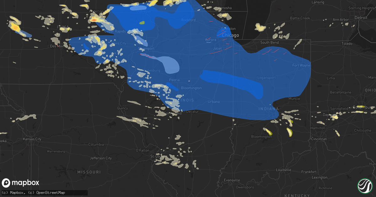
July 15 map
$229
one time, instant access
Download today. No call, no setup
Keep the $229
Bought the map and want the full workflow? Apply the entire $229 to a subscription within 7 days. None of it is wasted.
Every map, not just this one
This buys you this map. Subscription and you get every map we run, in the markets you choose from a few cities to whole states to nationwide. Plus real-time alerts the moment a storm fires.
Contact data
Name, contact info, occupancy, even credit band for addresses in the footprint. You go from where it hit to who to call.
Become the source they trust
Unlimited branding weather history reports on demand. You already have the documented answer ready for the property owner, and you are the one who showed up with it.
Property data and RoofTrace estimates
Pull up any address you have got, its value and the exact code rules for that jurisdiction, straight from One Click Code. Then RoofTrace estimates the squares, pitch, and roof value, priced the way you price.
Storm reports in Illinois
Illinois
| Date | Description |
|---|---|
| 07/15/20246:56 PM CDT | A local report indicates 84 MPH wind near 3 N Stockton |
| 07/15/20246:45 PM CDT | Large tree branches down... Garden corn flattened. Delayed report. |
| 07/15/20246:44 PM CDT | Estimated winds of 60 mph at the leading edge of the line... With low visibility. |
| 07/15/20246:30 PM CDT | Estimated 80 mph winds with damage to well build slide at this location. |
| 07/15/202410:13 AM CDT | Delayed report of a 13 inch tree branch down on the corner of crescent and hemlock in champaign. |
| 07/15/20243:39 AM CDT | Several tree branches were blown down... Including one that fell onto a house. |
| 07/14/202410:45 PM CDT | Report from mping: 3-inch tree limbs broken; power poles broken. |
| 07/14/202410:44 PM CDT | Report from mping: 1-inch tree limbs broken; shingles blown off. |
| 07/14/202410:43 PM CDT | Corrects previous tstm wnd dmg report from 2 se channahon. Portions of i-55 shut down between channahon and lorenzo due to debris and power lines down. |
| 07/14/202410:43 PM CDT | Portions of i-55 shut down between channahon and lorenzo due to debris and power lines down. |
| 07/14/202410:42 PM CDT | Numerous reports of power lines and trees down in vermilion county. |
| 07/14/202410:36 PM CDT | Report from mping: 3-inch tree limbs broken; power poles broken. |
| 07/14/202410:35 PM CDT | Several tree branches down. Social media report. Time estimated from radar. |
| 07/14/202410:30 PM CDT | Several large tree branches were blown down. |
| 07/14/202410:25 PM CDT | Tree branches broken. Part of fence blown down from high winds. |
| 07/14/202410:25 PM CDT | Corn flattened along douglas-coles county line. Social media report. Time estimated. |
| 07/14/202410:22 PM CDT | Report from mping: 1-inch tree limbs broken; shingles blown off. |
| 07/14/202410:20 PM CDT | Large tree branches down. Social media report. Time estimated from radar. |
| 07/14/202410:15 PM CDT | Numerous large trees and tree branches were blown down... Including some on cars and roofs. |
| 07/14/202410:15 PM CDT | Large tree branch down. Social media report. Time estimated from radar. |
| 07/14/202410:15 PM CDT | Corrects previous tstm wnd dmg report from 2 nw savoy. Report from mping: 3-inch tree limbs broken; power poles broken. |
| 07/14/202410:13 PM CDT | Delayed report. Considerable tree damage... Including an estimated 12 to 24 inch diameter tree limb down onto a house producing structural damage. |
| 07/14/202410:13 PM CDT | Corrects previous tstm wnd dmg report from 2 ssw champaign. Delayed report of a 13 inch tree branch down on the corner of crescent and hemlock in champaign. |
| 07/14/202410:12 PM CDT | Report from mping: 3-inch tree limbs broken; power poles broken. |
| 07/14/202410:12 PM CDT | Delayed report. Tree limb down blocking brownfield road. |
| 07/14/202410:11 PM CDT | Multiple reports of tree damage in the blue island and midlothian areas. Relayed via mping. |
| 07/14/202410:08 PM CDT | A local report indicates 60 MPH wind near 3 S Bement |
| 07/14/202410:06 PM CDT | Report from mping: 1-inch tree limbs broken; shingles blown off. |
| 07/14/202410:05 PM CDT | Tree branches up to 8 inch diameter blown down from near frederick to sheldon's grove area and along il route 100. |
| 07/14/202410:04 PM CDT | Large tree limbs down at hemlock and crescent drive. Limbs down on harrington dr. Power outage on mattis ave and sangamon dr. Photos on social media. |
| 07/14/202410:04 PM CDT | Peak wind gust 62 mph from the northwest at champaign airport. |
| 07/14/202410:04 PM CDT | A large tree was blown onto a garage on west church street in champaign. |
| 07/14/20249:59 PM CDT | Report from mping: 1-inch tree limbs broken; shingles blown off. |
| 07/14/20249:59 PM CDT | Delayed report. Several tree limbs blown down. |
| 07/14/20249:58 PM CDT | Tree branches blown down. |
| 07/14/20249:56 PM CDT | Measured at personal weather station kilchica996. |
| 07/14/20249:54 PM CDT | A local report indicates 70 MPH wind near 1 N Douglas - Chicago |
| 07/14/20249:52 PM CDT | Trained spotter reports damage to shingles and trees on the north side of lansing. Multiple large branches broken and a pine tree uprooted. Time estimated by radar. |
| 07/14/20249:52 PM CDT | Tree damage in logan square community area of chicago. Relayed via mping. Time estimated by radar. |
| 07/14/20249:51 PM CDT | Numerous trees down across town. Roofing material removed from residence. Power pole snapped. Time estimated by radar. |
| 07/14/20249:51 PM CDT | Large tree branch downed onto car in the west loop area of chicago. Time estimated by radar. |
| 07/14/20249:50 PM CDT | Social media images posted of tree damage in ukranian village along superior between western and rockwell including a large tree uprooted that landed on the hood of a c |
| 07/14/20249:50 PM CDT | Two large trees down on riverbend blvd. Delayed report from 7/15. |
| 07/14/20249:48 PM CDT | Large tree reported on a house. |
| 07/14/20249:47 PM CDT | Measured at personal weather station kilcrete19. |
| 07/14/20249:46 PM CDT | Public report of uprooted tree west of grant park. Relayed via mping. Time estimated by radar. |
| 07/14/20249:45 PM CDT | Report of roof blown off a home in crestwood... Il. Time estimated via radar. |
| 07/14/20249:45 PM CDT | Large tree branches blown down near a house. Photo on social media. |
| 07/14/20249:45 PM CDT | Report from mping: 3-inch tree limbs broken; power poles broken. |
| 07/14/20249:44 PM CDT | Public report of broken 5-inch tree branch. Time estimated by radar. |
| 07/14/20249:44 PM CDT | Corrects previous report from 1 nw norridge. Public report of broken 5-inch tree branch. Time estimated by radar. |
| 07/14/20249:44 PM CDT | 2-4 inch tree limbs reported down. |
| 07/14/20249:43 PM CDT | Numerous tree limbs downed... Varying from 8-12 inch diameter. Minor house damage to fascia... Roof... And chimney. |
| 07/14/20249:42 PM CDT | Public report of tree branches downed west of country club hills. Strongest winds lasted approximately 45 seconds. Time estimated by radar. |
| 07/14/20249:42 PM CDT | A local report indicates 75 MPH wind near O'Hare Airport |
| 07/14/20249:42 PM CDT | Trees limbs reported down across town. Time estimated by radar. |
| 07/14/20249:42 PM CDT | Report of tree tops broken off 12 inch diameter. |
| 07/14/20249:42 PM CDT | Minor tree damage reported around the big oaks neighborhood. Time estimated by radar. |
| 07/14/20249:42 PM CDT | Local media sent in a user photo of a large tree knocked over in their yard. No specific location shared other than in oak park. Time estimated by radar. |
| 07/14/20249:41 PM CDT | 30 inch tree down. |
| 07/14/20249:41 PM CDT | Public report of large tree branch broken east of manteno. Relayed via mping. Time estimated by radar. |
| 07/14/20249:40 PM CDT | Tree down blocking rt. 54. Time estimated. |
| 07/14/20249:40 PM CDT | Damage to outbuilding/garage at 107 n west street with boards and rocks blown down street. |
| 07/14/20249:38 PM CDT | A local report indicates 80 MPH wind near Piper City |
| 07/14/20249:38 PM CDT | Public report of tree branch downed near orland hills. Relayed via mping. Time estimated by radar. |
| 07/14/20249:38 PM CDT | Powerlines down east of waynesville along jim town road. |
| 07/14/20249:38 PM CDT | Trees reported down through town. |
| 07/14/20249:36 PM CDT | Measured at an ambient personal weather station. |
| 07/14/20249:36 PM CDT | Public report of an 8-inch diameter tree limb broken. Time estimated by radar. |
| 07/14/20249:36 PM CDT | Bellwood em reports partial garage collapse on 25th street in broadview. |
| 07/14/20249:36 PM CDT | Report of partial garage collapse. |
| 07/14/20249:35 PM CDT | Corrects previous tstm wnd dmg report from piper city. Trees and limbs reported down across town. |
| 07/14/20249:35 PM CDT | Public report of large tree branch broken east of mokena. Relayed via mping. Time estimated by radar. |
| 07/14/20249:35 PM CDT | Multiple reports of tree damage near elk grove village. Relayed via mping. |
| 07/14/20249:34 PM CDT | Measured at a personal weather station. |
| 07/14/20249:33 PM CDT | Report from mping: 3-inch tree limbs broken; power poles broken. |
| 07/14/20249:31 PM CDT | 2-foot diameter tree snapped near state street and new avenue north of lockport. Tree landed on power lines and a house. Time estimated by radar. |
| 07/14/20249:30 PM CDT | Hanover township em reports widespread damage to power lines and trees in bartlett and streamwood. Time estimated by radar. |
| 07/14/20249:29 PM CDT | A couple structures damaged and multiple trees downed in ranch oaks neighborhood. |
| 07/14/20249:28 PM CDT | Multiple reports of trees down on homes on s locust street. |
| 07/14/20249:28 PM CDT | Power lines down in town. |
| 07/14/20249:28 PM CDT | Portions of roof removed from storage facility near baker and eastern roads. Time estimated by radar. |
| 07/14/20249:27 PM CDT | Public report of multiple tree branches broken and power lines downed near ardmore avenue and kenilworth avenue in villa park. Time estimated by radar. |
| 07/14/20249:27 PM CDT | Multiple trees uprooted in area. |
| 07/14/20249:25 PM CDT | Public report of possible tree damage in downers grove. Relayed via mping. Time estimated by radar. |
| 07/14/20249:25 PM CDT | Large branch downed near arlington drive and kingston drive in romeoville. Time estimated by radar. |
| 07/14/20249:25 PM CDT | A local report indicates 62 MPH wind near Le Roy |
| 07/14/20249:25 PM CDT | Public report of large branch broken in ingalls park. Time estimated by radar. Relayed via mping. |
| 07/14/20249:24 PM CDT | Public report of uprooted tree near boughton road and schmidt road in bolingbrook. Time estimated by radar. Relayed by mping. |
| 07/14/20249:24 PM CDT | Several 20 inch diameter trees down with power lines also down. |
| 07/14/20249:24 PM CDT | Joliet police report numerous power lines and tree branches downed across joliet. Time estimated by radar. |
| 07/14/20249:21 PM CDT | Multiple trees damaged and power poles snapped. Time estimated by radar. |
| 07/14/20249:18 PM CDT | Central il airport in bloominton measured wind gust of 72 mph out of the wnw. |
| 07/14/20249:17 PM CDT | Report from mping: 1-inch tree limbs broken; shingles blown off. |
| 07/14/20249:17 PM CDT | Public report of possible tree damage near gaylord road and frontier lane in the crest hill and joliet areas. Time estimated from radar. Relayed via mping. |
| 07/14/20249:17 PM CDT | Public report of possible tree damage near bartlett. Relayed via mping. |
| 07/14/20249:16 PM CDT | High tension line down in dresden lock area. |
| 07/14/20249:16 PM CDT | Possible tree damage in north naperville. Relayed via mping. Time estimated by radar. |
| 07/14/20249:16 PM CDT | Measured at personal weather station kilnaper225. |
| 07/14/20249:15 PM CDT | Public report of possible tree damage near algonquin. Relayed via mping. Time estimated by radar. |
| 07/14/20249:15 PM CDT | Public report of large tree branch downed west of channahon. Relayed via mping. Time estimated by radar. |
| 07/14/20249:15 PM CDT | Possible tree damage southwest of minooka. Time estimated by radar. Relayed via mping. |
| 07/14/20249:15 PM CDT | Large tree downed into power lines... Road blocked at talbot and rt56. Time estimated by radar. |
| 07/14/20249:13 PM CDT | 52 kt gust measured by kdpa asos. |
| 07/14/20249:13 PM CDT | Report from mping: 3-inch tree limbs broken; power poles broken. |
| 07/14/20249:12 PM CDT | Large tree limbs blown down on morris street half mile north of miller park. |
| 07/14/20249:11 PM CDT | Corrects previous tstm wnd gst report from cuba. Report from mping: 3-inch tree limbs broken; power poles broken. |
| 07/14/20249:11 PM CDT | Report from mping: 3-inch tree limbs broken; power poles broken. |
| 07/14/20249:11 PM CDT | Public report of damage to shingles... Trees... And fences near arbeiter road and wildspring parkway in west joliet. Time estimated by radar. |
| 07/14/20249:08 PM CDT | Multiple reports received of possible tree damage just north of morris near i-55. Relayed via mping. Time estimated by radar. |
| 07/14/20249:07 PM CDT | Public report of possible tree damage in streator. Relayed via mping. Time estimated by radar. |
| 07/14/20249:07 PM CDT | Measured at an ambient personal weather station. |
| 07/14/20249:04 PM CDT | Roof damage to multiple homes near southbury boulevard and lakeshore drive in oswego. Time estimated by radar. |
| 07/14/20249:04 PM CDT | 5-6 inch trees down. |
| 07/14/20249:02 PM CDT | Report from mping: 3-inch tree limbs broken; power poles broken. |
| 07/14/20249:02 PM CDT | Public report of possible tree damage west of north aurora. Time estimated by radar. Relayed via mping. |
| 07/14/20249:02 PM CDT | Public report of possible tree damage on the southwest side of oswego. Relayed via mping. Time estimated by radar. |
| 07/14/20249:01 PM CDT | Trees and power lines down in area with minor house and vehicle damage. Time estimated by radar. |
| 07/14/20248:59 PM CDT | 18 inch tree limbs blown down at 307 west pine street. |
| 07/14/20248:59 PM CDT | Measured at an ambient personal weather station. |
| 07/14/20248:58 PM CDT | Public report of large branch downed west of st charles. Time estimated by radar. Relayed via mping. |
| 07/14/20248:57 PM CDT | Asos measured 61 kt gust at aurora municipal airport |
| 07/14/20248:56 PM CDT | Report from mping: 3-inch tree limbs broken; power poles broken. Estimated time by radar. |
| 07/14/20248:55 PM CDT | Mulitple highway signs blown down along i-39. Numerous trees damaged from high winds. |
| 07/14/20248:55 PM CDT | Public report of 64 mph wind gust north of lily lake. Report also indicates multiple large branches downed near il-47 and empire road. Additional public reports of tree |
| 07/14/20248:53 PM CDT | Public report of tree snapped in sugar grove. Time estimated by radar. |
| 07/14/20248:52 PM CDT | Estimated wind gust 75 mph. |
| 07/14/20248:51 PM CDT | Public report of possible tree damage southeast of big rock. Time estimated by radar. Relayed via mping. |
| 07/14/20248:50 PM CDT | Trees blown down blocking traffic between goofy ridge and bishop. |
| 07/14/20248:50 PM CDT | Debris falling form sky at wash blacktop and robinson. |
| 07/14/20248:50 PM CDT | Tree damage on kentuckian road from high wind gusts. |
| 07/14/20248:50 PM CDT | Corrects previous tstm wnd gst report from 3 e toluca. Mesonet station dvi03891 toluca. |
| 07/14/20248:50 PM CDT | A local report indicates 60 MPH wind near 1 SW Varna |
| 07/14/20248:48 PM CDT | Delayed report. Large tree branch down onto power lines. |
| 07/14/20248:46 PM CDT | Measured 61 mph wind gust. |
| 07/14/20248:46 PM CDT | As gust front moved through. |
| 07/14/20248:46 PM CDT | Multiple very large trees blown down on jackson street from high school to mcclallen park. |
| 07/14/20248:45 PM CDT | Time estimated from radar. |
| 07/14/20248:45 PM CDT | A local report indicates 70 MPH wind near Henry |
| 07/14/20248:45 PM CDT | Delayed report. 6 to 7 inch diameter tree limbs broken. |
| 07/14/20248:45 PM CDT | Large tree branches were blown down near south market street and logan street. |
| 07/14/20248:45 PM CDT | Several trees were blown down and a power pole was snapped in half near low point-washburn elementary. |
| 07/14/20248:45 PM CDT | Large tree blown down on a car. Delayed report. |
| 07/14/20248:45 PM CDT | Tree limbs down and fence destroyed. Social media report. Time estimated from radar. |
| 07/14/20248:45 PM CDT | Some shingles and siding blown off neigbhors house. Funnel cloud sighted. |
| 07/14/20248:43 PM CDT | Several trees blown down near high school and from jackson street north to tennessee street. |
| 07/14/20248:41 PM CDT | Tree blocking illinois 18 just east of the illinois river bridge. Time estimated by using radar. |
| 07/14/20248:41 PM CDT | A local report indicates 78 MPH wind near 1 N South Pekin |
| 07/14/20248:40 PM CDT | Power flashes from high winds. |
| 07/14/20248:40 PM CDT | Four to 6 inch tree limbs blown down with power hits on north grand blvd. |
| 07/14/20248:40 PM CDT | Weather station at the henry marina measured an 80 mph wind gust. |
| 07/14/20248:39 PM CDT | Numerous trees were blown down... Including one that fell onto a garage. |
| 07/14/20248:39 PM CDT | Several trees were blown down... Including one that fell onto a house. |
| 07/14/20248:39 PM CDT | Numerous large tree branches were blown down. |
| 07/14/20248:39 PM CDT | 5 inch trees snapped off along il 18 east of the il river. Downed power lines with trees blown down. Minor flooding. |
| 07/14/20248:38 PM CDT | 8 inch tree limbs blowns donw on a house between pekin and groveland at 4200 block sheridan. |
| 07/14/20248:38 PM CDT | Report from mping: 3-inch tree limbs broken; power poles broken. |
| 07/14/20248:37 PM CDT | Estimated wind gust 60 to 65 mph in north pekin. |
| 07/14/20248:37 PM CDT | Tree blown down on jefferson street. |
| 07/14/20248:36 PM CDT | Delayed report. Large oak tree blown down onto fairview avenue blocking the road. |
| 07/14/20248:36 PM CDT | Several large tree branches were blown down in riverfront park. |
| 07/14/20248:36 PM CDT | Nws damage survey determined a tornado developed se of east peoria and progressed through morton toward makinaw before dissipating. Tornado was on the ground for 12.39 |
| 07/14/20248:35 PM CDT | Large tree down across spoon river overflow bridge. Time estimated from radar. |
| 07/14/20248:35 PM CDT | Tree blocking southport road near fire station. Social media report. Time estimated. |
| 07/14/20248:35 PM CDT | Delayed report. Five trees blown down in hopewell including one onto a house. Swop report. |
| 07/14/20248:35 PM CDT | Public report of possible tree damage near earlville. Relayed via mping. Time estimated by radar. |
| 07/14/20248:35 PM CDT | Report from mping: 1-inch tree limbs broken; shingles blown off. Time estimated by radar. |
| 07/14/20248:35 PM CDT | Report from mping: trees uprooted or snapped; roof blown off. Time estimated from radar. |
| 07/14/20248:34 PM CDT | Possible tree damage northeast of sycamore. Relayed via mping. Time estimated by radar. |
| 07/14/20248:33 PM CDT | Corrects previous tstm wnd dmg report from 1 e chillicothe. Trees blown down and blocking route 26 near woodford and marshall county line. |
| 07/14/20248:33 PM CDT | Trees blown down and blocking routhe 29 near woodford and marshall county line. |
| 07/14/20248:32 PM CDT | A local report indicates 60 MPH wind near 3 N Sycamore |
| 07/14/20248:32 PM CDT | Delayed report. Tree blown onto house. |
| 07/14/20248:31 PM CDT | Lewistown emergency manager estimated 60 mph wind gust. |
| 07/14/20248:30 PM CDT | Wind gusting 60 to 70 mph from lewistown esda. |
| 07/14/20248:30 PM CDT | Estimated wind gust 60 mph. |
| 07/14/20248:30 PM CDT | Tree and power line down across us-136. |
| 07/14/20248:28 PM CDT | A local report indicates 58 MPH wind near 2 NW Sycamore |
| 07/14/20248:28 PM CDT | Report from mping: 1-inch tree limbs broken; shingles blown off. |
| 07/14/20248:27 PM CDT | Report from mping: 1-inch tree limbs broken; shingles blown off. |
| 07/14/20248:25 PM CDT | Measured wind gust 105 mph. Half of corn crib destroyed. |
| 07/14/20248:25 PM CDT | Significant damage to siding on house on crimson road in dunlap. Weather station measured wind gust 111 mph. |
| 07/14/20248:22 PM CDT | Estimated 65 mph wind gust with 4-6 inch tree limbs blown down and power outages. |
| 07/14/20248:22 PM CDT | A local report indicates 58 MPH wind near Trivoli |
| 07/14/20248:22 PM CDT | Report from mping: 1-inch tree limbs broken; shingles blown off. |
| 07/14/20248:20 PM CDT | Public report of large branch broken near lee. Time estimated by radar. Relayed via mping. |
| 07/14/20248:16 PM CDT | Winnebago em reports large tree branches downed along mulford road southwest of cherry valley. Time estimated by radar. |
| 07/14/20248:15 PM CDT | Small outbuilding destroyed. Social media report. |
| 07/14/20248:15 PM CDT | A local report indicates 71 MPH wind near Elmwood |
| 07/14/20248:13 PM CDT | Delayed report. Trees and power poles blown down. |
| 07/14/20248:12 PM CDT | A local report indicates 64 MPH wind near Rockford Airport |
| 07/14/20248:12 PM CDT | Winnebago em reports trees uprooted near us-20 and main street. Time estimated by radar. |
| 07/14/20248:11 PM CDT | Il-2. Closed due to numerous large branches downed onto roadway. Time estimated by radar. |
| 07/14/20248:09 PM CDT | Trees uprooted around apartments near sandy hollow road and hampton ridge drive in rockford... Il. Time estimated by radar. |
| 07/14/20248:06 PM CDT | Public report of possible tree damage near roscoe. Relayed via mping. Time estimated by radar. |
| 07/14/20248:05 PM CDT | Trees and power lines downed. |
| 07/14/20248:05 PM CDT | Reports of numerous trees downed. |
| 07/14/20248:05 PM CDT | Report from mping: 3-inch tree limbs broken; power poles broken. |
| 07/14/20248:05 PM CDT | Trees downed on meridian road. |
| 07/14/20248:02 PM CDT | The city of kewanee experienced significant winds throughout a large portion of the city... With a concentrated area of convergent damage consistent with a high end ef1 |
| 07/14/20248:01 PM CDT | Trees and power lines down. |
| 07/14/20248:00 PM CDT | Widespread tree damage in galva. 4 to 5 powerlines down. Us 34 blocked due to tree limbs on road. 3 homes have tree limbs on them... And one has a broken window and roo |
| 07/14/20248:00 PM CDT | Public report of 101 mph gust west of davis junction measured on anemometer. Report also indicates widespread tree damage vicinity. |
| 07/14/20248:00 PM CDT | A partial roof collapse from a house in kewanee... Illinois. Possible tornado damage. Information came from social media. Time estimated by radar. |
| 07/14/20248:00 PM CDT | A local report indicates 60 MPH wind near 1 W Dallas City |
| 07/14/20248:00 PM CDT | Widespread tree damage throughout galva. 4-5 power lines down... Plus several electrical services pulled from houses. Us 34 is still blocked due to power lines too low |
| 07/14/20247:59 PM CDT | Trees down across prairie road near fitzgerald road. Time estimated by radar. |
| 07/14/20247:58 PM CDT | Corn belt energy reported extensive tree and power line damage in the oak run area. Time estimated from radar. |
| 07/14/20247:58 PM CDT | Delayed report. Tree down across moline rd. |
| 07/14/20247:55 PM CDT | Extensive tree and power line damage across the southern half of galesburg. Time estimated from radar. |
| 07/14/20247:55 PM CDT | Lots of damage in town... Estimated winds between 80-100 mph. |
| 07/14/20247:47 PM CDT | Public report of quarter size hail in beach park. Relayed via mping. Time estimated by radar. |
| 07/14/20247:47 PM CDT | Multiple public reports of possible tree damage southeast of durand. Relayed via mping. Time estimated by radar. |
| 07/14/20247:46 PM CDT | Photo shared on social media of a power pole down near the prarie view golf course on german church road. Time estimated by radar. |
| 07/14/20247:42 PM CDT | Power pole down on highway 94. |
| 07/14/20247:40 PM CDT | Large branches downed by the winds... Along with a car port that was blown into the side of a house. |
| 07/14/20247:37 PM CDT | Delayed report. Report from mping: 3-inch tree limbs broken; power poles broken. |
| 07/14/20247:35 PM CDT | Time and location estimated by radar and phone call received of a possible tornado... With a second possible as well. Damage is unknown at this time. |
| 07/14/20247:34 PM CDT | Delayed report. Report from mping: 3-inch tree limbs broken; power poles broken. |
| 07/14/20247:33 PM CDT | Multiple downed trees. Time estimated using radar. |
| 07/14/20247:32 PM CDT | Large section of tree downed on 37th avenue and archer. |
| 07/14/20247:32 PM CDT | In neighborhood... Large tree sections in yard from a tree at least 25 feet across the street. Several large pieces of roofing materials in yard. Home with a tree throu |
| 07/14/20247:30 PM CDT | Damage to a farm in swedona. Noted that two barns were lost and 2 grain bins. Possible tornado. |
| 07/14/20247:30 PM CDT | Social media image received of a large tree that was snapped... With multiple large branches downed by the winds. |
| 07/14/20247:30 PM CDT | Asos. |
| 07/14/20247:30 PM CDT | Delayed report of several large trees that were either split by the wind or had large branches downed. Also... Seems like a large metal outbuilding was destroyed by the |
| 07/14/20247:30 PM CDT | Public report of possible tree damage in forreston. Time estimated by radar. Relayed via mping. |
| 07/14/20247:28 PM CDT | A local report indicates 60 MPH wind near 1 SSW Rock Island |
| 07/14/20247:26 PM CDT | Several power outages... Tree limbs down... And gutters blown off houses. Time estimated from radar. |
| 07/14/20247:25 PM CDT | Tree reported down. Time estimated from radar data. |
| 07/14/20247:25 PM CDT | A local report indicates 93 MPH wind near Lena |
| 07/14/20247:20 PM CDT | Social media report of a large tree and powerlines downed by the thunderstorm winds. |
| 07/14/20247:18 PM CDT | Received a photo of a large section of a tree snapped by the wind... Which fell on a vehicle. |
| 07/14/20247:17 PM CDT | This tornado track was in close proximity to the towns of taylor ridge... Reynolds... Preemption... Sherrard... Swedona... And andover. Two large grain elevator bins we |
| 07/14/20247:05 PM CDT | Large tree reported down on power line. |
| 07/14/20247:05 PM CDT | Photo received on social media of a large tree limb that was downed by the winds... Nearly falling on a garage in town. |
| 07/14/20247:00 PM CDT | Tree uprooted by the thunderstorm winds. |
| 07/14/20247:00 PM CDT | Several tree branches down of various diameter down once that is 1 foot and a half. |
All States Impacted by Hail Map on July 15, 2024
Cities Impacted by Hail Map on July 15, 2024
- Murdock, MN
- Montevideo, MN
- Maynard, MN
- Kerkhoven, MN
- Springfield, MN
- Raymond, MN
- Clara City, MN
- Sleepy Eye, MN
- Comfrey, MN
- Morgan, MN
- Canistota, SD
- Prinsburg, MN
- Willmar, MN
- Lake Lillian, MN
- Renville, MN
- Blomkest, MN
- Montrose, SD
- Saint James, MN
- Danube, MN
- Olivia, MN
- Bird Island, MN
- Hector, MN
- Fairfax, MN
- Lewisville, MN
- Truman, MN
- Winnebago, MN
- Westfield, NY
- Ripley, NY
- Portland, NY
- Fredonia, NY
- Brocton, NY
- Mantee, MS
- Woodland, MS
- Buffalo, NY
- Grand Island, NY
- Tonawanda, NY
- East Amherst, NY
- Clarence, NY
- Clarence Center, NY
- Gilbertown, AL
- Pheba, MS
- Cedarbluff, MS
- Eupora, MS
- Gainesville, FL
- Ackerman, MS
- Society Hill, SC
- Cheraw, SC
- West Warren, MA
- Ware, MA
- Palmer, MA
- Warren, MA
- Silver Creek, NY
- Jesup, GA
- Greenfield, IN
- Angola, NY
- Eden, NY
- Hamburg, NY
- Arlington, IN
- Carthage, IN
- Columbus, MS
- Starkville, MS
- Arcanum, OH
- Citra, FL
- Buena Vista, GA
- Hazlehurst, GA
- New Palestine, IN
- Fountaintown, IN
- Lake City, FL
- Belchertown, MA
- Granby, MA
- Ludlow, MA
- Gowanda, NY
- Collins, NY
- Morristown, IN
- West Falls, NY
- East Aurora, NY
- Orchard Park, NY
- Boston, NY
- Colden, NY
- Riceboro, GA
- Cassadaga, NY
- Somerville, OH
- Hamilton, OH
- Rushville, IN
- Louisville, MS
- Elma, NY
- Alden, NY
- Lancaster, NY
- Depew, NY
- Reynolds, GA
- Fort Valley, GA
- Darien, GA
- Townsend, GA
- Ocala, FL
- Anthony, FL
- South Wales, NY
- Saint Matthews, SC
- Middletown, OH
- Brunswick, GA
- Dayton, OH
- Napoleonville, LA
- Trenton, OH
- Attica, NY
- Warsaw, NY
- Dale, NY
- Wyoming, NY
- East Bethany, NY
- Reform, AL
- Butler, GA
- Connersville, IN
- Glenwood, IN
- Port Wentworth, GA
- Pooler, GA
- Savannah, GA
- Gwynneville, IN
- Bloomingdale, GA
- Springville, NY
- Valdosta, GA
- Cattaraugus, NY
- Xenia, OH
- Alpha, OH
- Yellow Springs, OH
- Holland, NY
- Green Pond, SC
- Marshville, NC
- Mount Kisco, NY
- Bedford Hills, NY
- Katonah, NY
- Pavilion, NY
- Byron, GA
- Warner Robins, GA
- Centerville, GA
- Clewiston, FL
- Alexander, NY
- Franklin, OH
- Fairborn, OH
- Bellbrook, OH
- Linwood, NY
- Le Roy, NY
- Caledonia, NY
- Spring Valley, OH
- Cedarville, OH
- Springfield, OH
- South Charleston, OH
- Bedford, NY
- Eaton, OH
- Cuthbert, GA
- Kiron, IA
- Ida Grove, IA
- Bowman, SC
- Cameron, SC
- Schleswig, IA
- South Solon, OH
- Geneseo, NY
- Avon, NY
- Rush, NY
- Honeoye Falls, NY
- Lima, NY
- Bloomfield, NY
- Canandaigua, NY
- West Bloomfield, NY
- Ionia, NY
- Victor, NY
- Saint Augustine, FL
- Livonia, NY
- Lakeville, NY
- Americus, GA
- Odebolt, IA
- Deloit, IA
- Denison, IA
- Kingman, AZ
- New Iberia, LA
- Loreauville, LA
- Dows, IA
- Ridgeland, SC
- Pineland, SC
- Knightstown, IN
- Shelbyville, IN
- Yemassee, SC
- Early Branch, SC
- Brookville, OH
- Lewisburg, OH
- West Alexandria, OH
- Tillman, SC
- Wilberforce, OH
- Farmington, NY
- Shortsville, NY
- Palmyra, NY
- London, OH
- Mount Sterling, OH
- Lehigh, IA
- Vail, IA
- Westside, IA
- Traer, IA
- Stamford, CT
- Coosawhatchie, SC
- Loris, SC
- Lewisville, IN
- Falmouth, IN
- Reinbeck, IA
- Buckingham, IA
- Franklin, GA
- Saint Martinville, LA
- Spiceland, IN
- Shirley, IN
- Charlottesville, IN
- Jeffersonville, OH
- Macedon, NY
- Manchester, NY
- Clifton Springs, NY
- Fort Washakie, WY
- Lander, WY
- Arapahoe, WY
- Riverton, WY
- Hudson, WY
- Darien, CT
- Grove City, OH
- Orient, OH
- Plains, GA
- Lumpkin, GA
- New Castle, IN
- Alden, IA
- Arcadia, IA
- Nevada, IA
- Miamisburg, OH
- Atlanta, GA
- Decatur, GA
- Stratford, IA
- Manning, IA
- Manilla, IA
- La Porte City, IA
- Dysart, IA
- Arthur, IA
- Lagrange, GA
- Lumberton, NC
- Aplington, IA
- Parkersburg, IA
- Westminster, CO
- Broomfield, CO
- Templeton, IA
- Clyo, GA
- Jacksonville, GA
- Milan, GA
- Roanoke, AL
- Duluth, GA
- Hemingway, SC
- Nesmith, SC
- Lake City, SC
- Breaux Bridge, LA
- Conway, SC
- Callender, IA
- Forkland, AL
- Greensboro, AL
- Gallion, AL
- Garnett, SC
- Milton, IN
- Galloway, OH
- West Jefferson, OH
- Stanley, NY
- Newark, NY
- Phelps, NY
- Geneva, NY
- Waterloo, NY
- Seneca Falls, NY
- Lyons, NY
- Clyde, NY
- Cuba, AL
- Gowrie, IA
- Somers, IA
- Pataskala, OH
- Etna, OH
- Toomsuba, MS
- New Hartford, IA
- Shell Rock, IA
- Allison, IA
- Webster City, IA
- Wall Lake, IA
- Audubon, IA
- Dedham, IA
- Breda, IA
- Carroll, IA
- Iowa Falls, IA
- Lafayette, LA
- Kingstree, SC
- Bladenboro, NC
- Duncombe, IA
- New Windsor, MD
- Westminster, MD
- Tar Heel, NC
- Straughn, IN
- Andrews, SC
- Hudson, IA
- Mount Auburn, IA
- Fort Dodge, IA
- Steamboat Rock, IA
- Stanhope, IA
- Coon Rapids, IA
- Bayard, IA
- Jeffrey City, WY
- Milroy, IN
- Trout Creek, MI
- Iron River, MI
- Dayton, IA
- Millersport, OH
- Kirkersville, OH
- Hebron, OH
- Broussard, LA
- Eldora, IA
- Finksburg, MD
- Hampstead, MD
- Flagstaff, AZ
- Clifton, AZ
- San Carlos, AZ
- Rhine, GA
- Adrian, GA
- Garrison, IA
- Vinton, IA
- Watton, MI
- Upperco, MD
- Daggett, MI
- Vulcan, MI
- White Oak, NC
- Hogansville, GA
- Jesup, IA
- Lake, MS
- Forest, MS
- Columbus, OH
- Hilliard, OH
- Savannah, NY
- Cayuga, NY
- Montezuma, NY
- Port Byron, NY
- Red Creek, NY
- Cato, NY
- Auburn, NY
- Elbridge, NY
- Weedsport, NY
- Jordan, NY
- Lawrenceville, PA
- Middlebury Center, PA
- Nelson, PA
- Ulysses, PA
- Knoxville, PA
- Westfield, PA
- Corning, NY
- Lindley, NY
- Painted Post, NY
- Addison, NY
- Osceola, PA
- Harrison Valley, PA
- Tioga, PA
- Elkland, PA
- Mansfield, PA
- Sabinsville, PA
- Wellsboro, PA
- Woodhull, NY
- Big Flats, NY
- Pine City, NY
- Horseheads, NY
- Millerton, PA
- Elmira, NY
- Columbia Cross Roads, PA
- Wellsburg, NY
- Gillett, PA
- Breesport, NY
- Pine Valley, NY
- Lowman, NY
- Erin, NY
- Waterloo, IA
- Cedar Falls, IA
- Carney, MI
- Estill, SC
- Iron Mountain, MI
- Eatonton, GA
- Lockbourne, OH
- Crystal Falls, MI
- Grundy Center, IA
- Wellsburg, IA
- Westfield, MA
- Manilla, IN
- Homer, IN
- Fairland, IN
- Prescott, AZ
- Arnaudville, LA
- Arlington, GA
- Hingham, MA
- Midland, OH
- Blanchester, OH
- Lake View, IA
- Wilson, MI
- Stephenson, MI
- Martville, NY
- Baldwinsville, NY
- Fulton, NY
- Hannibal, NY
- Memphis, NY
- Phoenix, NY
- Warners, NY
- Pennellville, NY
- Camillus, NY
- Liverpool, NY
- Cicero, NY
- Syracuse, NY
- Clay, NY
- Chemung, NY
- Spencer, NY
- Ithaca, NY
- Newfield, NY
- Van Etten, NY
- Cayuta, NY
- Brooktondale, NY
- Willseyville, NY
- Lockwood, NY
- Bark River, MI
- Pilot Mound, IA
- Yarnell, AZ
- Martinsville, IN
- Cohasset, MA
- Hull, MA
- Marenisco, MI
- Bergland, MI
- Mooresboro, NC
- Heath, OH
- Glenford, OH
- Thornville, OH
- Weymouth, MA
- East Weymouth, MA
- Aiken, SC
- Ashburn, GA
- Paton, IA
- Boxholm, IA
- Ogden, IA
- Walker, LA
- Denham Springs, LA
- Gilbertville, IA
- Owego, NY
- Barton, NY
- Waverly, NY
- Sayre, PA
- Candor, NY
- Independence, IA
- Brandon, IA
- Jersey Shore, PA
- Williamsport, PA
- Montgomery, PA
- Linden, PA
- Trout Run, PA
- Cogan Station, PA
- Montoursville, PA
- Hughesville, PA
- Muncy, PA
- Forksville, PA
- New Albany, PA
- Hillsgrove, PA
- Muncy Valley, PA
- Shunk, PA
- Eagles Mere, PA
- Dushore, PA
- Canton, PA
- Laporte, PA
- Unityville, PA
- Lairdsville, PA
- Rowley, IA
- Walker, IA
- Urbana, IA
- Center Point, IA
- Morgantown, IN
- Nashville, IN
- Ewen, MI
- Canal Winchester, OH
- Groveport, OH
- Ashville, OH
- Monticello, GA
- Colo, IA
- State Center, IA
- Towanda, PA
- Troy, PA
- Ulster, PA
- Dana, IA
- Boone, IA
- Williams, IA
- Harcourt, IA
- Carroll, OH
- Lancaster, OH
- Baltimore, OH
- Pickerington, OH
- Hillsboro, GA
- Thurston, OH
- Pleasantville, OH
- Indianapolis, IN
- Clarksville, OH
- Brewerton, NY
- Central Square, NY
- Constantia, NY
- West Monroe, NY
- Lisle, NY
- Newark Valley, NY
- Richford, NY
- Slaterville Springs, NY
- Berkshire, NY
- Dryden, NY
- Harford, NY
- Freeville, NY
- Marathon, NY
- Cortland, NY
- Homer, NY
- McGraw, NY
- Lopez, PA
- Mildred, PA
- Republic, MI
- Cleveland, NY
- Bernhards Bay, NY
- Williamstown, NY
- Tully, NY
- Truxton, NY
- Cincinnatus, NY
- Willet, NY
- Wyalusing, PA
- Laceyville, PA
- Sugar Run, PA
- Meshoppen, PA
- Tunkhannock, PA
- Mehoopany, PA
- Rome, PA
- Warren Center, PA
- Le Raysville, PA
- Little Meadows, PA
- Lynchburg, OH
- Greensburg, IN
- Ontario, NY
- Walworth, NY
- Radcliffe, IA
- Greenwood, IN
- Waldron, IN
- Palo, IA
- Appling, GA
- Aurora, IA
- Shellsburg, IA
- Hazleton, IA
- Urbandale, IA
- Windsor Heights, IA
- Des Moines, IA
- Parish, NY
- Camden, NY
- De Ruyter, NY
- McDonough, NY
- Pitcher, NY
- South Otselic, NY
- North Pitcher, NY
- Apalachin, NY
- Montrose, PA
- Springville, PA
- Strawberry Point, IA
- Lamont, IA
- Winthrop, IA
- Stanley, IA
- Oelwein, IA
- Fairbank, IA
- Dunkerton, IA
- Dundee, IA
- Fairfax, IA
- Alburnett, IA
- Van Horne, IA
- Newhall, IA
- Robins, IA
- Central City, IA
- Masonville, IA
- Toddville, IA
- Coggon, IA
- Quasqueton, IA
- Hiawatha, IA
- Cedar Rapids, IA
- Swisher, IA
- Marion, IA
- Atkins, IA
- Norway, IA
- Guttenberg, IA
- Dyersville, IA
- Worthington, IA
- Edgewood, IA
- Earlville, IA
- Hopkinton, IA
- Ely, IA
- Prairieburg, IA
- Holy Cross, IA
- Farley, IA
- Colesburg, IA
- Delhi, IA
- New Vienna, IA
- Springville, IA
- Delaware, IA
- Manchester, IA
- Luxemburg, IA
- Ryan, IA
- Monticello, IA
- Greeley, IA
- Anamosa, IA
- Nineveh, IN
- Westdale, NY
- Altmar, NY
- Redfield, NY
- Saint Paul, IN
- Flat Rock, IN
- Panora, IA
- Guthrie Center, IA
- Athens, PA
- Elizabethtown, NC
- Ames, IA
- Wysox, PA
- Milan, PA
- Zanesville, OH
- Hubbard, IA
- Willcox, AZ
- Damascus, GA
- Benton, PA
- Cuba City, WI
- Platteville, WI
- Toledo, IA
- Hillsboro, OH
- Aurora, NY
- Romulus, NY
- Ovid, NY
- Gilbert, IA
- Dike, IA
- Whiteland, IN
- Chelsea, IA
- Gladbrook, IA
- Lincoln, IA
- Elberon, IA
- Vining, IA
- Belle Plaine, IA
- Albany, GA
- Clarksville, IA
- Sherrill, IA
- Langworthy, IA
- Durango, IA
- Potosi, WI
- Martelle, IA
- Cascade, IA
- Dickeyville, WI
- Dubuque, IA
- Mount Vernon, IA
- Peosta, IA
- Epworth, IA
- Garber, IA
- North Buena Vista, IA
- Cassville, WI
- Morley, IA
- Center Junction, IA
- Zwingle, IA
- Olin, IA
- Wyoming, IA
- Mechanicsville, IA
- Onslow, IA
- Bernard, IA
- Hazel Green, WI
- Kieler, WI
- Lisbon, IA
- Solon, IA
- Alcova, WY
- Casper, WY
- Mills, WY
- Evansville, WY
- Erieville, NY
- South Plymouth, NY
- Smyrna, NY
- Georgetown, NY
- Sherburne, NY
- Plymouth, NY
- Hamilton, NY
- Earlville, NY
- Eaton, NY
- New Woodstock, NY
- Bouckville, NY
- Madison, NY
- Hubbardsville, NY
- Morrisville, NY
- Waterville, NY
- Vestal, NY
- Endicott, NY
- Harford, PA
- Kingsley, PA
- Factoryville, PA
- Hop Bottom, PA
- New Milford, PA
- Nicholson, PA
- Madrid, IA
- Kelley, IA
- Slater, IA
- Tama, IA
- Casey, IA
- Newton, GA
- Yale, IA
- Lincoln, AL
- Darlington, WI
- Belmont, WI
- Mineral Point, WI
- Granger, IA
- Woodward, IA
- Lake Park, GA
- Story City, IA
- Naples, NY
- Rushville, NY
- Chandlersville, OH
- Morrison, IA
- Keystone, IA
- Watkins, IA
- Walford, IA
- Glenrock, WY
- West Winfield, NY
- West Edmeston, NY
- Brookfield, NY
- Oriskany Falls, NY
- North Brookfield, NY
- Leonardsville, NY
- Cassville, NY
- Bridgewater, NY
- Sauquoit, NY
- North Liberty, IA
- Tiffin, IA
- Oxford, IA
- Lowville, NY
- Constableville, NY
- Richland, NY
- Lorraine, NY
- Marion, NY
- South Wayne, WI
- Argyle, WI
- Huxley, IA
- Maxwell, IA
- Johnston, IA
- Polk City, IA
- Dallas Center, IA
- Grimes, IA
- Blakely, GA
- Menlo, IA
- Cochise, AZ
- Grand Junction, IA
- Sheldahl, IA
- Clutier, IA
- New Concord, OH
- Pearce, AZ
- Clinton, WI
- Sharon, WI
- Washington, GA
- Kellogg, IA
- Hartwick, IA
- Middle Amana, IA
- Homestead, IA
- Newton, IA
- Malcom, IA
- Williamsburg, IA
- South Amana, IA
- Amana, IA
- Marengo, IA
- Gilman, IA
- Grinnell, IA
- Baxter, IA
- Laurel, IA
- Conroy, IA
- Brooklyn, IA
- Ladora, IA
- Victor, IA
- Mingo, IA
- Ira, IA
- Colfax, IA
- Deep River, IA
- Montezuma, IA
- Prairie City, IA
- Monroe, IA
- Pella, IA
- Guernsey, IA
- Otley, IA
- Lynnville, IA
- Killduff, IA
- Sully, IA
- Searsboro, IA
- Reasnor, IA
- New Sharon, IA
- Blairstown, IA
- Luzerne, IA
- Clarence, IA
- Oxford Junction, IA
- La Motte, IA
- Delmar, IA
- Lost Nation, IA
- Maquoketa, IA
- Andrew, IA
- Bellevue, IA
- Spragueville, IA
- Monmouth, IA
- Baldwin, IA
- East Dubuque, IL
- Benton, WI
- Galena, IL
- Shullsburg, WI
- Preston, IA
- Scales Mound, IL
- Lowden, IA
- Wheatland, IA
- Hanover, IL
- Charlotte, IA
- Stanwood, IA
- Savanna, IL
- Millville, PA
- Sweet Valley, PA
- Shickshinny, PA
- Harveys Lake, PA
- Old Forge, PA
- Duryea, PA
- Pittston, PA
- Dalton, PA
- Kingston, PA
- Taylor, PA
- Moosic, PA
- Hunlock Creek, PA
- Wyoming, PA
- Dallas, PA
- Falls, PA
- Noxen, PA
- Shavertown, PA
- Clarks Summit, PA
- Archbald, PA
- Fleetville, PA
- Lenoxville, PA
- Union Dale, PA
- Scranton, PA
- Jermyn, PA
- Forest City, PA
- Lake Ariel, PA
- Olyphant, PA
- Jessup, PA
- Moscow, PA
- Waymart, PA
- Carbondale, PA
- Waverly, PA
- Honesdale, PA
- Peckville, PA
- Susquehanna, PA
- Hawley, PA
- Prompton, PA
- South Gibson, PA
- Pleasant Mount, PA
- Herrick Center, PA
- Thompson, PA
- Jackson, PA
- Blanchardville, WI
- Monticello, WI
- New Glarus, WI
- Richfield Springs, NY
- Clayville, NY
- Ilion, NY
- Frankfort, NY
- Bondurant, IA
- Shelby, NC
- Lawndale, NC
- Bargersville, IN
- Sierra Vista, AZ
- Hereford, AZ
- Winterville, GA
- Saint David, AZ
- Mitchellville, IA
- Luther, IA
- Ankeny, IA
- Monroe, WI
- Mullins, SC
- Galivants Ferry, SC
- Nichols, SC
- Liscomb, IA
- Union Springs, NY
- Elliott, IA
- Red Oak, IA
- Gibson, IA
- Rose Hill, IA
- Barnes City, IA
- Leighton, IA
- North English, IA
- Webster, IA
- Oskaloosa, IA
- Delta, IA
- Keswick, IA
- Millersburg, IA
- Parnell, IA
- What Cheer, IA
- Hedrick, IA
- South English, IA
- Sigourney, IA
- Harper, IA
- Hayesville, IA
- Hills, IA
- Kalona, IA
- Iowa City, IA
- Washington, IA
- Lone Tree, IA
- Atalissa, IA
- West Branch, IA
- Nichols, IA
- Riverside, IA
- West Liberty, IA
- West Chester, IA
- Wellman, IA
- Ainsworth, IA
- Keota, IA
- Ollie, IA
- Grand Mound, IA
- Calamus, IA
- Coralville, IA
- Moscow, IA
- Wilton, IA
- Tipton, IA
- Bennett, IA
- Stockton, IL
- Miles, IA
- Apple River, IL
- Elizabeth, IL
- Gratiot, WI
- Warren, IL
- Lena, IL
- Nora, IL
- Westport, IN
- Bryant, IA
- Sabula, IA
- Jacksonville, AL
- Young, AZ
- Louisville, GA
- Garland, NC
- Franklin, IN
- Model, CO
- Runnells, IA
- Altoona, IA
- Pleasant Hill, IA
- Copenhagen, NY
- Mohawk, NY
- Herkimer, NY
- Little Falls, NY
- Jordanville, NY
- Friendsville, PA
- Brackney, PA
- Binghamton, NY
- Windsor, NY
- Kirkwood, NY
- Conklin, NY
- Johnson City, NY
- Port Crane, NY
- Harpursville, NY
- Afton, NY
- Ouaquaga, NY
- Packwood, IA
- Richland, IA
- Martinsburg, IA
- Brighton, IA
- Columbus Junction, IA
- Fruitland, IA
- Crawfordsville, IA
- De Witt, IA
- Donahue, IA
- Muscatine, IA
- Welton, IA
- Walcott, IA
- Stockton, IA
- Dixon, IA
- Durant, IA
- New Liberty, IA
- Conesville, IA
- Blue Grass, IA
- Letts, IA
- Wayland, IA
- Illinois City, IL
- Long Grove, IA
- Goose Lake, IA
- Clinton, IA
- Eldridge, IA
- Davenport, IA
- Teeds Grove, IA
- Mount Carroll, IL
- Lanark, IL
- Woodford, WI
- Shannon, IL
- Winslow, IL
- Pearl City, IL
- Browntown, WI
- Kent, IL
- Walton, NY
- Milanville, PA
- Fishs Eddy, NY
- East Branch, NY
- Equinunk, PA
- Starlight, PA
- Damascus, PA
- Preston Park, PA
- Long Eddy, NY
- Hancock, NY
- Lake Como, PA
- Beach Lake, PA
- Tyler Hill, PA
- Lakewood, PA
- Starrucca, PA
- Downsville, NY
- Narrowsburg, NY
- Hankins, NY
- Cochecton, NY
- Lake Huntington, NY
- Hortonville, NY
- Roscoe, NY
- Callicoon, NY
- Fremont Center, NY
- Youngsville, NY
- Ferndale, NY
- Ellenville, NY
- Kiamesha Lake, NY
- North Branch, NY
- Napanoch, NY
- Swan Lake, NY
- South Fallsburg, NY
- Smallwood, NY
- Liberty, NY
- Eldred, NY
- Claryville, NY
- Parksville, NY
- Monticello, NY
- Bethel, NY
- Neversink, NY
- Livingston Manor, NY
- Mongaup Valley, NY
- Loch Sheldrake, NY
- Kenoza Lake, NY
- White Sulphur Springs, NY
- Harris, NY
- White Lake, NY
- Grahamsville, NY
- Woodridge, NY
- Fallsburg, NY
- Jeffersonville, NY
- Hurleyville, NY
- Woodbourne, NY
- Delancey, NY
- Delhi, NY
- Andes, NY
- Hamden, NY
- Arkville, NY
- Bloomville, NY
- Margaretville, NY
- Bovina Center, NY
- Orangeville, IL
- Freeport, IL
- McConnell, IL
- Sidney, NY
- Unadilla, NY
- Mount Upton, NY
- Deposit, NY
- Nineveh, NY
- Bainbridge, NY
- South New Berlin, NY
- Masonville, NY
- Franklin, NY
- Wells Bridge, NY
- Oneonta, NY
- Sidney Center, NY
- Otego, NY
- Wrens, GA
- Bisbee, AZ
- Belleville, WI
- Albany, WI
- Brooklyn, WI
- Knoxville, IA
- Harrells, NC
- Patagonia, AZ
- Swan, IA
- Locke, NY
- Genoa, NY
- Reynolds, IL
- Milan, IL
- Morris, NY
- West Oneonta, NY
- Laurens, NY
- Maryland, NY
- Mediapolis, IA
- Columbus City, IA
- Grandview, IA
- Mount Pleasant, IA
- Winfield, IA
- Wapello, IA
- New Boston, IL
- Morning Sun, IA
- Olds, IA
- Sperry, IA
- Mount Union, IA
- Yarmouth, IA
- Keithsburg, IL
- Oakville, IA
- Aledo, IL
- Seaton, IL
- Joy, IL
- Andalusia, IL
- Buffalo, IA
- Taylor Ridge, IL
- Rock Island, IL
- Montpelier, IA
- Sherrard, IL
- South Kortright, NY
- Halcottsville, NY
- Roxbury, NY
- New Kingston, NY
- Fleischmanns, NY
- Hobart, NY
- Denver, NY
- Stamford, NY
- Big Indian, NY
- Pine Hill, NY
- Williams Bay, WI
- Shadyside, OH
- Jacobsburg, OH
- Jacksonville, FL
- Lake Geneva, WI
- Folkston, GA
- Fairfield, IA
- Round Lake, IL
- Grayslake, IL
- Lake Villa, IL
- Ottumwa, IA
- Agency, IA
- Batavia, IA
- Needham, IN
- Moravia, NY
- Fargo, GA
- Brodhead, WI
- Cedarville, IL
- Juda, WI
- Dakota, IL
- Evansville, WI
- Lynn Center, IL
- West Shokan, NY
- Phoenicia, NY
- Woodstock, NY
- Boiceville, NY
- West Kill, NY
- Mount Tremper, NY
- Chichester, NY
- Lanesville, NY
- Bearsville, NY
- Hunter, NY
- Lake Hill, NY
- Willow, NY
- Glenford, NY
- Prattsville, NY
- Grand Gorge, NY
- Shandaken, NY
- West Hurley, NY
- Olivebridge, NY
- Saugerties, NY
- Shokan, NY
- Jewett, NY
- Cornwallville, NY
- Oak Hill, NY
- East Durham, NY
- Round Top, NY
- Haines Falls, NY
- Medusa, NY
- Elka Park, NY
- Tannersville, NY
- Preston Hollow, NY
- East Jewett, NY
- Middleburgh, NY
- Hensonville, NY
- Windham, NY
- Acra, NY
- Ashland, NY
- Maplecrest, NY
- Durham, NY
- Gilboa, NY
- North Blenheim, NY
- Palenville, NY
- West Fulton, NY
- Fultonham, NY
- Jefferson, NY
- Chana, IL
- Oregon, IL
- Mount Morris, IL
- Baileyville, IL
- Forreston, IL
- Rock City, IL
- German Valley, IL
- Byron, IL
- Stillman Valley, IL
- Rockford, IL
- Davis, IL
- Pecatonica, IL
- Leaf River, IL
- Ridott, IL
- Winnebago, IL
- Polo, IL
- Libertyville, IL
- Wadsworth, IL
- Gurnee, IL
- Waukegan, IL
- Poulan, GA
- Libertyville, IA
- Lockridge, IA
- Eldon, IA
- Broxton, GA
- Wray, GA
- Sylvester, GA
- Berne, NY
- Purling, NY
- Surprise, NY
- Leeds, NY
- Greenville, NY
- Rensselaerville, NY
- Cairo, NY
- Earlton, NY
- Freehold, NY
- Westerlo, NY
- Catskill, NY
- South Cairo, NY
- Jakin, GA
- Norwich, OH
- Benson, AZ
- Livermore, CO
- Colquitt, GA
- Burlington, WI
- Genoa City, WI
- Orfordville, WI
- Shirland, IL
- Durand, IL
- Janesville, WI
- Rockton, IL
- Footville, WI
- Beloit, WI
- South Beloit, IL
- Chadwick, IL
- Thomson, IL
- Milledgeville, IL
- Edgerton, WI
- Cambridge, IL
- Orion, IL
- Andover, IL
- Galva, IL
- Kewanee, IL
- Bishop Hill, IL
- Danville, IA
- Oquawka, IL
- West Burlington, IA
- Burlington, IA
- Viola, IL
- New London, IA
- Cameron, IL
- Gerlaw, IL
- Biggsville, IL
- Alexis, IL
- North Henderson, IL
- New Windsor, IL
- Galesburg, IL
- Little York, IL
- Gladstone, IL
- Kirkwood, IL
- Monmouth, IL
- Ophiem, IL
- Alpha, IL
- Osco, IL
- Matherville, IL
- Oneida, IL
- Altona, IL
- Henderson, IL
- Coal Valley, IL
- Rio, IL
- Wataga, IL
- Woodhull, IL
- Geneseo, IL
- Colona, IL
- Hampton, IL
- Morrison, IL
- Camanche, IA
- Port Byron, IL
- Woosung, IL
- Rock Falls, IL
- Cordova, IL
- Bettendorf, IA
- Lyndon, IL
- East Moline, IL
- Moline, IL
- Atkinson, IL
- Carbon Cliff, IL
- Harmon, IL
- Fenton, IL
- Princeton, IA
- Rapids City, IL
- Silvis, IL
- Hillsdale, IL
- McCausland, IA
- Pleasant Valley, IA
- Dixon, IL
- Fulton, IL
- Erie, IL
- Sterling, IL
- Albany, IL
- Tampico, IL
- Low Moor, IA
- Le Claire, IA
- Ashton, IL
- Franklin Grove, IL
- Prophetstown, IL
- Glen Wild, NY
- Mountain Dale, NY
- Greenfield Park, NY
- Salem, WI
- Sumner, GA
- Sedona, AZ
- Leary, GA
- Stockport, IA
- Birmingham, IA
- Tombstone, AZ
- Zion, IL
- Doerun, GA
- Leesville, SC
- North Chicago, IL
- Wilkinson, IN
- Brimfield, IL
- La Fayette, IL
- Toulon, IL
- Princeville, IL
- Neponset, IL
- Speer, IL
- Laura, IL
- Davis Junction, IL
- Roscoe, IL
- Machesney Park, IL
- Loves Park, IL
- Afton, WI
- Cherry Valley, IL
- Belvidere, IL
- Esmond, IL
- Rochelle, IL
- Clare, IL
- Holcomb, IL
- Lindenwood, IL
- Caledonia, IL
- Malta, IL
- Monroe Center, IL
- Kirkland, IL
- Dekalb, IL
- Sycamore, IL
- Kingston, IL
- Steward, IL
- Eldena, IL
- Amboy, IL
- Milton, WI
- Poplar Grove, IL
- Carman, IL
- Stronghurst, IL
- Niota, IL
- Lomax, IL
- Dallas City, IL
- Wever, IA
- Smithshire, IL
- Media, IL
- Raritan, IL
- Berwick, IL
- Avon, IL
- Blandinsville, IL
- Abingdon, IL
- Saint Augustine, IL
- Sciota, IL
- La Harpe, IL
- Bushnell, IL
- Roseville, IL
- Good Hope, IL
- Prairie City, IL
- Dahinda, IL
- East Galesburg, IL
- Knoxville, IL
- Elmwood, IL
- Victoria, IL
- Maquon, IL
- Ellisville, IL
- Fairview, IL
- Williamsfield, IL
- London Mills, IL
- Gilson, IL
- Yates City, IL
- Wyoming, IL
- Mineral, IL
- La Moille, IL
- Deer Grove, IL
- Wyanet, IL
- Sheffield, IL
- Sublette, IL
- New Bedford, IL
- Ohio, IL
- Hooppole, IL
- Walnut, IL
- Annawan, IL
- Manlius, IL
- Compton, IL
- Paw Paw, IL
- Shabbona, IL
- Lee, IL
- West Brooklyn, IL
- Mountain Top, PA
- Klingerstown, PA
- Moorefield, WV
- Drums, PA
- Chambersburg, PA
- Riverton, WV
- Shermans Dale, PA
- Mercersburg, PA
- Halifax, PA
- Lykens, PA
- Wilburton, PA
- Shippensburg, PA
- Paw Paw, WV
- Sacramento, PA
- Sugarloaf, PA
- Newville, PA
- Greencastle, PA
- Spring Glen, PA
- Carlisle, PA
- Ashland, PA
- Augusta, WV
- Wilkes Barre, PA
- Hegins, PA
- Petersburg, WV
- Marysville, PA
- Duncannon, PA
- Shamokin, PA
- Berkeley Springs, WV
- Pitman, PA
- Slanesville, WV
- Bear Creek, PA
- Catawissa, PA
- Zion Grove, PA
- Cooks, MI
- Rapid River, MI
- Manistique, MI
- Garden, MI
- Bristol, WI
- Silver Lake, WI
- Trevor, WI
- Fort Huachuca, AZ
- Great Lakes, IL
- Kenosha, WI
- Donalsonville, GA
- Fort Atkinson, WI
- Rio Rico, AZ
- Jackson, AL
- Nogales, AZ
- Dunlap, IL
- Bradford, IL
- Edelstein, IL
- Sparland, IL
- Henry, IL
- Buda, IL
- Chillicothe, IL
- Tiskilwa, IL
- Farmington, IL
- Edwards, IL
- Putnam, IL
- Colchester, IL
- Macomb, IL
- Carthage, IL
- Table Grove, IL
- Vermont, IL
- Tennessee, IL
- Ipava, IL
- Trivoli, IL
- Adair, IL
- Hanna City, IL
- Norris, IL
- Smithfield, IL
- Marietta, IL
- Bardolph, IL
- Canton, IL
- Cuba, IL
- Lewistown, IL
- Peoria, IL
- Dover, IL
- Arlington, IL
- Van Orin, IL
- Mendota, IL
- Malden, IL
- Princeton, IL
- Waterman, IL
- Earlville, IL
- Darien, WI
- Garden Prairie, IL
- Capron, IL
- Whitewater, WI
- Avalon, WI
- Marengo, IL
- Genoa, IL
- Delavan, WI
- Cortland, IL
- Bay Springs, MS
- Payson, AZ
- Gaithersburg, MD
- Potomac, MD
- Thomson, GA
- Great Falls, VA
- Sterling, VA
- Baconton, GA
- Ty Ty, GA
- Keosauqua, IA
- Bonaparte, IA
- Hillsboro, IA
- East Troy, WI
- Atmore, AL
- Armonk, NY
- West Point, IA
- Fort Madison, IA
- Aynor, SC
- Richland, GA
- Elkhorn, WI
- Rayle, GA
- Salem, IA
- Donnellson, IA
- Saint Paul, IA
- Glasford, IL
- Mossville, IL
- Saint David, IL
- Mapleton, IL
- Havana, IL
- Astoria, IL
- Bryant, IL
- Liverpool, IL
- Eureka, IL
- Carlock, IL
- Washington, IL
- Forest City, IL
- Lowpoint, IL
- East Peoria, IL
- Deer Creek, IL
- Green Valley, IL
- Congerville, IL
- Morton, IL
- Mackinaw, IL
- Metamora, IL
- Goodfield, IL
- Peoria Heights, IL
- Minier, IL
- Kingston Mines, IL
- Creve Coeur, IL
- Manito, IL
- South Pekin, IL
- Pekin, IL
- Tremont, IL
- Delavan, IL
- Groveland, IL
- Hopedale, IL
- Topeka, IL
- Danvers, IL
- Tonica, IL
- Grand Ridge, IL
- Seneca, IL
- Newark, IL
- Mark, IL
- Ottawa, IL
- Hennepin, IL
- Granville, IL
- Spring Valley, IL
- Oglesby, IL
- Toluca, IL
- Cornell, IL
- Roanoke, IL
- Magnolia, IL
- Bureau, IL
- Ancona, IL
- Rutland, IL
- Blackstone, IL
- Bloomington, IL
- El Paso, IL
- Flanagan, IL
- Hudson, IL
- Benson, IL
- Standard, IL
- Dana, IL
- Ransom, IL
- Cedar Point, IL
- Long Point, IL
- Lacon, IL
- Varna, IL
- Lostant, IL
- Marseilles, IL
- Dalzell, IL
- Morris, IL
- Minonk, IL
- Secor, IL
- La Salle, IL
- McNabb, IL
- Leonore, IL
- Streator, IL
- Washburn, IL
- La Rose, IL
- Wenona, IL
- Peru, IL
- Utica, IL
- Leland, IL
- Cherry, IL
- Seatonville, IL
- Triumph, IL
- Sheridan, IL
- Somonauk, IL
- Troy Grove, IL
- Wedron, IL
- Depue, IL
- Ladd, IL
- Serena, IL
- Sandwich, IL
- Elburn, IL
- Saint Charles, IL
- Woodstock, IL
- Crystal Lake, IL
- Sugar Grove, IL
- Millbrook, IL
- Harvard, IL
- Gilberts, IL
- Aurora, IL
- Millington, IL
- Big Rock, IL
- Hebron, IL
- Hampshire, IL
- Batavia, IL
- Geneva, IL
- Elgin, IL
- Union, IL
- Bristol, IL
- Hinckley, IL
- Fontana, WI
- Plano, IL
- Burlington, IL
- Wasco, IL
- Maple Park, IL
- Huntley, IL
- Yorkville, IL
- Montgomery, IL
- Walworth, WI
- North Aurora, IL
- Safford, AZ
- Stevensville, MI
- Pleasant Prairie, WI
- Antioch, IL
- Mukwonago, WI
- Sonoita, AZ
- Eagle, WI
- Oswego, IL
- Baroda, MI
- Bridgman, MI
- Saint Joseph, MI
- Tifton, GA
- Bradenton, FL
- Swanton, VT
- Highgate Center, VT
- Uriah, AL
- Mchenry, IL
- Channahon, IL
- Elwood, IL
- Manhattan, IL
- Atlanta, IL
- Oakford, IL
- Hartsburg, IL
- Kilbourne, IL
- Mason City, IL
- Emden, IL
- Cantrall, IL
- Lincoln, IL
- Armington, IL
- New Holland, IL
- Elkhart, IL
- Greenview, IL
- Williamsville, IL
- Stanford, IL
- Sherman, IL
- Petersburg, IL
- Springfield, IL
- Easton, IL
- Athens, IL
- San Jose, IL
- Bath, IL
- Middletown, IL
- Buffalo, IL
- Lawndale, IL
- McLean, IL
- Dawson, IL
- Riverton, IL
- Mount Pulaski, IL
- Dewitt, IL
- Verona, IL
- Maroa, IL
- Shirley, IL
- Chestnut, IL
- Wapella, IL
- Graymont, IL
- Kenney, IL
- Farmer City, IL
- Pontiac, IL
- Lexington, IL
- Kinsman, IL
- Fairbury, IL
- Towanda, IL
- Heyworth, IL
- Arrowsmith, IL
- Latham, IL
- Odell, IL
- Le Roy, IL
- Downs, IL
- Illiopolis, IL
- Colfax, IL
- Dwight, IL
- Waynesville, IL
- Beason, IL
- Chenoa, IL
- Normal, IL
- Cooksville, IL
- Gridley, IL
- Ellsworth, IL
- Clinton, IL
- Rock Hill, SC
- North Augusta, SC
- Augusta, GA
- Benton Harbor, MI
- Custer, SD
- Sodus, MI
- Tribune, KS
- Brewton, AL
- Gibson City, IL
- Chatsworth, IL
- Bellflower, IL
- Sibley, IL
- Cullom, IL
- Gardner, IL
- Cabery, IL
- Mazon, IL
- Saunemin, IL
- Anchor, IL
- Cropsey, IL
- Saybrook, IL
- Strawn, IL
- Forrest, IL
- Emington, IL
- Niles, MI
- Edwardsburg, MI
- Island Lake, IL
- Carpentersville, IL
- Mooseheart, IL
- Cary, IL
- Dundee, IL
- Roselle, IL
- Wauconda, IL
- Arlington Heights, IL
- Fox River Grove, IL
- Rolling Meadows, IL
- Palatine, IL
- Wayne, IL
- Algonquin, IL
- Lake Zurich, IL
- Barrington, IL
- West Chicago, IL
- Schaumburg, IL
- Lake In The Hills, IL
- South Elgin, IL
- Hanover Park, IL
- Prospect Heights, IL
- Bartlett, IL
- Wheeling, IL
- Streamwood, IL
- Buffalo Grove, IL
- Wonder Lake, IL
- Hoffman Estates, IL
- Ringwood, IL
- Hermosa, SD
- Richmond, IL
- Justice, IL
- Bridgeview, IL
- Chicago, IL
- Matteson, IL
- Frankfort, IL
- Flossmoor, IL
- Country Club Hills, IL
- Homewood, IL
- Glenwood, IL
- Thornton, IL
- Lake Forest, IL
- Sheridan Lake, CO
- Cassopolis, MI
- Union, MI
- Lincolnshire, IL
- Addison, IL
- Warrenville, IL
- Niles, IL
- Northbrook, IL
- Vernon Hills, IL
- Carol Stream, IL
- Glencoe, IL
- Glenview, IL
- Highland Park, IL
- Medinah, IL
- Wood Dale, IL
- Itasca, IL
- Deerfield, IL
- Mundelein, IL
- Mount Prospect, IL
- Des Plaines, IL
- Elk Grove Village, IL
- Winnetka, IL
- Bloomingdale, IL
- Glendale Heights, IL
- Lemont, IL
- Park Ridge, IL
- Plainfield, IL
- Bellwood, IL
- Westmont, IL
- Hines, IL
- Franklin Park, IL
- Willowbrook, IL
- Oak Brook, IL
- La Grange, IL
- Hinsdale, IL
- Riverside, IL
- Skokie, IL
- Wilmette, IL
- Stone Park, IL
- Broadview, IL
- Villa Park, IL
- Lombard, IL
- Bolingbrook, IL
- Cicero, IL
- Elmwood Park, IL
- Berkeley, IL
- Kenilworth, IL
- Elmhurst, IL
- Western Springs, IL
- Glen Ellyn, IL
- Berwyn, IL
- Melrose Park, IL
- Wheaton, IL
- Hillside, IL
- Woodridge, IL
- Winfield, IL
- Schiller Park, IL
- Bensenville, IL
- Evanston, IL
- Darien, IL
- Naperville, IL
- La Grange Park, IL
- Lisle, IL
- Romeoville, IL
- Forest Park, IL
- Westchester, IL
- Maywood, IL
- Morton Grove, IL
- Lincolnwood, IL
- Harwood Heights, IL
- River Forest, IL
- Clarendon Hills, IL
- Golf, IL
- Brookfield, IL
- Downers Grove, IL
- River Grove, IL
- Lyons, IL
- Minooka, IL
- Oak Park, IL
- Buckingham, IL
- Markham, IL
- Oak Forest, IL
- Hazel Crest, IL
- Willow Springs, IL
- Braceville, IL
- Hometown, IL
- Posen, IL
- Summit Argo, IL
- Peotone, IL
- Palos Park, IL
- Piper City, IL
- Herscher, IL
- Midlothian, IL
- South Wilmington, IL
- Palos Heights, IL
- Alsip, IL
- Chicago Ridge, IL
- Wilmington, IL
- Hickory Hills, IL
- New Lenox, IL
- Shorewood, IL
- Worth, IL
- Clifton, IL
- Crestwood, IL
- Braidwood, IL
- Bonfield, IL
- Harvey, IL
- Mokena, IL
- Richton Park, IL
- Union Hill, IL
- Robbins, IL
- University Park, IL
- Burbank, IL
- Essex, IL
- Kankakee, IL
- Campus, IL
- Blue Island, IL
- Joliet, IL
- Olympia Fields, IL
- Manteno, IL
- Palos Hills, IL
- Riverdale, IL
- Evergreen Park, IL
- Reddick, IL
- Lockport, IL
- Kempton, IL
- Crest Hill, IL
- Oak Lawn, IL
- Bourbonnais, IL
- Orland Park, IL
- Monee, IL
- Coal City, IL
- Tinley Park, IL
- Homer Glen, IL
- Melvin, IL
- Thawville, IL
- Chebanse, IL
- Chicago Heights, IL
- Crescent City, IL
- Bradley, IL
- Roberts, IL
- Onarga, IL
- Grant Park, IL
- Milford, IL
- Steger, IL
- Elliott, IL
- Momence, IL
- Crete, IL
- Aroma Park, IL
- Pembroke Township, IL
- Paxton, IL
- Ashkum, IL
- Gilman, IL
- Buckley, IL
- Watseka, IL
- South Holland, IL
- Martinton, IL
- Park Forest, IL
- Beecher, IL
- Loda, IL
- Saint Anne, IL
- Foosland, IL
- Papineau, IL
- Danforth, IL
- Cissna Park, IL
- De Land, IL
- Weldon, IL
- Champaign, IL
- Argenta, IL
- Lane, IL
- Fisher, IL
- Seymour, IL
- Dewey, IL
- Monticello, IL
- Warrensburg, IL
- Thomasboro, IL
- Rantoul, IL
- Ludlow, IL
- Mansfield, IL
- White Heath, IL
- Mahomet, IL
- Cisco, IL
- Rankin, IL
- Fairburn, SD
- Granger, IN
- White Pigeon, MI
- Constantine, MI
- Jones, MI
- Vandalia, MI
- Dolton, IL
- Lowell, IN
- Whiting, IN
- Valparaiso, IN
- Hebron, IN
- Lake Station, IN
- Griffith, IN
- East Chicago, IN
- Highland, IN
- Thayer, IN
- Calumet City, IL
- Dyer, IN
- Iroquois, IL
- Demotte, IN
- Munster, IN
- Saint John, IN
- Gary, IN
- Beaverville, IL
- Merrillville, IN
- Lansing, IL
- Fair Oaks, IN
- Lake Village, IN
- Shelby, IN
- Cedar Lake, IN
- Morocco, IN
- Hammond, IN
- Schneider, IN
- Hobart, IN
- Schererville, IN
- Donovan, IL
- Crown Point, IN
- Sheldon, IL
- Cerro Gordo, IL
- Niantic, IL
- Harristown, IL
- Forsyth, IL
- Oreana, IL
- Decatur, IL
- Milmine, IL
- Middlebury, IN
- Decatur, MI
- Dowagiac, MI
- Bridgeport, NE
- Eau Claire, MI
- Lawton, MI
- Harbor Springs, MI
- Lawrence, MI
- Little River, AL
- Southern Pines, NC
- Wolcottville, IN
- Lagrange, IN
- Marcellus, MI
- Rome City, IN
- Oshkosh, NE
- Eufaula, AL
- Abbeville, AL
- Clopton, AL
- Portage, IN
- Sadorus, IL
- Tolono, IL
- Bement, IL
- Ivesdale, IL
- Bondville, IL
- Kentland, IN
- Collison, IL
- Armstrong, IL
- Sidney, IL
- Royal, IL
- Potomac, IL
- Wellington, IL
- Ambia, IN
- Fithian, IL
- Williamsport, IN
- Philo, IL
- Urbana, IL
- Gifford, IL
- Hoopeston, IL
- Alvin, IL
- Ogden, IL
- Stockland, IL
- Saint Joseph, IL
- Savoy, IL
- Earl Park, IN
- Boswell, IN
- Henning, IL
- Danville, IL
- Penfield, IL
- Brook, IN
- Oakwood, IL
- Homer, IL
- Fowler, IN
- Rossville, IL
- Goodland, IN
- Mount Ayr, IN
- Rensselaer, IN
- Ellsworth, NE
- Hay Springs, NE
- Rushville, OH
- Three Rivers, MI
- Centreville, MI
- Mattawan, MI
- Howe, IN
- Callahan, FL
- Pine Ridge, SD
- Schoolcraft, MI
- Kalamazoo, MI
- Hilliard, FL
- Longview, IL
- Kingman, IN
- Perrysville, IN
- Fairmount, IL
- Ridge Farm, IL
- Dana, IN
- West Lebanon, IN
- Oxford, IN
- Metcalf, IL
- Pine Village, IN
- Hillsdale, IN
- Westville, IL
- Chrisman, IL
- Broadlands, IL
- Clinton, IN
- Newman, IL
- Pesotum, IL
- Tilton, IL
- Catlin, IL
- Attica, IN
- Bismarck, IL
- Tuscola, IL
- Georgetown, IL
- Hume, IL
- Allerton, IL
- Villa Grove, IL
- Sidell, IL
- Montezuma, IN
- Cayuga, IN
- Veedersburg, IN
- State Line, IN
- Muncie, IL
- Indianola, IL
- Remington, IN
- Covington, IN
- Orland, IN
- Bronson, MI
- Brocton, IL
- Waveland, IN
- Crawfordsville, IN
- Mecca, IN
- Delphi, IN
- Battle Ground, IN
- Monticello, IN
- Romney, IN
- Newtown, IN
- Otterbein, IN
- Murdock, IL
- Boone Grove, IN
- Buck Creek, IN
- Westpoint, IN
- New Richmond, IN
- Bloomingdale, IN
- Kouts, IN
- Francesville, IN
- Wingate, IN
- Lafayette, IN
- Waynetown, IN
- Templeton, IN
- Atwood, IL
- Hillsboro, IN
- Clarks Hill, IN
- Rockville, IN
- Rossville, IN
- Mellott, IN
- Camargo, IL
- Chalmers, IN
- Alamo, IN
- Marshall, IN
- Mulberry, IN
- Monon, IN
- West Lafayette, IN
- Dayton, IN
- Paris, IL
- Hammond, IL
- Reynolds, IN
- Brookston, IN
- Linden, IN
- Wolcott, IN
- Darlington, IN
- Wheatfield, IN
- Frankfort, IN
- Medaryville, IN
- Flora, IN
- Bringhurst, IN
- Cutler, IN
- Burnettsville, IN
- Star City, IN
- Buffalo, IN
- La Crosse, IN
- Winamac, IN
- Yeoman, IN
- North Judson, IN
- Idaville, IN
- Royal Center, IN
- Wanatah, IN
- San Pierre, IN
- Plymouth, IN
- Grovertown, IN
- Walkerton, IN
- Bremen, IN
- Kingsland, GA
- Sells, AZ
- Arapahoe, CO
- Yulee, FL
- Weskan, KS
- Zionsville, IN
- Westfield, IN
- Hillsboro, WI
- Nappanee, IN
- Pirtleville, AZ
- Morgan, GA
- Powhatan Point, OH
- Syracuse, IN
- Tippecanoe, IN
- Mentone, IN
- Etna Green, IN
- Colfax, IN
- Lucerne, IN
- Argos, IN
- Ora, IN
- Monterey, IN
- Knox, IN
- Bourbon, IN
- Culver, IN
- Rochester, IN
- Warsaw, IN
- Akron, IN
- Atwood, IN
- Kewanna, IN
- Hanna, IN
- Logansport, IN
- Camden, IN
- Amboy, IN
- Larwill, IN
- Columbia City, IN
- Arcola, IN
- Churubusco, IN
- Peru, IN
- Fort Wayne, IN
- New Waverly, IN
- Laketon, IN
- Miami, IN
- Galveston, IN
- Mexico, IN
- Macy, IN
- North Manchester, IN
- Yoder, IN
- Russiaville, IN
- Burket, IN
- Kokomo, IN
- Onward, IN
- Twelve Mile, IN
- Liberty Mills, IN
- Roann, IN
- Huntington, IN
- Young America, IN
- Leo, IN
- Burlington, IN
- Walton, IN
- Urbana, IN
- Bunker Hill, IN
- Harlan, IN
- Servia, IN
- Winona Lake, IN
- Grabill, IN
- Grissom Arb, IN
- South Whitley, IN
- Roanoke, IN
- Pierceton, IN
- Denver, IN
- Andrews, IN
- Silver Lake, IN
- New Haven, IN
- Woodburn, IN
- Claypool, IN
- Lagro, IN
- Wabash, IN
- Danville, IN
- Gas City, IN
- Lebanon, IN
- Advance, IN
- Fillmore, IN
- Kirklin, IN
- Decatur, IN
- Warren, IN
- Marion, IN
- North Salem, IN
- Maxwell, IN
- Gaston, IN
- Mooresville, IN
- Jonesboro, IN
- Sheridan, IN
- Atlanta, IN
- Carbon, IN
- Markle, IN
- Greencastle, IN
- Beech Grove, IN
- Carmel, IN
- Coatesville, IN
- Brazil, IN
- Hoagland, IN
- Lizton, IN
- Windfall, IN
- Uniondale, IN
- Anderson, IN
- Fortville, IN
- Goldsmith, IN
- Pendleton, IN
- Hartford City, IN
- Camby, IN
- Kempton, IN
- Fowlerton, IN
- Cicero, IN
- Plainfield, IN
- Russellville, IN
- Mccordsville, IN
- Van Buren, IN
- Forest, IN
- Summitville, IN
- Clayton, IN
- Whitestown, IN
- Ingalls, IN
- Sweetser, IN
- Avon, IN
- Tipton, IN
- Rosedale, IN
- Bluffton, IN
- Liberty Center, IN
- Bainbridge, IN
- Alexandria, IN
- Fishers, IN
- Arcadia, IN
- West Newton, IN
- Swayzee, IN
- Lapel, IN
- Roachdale, IN
- Elwood, IN
- Bridgeton, IN
- La Fontaine, IN
- Stilesville, IN
- Jamestown, IN
- New Market, IN
- Frankton, IN
- Zanesville, IN
- Montpelier, IN
- Fairmount, IN
- Ladoga, IN
- Pittsboro, IN
- Michigantown, IN
- Poneto, IN
- Converse, IN
- Brownsburg, IN
- Matthews, IN
- Amo, IN
- Ossian, IN
- Greentown, IN
- Thorntown, IN
- New Ross, IN
- Upland, IN
- Sharpsville, IN
- Noblesville, IN
- Berne, IN
- Middletown, IN
- Keystone, IN
- Albany, IN
- Redkey, IN
- Eaton, IN
- Ridgeville, IN
- Dunkirk, IN
- Markleville, IN
- Selma, IN
- Muncie, IN
- Monroeville, IN
- Bryant, IN
- Daleville, IN
- Craigville, IN
- Geneva, IN
- Portland, IN
- Monroe, IN
- Parker City, IN
- Yorktown, IN
- Pennville, IN
- Petroleum, IN
- Payne, OH
- Millersburg, IN
- Auburn, IN
- Cromwell, IN
- Elkhart, IN
- North Liberty, IN
- North Webster, IN
- Garrett, IN
- Laotto, IN
- Milford, IN
- Mishawaka, IN
- Huntertown, IN
- Albion, IN
- New Paris, IN
- Kimmell, IN
- Springport, IN
- Goshen, IN
- Spencerville, IN
- Leesburg, IN
- South Bend, IN
- Lakeville, IN
- Wakarusa, IN
- Farmland, IN
- Avilla, IN
- Ligonier, IN
- Hamlet, IN
- Douglas, AZ
- Sharon Springs, KS
- Grass Lake, MI
- Jackson, MI
- Brooklyn, MI
- Dighton, KS
- Manchester, MI
- Milan, MI
- Winona, KS
- Beeler, KS
- Ypsilanti, MI
- Willis, MI
- Saline, MI
- Ann Arbor, MI
- Gove, KS
- Utica, KS
- Ashland, IL
- Virginia, IL
- Flat Rock, MI
- New Boston, MI
- Tallula, IL
- Belleville, MI
- Carleton, MI
- West Terre Haute, IN
- Golden, IL
- Ransom, KS
- Quinter, KS
- Park, KS
- Collyer, KS
- Healy, KS
- La Prairie, IL
- Timewell, IL
- Winchester, IL
- Clayton, IL
- Camp Point, IL
- Arnold, KS
- Ness City, KS
- Rochester, IL
- Marshall, IL
- Edinburg, IL
- Pleasant Plains, IL
- Wakeeney, KS
- Ellis, KS
- Mendon, IL
- Mount Sterling, IL
- Loraine, IL
- Arkansas City, KS
- Jacksonville, IL
- Barry, IL
- Hollenberg, KS
- Hays, KS
- Beardstown, IL
- Rushville, IL
- Alexander, IL
- Chandlerville, IL
- Pittsfield, IL
- Victoria, KS
- Gorham, KS
- New Berlin, IL
- Catharine, KS
- Berrien Springs, MI
- Spring Grove, IL
- New Canton, IL
- Kinderhook, IL
- Griggsville, IL
- New London, MO
- Walker, KS
- Russell, KS
- Paradise, KS
- Gillespie, IL
- Natoma, KS
- Hannibal, MO
- Edwardsville, IL
- Bunker Hill, KS
- Waldo, KS
- Milton, IL
- Pearl, IL
- Luray, KS
- Chatham, IL
- Rockport, IL
- Alhambra, IL
- Worden, IL
- Hillsboro, IL
- Butler, IL
- Irving, IL
- Nokomis, IL
- Mount Olive, IL
- Lucas, KS
- Dorrance, KS
- Taylor Springs, IL
- Coffeen, IL
- Roodhouse, IL
- White Hall, IL
- Greenfield, IL
- Hillview, IL
- Murrayville, IL
- Greenville, IL
- Franklin, IL
- Woodston, KS
- Mulberry Grove, IL
- Donnellson, IL
- Sorento, IL
- Granite City, IL
- Stockton, KS
- Plainville, KS
- Shobonier, IL
- Keyesport, IL
- Sylvan Grove, KS
- Marine, IL
- Highland, IL
- Trenton, IL
- Barnard, KS
- Lincoln, KS
- Brookville, KS
- Wilson, KS
- Tescott, KS
- Salina, KS
- Ellsworth, KS
- Beverly, KS
- Pocahontas, IL
- Collinsville, IL
- Alton, KS
- Caseyville, IL
- O'Fallon, IL
- Lebanon, IL
- Fairview Heights, IL
- Belleville, IL
- Patoka, IL
- Vernon, IL
- Minneapolis, KS
- Osborne, KS
- Freeburg, IL
- Alma, IL
- Kite, GA
- Germantown, IL
- Palmyra, MO
- Mascoutah, IL
- New Baden, IL
- Monroe City, MO
- Bartelso, IL
- Scott Air Force Base, IL
- Hull, IL
- Albers, IL
- Okawville, IL
- Aviston, IL
- Addieville, IL
- Bennington, KS
- New Cambria, KS
- Nashville, IL
- Texico, IL
- Iuka, IL
- Kell, IL
- Dix, IL
- Hunnewell, MO
- Hoyleton, IL
- Solomon, KS
- New Cambria, MO
- Venice, IL
- Saint Louis, MO
- Madison, IL
- Longford, KS
- Abilene, KS
- Clay Center, KS
- Carlyle, IL
- Richview, IL
- East Saint Louis, IL
- Woodlawn, IL
- Ashley, IL
- Mount Vernon, IL
- Ramsey, IL
- Pleasant Hill, IL
- Wakefield, KS
- Talmage, KS
- Chapman, KS
- Junction City, KS
- Riley, KS
- Milford, KS
- Troy, KS
- Callao, MO
- Bevier, MO
- Lancaster, KS
- Opdyke, IL
- Atchison, KS
- Bluford, IL
- Belle Rive, IL
- Vandalia, IL
- East Carondelet, IL
- Dupo, IL
- De Kalb, MO
- Saint Joseph, MO
- Rushville, MO
- Macon, MO
- Atlanta, MO
- Saint Charles, MO
- Breese, IL
- Wathena, KS
- Nebo, IL
- Manhattan, KS
- Fort Riley, KS
- Alta Vista, KS
- Ogden, KS
- Delia, KS
- Mayetta, KS
- Millstadt, IL
- Olsburg, KS
- Agency, MO
- Faucett, MO
- Anabel, MO
- Wrights, IL
- Saint George, KS
- Wamego, KS
- Alma, KS
- Hoyt, KS
- Dupree, SD
- Waltonville, IL
- Columbia, IL
- Meriden, KS
- Roxana, IL
- South Roxana, IL
- Riverside, AL
- Saint Jacob, IL
- Easton, MO
- Westmoreland, KS
- Leonardville, KS
- McFarland, KS
- Belvue, KS
- Paxico, KS
- Onaga, KS
- Lonedell, MO
- Ballwin, MO
- Gower, MO
- Valley Falls, KS
- Ozawkie, KS
- Richwoods, MO
- Glen Carbon, IL
- Stewartsville, MO
- Plattsburg, MO


