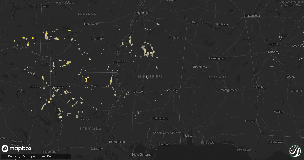
Hail Map in Mississippi on July 13, 2022
Get this storm
July 13 map
$229
one time, instant access
Download today. No call, no setup
Keep the $229
Bought the map and want the full workflow? Apply the entire $229 to a subscription within 7 days. None of it is wasted.
Every map, not just this one
This buys you this map. Subscription and you get every map we run, in the markets you choose from a few cities to whole states to nationwide. Plus real-time alerts the moment a storm fires.
Contact data
Name, contact info, occupancy, even credit band for addresses in the footprint. You go from where it hit to who to call.
Become the source they trust
Unlimited branding weather history reports on demand. You already have the documented answer ready for the property owner, and you are the one who showed up with it.
Property data and RoofTrace estimates
Pull up any address you have got, its value and the exact code rules for that jurisdiction, straight from One Click Code. Then RoofTrace estimates the squares, pitch, and roof value, priced the way you price.
Storm reports in Mississippi
Mississippi
| Date | Description |
|---|---|
| 07/13/20226:56 PM CDT | Claborine county sheriff office reported trees down on highway 18. |
| 07/13/20226:56 PM CDT | Claborine county sheriff office reported trees down on old port gibson rd. |
| 07/13/20226:51 PM CDT | *** 1 inj *** via social media... Tree down on a mobile home in eagle lake with a report of one injury. |
| 07/13/20226:15 PM CDT | Via social media... Report of several trees fell onto primitive baptist church and a large limb in the yard of the new home church. There are also trees down on high 54 |
| 07/13/20225:34 PM CDT | Via social media... Tree down on a powerline in the backyard of a home in the belhaven heights community. |
| 07/13/20223:21 PM CDT | Power lines downed on mars hill rd. |
| 07/13/20223:16 PM CDT | Trees down on hwy 19 south near zama. |
| 07/13/20223:16 PM CDT | Roebuck barn destroyed by straight line winds. |
| 07/13/20222:50 PM CDT | Tree down across the road. |
| 07/13/20222:39 PM CDT | Tree down on highway 12. |
| 07/13/20222:35 PM CDT | Trees were blown down 4 mi e. |
| 07/13/20222:30 PM CDT | Trees down hw 35 n. |
| 07/13/20222:00 PM CDT | Tree down on the natchez trace parkway. |
| 07/13/20221:50 PM CDT | Via social media... Trees down on 404 east between duck hill and alva. |
| 07/13/20221:29 PM CDT | Multiple trees downed in the holcomb area. |
| 07/13/202212:58 PM CDT | Trees downed on gore springs rd. |
| 07/13/202212:43 PM CDT | A few trees were reported down just north of tomnolen. Small hail was also observed. |
| 07/13/20227:45 AM CDT | At 1244 PM CDT, a severe thunderstorm was located near Gore Springs, or 9 miles east of Grenada, and is nearly stationary. HAZARD...60 mph wind gusts and quarter size hail. SOURCE...Radar indicated. IMPACT...Hail damage to vehicles is expected. Expect wind damage to roofs, siding, and trees. This severe thunderstorm will remain over mainly rural areas of southeastern Grenada County. |
| 07/13/20227:31 AM CDT | At 1231 PM CDT, a severe thunderstorm was located near Lodi, or 19 miles east of Winona, moving southwest at 5 mph. HAZARD...60 mph wind gusts and quarter size hail. SOURCE...Radar indicated. IMPACT...Hail damage to vehicles is expected. Expect wind damage to roofs, siding, and trees. This severe thunderstorm will remain over mainly rural areas of southwestern Webster County. |
| 07/13/20224:05 AM CDT | At 904 PM CDT, a severe thunderstorm was located near Mccomb, moving east at 5 mph. HAZARD...60 mph wind gusts and quarter size hail. SOURCE...Radar indicated. IMPACT...Hail damage to vehicles is expected. Expect wind damage to roofs, siding, and trees. Locations impacted include... Mccomb, Magnolia and Summit. This includes Interstate 55 in Mississippi near mile marker 21. |
| 07/13/20221:56 AM CDT | At 656 PM CDT, a severe thunderstorm was located over Rocky Springs, or 18 miles south of Vicksburg, moving south at 20 mph. HAZARD...60 mph wind gusts. SOURCE...Radar indicated. IMPACT...Expect damage to roofs, siding, and trees. This severe thunderstorm will be near... Hermanville around 720 PM CDT. |
| 07/12/202210:53 PM CDT | At 352 PM CDT, severe thunderstorms were located along a line extending from Sharon to Tuscola to Dowdville to near Philadelphia, moving south at 30 mph. HAZARD...60 mph wind gusts. SOURCE...Radar indicated. IMPACT...Expect damage to roofs, siding, and trees. Severe thunderstorms will be near... Prospect and Harperville around 410 PM CDT. Hillsboro and Steele around 415 PM CDT. Stratton, Conehatta, Goshen Springs, Pisgah and Little Rock around 425 PM CDT. Leesburg around 430 PM CDT. Forest and Decatur around 435 PM CDT. Lawrence, Pelahatchie and Pulaski around 445 PM CDT. Newton and Homewood around 450 PM CDT. Roberts around 455 PM CDT.Other locations impacted by these severe thunderstorms include Lake,Hickory and Sebastopol. |
| 07/12/202210:38 PM CDT | At 337 PM CDT, a severe thunderstorm was located over Camden, or 16 miles northeast of Canton, moving south at 25 mph. HAZARD...60 mph wind gusts. SOURCE...Radar indicated. IMPACT...Expect damage to roofs, siding, and trees. This severe thunderstorm will be near... Sharon around 355 PM CDT. Farmhaven around 400 PM CDT. |
| 07/12/202210:31 PM CDT | At 331 PM CDT, a severe thunderstorm was located over Pearl River, or near Edinburg, moving southeast at 25 mph. HAZARD...60 mph wind gusts. SOURCE...Radar indicated. IMPACT...Expect damage to roofs, siding, and trees. This severe thunderstorm will be near... Pearl River around 335 PM CDT. Philadelphia and Dowdville around 345 PM CDT. Dixon around 355 PM CDT. Neshoba and Bethsaida around 410 PM CDT. House around 415 PM CDT.Other locations impacted by this severe thunderstorm include Tucker. |
| 07/12/202210:09 PM CDT | At 308 PM CDT, a severe thunderstorm was located over Ruleville, moving east at 15 mph. HAZARD...60 mph wind gusts. SOURCE...Radar indicated. IMPACT...Expect damage to roofs, siding, and trees. This severe thunderstorm will be near... Sunnyside, Minter City and Money around 415 PM CDT.Other locations impacted by this severe thunderstorm include Schlaterand Doddsville. |
| 07/12/202210:00 PM CDT | At 259 PM CDT, a severe thunderstorm was located near Smyrna, or 7 miles south of Kosciusko, moving south at 25 mph. HAZARD...60 mph wind gusts. SOURCE...Radar indicated. IMPACT...Expect damage to roofs, siding, and trees. This severe thunderstorm will be near... Singleton and Thomastown around 310 PM CDT. Renfroe around 320 PM CDT. Carthage around 330 PM CDT. Tuscola around 355 PM CDT.Other locations impacted by this severe thunderstorm include Lena,Walnut Grove, Redwater and Standing Pine. |
| 07/12/20229:57 PM CDT | At 257 PM CDT, a severe thunderstorm was located over Smyrna, or near Kosciusko, moving southeast at 20 mph. HAZARD...60 mph wind gusts. SOURCE...Radar indicated. IMPACT...Expect damage to roofs, siding, and trees. This severe thunderstorm will be near... Zama around 320 PM CDT. |
| 07/12/20229:47 PM CDT | At 247 PM CDT, a severe thunderstorm was located near Lexington, or 8 miles south of Black Hawk, moving south at 15 mph. HAZARD...60 mph wind gusts. SOURCE...Radar indicated. IMPACT...Expect damage to roofs, siding, and trees. This severe thunderstorm will be near... Lexington around 310 PM CDT. Franklin and Brozville around 330 PM CDT. Ebenezer around 345 PM CDT. |
| 07/12/20229:45 PM CDT | At 245 PM CDT, a severe thunderstorm was located over Vaiden, or 10 miles south of Winona, moving south at 15 mph. HAZARD...60 mph wind gusts. SOURCE...Radar indicated. IMPACT...Expect damage to roofs, siding, and trees. This severe thunderstorm will remain over mainly rural areas of southeastern Carroll and southwestern Montgomery Counties. |
| 07/12/20229:23 PM CDT | At 222 PM CDT, a severe thunderstorm was located near Money, or near Itta Bena, moving east at 20 mph. HAZARD...60 mph wind gusts. SOURCE...Radar indicated. IMPACT...Expect damage to roofs, siding, and trees. This severe thunderstorm will be near... Money around 235 PM CDT. Greenwood around 250 PM CDT.Other locations impacted by this severe thunderstorm includeSchlater. |
| 07/12/20229:18 PM CDT | At 217 PM CDT, a severe thunderstorm was located near Clarksdale, moving southeast at 15 mph. HAZARD...60 mph wind gusts and penny size hail. SOURCE...Radar indicated. IMPACT...Expect damage to roofs, siding, and trees. Locations impacted include... Clarksdale, Tutwiler, Webb, Sumner, Dublin, Vance, Mattson, Counts, Hopson, Mikoma, Stover, Longstreet, Waverly, Lurand, Brazil, Beaver Dam, Albin and Claremont. |
| 07/12/20229:15 PM CDT | Numerous locations in the county reporting trees and power lines down. |
| 07/12/20229:09 PM CDT | At 209 PM CDT, a severe thunderstorm was located 12 miles southeast of Poplar Creek, or 14 miles northeast of Kosciusko, moving south at 10 mph. HAZARD...60 mph wind gusts and nickel size hail. SOURCE...Radar indicated. IMPACT...Expect damage to roofs, siding, and trees. This severe thunderstorm will remain over mainly rural areas of northeastern Attala County, including the following locations... Mccool and Ethel. |
| 07/12/20228:48 PM CDT | At 148 PM CDT, a severe thunderstorm was located near North Carrollton, or 13 miles northwest of Winona, moving south at 35 mph. HAZARD...70 mph wind gusts. SOURCE...Radar indicated. IMPACT...Expect considerable tree damage. Damage is likely to mobile homes, roofs, and outbuildings. This severe thunderstorm will be near... North Carrollton around 155 PM CDT. Coila around 210 PM CDT. Black Hawk around 215 PM CDT.Other locations impacted by this severe thunderstorm includeCarrollton. |
| 07/12/20228:34 PM CDT | At 134 PM CDT, a severe thunderstorm was located near Lodi, or 11 miles northeast of Winona, moving south at 15 mph. HAZARD...60 mph wind gusts. SOURCE...Radar indicated. IMPACT...Expect damage to roofs, siding, and trees. This severe thunderstorm will be near... Lodi around 145 PM CDT. Kilmichael around 215 PM CDT. |
| 07/12/20228:24 PM CDT | At 123 PM CDT, a severe thunderstorm was located near Bew Springs, or 8 miles northwest of Grenada, moving south at 20 mph. HAZARD...60 mph wind gusts. SOURCE...Radar indicated. IMPACT...Expect damage to roofs, siding, and trees. This severe thunderstorm will be near... Grenada and Bew Springs around 130 PM CDT. Holcomb around 135 PM CDT. |
All States Impacted by Hail Map on July 13, 2022
Cities Impacted by Hail Map on July 13, 2022
- Hammond, MT
- Ringold, OK
- Dawsonville, GA
- Dewy Rose, GA
- Elberton, GA
- Broken Bow, OK
- Homer, MI
- Tekonsha, MI
- Litchfield, MI
- Holly Springs, MS
- Potts Camp, MS
- Mosby, MT
- Clarksdale, MS
- Lyon, MS
- Coahoma, MS
- Coffeeville, MS
- De Witt, AR
- Senatobia, MS
- Como, MS
- Schlater, MS
- Hickman, NE
- Roca, NE
- Lincoln, NE
- Bennet, NE
- Gainesville, GA
- Cumming, GA
- Queen City, TX
- Mena, AR
- Norman, AR
- Ringgold, LA
- Florien, LA
- Anacoco, LA
- Winona, KS
- Brewster, KS
- Colby, KS
- Levant, KS
- Atwood, KS
- Roanoke Rapids, NC
- Halifax, NC
- Mount Ida, AR
- Carlton, GA
- Firth, NE
- Alligator, MS
- Greenville, MS
- Ingomar, MT
- Musselshell, MT
- Pendleton, NC
- Amity, AR
- Cove, AR
- Shelby, MS
- Mound Bayou, MS
- Belhaven, NC
- Rayville, LA
- Burlington, NC
- Beaver Crossing, NE
- York, NE
- Exeter, NE
- Cordova, NE
- Friend, NE
- Long Branch, TX
- Carthage, TX
- Donaldson, AR
- Enterprise, LA
- Harrisonburg, LA
- Lexington, GA
- Edwards, MS
- Utica, MS
- Lewisville, AR
- Taylor, AR
- Keithville, LA
- Waskom, TX
- Karnack, TX
- Grenada, MS
- Scobey, MS
- Holcomb, MS
- Cascilla, MS
- Greenwood, MS
- Carrollton, MS
- Charleston, MS
- Tillatoba, MS
- Odell, NE
- Wright City, OK
- Brent, AL
- Centreville, AL
- Ashland, VA
- Glen Allen, VA
- Littleton, NC
- Oakland, MS
- Enid, MS
- Livingston Manor, NY
- Claryville, NY
- Roscoe, NY
- Utica, NE
- Milford, NE
- Seward, NE
- Goehner, NE
- Jonesville, MI
- Coushatta, LA
- Elm Grove, LA
- Waco, NE
- Walhalla, SC
- Crete, NE
- Newhope, AR
- Umpire, AR
- South Hill, VA
- Clarksville, VA
- Bullock, NC
- Boydton, VA
- Baskerville, VA
- Arkadelphia, AR
- Jefferson City, MT
- Lincolnton, NC
- Maiden, NC
- Denver, NC
- Hampton, AR
- Sheridan, AR
- Valliant, OK
- Garvin, OK
- West Yellowstone, MT
- Thornton, AR
- Doddridge, AR
- Rattan, OK
- Meridian, MS
- Newbern, AL
- Uniontown, AL
- Faunsdale, AL
- Lithonia, GA
- Zwolle, LA
- Many, LA
- Noble, LA
- Delhi, LA
- El Dorado, AR
- Daingerfield, TX
- Jamestown, LA
- Castor, LA
- Cades, SC
- Kingstree, SC
- Jefferson, TX
- Pittsburg, TX
- Diller, NE
- Tutwiler, MS
- Drew, MS
- Newellton, LA
- Rosston, AR
- Buckner, AR
- Goodman, MS
- Camden, MS
- Pickens, MS
- Warrenton, NC
- Roy, MT
- Dierks, AR
- De Queen, AR
- Mount Pleasant, TX
- Royal, AR
- Hot Springs National Park, AR
- Banks, AR
- Hampton, GA
- Jonesboro, GA
- Leesburg, TX
- Goldonna, LA
- Winnfield, LA
- Buffalo, MT
- Joaquin, TX
- Farmerville, LA
- Bernice, LA
- Choudrant, LA
- Eudora, AR
- Brusett, MT
- Duck Hill, MS
- Summit, MS
- Jordan, MT
- Mesa, AZ
- Gilbert, AZ
- Belgrade, MT
- Skaneateles, NY
- Elbridge, NY
- Syracuse, NY
- Marcellus, NY
- Wickes, AR
- Vandervoort, AR
- Grannis, AR
- Gillham, AR
- Deadwood, SD
- Waterford, MS
- Hugo, OK
- Zolfo Springs, FL
- Arcadia, FL
- McCool Junction, NE
- Waynesboro, MS
- Thonotosassa, FL
- Plant City, FL
- Dover, FL
- Lakeland, FL
- Orlando, FL
- Kirby, AR
- Logansport, LA
- Magnolia, AR
- Waldo, AR
- McNeil, AR
- Fouke, AR
- Comer, GA
- Shreveport, LA
- Leoti, KS
- Wallace, KS
- Sharon Springs, KS
- Tribune, KS
- Davenport, FL
- Stamps, AR
- Saline, LA
- Cloutierville, LA
- Lena, LA
- Eupora, MS
- Stewart, MS
- Center, TX
- Eutaw, AL
- Provencal, LA
- Punta Gorda, FL
- North Fort Myers, FL
- Oak Grove, LA
- Pioneer, LA
- Wharton, TX
- Trout, LA
- Wilmot, AR
- Grady, AR
- Texarkana, AR
- Nemaha, NE
- Brownville, NE
- Groveland, FL
- Yalaha, FL
- Howey In The Hills, FL
- Bunnell, FL
- Gloster, LA
- Tenaha, TX
- Smoaks, SC
- Williams, SC
- Ruffin, SC
- Eros, LA
- Nacogdoches, TX
- Ozona, TX
- Gore Springs, MS
- Summerfield, LA
- Fort Supply, OK
- Woodward, OK
- Hurley, NY
- West Hurley, NY
- Kingston, NY
- Ruleville, MS
- Lewistown, MT
- Stonewall, LA
- Rodessa, LA
- Ruth, MS
- Boling, TX
- Tetonia, ID
- Islandton, SC
- McCool, MS
- Ethel, MS
- Colbert, GA
- Louise, TX
- Monticello, MS
- Colfax, LA
- El Campo, TX
- Comstock, TX
- Clewiston, FL
- Hobson, MT
- Lake Providence, LA
- Sells, AZ
- Frierson, LA
- Mansfield, LA
- Douglass, TX
- Natchitoches, LA
- Hemphill, TX
- Tavares, FL
- Timpson, TX
- Umatilla, FL
- Eustis, FL
- Lillie, LA
- Junction City, AR
- Bloomington, NY
- Port Ewen, NY
- Cottekill, NY
- Stone Ridge, NY
- Olivebridge, NY
- Bogue Chitto, MS
- Hartwell, GA
- Rhinebeck, NY
- Ulster Park, NY
- Rosendale, NY
- Alcolu, SC
- Gable, SC
- Bivins, TX
- Vicksburg, MS
- Itta Bena, MS
- Garwood, TX
- Hallettsville, TX
- Boyle, MS
- Louin, MS
- Pierson, FL
- Seville, FL
- Keatchie, LA
- Grand Cane, LA
- Greenwood, LA
- McCarley, MS
- Lodge, SC
- Gunnison, MS
- Snow Lake, AR
- Wimauma, FL
- Bowman, GA
- Marshall, TX
- Hallsville, TX
- Terry, MS
- Raymond, MS
- Brady, TX
- Tallulah, LA
- Mount Vernon, TX
- San Augustine, TX
- Immokalee, FL
- Port Gibson, MS
- Alexis, NC
- Iron Station, NC
- Stanley, NC
- Cleveland, MS
- Doddsville, MS
- Holly Grove, AR
- Marvell, AR
- Dubberly, LA
- Brookhaven, MS
- Hernando, MS
- De Kalb, TX
- Griffin, GA
- Williamson, GA
- Mcdonough, GA
- Lorman, MS
- Brooks, GA
- Sparkman, AR
- Sontag, MS
- Leesburg, FL
- Felt, ID
- Lavonia, GA
- Alva, FL
- Brandon, FL
- Tampa, FL
- Riverview, FL
- Portland, AR
- Sondheimer, LA
- Epps, LA
- Greensboro, GA
- Hickory, MS
- Chunky, MS
- Dodson, LA
- Jena, LA
- Jefferson, GA
- Mora, LA
- Flatwoods, LA
- West Monroe, LA
- Bentley, LA
- Dry Prong, LA
- Monticello, AR
- Byram, MS
- Waverly, AL
- Mize, MS
- Raleigh, MS
- Naples, FL
- Joliet, MT
- Columbus, MT
- Laurel, MT
- Park City, MT
- Nedrow, NY
- East Branch, NY
- Downsville, NY


