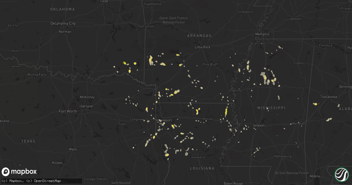
Hail Map on July 13, 2022
Get this storm
July 13 map
$229
one time, instant access
Download today. No call, no setup
Keep the $229
Bought the map and want the full workflow? Apply the entire $229 to a subscription within 7 days. None of it is wasted.
Every map, not just this one
This buys you this map. Subscription and you get every map we run, in the markets you choose from a few cities to whole states to nationwide. Plus real-time alerts the moment a storm fires.
Contact data
Name, contact info, occupancy, even credit band for addresses in the footprint. You go from where it hit to who to call.
Become the source they trust
Unlimited branding weather history reports on demand. You already have the documented answer ready for the property owner, and you are the one who showed up with it.
Property data and RoofTrace estimates
Pull up any address you have got, its value and the exact code rules for that jurisdiction, straight from One Click Code. Then RoofTrace estimates the squares, pitch, and roof value, priced the way you price.
States Impacted by Hail Map on July 13, 2022
Storm reports
Arkansas
| Date | Description |
|---|---|
| 07/13/20226:35 PM CDT | Large tree down on miller county road 9... Near the pisgah baptist church... South of fouke. |
| 07/13/20226:25 PM CDT | Arkansas state police reported large limbs across state hwy 29... About 5 miles nnw of lewisville... Along with quarter size hail. |
| 07/13/20226:25 PM CDT | Quarter size hail reported on hwy 29 at the hempstead and lafayette county line. |
| 07/13/20226:25 PM CDT | Two large trees down at residence on miller county road 481. One tree was uprooted and the other was snapped. |
| 07/13/20225:30 PM CDT | A local report indicates 1.00 inch wind near DAISY |
| 07/13/20221:59 AM CDT | At 659 PM CDT, a severe thunderstorm was located near Lanark, or 9 miles southeast of Hampton, moving south at 5 mph. HAZARD...60 mph wind gusts and quarter size hail. SOURCE...Radar indicated. IMPACT...Hail damage to vehicles is expected. Expect wind damage to roofs, siding, and trees. Locations impacted include... Hermitage... Harrell... Lanark... Jersey... Gravelridge... |
| 07/13/20221:54 AM CDT | At 654 PM CDT, a severe thunderstorm was located over Caddo Valley, or near Arkadelphia, moving southeast at 5 mph. HAZARD...60 mph wind gusts and quarter size hail. SOURCE...Radar indicated. IMPACT...Hail damage to vehicles is expected. Expect wind damage to roofs, siding, and trees. Locations impacted include... Arkadelphia... Caddo Valley... Gum Springs in Clark County... Richwoods... DeGray Lake State Park... Joan... Lower Lake Recreation Area... This includes Interstate 30 between mile markers 65 and 81. |
| 07/13/20221:32 AM CDT | At 631 PM CDT, a severe thunderstorm was located over Fouke, or 15 miles southeast of Texarkana, and is nearly stationary. HAZARD...60 mph wind gusts and quarter size hail. SOURCE...Radar indicated. IMPACT...Hail damage to vehicles is expected. Expect wind damage to roofs, siding, and trees. Locations impacted include... Fouke and Fort Lynn. |
| 07/13/20221:29 AM CDT | At 629 PM CDT, a severe thunderstorm was located near Lewisville, and is nearly stationary. HAZARD...60 mph wind gusts and quarter size hail. SOURCE...Public. IMPACT...Hail damage to vehicles is expected. Expect wind damage to roofs, siding, and trees. Locations impacted include... Stamps, Lewisville, Buckner, Patmos, Spirit Lake and Piney Grove. |
| 07/13/202212:28 AM CDT | At 528 PM CDT, a severe thunderstorm was located near Smithland, or 7 miles southeast of Stamps, moving northeast at 5 mph. HAZARD...60 mph wind gusts and quarter size hail. SOURCE...Radar indicated. IMPACT...Hail damage to vehicles is expected. Expect wind damage to roofs, siding, and trees. Locations impacted include... Magnolia, Stamps, Waldo, McNeil, Buckner, Smithland, Mount Vernon, Cornelius, Lerch, McKamie and Lamartine. |
| 07/13/202212:15 AM CDT | At 515 PM CDT, a severe thunderstorm was located over Daisy, or 12 miles northwest of Murfreesboro, moving southeast at 5 mph. HAZARD...60 mph wind gusts and quarter size hail. SOURCE...Radar indicated. IMPACT...Hail damage to vehicles is expected. Expect wind damage to roofs, siding, and trees. Locations impacted include... Daisy... Narrows Dam... Daisy State Park... Bear Creek Public Use Area... Kirby... New Hope in Pike County... Langley... |
| 07/12/202211:50 PM CDT | At 449 PM CDT, a severe thunderstorm was located near Wickes, or 13 miles west of Umpire, moving southeast at 5 mph. Other scattered storms were rapidly developing northward toward Mena, and may become severe. HAZARD...60 mph wind gusts and quarter size hail. SOURCE...Radar indicated. IMPACT...Hail damage to vehicles is expected. Expect wind damage to roofs, siding, and trees. Locations impacted include... Mena... Wickes... Grannis... Vandervoort... Shady... Hartley... Cossatot River State Park... Bard Springs Recreation Area... Caney Creek Wilderness... Polk County Fairgrounds... Mena Intermountain Airport... Mccauley... Shady Lake Recreation Area... Hatton... Roaring Branch Natural Area... Dallas... Nunley... |
| 07/12/202211:19 PM CDT | At 418 PM CDT, a severe thunderstorm was located near Oak Grove, or 10 miles northwest of Lake Providence, moving east at 10 mph. HAZARD...60 mph wind gusts and quarter size hail. SOURCE...Radar indicated. IMPACT...Hail damage to vehicles is expected. Expect wind damage to roofs, siding, and trees. This severe thunderstorm will be near... Millikin around 440 PM CDT. Shelburn around 450 PM CDT. Lake Providence around 510 PM CDT.Other locations impacted by this severe thunderstorm includeKilbourne and Forest. |
| 07/12/202210:58 PM CDT | At 358 PM CDT, a severe thunderstorm was located 7 miles west of Umpire, moving southeast at 10 mph. HAZARD...60 mph wind gusts and penny size hail. SOURCE...Radar indicated. IMPACT...Expect damage to roofs, siding, and trees. Locations impacted include... Umpire and Burg. |
| 07/12/20227:00 PM CDT | A local report indicates 1.00 inch wind near 2 NNE DE GRAY |
Virginia
| Date | Description |
|---|---|
| 07/13/20223:10 PM CDT | Tree downed onto roadway along va-138 south hill rd just south of columbus ln. |
| 07/13/20222:30 PM CDT | Trees downed at intersection of taylor ferry rd and lambert rd in boydton. Time radar estimated. |
| 07/13/20224:53 AM CDT | At 953 PM EDT, a severe thunderstorm was located over Warrenton, moving east at 20 mph. HAZARD...60 mph wind gusts. SOURCE...Radar indicated. IMPACT...Damaging winds will cause some trees and large branches to fall. This could injure those outdoors, as well as damage homes and vehicles. Roadways may become blocked by downed trees. Localized power outages are possible. Unsecured light objects may become projectiles. Locations impacted include... Warrenton, Linton Hall, Haymarket, Gainesville, New Baltimore, Nokesville, Opal, Catlett, Woolsey, Broken Hill, Auburn, Casanova, Greenwich, Turnbull, Meadowville, Airlie and Broad Run. |
| 07/12/202211:03 PM CDT | At 403 PM EDT, a severe thunderstorm was located near South Hill, moving east at 25 mph. HAZARD...60 mph wind gusts and quarter size hail. SOURCE...Radar indicated. IMPACT...Minor damage to vehicles is possible. Expect wind damage to trees and powerlines. This severe thunderstorm will be near... Dundas around 420 PM EDT. Alberta around 430 PM EDT.Other locations impacted by this severe thunderstorm include Gary,Bacons Fork, Cochran, Gills Corner, Dolphin, Barrows Store,Meredithville, Forksville, Lafoon Corner and Ordsburg. |
| 07/12/20229:15 PM CDT | There was a report of trees and several large tree limbs blown down northwest of haymarket. |
Wyoming
| Date | Description |
|---|---|
| 07/12/202211:36 PM CDT | I-80 at coal road |
| 07/12/202211:35 PM CDT | Evanston-uinta county airport burns field |
| 07/12/202210:20 PM CDT | Asos station kgey greybull airport. |
| 07/12/20229:55 PM CDT | Awos station kpoy powell airport. |
Montana
| Date | Description |
|---|---|
| 07/13/20226:00 PM CDT | Mesonet station yctim yellowstone club - avalanche. |
| 07/13/20225:26 PM CDT | A local report indicates 67 MPH wind near 6 S LOCKWOOD |
| 07/13/20225:19 PM CDT | A local report indicates 60 MPH wind near JUDITH GAP |
| 07/13/20224:30 PM CDT | Report sent via social media. |
| 07/13/20223:00 PM CDT | Estimated 60 mph wind gust. |
| 07/13/20224:07 AM CDT | At 905 PM MDT, severe thunderstorms were located along a line extending from 13 miles west of Duck Creek Rec Area to 8 miles east of Rock Creek Rec Area to 11 miles east of Hillside, moving northeast at 40 mph. HAZARD...70 mph wind gusts and penny size hail. SOURCE...Trained weather spotters. IMPACT...Expect considerable tree damage. Damage is likely to mobile homes, roofs, and outbuildings. Locations impacted include... Glasgow, Wolf Point, Poplar, Circle, Nashua, Brockton, Fort Peck, Richey, Duck Creek Rec Area, Brockway, Hillside, Flowing Wells Rest Area, The Pines Rec Area, Lustre, Fort Peck Marina, Frazer, Vida, Nelson Creek Rec Area, Lindsay and Rock Creek Rec Area. |
| 07/13/20223:26 AM CDT | At 825 PM MDT, a severe thunderstorm was located 22 miles south of Hillside, or 25 miles northeast of Forsyth, moving northeast at 25 mph. HAZARD...60 mph wind gusts and quarter size hail. SOURCE...Radar indicated. IMPACT...Hail damage to vehicles is expected. Expect wind damage to roofs, siding, and trees. Locations impacted include... Rock Springs and Angela. |
| 07/13/20223:26 AM CDT | At 824 PM MDT, a severe thunderstorm was located 10 miles northwest of Jordan, moving northeast at 20 mph. HAZARD...70 mph wind gusts and penny size hail. SOURCE...Radar indicated. IMPACT...Expect considerable tree damage. Damage is likely to mobile homes, roofs, and outbuildings. Locations impacted include... Jordan, The Pines Rec Area, Hell Creek Rec Area, Flowing Wells Rest Area, Cohagen, Nelson Creek Rec Area, Brusett and Van Norman. |
| 07/13/20222:35 AM CDT | At 734 PM MDT, severe thunderstorms were located along a line extending from 11 miles north of Sand Springs to 20 miles southwest of Cohagen, moving northeast at 35 mph. HAZARD...70 mph wind gusts and quarter size hail. SOURCE...Radar indicated. IMPACT...Hail damage to vehicles is expected. Expect considerable tree damage. Wind damage is also likely to mobile homes, roofs, and outbuildings. Locations impacted include... Jordan, Sand Springs, Hell Creek Rec Area, Edwards, Cohagen, Brusett and Steve Fork. |
| 07/12/202211:30 PM CDT | At 428 PM MDT, a severe thunderstorm was located 12 miles southeast of Moore, or 16 miles south of Lewistown, moving east at 40 mph. HAZARD...Ping pong ball size hail and 60 mph wind gusts. SOURCE...Radar indicated. IMPACT...People and animals outdoors will be injured. Expect hail damage to roofs, siding, windows, and vehicles. Expect wind damage to roofs, siding, and trees. Locations impacted include... Lewistown, Moore, Grass Range, Forestgrove, Glengarry, Heath, Buffalo and Garneill. |
| 07/12/202211:12 PM CDT | At 411 PM MDT, a severe thunderstorm was located 13 miles south of Alder, or 13 miles southwest of Virginia City, moving northeast at 30 mph. HAZARD...60 mph wind gusts and penny size hail. SOURCE...Radar indicated. IMPACT...Expect damage to roofs, siding, and trees. Locations impacted include... Virginia City, Ennis, Alder, Harrison, Pony, Norris, Mcallister, Jeffers, Laurin and Cameron. |
| 07/12/202210:46 PM CDT | At 346 PM MDT, a severe thunderstorm was located 15 miles southwest of Hobson, or 21 miles south of Stanford, moving east at 35 mph. HAZARD...60 mph wind gusts and quarter size hail. SOURCE...Radar indicated. IMPACT...Hail damage to vehicles is expected. Expect wind damage to roofs, siding, and trees. Locations impacted include... Hobson, Moore, Ackley Lake State Park, Sapphire Village, Glengarry, Utica, Buffalo and Garneill. |
| 07/12/202210:42 PM CDT | At 340 PM MDT, severe thunderstorms were located along a line extending from 15 miles northwest of Columbus to near Joliet, moving northeast at 35 mph. HAZARD...70 mph wind gusts. SOURCE...Public. At 335 PM, 69 mph wind was reported 2 miles east southeast of Columbus. IMPACT...Expect considerable tree damage. Damage is likely to mobile homes, roofs, and outbuildings. Locations impacted include... Billings, Columbus, Laurel, Lockwood, Billings Heights, Billings West End, Broadview, Reed Point, Halfbreed Lake Wildlife, Hailstone Wildlife Refuge, Molt, Silesia, Acton, Park City, Rapelje and Comanche. |
| 07/12/202210:30 PM CDT | At 329 PM MDT, a severe thunderstorm was located 10 miles east of North Fork, or 13 miles north of Salmon, moving northeast at 45 mph. HAZARD...60 mph wind gusts. SOURCE...Radar indicated. IMPACT...Expect damage to roofs, siding, and trees. Locations impacted include... Salmon, North Fork, Gibbonsville and Carmen. |
| 07/12/202210:21 PM CDT | At 320 PM MDT, a severe thunderstorm was located near Three Forks, or 26 miles west of Bozeman, moving northeast at 15 mph. HAZARD...60 mph wind gusts and nickel size hail. SOURCE...Radar indicated. IMPACT...Expect damage to roofs, siding, and trees. Locations impacted include... Belgrade, Three Forks, Manhattan, Logan, Amsterdam, Trident, Church Hill, Willow Creek, Menard, Madison Buffalo Jump State Park and Missouri Headwaters State Park. |
| 07/12/202210:15 PM CDT | A local report indicates 65 MPH wind near 14 NW WELDON |
| 07/12/202210:15 PM CDT | A local report indicates 58 MPH wind near 13 NNE NELSON CREEK REC |
| 07/12/202210:11 PM CDT | A local report indicates 60 MPH wind near 11 NNE NELSON CREEK REC |
| 07/12/202210:03 PM CDT | A local report indicates 63 MPH wind near 1 WNW THE PINES RECREAT |
| 07/12/20229:35 PM CDT | A local report indicates 60 MPH wind near 13 ESE HELL CREEK REC A |
| 07/12/20229:30 PM CDT | A local report indicates 70 MPH wind near 8 N JORDAN |
| 07/12/20229:12 PM CDT | A local report indicates 60 MPH wind near 1 SSW JORDAN |
| 07/12/20229:10 PM CDT | A local report indicates 60 MPH wind near JORDAN |
| 07/12/20229:03 PM CDT | At 202 PM MDT, a severe thunderstorm was located near Dillon, moving northeast at 35 mph. Wind gusts to 60 mph have been observed with this storm. HAZARD...60 mph wind gusts and penny size hail. SOURCE...Trained weather spotters. IMPACT...Expect damage to roofs, siding, and trees. Locations impacted include... Dillon, Alder, Beaverhead Rock State Park, Melrose, Bannack, Laurin, Clark Canyon, Bannack State Park and Glen. |
| 07/12/20228:37 PM CDT | A local report indicates 63 MPH wind near 4 WSW SAND SPRINGS |
| 07/12/20228:30 PM CDT | At 130 PM MDT, a severe thunderstorm was located 10 miles southwest of Montana City, or 12 miles north of Boulder, moving northeast at 30 mph. HAZARD...60 mph wind gusts and quarter size hail. SOURCE...Radar indicated. IMPACT...Hail damage to vehicles is expected. Expect wind damage to roofs, siding, and trees. Locations impacted include... Townsend, Montana City, Wickes, Winston, Alhambra, Corbin, Silos, Clancy, Jefferson City, Elkhorn State Park and Goose Bay. |
| 07/12/20228:22 PM CDT | A local report indicates 68 MPH wind near 4 WSW SAND SPRINGS |
| 07/12/20228:22 PM CDT | Observed from lufborough hill mt dot site. |
South Dakota
| Date | Description |
|---|---|
| 07/12/202210:27 PM CDT | At 327 PM MDT, a severe thunderstorm was located near Roubaix Lake, or 12 miles southeast of Lead, moving southeast at 15 mph. HAZARD...Quarter size hail. SOURCE...Radar indicated. IMPACT...Damage to vehicles is expected. This severe thunderstorm will be near... Nemo around 345 PM MDT. |
Nevada
| Date | Description |
|---|---|
| 07/13/20225:39 PM CDT | Red butte raws |
Alabama
| Date | Description |
|---|---|
| 07/13/20221:55 PM CDT | A few trees were blown down near highway 5. |
| 07/13/20221:45 PM CDT | One carport destroyed and a few trees and power lines blown down. |
| 07/13/20221:42 PM CDT | A few trees were blown down. |
| 07/13/202212:50 AM CDT | At 550 PM CDT, a severe thunderstorm was located over Waynesboro, moving southeast at 15 mph. HAZARD...60 mph wind gusts. SOURCE...Radar indicated. IMPACT...Expect damage to roofs, siding, and trees. Locations impacted include... Waynesboro, Clara and Buckatunna. |
| 07/13/202212:23 AM CDT | At 523 PM CDT, a severe thunderstorm was located over Faunsdale, or near Uniontown, and is nearly stationary. HAZARD...60 mph wind gusts and quarter size hail. SOURCE...Radar indicated. IMPACT...Hail damage to vehicles is expected. Expect wind damage to roofs, siding, and trees. Locations impacted include... Faunsdale, Dayton and Laneville. |
| 07/12/202211:50 PM CDT | At 450 PM CDT, a severe thunderstorm was located near West Greene, or 11 miles southeast of Aliceville, and is nearly stationary. HAZARD...60 mph wind gusts and quarter size hail. SOURCE...Radar indicated. IMPACT...Hail damage to vehicles is expected. Expect wind damage to roofs, siding, and trees. Locations impacted include... West Greene, New West Greene, Pleasant Ridge, Clinton and Lewiston. |
| 07/12/20228:55 PM CDT | At 155 PM CDT, a severe thunderstorm was located over Brent, moving southeast at 10 mph. HAZARD...60 mph wind gusts and quarter size hail. SOURCE...Radar indicated. IMPACT...Hail damage to vehicles is expected. Expect wind damage to roofs, siding, and trees. Locations impacted include... Brent, Centreville, Talladega National Forest, West Centreville, Oakmulgee, Trio and Bibb County Airport. |
Oklahoma
| Date | Description |
|---|---|
| 07/13/20224:27 PM CDT | Thunderstorm wind damage... Including several trees downed... Across the city of broken bow. |
| 07/12/202211:43 PM CDT | At 443 PM CDT, a severe thunderstorm was located 4 miles southeast of Cloudy, and is nearly stationary. HAZARD...60 mph wind gusts and quarter size hail. SOURCE...Radar indicated. IMPACT...Hail damage to vehicles is expected. Expect wind damage to roofs, siding, and trees. Locations in or near the path include... Corinne... Sobol... |
| 07/12/202211:22 PM CDT | At 421 PM CDT, a severe thunderstorm was located 16 miles north of Broken Bow, or 31 miles northwest of De Queen, and is nearly stationary. HAZARD...60 mph wind gusts and quarter size hail. SOURCE...Radar indicated. IMPACT...Hail damage to vehicles is expected. Expect wind damage to roofs, siding, and trees. Locations impacted include... Broken Bow, Hochatown, Eagletown, Mount Herman and Sherwood. |
Arizona
| Date | Description |
|---|---|
| 07/13/20223:29 AM CDT | At 829 PM MST, a severe thunderstorm was located over Freestone Park, or over Gilbert, and is nearly stationary. HAZARD...60 mph wind gusts. SOURCE...Radar indicated. IMPACT...Expect damage to roofs, siding, and trees. Locations impacted include... Mesa, Chandler, Gilbert, Tempe, East Mesa, Mesa Riverview Mall, Tempe Marketplace, Gilbert City Hall, Falcon Field Airport, Salt River Indian Community, Downtown Mesa, Superstition Springs Mall, Chandler City Hall, San Tan Village Mall and Freestone Park.This includes the following highways...US Highway 60 between mile markers 176 and 191.AZ Route 87 between mile markers 165 and 180.AZ Route 202 between mile markers 9 and 20, between mile markers 22and 32, and between mile markers 35 and 50. |
| 07/13/20221:15 AM CDT | At 615 PM MST, a severe thunderstorm was located 7 miles east of Kaka, or 39 miles east of Ajo, and is nearly stationary. HAZARD...60 mph wind gusts and quarter size hail. SOURCE...Radar indicated. IMPACT...Hail damage to vehicles is expected. Expect wind damage to roofs, siding, and trees. Locations impacted include... Ventana. |
| 07/13/202212:44 AM CDT | At 543 PM MST, a severe thunderstorm was located 13 miles east of Freeman, or 19 miles west of Casa Grande, moving north at 15 mph. HAZARD...60 mph wind gusts. SOURCE...Radar indicated. IMPACT...Expect damage to roofs, siding, and trees. Locations impacted include... Stanfield.This includes the following highways...AZ Interstate 8 between mile markers 146 and 167.AZ Route 347 between mile markers 161 and 168. |
| 07/12/202210:40 PM CDT | ***delayed report*** large metal canopy ripped off pillars due to winds estimated at 55 - 60 mph. |
| 07/12/202210:35 PM CDT | ***delayed report*** large tree uprooted and fell onto a car due to winds estimated at 55 - 60 mph. |
| 07/12/202210:35 PM CDT | Photos show medium- to large-sized trees uprooted... Street signs... And street light down in the area. Time estimated based on radar. |
| 07/12/202210:35 PM CDT | Trained spotter... Law enforcement... And social media report trees down near lindsay & baseline. Time estimated based on radar. |
| 07/12/202210:32 PM CDT | Damage showing tree limbs that were 3 to 4 inches in diameter snapped. |
| 07/12/20227:53 PM CDT | ***delayed report*** semi-truck flipped on i-8 at mile 157 due to strong winds estimated at 60 mph. |
Pennsylvania
| Date | Description |
|---|---|
| 07/13/20221:43 AM CDT | At 643 PM EDT, a severe thunderstorm was located over Peabrook, or 16 miles south of Walton, moving east at 25 mph. HAZARD...60 mph wind gusts and penny size hail. SOURCE...Radar indicated. IMPACT...Expect damage to roofs, siding, and trees. Locations impacted include... Rockland, Fremont, Jeffersonville, White Sulphur Springs, Stalker, Hazel, Fishs Eddy, Livingston Manor, East Branch and Roscoe. |
New York
| Date | Description |
|---|---|
| 07/13/20226:20 PM CDT | State police came across a tree and wires down on roadway. |
| 07/13/20226:20 PM CDT | Tree down on roadway. |
| 07/13/20225:12 PM CDT | Wires down on roadway. |
| 07/13/20224:56 PM CDT | Power lines down on roadway. |
| 07/13/20224:53 PM CDT | Report from mping: quarter |
| 07/13/20224:52 PM CDT | Multiple downed trees with quarter sized hail. |
| 07/13/20224:51 PM CDT | Multiple trees and power lines down on falls rd. |
| 07/13/20224:50 PM CDT | Numerous trees down. Some tree 14 to 16 inches in diameter snapped. Nickel sized hail. |
| 07/13/20224:50 PM CDT | Trained spotter reported multiple trees down or split as well as dime sized hail. |
| 07/13/20224:49 PM CDT | A tree down on vehicle and a large tree uprooted in yard around roman ave and cranapple dr. |
| 07/13/20224:44 PM CDT | Tree and wires down on foster rd. Tree blocking entire road. |
| 07/13/20223:38 AM CDT | At 838 PM EDT, a severe thunderstorm was located near Olivebridge, or 7 miles west of Kingston, moving east at 30 mph. HAZARD...60 mph wind gusts. SOURCE...Radar indicated. IMPACT...Expect damage to roofs, siding, and trees. Locations impacted include... Kingston, Rhinebeck, Hyde Park, Hurley, Woodstock, Pine Plains, Red Hook, Millbrook, High Falls, Stanfordville, Tillson, West Hurley, Port Ewen, Kenneth L Wilson Campground, Lake Katrine, Staatsburg, Olivebridge, Esopus, Rosendale and Marbletown. |
| 07/13/20222:26 AM CDT | At 726 PM EDT, a severe thunderstorm was located near Willowemoc, or 12 miles north of Liberty, moving east at 30 mph. HAZARD...60 mph wind gusts and quarter size hail. SOURCE...Radar indicated. IMPACT...Hail damage to vehicles is expected. Expect wind damage to roofs, siding, and trees. Locations impacted include... Grahamsville, Willowemoc, Mongaup Pond Campground, Parkston, Lewbeach, Waneta Lake, Joscelyn, Debruce and Anderson. |
| 07/13/20222:22 AM CDT | At 721 PM EDT, a severe thunderstorm was located near Livingston Manor, or 10 miles north of Liberty, moving east at 30 mph. HAZARD...60 mph wind gusts. SOURCE...Radar indicated. IMPACT...Expect damage to roofs, siding, and trees. Locations impacted include... Hurley, Woodstock, Woodland Valley Campground, West Shokan, Kenneth L Wilson Campground, High Falls, West Hurley, Mount Tremper, Olivebridge, Kerhonkson, Marbletown, Denning, Cherrytown, Glenford, Palentown, Atwood, Oliverea, Shultis Corners, Pacama and Brodhead. |
| 07/13/20221:03 AM CDT | At 603 PM EDT, a severe thunderstorm was located near Syracuse, moving east at 30 mph. HAZARD...60 mph wind gusts and quarter size hail. SOURCE...Radar indicated. IMPACT...Hail damage to vehicles is expected. Expect wind damage to roofs, siding, and trees. Locations impacted include... Onondaga, Syracuse, De Witt, Sullivan, Solvay, Chittenango, Manlius, Fayetteville, Minoa and East Syracuse. |
| 07/13/202212:42 AM CDT | At 542 PM EDT, a severe thunderstorm was located near Skaneateles, or 8 miles northeast of Auburn, moving east at 25 mph. HAZARD...Quarter size hail. SOURCE...Radar indicated. IMPACT...Damage to vehicles is expected. Locations impacted include... Onondaga, Syracuse, Solvay, Skaneateles, Marcellus, Amboy, Camillus, Elbridge, New York State Fairgrounds and Galeville. |
| 07/12/20227:55 PM CDT | Tree and wires down broadway |
| 07/12/20227:50 PM CDT | Tree on trailer |
| 07/12/20227:50 PM CDT | Propane tank stuck by tree... Tank leaking... Lynette blvd |
| 07/12/20227:48 PM CDT | Tree on house |
| 07/12/20227:43 PM CDT | Route 209 closed at marbletown road due to a fallen tree and wires |
| 07/12/20227:42 PM CDT | Tree on wires route 209 |
| 07/12/20227:40 PM CDT | Tree and wires down atwood rd |
Maryland
| Date | Description |
|---|---|
| 07/13/20227:26 AM CDT | At 1225 AM EDT, a severe thunderstorm was located near Colonial Beach, moving east at 55 mph. HAZARD...60 mph wind gusts. SOURCE...Radar indicated. IMPACT...Damaging winds will cause some trees and large branches to fall. This could injure those outdoors, as well as damage homes and vehicles. Roadways may become blocked by downed trees. Localized power outages are possible. Unsecured light objects may become projectiles. Locations impacted include... Lexington Park, Leonardtown, Tall Timbers, Saint Clements Bay, Town Creek, White Point Beach, California, Hollywood, Wicomico, Mechanicsville, Rock Point, Bushwood, Clements, Abell, Valley Lee, Chaptico, Sandgates, Great Mills, Avenue and Loveville. |
| 07/13/20227:12 AM CDT | At 1212 AM EDT, a severe thunderstorm was located over King George, moving east at 45 mph. HAZARD...60 mph wind gusts. SOURCE...Radar indicated. IMPACT...Damaging winds will cause some trees and large branches to fall. This could injure those outdoors, as well as damage homes and vehicles. Roadways may become blocked by downed trees. Localized power outages are possible. Unsecured light objects may become projectiles. Locations impacted include... King George, Potomac Beach, Rollins Fork, Ninde, Lambs Creek, Jersey, Shiloh, Dogue and Weedonville. |
South Carolina
| Date | Description |
|---|---|
| 07/13/20222:57 PM CDT | Colleton county warning point reported several trees down between the 4000 and 5000 block of white hall road. |
| 07/13/20222:43 PM CDT | South carolina highway patrol reported a tree down at red dam road and hurricane alley. |
| 07/13/20222:29 PM CDT | Local power company reports nearly 100 outages in lake city due to fallen trees on a power line. Outage occurred at the intersection of hwy 341 and south wallace street |
| 07/13/20222:02 PM CDT | Tree reported down along halfway creek lane. Time estimated from radar. |
| 07/13/20221:40 PM CDT | Tree downed along hwy 183... Location approximate. |
| 07/13/20221:34 PM CDT | Black river electric cooperative reported outages to to trees on power lines along salem road near hwy. 378. |
| 07/13/202212:57 PM CDT | Black river electric cooperative reported trees on power lines along geddings road near pearson road. |
| 07/12/202210:58 PM CDT | At 357 PM EDT, a severe thunderstorm was located over White Hall, moving east at 40 mph. HAZARD...60 mph wind gusts. SOURCE...Radar indicated. IMPACT...Expect damage to trees and powerlines. Locations impacted include: Hendersonville, Ashepoo, Green Pond, Ritter and White Hall. This warning includes I-95 in South Carolina between mile markers 44and 48. |
| 07/12/202210:42 PM CDT | At 341 PM EDT, severe thunderstorms were located along a line extending from near Jacksonboro to near Bennetts Point, moving east at 35 mph. HAZARD...60 mph wind gusts and quarter size hail. SOURCE...Radar indicated. IMPACT...Minor hail damage to vehicles is possible. Expect wind damage to trees and powerlines. Locations impacted include: North Charleston, Hanahan, West Ashley, Johns Island, Hollywood, Ravenel, Meggett, Charleston Airport, Jacksonboro, Bears Bluff, Wadmalaw Island, Delemar Crossroads, Yonges Island, Magnolia Gardens and Adams Run.This warning includes I-26 between mile markers 210 and 213. |
| 07/12/202210:27 PM CDT | At 327 PM EDT, severe thunderstorms were located along a line extending from 7 miles west of Pinopolis to near Knightsville, moving east at 35 mph. HAZARD...60 mph wind gusts and nickel size hail. SOURCE...Radar indicated. IMPACT...Expect damage to trees and powerlines. Locations impacted include: North Charleston, Mount Pleasant, Summerville, Goose Creek, Hanahan, Moncks Corner, Naval Weapons Station Charleston, Ladson, Daniel Island, Ridgeville, Crowfield Plantation, Jedburg, Old Santee Canal State Park, Huger and Cainhoy.This warning includes I-26 between mile markers 189 and 209. |
| 07/12/202210:24 PM CDT | At 324 PM EDT, a severe thunderstorm was located near Gillisonville, moving east at 30 mph. HAZARD...60 mph wind gusts and quarter size hail. SOURCE...Radar indicated. IMPACT...Minor hail damage to vehicles is possible. Expect wind damage to trees and powerlines. Locations impacted include: Yemassee, Hendersonville, Coosawhatchie, Gardens Corner, Pineland, Sheldon, Early Branch, Gillisonville, McPhersonville, Grays and Pocotaligo.This warning includes I-95 in South Carolina between mile markers 30and 48. |
| 07/12/20229:59 PM CDT | At 259 PM EDT, a severe thunderstorm was located near New Hope, or near Lake City, moving east at 30 mph. HAZARD...60 mph wind gusts. SOURCE...Radar indicated. IMPACT...Expect wind damage to trees and power lines. Locations impacted include... Florence, Lake City, Pamplico, Mars Bluff, Cades, Poston, Gresham, Hebron, New Hope, Sardis, Hyman, Hannah, Effingham, Francis Marion University, Friendfield, Claussen, Evergreen, Kingsburg, Brittons Neck and Scranton. |
| 07/12/20229:13 PM CDT | At 213 PM EDT, a severe thunderstorm was located 4 miles northwest of Walhalla, or near Oconee State Park, moving east at 10 mph. HAZARD...60 mph wind gusts and quarter size hail. SOURCE...Radar indicated. IMPACT...Minor hail damage to vehicles is expected. Expect wind damage to trees and power lines. Locations impacted include... Walhalla, Salem, Oconee State Park, Mountain Rest and Lake Keowee. |
| 07/12/20228:47 PM CDT | At 146 PM EDT, a severe thunderstorm was located 8 miles southeast of Poinsett State Park, or 12 miles west of Manning, moving east at 20 mph. HAZARD...60 mph wind gusts and nickel size hail. SOURCE...Radar indicated. IMPACT...Expect damage to trees and powerlines. Locations impacted include... Manning, South Sumter, Summerton, Alcolu, Pinewood, Paxville, Rimini, Stumphole Landing, Brogdon, Lakewood, Privateer, Davis Station, Lone Star and Low Falls Landing.This includes Interstate 95 between mile markers 109 and 128. |
| 07/12/20228:30 PM CDT | At 130 PM EDT, a severe thunderstorm was located over Williams, moving northeast at 25 mph. HAZARD...60 mph wind gusts and quarter size hail. SOURCE...Radar indicated. IMPACT...Minor hail damage to vehicles is possible. Expect wind damage to trees and powerlines. Locations impacted include: Saint George, Colleton, Reevesville, Smoaks, Williams, Ruffin, Padgetts and Canadys.This warning includes I-95 in South Carolina between mile markers 64and 85. |
Kansas
| Date | Description |
|---|---|
| 07/13/20223:49 AM CDT | At 848 PM CDT, a severe thunderstorm was located 6 miles southwest of Levant, moving south at 15 mph. HAZARD...60 mph wind gusts and half dollar size hail. SOURCE...Radar indicated. IMPACT...Hail damage to vehicles is expected. Expect wind damage to roofs, siding, and trees. This severe thunderstorm will remain over mainly rural areas of southwestern Thomas County.This includes Interstate 70 in Kansas between mile markers 36 and 37. |
| 07/13/20223:26 AM CDT | At 826 PM MDT/926 PM CDT/, a severe thunderstorm was located 7 miles northwest of Winona, or 15 miles south of Brewster, moving south at 15 mph. HAZARD...60 mph wind gusts and quarter size hail. SOURCE...Radar indicated. IMPACT...Hail damage to vehicles is expected. Expect wind damage to roofs, siding, and trees. This severe thunderstorm will be near... Winona around 940 PM CDT. |
| 07/13/20223:22 AM CDT | At 821 PM MDT/921 PM CDT/, a severe thunderstorm was located 9 miles south of Wallace, or 13 miles southeast of Sharon Springs, moving south at 20 mph. HAZARD...60 mph wind gusts and half dollar size hail. SOURCE...Law enforcement and Mesonet sites confirmed 60 mph wind gusts south of Wallace. IMPACT...Hail damage to vehicles is expected. Expect wind damage to roofs, siding, and trees. This severe thunderstorm will remain over mainly rural areas of northwestern Wichita and northeastern Greeley Counties. |
| 07/13/20222:59 AM CDT | At 758 PM MDT/858 PM CDT/, a severe thunderstorm was located 6 miles southeast of Wallace, or 13 miles east of Sharon Springs, moving southwest at 15 mph. HAZARD...60 mph wind gusts and half dollar size hail. SOURCE...Radar indicated. IMPACT...Hail damage to vehicles is expected. Expect wind damage to roofs, siding, and trees. This severe thunderstorm will remain over mainly rural areas of southeastern Wallace and southwestern Logan Counties. |
| 07/13/20222:30 AM CDT | At 730 PM MDT/830 PM CDT/, a severe thunderstorm was located 10 miles east of Wallace, or 19 miles east of Sharon Springs, moving south at 10 mph. HAZARD...60 mph wind gusts and quarter size hail. SOURCE...Radar indicated. IMPACT...Hail damage to vehicles is expected. Expect wind damage to roofs, siding, and trees. Accumulating hail may be occuring with this storm. This severe thunderstorm will remain over mainly rural areas of east central Wallace and west central Logan Counties. |
| 07/12/202210:10 PM CDT | Hail and wind due to thunderstorm possibly knocked out the power in tribune... Ks... As reported by the dispatcher. Hail size and wind magnitude are unknown. Power turn |
| 07/12/20229:20 PM CDT | Time estimated by radar. Pictures submitted via social media show large... Approximately 12 inch in diameter tree limb broken from live tree. |
| 07/12/20229:20 PM CDT | Time estimated via radar... Report received via social media. |
| 07/12/20229:09 PM CDT | A local report indicates 60 MPH wind near 2 S WALLACE |
| 07/12/20228:59 PM CDT | Site kkswalla2. |
| 07/12/20228:55 PM CDT | Corrects previous tstm wnd gst report from 2 s wallace. |
| 07/12/20227:00 PM CDT | Delayed report. A 12 inch healthy cottonwood tree limb went through a metal roof of a workshop. Time estimated by spotter. |
Florida
| Date | Description |
|---|---|
| 07/13/20226:20 PM CDT | Hardee county sheriff office reported downed power lines along state route 64 near zolfo springs. Time estimated from radar. |
| 07/13/20223:44 AM CDT | At 843 PM EDT, a severe thunderstorm was located over Howey-In-the-hills, moving northeast at 5 mph. HAZARD...60 mph wind gusts. SOURCE...Radar indicated. IMPACT...Expect damage to roofs, siding, and trees. Locations impacted include... Tavares, Howey-In-the-hills, Lake Harris, Leesburg Airport and Astatula. |
| 07/13/20222:34 AM CDT | At 734 PM EDT, a severe thunderstorm was located near Pierson, moving northeast at 5 mph. HAZARD...60 mph wind gusts. SOURCE...Radar indicated. IMPACT...Expect damage to roofs, siding, and trees. Locations impacted include... Pierson, Lake George, Eldridge, Seville and Bakerstown. |
Ohio
| Date | Description |
|---|---|
| 07/13/20224:37 PM CDT | Several large tree branches downed. One fell onto house. No damage to house noted in report. Time estimated via radar. |
| 07/13/20224:12 PM CDT | Multiple trees down in franklin township. Time estimated via radar. |
| 07/13/20223:54 PM CDT | Tree fell onto a car and power lines reported down. Time estimated via radar. |
| 07/13/20222:52 PM CDT | Tree and multiple power lines down near sperry road. |
| 07/13/20222:27 PM CDT | Several trees down in the city of huron. Time estimated from radar. |
| 07/12/202211:47 PM CDT | At 447 PM EDT, a severe thunderstorm was located over Hudson, or 12 miles north of Akron, moving southeast at 20 mph. HAZARD...60 mph wind gusts. SOURCE...Radar indicated. IMPACT...Expect damage to trees and power lines. Locations impacted include... Ravenna, Cuyahoga Falls, Kent, Hudson, Twinsburg, Tallmadge, Streetsboro, Macedonia, Stow, Aurora, Brimfield, Munroe Falls, Silver Lake, Boston Heights, Peninsula, Brady Lake and Sugar Bush Knolls. |
| 07/12/202211:46 PM CDT | At 446 PM EDT, a severe thunderstorm was located near Chippewa Lake, or near Medina, moving southeast at 45 mph. HAZARD...60 mph wind gusts. SOURCE...Radar indicated. IMPACT...Expect damage to trees and power lines. Locations impacted include... Akron, Canton, Medina, Massillon, Barberton, Green, Wadsworth, Tallmadge, North Canton, Rittman, Mogadore, Doylestown, Hartville, Creston, Navarre, Chippewa Lake, New Franklin, Norton, Fairlawn and Canal Fulton. |
| 07/12/202210:44 PM CDT | At 344 PM EDT, severe thunderstorms were located along a line extending from near Western Vermilion to Vermilion to 6 miles north of Wakeman, moving east at 35 mph. HAZARD...60 mph wind gusts. SOURCE...Radar indicated. IMPACT...Expect damage to trees and power lines. Locations impacted include... Lorain, Elyria, Western Vermilion, Vermilion, Westlake, North Ridgeville, Avon Lake, Amherst, Grafton, Avon, Bay Village, Sheffield Lake, Eaton, Oberlin, Sheffield, South Amherst, Berlin Heights, Birmingham and Eaton Estates. |
Utah
| Date | Description |
|---|---|
| 07/13/20225:40 PM CDT | Gunnison island mesonet station measured a peak sustained with of 66 mph gusting to 75 mph. At least 15 minutes of 58 mph or higher gusts. |
| 07/13/20225:25 PM CDT | Lakeside mountain mesonet station reported 15 minutess of greater than 58 mph wind gusts... Peaking at sustained 69 mph wind gusting to 91 mph at 425pm. |
| 07/13/20225:15 PM CDT | Lakeside mountain mesonet station measured sustained wind of 48 mph with gust to 63 mph. |
| 07/12/202211:24 PM CDT | At 423 PM MDT, severe thunderstorms were located along a line extending from 12 miles northwest of Great Salt Lake North of the Causeway to 17 miles northwest of Great Salt Lake South of the Causeway to 12 miles north of Delle, moving northeast at 35 mph. HAZARD...60 mph wind gusts. SOURCE...Radar indicated. IMPACT...Expect damage to roofs, siding, and trees. Locations impacted include... Roy, Syracuse, Clinton, Hooper, Marriott-Slaterville, Howell, Great Salt Lake North of the Causeway, Great Salt Lake South of the Causeway, South Willard, West Haven, West Point, Farr West, Plain City, Hat Island, Promontory, West Warren, Penrose, Warren, West Weber and Thatcher. |
| 07/12/202210:55 PM CDT | At 355 PM MDT, a severe thunderstorm was located over Utah Test and Training Range North, or 48 miles northeast of Wendover, moving northeast at 40 mph. HAZARD...60 mph wind gusts. SOURCE...Radar indicated. IMPACT...Expect damage to roofs, siding, and trees. Locations impacted include... Utah Test and Training Range North, Great Salt Lake North of the Causeway, Gunnison Island and Lakeside. |
Idaho
| Date | Description |
|---|---|
| 07/13/20226:41 PM CDT | Tree fell on power line resulting in wildfire. |
| 07/13/20226:30 PM CDT | Mesonet station pc141 canyon creek. |
| 07/13/20226:25 PM CDT | Large tree limbs down around south boulevard. |
| 07/13/20226:25 PM CDT | Updated...large tree limbs down on south boulevard near e 23rd st... Knocking out power to around 1...400 customers per idaho falls power. |
| 07/13/20226:06 PM CDT | Portion of a tree down in shelley. Report and photo posted by the public on the kifi local news 8 facebook page. Time estimated based on radar. |
| 07/13/20226:00 PM CDT | Rover arl. |
| 07/13/20225:56 PM CDT | Kettle butte itd. |
| 07/13/20225:48 PM CDT | Quarter size hail fell in the area of thunder ridge high school. Photo provided by the public. |
| 07/13/20225:45 PM CDT | Telegraph hill itd. |
| 07/13/20225:45 PM CDT | About 52 customers without power in the blackfoot area. It is a weather related outage. |
| 07/13/20224:51 PM CDT | Mesonet station krci1 kriley creek raws. |
| 07/13/20224:36 PM CDT | Mesonet station smyi1 salmon. |
| 07/13/20224:31 PM CDT | Report of several trees and tree limbs down. Two reports of trees across power lines... Causing outages. |
| 07/13/20224:16 PM CDT | Multiple willow trees... 6 inches in diameter... Downed by the wind. The strong wind lasted for a while. |
| 07/13/20224:15 PM CDT | Roof blown off a trailer. |
| 07/13/20224:15 PM CDT | Reports of bleacher damage and damage to one of the modular units on the high school campus. |
| 07/13/20224:14 PM CDT | Report of roof damage at a business in town. |
| 07/13/20223:44 PM CDT | Corrects previous non-tstm wnd gst report from 5 n owinza. Mesonet station roci1 5 n owinza. |
| 07/13/20221:53 AM CDT | At 653 PM MDT, severe thunderstorms were located along a line extending from near Soda Springs to near Saint Charles, moving east at 30 mph. HAZARD...60 mph wind gusts. SOURCE...Trained weather spotters. IMPACT...Expect damage to roofs, siding, and trees. Locations impacted include... Montpelier, Bear Lake Idaho Portion, Georgetown, Saint Charles, Dingle, Paris, Bloomington, Bern, Ovid, Border Summit, Georgetown Summit, Geneva, Fish Haven, Liberty, Pegram, Geneva Summit and Bennington. |
| 07/12/202211:45 PM CDT | At 444 PM MDT, a severe thunderstorm was located over Rose, or near Blackfoot, moving northeast at 35 mph. HAZARD...60 mph wind gusts. SOURCE...Radar indicated. IMPACT...Expect damage to roofs, siding, and trees. Locations impacted include... Blackfoot, Goshen, Shelley, Firth, Rose, Fort Hall Lincoln Creek Lodge, Groveland, Basalt, Trail Creek Campground and Wapello. |
| 07/12/202211:15 PM CDT | At 415 PM MDT, a severe thunderstorm was located over Fort Hall Eagle Lodge, or 8 miles southwest of Blackfoot, moving northeast at 30 mph. HAZARD...60 mph wind gusts. SOURCE...Radar indicated. IMPACT...Expect damage to roofs, siding, and trees. Locations impacted include... Blackfoot, Fort Hall Buffalo Lodge, Fort Hall Townsite, Rose, Fort Hall Eagle Lodge, Fort Hall Lincoln Creek Lodge, Pingree, Groveland and Wapello. |
| 07/12/202210:55 PM CDT | At 355 PM MDT, a severe thunderstorm was located near Aberdeen, or near American Falls Reservoir, moving northeast at 40 mph. HAZARD...60 mph wind gusts. SOURCE...Radar indicated. IMPACT...Expect damage to roofs, siding, and trees. Locations impacted include... American Falls Reservoir, Fort Hall Eagle Lodge, Springfield, Pingree, Rockford and Sterling. |
| 07/12/202210:32 PM CDT | At 331 PM MDT, a severe thunderstorm was located 10 miles northwest of American Falls, moving northeast at 30 mph. HAZARD...60 mph wind gusts. SOURCE...Radar indicated. IMPACT...Expect damage to roofs, siding, and trees. Locations impacted include... American Falls Reservoir and Aberdeen. |
| 07/12/202210:05 PM CDT | At 305 PM MDT, severe thunderstorms were located along a line extending from 17 miles northeast of Minidoka to near Lake Walcott to 6 miles southeast of Almo, moving east at 30 mph. HAZARD...60 mph wind gusts. SOURCE...Radar indicated. IMPACT...Expect damage to roofs, siding, and trees. Locations impacted include... American Falls, Malta, Neeley, western American Falls Reservoir, southern Lake Walcott, Aberdeen, Rockland, Cold Water Rest Area, Massacre Rocks, Sweetzer Summit, Pilar Butte, Idahome, Sublett Reservoir and Bridge. |
| 07/12/20227:55 PM CDT | A local report indicates 60 MPH wind near 1 NNW BERN |
| 07/12/20227:00 PM CDT | Mesonet station dvi04057 ririe. |
Mississippi
| Date | Description |
|---|---|
| 07/13/20226:56 PM CDT | Claborine county sheriff office reported trees down on old port gibson rd. |
| 07/13/20226:56 PM CDT | Claborine county sheriff office reported trees down on highway 18. |
| 07/13/20226:51 PM CDT | *** 1 inj *** via social media... Tree down on a mobile home in eagle lake with a report of one injury. |
| 07/13/20226:15 PM CDT | Via social media... Report of several trees fell onto primitive baptist church and a large limb in the yard of the new home church. There are also trees down on high 54 |
| 07/13/20225:34 PM CDT | Via social media... Tree down on a powerline in the backyard of a home in the belhaven heights community. |
| 07/13/20223:21 PM CDT | Power lines downed on mars hill rd. |
| 07/13/20223:16 PM CDT | Trees down on hwy 19 south near zama. |
| 07/13/20223:16 PM CDT | Roebuck barn destroyed by straight line winds. |
| 07/13/20222:50 PM CDT | Tree down across the road. |
| 07/13/20222:39 PM CDT | Tree down on highway 12. |
| 07/13/20222:35 PM CDT | Trees were blown down 4 mi e. |
| 07/13/20222:30 PM CDT | Trees down hw 35 n. |
| 07/13/20222:00 PM CDT | Tree down on the natchez trace parkway. |
| 07/13/20221:50 PM CDT | Via social media... Trees down on 404 east between duck hill and alva. |
| 07/13/20221:29 PM CDT | Multiple trees downed in the holcomb area. |
| 07/13/202212:58 PM CDT | Trees downed on gore springs rd. |
| 07/13/202212:43 PM CDT | A few trees were reported down just north of tomnolen. Small hail was also observed. |
| 07/13/20227:45 AM CDT | At 1244 PM CDT, a severe thunderstorm was located near Gore Springs, or 9 miles east of Grenada, and is nearly stationary. HAZARD...60 mph wind gusts and quarter size hail. SOURCE...Radar indicated. IMPACT...Hail damage to vehicles is expected. Expect wind damage to roofs, siding, and trees. This severe thunderstorm will remain over mainly rural areas of southeastern Grenada County. |
| 07/13/20227:31 AM CDT | At 1231 PM CDT, a severe thunderstorm was located near Lodi, or 19 miles east of Winona, moving southwest at 5 mph. HAZARD...60 mph wind gusts and quarter size hail. SOURCE...Radar indicated. IMPACT...Hail damage to vehicles is expected. Expect wind damage to roofs, siding, and trees. This severe thunderstorm will remain over mainly rural areas of southwestern Webster County. |
| 07/13/20224:05 AM CDT | At 904 PM CDT, a severe thunderstorm was located near Mccomb, moving east at 5 mph. HAZARD...60 mph wind gusts and quarter size hail. SOURCE...Radar indicated. IMPACT...Hail damage to vehicles is expected. Expect wind damage to roofs, siding, and trees. Locations impacted include... Mccomb, Magnolia and Summit. This includes Interstate 55 in Mississippi near mile marker 21. |
| 07/13/20221:56 AM CDT | At 656 PM CDT, a severe thunderstorm was located over Rocky Springs, or 18 miles south of Vicksburg, moving south at 20 mph. HAZARD...60 mph wind gusts. SOURCE...Radar indicated. IMPACT...Expect damage to roofs, siding, and trees. This severe thunderstorm will be near... Hermanville around 720 PM CDT. |
| 07/12/202210:53 PM CDT | At 352 PM CDT, severe thunderstorms were located along a line extending from Sharon to Tuscola to Dowdville to near Philadelphia, moving south at 30 mph. HAZARD...60 mph wind gusts. SOURCE...Radar indicated. IMPACT...Expect damage to roofs, siding, and trees. Severe thunderstorms will be near... Prospect and Harperville around 410 PM CDT. Hillsboro and Steele around 415 PM CDT. Stratton, Conehatta, Goshen Springs, Pisgah and Little Rock around 425 PM CDT. Leesburg around 430 PM CDT. Forest and Decatur around 435 PM CDT. Lawrence, Pelahatchie and Pulaski around 445 PM CDT. Newton and Homewood around 450 PM CDT. Roberts around 455 PM CDT.Other locations impacted by these severe thunderstorms include Lake,Hickory and Sebastopol. |
| 07/12/202210:38 PM CDT | At 337 PM CDT, a severe thunderstorm was located over Camden, or 16 miles northeast of Canton, moving south at 25 mph. HAZARD...60 mph wind gusts. SOURCE...Radar indicated. IMPACT...Expect damage to roofs, siding, and trees. This severe thunderstorm will be near... Sharon around 355 PM CDT. Farmhaven around 400 PM CDT. |
| 07/12/202210:31 PM CDT | At 331 PM CDT, a severe thunderstorm was located over Pearl River, or near Edinburg, moving southeast at 25 mph. HAZARD...60 mph wind gusts. SOURCE...Radar indicated. IMPACT...Expect damage to roofs, siding, and trees. This severe thunderstorm will be near... Pearl River around 335 PM CDT. Philadelphia and Dowdville around 345 PM CDT. Dixon around 355 PM CDT. Neshoba and Bethsaida around 410 PM CDT. House around 415 PM CDT.Other locations impacted by this severe thunderstorm include Tucker. |
| 07/12/202210:09 PM CDT | At 308 PM CDT, a severe thunderstorm was located over Ruleville, moving east at 15 mph. HAZARD...60 mph wind gusts. SOURCE...Radar indicated. IMPACT...Expect damage to roofs, siding, and trees. This severe thunderstorm will be near... Sunnyside, Minter City and Money around 415 PM CDT.Other locations impacted by this severe thunderstorm include Schlaterand Doddsville. |
| 07/12/202210:00 PM CDT | At 259 PM CDT, a severe thunderstorm was located near Smyrna, or 7 miles south of Kosciusko, moving south at 25 mph. HAZARD...60 mph wind gusts. SOURCE...Radar indicated. IMPACT...Expect damage to roofs, siding, and trees. This severe thunderstorm will be near... Singleton and Thomastown around 310 PM CDT. Renfroe around 320 PM CDT. Carthage around 330 PM CDT. Tuscola around 355 PM CDT.Other locations impacted by this severe thunderstorm include Lena,Walnut Grove, Redwater and Standing Pine. |
| 07/12/20229:57 PM CDT | At 257 PM CDT, a severe thunderstorm was located over Smyrna, or near Kosciusko, moving southeast at 20 mph. HAZARD...60 mph wind gusts. SOURCE...Radar indicated. IMPACT...Expect damage to roofs, siding, and trees. This severe thunderstorm will be near... Zama around 320 PM CDT. |
| 07/12/20229:47 PM CDT | At 247 PM CDT, a severe thunderstorm was located near Lexington, or 8 miles south of Black Hawk, moving south at 15 mph. HAZARD...60 mph wind gusts. SOURCE...Radar indicated. IMPACT...Expect damage to roofs, siding, and trees. This severe thunderstorm will be near... Lexington around 310 PM CDT. Franklin and Brozville around 330 PM CDT. Ebenezer around 345 PM CDT. |
| 07/12/20229:45 PM CDT | At 245 PM CDT, a severe thunderstorm was located over Vaiden, or 10 miles south of Winona, moving south at 15 mph. HAZARD...60 mph wind gusts. SOURCE...Radar indicated. IMPACT...Expect damage to roofs, siding, and trees. This severe thunderstorm will remain over mainly rural areas of southeastern Carroll and southwestern Montgomery Counties. |
| 07/12/20229:23 PM CDT | At 222 PM CDT, a severe thunderstorm was located near Money, or near Itta Bena, moving east at 20 mph. HAZARD...60 mph wind gusts. SOURCE...Radar indicated. IMPACT...Expect damage to roofs, siding, and trees. This severe thunderstorm will be near... Money around 235 PM CDT. Greenwood around 250 PM CDT.Other locations impacted by this severe thunderstorm includeSchlater. |
| 07/12/20229:18 PM CDT | At 217 PM CDT, a severe thunderstorm was located near Clarksdale, moving southeast at 15 mph. HAZARD...60 mph wind gusts and penny size hail. SOURCE...Radar indicated. IMPACT...Expect damage to roofs, siding, and trees. Locations impacted include... Clarksdale, Tutwiler, Webb, Sumner, Dublin, Vance, Mattson, Counts, Hopson, Mikoma, Stover, Longstreet, Waverly, Lurand, Brazil, Beaver Dam, Albin and Claremont. |
| 07/12/20229:15 PM CDT | Numerous locations in the county reporting trees and power lines down. |
| 07/12/20229:09 PM CDT | At 209 PM CDT, a severe thunderstorm was located 12 miles southeast of Poplar Creek, or 14 miles northeast of Kosciusko, moving south at 10 mph. HAZARD...60 mph wind gusts and nickel size hail. SOURCE...Radar indicated. IMPACT...Expect damage to roofs, siding, and trees. This severe thunderstorm will remain over mainly rural areas of northeastern Attala County, including the following locations... Mccool and Ethel. |
| 07/12/20228:48 PM CDT | At 148 PM CDT, a severe thunderstorm was located near North Carrollton, or 13 miles northwest of Winona, moving south at 35 mph. HAZARD...70 mph wind gusts. SOURCE...Radar indicated. IMPACT...Expect considerable tree damage. Damage is likely to mobile homes, roofs, and outbuildings. This severe thunderstorm will be near... North Carrollton around 155 PM CDT. Coila around 210 PM CDT. Black Hawk around 215 PM CDT.Other locations impacted by this severe thunderstorm includeCarrollton. |
| 07/12/20228:34 PM CDT | At 134 PM CDT, a severe thunderstorm was located near Lodi, or 11 miles northeast of Winona, moving south at 15 mph. HAZARD...60 mph wind gusts. SOURCE...Radar indicated. IMPACT...Expect damage to roofs, siding, and trees. This severe thunderstorm will be near... Lodi around 145 PM CDT. Kilmichael around 215 PM CDT. |
| 07/12/20228:24 PM CDT | At 123 PM CDT, a severe thunderstorm was located near Bew Springs, or 8 miles northwest of Grenada, moving south at 20 mph. HAZARD...60 mph wind gusts. SOURCE...Radar indicated. IMPACT...Expect damage to roofs, siding, and trees. This severe thunderstorm will be near... Grenada and Bew Springs around 130 PM CDT. Holcomb around 135 PM CDT. |
Louisiana
| Date | Description |
|---|---|
| 07/13/20226:50 PM CDT | Corrects previous hail report from 5 w farmerville. Public reports hail of very large hail at lake d arbonne state park. |
| 07/13/20225:19 PM CDT | Trees down on philley lane. |
| 07/13/20225:15 PM CDT | Three trees down on hwy 17 south. |
| 07/13/20225:15 PM CDT | Trees down on hurt rd. |
| 07/13/20225:08 PM CDT | Trees down on brake rd. |
| 07/13/20224:56 PM CDT | Nickel to quarter size hail in pioneer. |
| 07/13/20224:56 PM CDT | Multiple trees down in pioneer. |
| 07/13/20224:50 PM CDT | Trees down on forest cemetery rd. |
| 07/13/20224:44 PM CDT | Powerlines down on hwy 589. |
| 07/13/20224:20 PM CDT | Quarter size hail fell along philley ln. |
| 07/13/20224:19 PM CDT | Corrects previous tstm wnd dmg report from 2 ene oak grove. Trees down on philley lane. |
| 07/13/202211:00 AM CDT | Sheriff department reports numerous trees and powerlines down across sabine parish... Including the city of many. |
| 07/13/20226:18 AM CDT | At 1117 PM CDT, a severe thunderstorm was located 8 miles northwest of Toledo Bend Dam, moving south at 35 mph. HAZARD...60 mph wind gusts and quarter size hail. SOURCE...Radar indicated. IMPACT...Hail damage to vehicles is expected. Expect wind damage to roofs, siding, and trees. Locations impacted include... Hemphill, Columbus, Fairmount and Yellowpine. |
| 07/13/20225:42 AM CDT | At 1041 PM CDT, a severe thunderstorm was located near Hutton, or 7 miles northeast of Slagle, moving south at 20 mph. HAZARD...60 mph wind gusts and quarter size hail. SOURCE...Radar indicated. IMPACT...Hail damage to vehicles is expected. Expect wind damage to roofs, siding, and trees. Locations impacted include... Slagle, Fort Polk, Lacamp, Kurthwood, Leander, Sieper, Hutton, Clifton and Simpson. |
| 07/13/20224:04 AM CDT | At 904 PM CDT, a severe thunderstorm was located near Natchitoches, moving south at 5 mph. HAZARD...60 mph wind gusts and quarter size hail. SOURCE...Radar indicated. IMPACT...Hail damage to vehicles is expected. Expect wind damage to roofs, siding, and trees. Locations impacted include... Natchitoches, Clarence, Grand Ecore and St. Maurice. |
| 07/13/20223:26 AM CDT | At 826 PM CDT, a severe thunderstorm was located near Shreveport, moving southeast at 5 mph. HAZARD...60 mph wind gusts and half dollar size hail. SOURCE...Radar indicated. IMPACT...Hail damage to vehicles is expected. Expect wind damage to roofs, siding, and trees. Locations impacted include... Shreveport, Greenwood, Cross Lake, Forbing and Keithville. |
| 07/13/20223:16 AM CDT | At 815 PM CDT, severe thunderstorms were located along a line extending from near Lawson to near Junction City to 7 miles west of Bernice, moving east at 20 mph. HAZARD...60 mph wind gusts and quarter size hail. SOURCE...Radar indicated. IMPACT...Hail damage to vehicles is expected. Expect wind damage to roofs, siding, and trees. Locations impacted include... Bernice, Strong, Urbana, Lawson, Cooley, Junction City, Lisbon, Spearsville, Lillie, Aurelle, Taylorville, Hillsboro, Corney Lake, Lockhart and Catesville. |
| 07/13/20222:58 AM CDT | At 757 PM CDT, a severe thunderstorm was located 8 miles southeast of Shreveport, moving southeast at 5 mph. HAZARD...60 mph wind gusts and half dollar size hail. SOURCE...Radar indicated. IMPACT...Hail damage to vehicles is expected. Expect wind damage to roofs, siding, and trees. Locations impacted include... Shreveport, Taylortown, Robson, Frierson and Forbing. |
| 07/13/20222:15 AM CDT | At 715 PM CDT, a severe thunderstorm was located 8 miles west of Ringgold, or 19 miles southeast of Bossier City, moving north at 5 mph. HAZARD...60 mph wind gusts and quarter size hail. SOURCE...Radar indicated. IMPACT...Hail damage to vehicles is expected. Expect wind damage to roofs, siding, and trees. Locations impacted include... Lake Bistineau South, Elm Grove, Mc Dade, Curtis and Koran. |
| 07/13/20222:10 AM CDT | At 709 PM CDT, a severe thunderstorm was located near Joaquin, or 12 miles north of Center, and is nearly stationary. HAZARD...60 mph wind gusts and quarter size hail. SOURCE...Radar indicated. IMPACT...Hail damage to vehicles is expected. Expect wind damage to roofs, siding, and trees. Locations impacted include... Logansport, Joaquin, Deadwood and Paxton. |
| 07/13/20221:50 AM CDT | At 649 PM CDT, a severe thunderstorm was located near Ringgold, or 23 miles south of Minden, and is nearly stationary. HAZARD...60 mph wind gusts and quarter size hail. SOURCE...Radar indicated. IMPACT...Hail damage to vehicles is expected. Expect wind damage to roofs, siding, and trees. Locations impacted include... Ringgold, Jamestown, Lake Bistineau South, Lake Bistineau North and Plum Orchard Landing. |
| 07/12/202211:54 PM CDT | At 454 PM CDT, a severe thunderstorm was located near Darnell, or 12 miles west of Transylvania, moving south at 30 mph. HAZARD...Ping pong ball size hail and 60 mph wind gusts. SOURCE...Radar indicated. IMPACT...People and animals outdoors will be injured. Expect hail damage to roofs, siding, windows, and vehicles. Expect wind damage to roofs, siding, and trees. This severe thunderstorm will be near... Darnell around 500 PM CDT. Monticello around 510 PM CDT. Warden around 520 PM CDT. Delhi, Waverly and Tendal around 535 PM CDT.Other locations impacted by this severe thunderstorm include Pioneerand Epps. |
| 07/12/202211:00 PM CDT | Corrects previous tstm wnd dmg report from many. Sheriff department reports numerous trees and powerlines down across sabine parish... Including the city of many. |
| 07/12/20229:25 PM CDT | Reports of large tree down on bucks grocery road... Just south of the grand ecore community. |
| 07/12/20227:56 PM CDT | A picture was posted to social media of a tree that was blown down across ellerbe road south of norris ferry road. |
| 07/12/20227:30 PM CDT | Public report of hail around quarter size on barnes bridge road... Resulting in a cracked windshield. |
| 07/12/20227:10 PM CDT | Report of a fallen limb on a car in the town of newellton. |
| 07/12/20227:10 PM CDT | Via social media... Damage to a home on shackleford road in newellton. |
Georgia
| Date | Description |
|---|---|
| 07/13/20221:24 PM CDT | Large tree down on powerlines and across roadway on ga hwy 9 south. |
| 07/13/20221:20 PM CDT | Tree down across power lines at perimeter rd and shoal creek rd |
| 07/12/20228:31 PM CDT | At 131 PM EDT, a severe thunderstorm was located near Quitman, moving northeast at 30 mph. HAZARD...60 mph wind gusts. SOURCE...Radar indicated. IMPACT...Expect damage to roofs, siding, and trees. Locations impacted include... Lake Park, Quitman, Valdosta, Hahira, I-75 At Exit 16, Remerton, Dasher, Morven, Twin Lakes, Valdosta Regional Airport, Kinderlou, I-75 At Exit 5, I-75 At Exit 29, Empress, Clyattville, Brooks Co A/p, Blue Springs, I-75 At Exit 22 and I-75 At Exit 11. |
Texas
| Date | Description |
|---|---|
| 07/13/20222:21 AM CDT | At 721 PM CDT, a severe thunderstorm was located near Lodi, or 20 miles southwest of Atlanta, moving southeast at 10 mph. HAZARD...60 mph wind gusts and quarter size hail. SOURCE...Radar indicated. IMPACT...Hail damage to vehicles is expected. Expect wind damage to roofs, siding, and trees. Locations impacted include... Jefferson, Berea, Smithland, Lodi and Pruett. |
| 07/13/202212:55 AM CDT | At 554 PM CDT, a pair of rapidly developing thunderstorms were located from near Kent and near Hugo, and are nearly stationary or drifting slowly southeast. HAZARD...60 mph wind gusts and quarter size hail. SOURCE...Radar indicated. IMPACT...Hail damage to vehicles is expected. Expect wind damage to roofs, siding, and trees. Locations in or near the path include... Hugo... Kent... Goodland... Messer... Grant... Ord... Speer... Dela... Fallon... |
| 07/12/202211:47 PM CDT | At 446 PM CDT, a severe thunderstorm was located 13 miles northwest of Idabel, or 27 miles north of Clarksville, moving south at 10 mph. HAZARD...60 mph wind gusts and quarter size hail. SOURCE...Radar indicated. IMPACT...Hail damage to vehicles is expected. Expect wind damage to roofs, siding, and trees. Locations impacted include... Idabel, Wright City, Valliant, Millerton, Garvin, Farmers Hill and Golden. |
| 07/12/20228:01 PM CDT | A picture was posted to social media of a large tree that fell on a boathouse and boats along big cypress bayou at the turning basin riverboat tours facility in the sou |
| 07/12/20228:00 PM CDT | Numerous trees... Powerlines... And power poles down across the city of jefferson. |
| 07/12/20227:12 PM CDT | Shelby county em reports lots of thunderstorm wind damage just west of joaquin. |
| 07/12/20227:12 PM CDT | Deep east texas electric cooperative reported several powerline poles down near crystal lake... Just west of the town of joaquin. |
North Carolina
| Date | Description |
|---|---|
| 07/13/20222:45 PM CDT | Powerlines down along kannapolis hwy near the i-85 overpass. |
| 07/13/20221:29 AM CDT | At 629 PM EDT, severe thunderstorms were located along a line extending from near Mashoes to 6 miles northwest of Stumpy Point, moving northeast at 55 mph. HAZARD...60 mph wind gusts and quarter size hail. SOURCE...Radar indicated. IMPACT...Hail damage to vehicles is expected. Expect wind damage to roofs, siding, and trees. Locations impacted include... Kill Devil Hills, Manns Harbor, Nags Head, Mashoes, Manteo, Colington, Whalebone, Roanoke Island Festival Park, Jockeys Ridge State Park, Wright Brothers National Monument, Nags Head Fishing Pier, Avalon Pier, Wanchese, Bodie Island Lighthouse and Outer Banks Fishing Pier. |
| 07/13/202212:49 AM CDT | At 549 PM EDT, a severe thunderstorm was located near Ponzer, or 25 miles southeast of Plymouth, moving northeast at 45 mph. HAZARD...60 mph wind gusts and quarter size hail. SOURCE...Radar indicated. IMPACT...Hail damage to vehicles is expected. Expect wind damage to roofs, siding, and trees. Locations impacted include... Stumpy Point, Killkenny, Manns Harbor, Ponzer, Gum Neck, Kilkenny, Fairfield, Manteo, East Lake, Fort Landing, Buffalo City, Frying Pan Landing and Alligator Lake. |
| 07/12/202210:21 PM CDT | At 321 PM EDT, a severe thunderstorm was located near Boydton, or 10 miles southwest of South Hill, moving northeast at 25 mph. HAZARD...60 mph wind gusts and quarter size hail. SOURCE...Radar indicated. IMPACT...Minor damage to vehicles is possible. Expect wind damage to trees and powerlines. This severe thunderstorm will be near... South Hill around 345 PM EDT.Other locations impacted by this severe thunderstorm includeBeechwood, Bracey, John H Kerr Dam, Eppes Fork, Baskerville, Keatsand John H Kerr Reservoir. |
Cities Impacted by Hail Map on July 13, 2022
- Hammond, MT
- Ringold, OK
- Dawsonville, GA
- Dewy Rose, GA
- Elberton, GA
- Broken Bow, OK
- Homer, MI
- Tekonsha, MI
- Litchfield, MI
- Holly Springs, MS
- Potts Camp, MS
- Mosby, MT
- Clarksdale, MS
- Lyon, MS
- Coahoma, MS
- Coffeeville, MS
- De Witt, AR
- Senatobia, MS
- Como, MS
- Schlater, MS
- Hickman, NE
- Roca, NE
- Lincoln, NE
- Bennet, NE
- Gainesville, GA
- Cumming, GA
- Queen City, TX
- Mena, AR
- Norman, AR
- Ringgold, LA
- Florien, LA
- Anacoco, LA
- Winona, KS
- Brewster, KS
- Colby, KS
- Levant, KS
- Atwood, KS
- Roanoke Rapids, NC
- Halifax, NC
- Mount Ida, AR
- Carlton, GA
- Firth, NE
- Alligator, MS
- Greenville, MS
- Ingomar, MT
- Musselshell, MT
- Pendleton, NC
- Amity, AR
- Cove, AR
- Shelby, MS
- Mound Bayou, MS
- Belhaven, NC
- Rayville, LA
- Burlington, NC
- Beaver Crossing, NE
- York, NE
- Exeter, NE
- Cordova, NE
- Friend, NE
- Long Branch, TX
- Carthage, TX
- Donaldson, AR
- Enterprise, LA
- Harrisonburg, LA
- Lexington, GA
- Edwards, MS
- Utica, MS
- Lewisville, AR
- Taylor, AR
- Keithville, LA
- Waskom, TX
- Karnack, TX
- Grenada, MS
- Scobey, MS
- Holcomb, MS
- Cascilla, MS
- Greenwood, MS
- Carrollton, MS
- Charleston, MS
- Tillatoba, MS
- Odell, NE
- Wright City, OK
- Brent, AL
- Centreville, AL
- Ashland, VA
- Glen Allen, VA
- Littleton, NC
- Oakland, MS
- Enid, MS
- Livingston Manor, NY
- Claryville, NY
- Roscoe, NY
- Utica, NE
- Milford, NE
- Seward, NE
- Goehner, NE
- Jonesville, MI
- Coushatta, LA
- Elm Grove, LA
- Waco, NE
- Walhalla, SC
- Crete, NE
- Newhope, AR
- Umpire, AR
- South Hill, VA
- Clarksville, VA
- Bullock, NC
- Boydton, VA
- Baskerville, VA
- Arkadelphia, AR
- Jefferson City, MT
- Lincolnton, NC
- Maiden, NC
- Denver, NC
- Hampton, AR
- Sheridan, AR
- Valliant, OK
- Garvin, OK
- West Yellowstone, MT
- Thornton, AR
- Doddridge, AR
- Rattan, OK
- Meridian, MS
- Newbern, AL
- Uniontown, AL
- Faunsdale, AL
- Lithonia, GA
- Zwolle, LA
- Many, LA
- Noble, LA
- Delhi, LA
- El Dorado, AR
- Daingerfield, TX
- Jamestown, LA
- Castor, LA
- Cades, SC
- Kingstree, SC
- Jefferson, TX
- Pittsburg, TX
- Diller, NE
- Tutwiler, MS
- Drew, MS
- Newellton, LA
- Rosston, AR
- Buckner, AR
- Goodman, MS
- Camden, MS
- Pickens, MS
- Warrenton, NC
- Roy, MT
- Dierks, AR
- De Queen, AR
- Mount Pleasant, TX
- Royal, AR
- Hot Springs National Park, AR
- Banks, AR
- Hampton, GA
- Jonesboro, GA
- Leesburg, TX
- Goldonna, LA
- Winnfield, LA
- Buffalo, MT
- Joaquin, TX
- Farmerville, LA
- Bernice, LA
- Choudrant, LA
- Eudora, AR
- Brusett, MT
- Duck Hill, MS
- Summit, MS
- Jordan, MT
- Mesa, AZ
- Gilbert, AZ
- Belgrade, MT
- Skaneateles, NY
- Elbridge, NY
- Syracuse, NY
- Marcellus, NY
- Wickes, AR
- Vandervoort, AR
- Grannis, AR
- Gillham, AR
- Deadwood, SD
- Waterford, MS
- Hugo, OK
- Zolfo Springs, FL
- Arcadia, FL
- McCool Junction, NE
- Waynesboro, MS
- Thonotosassa, FL
- Plant City, FL
- Dover, FL
- Lakeland, FL
- Orlando, FL
- Kirby, AR
- Logansport, LA
- Magnolia, AR
- Waldo, AR
- McNeil, AR
- Fouke, AR
- Comer, GA
- Shreveport, LA
- Leoti, KS
- Wallace, KS
- Sharon Springs, KS
- Tribune, KS
- Davenport, FL
- Stamps, AR
- Saline, LA
- Cloutierville, LA
- Lena, LA
- Eupora, MS
- Stewart, MS
- Center, TX
- Eutaw, AL
- Provencal, LA
- Punta Gorda, FL
- North Fort Myers, FL
- Oak Grove, LA
- Pioneer, LA
- Wharton, TX
- Trout, LA
- Wilmot, AR
- Grady, AR
- Texarkana, AR
- Nemaha, NE
- Brownville, NE
- Groveland, FL
- Yalaha, FL
- Howey In The Hills, FL
- Bunnell, FL
- Gloster, LA
- Tenaha, TX
- Smoaks, SC
- Williams, SC
- Ruffin, SC
- Eros, LA
- Nacogdoches, TX
- Ozona, TX
- Gore Springs, MS
- Summerfield, LA
- Fort Supply, OK
- Woodward, OK
- Hurley, NY
- West Hurley, NY
- Kingston, NY
- Ruleville, MS
- Lewistown, MT
- Stonewall, LA
- Rodessa, LA
- Ruth, MS
- Boling, TX
- Tetonia, ID
- Islandton, SC
- McCool, MS
- Ethel, MS
- Colbert, GA
- Louise, TX
- Monticello, MS
- Colfax, LA
- El Campo, TX
- Comstock, TX
- Clewiston, FL
- Hobson, MT
- Lake Providence, LA
- Sells, AZ
- Frierson, LA
- Mansfield, LA
- Douglass, TX
- Natchitoches, LA
- Hemphill, TX
- Tavares, FL
- Timpson, TX
- Umatilla, FL
- Eustis, FL
- Lillie, LA
- Junction City, AR
- Bloomington, NY
- Port Ewen, NY
- Cottekill, NY
- Stone Ridge, NY
- Olivebridge, NY
- Bogue Chitto, MS
- Hartwell, GA
- Rhinebeck, NY
- Ulster Park, NY
- Rosendale, NY
- Alcolu, SC
- Gable, SC
- Bivins, TX
- Vicksburg, MS
- Itta Bena, MS
- Garwood, TX
- Hallettsville, TX
- Boyle, MS
- Louin, MS
- Pierson, FL
- Seville, FL
- Keatchie, LA
- Grand Cane, LA
- Greenwood, LA
- McCarley, MS
- Lodge, SC
- Gunnison, MS
- Snow Lake, AR
- Wimauma, FL
- Bowman, GA
- Marshall, TX
- Hallsville, TX
- Terry, MS
- Raymond, MS
- Brady, TX
- Tallulah, LA
- Mount Vernon, TX
- San Augustine, TX
- Immokalee, FL
- Port Gibson, MS
- Alexis, NC
- Iron Station, NC
- Stanley, NC
- Cleveland, MS
- Doddsville, MS
- Holly Grove, AR
- Marvell, AR
- Dubberly, LA
- Brookhaven, MS
- Hernando, MS
- De Kalb, TX
- Griffin, GA
- Williamson, GA
- Mcdonough, GA
- Lorman, MS
- Brooks, GA
- Sparkman, AR
- Sontag, MS
- Leesburg, FL
- Felt, ID
- Lavonia, GA
- Alva, FL
- Brandon, FL
- Tampa, FL
- Riverview, FL
- Portland, AR
- Sondheimer, LA
- Epps, LA
- Greensboro, GA
- Hickory, MS
- Chunky, MS
- Dodson, LA
- Jena, LA
- Jefferson, GA
- Mora, LA
- Flatwoods, LA
- West Monroe, LA
- Bentley, LA
- Dry Prong, LA
- Monticello, AR
- Byram, MS
- Waverly, AL
- Mize, MS
- Raleigh, MS
- Naples, FL
- Joliet, MT
- Columbus, MT
- Laurel, MT
- Park City, MT
- Nedrow, NY
- East Branch, NY
- Downsville, NY