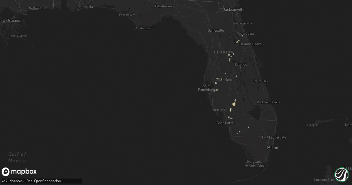
Hail Map in Florida on July 13, 2022
Get this storm
July 13 map
$229
one time, instant access
Download today. No call, no setup
Keep the $229
Bought the map and want the full workflow? Apply the entire $229 to a subscription within 7 days. None of it is wasted.
Every map, not just this one
This buys you this map. Subscription and you get every map we run, in the markets you choose from a few cities to whole states to nationwide. Plus real-time alerts the moment a storm fires.
Contact data
Name, contact info, occupancy, even credit band for addresses in the footprint. You go from where it hit to who to call.
Become the source they trust
Unlimited branding weather history reports on demand. You already have the documented answer ready for the property owner, and you are the one who showed up with it.
Property data and RoofTrace estimates
Pull up any address you have got, its value and the exact code rules for that jurisdiction, straight from One Click Code. Then RoofTrace estimates the squares, pitch, and roof value, priced the way you price.
Storm reports in Florida
Florida
| Date | Description |
|---|---|
| 07/13/20226:20 PM CDT | Hardee county sheriff office reported downed power lines along state route 64 near zolfo springs. Time estimated from radar. |
| 07/13/20223:44 AM CDT | At 843 PM EDT, a severe thunderstorm was located over Howey-In-the-hills, moving northeast at 5 mph. HAZARD...60 mph wind gusts. SOURCE...Radar indicated. IMPACT...Expect damage to roofs, siding, and trees. Locations impacted include... Tavares, Howey-In-the-hills, Lake Harris, Leesburg Airport and Astatula. |
| 07/13/20222:34 AM CDT | At 734 PM EDT, a severe thunderstorm was located near Pierson, moving northeast at 5 mph. HAZARD...60 mph wind gusts. SOURCE...Radar indicated. IMPACT...Expect damage to roofs, siding, and trees. Locations impacted include... Pierson, Lake George, Eldridge, Seville and Bakerstown. |
All States Impacted by Hail Map on July 13, 2022
Cities Impacted by Hail Map on July 13, 2022
- Hammond, MT
- Ringold, OK
- Dawsonville, GA
- Dewy Rose, GA
- Elberton, GA
- Broken Bow, OK
- Homer, MI
- Tekonsha, MI
- Litchfield, MI
- Holly Springs, MS
- Potts Camp, MS
- Mosby, MT
- Clarksdale, MS
- Lyon, MS
- Coahoma, MS
- Coffeeville, MS
- De Witt, AR
- Senatobia, MS
- Como, MS
- Schlater, MS
- Hickman, NE
- Roca, NE
- Lincoln, NE
- Bennet, NE
- Gainesville, GA
- Cumming, GA
- Queen City, TX
- Mena, AR
- Norman, AR
- Ringgold, LA
- Florien, LA
- Anacoco, LA
- Winona, KS
- Brewster, KS
- Colby, KS
- Levant, KS
- Atwood, KS
- Roanoke Rapids, NC
- Halifax, NC
- Mount Ida, AR
- Carlton, GA
- Firth, NE
- Alligator, MS
- Greenville, MS
- Ingomar, MT
- Musselshell, MT
- Pendleton, NC
- Amity, AR
- Cove, AR
- Shelby, MS
- Mound Bayou, MS
- Belhaven, NC
- Rayville, LA
- Burlington, NC
- Beaver Crossing, NE
- York, NE
- Exeter, NE
- Cordova, NE
- Friend, NE
- Long Branch, TX
- Carthage, TX
- Donaldson, AR
- Enterprise, LA
- Harrisonburg, LA
- Lexington, GA
- Edwards, MS
- Utica, MS
- Lewisville, AR
- Taylor, AR
- Keithville, LA
- Waskom, TX
- Karnack, TX
- Grenada, MS
- Scobey, MS
- Holcomb, MS
- Cascilla, MS
- Greenwood, MS
- Carrollton, MS
- Charleston, MS
- Tillatoba, MS
- Odell, NE
- Wright City, OK
- Brent, AL
- Centreville, AL
- Ashland, VA
- Glen Allen, VA
- Littleton, NC
- Oakland, MS
- Enid, MS
- Livingston Manor, NY
- Claryville, NY
- Roscoe, NY
- Utica, NE
- Milford, NE
- Seward, NE
- Goehner, NE
- Jonesville, MI
- Coushatta, LA
- Elm Grove, LA
- Waco, NE
- Walhalla, SC
- Crete, NE
- Newhope, AR
- Umpire, AR
- South Hill, VA
- Clarksville, VA
- Bullock, NC
- Boydton, VA
- Baskerville, VA
- Arkadelphia, AR
- Jefferson City, MT
- Lincolnton, NC
- Maiden, NC
- Denver, NC
- Hampton, AR
- Sheridan, AR
- Valliant, OK
- Garvin, OK
- West Yellowstone, MT
- Thornton, AR
- Doddridge, AR
- Rattan, OK
- Meridian, MS
- Newbern, AL
- Uniontown, AL
- Faunsdale, AL
- Lithonia, GA
- Zwolle, LA
- Many, LA
- Noble, LA
- Delhi, LA
- El Dorado, AR
- Daingerfield, TX
- Jamestown, LA
- Castor, LA
- Cades, SC
- Kingstree, SC
- Jefferson, TX
- Pittsburg, TX
- Diller, NE
- Tutwiler, MS
- Drew, MS
- Newellton, LA
- Rosston, AR
- Buckner, AR
- Goodman, MS
- Camden, MS
- Pickens, MS
- Warrenton, NC
- Roy, MT
- Dierks, AR
- De Queen, AR
- Mount Pleasant, TX
- Royal, AR
- Hot Springs National Park, AR
- Banks, AR
- Hampton, GA
- Jonesboro, GA
- Leesburg, TX
- Goldonna, LA
- Winnfield, LA
- Buffalo, MT
- Joaquin, TX
- Farmerville, LA
- Bernice, LA
- Choudrant, LA
- Eudora, AR
- Brusett, MT
- Duck Hill, MS
- Summit, MS
- Jordan, MT
- Mesa, AZ
- Gilbert, AZ
- Belgrade, MT
- Skaneateles, NY
- Elbridge, NY
- Syracuse, NY
- Marcellus, NY
- Wickes, AR
- Vandervoort, AR
- Grannis, AR
- Gillham, AR
- Deadwood, SD
- Waterford, MS
- Hugo, OK
- Zolfo Springs, FL
- Arcadia, FL
- McCool Junction, NE
- Waynesboro, MS
- Thonotosassa, FL
- Plant City, FL
- Dover, FL
- Lakeland, FL
- Orlando, FL
- Kirby, AR
- Logansport, LA
- Magnolia, AR
- Waldo, AR
- McNeil, AR
- Fouke, AR
- Comer, GA
- Shreveport, LA
- Leoti, KS
- Wallace, KS
- Sharon Springs, KS
- Tribune, KS
- Davenport, FL
- Stamps, AR
- Saline, LA
- Cloutierville, LA
- Lena, LA
- Eupora, MS
- Stewart, MS
- Center, TX
- Eutaw, AL
- Provencal, LA
- Punta Gorda, FL
- North Fort Myers, FL
- Oak Grove, LA
- Pioneer, LA
- Wharton, TX
- Trout, LA
- Wilmot, AR
- Grady, AR
- Texarkana, AR
- Nemaha, NE
- Brownville, NE
- Groveland, FL
- Yalaha, FL
- Howey In The Hills, FL
- Bunnell, FL
- Gloster, LA
- Tenaha, TX
- Smoaks, SC
- Williams, SC
- Ruffin, SC
- Eros, LA
- Nacogdoches, TX
- Ozona, TX
- Gore Springs, MS
- Summerfield, LA
- Fort Supply, OK
- Woodward, OK
- Hurley, NY
- West Hurley, NY
- Kingston, NY
- Ruleville, MS
- Lewistown, MT
- Stonewall, LA
- Rodessa, LA
- Ruth, MS
- Boling, TX
- Tetonia, ID
- Islandton, SC
- McCool, MS
- Ethel, MS
- Colbert, GA
- Louise, TX
- Monticello, MS
- Colfax, LA
- El Campo, TX
- Comstock, TX
- Clewiston, FL
- Hobson, MT
- Lake Providence, LA
- Sells, AZ
- Frierson, LA
- Mansfield, LA
- Douglass, TX
- Natchitoches, LA
- Hemphill, TX
- Tavares, FL
- Timpson, TX
- Umatilla, FL
- Eustis, FL
- Lillie, LA
- Junction City, AR
- Bloomington, NY
- Port Ewen, NY
- Cottekill, NY
- Stone Ridge, NY
- Olivebridge, NY
- Bogue Chitto, MS
- Hartwell, GA
- Rhinebeck, NY
- Ulster Park, NY
- Rosendale, NY
- Alcolu, SC
- Gable, SC
- Bivins, TX
- Vicksburg, MS
- Itta Bena, MS
- Garwood, TX
- Hallettsville, TX
- Boyle, MS
- Louin, MS
- Pierson, FL
- Seville, FL
- Keatchie, LA
- Grand Cane, LA
- Greenwood, LA
- McCarley, MS
- Lodge, SC
- Gunnison, MS
- Snow Lake, AR
- Wimauma, FL
- Bowman, GA
- Marshall, TX
- Hallsville, TX
- Terry, MS
- Raymond, MS
- Brady, TX
- Tallulah, LA
- Mount Vernon, TX
- San Augustine, TX
- Immokalee, FL
- Port Gibson, MS
- Alexis, NC
- Iron Station, NC
- Stanley, NC
- Cleveland, MS
- Doddsville, MS
- Holly Grove, AR
- Marvell, AR
- Dubberly, LA
- Brookhaven, MS
- Hernando, MS
- De Kalb, TX
- Griffin, GA
- Williamson, GA
- Mcdonough, GA
- Lorman, MS
- Brooks, GA
- Sparkman, AR
- Sontag, MS
- Leesburg, FL
- Felt, ID
- Lavonia, GA
- Alva, FL
- Brandon, FL
- Tampa, FL
- Riverview, FL
- Portland, AR
- Sondheimer, LA
- Epps, LA
- Greensboro, GA
- Hickory, MS
- Chunky, MS
- Dodson, LA
- Jena, LA
- Jefferson, GA
- Mora, LA
- Flatwoods, LA
- West Monroe, LA
- Bentley, LA
- Dry Prong, LA
- Monticello, AR
- Byram, MS
- Waverly, AL
- Mize, MS
- Raleigh, MS
- Naples, FL
- Joliet, MT
- Columbus, MT
- Laurel, MT
- Park City, MT
- Nedrow, NY
- East Branch, NY
- Downsville, NY


