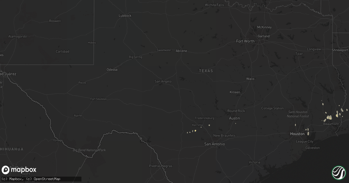
Hail Map in Texas on July 10, 2022
Get this storm
July 10 map
$229
one time, instant access
Download today. No call, no setup
Keep the $229
Bought the map and want the full workflow? Apply the entire $229 to a subscription within 7 days. None of it is wasted.
Every map, not just this one
This buys you this map. Subscription and you get every map we run, in the markets you choose from a few cities to whole states to nationwide. Plus real-time alerts the moment a storm fires.
Contact data
Name, contact info, occupancy, even credit band for addresses in the footprint. You go from where it hit to who to call.
Become the source they trust
Unlimited branding weather history reports on demand. You already have the documented answer ready for the property owner, and you are the one who showed up with it.
Property data and RoofTrace estimates
Pull up any address you have got, its value and the exact code rules for that jurisdiction, straight from One Click Code. Then RoofTrace estimates the squares, pitch, and roof value, priced the way you price.
Storm reports in Texas
Texas
| Date | Description |
|---|---|
| 07/10/20226:08 PM CDT | Trees and fences downed just inside bastrop county on fm 672 near the caldwell county line and st. Johns colony. |
| 07/10/20225:32 PM CDT | 8 rvs were pushed over at a dealership and repair shop. |
| 07/10/20224:55 PM CDT | Measured by kerrville awos. |
| 07/10/20224:55 PM CDT | Measured by kerrville/kerr county airport awos. |
| 07/10/20224:17 PM CDT | Several large tree limbs snapped in mission hills ranch subdivision. Microburst evident on radar at the time. |
| 07/10/20223:56 PM CDT | Measured by san marcos regional airport awos. |
| 07/10/20224:06 AM CDT | At 905 PM CDT, a severe thunderstorm was located over Spring, moving east at 15 mph. HAZARD...60 mph wind gusts. SOURCE...Radar indicated. IMPACT...Expect damage to roofs, siding, and trees. Locations impacted include... Humble, Spring, Kingwood and northwestern Bush Intercontinental Airport. |
| 07/10/202212:25 AM CDT | At 525 PM CDT, a severe thunderstorm was located near Medina, moving southwest at 20 mph. HAZARD...60 mph wind gusts and quarter size hail. SOURCE...Radar indicated. IMPACT...Hail damage to vehicles is expected. Expect wind damage to roofs, siding, and trees. Locations impacted include... Medina and Tarpley. |
| 07/09/202211:02 PM CDT | At 402 PM CDT, a severe thunderstorm was located near Smithson Valley, or 9 miles southwest of Canyon Lake Dam, moving southwest at 10 mph. HAZARD...60 mph wind gusts. SOURCE...Radar indicated. IMPACT...Expect damage to roofs, siding, and trees. Locations impacted include... New Braunfels, Schertz, Universal City, Selma, Canyon Lake, Bulverde, Garden Ridge, Smithson Valley, Timberwood Park, Solms and Bracken. |
All States Impacted by Hail Map on July 10, 2022
Cities Impacted by Hail Map on July 10, 2022
- Padroni, CO
- Champion, NE
- Argyle, MN
- Stephen, MN
- Ayr, ND
- Buffalo, ND
- Hawley, MN
- Pelican Rapids, MN
- Detroit Lakes, MN
- Glyndon, MN
- Vergas, MN
- New York Mills, MN
- Barnesville, MN
- Perham, MN
- Audubon, MN
- Menahga, MN
- Lake Park, MN
- Sebeka, MN
- Frazee, MN
- Ponsford, MN
- Clearwater, NE
- Orchard, NE
- Valley City, ND
- Gordon, WI
- Solon Springs, WI
- Iowa, LA
- Backus, MN
- Dilworth, MN
- Moorhead, MN
- Woodville, TX
- Colfax, ND
- Barney, ND
- Hunter, ND
- Erie, ND
- Columbus Junction, IA
- Conesville, IA
- Wyola, MT
- Burwell, NE
- Moose Lake, MN
- Sturgeon Lake, MN
- Winnebago, MN
- Andover, MN
- Forest Lake, MN
- Circle Pines, MN
- Ewing, NE
- Pine River, MN
- Crosslake, MN
- Pequot Lakes, MN
- Singer, LA
- Odebolt, IA
- Ida Grove, IA
- Arthur, IA
- What Cheer, IA
- Greensburg, LA
- Grover, CO
- New Raymer, CO
- Bushnell, NE
- Neligh, NE
- Holyoke, CO
- Lance Creek, WY
- Sundance, WY
- Alva, WY
- Hulett, WY
- Lodge Grass, MT
- Bridger, MT
- Harcourt, IA
- Dayton, IA
- Ainsworth, IA
- Imperial, NE
- Piedmont, SD
- Collins, IA
- White Owl, SD
- Howes, SD
- Adams, MN
- Medina, TX
- Haxtun, CO
- Boerne, TX
- Devils Lake, ND
- Crary, ND
- Deridder, LA
- Broken Bow, NE
- Anselmo, NE
- Story City, IA
- Wells, MN
- Hartland, MN
- Aitkin, MN
- Bartlett, NE
- Zachary, LA
- Petersburg, NE
- Spalding, NE
- Albion, NE
- Merriman, NE
- Martin, SD
- Wounded Knee, SD
- Batesland, SD
- Manderson, SD
- Pine Ridge, SD
- Pitkin, LA
- Owanka, SD
- New Underwood, SD
- Puposky, MN
- Black River Falls, WI
- Merrillan, WI
- Stewart, MN
- Malcom, IA
- Montezuma, IA
- Kerrick, MN
- Kingsley, IA
- Le Mars, IA
- Merrill, IA
- Hinton, IA
- Remsen, IA
- Verdigre, NE
- Center, NE
- Winnetoon, NE
- Monroe, NE
- Platte Center, NE
- Genoa, NE
- Atkinson, NE
- Oneill, NE
- Kathryn, ND
- Spiritwood, ND
- Fingal, ND
- Ypsilanti, ND
- Sheldon, ND
- Enderlin, ND
- Sanborn, ND
- Wyndmere, ND
- Litchville, ND
- Marion, ND
- Nome, ND
- Mcleod, ND
- Leonard, ND
- Yarmouth, IA
- Mount Union, IA
- Delavan, MN
- Sugartown, LA
- Mittie, LA
- Ragley, LA
- Oakdale, LA
- Grant, LA
- Dry Creek, LA
- Longville, LA
- Newcastle, WY
- Crosby, MN
- Deweyville, TX
- Call, TX
- Onawa, IA
- Moorhead, IA
- Hammond, MT
- Broadus, MT
- Alzada, MT
- New Roads, LA
- Somerset, WI
- Stillwater, MN
- Silsbee, TX
- Kountze, TX
- Belgrade, NE
- Cedar Rapids, NE
- Saint Edward, NE
- Fullerton, NE
- Baytown, TX
- Belle Fourche, SD
- Franklinton, LA
- Quinn, SD
- Wall, SD
- Tower City, ND
- Wasta, SD
- Crosby, TX
- Georgetown, MN
- Gardner, ND
- Harwood, ND
- Fargo, ND
- Felton, MN
- Argusville, ND
- Sherburn, MN
- Vale, SD
- Newell, SD
- Union Center, SD
- Sturgis, SD
- Rapid City, SD
- Box Elder, SD
- Kadoka, SD
- Caputa, SD
- Nunn, CO
- Claxton, GA
- Oriska, ND
- Page, ND
- Clearmont, WY
- Slaughter, LA
- Ethel, LA
- Saint Xavier, MT
- Port Allen, LA
- Enders, NE
- Sherwood, ND
- Akeley, MN
- Bemidji, MN
- Ventress, LA
- Durand, WI
- Mondovi, WI
- Willow River, MN
- West Point, NE
- Watkins, IA
- Blairstown, IA
- Ogema, MN
- Metter, GA
- Buna, TX
- Arnaudville, LA
- Davenport, ND
- Mapleton, ND
- Hammond, WI
- Houlton, WI
- Marine On Saint Croix, MN
- New Richmond, WI
- Holyoke, MN
- Keswick, IA
- Sigourney, IA
- Webster, IA
- Harper, IA
- Tenstrike, MN
- Busby, MT
- Garryowen, MT
- Callaway, NE
- Starks, LA
- Rochert, MN
- Callaway, MN
- Petersburg, ND
- Grand Marais, MN
- Hines, MN
- Greeley, NE
- Scotia, NE
- Wolbach, NE
- Grafton, ND
- Osage, MN
- Park Rapids, MN
- Erwinville, LA
- Jarreau, LA
- Lakeland, LA
- Nichols, IA
- Lone Tree, IA
- Horace, ND
- Wheatland, ND
- Chelsea, IA
- Elberon, IA
- Wauneta, NE
- Craig, NE
- Oakland, NE
- Philip, SD
- Milesville, SD
- Custer, SD
- Hot Springs, SD
- Edgemont, SD
- Amite, LA
- Winfield, IA
- Crawfordsville, IA
- Washington, IA
- Olds, IA
- Mount Pleasant, IA
- Wayland, IA
- Brighton, IA
- Wapello, IA
- Morning Sun, IA
- Austin, TX
- Paoli, CO
- Amherst, CO
- Sour Lake, TX
- Elsie, NE
- Hayes Center, NE
- Madrid, NE
- Marengo, IA
- Tylertown, MS
- Boone, IA
- Ames, IA
- Gilman, IA
- Hartwick, IA
- Montour, IA
- Deep River, IA
- Parnell, IA
- Brooklyn, IA
- Tama, IA
- Wellman, IA
- North English, IA
- Guernsey, IA
- Ladora, IA
- Williamsburg, IA
- Belle Plaine, IA
- South English, IA
- Kalona, IA
- Grinnell, IA
- Victor, IA
- Fordville, ND
- West Fargo, ND
- Birney, MT
- Amana, IA
- Norway, IA
- Keota, IA
- Forest Hill, LA
- Spring, TX
- Houston, TX
- Breaux Bridge, LA
- Gothenburg, NE
- Brady, NE
- Dent, MN
- Henderson, MN
- Green Isle, MN
- Ellsworth Afb, SD
- Rothsay, MN
- Wolverton, MN
- Neillsville, WI
- Deerwood, MN
- Nisland, SD
- Spearfish, SD
- Lead, SD
- Moorcroft, WY
- Deadwood, SD
- Whitewood, SD
- Devils Tower, WY
- Weston, WY
- Aladdin, WY
- Beulah, WY
- Black Hawk, SD
- Nemo, SD
- Decatur, NE
- Tekamah, NE
- Stapleton, NE
- Arnold, NE
- Merna, NE
- Casselton, ND
- Nevis, MN
- Armstrong Creek, WI
- Argonne, WI
- Conrad, IA
- Staples, MN
- Verndale, MN
- Rose Creek, MN
- West Chester, IA
- Fairmont, MN
- Welcome, MN
- Lake City, IA
- Lake View, IA
- Gowrie, IA
- Stratford, IA
- Auburn, IA
- Breda, IA
- Rockwell City, IA
- Kiron, IA
- Farnhamville, IA
- Carroll, IA
- Wall Lake, IA
- Lohrville, IA
- Borup, MN
- Boyes, MT
- Batchelor, LA
- Morganza, LA
- Strum, WI
- Whitehall, WI
- Eleva, WI
- Independence, WI
- Osseo, WI
- Bon Wier, TX
- Sioux City, IA
- Ironton, MN
- Otter, MT
- Merryville, LA
- Granada, MN
- Rose Hill, IA
- Delta, IA
- Vanderpool, TX
- Colo, IA
- Zearing, IA
- Jewell, IA
- Melbourne, IA
- Rhodes, IA
- Marshalltown, IA
- Stanhope, IA
- McCallsburg, IA
- State Center, IA
- Roland, IA
- Saint Anthony, IA
- Clemons, IA
- Nevada, IA
- Riceville, IA
- McIntire, IA
- Lumberton, TX
- International Falls, MN
- Sterling, CO
- Newman Grove, NE
- Maywood, NE
- Jackson, LA
- Saint Francisville, LA
- Lyle, MN
- White River, SD
- Long Valley, SD
- Wanblee, SD
- Van Horne, IA
- Keystone, IA
- Luzerne, IA
- Kentwood, LA
- Midland, SD
- Dayton, TX
- Center Point, TX
- Curtis, NE
- Vidor, TX
- Stacyville, IA
- Riverside, IA
- Columbus, MT
- Enning, SD
- Amelia, NE
- Austin, MN
- Albert Lea, MN
- Decker, MT
- Elma, IA
- Taopi, MN
- Kellogg, IA
- Gilbert, IA
- Muscatine, IA
- Haverhill, IA
- Letts, IA
- Millersburg, IA
- New Boston, IL
- Fruitland, IA
- Illinois City, IL
- Scenic, SD
- Hermosa, SD
- Jamestown, ND
- Cleveland, ND
- Medina, ND
- Niagara, ND
- Manvel, ND
- Red Lake Falls, MN
- East Grand Forks, MN
- Finley, ND
- Mcville, ND
- Emerado, ND
- Thompson, ND
- Jessie, ND
- Arvilla, ND
- Mchenry, ND
- Reynolds, ND
- Grand Forks, ND
- Newfolden, MN
- New Rockford, ND
- Michigan, ND
- Sharon, ND
- Grand Forks Afb, ND
- Larimore, ND
- Middle River, MN
- Pekin, ND
- Mekinock, ND
- Hope, ND
- Warren, MN
- Thief River Falls, MN
- Warwick, ND
- Viking, MN
- Plummer, MN
- Crookston, MN
- Gatzke, MN
- Cooperstown, ND
- Brooks, MN
- Cummings, ND
- Mayville, ND
- Fisher, MN
- Northwood, ND
- Aneta, ND
- Goodridge, MN
- Lakota, ND
- Glenfield, ND
- Tolna, ND
- Hatton, ND
- Portland, ND
- Mentor, MN
- Grygla, MN
- Euclid, MN
- Saint Hilaire, MN
- Climax, MN
- Binford, ND
- Buxton, ND
- Shevlin, MN
- Solway, MN
- Ulen, MN
- Ada, MN
- Cass Lake, MN
- Lake George, MN
- Bejou, MN
- Mahnomen, MN
- Fosston, MN
- Gary, MN
- Bagley, MN
- Naytahwaush, MN
- Twin Valley, MN
- Lengby, MN
- Hitterdal, MN
- Sabin, MN
- Waubun, MN
- White Earth, MN
- Perley, MN
- Laporte, MN
- Arlington, NE
- Paton, IA
- Humphrey, NE
- Kelley, IA
- Missouri Valley, IA
- Manning, IA
- Beaver, IA
- Rogers, NE
- Earling, IA
- Lyons, NE
- Madison, NE
- Denison, IA
- Ralston, IA
- Charter Oak, IA
- Woodward, IA
- Lidderdale, IA
- Modale, IA
- Rippey, IA
- Halbur, IA
- Vail, IA
- Churdan, IA
- Hooper, NE
- Howells, NE
- Irwin, IA
- Blencoe, IA
- Glidden, IA
- Madrid, IA
- Luther, IA
- Aspinwall, IA
- Perry, IA
- Dow City, IA
- Woodbine, IA
- Linwood, NE
- Boxholm, IA
- Dedham, IA
- Scribner, NE
- Manilla, IA
- Pisgah, IA
- Little Sioux, IA
- Schuyler, NE
- Scranton, IA
- Ute, IA
- Coon Rapids, IA
- North Bend, NE
- Bagley, IA
- Jamaica, IA
- Mondamin, IA
- Nickerson, NE
- Kennard, NE
- Logan, IA
- Dunlap, IA
- Lindsay, NE
- Westside, IA
- Stanton, NE
- Dana, IA
- Defiance, IA
- Herman, NE
- Magnolia, IA
- Wisner, NE
- Creston, NE
- Fort Calhoun, NE
- Jefferson, IA
- Grand Junction, IA
- Morse Bluff, NE
- Winslow, NE
- Snyder, NE
- Panama, IA
- Columbus, NE
- Clarkson, NE
- Portsmouth, IA
- Pilot Mound, IA
- Ames, NE
- Uehling, NE
- Leigh, NE
- Ogden, IA
- Arion, IA
- Blair, NE
- Deloit, IA
- Templeton, IA
- Arcadia, IA
- Dodge, NE
- Soldier, IA
- Fremont, NE
- Persia, IA
- Walcott, ND
- Wahpeton, ND
- Hereford, CO


