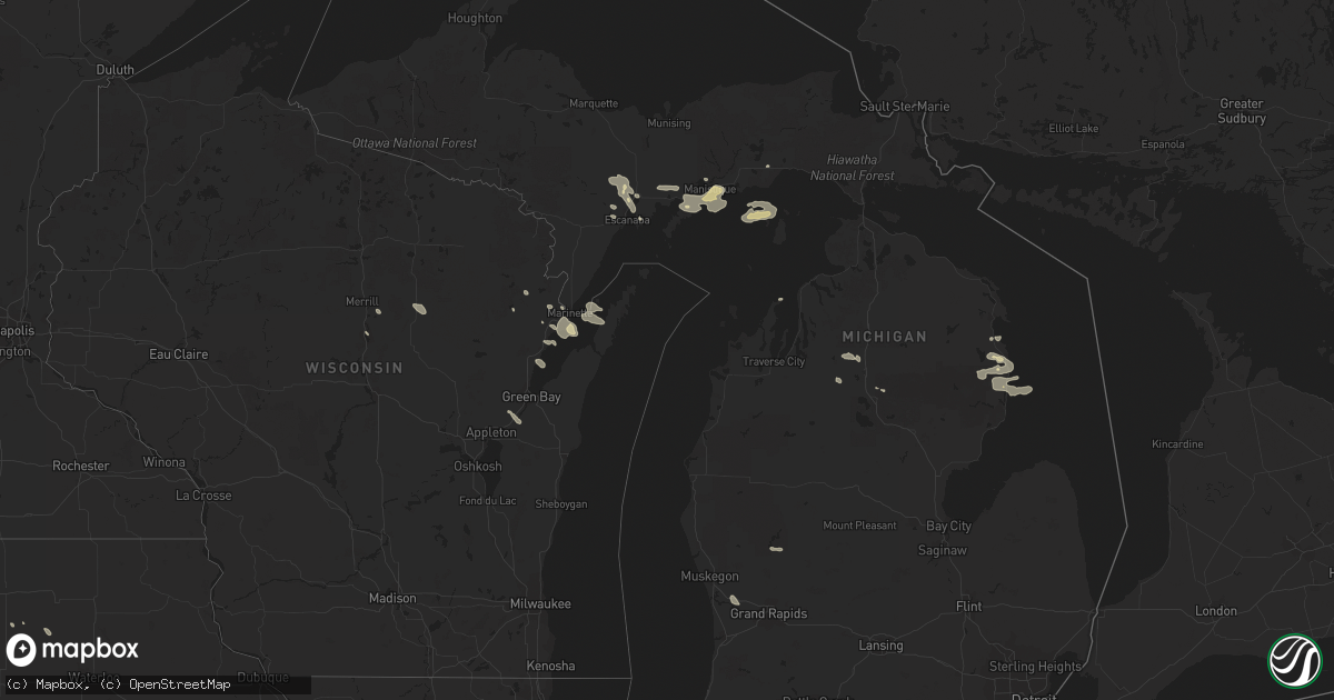
Hail Map in Michigan on July 5, 2021
Get this storm
July 5 map
$229
one time, instant access
Download today. No call, no setup
Keep the $229
Bought the map and want the full workflow? Apply the entire $229 to a subscription within 7 days. None of it is wasted.
Every map, not just this one
This buys you this map. Subscription and you get every map we run, in the markets you choose from a few cities to whole states to nationwide. Plus real-time alerts the moment a storm fires.
Contact data
Name, contact info, occupancy, even credit band for addresses in the footprint. You go from where it hit to who to call.
Become the source they trust
Unlimited branding weather history reports on demand. You already have the documented answer ready for the property owner, and you are the one who showed up with it.
Property data and RoofTrace estimates
Pull up any address you have got, its value and the exact code rules for that jurisdiction, straight from One Click Code. Then RoofTrace estimates the squares, pitch, and roof value, priced the way you price.
Storm reports in Michigan
Michigan
| Date | Description |
|---|---|
| 07/05/20216:30 PM CDT | Pictures of multiple trees down in the village. Time estimated via radar. |
| 07/05/20213:34 AM CDT | At 834 PM EDT, a severe thunderstorm was located over Black River, or 9 miles southeast of Ossineke, moving east at 30 mph. HAZARD...60 mph wind gusts and quarter size hail. SOURCE...Radar indicated. IMPACT...Hail damage to vehicles is expected. Expect wind damage to roofs, siding, and trees. This severe thunderstorm will be near... Black River around 840 PM EDT. |
| 07/05/20211:32 AM CDT | At 632 PM EDT, a severe thunderstorm was located 8 miles northwest of Escanaba, moving southeast at 20 mph. HAZARD...Quarter size hail. SOURCE...Radar indicated. IMPACT...Damage to vehicles is expected. This severe thunderstorm will be near... Gladstone around 645 PM EDT. Escanaba around 650 PM EDT. |
| 07/04/202110:15 PM CDT | At 313 PM EDT, a severe thunderstorm was located over Gladstone, or near Escanaba, moving southeast at 25 mph. HAZARD...60 mph wind gusts and quarter size hail. SOURCE...Radar indicated. IMPACT...Hail damage to vehicles is expected. Expect wind damage to roofs, siding, and trees. This severe thunderstorm will remain over mainly rural areas of central Delta County, including the following locations... Stonington. |
| 07/04/202110:01 PM CDT | At 300 PM EDT, a severe thunderstorm was located near Gladstone, or 11 miles north of Escanaba, moving southeast at 20 mph. HAZARD...Quarter size hail. SOURCE...Radar indicated. IMPACT...Damage to vehicles is expected. This severe thunderstorm will be near... Rapid River around 310 PM EDT. Gladstone around 315 PM EDT. |
| 07/04/20219:43 PM CDT | At 243 PM EDT, a severe thunderstorm was located over Lincoln, or near Harrisville, moving east at 30 mph. HAZARD...60 mph wind gusts and quarter size hail. SOURCE...Radar indicated. IMPACT...Hail damage to vehicles is expected. Expect wind damage to roofs, siding, and trees. This severe thunderstorm will be near... Harrisville and Harrisville State Park around 255 PM EDT. |
| 07/04/20217:35 PM CDT | At least five 12-18 size trees are down on the property due to strong winds. Minor damage to one building as one tree fell against it. |
All States Impacted by Hail Map on July 5, 2021
Cities Impacted by Hail Map on July 5, 2021
- De Pere, WI
- Glen Ullin, ND
- Gladstone, ND
- Taylor, ND
- Hebron, ND
- Richardton, ND
- Douglas, WY
- Marinette, WI
- Peshtigo, WI
- Merrill, WI
- Wausau, WI
- Coopersville, MI
- Nunica, MI
- Porterfield, WI
- Lennox, SD
- Chancellor, SD
- Draper, SD
- Wood, SD
- Mora, NM
- Chamberlain, SD
- Pukwana, SD
- Okeechobee, FL
- Fort Pierre, SD
- Pierre, SD
- Hayes, SD
- Menno, SD
- Hartley, IA
- Primghar, IA
- Hudson, FL
- Chester, MT
- Newaygo, MI
- Howard City, MI
- Harrisville, MI
- Lincoln, MI
- Sanborn, IA
- Ashton, IA
- Sheldon, IA
- Crivitz, WI
- Greenbush, MI
- Mikado, MI
- Westcliffe, CO
- George, IA
- Kennebec, SD
- Reliance, SD
- Kimball, SD
- South Heart, ND
- Garden, MI
- Northport, MI
- Dubois, ID
- Meadow, SD
- Mott, ND
- Hettinger, ND
- Carrizozo, NM
- Freeman, SD
- Hull, IA
- Doon, IA
- Roscommon, MI
- Manistique, MI
- Presho, SD
- Rapid River, MI
- Pearsall, TX
- Dilley, TX
- Sturgis, SD
- Nemo, SD
- Piedmont, SD
- Lodgepole, SD
- Lemmon, SD
- Bridgewater, SD
- Emery, SD
- Cotulla, TX
- Olivet, SD
- Georgetown, CO
- Frederic, MI
- Kalkaska, MI
- Hurley, SD
- Red River, NM
- Black River, MI
- Dickens, IA
- Cooks, MI
- Barton City, MI
- Newcastle, WY
- Orlando, FL
- Ocoee, FL
- Willard, NM
- Plankinton, SD
- Wheatland, WY
- Beaver Island, MI
- Holabird, SD
- Montague, MA
- Wendell, MA
- Millers Falls, MA
- Stickney, SD
- Corsica, SD
- Rociada, NM
- Byers, CO
- White River, SD
- Murdo, SD
- Prairie City, SD
- Florissant, CO
- Belfield, ND
- Hondo, TX
- White Lake, SD
- Jeffrey City, WY
- Collins, MS
- Cornell, MI
- Gladstone, MI
- Waynesboro, MS
- Hamill, SD
- Kaukauna, WI
- Greenleaf, WI
- Wrightstown, WI
- Mission, SD
- Windermere, FL
- Harrisburg, SD
- Tea, SD
- Worthing, SD
- Sioux Falls, SD
- Canton, SD
- Oacoma, SD
- Empire, CO
- Idaho Springs, CO
- Garrett, WY
- Bison, SD
- Deadwood, SD
- Ossineke, MI
- Mount Vernon, SD
- Ethan, SD
- Egg Harbor, WI
- Reva, SD
- Naubinway, MI
- Parkston, SD
- Dimock, SD
- Lead, SD
- Spencer, IA
- West Winfield, NY
- Greene, IA
- Allison, IA
- Wasta, SD
- Fort Sumner, NM
- Gregory, SD
- Harrold, SD
- Marion, SD
- Fife Lake, MI
- Sheffield, IA
- Galata, MT
- Shelby, MT
- Lindon, CO
- Perkins, MI
- Rock, MI
- Pound, WI
- Spruce, MI
- Platte, SD
- Viborg, SD
- Parker, SD
- Davis, SD
- Garita, NM
- Harrison, SD
- Armour, SD
- Cochise, AZ
- Guffey, CO
- Vivian, SD
- Mountainair, NM
- Oconto, WI
- Mico, TX
- Dougherty, IA
- Centerville, SD
- Antigo, WI
- Little Suamico, WI
- Boyden, IA
- Kenansville, FL
- Coleman, WI
- Escanaba, MI
- Canistota, SD
- Beaver Creek, MN
- Valley Springs, SD
- Brandon, SD
- Hills, MN
- Crooks, SD
- Salem, SD
- Inwood, IA
- Garretson, SD
- Larchwood, IA
- Humboldt, SD
- Montrose, SD
- Hartford, SD
- Luverne, MN
- Fort Meade, SD
- Edgemont, SD
- Custer, SD
- Blackfoot, ID
- Riverton, WY
- Lander, WY
- Casper, WY


