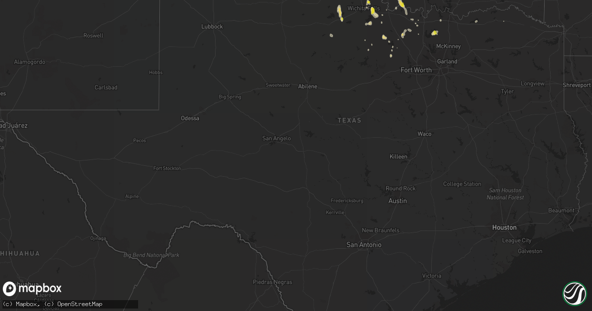
Hail Map in Texas on July 3, 2022
Get this storm
July 3 map
$229
one time, instant access
Download today. No call, no setup
Keep the $229
Bought the map and want the full workflow? Apply the entire $229 to a subscription within 7 days. None of it is wasted.
Every map, not just this one
This buys you this map. Subscription and you get every map we run, in the markets you choose from a few cities to whole states to nationwide. Plus real-time alerts the moment a storm fires.
Contact data
Name, contact info, occupancy, even credit band for addresses in the footprint. You go from where it hit to who to call.
Become the source they trust
Unlimited branding weather history reports on demand. You already have the documented answer ready for the property owner, and you are the one who showed up with it.
Property data and RoofTrace estimates
Pull up any address you have got, its value and the exact code rules for that jurisdiction, straight from One Click Code. Then RoofTrace estimates the squares, pitch, and roof value, priced the way you price.
Storm reports in Texas
Texas
| Date | Description |
|---|---|
| 07/03/20226:22 PM CDT | West texas mesonet |
| 07/03/20224:04 PM CDT | Also a gust to 59 mph at 403 pm. West texas mesonet. |
| 07/03/20222:15 PM CDT | Wood shed/outbuilding damaged and two large aluminum barn doors blown out. Time est via radar. |
| 07/03/202212:21 AM CDT | At 520 PM CDT, a severe thunderstorm was located near Pilot Point, or 14 miles south of Whitesboro, moving northeast at 10 mph. HAZARD...60 mph wind gusts and quarter size hail. SOURCE...Radar indicated. IMPACT...Hail damage to vehicles is expected. Expect wind damage to roofs, siding, and trees. Locations impacted include... Sherman, Whitesboro, Pilot Point, Howe, Collinsville, Gunter, Dorchester, Ray Roberts Park Isle Du Bois, Ray Roberts Park Johnson Branch, Lake Kiowa, Southmayd, Tioga and Sadler. |
| 07/02/202210:30 PM CDT | At 330 PM CDT, a severe thunderstorm was located 8 miles southwest of Electra, moving north at 20 mph. HAZARD...60 mph wind gusts and nickel size hail. SOURCE...Radar indicated. IMPACT...Expect damage to roofs, siding, and trees. Locations impacted include... Harrold. |
| 07/02/202210:08 PM CDT | At 308 PM CDT, a severe thunderstorm was located 4 miles southeast of Overbrook, moving north at 10 mph. HAZARD...60 mph wind gusts and nickel size hail. SOURCE...Radar indicated. IMPACT...Expect damage to roofs, siding, and trees. Locations impacted include... Ardmore, Marietta, Lone Grove, Dickson, Lake Murray and Overbrook. |
| 07/02/20229:00 PM CDT | At 159 PM CDT, a severe thunderstorm was located near Henrietta, moving northwest at 20 mph. HAZARD...60 mph wind gusts and quarter size hail. SOURCE...Radar indicated. IMPACT...Hail damage to vehicles is expected. Expect wind damage to roofs, siding, and trees. Locations impacted include... Henrietta, Petrolia, Dean and Jolly. |
All States Impacted by Hail Map on July 3, 2022
Cities Impacted by Hail Map on July 3, 2022
- Brewster, WA
- Quincy, WA
- Malaga, WA
- Rock Island, WA
- Philipsburg, MT
- Cohagen, MT
- Orofino, ID
- Mound City, SD
- Ismay, MT
- Regent, ND
- Mott, ND
- New England, ND
- Hettinger, ND
- Fallon, MT
- Glendive, MT
- Terry, MT
- Max, ND
- Douglas, ND
- Wakpala, SD
- McLaughlin, SD
- Pollock, SD
- Herreid, SD
- Colfax, WA
- Ekalaka, MT
- Interior, SD
- Elgin, ND
- Glen Ullin, ND
- Almont, ND
- Plains, MT
- Wyndmere, ND
- Lidgerwood, ND
- Velva, ND
- Wibaux, MT
- Aberdeen, SD
- Westport, SD
- Lindsay, MT
- Bloomfield, MT
- Deer Park, WA
- Nine Mile Falls, WA
- Leola, SD
- Decker, MT
- Spencer, ID
- Lima, MT
- Dubois, ID
- Cameron, MT
- Bowdle, SD
- Darby, MT
- Volborg, MT
- Pray, MT
- Gardiner, MT
- Livingston, MT
- Huntley, MT
- Sheridan, WY
- Birney, MT
- Hardin, MT
- Worden, MT
- Ballantine, MT
- Colstrip, MT
- Pompeys Pillar, MT
- Bighorn, MT
- Otter, MT
- Forsyth, MT
- Thornton, WA
- Oakesdale, WA
- Jordan, MT
- Midland, SD
- Cresbard, SD
- Long Valley, SD
- Belvidere, SD
- Rhame, ND
- Bowman, ND
- Underwood, MN
- Battle Lake, MN
- Washburn, ND
- Selfridge, ND
- Northville, SD
- Sand Springs, MT
- Brockway, MT
- Brusett, MT
- Winnett, MT
- Mosby, MT
- Underwood, ND
- Kadoka, SD
- Amidon, ND
- Webster, SD
- Pomaria, SC
- White River, SD
- Pine Ridge, SD
- Conner, MT
- Sula, MT
- Rosebud, MT
- Eureka, SD
- Java, SD
- Hot Springs, MT
- Lonepine, MT
- Ludlow, SD
- Billings, MT
- Shepherd, MT
- Acton, MT
- Colville, WA
- Long Lake, SD
- Chamberlain, SD
- Hamill, SD
- Gregory, SD
- Graettinger, IA
- Bridgeport, TX
- Wilmington, NC
- Philip, SD
- Wall, SD
- Pukwana, SD
- Model, CO
- Jacksboro, TX
- Bowie, TX
- Ward, CO
- Jamestown, CO
- Windthorst, TX
- Scotland, TX
- Henrietta, TX
- Dodd City, TX
- Windom, TX
- Honey Grove, TX
- Forestburg, TX
- Alvord, TX
- Jerico Springs, MO
- New Underwood, SD
- Bishopville, SC
- Hartsville, SC
- McBee, SC
- Saint Jo, TX
- Muenster, TX
- Chico, TX
- Ryan, OK
- Ringling, OK
- Nocona, TX
- Marietta, OK
- Fort Scott, KS
- Bertrand, NE
- Waldo, KS
- Paradise, KS
- Russell, KS
- Arcadia, NE
- Ipswich, SD
- New Bern, NC
- Cave Springs, AR
- Springdale, AR
- Lowell, AR
- Rogers, AR
- Bentonville, AR
- Early Branch, SC
- Throckmorton, TX
- Seymour, TX
- Willard, MO
- Le Roy, KS
- Roscoe, SD
- Hosmer, SD
- Yemassee, SC
- Colony, KS
- Tolstoy, SD
- Ree Heights, SD
- Highmore, SD
- Miller, SD
- Campbell, NE
- Bladen, NE
- Murdo, SD
- Clarkton, NC
- Bladenboro, NC
- Norris, SD
- Martin, SD
- Wichita Falls, TX
- Wolsey, SD
- Big Timber, MT
- Ryegate, MT
- Melville, MT
- Rapelje, MT
- Reed Point, MT
- Draper, SD
- Porcupine, SD
- Wounded Knee, SD
- Wanblee, SD
- Batesland, SD
- Allen, SD
- Kyle, SD
- Wasta, SD
- Scenic, SD
- Owanka, SD
- Goodland, KS
- Pilot Point, TX
- Tioga, TX
- Alpena, SD
- Woonsocket, SD
- Neodesha, KS
- Altoona, KS
- Buffalo, KS
- Benedict, KS
- Fredonia, KS
- Glenvil, NE
- Hastings, NE
- Inland, NE
- Ayr, NE
- Curtis, NE
- Moorefield, NE
- Okaton, SD
- Cleo Springs, OK
- Nevada, MO
- Arcadia, KS
- Elizabethtown, NC
- Greensboro, GA
- Union Point, GA
- Bryson, TX
- Lindsay, NE
- Bellevue, TX
- Gainesville, TX
- Tuthill, SD
- Mcdonough, GA
- Concord, GA
- Molena, GA
- Huron, SD
- Oacoma, SD
- Yates Center, KS
- Carthage, SD
- Artesian, SD
- Sturgis, SD
- Fort Meade, SD
- Kennebec, SD
- Fort Myers, FL
- Lakemont, GA
- Tiger, GA
- Troy, NC
- Lewellen, NE
- Chappell, NE
- Oshkosh, NE
- Big Springs, NE
- Graniteville, SC
- Auburntown, TN
- Liberty, TN
- Alexandria, TN
- Ruby, SC
- Chesterfield, SC
- Nashville, TN
- Randlett, OK
- Delco, NC
- Westphalia, KS
- Burlington, KS
- Waverly, KS
- Fergus Falls, MN
- Dalton, MN
- Loving, TX
- Neosho Falls, KS
- Electra, TX
- Broadview, MT
- Rapid City, SD
- Piedmont, SD
- Farnam, NE
- Stockville, NE
- Maywood, NE
- Wellfleet, NE
- Hayes Center, NE
- Ridgeway, SC
- Ottawa, KS
- Dalzell, SC
- Rembert, SC
- Graysville, TN
- Presho, SD
- Vivian, SD
- Richmond, KS
- Garnett, KS
- Durant, OK
- Faulkton, SD
- Leland, NC
- Kimball, SD
- White Lake, SD
- Wessington Springs, SD
- Scottsbluff, NE
- Gann Valley, SD
- Plankinton, SD
- Cove City, NC
- Pomona, KS
- Watkinsville, GA
- Bishop, GA
- Millen, GA
- Dulce, NM
- Magnolia, NC
- Warsaw, NC
- Hookerton, NC
- Grifton, NC
- Minatare, NE
- Holliday, TX
- Elizabeth City, NC
- Roseland, NE
- Eden, SD
- Opelika, AL
- Redfield, SD
- Brentford, SD
- Ashton, SD
- Conde, SD
- Doland, SD
- Turton, SD
- Frankfort, SD
- Mellette, SD
- Sanger, TX
- Monroe, NC
- Pageland, SC
- Molt, MT
- Dalton, NE
- Lisco, NE
- Wood, SD
- Lumberton, NC
- Oak Ridge, TN
- Valley View, TX
- Sherman, TX
- Missouri Valley, IA
- Logan, IA
- Kinston, NC
- Manderson, SD
- Piqua, KS
- Evergreen, NC
- Chadbourn, NC
- Upland, NE
- Minden, NE
- Franklin, NE
- Bloomington, NE
- Hildreth, NE
- Harvard, NE
- Athens, GA
- South Mills, NC
- Virgil, SD
- Wessington, SD
- Oakes, ND
- Cogswell, ND
- Reliance, SD
- Lower Brule, SD
- Fayetteville, NC
- White Oak, NC
- Hiawassee, GA
- Ellsworth, NE
- Bingham, NE
- Riverton, NE
- Galivants Ferry, SC
- Marion, SC
- Gresham, SC
- Blossom, TX
- Jefferson, SC
- Ringgold, TX
- Millry, AL
- Saint Lawrence, SD
- Loco, OK
- Deadwood, SD
- Clarks Hill, SC
- Caputa, SD
- Fort Pierre, SD
- Quinn, SD
- Fedora, SD
- Iroquois, SD
- Cavour, SD
- Albion, NE
- Comstock, NE
- Westerville, NE
- Ansley, NE
- Rosston, TX
- Blair, SC
- Paradise, TX
- Rutledge, GA
- Madison, GA
- Lamar, SC
- Lance Creek, WY
- Kershaw, SC
- Ringgold, GA
- Mitchell, NE
- Edgemont, SD
- Columbus, KS
- Scammon, KS
- Fruitdale, AL
- Vinegar Bend, AL
- Monroe, GA
- Good Hope, GA
- Milo, MO
- Conyers, GA
- Onaka, SD
- Hooper, NE
- Mullins, SC
- Wrightsville Beach, NC
- Ashley, ND
- Cayuga, ND
- Rockham, SD
- Dewy Rose, GA
- Saint Pauls, NC
- Poolville, TX
- Fayetteville, AR
- Naponee, NE
- Bogart, GA
- Statham, GA
- Omaha, NE
- Addy, WA
- Strandquist, MN
- Newfolden, MN
- New Leipzig, ND
- Pendleton, OR
- Estelline, SD
- Henning, MN
- Brule, NE
- Plevna, MT
- Baker, MT
- Willard, MT
- Milesville, SD
- Groton, SD
- Warner, SD
- Andover, SD
- Mansfield, SD
- Stratford, SD
- Bath, SD
- Ferney, SD
- Reva, SD
- Buffalo, SD
- Raymond, SD
- Grand Island, NE
- Polson, MT
- Custer, MT
- Marmarth, ND
- Mullen, NE
- Sutherland, NE
- Arthur, NE
- Tryon, NE
- Lemoyne, NE
- Doniphan, NE
- Chapman, NE
- Phillips, NE
- Alda, NE
- Black Hawk, SD
- Enning, SD
- Howes, SD
- Carson, ND
- Scranton, ND
- Reeder, ND
- Dickinson, ND


