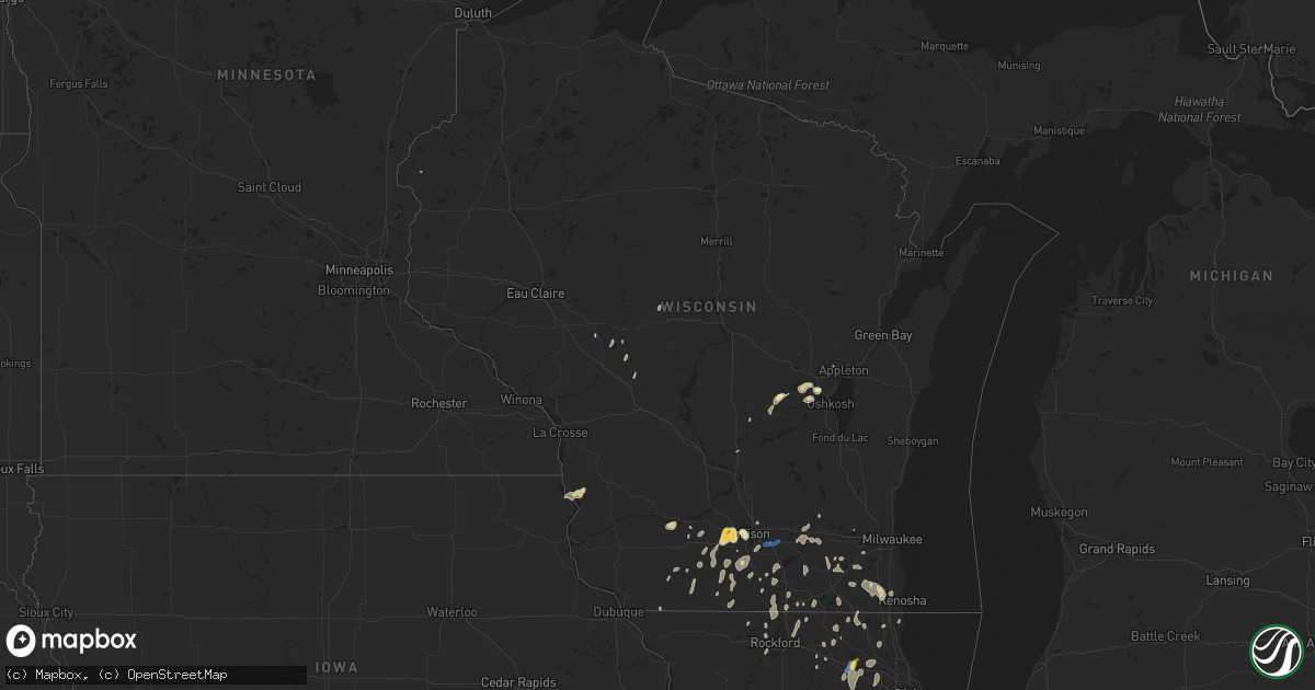
Hail Map in Wisconsin on June 29, 2020
Get this storm
June 29 map
$229
one time, instant access
Download today. No call, no setup
Keep the $229
Bought the map and want the full workflow? Apply the entire $229 to a subscription within 7 days. None of it is wasted.
Every map, not just this one
This buys you this map. Subscription and you get every map we run, in the markets you choose from a few cities to whole states to nationwide. Plus real-time alerts the moment a storm fires.
Contact data
Name, contact info, occupancy, even credit band for addresses in the footprint. You go from where it hit to who to call.
Become the source they trust
Unlimited branding weather history reports on demand. You already have the documented answer ready for the property owner, and you are the one who showed up with it.
Property data and RoofTrace estimates
Pull up any address you have got, its value and the exact code rules for that jurisdiction, straight from One Click Code. Then RoofTrace estimates the squares, pitch, and roof value, priced the way you price.
Storm reports in Wisconsin
Wisconsin
| Date | Description |
|---|---|
| 06/29/20203:32 PM CDT | Flooding on n. Blair st. And e. Dayton st.. Reports vehicles struggling to drive through standing water. |
| 06/29/20201:44 PM CDT | Tree limbs on power lines. |
| 06/29/20201:15 PM CDT | Report from mping: quarter |
| 06/29/202012:52 PM CDT | Relayed via social media. |
| 06/29/202011:35 AM CDT | Small to medium trees down as well as large branches and wires down. Time of the event is estimated based on radar. Delayed report. High winds lasted approximately 10 t |
| 06/29/20207:45 AM CDT | At 1244 PM CDT, severe thunderstorms were located along a broken line extending from near Spring Green to 7 miles west of Sauk City to near Middleton, moving north at 30 mph. HAZARD...60 mph wind gusts and quarter size hail. SOURCE...Radar indicated. IMPACT...Hail damage to vehicles is expected. Expect wind damage to roofs, siding, and trees. Locations impacted include... Madison, Sun Prairie, Fitchburg, Middleton, Waunakee, Baraboo, Verona, Oregon, Monona, Mount Horeb, Windsor, Dodgeville, Prairie Du Sac, Sauk City, Lake Wisconsin, Deforest, Cross Plains, Lodi, Poynette and Belleville.This includes the following Locations Wisconsin State Capitol,Gibraltar Rock Natural Area County Park, Alliant Energy Portage PowerPlant, Hyde's Mill, and The House on the Rock. |
| 06/28/20209:48 PM CDT | At 248 PM CDT, a severe thunderstorm was located near Redgranite, or 7 miles northwest of Berlin, moving northeast at 10 mph. HAZARD...60 mph wind gusts and quarter size hail. SOURCE...Radar indicated. IMPACT...Hail damage to vehicles is expected. Expect wind damage to roofs, siding, and trees. This severe thunderstorm will be near... Lake Poygan around 345 PM CDT.Other locations impacted by this severe thunderstorm includeSaxeville, Winneconne, Silver Lake, Lohrville, Mount Morris, PineRiver, Auroraville, Poy Sippi, Tustin and Metz. |
| 06/28/20209:11 PM CDT | At 211 PM CDT, severe thunderstorms were located along a broken line extending from Deerfield to near Cambridge to near Edgerton, moving east at 20 mph. HAZARD...60 mph wind gusts. SOURCE...Radar indicated. IMPACT...Expect damage to roofs, siding, and trees. Locations impacted include... Eastern Madison, Fitchburg, Whitewater, Stoughton, Fort Atkinson, Oregon, Jefferson, McFarland, Monona, Lake Mills, Edgerton, Cottage Grove, Johnson Creek, Deerfield, Palmyra, Cambridge, Brooklyn, Lake Ripley, Lake Koshkonong and Ixonia. |
| 06/28/20208:35 PM CDT | At 134 PM CDT, severe thunderstorms were located along a line extending from Madison to Evansville, moving northeast at 15 mph. HAZARD...60 mph wind gusts and quarter size hail. SOURCE...Radar indicated. IMPACT...Hail damage to vehicles is expected. Expect wind damage to roofs, siding, and trees. Locations impacted include... Madison, Sun Prairie, Fitchburg, Middleton, Stoughton, Waunakee, Verona, Oregon, McFarland, Monona, Windsor, Edgerton, Evansville, Marshall, Deforest, Cottage Grove, Deerfield, Shorewood Hills, Cambridge and Brooklyn.This includes the following Location Wisconsin State Capitol. |
All States Impacted by Hail Map on June 29, 2020
Cities Impacted by Hail Map on June 29, 2020
- Meadow, SD
- Dupree, SD
- Caputa, SD
- New Underwood, SD
- Albany, TX
- Dundee, IL
- New Haven, IL
- Ridgway, IL
- New Paltz, NY
- Alva, WY
- Seymour, IN
- Comstock, TX
- Belle Fourche, SD
- Beulah, WY
- Saint Onge, SD
- Spearfish, SD
- Ozona, TX
- Bison, SD
- Gallatin, TN
- Bethpage, TN
- Portland, TN
- Castalian Springs, TN
- Oshkosh, WI
- Winneconne, WI
- Glendive, MT
- Sundance, WY
- Raleigh, ND
- Watauga, SD
- New Leipzig, ND
- Shields, ND
- Morristown, SD
- Selfridge, ND
- Carson, ND
- Jacksonville, VT
- Colrain, MA
- Union Grove, WI
- Kenosha, WI
- Lueders, TX
- Stamford, TX
- Avoca, TX
- Plentywood, MT
- Clarksville, TN
- Deadwood, SD
- Nemo, SD
- Old Lyme, CT
- Montgomery, NY
- Walden, NY
- Union Center, SD
- Ovalo, TX
- Tuscola, TX
- Williamsburg, KY
- Newell, SD
- Madison, WI
- Killdeer, ND
- Fairfield, ND
- Watford City, ND
- Grassy Butte, ND
- Arnegard, ND
- Cartwright, ND
- Highland, NY
- Tillson, NY
- Ulster Park, NY
- Brooklyn, NY
- Outlook, MT
- Wibaux, MT
- Johnson Creek, WI
- Watertown, WI
- Granville, MA
- Sandisfield, MA
- Waddy, KY
- Shelbyville, KY
- Plaza, ND
- Lemmon, SD
- Belleville, WI
- New Glarus, WI
- Keene, ND
- Monon, IN
- Rensselaer, IN
- Birmingham, AL
- Norton, TX
- Winters, TX
- Bronte, TX
- Whitewood, SD
- Colebrook, CT
- Winsted, CT
- Knoxville, TN
- Prospect, TN
- Prairie City, SD
- Faith, SD
- Wingate, TX
- Blackwell, TX
- Flasher, ND
- Vale, SD
- Sturgis, SD
- Port Orange, FL
- Edgerton, WI
- Janesville, WI
- Venus, FL
- Lake Placid, FL
- Moorcroft, WY
- Louisville, KY
- Charlemont, MA
- Ashfield, MA
- Hazel Green, AL
- Meridianville, AL
- Toney, AL
- Huntsville, AL
- New Market, AL
- Ohatchee, AL
- Brooklyn, WI
- Mott, ND
- Estill Springs, TN
- Hill City, SD
- Redgranite, WI
- Neshkoro, WI
- Colchester, CT
- Lebanon, CT
- Upton, WY
- East Lyme, CT
- Pelzer, SC
- Malvern, AR
- Donaldson, AR
- Kansasville, WI
- Mundelein, IL
- Lake Zurich, IL
- Dickinson, ND
- New England, ND
- Lead, SD
- Scottsburg, IN
- Wilmington, IL
- Channahon, IL
- Mud Butte, SD
- Niantic, CT
- Orient, NY
- Fort Payne, AL
- Mentone, AL
- Gibbon, MN
- Winthrop, MN
- Barrington, IL
- Palatine, IL
- Hoffman Estates, IL
- Richardton, ND
- Robert Lee, TX
- Elgin, IL
- Carpentersville, IL
- Manning, ND
- Easley, SC
- Piedmont, SC
- Pine Ridge, SD
- Greenville, WI
- Sheridan, AR
- Abilene, TX
- Beach, ND
- Medora, ND
- Belfield, ND
- Belleville, IL
- O'Fallon, IL
- Traskwood, AR
- Poyen, AR
- Hulett, WY
- Sopchoppy, FL
- Cliffside Park, NJ
- Fort Lee, NJ
- Englewood, NJ
- Breezy Point, NY
- Tenafly, NJ
- Edgewater, NJ
- Leonia, NJ
- Astoria, NY
- Palisades Park, NJ
- Englewood Cliffs, NJ
- New York, NY
- Long Island City, NY
- North Bergen, NJ
- Bergenfield, NJ
- Stoughton, WI
- Piedmont, SD
- Berlin, WI
- Pine River, WI
- Whitewater, WI
- Rockford, IL
- Eubank, KY
- Science Hill, KY
- Redstone, MT
- Tye, TX
- Dyess Afb, TX
- Crawfordsville, IN
- Middleton, WI
- Homestead, MT
- Osage, WY
- Newcastle, WY
- Clintondale, NY
- Modena, NY
- Timber Lake, SD
- Ellington, CT
- Holdingford, MN
- Albany, MN
- Grey Eagle, MN
- Bowlus, MN
- Burtrum, MN
- Upsala, MN
- Neillsville, WI
- Raymond, MT
- Barnhart, TX
- Reeder, ND
- Aladdin, WY
- Greenwood, IN
- Dunn Center, ND
- Rapid City, SD
- Black Hawk, SD
- Enning, SD
- Accord, NY
- Peotone, IL
- Union, IL
- Woodstock, IL
- Merkel, TX
- Wallkill, NY
- Adams, TN
- Rockford, TN
- Dyer, IN
- Crown Point, IN
- Cedar Lake, IN
- Saint John, IN
- Schererville, IN
- Gladstone, ND
- Taylor, ND
- Prospect, KY
- Charlestown, IN
- Jeffersonville, IN
- Valparaiso, IN
- Milton, KY
- Blanchardville, WI
- Freeburg, IL
- Mascoutah, IL
- Storrs Mansfield, CT
- Mansfield Center, CT
- Goshen, KY
- Crestwood, KY
- Verona, WI
- New Bedford, MA
- South Dartmouth, MA
- North Dartmouth, MA
- Elizabethtown, IL
- Capron, IL
- Poplar Grove, IL
- Hull, IL
- Bardstown, KY
- Liberty, KY
- Coventry, CT
- Pell City, AL
- Eight Mile, AL
- Saraland, AL
- Roselle, IL
- Schaumburg, IL
- Pine Bush, NY
- Regent, ND
- Eagle Bend, MN
- South Wayne, WI
- Argyle, WI
- Ferryville, WI
- Colfax, IN
- Darlington, IN
- Bradfordsville, KY
- Lawn, TX
- Wolcott, IN
- Whiteland, IN
- Franklin, IN
- North Port, FL
- Blue Mounds, WI
- Black Earth, WI
- Monroe, WI
- Albany, WI
- Monticello, WI
- Mulberry Grove, IL
- Barneveld, WI
- Mattapoisett, MA
- Fairhaven, MA
- Acushnet, MA
- New Town, ND
- Richmond, IL
- Twin Lakes, WI
- Spring Grove, IL
- Ringwood, IL
- Mchenry, IL
- Rosendale, NY
- Gardiner, NY
- Newburgh, NY
- Marlboro, NY
- Cottontown, TN
- Sullivan, WI
- Jefferson, WI
- Helenville, WI
- Collinsville, AL
- Cedar Bluff, AL
- Leesburg, AL
- Clyde, TX
- Chattanooga, TN
- Donnybrook, ND
- Shepherdsville, KY
- Rock Spring, GA
- La Fayette, GA
- Mandaree, ND
- Lefor, ND
- Tunnel Hill, GA
- Ringgold, GA
- Mount Horeb, WI
- Cross Plains, WI
- Lake Crystal, MN
- Burlington, WI
- Francesville, IN
- Lebanon, IN
- Butte Des Morts, WI
- Bowling Green, FL
- Bartow, FL
- Fort Meade, FL
- Swanville, MN
- Little Falls, MN
- Lodgepole, SD
- Sharon, WI
- Bourbonnais, IL
- Hettinger, ND
- Rowe, MA
- Eagle, WI
- Belvidere, IL
- Caledonia, IL
- Bethelridge, KY
- Belton, SC
- Olivebridge, NY
- Loogootee, IN
- Gary, IN
- Hebron, IN
- Lowell, IN
- Pleasant Shade, TN
- Dixon Springs, TN
- Lafayette, TN
- Devils Tower, WY
- Marengo, IL
- Mertzon, TX
- Mount Washington, KY
- Hampshire, IL
- Fulda, MN
- Simpsonville, SC
- Fountain Inn, SC
- Falls Village, CT
- Frankfort, IN
- Crothersville, IN
- Omro, WI
- Larsen, WI
- Lansing, IL
- Calumet City, IL
- Hammond, IN
- Oregon, WI
- Austin, IN
- Bristol, WI
- Rockton, IL
- Stone Ridge, NY
- Louisville, TN
- Jamestown, TN
- Minooka, IL
- Marshfield, WI
- Monee, IL
- Braidwood, IL
- Coal City, IL
- Morris, IL
- Manhattan, IL
- Bedford, KY
- Spring Green, WI
- Darlington, WI
- Mineral Point, WI
- Shullsburg, WI
- Edgefield, SC
- Johnston, SC
- Saluda, SC
- Ward, SC
- Browerville, MN
- Cedar Hill, TN
- Springfield, KY
- Hermosa, SD
- Hollandale, WI
- East Haddam, CT
- Evansville, WI
- Millstadt, IL
- Clanton, AL
- Jefferson, AR
- White Hall, AR
- Lansing, IA
- Lafayette, IN
- Fishers, IN
- Keldron, SD
- Lynchburg, OH
- Sardinia, OH
- Auburndale, FL
- Lake Alfred, FL
- Parsons, KS
- Fort Myers, FL
- Griffith, IN
- Crete, IL
- Gurley, AL
- Hot Springs National Park, AR
- Pulaski, TN
- Scottsboro, AL
- Black River Falls, WI
- Madelia, MN
- Hanska, MN
- Saint James, MN
- Pewaukee, WI
- Harvard, IL
- Kerhonkson, NY
- Altheimer, AR
- Attica, IN
- Williamsport, IN
- La Grange, KY
- Westport, KY
- Montello, WI
- Loretto, KY
- Winamac, IN
- Morgantown, IN
- Stevenson, AL
- Scipio, IN
- Lakeland, FL
- Clayton, IN
- Golconda, IL
- Pecatonica, IL
- Durand, IL
- Isabel, SD
- Halliday, ND
- Prattsville, AR
- Endeavor, WI
- Springfield, TN
- White House, TN
- Greenbrier, TN
- Labelle, FL
- Mukwonago, WI
- Mazon, IL
- Wilsonville, AL
- Beulah, ND
- Bloomingdale, IL
- Elk Grove Village, IL
- Medinah, IL
- Itasca, IL
- Coleman, TX
- Goldsboro, TX
- Grantsburg, WI
- Sturgis, KY
- Morganfield, KY
- Shawneetown, IL
- Buffalo Gap, TX
- Novice, TX
- Nolan, TX
- White Plains, KY
- Juda, WI
- Ware Shoals, SC
- Waterloo, SC
- Laurens, SC
- Dunnville, KY
- McLaughlin, SD
- Bartlett, IL
- Wayne, IL
- Saint Charles, IL
- South Elgin, IL
- Streamwood, IL
- Algonquin, IL
- Bethel, OH
- Williamsburg, OH
- Trenton, KY
- Kankakee, IL
- Thorntown, IN
- South Heart, ND
- Long Prairie, MN
- Hampton, KY
- Ragland, AL
- Sun Prairie, WI
- Arena, WI
- Chicago Heights, IL
- Glenwood, IL
- Burna, KY
- Liberty, SC
- New Berlin, WI
- Big Bend, WI
- Waukesha, WI
- McIntosh, SD
- Lance Creek, WY
- Monticello, GA
- Jackson, GA
- Waukegan, IL
- Zion, IL
- Westmoreland, TN
- Hartsville, TN
- Coatesville, IN
- Beloit, WI
- Lake Geneva, WI
- Deerfield, MA
- Romney, IN
- Lebanon, KY
- Greenwood, SC
- Hodges, SC
- Salem, WI
- Saint Louis, MO
- Red Boiling Springs, TN
- Alexandria, AL
- Bowling Green, MO
- Palmyra, WI
- East Troy, WI
- Pelham, AL
- Florence, AL
- Killen, AL
- Brooklyn, IN
- Mooresville, IN
- Martinsville, IN
- East Chicago, IN
- Norris City, IL
- Omaha, IL
- Lewisburg, KY
- Walland, TN
- Sherrill, AR
- Warrens, WI
- Amsterdam, NY
- Momence, IL
- Grant Park, IL
- Brookport, IL
- Stanley, ND
- Menlo, GA
- Highland, IN
- Roodhouse, IL
- Guthrie, KY
- Manteno, IL
- Stony Point, NY
- Southfields, NY
- Pomona, NY
- Ormond Beach, FL
- Genoa, IL
- Demotte, IN
- Bloomfield, KY
- South Beloit, IL
- Merrillan, WI
- Seymour, TN
- Nantucket, MA
- Foster, KY
- Taylorsville, KY
- Coxs Creek, KY
- Bertha, MN
- Humbird, WI
- Russellville, KY
- Lake Villa, IL
- Gurnee, IL
- Mulberry, TN
- Clinton, WI
- Salem, CT
- Rantoul, IL
- Wonder Lake, IL
- Hebron, IL
- Haskell, TX
- Waterford, WI
- Leeds, AL
- Henagar, AL
- Pigeon Forge, TN
- Sevierville, TN
- Fox Lake, IL
- Ingleside, IL
- Gilberts, IL
- Deerfield, WI
- Cambridge, WI
- Cottage Grove, WI
- Box Elder, SD
- Ross, ND
- Dodge, ND
- Summerville, GA
- Alexander, ND
- Greenfield, MA
- Easthampton, MA
- Northampton, MA
- South Hadley, MA
- Chicopee, MA
- Granby, MA
- Oakdale, CT
- Goshen, CT
- West Cornwall, CT


