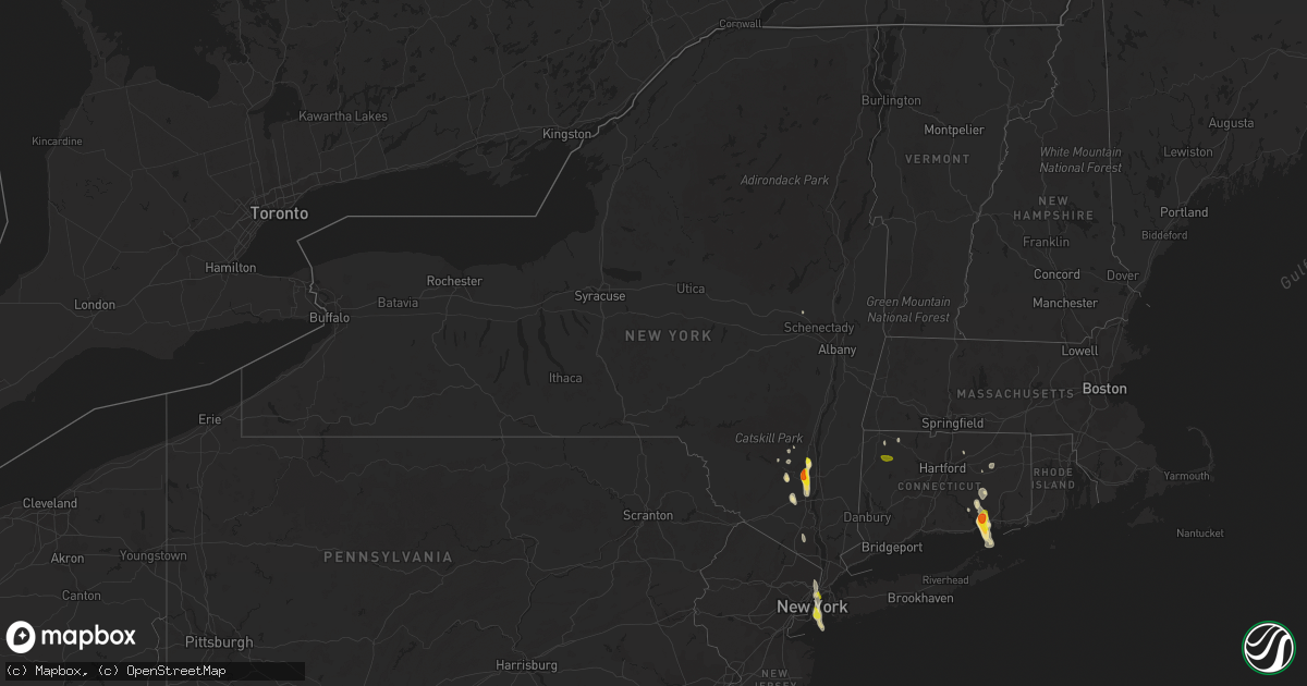
Hail Map in New York on June 29, 2020
Get this storm
June 29 map
$229
one time, instant access
Download today. No call, no setup
Keep the $229
Bought the map and want the full workflow? Apply the entire $229 to a subscription within 7 days. None of it is wasted.
Every map, not just this one
This buys you this map. Subscription and you get every map we run, in the markets you choose from a few cities to whole states to nationwide. Plus real-time alerts the moment a storm fires.
Contact data
Name, contact info, occupancy, even credit band for addresses in the footprint. You go from where it hit to who to call.
Become the source they trust
Unlimited branding weather history reports on demand. You already have the documented answer ready for the property owner, and you are the one who showed up with it.
Property data and RoofTrace estimates
Pull up any address you have got, its value and the exact code rules for that jurisdiction, straight from One Click Code. Then RoofTrace estimates the squares, pitch, and roof value, priced the way you price.
Storm reports in New York
New York
| Date | Description |
|---|---|
| 06/29/20205:57 PM CDT | A marine thunderstorm wind gust of 60 knots was reported at breezy point mesonet |
| 06/29/20205:50 PM CDT | Tree snapped at base and high up and fallen to ground at ocean parkway and ocean court |
| 06/29/20205:50 PM CDT | Tree down in marine park section of brooklyn |
| 06/29/20205:48 PM CDT | Large tree limbs reported down on mcdonald avenue at samual hubbard house and sourrounding area |
| 06/29/20205:45 PM CDT | Large tree down on a house near intersection of 9th avenue and 57th street. |
| 06/29/20205:25 PM CDT | Tree down on car on 80th st between york and 1st ave |
| 06/29/20204:36 PM CDT | Large tree fell on top of a car crushing it with nobody inside |
| 06/29/20203:19 PM CDT | Hail slightly larger than quarters in ardonia. Time estimated by radar. |
| 06/29/20203:15 PM CDT | Hail of various sizes... Up to golf balls |
| 06/29/20203:10 PM CDT | A local report indicates 1.75 inch wind near NEW PALTZ |
| 06/29/20203:00 PM CDT | A local report indicates 1.25 inch wind near 2 ESE TILLSON |
| 06/29/20202:55 PM CDT | A local report indicates 1.00 inch wind near TILLSON |
| 06/29/20202:00 PM CDT | Downed tree on powerline near guy park ave. And evelyn st. Time estimated. |
| 06/29/20202:00 PM CDT | Downed tree on powerline on east main st. Time estimated. |
| 06/28/202011:14 PM CDT | At 414 PM EDT, a severe thunderstorm was located over Plattekill, or 7 miles northeast of Walden, moving south at 35 mph. HAZARD...Quarter size hail. SOURCE...Radar indicated. IMPACT...Minor damage to vehicles is possible. This severe thunderstorm will be near... Gardnertown around 425 PM EDT. Newburgh around 430 PM EDT. New Windsor around 435 PM EDT. West Point around 445 PM EDT. Monroe around 450 PM EDT. Harriman around 455 PM EDT. |
| 06/28/202010:52 PM CDT | At 352 PM EDT, a severe thunderstorm was located near Tillson, or near New Paltz, moving south at 15 mph. HAZARD...Quarter size hail. SOURCE...Radar indicated. IMPACT...Damage to vehicles is expected. Locations impacted include... New Paltz, Plattekill, Highland, Tillson, Modena, Marlboro, Lloyd, Tuckers Corner, Lattintown, Elting Corners, Stoneco, Ardonia, Sylva, Baileys Gap, Barnegat, Rifton, Jenkinstown, Oakes, Highland Landing and Plutarch. |
All States Impacted by Hail Map on June 29, 2020
Cities Impacted by Hail Map on June 29, 2020
- Meadow, SD
- Dupree, SD
- Caputa, SD
- New Underwood, SD
- Albany, TX
- Dundee, IL
- New Haven, IL
- Ridgway, IL
- New Paltz, NY
- Alva, WY
- Seymour, IN
- Comstock, TX
- Belle Fourche, SD
- Beulah, WY
- Saint Onge, SD
- Spearfish, SD
- Ozona, TX
- Bison, SD
- Gallatin, TN
- Bethpage, TN
- Portland, TN
- Castalian Springs, TN
- Oshkosh, WI
- Winneconne, WI
- Glendive, MT
- Sundance, WY
- Raleigh, ND
- Watauga, SD
- New Leipzig, ND
- Shields, ND
- Morristown, SD
- Selfridge, ND
- Carson, ND
- Jacksonville, VT
- Colrain, MA
- Union Grove, WI
- Kenosha, WI
- Lueders, TX
- Stamford, TX
- Avoca, TX
- Plentywood, MT
- Clarksville, TN
- Deadwood, SD
- Nemo, SD
- Old Lyme, CT
- Montgomery, NY
- Walden, NY
- Union Center, SD
- Ovalo, TX
- Tuscola, TX
- Williamsburg, KY
- Newell, SD
- Madison, WI
- Killdeer, ND
- Fairfield, ND
- Watford City, ND
- Grassy Butte, ND
- Arnegard, ND
- Cartwright, ND
- Highland, NY
- Tillson, NY
- Ulster Park, NY
- Brooklyn, NY
- Outlook, MT
- Wibaux, MT
- Johnson Creek, WI
- Watertown, WI
- Granville, MA
- Sandisfield, MA
- Waddy, KY
- Shelbyville, KY
- Plaza, ND
- Lemmon, SD
- Belleville, WI
- New Glarus, WI
- Keene, ND
- Monon, IN
- Rensselaer, IN
- Birmingham, AL
- Norton, TX
- Winters, TX
- Bronte, TX
- Whitewood, SD
- Colebrook, CT
- Winsted, CT
- Knoxville, TN
- Prospect, TN
- Prairie City, SD
- Faith, SD
- Wingate, TX
- Blackwell, TX
- Flasher, ND
- Vale, SD
- Sturgis, SD
- Port Orange, FL
- Edgerton, WI
- Janesville, WI
- Venus, FL
- Lake Placid, FL
- Moorcroft, WY
- Louisville, KY
- Charlemont, MA
- Ashfield, MA
- Hazel Green, AL
- Meridianville, AL
- Toney, AL
- Huntsville, AL
- New Market, AL
- Ohatchee, AL
- Brooklyn, WI
- Mott, ND
- Estill Springs, TN
- Hill City, SD
- Redgranite, WI
- Neshkoro, WI
- Colchester, CT
- Lebanon, CT
- Upton, WY
- East Lyme, CT
- Pelzer, SC
- Malvern, AR
- Donaldson, AR
- Kansasville, WI
- Mundelein, IL
- Lake Zurich, IL
- Dickinson, ND
- New England, ND
- Lead, SD
- Scottsburg, IN
- Wilmington, IL
- Channahon, IL
- Mud Butte, SD
- Niantic, CT
- Orient, NY
- Fort Payne, AL
- Mentone, AL
- Gibbon, MN
- Winthrop, MN
- Barrington, IL
- Palatine, IL
- Hoffman Estates, IL
- Richardton, ND
- Robert Lee, TX
- Elgin, IL
- Carpentersville, IL
- Manning, ND
- Easley, SC
- Piedmont, SC
- Pine Ridge, SD
- Greenville, WI
- Sheridan, AR
- Abilene, TX
- Beach, ND
- Medora, ND
- Belfield, ND
- Belleville, IL
- O'Fallon, IL
- Traskwood, AR
- Poyen, AR
- Hulett, WY
- Sopchoppy, FL
- Cliffside Park, NJ
- Fort Lee, NJ
- Englewood, NJ
- Breezy Point, NY
- Tenafly, NJ
- Edgewater, NJ
- Leonia, NJ
- Astoria, NY
- Palisades Park, NJ
- Englewood Cliffs, NJ
- New York, NY
- Long Island City, NY
- North Bergen, NJ
- Bergenfield, NJ
- Stoughton, WI
- Piedmont, SD
- Berlin, WI
- Pine River, WI
- Whitewater, WI
- Rockford, IL
- Eubank, KY
- Science Hill, KY
- Redstone, MT
- Tye, TX
- Dyess Afb, TX
- Crawfordsville, IN
- Middleton, WI
- Homestead, MT
- Osage, WY
- Newcastle, WY
- Clintondale, NY
- Modena, NY
- Timber Lake, SD
- Ellington, CT
- Holdingford, MN
- Albany, MN
- Grey Eagle, MN
- Bowlus, MN
- Burtrum, MN
- Upsala, MN
- Neillsville, WI
- Raymond, MT
- Barnhart, TX
- Reeder, ND
- Aladdin, WY
- Greenwood, IN
- Dunn Center, ND
- Rapid City, SD
- Black Hawk, SD
- Enning, SD
- Accord, NY
- Peotone, IL
- Union, IL
- Woodstock, IL
- Merkel, TX
- Wallkill, NY
- Adams, TN
- Rockford, TN
- Dyer, IN
- Crown Point, IN
- Cedar Lake, IN
- Saint John, IN
- Schererville, IN
- Gladstone, ND
- Taylor, ND
- Prospect, KY
- Charlestown, IN
- Jeffersonville, IN
- Valparaiso, IN
- Milton, KY
- Blanchardville, WI
- Freeburg, IL
- Mascoutah, IL
- Storrs Mansfield, CT
- Mansfield Center, CT
- Goshen, KY
- Crestwood, KY
- Verona, WI
- New Bedford, MA
- South Dartmouth, MA
- North Dartmouth, MA
- Elizabethtown, IL
- Capron, IL
- Poplar Grove, IL
- Hull, IL
- Bardstown, KY
- Liberty, KY
- Coventry, CT
- Pell City, AL
- Eight Mile, AL
- Saraland, AL
- Roselle, IL
- Schaumburg, IL
- Pine Bush, NY
- Regent, ND
- Eagle Bend, MN
- South Wayne, WI
- Argyle, WI
- Ferryville, WI
- Colfax, IN
- Darlington, IN
- Bradfordsville, KY
- Lawn, TX
- Wolcott, IN
- Whiteland, IN
- Franklin, IN
- North Port, FL
- Blue Mounds, WI
- Black Earth, WI
- Monroe, WI
- Albany, WI
- Monticello, WI
- Mulberry Grove, IL
- Barneveld, WI
- Mattapoisett, MA
- Fairhaven, MA
- Acushnet, MA
- New Town, ND
- Richmond, IL
- Twin Lakes, WI
- Spring Grove, IL
- Ringwood, IL
- Mchenry, IL
- Rosendale, NY
- Gardiner, NY
- Newburgh, NY
- Marlboro, NY
- Cottontown, TN
- Sullivan, WI
- Jefferson, WI
- Helenville, WI
- Collinsville, AL
- Cedar Bluff, AL
- Leesburg, AL
- Clyde, TX
- Chattanooga, TN
- Donnybrook, ND
- Shepherdsville, KY
- Rock Spring, GA
- La Fayette, GA
- Mandaree, ND
- Lefor, ND
- Tunnel Hill, GA
- Ringgold, GA
- Mount Horeb, WI
- Cross Plains, WI
- Lake Crystal, MN
- Burlington, WI
- Francesville, IN
- Lebanon, IN
- Butte Des Morts, WI
- Bowling Green, FL
- Bartow, FL
- Fort Meade, FL
- Swanville, MN
- Little Falls, MN
- Lodgepole, SD
- Sharon, WI
- Bourbonnais, IL
- Hettinger, ND
- Rowe, MA
- Eagle, WI
- Belvidere, IL
- Caledonia, IL
- Bethelridge, KY
- Belton, SC
- Olivebridge, NY
- Loogootee, IN
- Gary, IN
- Hebron, IN
- Lowell, IN
- Pleasant Shade, TN
- Dixon Springs, TN
- Lafayette, TN
- Devils Tower, WY
- Marengo, IL
- Mertzon, TX
- Mount Washington, KY
- Hampshire, IL
- Fulda, MN
- Simpsonville, SC
- Fountain Inn, SC
- Falls Village, CT
- Frankfort, IN
- Crothersville, IN
- Omro, WI
- Larsen, WI
- Lansing, IL
- Calumet City, IL
- Hammond, IN
- Oregon, WI
- Austin, IN
- Bristol, WI
- Rockton, IL
- Stone Ridge, NY
- Louisville, TN
- Jamestown, TN
- Minooka, IL
- Marshfield, WI
- Monee, IL
- Braidwood, IL
- Coal City, IL
- Morris, IL
- Manhattan, IL
- Bedford, KY
- Spring Green, WI
- Darlington, WI
- Mineral Point, WI
- Shullsburg, WI
- Edgefield, SC
- Johnston, SC
- Saluda, SC
- Ward, SC
- Browerville, MN
- Cedar Hill, TN
- Springfield, KY
- Hermosa, SD
- Hollandale, WI
- East Haddam, CT
- Evansville, WI
- Millstadt, IL
- Clanton, AL
- Jefferson, AR
- White Hall, AR
- Lansing, IA
- Lafayette, IN
- Fishers, IN
- Keldron, SD
- Lynchburg, OH
- Sardinia, OH
- Auburndale, FL
- Lake Alfred, FL
- Parsons, KS
- Fort Myers, FL
- Griffith, IN
- Crete, IL
- Gurley, AL
- Hot Springs National Park, AR
- Pulaski, TN
- Scottsboro, AL
- Black River Falls, WI
- Madelia, MN
- Hanska, MN
- Saint James, MN
- Pewaukee, WI
- Harvard, IL
- Kerhonkson, NY
- Altheimer, AR
- Attica, IN
- Williamsport, IN
- La Grange, KY
- Westport, KY
- Montello, WI
- Loretto, KY
- Winamac, IN
- Morgantown, IN
- Stevenson, AL
- Scipio, IN
- Lakeland, FL
- Clayton, IN
- Golconda, IL
- Pecatonica, IL
- Durand, IL
- Isabel, SD
- Halliday, ND
- Prattsville, AR
- Endeavor, WI
- Springfield, TN
- White House, TN
- Greenbrier, TN
- Labelle, FL
- Mukwonago, WI
- Mazon, IL
- Wilsonville, AL
- Beulah, ND
- Bloomingdale, IL
- Elk Grove Village, IL
- Medinah, IL
- Itasca, IL
- Coleman, TX
- Goldsboro, TX
- Grantsburg, WI
- Sturgis, KY
- Morganfield, KY
- Shawneetown, IL
- Buffalo Gap, TX
- Novice, TX
- Nolan, TX
- White Plains, KY
- Juda, WI
- Ware Shoals, SC
- Waterloo, SC
- Laurens, SC
- Dunnville, KY
- McLaughlin, SD
- Bartlett, IL
- Wayne, IL
- Saint Charles, IL
- South Elgin, IL
- Streamwood, IL
- Algonquin, IL
- Bethel, OH
- Williamsburg, OH
- Trenton, KY
- Kankakee, IL
- Thorntown, IN
- South Heart, ND
- Long Prairie, MN
- Hampton, KY
- Ragland, AL
- Sun Prairie, WI
- Arena, WI
- Chicago Heights, IL
- Glenwood, IL
- Burna, KY
- Liberty, SC
- New Berlin, WI
- Big Bend, WI
- Waukesha, WI
- McIntosh, SD
- Lance Creek, WY
- Monticello, GA
- Jackson, GA
- Waukegan, IL
- Zion, IL
- Westmoreland, TN
- Hartsville, TN
- Coatesville, IN
- Beloit, WI
- Lake Geneva, WI
- Deerfield, MA
- Romney, IN
- Lebanon, KY
- Greenwood, SC
- Hodges, SC
- Salem, WI
- Saint Louis, MO
- Red Boiling Springs, TN
- Alexandria, AL
- Bowling Green, MO
- Palmyra, WI
- East Troy, WI
- Pelham, AL
- Florence, AL
- Killen, AL
- Brooklyn, IN
- Mooresville, IN
- Martinsville, IN
- East Chicago, IN
- Norris City, IL
- Omaha, IL
- Lewisburg, KY
- Walland, TN
- Sherrill, AR
- Warrens, WI
- Amsterdam, NY
- Momence, IL
- Grant Park, IL
- Brookport, IL
- Stanley, ND
- Menlo, GA
- Highland, IN
- Roodhouse, IL
- Guthrie, KY
- Manteno, IL
- Stony Point, NY
- Southfields, NY
- Pomona, NY
- Ormond Beach, FL
- Genoa, IL
- Demotte, IN
- Bloomfield, KY
- South Beloit, IL
- Merrillan, WI
- Seymour, TN
- Nantucket, MA
- Foster, KY
- Taylorsville, KY
- Coxs Creek, KY
- Bertha, MN
- Humbird, WI
- Russellville, KY
- Lake Villa, IL
- Gurnee, IL
- Mulberry, TN
- Clinton, WI
- Salem, CT
- Rantoul, IL
- Wonder Lake, IL
- Hebron, IL
- Haskell, TX
- Waterford, WI
- Leeds, AL
- Henagar, AL
- Pigeon Forge, TN
- Sevierville, TN
- Fox Lake, IL
- Ingleside, IL
- Gilberts, IL
- Deerfield, WI
- Cambridge, WI
- Cottage Grove, WI
- Box Elder, SD
- Ross, ND
- Dodge, ND
- Summerville, GA
- Alexander, ND
- Greenfield, MA
- Easthampton, MA
- Northampton, MA
- South Hadley, MA
- Chicopee, MA
- Granby, MA
- Oakdale, CT
- Goshen, CT
- West Cornwall, CT


