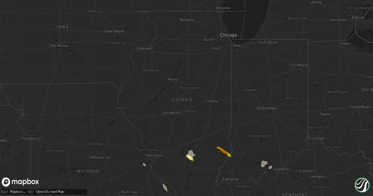
Hail Map in Illinois on June 26, 2013
Get this storm
June 26 map
$229
one time, instant access
Download today. No call, no setup
Keep the $229
Bought the map and want the full workflow? Apply the entire $229 to a subscription within 7 days. None of it is wasted.
Every map, not just this one
This buys you this map. Subscription and you get every map we run, in the markets you choose from a few cities to whole states to nationwide. Plus real-time alerts the moment a storm fires.
Contact data
Name, contact info, occupancy, even credit band for addresses in the footprint. You go from where it hit to who to call.
Become the source they trust
Unlimited branding weather history reports on demand. You already have the documented answer ready for the property owner, and you are the one who showed up with it.
Property data and RoofTrace estimates
Pull up any address you have got, its value and the exact code rules for that jurisdiction, straight from One Click Code. Then RoofTrace estimates the squares, pitch, and roof value, priced the way you price.
Storm reports in Illinois
Illinois
| Date | Description |
|---|---|
| 06/26/20135:11 PM CDT | 3 foot diameter tree snapped at base along bluff road...time estimated from radar |
| 06/26/20135:05 PM CDT | Numerous large trees down and broken trees west of williamson co airport. Old fairfield road blocked by downed tree about 1 mi west of ap. Reported about 7 pm. |
| 06/26/20135:05 PM CDT | Numerous large trees down and broken trees west of airport. Old fairfield road blocked by downed tree about 1 mi west of airport. Reported about 7 pm. |
| 06/26/20134:55 PM CDT | Large trees and power lines down...time estimated from radar. Report relayed via kmov |
| 06/26/20133:37 PM CDT | Hail was mostly half dollar sized...with some as large as golfball |
| 06/25/20138:00 PM CDT | Several trees on cars and homes |
All States Impacted by Hail Map on June 26, 2013
Cities Impacted by Hail Map on June 26, 2013
- Darien, GA
- Townsend, GA
- Mayfield, KY
- Sandoval, IL
- Odin, IL
- Kell, IL
- Centralia, IL
- Salem, IL
- North Charleston, SC
- Johns Island, SC
- Charleston, SC
- Hanahan, SC
- Ravenel, SC
- Nebo, NC
- Morganton, NC
- Webster, WI
- Siren, WI
- Ramsey, IN
- Crandall, IN
- Depauw, IN
- New Salisbury, IN
- Corydon, IN
- Wing, ND
- Perryville, MO
- Saint Mary, MO
- Fredericksburg, VA
- Verdigre, NE
- Winnetoon, NE
- Orchard, NE
- Sapelo Island, GA
- Wadmalaw Island, SC
- Charleston Afb, SC
- Sedalia, KY
- Wingo, KY
- Palmersville, TN
- Fulton, KY
- Cottage Grove, TN
- Paris, TN
- Dukedom, TN
- Dresden, TN
- McKenzie, TN
- Cedar Hill, MO
- House Springs, MO
- Hillsboro, MO
- Hardinsburg, IN
- Marengo, IN
- Paoli, IN
- Milltown, IN
- English, IN
- Iuka, IL
- Alma, IL
- Patoka, IL
- Linden, VA
- Front Royal, VA
- Texico, IL
- Vincennes, IN
- Lawrenceville, IL
- Saint Francisville, IL
- Dundas, IL
- Olney, IL
- Willow Hill, IL
- Sumner, IL
- Claremont, IL
- West Liberty, IL
- Bridgeport, IL
- Mizpah, MN
- Northome, MN
- Kelliher, MN
- Wirt, MN
- Max, MN


