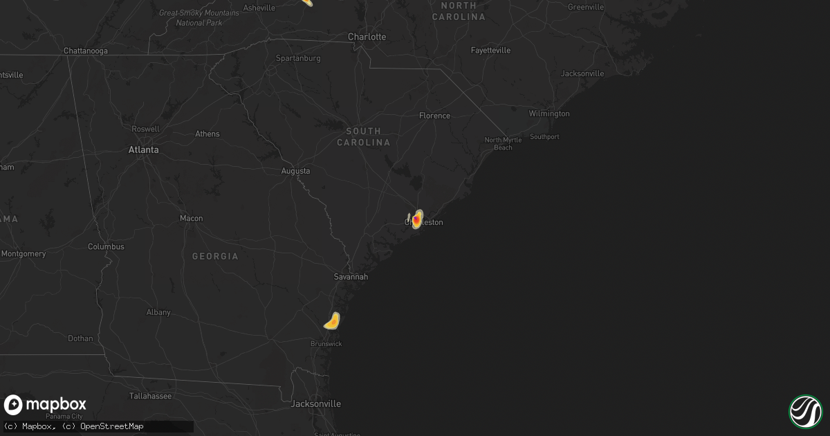
Hail Map on June 26, 2013
Get this storm
June 26 map
$229
one time, instant access
Download today. No call, no setup
Keep the $229
Bought the map and want the full workflow? Apply the entire $229 to a subscription within 7 days. None of it is wasted.
Every map, not just this one
This buys you this map. Subscription and you get every map we run, in the markets you choose from a few cities to whole states to nationwide. Plus real-time alerts the moment a storm fires.
Contact data
Name, contact info, occupancy, even credit band for addresses in the footprint. You go from where it hit to who to call.
Become the source they trust
Unlimited branding weather history reports on demand. You already have the documented answer ready for the property owner, and you are the one who showed up with it.
Property data and RoofTrace estimates
Pull up any address you have got, its value and the exact code rules for that jurisdiction, straight from One Click Code. Then RoofTrace estimates the squares, pitch, and roof value, priced the way you price.
States Impacted by Hail Map on June 26, 2013
Storm reports
Ohio
| Date | Description |
|---|---|
| 06/26/20134:00 PM CDT | Also wlio relayed sheriff report of a few power lines down near airport |
| 06/26/20133:30 PM CDT | Trees down on power lines at 7100 drake ave in madeira. Corrected event type. |
| 06/26/20133:30 PM CDT | Trees down near s bickett and jasper rd. Corrected event type. |
| 06/26/20132:47 PM CDT | Large limbs downed |
Alabama
| Date | Description |
|---|---|
| 06/26/20136:48 AM CDT | Numerous trees down near the intersection of hurricane road and fuzzy hill road. |
| 06/26/20136:33 AM CDT | Half of a tin roof was blown off a barn. Pieces of the barn were blown across the road near the intersection of oscar patterson road and coleman drive. |
| 06/26/20133:26 AM CDT | Several trees...both large and small...reported down in florence and killen. Some of those trees were down along cr 25 north of killen. |
| 06/26/20133:22 AM CDT | Several trees down along kolbe lane. |
| 06/26/20133:18 AM CDT | Several trees down along the natchez trace close to the tennessee state line. |
| 06/26/20133:18 AM CDT | Several trees down along dowdy drive in florence. |
| 06/26/20133:14 AM CDT | Several trees down near the intersection of county road 224 and butler creek road. |
| 06/26/20133:10 AM CDT | Several trees down near the intersection of county road 25 and baylee drive in killen. |
| 06/26/20133:10 AM CDT | A tree down on locke six road south of highway 236 in killen. |
| 06/26/20133:10 AM CDT | Several trees down near the intersection of county road 8 and county road 301. |
| 06/26/20133:10 AM CDT | Several trees down near the intersection of county road 61 and county road 300. |
| 06/26/20133:10 AM CDT | Several trees down along county road 298 in zip city. |
| 06/26/20133:07 AM CDT | Several trees down near the intersection of highway 17 and county road 8 in zip city. |
North Dakota
| Date | Description |
|---|---|
| 06/26/20135:30 PM CDT | Small trees uprooted. 64 foot antenna tower broken in half. 24 foot bay door blown in and roofing blown off. Wind breaks for cattle damaged. Received 1.5 inches of rain |
| 06/26/20133:25 PM CDT | 50 mph winds accompanied the large hail. |
Maryland
| Date | Description |
|---|---|
| 06/26/20134:20 PM CDT | Tree down on west lombard st |
| 06/26/20132:41 PM CDT | A tree was down on wires along jacksontown road. |
New Jersey
| Date | Description |
|---|---|
| 06/26/20136:30 PM CDT | Tree down on telegraph hill road. |
Pennsylvania
| Date | Description |
|---|---|
| 06/26/20135:22 PM CDT | Tree down on wires near the intersection of lititz and oregon pikes. |
| 06/26/20135:12 PM CDT | Wires reported down. |
| 06/26/20134:23 PM CDT | Trees reported down. |
| 06/26/20134:15 PM CDT | Trees reported down. |
| 06/26/20134:13 PM CDT | Trees reported down. |
| 06/26/20134:12 PM CDT | Trees reported down in the city of harrisburg. |
| 06/25/20137:30 PM CDT | Trees down. |
Virginia
| Date | Description |
|---|---|
| 06/26/20135:42 PM CDT | Tree down |
| 06/26/20134:10 PM CDT | Several trees down. Barn door blown off. |
| 06/26/20133:56 PM CDT | A tree down across a local road in the city of lynchburg. |
| 06/26/20133:46 PM CDT | Tree down on state rte 699 |
| 06/26/20133:34 PM CDT | A few trees down at 16th and wise street in lynchburg city and a few more trees down on triple circle in lynchburg city. |
| 06/26/20133:20 PM CDT | Trees down on rte 250 |
| 06/26/20133:19 PM CDT | A tree down across a local road in the city of lynchburg. |
| 06/26/20133:16 PM CDT | 3 trees down on perrowville road near ivy hill/candlestick park areas |
| 06/26/20133:15 PM CDT | Quarter size hail reported on paul street |
| 06/26/20133:11 PM CDT | Two trees down in 100 block of overlook dr. |
| 06/26/20133:05 PM CDT | Tree down on power line blocking road..measured 45 mph wind gust nearby |
| 06/26/20133:00 PM CDT | Trees were down along monacan trail road. |
| 06/26/20132:55 PM CDT | Tree down on windsor drive just west of dahlgren. |
| 06/26/20132:45 PM CDT | Tree down at the intersection of blackburn run and dahlgren road. |
| 06/26/20132:38 PM CDT | Trees and power lines down across route 1 between layhill road and truslow road |
| 06/26/20132:32 PM CDT | Tree down along caledon road. |
| 06/26/20132:25 PM CDT | Trees and power lines down across route 1 between layhill road and truslow road |
| 06/26/20132:25 PM CDT | Large limb down near goodview elementary school and possibly additional tree damage in the area. Also some hail smaller than pennies. |
| 06/26/20132:25 PM CDT | Tree down along bloomsbury road. |
| 06/26/20132:21 PM CDT | A couple of trees down in wirtz |
| 06/26/20132:20 PM CDT | Tree down on morland gap |
| 06/26/20132:20 PM CDT | A few trees down in the hardy area along wysong mill road and deepwoods road. |
| 06/26/20132:17 PM CDT | At least 10 trees down in the stewartsville...goodview road area. Some power lines down in this area as well. |
| 06/26/20132:17 PM CDT | At least 10 trees down in the stewartsville...goodview road area. Some power lines down in this area as well. |
| 06/26/20132:15 PM CDT | Trees and powerlines down route one and layhill road. |
| 06/26/20132:10 PM CDT | A local report indicates 62 MPH wind near BROOKFIELD |
| 06/26/20132:00 PM CDT | Trees were down along monacan trail road. |
| 06/26/20132:00 PM CDT | Scattered reports of trees/wires down in roanoke |
| 06/26/20132:00 PM CDT | A local report indicates 1.00 inch wind near 1 NNE BLUE MOUNTAIN |
| 06/26/20131:57 PM CDT | Wind gust to 71mph measured at the airport |
| 06/26/20131:36 PM CDT | Tree over road. |
| 06/26/20131:33 PM CDT | Multiple trees down |
| 06/26/20131:29 PM CDT | Tree over road. |
| 06/26/20131:24 PM CDT | Tree over road. |
| 06/26/20131:20 PM CDT | Numerous large tree limbs down on grove avenue. Also dime size hail. |
| 06/26/20131:17 PM CDT | Trees/limbs down and trees on wires in fairlawn |
| 06/26/20131:17 PM CDT | Quarter size hail with numerous limbs down on old peppers ferry road |
| 06/26/20131:15 PM CDT | 2 ft diameter tree uprooted on mountain run lake rd |
| 06/26/20131:15 PM CDT | Few trees down near intersection of leon rd and mountain prospect ln |
| 06/26/201312:56 PM CDT | Trees uprooted |
| 06/26/201312:52 PM CDT | Several trees down. Carport damaged. Barn and fence damaged. |
Minnesota
| Date | Description |
|---|---|
| 06/26/20133:47 PM CDT | Large tree down blocking lane of traffic on county road 5. |
| 06/26/20133:40 PM CDT | Tree limb fell on power lines and started a fire. |
| 06/26/20133:30 PM CDT | Uncut hay blown down flat across field. Time estimated. |
South Dakota
| Date | Description |
|---|---|
| 06/25/20137:15 PM CDT | Local business had a communications tower come down in the wind. The tower landed on a company vehicle. |
Tennessee
| Date | Description |
|---|---|
| 06/26/20131:32 PM CDT | Few trees down. |
| 06/26/20131:22 PM CDT | Few trees down |
| 06/26/20131:30 AM CDT | 1 tree down on tarr rd just across the county line. |
| 06/26/20131:30 AM CDT | One tree down along old aj hwy. |
| 06/26/20131:30 AM CDT | 1 tree down on jenkins rd. |
| 06/26/20131:25 AM CDT | Tree down along highway 13 at mile marker 17 near lobelville |
| 06/26/20131:15 AM CDT | Several trees down. |
| 06/26/201312:50 AM CDT | Several trees down across county. |
| 06/26/201312:45 AM CDT | One tree down near cedar grove road. |
| 06/26/201312:42 AM CDT | One tree down on beech grove road. |
| 06/26/201312:00 AM CDT | 3 trees down. |
| 06/25/201310:36 PM CDT | An older...small...weak and shallow rooted tree was blown down in dover |
Michigan
| Date | Description |
|---|---|
| 06/26/20134:50 PM CDT | Fairly large tree down on powerlines at pelkie rd and m-38. Reported by dispatch and sheriffs office. Time estimated by radar and time of report to sheriff. |
| 06/26/20134:45 PM CDT | Trees down across kuusisto rd and hidden acres road. Jcbm4 reported gusts of 50 mph between 545 pm and 6 pm edt. Houghton county emergency manager also reported trees d |
Georgia
| Date | Description |
|---|---|
| 06/26/20135:10 PM CDT | Public report and image relayed from savannah media via nws chat. |
| 06/26/20135:10 PM CDT | Driver on the road near meridian reports at least quarter size hail. |
| 06/26/20133:25 PM CDT | Several trees down on giles st. And hwy 23 in sardis. |
Indiana
| Date | Description |
|---|---|
| 06/26/20136:16 PM CDT | Late report from evening of 6/26. Possible tornado. Large equipment shed destroyed. |
| 06/26/20134:51 PM CDT | 4 inch diameter tree limb downed in the 500 block of church street. Time estimated from radar. |
| 06/26/20133:26 PM CDT | Tree on a house... Cars damaged... Garage with damage and outbuilding destroyed on twin ponds road. |
| 06/26/20132:00 PM CDT | Numerous trees and power lines downed. |
| 06/26/20131:58 PM CDT | Numerous trees and power lines downed. |
| 06/26/20131:56 PM CDT | A local report indicates 67 MPH wind near 3 NE MITCHELL |
| 06/26/20131:22 PM CDT | Second hand report of a tree down onto a home on south spring road near the park |
| 06/26/20131:18 PM CDT | Red maple tree branches blown down...described as big as medium size.. Second hand report |
| 06/25/20138:51 PM CDT | A local report indicates 60 MPH wind near SANTA CLAUS |
| 06/25/20138:45 PM CDT | Trees and power lines down in grandview and rockport |
| 06/25/20138:38 PM CDT | Transformers arcing |
| 06/25/20138:29 PM CDT | An ef1 tornado touched down southwest of troy and moved southeast through tell city lifting just north of cannelton. The path length was 5.15 miles with wind speeds up |
| 06/25/20138:00 PM CDT | Late report. Lots of trees down and/or large limbs snapped on the west side of us 41 just north of 350s. Some of the trees and tree limbs produced some damage to houses |
| 06/25/20137:45 PM CDT | Numeous trees down. |
| 06/25/20137:13 PM CDT | Trees reported down. |
| 06/25/20137:10 PM CDT | Numerous trees down along hwy 62 between corydon and leavenworth. |
| 06/25/20137:03 PM CDT | Tree limbs downed along state route 61. Time estimated from radar. |
North Carolina
| Date | Description |
|---|---|
| 06/26/20136:44 PM CDT | Multiple trees down around southern pines |
| 06/26/20136:44 PM CDT | Trees down in cameron |
| 06/26/20135:45 PM CDT | One tree was reported down along running creek church road near bethel church road. |
| 06/26/20135:45 PM CDT | One tree was reported donw along st. Martin road near hartsell road. |
| 06/26/20135:35 PM CDT | A couple trees blown down on nance road. |
| 06/26/20135:35 PM CDT | One tree was reported down along gold hill road near finger road. |
| 06/26/20135:00 PM CDT | 1 tree down on a residence no injuries |
| 06/26/20135:00 PM CDT | Powerlines down on the 1400 block of oxford road |
| 06/26/20134:55 PM CDT | 1 tree down on becks church road near i-85 mile marker 93 |
| 06/26/20134:52 PM CDT | 1 tree down on flat river church road at lacy wilkerson road in roxboro |
| 06/26/20134:48 PM CDT | 1 tree down on pinetop road at odell owen road |
| 06/26/20134:39 PM CDT | 2 trees down on hwy 150 near old hwy 64 |
| 06/26/20134:30 PM CDT | Multiple trees and power lines down on markland road and hwy 801 near advance |
| 06/26/20134:06 PM CDT | Multiple trees down in downtown winston salem |
| 06/26/20134:05 PM CDT | A local report indicates 1.00 inch wind near STATESVILLE |
| 06/26/20133:45 PM CDT | Quarter size hail reported on stadium drive |
| 06/26/20133:37 PM CDT | Several trees/wires down. One tree on a car on rhodes road. |
| 06/26/20133:24 PM CDT | Tree down |
| 06/26/20133:20 PM CDT | Trees and power lines down in vale. One tree fell on a home. |
| 06/26/20133:20 PM CDT | Many trees felled from thunderstorm winds in a wooded area about 100 yards long. |
| 06/26/20133:17 PM CDT | Several large trees down on 44th ave drive nw. Pea size hail. |
| 06/26/20133:16 PM CDT | Tree down |
| 06/26/20133:10 PM CDT | Trees down at intersection of wilkies grove rd and claude brittain rds |
| 06/26/20133:03 PM CDT | Several trees reported down south of danbury. |
| 06/26/20133:01 PM CDT | Trees blown down cullasaja gorge |
| 06/26/20132:57 PM CDT | Trees down on wards gap rd |
| 06/26/20132:57 PM CDT | Trees down vicinity will hudson rd |
| 06/26/20132:30 PM CDT | Ping pong hail observed on snow hill church rd |
| 06/26/20132:30 PM CDT | Trees and power lines down at the intersection of highway 70 and snow hill rd |
| 06/26/20132:27 PM CDT | Trees down in dobson |
| 06/26/20132:08 PM CDT | Tree fell on a house on reeves mill road |
| 06/26/20132:15 AM CDT | Several trees down on paint rock road. |
| 06/25/20138:55 PM CDT | Trees and limbs down on sam potts rd about 1 mile west of hallsboro rd. |
| 06/25/20138:05 PM CDT | Numerous trees down and power outages across the city. |
| 06/25/20137:55 PM CDT | 1 tree down at elk and cameron road |
| 06/25/20137:52 PM CDT | 1 tree down at cameron road and south main street |
| 06/25/20137:48 PM CDT | 1 tree down on lake upchurch road |
| 06/25/20137:40 PM CDT | Downed trees hwy 71. |
| 06/25/20137:12 PM CDT | Power lines were reported down along freeman mill road in hamlet. |
| 06/25/20137:05 PM CDT | One tree was reported down on a house on gore drive and west franklin street. |
| 06/25/20137:00 PM CDT | Several trees down at hilltop rd and edinburgh rd intersection. |
Florida
| Date | Description |
|---|---|
| 06/26/20135:30 PM CDT | Public report of a 58 mph wind gust measured by a residential weather station as thunderstorms moved through the ocala area. 2.2 inches of rainfall recorded at this loc |
| 06/26/20135:10 PM CDT | Marion county 911 dispatch reports a tree downed by strong thunderstorm wind gusts that damaged a roof. Several other reports of trees and powerlines downed in the ocal |
| 06/26/20135:05 PM CDT | 911 dispatch reports several trees and powerlines downed throughout the city of gainesville. Time of damage based on radar data |
| 06/26/20134:45 PM CDT | A few small tree limbs snapped. Winds estimated around 40 mph. |
| 06/26/20132:13 PM CDT | 60 mph wind gust at old st. Augustine road and loretto road. |
| 06/26/20132:10 PM CDT | Medium sized hollow oak tree downed in a parking lot near the intersection of bowden road and parental home road...damaging a car. Picture submitted via social media. T |
| 06/26/20132:05 PM CDT | Quarter sized hail at i-295 and st. Jose boulevard...and at i-295 at old st. Augustine road. |
Wisconsin
| Date | Description |
|---|---|
| 06/26/20135:30 PM CDT | A local report indicates 1.00 inch wind near MERRILL |
| 06/26/20135:07 PM CDT | Trees down on power line and house. Relayed from sheriff. Time estimated. |
| 06/26/20135:00 PM CDT | A local report indicates 1.25 inch wind near SIREN |
| 06/26/20134:56 PM CDT | A local report indicates 1.00 inch wind near TOMAHAWK |
| 06/26/20132:00 PM CDT | Several two inch diameter branches down in town. One and eight tenths inches of rainfall also recorded with passage of storm. |
| 06/26/20133:00 AM CDT | A wet microburst with winds at least 75 mph snapped or damaged over three dozen maple and oak trees west of hwy 141. About 3 inches of rain fell with the storm. |
Illinois
| Date | Description |
|---|---|
| 06/26/20135:11 PM CDT | 3 foot diameter tree snapped at base along bluff road...time estimated from radar |
| 06/26/20135:05 PM CDT | Numerous large trees down and broken trees west of williamson co airport. Old fairfield road blocked by downed tree about 1 mi west of ap. Reported about 7 pm. |
| 06/26/20135:05 PM CDT | Numerous large trees down and broken trees west of airport. Old fairfield road blocked by downed tree about 1 mi west of airport. Reported about 7 pm. |
| 06/26/20134:55 PM CDT | Large trees and power lines down...time estimated from radar. Report relayed via kmov |
| 06/26/20133:37 PM CDT | Hail was mostly half dollar sized...with some as large as golfball |
| 06/25/20138:00 PM CDT | Several trees on cars and homes |
South Carolina
| Date | Description |
|---|---|
| 06/26/20136:49 PM CDT | Kershaw dispatch reported power lines down in bethune. |
| 06/26/20135:52 PM CDT | Warning point reported tree down along witsell road and keans neck road. Time estimated by radar. |
| 06/26/20135:44 PM CDT | Sc highway patrol reports downed trees on wateree rd. Between debutary rd and woodside dr. |
| 06/26/20135:43 PM CDT | Warning point reported one tree down along the intersection of kinloch road and stroban road. Time estimated by radar. |
| 06/26/20135:35 PM CDT | Sc highway patrol reports trees down on heritage road near hwy 901 |
| 06/26/20135:24 PM CDT | Tree down on jasper station rd. |
| 06/26/20135:15 PM CDT | Public reported ping pong ball sized hail on bent hickory road. |
| 06/26/20135:15 PM CDT | Tree down reported at the intersection of okatie highway and lowcountry drive. |
| 06/26/20135:13 PM CDT | Public reported tree down on a house on bishop drive in west ashley. |
| 06/26/20135:05 PM CDT | Spotter reported up to tennis ball sized hail one mile south of the intersection of highway 61 and bees ferry road. |
| 06/26/20135:01 PM CDT | Law enforcement reported one tree down along bees ferry road and shadowmoss parkway. Time estimated by radar. |
| 06/26/20134:54 PM CDT | Spotter reported quarter sized hail in shadowmoss subdivision in west ashley. |
| 06/26/20134:31 PM CDT | Large tree down on graham cemetary rd. |
| 06/26/20134:31 PM CDT | Trees down on folk rd. Near old whitmire rd. |
| 06/26/20134:29 PM CDT | Media relayed report of quarter sized hail at tanner plantation in hanahan. |
| 06/26/20134:27 PM CDT | Tree fell on power lines and a tree limb caught fire. |
| 06/26/20134:27 PM CDT | Off duty nws employee reports an estimated 60 mph wind on maybank bridge. |
| 06/26/20134:25 PM CDT | A local report indicates 1.00 inch wind near 5 W LEEDS |
| 06/26/20134:24 PM CDT | Power lines down on bush river rd. |
| 06/26/20134:23 PM CDT | Tree and power line down reported on riverland drive. Report found via twitter. |
| 06/26/20134:14 PM CDT | Quarter size hail reported by public and relayed to us by wis-tv. |
| 06/26/20133:10 PM CDT | Tree in the roadway on main st. In new ellenton. |
| 06/26/20132:18 PM CDT | Trees on the roadway on short cut rd. At edgefield rd. |
Kentucky
| Date | Description |
|---|---|
| 06/26/20135:20 PM CDT | Tree down in the city. |
| 06/26/20134:45 PM CDT | Trees reported down. |
| 06/26/20133:47 PM CDT | One large tree down. Section of wooden fence broken off. |
| 06/26/20133:15 PM CDT | Several trees downed a half mile southwest of the kentucky speedway. |
| 06/26/20133:15 PM CDT | Pop up campers turned over. |
| 06/25/201311:40 PM CDT | Tree down on house in east bernstadt and second tree down on highway 490. Time estimated from radar. |
| 06/25/201311:40 PM CDT | One tree down on highway 229 in london. Time estimated from radar. |
| 06/25/201311:14 PM CDT | Tree limbs down on power lines with power outages. Also pea sized hail. |
| 06/25/201311:09 PM CDT | Trees and power lines down in monticello. Reports from broadcast and social media. Time estimated from radar. |
| 06/25/201310:59 PM CDT | Trees reported down. |
| 06/25/201310:44 PM CDT | Trees down in font hill community |
| 06/25/201310:40 PM CDT | Report of a roof blown off a barn in salem community |
| 06/25/201310:35 PM CDT | A local report indicates 58 MPH wind near 3 SSW LIBERTY |
| 06/25/201310:34 PM CDT | Facebook report of a tree down on a house in downtown liberty. |
| 06/25/201310:32 PM CDT | Trees down on kentucky 76 in the webbs crossroads community |
| 06/25/201310:26 PM CDT | Trees down and some power lines down. |
| 06/25/201310:21 PM CDT | Trees across power line at mile marker 48 on cumberland pkwy. |
| 06/25/201310:17 PM CDT | Siding ripped off one side of a residence. Several large limbs snapped. Time estimated from radar. |
| 06/25/201310:10 PM CDT | Trees down. |
| 06/25/201310:10 PM CDT | Trees down. |
| 06/25/20139:58 PM CDT | Trees and powerlines down around the city. |
| 06/25/20139:57 PM CDT | Power lines down. |
| 06/25/20139:55 PM CDT | Trees down. |
| 06/25/20139:45 PM CDT | Trees down. |
| 06/25/20139:30 PM CDT | Trees down carter brothers road and hodgensville road. |
| 06/25/20139:26 PM CDT | Trees reported down. |
| 06/25/20139:25 PM CDT | An ef2 tornado touched down along the hardin and larue county line. The tornado moved northeast with an approximate path length of seven miles and wind speeds up to 135 |
| 06/25/20139:18 PM CDT | Numerous trees reported down. |
| 06/25/20139:13 PM CDT | A local report indicates 60 MPH wind near 1 E VERTREES |
| 06/25/20139:09 PM CDT | Trees down and a shed reported blown over. |
| 06/25/20139:04 PM CDT | Trees reported down. |
| 06/25/20139:00 PM CDT | Power lines down and trees down on ky 261. |
| 06/25/20139:00 PM CDT | Trees reported down. |
| 06/25/20138:47 PM CDT | Two electric poles snapped on hillside dr |
| 06/25/20138:45 PM CDT | Power lines and trees down on ky 144. |
| 06/25/20138:33 PM CDT | Estimated 70 mph winds felled trees |
Missouri
| Date | Description |
|---|---|
| 06/26/20135:03 PM CDT | 12 inch diameter 50 ft tall trees blown over. |
| 06/26/20134:11 PM CDT | 50 foot oak tree fell on house. Major structural damage to home. Time estimated from radar. |
| 06/26/20134:10 PM CDT | Numerous large limbs down along mexico rd at spencer creek...time est by radar |
| 06/26/20134:06 PM CDT | Small tree limbs down around one half inch in diameter...near i-70 and tr hughes |
| 06/26/20134:05 PM CDT | Some fences down and numerous bradford pear trees down near hwy k and winding woods drive. Time estimated from radar. |
| 06/26/20134:05 PM CDT | Multiple 15-20 year old trees damaged with 4-8 inch diameter tree limbs blown down...near eagle ridge drive |
| 06/25/20137:12 PM CDT | A couple of reports of larger than quarter size hail |
Iowa
| Date | Description |
|---|---|
| 06/26/201312:43 PM CDT | Reported by emergency manager and trained spotter |
| 06/26/201310:20 AM CDT | Time estimated from radar. |
| 06/26/201310:10 AM CDT | Half mile wide swath of wind damage. A number of 8 inch branches broken as well as a large tree down over the road. Time estimated from radar. |
Cities Impacted by Hail Map on June 26, 2013
- Darien, GA
- Townsend, GA
- Mayfield, KY
- Sandoval, IL
- Odin, IL
- Kell, IL
- Centralia, IL
- Salem, IL
- North Charleston, SC
- Johns Island, SC
- Charleston, SC
- Hanahan, SC
- Ravenel, SC
- Nebo, NC
- Morganton, NC
- Webster, WI
- Siren, WI
- Ramsey, IN
- Crandall, IN
- Depauw, IN
- New Salisbury, IN
- Corydon, IN
- Wing, ND
- Perryville, MO
- Saint Mary, MO
- Fredericksburg, VA
- Verdigre, NE
- Winnetoon, NE
- Orchard, NE
- Sapelo Island, GA
- Wadmalaw Island, SC
- Charleston Afb, SC
- Sedalia, KY
- Wingo, KY
- Palmersville, TN
- Fulton, KY
- Cottage Grove, TN
- Paris, TN
- Dukedom, TN
- Dresden, TN
- McKenzie, TN
- Cedar Hill, MO
- House Springs, MO
- Hillsboro, MO
- Hardinsburg, IN
- Marengo, IN
- Paoli, IN
- Milltown, IN
- English, IN
- Iuka, IL
- Alma, IL
- Patoka, IL
- Linden, VA
- Front Royal, VA
- Texico, IL
- Vincennes, IN
- Lawrenceville, IL
- Saint Francisville, IL
- Dundas, IL
- Olney, IL
- Willow Hill, IL
- Sumner, IL
- Claremont, IL
- West Liberty, IL
- Bridgeport, IL
- Mizpah, MN
- Northome, MN
- Kelliher, MN
- Wirt, MN
- Max, MN