Hail Map in Nebraska on June 26, 2011
Get this storm
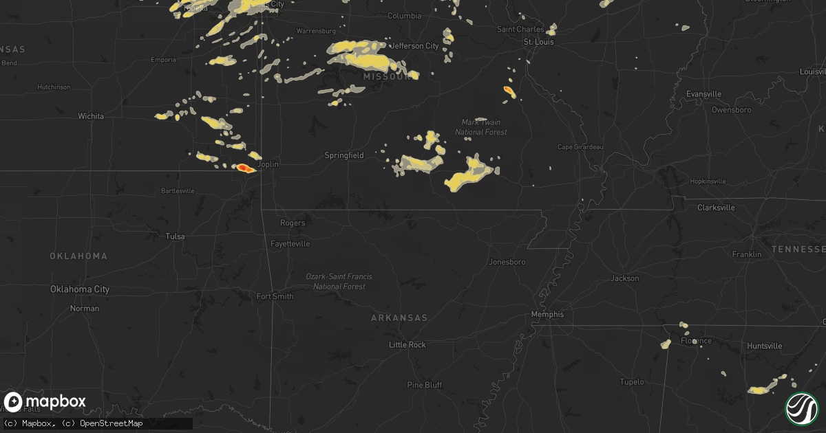
June 26 map
$229
one time, instant access
Download today. No call, no setup
Keep the $229
Bought the map and want the full workflow? Apply the entire $229 to a subscription within 7 days. None of it is wasted.
Every map, not just this one
This buys you this map. Subscription and you get every map we run, in the markets you choose from a few cities to whole states to nationwide. Plus real-time alerts the moment a storm fires.
Contact data
Name, contact info, occupancy, even credit band for addresses in the footprint. You go from where it hit to who to call.
Become the source they trust
Unlimited branding weather history reports on demand. You already have the documented answer ready for the property owner, and you are the one who showed up with it.
Property data and RoofTrace estimates
Pull up any address you have got, its value and the exact code rules for that jurisdiction, straight from One Click Code. Then RoofTrace estimates the squares, pitch, and roof value, priced the way you price.
Storm reports in Nebraska
Nebraska
| Date | Description |
|---|---|
| 06/26/20116:56 PM CDT | Hail up to ping pong ball size |
| 06/26/20116:55 PM CDT | A local report indicates 70 MPH wind near 5 W WISNER |
| 06/26/20116:48 PM CDT | Winds estimated at least 60 mph...maybe more. |
| 06/26/20116:46 PM CDT | Home damaged due to wind |
| 06/26/20116:45 PM CDT | Several large tree down. |
| 06/26/20116:45 PM CDT | Near highway 81 and highway 20 junction |
| 06/26/20116:44 PM CDT | A local report indicates 2.75 inch wind near 5 NW RUSHVILLE |
| 06/26/20116:44 PM CDT | A local report indicates 1.00 inch wind near 12 E RUSHVILLE |
| 06/26/20116:40 PM CDT | Large trees down and 6-8 inches of water over county road 519. |
| 06/26/20116:38 PM CDT | 80 mph gust from asos at norfolk airport |
| 06/26/20116:37 PM CDT | A local report indicates 1.50 inch wind near 6 N RUSHVILLE |
| 06/26/20116:35 PM CDT | 4 to 6 inch limbs blown down |
| 06/26/20116:35 PM CDT | A local report indicates 70 MPH wind near 1 W NORFOLK |
| 06/26/20116:35 PM CDT | 57 kt gust from asos at norfolk airport |
| 06/26/20116:25 PM CDT | 4 inch diameter branches down. Wind estimated up to 70 mph. |
| 06/26/20116:20 PM CDT | Hail up to quarter size |
| 06/26/20116:11 PM CDT | A local report indicates 1.75 inch wind near 17 N HAY SPRINGS |
| 06/26/20116:05 PM CDT | Also 30-40 mph winds and 0.76 inches of rain |
| 06/26/20116:05 PM CDT | A local report indicates 60 MPH wind near NELIGH |
| 06/26/20115:45 PM CDT | Torrential rain with 50 to 60 mph winds. |
| 06/26/20115:45 PM CDT | A local report indicates 1.00 inch wind near 1 N ROYAL |
| 06/26/20115:40 PM CDT | Mostly dime sized hail lasted for 5 minutes. |
| 06/26/20115:40 PM CDT | A local report indicates 60 MPH wind near 10 SE BARTLETT |
| 06/26/20115:35 PM CDT | Estimated 60 to 70 mph wind gusts along with pebble sized hail and very heavy rain. |
| 06/26/20115:15 PM CDT | Herdco feed lot reported very strong winds along with hail as large as golf balls. |
| 06/26/20115:15 PM CDT | Mostly nickel sized hail but some hail was as large as golfballs. Report was furnished by herdco feed lot. |
| 06/26/20114:28 PM CDT | A local report indicates 2.75 inch wind near 8 WSW AMELIA |
| 06/26/20114:23 PM CDT | Spotter estimated 60 to 70 mph winds 6 miles south of atkinson. |
| 06/26/20113:05 PM CDT | Hail and high winds from 305 pm to 325 pm cdt caused crop and pasture damage at this location. Report was furnished by an nerain observer. |
| 06/26/20113:05 PM CDT | A local report indicates 1.75 inch wind near 9 ENE ELSMERE |
| 06/26/20112:53 PM CDT | A local report indicates 1.00 inch wind near 12 S WOOD LAKE |
| 06/26/20112:53 PM CDT | Wind speeds of 60 mph occurring along with nickel to quarter sized hail at time of this report. |
| 06/26/20112:20 PM CDT | Public reported wind gust to 60 mph. Measured with home weather station. |
| 06/26/20112:10 PM CDT | 6 rural electric associaton power poles were blown down one half mile west of the valentine national wildlife refuge headquarters building. Time of damage estimated at |
| 06/26/20111:56 PM CDT | Reported by merritt trading post at merritt dam |
| 06/26/20111:56 PM CDT | Public reported cracked windshields and plastic parts damage. |
| 06/26/201110:11 AM CDT | Some marble sized also. |
| 06/26/201110:10 AM CDT | Hail broke out window in house |
| 06/26/20112:15 AM CDT | A local report indicates 1.00 inch wind near NEHAWKA |
| 06/26/20111:45 AM CDT | A local report indicates 1.00 inch wind near 3 SSW LINCOLN |
| 06/26/201112:45 AM CDT | A local report indicates 1.00 inch wind near FULLERTON |
| 06/26/201112:00 AM CDT | Windows blown out at the caseys gas station in town |
| 06/25/201111:59 PM CDT | A local report indicates 1.00 inch wind near 6 E ORD |
| 06/25/201111:57 PM CDT | A local report indicates 1.00 inch wind near NORTH PLATTE |
| 06/25/201111:54 PM CDT | A local report indicates 1.00 inch wind near 3 E ORD |
| 06/25/201111:41 PM CDT | A local report indicates 1.75 inch wind near HERSHEY |
| 06/25/201111:36 PM CDT | Reported from knop tv. |
| 06/25/201111:36 PM CDT | A local report indicates 1.00 inch wind near HERSHEY |
| 06/25/201111:00 PM CDT | A local report indicates 1.50 inch wind near 4 S DAWSON |
| 06/25/201111:00 PM CDT | Tree down across hwy 75 1/2 mile south of hwy 8 intersection. |
| 06/25/201110:35 PM CDT | A local report indicates 1.00 inch wind near HUMBOLDT |
| 06/25/201110:26 PM CDT | A local report indicates 1.00 inch wind near PAWNEE CITY |
| 06/25/201110:11 PM CDT | A local report indicates 2.00 inch wind near 2 E BURCHARD |
| 06/25/201110:10 PM CDT | 2 large trees uprooted. Small 10 x 10 garage demolished. |
| 06/25/201110:10 PM CDT | Tree branches down up to 5 inches in diameter. Power outages in tecumseh. |
| 06/25/201110:10 PM CDT | A local report indicates 1.00 inch wind near THEDFORD |
| 06/25/20119:58 PM CDT | A local report indicates 1.50 inch wind near STEINAUER |
| 06/25/20119:47 PM CDT | A local report indicates 1.00 inch wind near MULLEN |
| 06/25/20119:40 PM CDT | A local report indicates 1.00 inch wind near STERLING |
| 06/25/20119:36 PM CDT | A local report indicates 1.00 inch wind near 6 NNE MULLEN |
| 06/25/20119:25 PM CDT | A local report indicates 1.75 inch wind near 18 SSW HYANNIS |
| 06/25/20118:57 PM CDT | A local report indicates 1.75 inch wind near 47 S MERRIMAN |
| 06/25/20118:56 PM CDT | A local report indicates 1.00 inch wind near 47 S MERRIMAN |
| 06/25/20118:44 PM CDT | A local report indicates 1.25 inch wind near CRETE |
| 06/25/20118:40 PM CDT | Most of the stones were much smaller. |
| 06/25/20118:40 PM CDT | 54th and knox st. |
| 06/25/20118:38 PM CDT | Tree down at 48th and holdridge |
| 06/25/20118:38 PM CDT | A local report indicates 1.00 inch wind near LINCOLN |
| 06/25/20118:37 PM CDT | Quarter size hail continues. |
| 06/25/20118:36 PM CDT | A local report indicates 1.75 inch wind near LINCOLN |
| 06/25/20118:33 PM CDT | Small hail lasted from 733 pm until 743 pm mdt. The largest stones were up to walnut size. Estimated wind gusts of at least 40 mph preceded the rain and hail. |
| 06/25/20118:18 PM CDT | A local report indicates 1.00 inch wind near 3 SE GARLAND |
| 06/25/20118:11 PM CDT | Wind gust of 60 mph |
| 06/25/20117:50 PM CDT | Estimated 50 to 60 mph wind gusts preceded the storm. Nickle sized hail was observed at 702 pm mdt. |
| 06/25/20117:50 PM CDT | Numerous 4 to 6 inch diameter branches downed. |
| 06/25/20117:43 PM CDT | A local report indicates 69 MPH wind near TEKAMAH |
| 06/25/20117:40 PM CDT | A local report indicates 1.25 inch wind near 32 SSW MERRIMAN |
| 06/25/20117:40 PM CDT | A local report indicates 1.00 inch wind near 41 S MERRIMAN |
| 06/25/20117:35 PM CDT | Lots of blowing dust. |
| 06/25/20117:23 PM CDT | Numerous 4 to 6 inch diameter branches downed. |
| 06/25/20117:12 PM CDT | Small branches blown down |
| 06/25/20117:03 PM CDT | Tree damage including large branches blown down. |
All States Impacted by Hail Map on June 26, 2011
Cities Impacted by Hail Map on June 26, 2011
- Dent, MN
- Staples, MN
- Verndale, MN
- Rochert, MN
- Schaller, IA
- Alta, IA
- Rembrandt, IA
- Storm Lake, IA
- Royal, NE
- Ewing, NE
- Creighton, NE
- Brunswick, NE
- Orchard, NE
- Winnetoon, NE
- Page, NE
- Plainview, NE
- Stanton, NE
- Hyannis, NE
- Merriman, NE
- Whitman, NE
- Ashby, NE
- Ogden, IA
- Rippey, IA
- Perry, IA
- Menlo, IA
- Harrisburg, NE
- Dexter, IA
- Guthrie Center, IA
- Arthur, NE
- Plattsmouth, NE
- Louisville, NE
- Murray, IA
- Truro, IA
- Sidney, IA
- Randolph, IA
- Russell, IA
- Chariton, IA
- Burlington, IA
- Wever, IA
- Lomax, IL
- Carman, IL
- Gravity, IA
- Bedford, IA
- Harvard, NE
- Saronville, NE
- Sutton, NE
- Clay Center, NE
- West Point, IA
- Fort Madison, IA
- Peru, NE
- Nebraska City, NE
- Rock Port, MO
- Novinger, MO
- Green City, MO
- Unionville, MO
- Green Castle, MO
- Dallas City, IL
- Carthage, IL
- Brashear, MO
- Kirksville, MO
- Greentop, MO
- Queen City, MO
- Clyde, MO
- Stanberry, MO
- Conception Junction, MO
- Conception, MO
- Spickard, MO
- Milan, MO
- Stratton, NE
- Trenton, NE
- Beason, IL
- Maroa, IL
- Harristown, IL
- Decatur, IL
- Warrensburg, IL
- Niantic, IL
- Chestnut, IL
- Forsyth, IL
- Latham, IL
- Mount Pulaski, IL
- Liberty, NE
- Bremen, KS
- Oketo, KS
- Hollenberg, KS
- Beattie, KS
- Marysville, KS
- Hanover, KS
- Perry, MO
- Laddonia, MO
- Axtell, KS
- Frankfort, KS
- Havensville, KS
- Divernon, IL
- Leavenworth, KS
- Weston, MO
- Fort Leavenworth, KS
- Carrollton, MO
- Bowling Green, MO
- Delia, KS
- Mission, KS
- Kansas City, KS
- Cowden, IL
- Ramsey, IL
- Herrick, IL
- Meta, MO
- Dixon, MO
- Saint Elizabeth, MO
- Lincoln, MO
- Windsor, MO
- Rhineland, MO
- Chamois, MO
- Morrison, MO
- Hermann, MO
- Manhattan, KS
- Saint George, KS
- Columbus, KS
- Galena, KS
- Carl Junction, MO
- Hartshorn, MO
- Raymondville, MO
- Eunice, MO
- Summersville, MO
- Yukon, MO
- Cherokee, KS
- Scammon, KS
- West Mineral, KS
- McCune, KS
- Watkinsville, GA
- Chetopa, KS
- Cabool, MO
- Mountain Grove, MO
- Mountain View, MO
- Vanzant, MO
- Elk Creek, MO
- Willow Springs, MO
- Florence, AL
- Cypress Inn, TN
- Waterloo, AL
- Tishomingo, MS
- Iuka, MS
- Cherokee, AL
- Pine Apple, AL
- Statesboro, GA
- Glenwood, GA
- Alamo, GA
- Dawson, GA
- Yemassee, SC
- Chauncey, GA
- Cadwell, GA
- McRae Helena, GA
- Clayton, AL
- Norcross, MN
- Chipley, FL
- Elbow Lake, MN
- Quincy, FL
- Kulm, ND
- Laurel Hill, FL
- Defuniak Springs, FL
- Crestview, FL
- Hammond, MT
- Howes, SD
- Wasta, SD
- Worland, WY
- Manderson, WY
- Mullen, NE
- Gordon, NE
- Cody, NE
- Bingham, NE
- Valentine, NE
- Thedford, NE
- Seneca, NE
- Lindsay, NE
- Newman Grove, NE
- Meadow Grove, NE
- Madison, NE
- Albion, NE
- Battle Creek, NE
- Norfolk, NE
- Logan, IA
- Portsmouth, IA
- Woodbine, IA
- Stuart, IA
- Griswold, IA
- Elliott, IA
- Bridgewater, IA
- Orient, IA
- Fontanelle, IA
- Corning, IA
- Cumberland, IA
- Villisca, IA
- Red Oak, IA
- Creston, IA
- Grant, IA
- Prescott, IA
- Massena, IA
- Pleasant Dale, NE
- Seward, NE
- Raymond, NE
- Malcolm, NE
- Garland, NE
- Bee, NE
- Woodburn, IA
- Derby, IA
- Weldon, IA
- Wellfleet, NE
- North Platte, NE
- Eagleville, MO
- Blythedale, MO
- Lamoni, IA
- Max, NE
- Maywood, NE
- Maxwell, NE
- Moorefield, NE
- Brady, NE
- Curtis, NE
- Camden, IL
- Mount Sterling, IL
- Lincoln, IL
- Tonganoxie, KS
- Marshall, IL
- Atwood, KS
- Fairbury, NE
- Endicott, NE
- Pawnee, IL
- Sedalia, MO
- Florence, MO
- Green Ridge, MO
- Mora, MO
- Smithton, MO
- Syracuse, MO
- Ionia, MO
- Harrisonville, MO
- Galesburg, KS
- Erie, KS
- Chanute, KS
- Fall River, KS
- Fredonia, KS
- Guntersville, AL
- Salem, AL
- Opelika, AL
- La Fayette, GA
- Rock Spring, GA
- Rutherfordton, NC
- Dry Branch, GA
- Warwick, GA
- Ashburn, GA
- Arabi, GA
- Hinesville, GA
- Ludowici, GA
- Hilliard, FL
- Hayneville, AL
- Caputa, SD
- New Underwood, SD
- Edgemont, SD
- Martin, SD
- Johnstown, NE
- Atkinson, NE
- Burwell, NE
- Bartlett, NE
- Chambers, NE
- Amelia, NE
- Princeton, MO
- Exline, IA
- Moulton, IA
- Livonia, MO
- Coatsville, MO
- Cincinnati, IA
- Centerville, IA
- Melrose, IA
- Ottawa, KS
- Overbrook, KS
- Pomona, KS
- Lawrence, KS
- Baldwin City, KS
- Atwood, IL
- Hammond, IL
- Lovington, IL
- Mound City, MO
- Treece, KS
- Quapaw, OK
- Baxter Springs, KS
- Picher, OK
- Troy, AL
- Georgetown, GA
- Albany, GA
- Ellabell, GA
- Andalusia, AL
- Wood Lake, NE
- West Point, NE
- Dunning, NE
- Arnold, NE
- Halsey, NE
- Greeley, NE
- Spalding, NE
- Elyria, NE
- Ord, NE
- Genoa, NE
- Schuyler, NE
- Clarkson, NE
- Columbus, NE
- Leigh, NE
- Denton, NE
- Lincoln, NE
- Pulaski, IA
- Milton, IA
- Bloomfield, IA
- London Mills, IL
- Maquon, IL
- Westboro, MO
- Hamburg, IA
- Blanchard, IA
- Shenandoah, IA
- Northboro, IA
- Burlington Junction, MO
- Elmo, MO
- Clearmont, MO
- Kahoka, MO
- Wyaconda, MO
- Braymer, MO
- Garnett, KS
- Richmond, KS
- Bird City, KS
- McDonald, KS
- Glenwood, IA
- Malvern, IA
- New Virginia, IA
- Osceola, IA
- Oskaloosa, KS
- Silver Lake, KS
- Topeka, KS
- Callender, IA
- Moorland, IA
- Cantril, IA
- Mount Sterling, IA
- Arbela, MO
- Memphis, MO
- Rushville, NE
- Maple Hill, KS
- Mauk, GA
- Buena Vista, GA
- Ekalaka, MT
- Saint Joseph, MO
- De Kalb, MO
- Rushville, MO
- Tallahassee, FL
- Interior, SD
- Wanblee, SD
- Wall, SD
- Kadoka, SD
- Troy, KS
- Wathena, KS
- Turney, MO
- Cameron, MO
- Osborn, MO
- Plattsburg, MO
- Humboldt, NE
- Auburn, NE
- Elk Creek, NE
- Johnson, NE
- Norborne, MO
- Vidalia, GA
- Howells, NE
- Maryville, MO
- Skidmore, MO
- Mystic, IA
- Cadet, MO
- Blackwell, MO
- Colby, KS
- Odum, GA
- Jesup, GA
- Rapid City, SD
- Hay Springs, NE
- Taylor, NE
- Anselmo, NE
- Sargent, NE
- Brewster, NE
- Steinauer, NE
- Oregon, MO
- White Cloud, KS
- Highland, KS
- Forest City, MO
- Cherry Creek, SD
- Paton, IA
- Harcourt, IA
- Yankton, SD
- Saint Helena, NE
- Fordyce, NE
- Pine Ridge, SD
- Hermosa, SD
- Scenic, SD
- Lance Creek, WY
- Chadron, NE
- Ainsworth, NE
- Wayne, NE
- Shelby, NE
- Rising City, NE
- Bellevue, NE
- Papillion, NE
- Blandinsville, IL
- Montrose, IA
- Niota, IL
- Nauvoo, IL
- Keokuk, IA
- Dickens, NE
- Moravia, IA
- Farnam, NE
- Canton, IL
- Cuba, IL
- Denmark, TN
- Greeley, KS
- Parker, KS
- Lane, KS
- Cole Camp, MO
- Ida Grove, IA
- Arthur, IA
- Oreana, IL
- Argenta, IL
- Macon, MO
- Fairfax, MO
- Bucyrus, MO
- Success, MO
- Savannah, TN
- Washington, KS
- Birmingham, AL
- Pelham, AL
- Farmer City, IL
- Onaga, KS
- Severy, KS
- Valley, AL
- West Point, GA
- La Plata, MO
- Shelby, AL
- Columbiana, AL
- Pequot Lakes, MN
- Pine River, MN
- Motley, MN
- Long Pine, NE
- Purdum, NE
- Hayes Center, NE
- Avon, IL
- Pekin, IL
- Green Valley, IL
- Manito, IL
- Lucas, IA
- Bowen, IL
- Augusta, IL
- Basco, IL
- Plymouth, IL
- Graham, MO
- Barnard, MO
- Maitland, MO
- Payson, IL
- Quincy, IL
- Hannibal, MO
- Hull, IL
- Palmyra, MO
- New London, MO
- West Point, IL
- Loraine, IL
- Arthur, IL
- Glenvil, NE
- Louisburg, KS
- Bucyrus, KS
- Ashmore, IL
- Charleston, IL
- Gravois Mills, MO
- Barnett, MO
- Eldon, MO
- Rocky Mount, MO
- Versailles, MO
- Stover, MO
- Montgomery City, MO
- Carrollton, GA
- Mansfield, MO
- Hurtsboro, AL
- Camilla, GA
- Cottonwood, AL
- Remsen, IA
- Allen, SD
- Stronghurst, IL
- Media, IL
- Nehawka, NE
- Weeping Water, NE
- Union, NE
- Avoca, NE
- Ursa, IL
- Mendon, IL
- Gentry, MO
- Worth, MO
- Albany, MO
- Gorin, MO
- Hardin, MO
- Richmond, MO
- Glen Carbon, IL
- Granite City, IL
- Maryville, IL
- Collinsville, IL
- Greenville, GA
- Woodbury, GA
- Gay, GA
- Molena, GA
- Brierfield, AL
- Fort Stewart, GA
- Bloomingdale, GA
- Fargo, GA
- Macon, GA
- Dodge, NE
- Hastings, IA
- Udell, IA
- Unionville, IA
- Plano, IA
- Drakesville, IA
- Audubon, IA
- Kimballton, IA
- Manilla, IA
- Manning, IA
- Irwin, IA
- Lathrop, MO
- Smithville, MO
- Holt, MO
- Kearney, MO
- Rayville, MO
- Lawson, MO
- Trimble, MO
- Polo, MO
- Shelbina, MO
- Benkelman, NE
- Bogard, MO
- Stewartsville, MO
- Bonne Terre, MO
- Linwood, KS
- Bonner Springs, KS
- Bosworth, MO
- Houston, MO
- Lyons, GA
- Oelrichs, SD
- Pacific Junction, IA
- Martell, NE
- Roca, NE
- Hallam, NE
- Crete, NE
- Sprague, NE
- Easton, MO
- Gower, MO
- Agency, MO
- Herndon, KS
- Ludell, KS
- Ellsworth, NE
- Firth, NE
- Adams, NE
- Wheatland, MO
- Aldrich, MN
- Quinn, SD
- Ellsworth Afb, SD
- Box Elder, SD
- Owanka, SD
- Neligh, NE
- Alliance, NE
- Kyle, SD
- North Loup, NE
- Shelby, IA
- Westphalia, IA
- Earling, IA
- Anita, IA
- Coon Rapids, IA
- Kirkman, IA
- Defiance, IA
- Panama, IA
- Dow City, IA
- Persia, IA
- Dunlap, IA
- Hamlin, IA
- Elk Horn, IA
- Brayton, IA
- Adair, IA
- Harlan, IA
- Exira, IA
- Fremont, NE
- Ames, NE
- Tekamah, NE
- Herman, NE
- Kansas City, MO
- Helena, MO
- Horton, KS
- Tecumseh, NE
- Hiawatha, KS
- Rulo, NE
- Denton, KS
- Craig, MO
- Lewiston, NE
- Faucett, MO
- Cortland, NE
- Everest, KS
- Guilford, MO
- Dwight, NE
- Milford, NE
- Maysville, MO
- Amity, MO
- Dawson, NE
- Wilber, NE
- Hamilton, MO
- Stella, NE
- Cummings, KS
- Pickrell, NE
- Burchard, NE
- Brainard, NE
- Bennet, NE
- Excelsior Springs, MO
- Douglas, NE
- Salem, NE
- Shubert, NE
- Cosby, MO
- Sabetha, KS
- Camden Point, MO
- Edgerton, MO
- Crab Orchard, NE
- Eagle, NE
- Falls City, NE
- Hickman, NE
- Davey, NE
- Kingston, MO
- Robinson, KS
- Filley, NE
- Burr, NE
- Cowgill, MO
- Platte City, MO
- Lancaster, KS
- Fillmore, MO
- Muscotah, KS
- Bolckow, MO
- Darlington, MO
- Table Rock, NE
- Pawnee City, NE
- Union Star, MO
- Atchison, KS
- Savannah, MO
- Verdon, NE
- Morrill, KS
- Effingham, KS
- Rosendale, MO
- Bendena, KS
- Dorchester, NE
- Clatonia, NE
- Palmyra, NE
- Amazonia, MO
- Walton, NE
- De Witt, MO
- Du Bois, NE
- Liberty, MO
- Clarksdale, MO
- King City, MO
- Rea, MO
- Elwood, KS
- Sterling, NE
- Kidder, MO
- Ulysses, NE
- Colchester, IL
- Good Hope, IL
- Sciota, IL
- Macomb, IL
- Raritan, IL
- Danville, IA
- Middletown, IA
- Birmingham, IA
- Fairfield, IA
- Stockport, IA
- Clarinda, IA
- West Burlington, IA
- Thurman, IA
- Tabor, IA
- Mount Pleasant, IA
- New London, IA
- New Boston, MO
- Smithfield, IL
- Lewistown, IL
- Liverpool, IL
- Table Grove, IL
- Marietta, IL
- Ipava, IL
- Havana, IL
- Mattoon, IL
- Oakland, IL
- Humboldt, IL
- Kansas, IL
- Arcola, IL
- Tuscola, IL
- Home, KS
- De Soto, MO
- Flemington, MO
- Weaubleau, MO
- Frankford, MO
- Solo, MO
- Licking, MO
- Randolph, AL
- Jemison, AL
- Lizella, GA
- Humboldt, TN
- Gadsden, TN
- Calera, AL
- Sumner, GA
- Ty Ty, GA
- Sylvester, GA
- Doerun, GA
- Hershey, NE
- Sutherland, NE
- Beemer, NE
- Blair, NE
- Wisner, NE
- Seymour, IA
- Douds, IA
- Selma, IA
- Keosauqua, IA
- Fowler, IL
- Ewing, MO
- Durham, MO
- Edina, MO
- Warsaw, IL
- Hurdland, MO
- Alexandria, MO
- Bethel, MO
- Canton, MO
- Baring, MO
- Sutter, IL
- Saint Patrick, MO
- Emden, MO
- Philadelphia, MO
- La Grange, MO
- Monticello, MO
- Williamstown, MO
- Lewistown, MO
- Knox City, MO
- Rutledge, MO
- La Belle, MO
- Maywood, MO
- Paloma, IL
- New Holland, IL
- Elkhart, IL
- Middletown, IL
- Arlington, GA
- Bolton, NC
- Delco, NC
- Middletown, MO
- Vandalia, MO
- Riverside, MO
- De Soto, KS
- Basehor, KS
- Shawnee, KS
- Iola, KS
- Waycross, GA
- Hoboken, GA
- Eminence, MO
- Winona, MO
- Ponce De Leon, FL
- Norwood, MO
- Rebecca, GA
- Uniontown, KS
- Redfield, KS
- Hepler, KS
- Lake City, FL
- Oakland, NE
- New Cambria, MO
- Ethel, MO
- Cullman, AL
- Hanceville, AL
- Wamego, KS
- Belvue, KS
- Banks, AL
- Louisville, AL
- Wolbach, NE
- Guyton, GA
- Mound Valley, KS
- Coffeyville, KS
- Liberty, KS
- Ridgeway, MO
- Walthill, NE
- Petersburg, NE
- Humphrey, NE
- Pierce, NE
- Tilden, NE
- Honey Creek, IA
- Neola, IA
- Missouri Valley, IA
- Arlington, NE
- Ceresco, NE
- Waverly, NE
- Humeston, IA
- Lockridge, IA
- Hillsboro, IA
- Salem, IA
- Abingdon, IL
- Le Roy, IL
- Ravenwood, MO
- Elmer, MO
- Atlanta, MO
- Camden, MO
- Parsons, KS
- Butler, MO
- Fremont, MO
- Van Buren, MO
- Birch Tree, MO
- Alton, MO
- Peace Valley, MO
- Tuskegee, AL
- Shorter, AL
- Montevallo, AL
- Parkers Prairie, MN
- Vining, MN
- Elsmere, NE
- Monroe, NE
- Scotia, NE
- Ericson, NE
- Henderson, IA
- Argyle, IA
- Wayland, MO
- Hamilton, IL
- Farmington, IA
- Revere, MO
- Albia, IA
- Luray, MO
- Floris, IA
- Bonaparte, IA
- Browning, MO
- Galt, MO
- Humphreys, MO
- Trenton, MO
- McCook, NE
- Culbertson, NE
- Cuba, KS
- Haddam, KS
- Witt, IL
- Nokomis, IL
- Irving, IL
- Fillmore, IL
- Auburn, KS
- Anniston, AL
- Alexandria, AL
- Weaver, AL
- Gordon, AL
- Pansey, AL
- Grant City, MO
- Hatfield, MO
- Novelty, MO
- Leonard, MO
- Meriden, KS
- Tipton, MO
- Fortuna, MO
- Cherryvale, KS
- Register, GA
- Williamson, GA
- Concord, GA
- Scribner, NE
- Milesville, SD
- Lorimor, IA
- Denison, IA
- Charter Oak, IA
- Cainsville, MO
- Bethany, MO
- Mount Ayr, IA
- Martinsville, MO
- Redding, IA
- Somers, IA
- Fort Dodge, IA
- Barnum, IA
- Oshkosh, NE
- Lakeside, NE
- Casey, IA
- David City, NE
- Afton, IA
- Emerson, IA
- Davis City, IA
- Petersburg, IL
- Tallula, IL
- Palisade, NE
- Bucklin, MO
- Callao, MO
- Williamsville, IL
- Greenleaf, KS
- Barnes, KS
- Grantville, KS
- Ozawkie, KS
- Rossville, KS
- Tecumseh, KS
- Perry, KS
- Center, MO
- Monroe City, MO
- Portage Des Sioux, MO
- Cleveland, MO
- Box Springs, GA
- Claxton, GA
- Collins, GA
- Reidsville, GA
- Beaufort, SC
- Wellsville, MO
- Rincon, GA
- Wadesboro, NC
- Morven, NC
- Brewton, AL
- Edna, KS
- Altamont, KS
- Cordele, GA
- Amsterdam, MO
- Amoret, MO
- Bingham, IL
- Adel, GA
- Paola, KS
- Meriden, IA
- Cherokee, IA
- Carroll, NE
- Belden, NE
- Farragut, IA
- Coin, IA
- Hopkins, MO
- Pickering, MO
- Jameson, MO
- Gallatin, MO
- Altamont, MO
- Saint Paul, KS
- Thomasville, GA
- Monticello, FL
- Exeter, NE
- Huntsville, IL
- Easton, IL
- Hunnewell, MO
- Notasulga, AL
- Vergas, MN
- Burbank, SD
- Gayville, SD
- Avoca, IA
- Minden, IA
- Blencoe, IA
- Onawa, IA
- Donnellson, IA
- La Prairie, IL
- Camp Point, IL
- Downing, MO
- Clayton, IL
- Taylor, MO
- Ottumwa, IA
- Blakesburg, IA
- Golden, IL
- Shelbyville, MO
- Timewell, IL
- Coatsburg, IL
- Lovilia, IA
- Elvaston, IL
- Utica, NE
- Sheridan, MO
- New Hampton, MO
- Denver, MO
- McFall, MO
- Kilbourne, IL
- Mason City, IL
- Emmett, KS
- Hale, MO
- Paris, IL
- Slater, MO
- Miami, MO
- Marshall, MO
- Edwardsville, IL
- Eugene, MO
- Otterville, MO
- Russellville, MO
- Heflin, AL
- Helena, AL
- Childersburg, AL
- Wilsonville, AL
- Sylacauga, AL
- Brent, AL
- Garnett, SC
- Butler, GA
- Reynolds, GA
- Minter, AL
- Brooklet, GA
- Baconton, GA
- Blountstown, FL
- Wheaton, MN
- Saint Augustine, FL
- Jacksonville, FL
- Saint Johns, FL
- Statenville, GA
- Jasper, FL
- Fullerton, NE
- La Harpe, IL
- Imogene, IA
- Blockton, IA
- Parnell, MO
- Topeka, IL
- Saint Marys, KS
- Tina, MO
- Emerson, NE
- Thurston, NE
- Jamaica, IA
- Hooper, NE
- Redfield, IA
- Surprise, NE
- Tarkio, MO
- Riverton, IA
- Essex, IA
- Ayr, NE
- Hastings, NE
- South Pekin, IL
- Bern, KS
- Oneida, KS
- Seneca, KS
- Parks, NE
- Martinsville, IL
- Latham, MO
- Clarksburg, MO
- California, MO
- Cross Timbers, MO
- Ranburne, AL
- Lees Summit, MO
- Fitzgerald, GA
- Glennville, GA
- Silver Creek, NE
- Roopville, GA
- Marcus, IA
- Smithshire, IL
- Blue Rapids, KS
- Granville, IA
- Ridgeland, SC
- Pineland, SC
- Owensville, MO
- Bland, MO
- Morrisonville, IL
- Harveyville, KS
- Osmond, NE
- Leon, IA
- Swainsboro, GA
- Soperton, GA
- Baxley, GA
- Curryville, MO
- Ormond Beach, FL
- New Market, IA
- Paris, MO
- Stoutsville, MO
- Whiting, KS
- Holton, KS
- Vermillion, SD
- Creston, NE
- Baileyville, KS
- Levant, KS
- Bessemer, AL
- Mondamin, IA
- Halbur, IA
- Arcadia, IA
- Carroll, IA
- Greenfield, IA
- Circleville, KS
- Soldier, KS
- Le Mars, IA
- Randolph, NE
- Laurel, NE
- Yoder, WY
- Little Sioux, IA
- Pisgah, IA
- Staplehurst, NE
- Biggsville, IL
- Roseville, IL
- Monmouth, IL
- Gladstone, IL
- Kirkwood, IL
- Benton, IA
- Fairmont, NE
- Chillicothe, MO
- Jamesport, MO
- Greenview, IL
- Miami, OK
- Bartlett, KS
- Thompson, MO
- Centralia, MO
- Hartville, MO
- Gainesville, GA
- Blountsville, AL
- Drury, MO
- Baldwin, GA
- Murrayville, GA
- Holly Pond, AL
- Forsyth, GA
- Atlanta, GA
- Pine Mountain, GA
- Ailey, GA
- Uvalda, GA
- Mount Vernon, GA
- Middleburg, FL
- Vernon, FL
- Eudora, KS
- Batesland, SD
- Pender, NE
- Osceola, NE
- Winterset, IA
- Council Bluffs, IA
- Silver City, IA
- Tennessee, IL
- Mercer, MO
- Fairview, IL
- Saint Augustine, IL
- Pattonsburg, MO
- Rushville, IL
- Laclede, MO
- Linneus, MO
- Morrowville, KS
- Mayetta, KS
- Quenemo, KS
- Adrian, MO
- Benton City, MO
- Martinsburg, MO
- Rush Hill, MO
- Mexico, MO
- Walnut, KS
- Hatchechubbee, AL
- Lusk, WY
- Henning, MN
- Manson, IA
- Jay Em, WY
- Paullina, IA
- Cleghorn, IA
- Fonda, IA
- Rockwell City, IA
- Westside, IA
- Vail, IA
- Wakefield, NE
- Dedham, IA
- Platte Center, NE
- Atlantic, IA
- Marne, IA
- Craig, NE
- Decatur, NE
- Van Meter, IA
- Crescent, IA
- Geneva, NE
- Tingley, IA
- Van Wert, IA
- Astoria, IL
- Grafton, NE
- Lucerne, MO
- Powersville, MO
- Pollock, MO
- Courtland, KS
- Formoso, KS
- Coffey, MO
- Gilman City, MO
- Wheeling, MO
- Chula, MO
- Kenney, IL
- Clinton, IL
- Waynesville, IL
- Weatherby, MO
- Randolph, KS
- Santa Fe, MO
- Lexington, MO
- Henrietta, MO
- Vassar, KS
- Independence, MO
- Blue Springs, MO
- Troy, MO
- Silex, MO
- Rich Hill, MO
- Yates Center, KS
- Hermitage, MO
- Toronto, KS
- Piedmont, KS
- Eureka, KS
- Plato, MO
- Trenton, TN
- Bowdon, GA
- Dadeville, AL
- Daviston, AL
- Alto, GA
- Horton, AL
- Altoona, AL
- Jackson, TN
- Bells, TN
- Bethel Springs, TN
- Union Springs, AL
- Walterboro, SC
- Lumber City, GA
- Midway, AL
- Sale City, GA
- Clopton, AL
- Newton, GA
- Wing, AL
- Port Orange, FL
- Mims, FL
- Titusville, FL
- Okeechobee, FL
- Beresford, SD
- Oglala, SD
- Moorhead, IA
- Modale, IA
- Ute, IA
- Soldier, IA
- Linn, KS
- Lyndon, KS
- Melvern, KS
- Walnut, IA
- Mahaska, KS
- Climax Springs, MO
- Edwards, MO
- Macks Creek, MO
- Quincy, MO
- Greenwood, NE
- Murdock, NE
- Alvo, NE
- Sweet Springs, MO
- Houstonia, MO
- Wilmington, NC
- Hemingford, NE
- Weir, KS
- Whitesburg, GA
- Griggsville, IL
- Edgerton, KS
- Wellsville, KS
- Clinton, MO
- Philip, SD
- Granger, IA
- Pittsburg, MO
- North Bend, NE
- Jefferson, IA
- Rentz, GA
- Dublin, GA
- Elgin, NE
- Hillsboro, MO
- Piqua, KS
- Neosho Falls, KS
- Tuskegee Institute, AL
- Tallassee, AL
- Odebolt, IA
- Arab, AL
- Altoona, FL
- Lanett, AL
- Salisbury, MO
- Glasgow, MO
- Westmoreland, KS
- Shorterville, AL
- Abbeville, AL
- Town Creek, AL
- Russellville, AL
- Ava, MO
- Macomb, MO
- Marion, AL
- Hilton Head Island, SC
- Vienna, MO
- Cobbtown, GA
- Metter, GA
- Culloden, GA
- Roberta, GA
- Astatula, FL
- Mount Dora, FL
- Tavares, FL
- Chunchula, AL
- Edgeley, ND
- Marsland, NE
- Salix, IA
- Sloan, IA
- Linden, IA
- Yale, IA
- Panora, IA
- Bancroft, NE
- Treynor, IA
- Adel, IA
- Earlham, IA
- McClelland, IA
- Frederick, IL
- Corydon, IA
- Allerton, IA
- Goff, KS
- Wetmore, KS
- Martinsville, IN
- Elsberry, MO
- Eolia, MO
- Higbee, MO
- West Union, IL
- Imperial, MO
- Arnold, MO
- Valmeyer, IL
- New Florence, MO
- Linn, MO
- Bixby, MO
- Boss, MO
- West Plains, MO
- Wellington, AL
- Hazel, KY
- Murray, KY
- Lawrenceville, GA
- Dacula, GA
- Ruffin, SC
- Bluffton, SC
- Tarrytown, GA
- Wray, GA
- Barnesville, GA
- Jupiter, FL
- Screven, GA
- Clare, IA
- Coleridge, NE
- Rosalie, NE
- Macy, NE
- Winnebago, NE
- Oneill, NE
- Castana, IA
- Madrid, IA
- Saint Edward, NE
- Bellwood, NE
- Yarmouth, IA
- Sperry, IA
- Decatur, IA
- Inland, NE
- Lineville, IA
- Western, NE
- Springfield, IL
- Cantrall, IL
- Virden, IL
- Auburn, IL
- Macon, IL
- Louisiana, MO
- Oberlin, KS
- Meadville, MO
- Nortonville, KS
- Easton, KS
- Gilliam, MO
- Troy, IL
- Rantoul, KS
- Centerville, KS
- Blue Mound, KS
- Mound City, KS
- La Cygne, KS
- Drexel, MO
- Bloomfield, MO
- Advance, MO
- Ellsinore, MO
- Boaz, AL
- Rocky Face, GA
- Ringgold, GA
- Alabaster, AL
- Chelsea, AL
- Eastman, GA
- Pembroke, GA
- Twin City, GA
- Hazlehurst, GA
- Tifton, GA
- Live Oak, FL
- Quitman, GA
- Lyons, NE
- Center, NE
- Bayard, IA
- Bassett, NE
- Crofton, NE
- Pilger, NE
- Pleasantville, IA
- Diagonal, IA
- Shannon City, IA
- Springfield, NE
- Ashland, NE
- Cedar Bluffs, NE
- Saint Charles, IA
- Dunbar, NE
- Syracuse, NE
- Fairfield, NE
- Clearfield, IA
- Lenox, IA
- Cerro Gordo, IL
- La Place, IL
- Overland Park, KS
- Olathe, KS
- Fayette, MO
- Dittmer, MO
- Ellis Grove, IL
- Walsh, IL
- Foster, MO
- Bethany, IL
- Potosi, MO
- Mineral Point, MO
- Tuscumbia, AL
- Independence, KS
- Seymour, MO
- Clifton, TN
- Alamo, TN
- Rainsville, AL
- Fort Payne, AL
- Fruithurst, AL
- Maplesville, AL
- Clermont, GA
- Cusseta, AL
- Saint Helena Island, SC
- Ocilla, GA
- Ashford, AL
- Leesburg, GA
- Nashville, GA
- Stockton, GA
- Lake Park, GA
- Green Cove Springs, FL
- White Springs, FL
- Fort Pierce, FL
- Hewitt, MN
- Wadena, MN
- Crawford, NE
- Elk Point, SD
- Akron, IA
- Whiting, IA
- Hornick, IA
- Grimes, IA
- Gretna, NE
- Omaha, NE
- Valley, NE
- La Vista, NE
- Nickerson, NE
- Bennington, NE
- Waterloo, NE
- Boys Town, NE
- Kennard, NE
- Elkhorn, NE
- Fort Calhoun, NE
- Washington, NE
- Lewis, IA
- Underwood, IA
- Saint Paul, IA
- Hartsburg, IL
- McLean, IL
- Atlanta, IL
- Mt Zion, IL
- Illiopolis, IL
- Forest City, IL
- Adair, IL
- Athens, IL
- Armington, IL
- Pleasant Plains, IL
- Oakford, IL
- Buffalo, IL
- Lawndale, IL
- Delavan, IL
- Emden, IL
- Vermont, IL
- San Jose, IL
- Sherman, IL
- Ashland, IL
- Industry, IL
- Chandlerville, IL
- Waterville, KS
- Powhattan, KS
- Fairview, KS
- Clarksville, MO
- Grafton, IL
- Holliday, MO
- Clarence, MO
- Madison, MO
- Hughesville, MO
- Rochester, IL
- Edinburg, IL
- Chatham, IL
- Fontana, KS
- Bridgeport, IL
- Sumner, IL
- Mapleton, KS
- Fulton, KS
- Henley, MO
- Stark, KS
- Virgil, KS
- Buffalo, KS
- Fisk, MO
- Danville, AL
- Moulton, AL
- Kevil, KY
- La Center, KY
- Barlow, KY
- Fair Play, SC
- Crossville, AL
- Albertville, AL
- Winterville, GA
- Stephens, GA
- Arnoldsville, GA
- Athens, GA
- Douglasville, GA
- Winston, GA
- Cumming, GA
- Okatie, SC
- Fort Davis, AL
- Clio, AL
- Moultrie, GA
- Jennings, FL
- Madison, FL
- Manderson, SD
- Mclean, NE
- Mapleton, IA
- Indianola, IA
- Arion, IA
- Mead, NE
- Yutan, NE
- Stanton, IA
- Gilson, IL
- Galesburg, IL
- Garden Grove, IA
- Hampton, NE
- Henderson, NE
- Bath, IL
- Dawson, IL
- Dalton City, IL
- Malta Bend, MO
- Auxvasse, MO
- Waverly, MO
- Jonesburg, MO
- High Hill, MO
- Pleasanton, KS
- Fort Scott, KS
- Brownsville, TN
- Chickamauga, GA
- Muscle Shoals, AL
- Sheffield, AL
- Salem, MO
- Bonaire, GA
- Hartsfield, GA
- Youngstown, FL
- Vero Beach, FL
- Tuthill, SD
- Douglas, WY
- Wynot, NE
- Hartington, NE
- Grand Junction, IA
- Anabel, MO
- Scranton, IA
- Edgar, NE
- Promise City, IA
- Farber, MO
- Cedar Rapids, NE
- Westfield, IL
- Sullivan, IL
- Ellisville, IL
- Worthington, MO
- Gresham, NE
- Ellston, IA
- Thayer, IA
- Friend, NE
- Tobias, NE
- Berwick, IL
- Yates City, IL
- Cameron, IL
- Elmwood, NE
- Browning, IL
- Hoyt, KS
- McLouth, KS
- Sibley, MO
- Napoleon, MO
- Polk City, IA
- Waukee, IA
- Lacona, IA
- Valley Falls, KS
- La Monte, MO
- Olney, IL
- Dundas, IL
- Spring Hill, KS
- Brinktown, MO
- Richards, MO
- Holden, MO
- Garden City, MO
- Savonburg, KS
- Enville, TN
- Henderson, TN
- Finger, TN
- Sulphur, IN
- New Madrid, MO
- Clyo, GA
- Tillman, SC
- Pickens, SC
- Six Mile, SC
- Graham, AL
- Woodland, AL
- Pell City, AL
- Greenville, FL
- Lamont, FL
- Ten Sleep, WY
- Valparaiso, NE
- Uehling, NE
- Glenwood, MO
- Lansing, KS
- Dearborn, MO
- Winston, MO
- Cook, NE
- Julian, NE
- Gibbs, MO
- Murray, NE
- Summerfield, KS
- Newtown, MO
- Eldon, IA
- Farley, MO
- Versailles, IL
- Braddyville, IA
- Panama, NE
- Dawn, MO
- Winigan, MO
- Waldron, MO
- Clearwater, NE
- Brownville, NE
- Hoskins, NE
- Talmage, NE
- Duncan, NE
- Percival, IA
- Wymore, NE
- Newark, MO
- Bevier, MO
- Laredo, MO
- Beatrice, NE
- Nodaway, IA
- Watson, MO
- Virginia, NE
- Nemaha, NE
- Lenexa, KS
- Brock, NE
- Brookfield, MO
- Prairie Village, KS
- Lancaster, MO
- Orrick, MO
- Brunswick, MO
- Peru, IA
- Rogers, NE
- Littleton, IL
- Missouri City, MO
- Harris, MO
- Kellerton, IA
- Bement, IL
- Milmine, IL
- Bagley, IA
- Wapella, IL
- Downs, IL
- Dewitt, IL
- Lentner, MO
- Blue Mound, IL
- Stromsburg, NE
- Winchester, IL
- Weston, NE
- Winside, NE
- Ogallala, NE
- Packwood, IA
- Selden, KS
- Oakdale, NE
- Keenes, IL
- Peculiar, MO
- Freeman, MO
- Gosport, IN
- Rothville, MO
- Marceline, MO
- Denison, KS
- Graff, MO
- Osceola, MO
- Wayne City, IL
- Carnesville, GA
- Hickman, KY
- Collinsville, AL
- Junction City, GA
- Marshfield, MO
- Midway, FL
- Yatesville, GA
- Ellington, MO
- House Springs, MO
- High Ridge, MO
- Martin, GA
- Eastanollee, GA
- Deepwater, MO
- Appleton City, MO
- Montrose, MO
- Selmer, TN
- Folkston, GA
- McCalla, AL
- Kiron, IA
- Dana, IA
- Wiota, IA
- Unadilla, NE
- Batavia, IA
- Wauneta, NE
- Seymour, IL
- White Heath, IL
- Monticello, IL
- Farmersville, IL
- Portland, MO
- Armstrong, MO
- Calhoun, MO
- Warsaw, MO
- Tuscumbia, MO
- Olean, MO
- Bunker, MO
- Mill Spring, NC
- Dover, TN
- Stewart, TN
- Lutts, TN
- Lilesville, NC
- Auburn, AL
- Kathleen, GA
- Preston, GA
- Tyler, AL
- Nicholls, GA
- Homerville, GA
- Telogia, FL
- Hosford, FL
- Wewahitchka, FL
- Bristol, FL
- Starke, FL


