Hail Map in Illinois on June 26, 2011
Get this storm
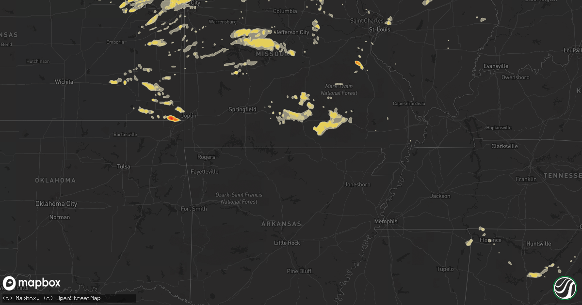
June 26 map
$229
one time, instant access
Download today. No call, no setup
Keep the $229
Bought the map and want the full workflow? Apply the entire $229 to a subscription within 7 days. None of it is wasted.
Every map, not just this one
This buys you this map. Subscription and you get every map we run, in the markets you choose from a few cities to whole states to nationwide. Plus real-time alerts the moment a storm fires.
Contact data
Name, contact info, occupancy, even credit band for addresses in the footprint. You go from where it hit to who to call.
Become the source they trust
Unlimited branding weather history reports on demand. You already have the documented answer ready for the property owner, and you are the one who showed up with it.
Property data and RoofTrace estimates
Pull up any address you have got, its value and the exact code rules for that jurisdiction, straight from One Click Code. Then RoofTrace estimates the squares, pitch, and roof value, priced the way you price.
Storm reports in Illinois
Illinois
| Date | Description |
|---|---|
| 06/26/20114:27 AM CDT | Tree down near intersection of us-40 and county road 1000e. |
| 06/26/20113:28 AM CDT | A local report indicates 62 MPH wind near 3 SSE EAST PEORIA |
| 06/26/20112:55 AM CDT | Delayed report. Trees down in town. Time estimated. |
| 06/26/20112:53 AM CDT | Tree split in two...landing on power lines |
| 06/26/20112:52 AM CDT | A local report indicates 60 MPH wind near LITTLE AMERICA |
| 06/26/20112:45 AM CDT | Observer is seeing power flashes |
| 06/26/20112:30 AM CDT | Several fir trees blown down in macomb. Delayed report. |
| 06/26/20112:30 AM CDT | Mobile home walls blown down and out. Trees and powerlines down. |
| 06/26/20112:30 AM CDT | Relayed from isp scanner traffic...power poles down south of jerseyville on us hwy 67 near crystal lake road |
| 06/26/20112:20 AM CDT | 18 inch diameter tree snapped off at base...downed powerlines and power out in town of colchester. |
| 06/26/20112:15 AM CDT | 20 inch diameter trunk/18 foot tall tree uprooted in colchester. Time estimated on delayed report. |
| 06/26/20112:05 AM CDT | One foot diameter tree limb blown out of a large pecan tree. |
| 06/26/20111:46 AM CDT | Numerous trees and power lines down. Time of damage estimated. |
| 06/26/20111:46 AM CDT | Estimated 65 to 70 mph wind. Power is out in bowen and also in augusta. Time was estimated. |
| 06/26/20111:45 AM CDT | Some buildings blown down between carthage and bentley. Second hand report. Time estimated. |
| 06/26/20111:45 AM CDT | Winds in excess of 70 mph blew down several trees and large limbs in bentley. Some roads were blocked. Some buildings and homes were also damaged. A new morton building |
| 06/26/20111:45 AM CDT | Numerous trees and power lines downed. |
| 06/26/20111:45 AM CDT | Several trees and limbs blown down. |
| 06/26/20111:44 AM CDT | Also observing powerline flashes on east side of carthage. |
| 06/26/20111:43 AM CDT | Estimated 60-70 mph wind gusts |
| 06/26/20111:41 AM CDT | 8-12 inch tree limbs down |
| 06/26/20111:38 AM CDT | Tree limbs and powerlines down. |
| 06/26/20111:38 AM CDT | A local report indicates 1.00 inch wind near WARSAW |
| 06/26/20111:37 AM CDT | 60-70 mph estimated wind gusts...power is out. |
| 06/26/20111:36 AM CDT | Estimated 60-70 mph wind gusts |
| 06/26/20111:35 AM CDT | A local report indicates 76 MPH wind near 4 NE BURTON |
| 06/26/20111:35 AM CDT | Trees and tree limbs down...pine tree snapped |
| 06/26/20111:35 AM CDT | Numerous trees down in town...power out |
| 06/26/20111:33 AM CDT | A local report indicates 80 MPH wind near PAYSON |
| 06/26/20111:30 AM CDT | 60-70 mph estimated wind gusts...power is out. |
| 06/26/20111:30 AM CDT | 8-12 inch tree limbs down |
| 06/26/20111:25 AM CDT | Several trees downed and power out |
| 06/26/201112:05 AM CDT | A local report indicates 60 MPH wind near 1 S LATHAM |
| 06/26/201112:05 AM CDT | A local report indicates 1.75 inch wind near 1 S LATHAM |
| 06/25/201111:35 PM CDT | Hail fell for 5 minutes |
| 06/25/201111:06 PM CDT | A local report indicates 61 MPH wind near 5 SW PEORIA |
| 06/25/201110:42 PM CDT | Small tree brancehs down. Corn stalks snapped near the ground. |
All States Impacted by Hail Map on June 26, 2011
Cities Impacted by Hail Map on June 26, 2011
- Dent, MN
- Staples, MN
- Verndale, MN
- Rochert, MN
- Schaller, IA
- Alta, IA
- Rembrandt, IA
- Storm Lake, IA
- Royal, NE
- Ewing, NE
- Creighton, NE
- Brunswick, NE
- Orchard, NE
- Winnetoon, NE
- Page, NE
- Plainview, NE
- Stanton, NE
- Hyannis, NE
- Merriman, NE
- Whitman, NE
- Ashby, NE
- Ogden, IA
- Rippey, IA
- Perry, IA
- Menlo, IA
- Harrisburg, NE
- Dexter, IA
- Guthrie Center, IA
- Arthur, NE
- Plattsmouth, NE
- Louisville, NE
- Murray, IA
- Truro, IA
- Sidney, IA
- Randolph, IA
- Russell, IA
- Chariton, IA
- Burlington, IA
- Wever, IA
- Lomax, IL
- Carman, IL
- Gravity, IA
- Bedford, IA
- Harvard, NE
- Saronville, NE
- Sutton, NE
- Clay Center, NE
- West Point, IA
- Fort Madison, IA
- Peru, NE
- Nebraska City, NE
- Rock Port, MO
- Novinger, MO
- Green City, MO
- Unionville, MO
- Green Castle, MO
- Dallas City, IL
- Carthage, IL
- Brashear, MO
- Kirksville, MO
- Greentop, MO
- Queen City, MO
- Clyde, MO
- Stanberry, MO
- Conception Junction, MO
- Conception, MO
- Spickard, MO
- Milan, MO
- Stratton, NE
- Trenton, NE
- Beason, IL
- Maroa, IL
- Harristown, IL
- Decatur, IL
- Warrensburg, IL
- Niantic, IL
- Chestnut, IL
- Forsyth, IL
- Latham, IL
- Mount Pulaski, IL
- Liberty, NE
- Bremen, KS
- Oketo, KS
- Hollenberg, KS
- Beattie, KS
- Marysville, KS
- Hanover, KS
- Perry, MO
- Laddonia, MO
- Axtell, KS
- Frankfort, KS
- Havensville, KS
- Divernon, IL
- Leavenworth, KS
- Weston, MO
- Fort Leavenworth, KS
- Carrollton, MO
- Bowling Green, MO
- Delia, KS
- Mission, KS
- Kansas City, KS
- Cowden, IL
- Ramsey, IL
- Herrick, IL
- Meta, MO
- Dixon, MO
- Saint Elizabeth, MO
- Lincoln, MO
- Windsor, MO
- Rhineland, MO
- Chamois, MO
- Morrison, MO
- Hermann, MO
- Manhattan, KS
- Saint George, KS
- Columbus, KS
- Galena, KS
- Carl Junction, MO
- Hartshorn, MO
- Raymondville, MO
- Eunice, MO
- Summersville, MO
- Yukon, MO
- Cherokee, KS
- Scammon, KS
- West Mineral, KS
- McCune, KS
- Watkinsville, GA
- Chetopa, KS
- Cabool, MO
- Mountain Grove, MO
- Mountain View, MO
- Vanzant, MO
- Elk Creek, MO
- Willow Springs, MO
- Florence, AL
- Cypress Inn, TN
- Waterloo, AL
- Tishomingo, MS
- Iuka, MS
- Cherokee, AL
- Pine Apple, AL
- Statesboro, GA
- Glenwood, GA
- Alamo, GA
- Dawson, GA
- Yemassee, SC
- Chauncey, GA
- Cadwell, GA
- McRae Helena, GA
- Clayton, AL
- Norcross, MN
- Chipley, FL
- Elbow Lake, MN
- Quincy, FL
- Kulm, ND
- Laurel Hill, FL
- Defuniak Springs, FL
- Crestview, FL
- Hammond, MT
- Howes, SD
- Wasta, SD
- Worland, WY
- Manderson, WY
- Mullen, NE
- Gordon, NE
- Cody, NE
- Bingham, NE
- Valentine, NE
- Thedford, NE
- Seneca, NE
- Lindsay, NE
- Newman Grove, NE
- Meadow Grove, NE
- Madison, NE
- Albion, NE
- Battle Creek, NE
- Norfolk, NE
- Logan, IA
- Portsmouth, IA
- Woodbine, IA
- Stuart, IA
- Griswold, IA
- Elliott, IA
- Bridgewater, IA
- Orient, IA
- Fontanelle, IA
- Corning, IA
- Cumberland, IA
- Villisca, IA
- Red Oak, IA
- Creston, IA
- Grant, IA
- Prescott, IA
- Massena, IA
- Pleasant Dale, NE
- Seward, NE
- Raymond, NE
- Malcolm, NE
- Garland, NE
- Bee, NE
- Woodburn, IA
- Derby, IA
- Weldon, IA
- Wellfleet, NE
- North Platte, NE
- Eagleville, MO
- Blythedale, MO
- Lamoni, IA
- Max, NE
- Maywood, NE
- Maxwell, NE
- Moorefield, NE
- Brady, NE
- Curtis, NE
- Camden, IL
- Mount Sterling, IL
- Lincoln, IL
- Tonganoxie, KS
- Marshall, IL
- Atwood, KS
- Fairbury, NE
- Endicott, NE
- Pawnee, IL
- Sedalia, MO
- Florence, MO
- Green Ridge, MO
- Mora, MO
- Smithton, MO
- Syracuse, MO
- Ionia, MO
- Harrisonville, MO
- Galesburg, KS
- Erie, KS
- Chanute, KS
- Fall River, KS
- Fredonia, KS
- Guntersville, AL
- Salem, AL
- Opelika, AL
- La Fayette, GA
- Rock Spring, GA
- Rutherfordton, NC
- Dry Branch, GA
- Warwick, GA
- Ashburn, GA
- Arabi, GA
- Hinesville, GA
- Ludowici, GA
- Hilliard, FL
- Hayneville, AL
- Caputa, SD
- New Underwood, SD
- Edgemont, SD
- Martin, SD
- Johnstown, NE
- Atkinson, NE
- Burwell, NE
- Bartlett, NE
- Chambers, NE
- Amelia, NE
- Princeton, MO
- Exline, IA
- Moulton, IA
- Livonia, MO
- Coatsville, MO
- Cincinnati, IA
- Centerville, IA
- Melrose, IA
- Ottawa, KS
- Overbrook, KS
- Pomona, KS
- Lawrence, KS
- Baldwin City, KS
- Atwood, IL
- Hammond, IL
- Lovington, IL
- Mound City, MO
- Treece, KS
- Quapaw, OK
- Baxter Springs, KS
- Picher, OK
- Troy, AL
- Georgetown, GA
- Albany, GA
- Ellabell, GA
- Andalusia, AL
- Wood Lake, NE
- West Point, NE
- Dunning, NE
- Arnold, NE
- Halsey, NE
- Greeley, NE
- Spalding, NE
- Elyria, NE
- Ord, NE
- Genoa, NE
- Schuyler, NE
- Clarkson, NE
- Columbus, NE
- Leigh, NE
- Denton, NE
- Lincoln, NE
- Pulaski, IA
- Milton, IA
- Bloomfield, IA
- London Mills, IL
- Maquon, IL
- Westboro, MO
- Hamburg, IA
- Blanchard, IA
- Shenandoah, IA
- Northboro, IA
- Burlington Junction, MO
- Elmo, MO
- Clearmont, MO
- Kahoka, MO
- Wyaconda, MO
- Braymer, MO
- Garnett, KS
- Richmond, KS
- Bird City, KS
- McDonald, KS
- Glenwood, IA
- Malvern, IA
- New Virginia, IA
- Osceola, IA
- Oskaloosa, KS
- Silver Lake, KS
- Topeka, KS
- Callender, IA
- Moorland, IA
- Cantril, IA
- Mount Sterling, IA
- Arbela, MO
- Memphis, MO
- Rushville, NE
- Maple Hill, KS
- Mauk, GA
- Buena Vista, GA
- Ekalaka, MT
- Saint Joseph, MO
- De Kalb, MO
- Rushville, MO
- Tallahassee, FL
- Interior, SD
- Wanblee, SD
- Wall, SD
- Kadoka, SD
- Troy, KS
- Wathena, KS
- Turney, MO
- Cameron, MO
- Osborn, MO
- Plattsburg, MO
- Humboldt, NE
- Auburn, NE
- Elk Creek, NE
- Johnson, NE
- Norborne, MO
- Vidalia, GA
- Howells, NE
- Maryville, MO
- Skidmore, MO
- Mystic, IA
- Cadet, MO
- Blackwell, MO
- Colby, KS
- Odum, GA
- Jesup, GA
- Rapid City, SD
- Hay Springs, NE
- Taylor, NE
- Anselmo, NE
- Sargent, NE
- Brewster, NE
- Steinauer, NE
- Oregon, MO
- White Cloud, KS
- Highland, KS
- Forest City, MO
- Cherry Creek, SD
- Paton, IA
- Harcourt, IA
- Yankton, SD
- Saint Helena, NE
- Fordyce, NE
- Pine Ridge, SD
- Hermosa, SD
- Scenic, SD
- Lance Creek, WY
- Chadron, NE
- Ainsworth, NE
- Wayne, NE
- Shelby, NE
- Rising City, NE
- Bellevue, NE
- Papillion, NE
- Blandinsville, IL
- Montrose, IA
- Niota, IL
- Nauvoo, IL
- Keokuk, IA
- Dickens, NE
- Moravia, IA
- Farnam, NE
- Canton, IL
- Cuba, IL
- Denmark, TN
- Greeley, KS
- Parker, KS
- Lane, KS
- Cole Camp, MO
- Ida Grove, IA
- Arthur, IA
- Oreana, IL
- Argenta, IL
- Macon, MO
- Fairfax, MO
- Bucyrus, MO
- Success, MO
- Savannah, TN
- Washington, KS
- Birmingham, AL
- Pelham, AL
- Farmer City, IL
- Onaga, KS
- Severy, KS
- Valley, AL
- West Point, GA
- La Plata, MO
- Shelby, AL
- Columbiana, AL
- Pequot Lakes, MN
- Pine River, MN
- Motley, MN
- Long Pine, NE
- Purdum, NE
- Hayes Center, NE
- Avon, IL
- Pekin, IL
- Green Valley, IL
- Manito, IL
- Lucas, IA
- Bowen, IL
- Augusta, IL
- Basco, IL
- Plymouth, IL
- Graham, MO
- Barnard, MO
- Maitland, MO
- Payson, IL
- Quincy, IL
- Hannibal, MO
- Hull, IL
- Palmyra, MO
- New London, MO
- West Point, IL
- Loraine, IL
- Arthur, IL
- Glenvil, NE
- Louisburg, KS
- Bucyrus, KS
- Ashmore, IL
- Charleston, IL
- Gravois Mills, MO
- Barnett, MO
- Eldon, MO
- Rocky Mount, MO
- Versailles, MO
- Stover, MO
- Montgomery City, MO
- Carrollton, GA
- Mansfield, MO
- Hurtsboro, AL
- Camilla, GA
- Cottonwood, AL
- Remsen, IA
- Allen, SD
- Stronghurst, IL
- Media, IL
- Nehawka, NE
- Weeping Water, NE
- Union, NE
- Avoca, NE
- Ursa, IL
- Mendon, IL
- Gentry, MO
- Worth, MO
- Albany, MO
- Gorin, MO
- Hardin, MO
- Richmond, MO
- Glen Carbon, IL
- Granite City, IL
- Maryville, IL
- Collinsville, IL
- Greenville, GA
- Woodbury, GA
- Gay, GA
- Molena, GA
- Brierfield, AL
- Fort Stewart, GA
- Bloomingdale, GA
- Fargo, GA
- Macon, GA
- Dodge, NE
- Hastings, IA
- Udell, IA
- Unionville, IA
- Plano, IA
- Drakesville, IA
- Audubon, IA
- Kimballton, IA
- Manilla, IA
- Manning, IA
- Irwin, IA
- Lathrop, MO
- Smithville, MO
- Holt, MO
- Kearney, MO
- Rayville, MO
- Lawson, MO
- Trimble, MO
- Polo, MO
- Shelbina, MO
- Benkelman, NE
- Bogard, MO
- Stewartsville, MO
- Bonne Terre, MO
- Linwood, KS
- Bonner Springs, KS
- Bosworth, MO
- Houston, MO
- Lyons, GA
- Oelrichs, SD
- Pacific Junction, IA
- Martell, NE
- Roca, NE
- Hallam, NE
- Crete, NE
- Sprague, NE
- Easton, MO
- Gower, MO
- Agency, MO
- Herndon, KS
- Ludell, KS
- Ellsworth, NE
- Firth, NE
- Adams, NE
- Wheatland, MO
- Aldrich, MN
- Quinn, SD
- Ellsworth Afb, SD
- Box Elder, SD
- Owanka, SD
- Neligh, NE
- Alliance, NE
- Kyle, SD
- North Loup, NE
- Shelby, IA
- Westphalia, IA
- Earling, IA
- Anita, IA
- Coon Rapids, IA
- Kirkman, IA
- Defiance, IA
- Panama, IA
- Dow City, IA
- Persia, IA
- Dunlap, IA
- Hamlin, IA
- Elk Horn, IA
- Brayton, IA
- Adair, IA
- Harlan, IA
- Exira, IA
- Fremont, NE
- Ames, NE
- Tekamah, NE
- Herman, NE
- Kansas City, MO
- Helena, MO
- Horton, KS
- Tecumseh, NE
- Hiawatha, KS
- Rulo, NE
- Denton, KS
- Craig, MO
- Lewiston, NE
- Faucett, MO
- Cortland, NE
- Everest, KS
- Guilford, MO
- Dwight, NE
- Milford, NE
- Maysville, MO
- Amity, MO
- Dawson, NE
- Wilber, NE
- Hamilton, MO
- Stella, NE
- Cummings, KS
- Pickrell, NE
- Burchard, NE
- Brainard, NE
- Bennet, NE
- Excelsior Springs, MO
- Douglas, NE
- Salem, NE
- Shubert, NE
- Cosby, MO
- Sabetha, KS
- Camden Point, MO
- Edgerton, MO
- Crab Orchard, NE
- Eagle, NE
- Falls City, NE
- Hickman, NE
- Davey, NE
- Kingston, MO
- Robinson, KS
- Filley, NE
- Burr, NE
- Cowgill, MO
- Platte City, MO
- Lancaster, KS
- Fillmore, MO
- Muscotah, KS
- Bolckow, MO
- Darlington, MO
- Table Rock, NE
- Pawnee City, NE
- Union Star, MO
- Atchison, KS
- Savannah, MO
- Verdon, NE
- Morrill, KS
- Effingham, KS
- Rosendale, MO
- Bendena, KS
- Dorchester, NE
- Clatonia, NE
- Palmyra, NE
- Amazonia, MO
- Walton, NE
- De Witt, MO
- Du Bois, NE
- Liberty, MO
- Clarksdale, MO
- King City, MO
- Rea, MO
- Elwood, KS
- Sterling, NE
- Kidder, MO
- Ulysses, NE
- Colchester, IL
- Good Hope, IL
- Sciota, IL
- Macomb, IL
- Raritan, IL
- Danville, IA
- Middletown, IA
- Birmingham, IA
- Fairfield, IA
- Stockport, IA
- Clarinda, IA
- West Burlington, IA
- Thurman, IA
- Tabor, IA
- Mount Pleasant, IA
- New London, IA
- New Boston, MO
- Smithfield, IL
- Lewistown, IL
- Liverpool, IL
- Table Grove, IL
- Marietta, IL
- Ipava, IL
- Havana, IL
- Mattoon, IL
- Oakland, IL
- Humboldt, IL
- Kansas, IL
- Arcola, IL
- Tuscola, IL
- Home, KS
- De Soto, MO
- Flemington, MO
- Weaubleau, MO
- Frankford, MO
- Solo, MO
- Licking, MO
- Randolph, AL
- Jemison, AL
- Lizella, GA
- Humboldt, TN
- Gadsden, TN
- Calera, AL
- Sumner, GA
- Ty Ty, GA
- Sylvester, GA
- Doerun, GA
- Hershey, NE
- Sutherland, NE
- Beemer, NE
- Blair, NE
- Wisner, NE
- Seymour, IA
- Douds, IA
- Selma, IA
- Keosauqua, IA
- Fowler, IL
- Ewing, MO
- Durham, MO
- Edina, MO
- Warsaw, IL
- Hurdland, MO
- Alexandria, MO
- Bethel, MO
- Canton, MO
- Baring, MO
- Sutter, IL
- Saint Patrick, MO
- Emden, MO
- Philadelphia, MO
- La Grange, MO
- Monticello, MO
- Williamstown, MO
- Lewistown, MO
- Knox City, MO
- Rutledge, MO
- La Belle, MO
- Maywood, MO
- Paloma, IL
- New Holland, IL
- Elkhart, IL
- Middletown, IL
- Arlington, GA
- Bolton, NC
- Delco, NC
- Middletown, MO
- Vandalia, MO
- Riverside, MO
- De Soto, KS
- Basehor, KS
- Shawnee, KS
- Iola, KS
- Waycross, GA
- Hoboken, GA
- Eminence, MO
- Winona, MO
- Ponce De Leon, FL
- Norwood, MO
- Rebecca, GA
- Uniontown, KS
- Redfield, KS
- Hepler, KS
- Lake City, FL
- Oakland, NE
- New Cambria, MO
- Ethel, MO
- Cullman, AL
- Hanceville, AL
- Wamego, KS
- Belvue, KS
- Banks, AL
- Louisville, AL
- Wolbach, NE
- Guyton, GA
- Mound Valley, KS
- Coffeyville, KS
- Liberty, KS
- Ridgeway, MO
- Walthill, NE
- Petersburg, NE
- Humphrey, NE
- Pierce, NE
- Tilden, NE
- Honey Creek, IA
- Neola, IA
- Missouri Valley, IA
- Arlington, NE
- Ceresco, NE
- Waverly, NE
- Humeston, IA
- Lockridge, IA
- Hillsboro, IA
- Salem, IA
- Abingdon, IL
- Le Roy, IL
- Ravenwood, MO
- Elmer, MO
- Atlanta, MO
- Camden, MO
- Parsons, KS
- Butler, MO
- Fremont, MO
- Van Buren, MO
- Birch Tree, MO
- Alton, MO
- Peace Valley, MO
- Tuskegee, AL
- Shorter, AL
- Montevallo, AL
- Parkers Prairie, MN
- Vining, MN
- Elsmere, NE
- Monroe, NE
- Scotia, NE
- Ericson, NE
- Henderson, IA
- Argyle, IA
- Wayland, MO
- Hamilton, IL
- Farmington, IA
- Revere, MO
- Albia, IA
- Luray, MO
- Floris, IA
- Bonaparte, IA
- Browning, MO
- Galt, MO
- Humphreys, MO
- Trenton, MO
- McCook, NE
- Culbertson, NE
- Cuba, KS
- Haddam, KS
- Witt, IL
- Nokomis, IL
- Irving, IL
- Fillmore, IL
- Auburn, KS
- Anniston, AL
- Alexandria, AL
- Weaver, AL
- Gordon, AL
- Pansey, AL
- Grant City, MO
- Hatfield, MO
- Novelty, MO
- Leonard, MO
- Meriden, KS
- Tipton, MO
- Fortuna, MO
- Cherryvale, KS
- Register, GA
- Williamson, GA
- Concord, GA
- Scribner, NE
- Milesville, SD
- Lorimor, IA
- Denison, IA
- Charter Oak, IA
- Cainsville, MO
- Bethany, MO
- Mount Ayr, IA
- Martinsville, MO
- Redding, IA
- Somers, IA
- Fort Dodge, IA
- Barnum, IA
- Oshkosh, NE
- Lakeside, NE
- Casey, IA
- David City, NE
- Afton, IA
- Emerson, IA
- Davis City, IA
- Petersburg, IL
- Tallula, IL
- Palisade, NE
- Bucklin, MO
- Callao, MO
- Williamsville, IL
- Greenleaf, KS
- Barnes, KS
- Grantville, KS
- Ozawkie, KS
- Rossville, KS
- Tecumseh, KS
- Perry, KS
- Center, MO
- Monroe City, MO
- Portage Des Sioux, MO
- Cleveland, MO
- Box Springs, GA
- Claxton, GA
- Collins, GA
- Reidsville, GA
- Beaufort, SC
- Wellsville, MO
- Rincon, GA
- Wadesboro, NC
- Morven, NC
- Brewton, AL
- Edna, KS
- Altamont, KS
- Cordele, GA
- Amsterdam, MO
- Amoret, MO
- Bingham, IL
- Adel, GA
- Paola, KS
- Meriden, IA
- Cherokee, IA
- Carroll, NE
- Belden, NE
- Farragut, IA
- Coin, IA
- Hopkins, MO
- Pickering, MO
- Jameson, MO
- Gallatin, MO
- Altamont, MO
- Saint Paul, KS
- Thomasville, GA
- Monticello, FL
- Exeter, NE
- Huntsville, IL
- Easton, IL
- Hunnewell, MO
- Notasulga, AL
- Vergas, MN
- Burbank, SD
- Gayville, SD
- Avoca, IA
- Minden, IA
- Blencoe, IA
- Onawa, IA
- Donnellson, IA
- La Prairie, IL
- Camp Point, IL
- Downing, MO
- Clayton, IL
- Taylor, MO
- Ottumwa, IA
- Blakesburg, IA
- Golden, IL
- Shelbyville, MO
- Timewell, IL
- Coatsburg, IL
- Lovilia, IA
- Elvaston, IL
- Utica, NE
- Sheridan, MO
- New Hampton, MO
- Denver, MO
- McFall, MO
- Kilbourne, IL
- Mason City, IL
- Emmett, KS
- Hale, MO
- Paris, IL
- Slater, MO
- Miami, MO
- Marshall, MO
- Edwardsville, IL
- Eugene, MO
- Otterville, MO
- Russellville, MO
- Heflin, AL
- Helena, AL
- Childersburg, AL
- Wilsonville, AL
- Sylacauga, AL
- Brent, AL
- Garnett, SC
- Butler, GA
- Reynolds, GA
- Minter, AL
- Brooklet, GA
- Baconton, GA
- Blountstown, FL
- Wheaton, MN
- Saint Augustine, FL
- Jacksonville, FL
- Saint Johns, FL
- Statenville, GA
- Jasper, FL
- Fullerton, NE
- La Harpe, IL
- Imogene, IA
- Blockton, IA
- Parnell, MO
- Topeka, IL
- Saint Marys, KS
- Tina, MO
- Emerson, NE
- Thurston, NE
- Jamaica, IA
- Hooper, NE
- Redfield, IA
- Surprise, NE
- Tarkio, MO
- Riverton, IA
- Essex, IA
- Ayr, NE
- Hastings, NE
- South Pekin, IL
- Bern, KS
- Oneida, KS
- Seneca, KS
- Parks, NE
- Martinsville, IL
- Latham, MO
- Clarksburg, MO
- California, MO
- Cross Timbers, MO
- Ranburne, AL
- Lees Summit, MO
- Fitzgerald, GA
- Glennville, GA
- Silver Creek, NE
- Roopville, GA
- Marcus, IA
- Smithshire, IL
- Blue Rapids, KS
- Granville, IA
- Ridgeland, SC
- Pineland, SC
- Owensville, MO
- Bland, MO
- Morrisonville, IL
- Harveyville, KS
- Osmond, NE
- Leon, IA
- Swainsboro, GA
- Soperton, GA
- Baxley, GA
- Curryville, MO
- Ormond Beach, FL
- New Market, IA
- Paris, MO
- Stoutsville, MO
- Whiting, KS
- Holton, KS
- Vermillion, SD
- Creston, NE
- Baileyville, KS
- Levant, KS
- Bessemer, AL
- Mondamin, IA
- Halbur, IA
- Arcadia, IA
- Carroll, IA
- Greenfield, IA
- Circleville, KS
- Soldier, KS
- Le Mars, IA
- Randolph, NE
- Laurel, NE
- Yoder, WY
- Little Sioux, IA
- Pisgah, IA
- Staplehurst, NE
- Biggsville, IL
- Roseville, IL
- Monmouth, IL
- Gladstone, IL
- Kirkwood, IL
- Benton, IA
- Fairmont, NE
- Chillicothe, MO
- Jamesport, MO
- Greenview, IL
- Miami, OK
- Bartlett, KS
- Thompson, MO
- Centralia, MO
- Hartville, MO
- Gainesville, GA
- Blountsville, AL
- Drury, MO
- Baldwin, GA
- Murrayville, GA
- Holly Pond, AL
- Forsyth, GA
- Atlanta, GA
- Pine Mountain, GA
- Ailey, GA
- Uvalda, GA
- Mount Vernon, GA
- Middleburg, FL
- Vernon, FL
- Eudora, KS
- Batesland, SD
- Pender, NE
- Osceola, NE
- Winterset, IA
- Council Bluffs, IA
- Silver City, IA
- Tennessee, IL
- Mercer, MO
- Fairview, IL
- Saint Augustine, IL
- Pattonsburg, MO
- Rushville, IL
- Laclede, MO
- Linneus, MO
- Morrowville, KS
- Mayetta, KS
- Quenemo, KS
- Adrian, MO
- Benton City, MO
- Martinsburg, MO
- Rush Hill, MO
- Mexico, MO
- Walnut, KS
- Hatchechubbee, AL
- Lusk, WY
- Henning, MN
- Manson, IA
- Jay Em, WY
- Paullina, IA
- Cleghorn, IA
- Fonda, IA
- Rockwell City, IA
- Westside, IA
- Vail, IA
- Wakefield, NE
- Dedham, IA
- Platte Center, NE
- Atlantic, IA
- Marne, IA
- Craig, NE
- Decatur, NE
- Van Meter, IA
- Crescent, IA
- Geneva, NE
- Tingley, IA
- Van Wert, IA
- Astoria, IL
- Grafton, NE
- Lucerne, MO
- Powersville, MO
- Pollock, MO
- Courtland, KS
- Formoso, KS
- Coffey, MO
- Gilman City, MO
- Wheeling, MO
- Chula, MO
- Kenney, IL
- Clinton, IL
- Waynesville, IL
- Weatherby, MO
- Randolph, KS
- Santa Fe, MO
- Lexington, MO
- Henrietta, MO
- Vassar, KS
- Independence, MO
- Blue Springs, MO
- Troy, MO
- Silex, MO
- Rich Hill, MO
- Yates Center, KS
- Hermitage, MO
- Toronto, KS
- Piedmont, KS
- Eureka, KS
- Plato, MO
- Trenton, TN
- Bowdon, GA
- Dadeville, AL
- Daviston, AL
- Alto, GA
- Horton, AL
- Altoona, AL
- Jackson, TN
- Bells, TN
- Bethel Springs, TN
- Union Springs, AL
- Walterboro, SC
- Lumber City, GA
- Midway, AL
- Sale City, GA
- Clopton, AL
- Newton, GA
- Wing, AL
- Port Orange, FL
- Mims, FL
- Titusville, FL
- Okeechobee, FL
- Beresford, SD
- Oglala, SD
- Moorhead, IA
- Modale, IA
- Ute, IA
- Soldier, IA
- Linn, KS
- Lyndon, KS
- Melvern, KS
- Walnut, IA
- Mahaska, KS
- Climax Springs, MO
- Edwards, MO
- Macks Creek, MO
- Quincy, MO
- Greenwood, NE
- Murdock, NE
- Alvo, NE
- Sweet Springs, MO
- Houstonia, MO
- Wilmington, NC
- Hemingford, NE
- Weir, KS
- Whitesburg, GA
- Griggsville, IL
- Edgerton, KS
- Wellsville, KS
- Clinton, MO
- Philip, SD
- Granger, IA
- Pittsburg, MO
- North Bend, NE
- Jefferson, IA
- Rentz, GA
- Dublin, GA
- Elgin, NE
- Hillsboro, MO
- Piqua, KS
- Neosho Falls, KS
- Tuskegee Institute, AL
- Tallassee, AL
- Odebolt, IA
- Arab, AL
- Altoona, FL
- Lanett, AL
- Salisbury, MO
- Glasgow, MO
- Westmoreland, KS
- Shorterville, AL
- Abbeville, AL
- Town Creek, AL
- Russellville, AL
- Ava, MO
- Macomb, MO
- Marion, AL
- Hilton Head Island, SC
- Vienna, MO
- Cobbtown, GA
- Metter, GA
- Culloden, GA
- Roberta, GA
- Astatula, FL
- Mount Dora, FL
- Tavares, FL
- Chunchula, AL
- Edgeley, ND
- Marsland, NE
- Salix, IA
- Sloan, IA
- Linden, IA
- Yale, IA
- Panora, IA
- Bancroft, NE
- Treynor, IA
- Adel, IA
- Earlham, IA
- McClelland, IA
- Frederick, IL
- Corydon, IA
- Allerton, IA
- Goff, KS
- Wetmore, KS
- Martinsville, IN
- Elsberry, MO
- Eolia, MO
- Higbee, MO
- West Union, IL
- Imperial, MO
- Arnold, MO
- Valmeyer, IL
- New Florence, MO
- Linn, MO
- Bixby, MO
- Boss, MO
- West Plains, MO
- Wellington, AL
- Hazel, KY
- Murray, KY
- Lawrenceville, GA
- Dacula, GA
- Ruffin, SC
- Bluffton, SC
- Tarrytown, GA
- Wray, GA
- Barnesville, GA
- Jupiter, FL
- Screven, GA
- Clare, IA
- Coleridge, NE
- Rosalie, NE
- Macy, NE
- Winnebago, NE
- Oneill, NE
- Castana, IA
- Madrid, IA
- Saint Edward, NE
- Bellwood, NE
- Yarmouth, IA
- Sperry, IA
- Decatur, IA
- Inland, NE
- Lineville, IA
- Western, NE
- Springfield, IL
- Cantrall, IL
- Virden, IL
- Auburn, IL
- Macon, IL
- Louisiana, MO
- Oberlin, KS
- Meadville, MO
- Nortonville, KS
- Easton, KS
- Gilliam, MO
- Troy, IL
- Rantoul, KS
- Centerville, KS
- Blue Mound, KS
- Mound City, KS
- La Cygne, KS
- Drexel, MO
- Bloomfield, MO
- Advance, MO
- Ellsinore, MO
- Boaz, AL
- Rocky Face, GA
- Ringgold, GA
- Alabaster, AL
- Chelsea, AL
- Eastman, GA
- Pembroke, GA
- Twin City, GA
- Hazlehurst, GA
- Tifton, GA
- Live Oak, FL
- Quitman, GA
- Lyons, NE
- Center, NE
- Bayard, IA
- Bassett, NE
- Crofton, NE
- Pilger, NE
- Pleasantville, IA
- Diagonal, IA
- Shannon City, IA
- Springfield, NE
- Ashland, NE
- Cedar Bluffs, NE
- Saint Charles, IA
- Dunbar, NE
- Syracuse, NE
- Fairfield, NE
- Clearfield, IA
- Lenox, IA
- Cerro Gordo, IL
- La Place, IL
- Overland Park, KS
- Olathe, KS
- Fayette, MO
- Dittmer, MO
- Ellis Grove, IL
- Walsh, IL
- Foster, MO
- Bethany, IL
- Potosi, MO
- Mineral Point, MO
- Tuscumbia, AL
- Independence, KS
- Seymour, MO
- Clifton, TN
- Alamo, TN
- Rainsville, AL
- Fort Payne, AL
- Fruithurst, AL
- Maplesville, AL
- Clermont, GA
- Cusseta, AL
- Saint Helena Island, SC
- Ocilla, GA
- Ashford, AL
- Leesburg, GA
- Nashville, GA
- Stockton, GA
- Lake Park, GA
- Green Cove Springs, FL
- White Springs, FL
- Fort Pierce, FL
- Hewitt, MN
- Wadena, MN
- Crawford, NE
- Elk Point, SD
- Akron, IA
- Whiting, IA
- Hornick, IA
- Grimes, IA
- Gretna, NE
- Omaha, NE
- Valley, NE
- La Vista, NE
- Nickerson, NE
- Bennington, NE
- Waterloo, NE
- Boys Town, NE
- Kennard, NE
- Elkhorn, NE
- Fort Calhoun, NE
- Washington, NE
- Lewis, IA
- Underwood, IA
- Saint Paul, IA
- Hartsburg, IL
- McLean, IL
- Atlanta, IL
- Mt Zion, IL
- Illiopolis, IL
- Forest City, IL
- Adair, IL
- Athens, IL
- Armington, IL
- Pleasant Plains, IL
- Oakford, IL
- Buffalo, IL
- Lawndale, IL
- Delavan, IL
- Emden, IL
- Vermont, IL
- San Jose, IL
- Sherman, IL
- Ashland, IL
- Industry, IL
- Chandlerville, IL
- Waterville, KS
- Powhattan, KS
- Fairview, KS
- Clarksville, MO
- Grafton, IL
- Holliday, MO
- Clarence, MO
- Madison, MO
- Hughesville, MO
- Rochester, IL
- Edinburg, IL
- Chatham, IL
- Fontana, KS
- Bridgeport, IL
- Sumner, IL
- Mapleton, KS
- Fulton, KS
- Henley, MO
- Stark, KS
- Virgil, KS
- Buffalo, KS
- Fisk, MO
- Danville, AL
- Moulton, AL
- Kevil, KY
- La Center, KY
- Barlow, KY
- Fair Play, SC
- Crossville, AL
- Albertville, AL
- Winterville, GA
- Stephens, GA
- Arnoldsville, GA
- Athens, GA
- Douglasville, GA
- Winston, GA
- Cumming, GA
- Okatie, SC
- Fort Davis, AL
- Clio, AL
- Moultrie, GA
- Jennings, FL
- Madison, FL
- Manderson, SD
- Mclean, NE
- Mapleton, IA
- Indianola, IA
- Arion, IA
- Mead, NE
- Yutan, NE
- Stanton, IA
- Gilson, IL
- Galesburg, IL
- Garden Grove, IA
- Hampton, NE
- Henderson, NE
- Bath, IL
- Dawson, IL
- Dalton City, IL
- Malta Bend, MO
- Auxvasse, MO
- Waverly, MO
- Jonesburg, MO
- High Hill, MO
- Pleasanton, KS
- Fort Scott, KS
- Brownsville, TN
- Chickamauga, GA
- Muscle Shoals, AL
- Sheffield, AL
- Salem, MO
- Bonaire, GA
- Hartsfield, GA
- Youngstown, FL
- Vero Beach, FL
- Tuthill, SD
- Douglas, WY
- Wynot, NE
- Hartington, NE
- Grand Junction, IA
- Anabel, MO
- Scranton, IA
- Edgar, NE
- Promise City, IA
- Farber, MO
- Cedar Rapids, NE
- Westfield, IL
- Sullivan, IL
- Ellisville, IL
- Worthington, MO
- Gresham, NE
- Ellston, IA
- Thayer, IA
- Friend, NE
- Tobias, NE
- Berwick, IL
- Yates City, IL
- Cameron, IL
- Elmwood, NE
- Browning, IL
- Hoyt, KS
- McLouth, KS
- Sibley, MO
- Napoleon, MO
- Polk City, IA
- Waukee, IA
- Lacona, IA
- Valley Falls, KS
- La Monte, MO
- Olney, IL
- Dundas, IL
- Spring Hill, KS
- Brinktown, MO
- Richards, MO
- Holden, MO
- Garden City, MO
- Savonburg, KS
- Enville, TN
- Henderson, TN
- Finger, TN
- Sulphur, IN
- New Madrid, MO
- Clyo, GA
- Tillman, SC
- Pickens, SC
- Six Mile, SC
- Graham, AL
- Woodland, AL
- Pell City, AL
- Greenville, FL
- Lamont, FL
- Ten Sleep, WY
- Valparaiso, NE
- Uehling, NE
- Glenwood, MO
- Lansing, KS
- Dearborn, MO
- Winston, MO
- Cook, NE
- Julian, NE
- Gibbs, MO
- Murray, NE
- Summerfield, KS
- Newtown, MO
- Eldon, IA
- Farley, MO
- Versailles, IL
- Braddyville, IA
- Panama, NE
- Dawn, MO
- Winigan, MO
- Waldron, MO
- Clearwater, NE
- Brownville, NE
- Hoskins, NE
- Talmage, NE
- Duncan, NE
- Percival, IA
- Wymore, NE
- Newark, MO
- Bevier, MO
- Laredo, MO
- Beatrice, NE
- Nodaway, IA
- Watson, MO
- Virginia, NE
- Nemaha, NE
- Lenexa, KS
- Brock, NE
- Brookfield, MO
- Prairie Village, KS
- Lancaster, MO
- Orrick, MO
- Brunswick, MO
- Peru, IA
- Rogers, NE
- Littleton, IL
- Missouri City, MO
- Harris, MO
- Kellerton, IA
- Bement, IL
- Milmine, IL
- Bagley, IA
- Wapella, IL
- Downs, IL
- Dewitt, IL
- Lentner, MO
- Blue Mound, IL
- Stromsburg, NE
- Winchester, IL
- Weston, NE
- Winside, NE
- Ogallala, NE
- Packwood, IA
- Selden, KS
- Oakdale, NE
- Keenes, IL
- Peculiar, MO
- Freeman, MO
- Gosport, IN
- Rothville, MO
- Marceline, MO
- Denison, KS
- Graff, MO
- Osceola, MO
- Wayne City, IL
- Carnesville, GA
- Hickman, KY
- Collinsville, AL
- Junction City, GA
- Marshfield, MO
- Midway, FL
- Yatesville, GA
- Ellington, MO
- House Springs, MO
- High Ridge, MO
- Martin, GA
- Eastanollee, GA
- Deepwater, MO
- Appleton City, MO
- Montrose, MO
- Selmer, TN
- Folkston, GA
- McCalla, AL
- Kiron, IA
- Dana, IA
- Wiota, IA
- Unadilla, NE
- Batavia, IA
- Wauneta, NE
- Seymour, IL
- White Heath, IL
- Monticello, IL
- Farmersville, IL
- Portland, MO
- Armstrong, MO
- Calhoun, MO
- Warsaw, MO
- Tuscumbia, MO
- Olean, MO
- Bunker, MO
- Mill Spring, NC
- Dover, TN
- Stewart, TN
- Lutts, TN
- Lilesville, NC
- Auburn, AL
- Kathleen, GA
- Preston, GA
- Tyler, AL
- Nicholls, GA
- Homerville, GA
- Telogia, FL
- Hosford, FL
- Wewahitchka, FL
- Bristol, FL
- Starke, FL


