Hail Map in Iowa on June 26, 2011
Get this storm
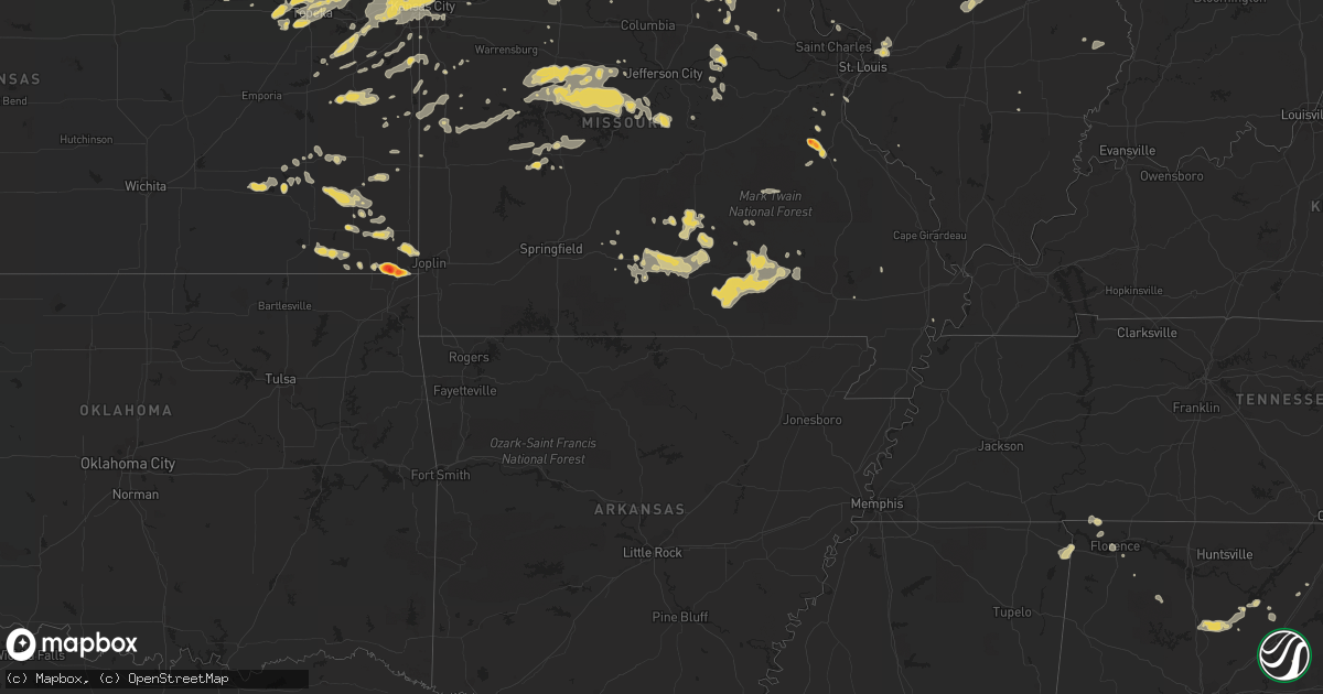
June 26 map
$229
one time, instant access
Download today. No call, no setup
Keep the $229
Bought the map and want the full workflow? Apply the entire $229 to a subscription within 7 days. None of it is wasted.
Every map, not just this one
This buys you this map. Subscription and you get every map we run, in the markets you choose from a few cities to whole states to nationwide. Plus real-time alerts the moment a storm fires.
Contact data
Name, contact info, occupancy, even credit band for addresses in the footprint. You go from where it hit to who to call.
Become the source they trust
Unlimited branding weather history reports on demand. You already have the documented answer ready for the property owner, and you are the one who showed up with it.
Property data and RoofTrace estimates
Pull up any address you have got, its value and the exact code rules for that jurisdiction, straight from One Click Code. Then RoofTrace estimates the squares, pitch, and roof value, priced the way you price.
Storm reports in Iowa
Iowa
| Date | Description |
|---|---|
| 06/26/20116:49 PM CDT | A local report indicates 60 MPH wind near CENTERVILLE |
| 06/26/20116:23 PM CDT | A local report indicates 1.00 inch wind near CENTERVILLE |
| 06/26/20116:22 PM CDT | Nickel to quarter sized hail covering parking lot. |
| 06/26/20116:21 PM CDT | Quarter to golf ball sized hail. |
| 06/26/20116:12 PM CDT | 3 to 4 inch tree branches down with pea size hail. |
| 06/26/20116:04 PM CDT | Electric pole partially blown over...wires sparking |
| 06/26/20116:00 PM CDT | Nickel to quarter hail relayed to law enforcement from public. |
| 06/26/20115:55 PM CDT | A local report indicates 1.00 inch wind near 3 S WOODBURN |
| 06/26/20115:25 PM CDT | A local report indicates 1.00 inch wind near CHARITON |
| 06/26/20114:55 PM CDT | A local report indicates 1.00 inch wind near 3 N CRESTON AIRPORT |
| 06/26/20117:46 AM CDT | At least six homes with roof damage with shingles blown off. Power lines downed. Grain bin destroyed in the outskirts of town. |
| 06/26/20111:32 AM CDT | Trees down in town. |
| 06/26/20111:15 AM CDT | Several trees were uprooted or snapped near the base. The pallet building on johnson street collapsed. The redemption center building on s 4th and johnson street collap |
| 06/25/201111:25 PM CDT | A local report indicates 60 MPH wind near E OTTUMWA |
| 06/25/201111:15 PM CDT | Time estimated |
| 06/25/201111:06 PM CDT | From kboe radio station reported by weather eye |
| 06/25/201111:00 PM CDT | A local report indicates 2.00 inch wind near CINCINNATI |
| 06/25/201110:52 PM CDT | Large tree blown down and cable wires hanging low. |
| 06/25/201110:40 PM CDT | A local report indicates 77 MPH wind near PELLA |
| 06/25/201110:38 PM CDT | A local report indicates 73 MPH wind near PELLA |
| 06/25/201110:35 PM CDT | Tree down in knoxville town square |
| 06/25/201110:34 PM CDT | Powerline and poles down |
| 06/25/201110:31 PM CDT | A local report indicates 62 MPH wind near KNOXVILLE |
| 06/25/201110:15 PM CDT | Tree branches down as well. |
| 06/25/201110:06 PM CDT | A local report indicates 58 MPH wind near DES MOINES INT AIRPORT |
| 06/25/201110:05 PM CDT | A local report indicates 70 MPH wind near NORWALK |
| 06/25/201110:05 PM CDT | A local report indicates 1.00 inch wind near CRESTON |
| 06/25/20119:52 PM CDT | 3 inch diameter tree branches down. |
| 06/25/20119:52 PM CDT | Measured at the kcci studios |
| 06/25/20119:52 PM CDT | Large tree limbs down and torrential rains. |
| 06/25/20119:50 PM CDT | Estimated 65 mph winds. 3-6 inch diameter tree branches down |
| 06/25/20119:47 PM CDT | A local report indicates 63 MPH wind near 5 WNW DES MOINES |
| 06/25/20119:45 PM CDT | Semi blown over near hw 30 in carroll |
| 06/25/20119:40 PM CDT | Three branch down in stuart blocking street and it hit a car. |
| 06/25/20119:38 PM CDT | Estimated wind speed. Could not check for damage |
| 06/25/20119:35 PM CDT | Heavy rain. Estimated 40 mph winds |
| 06/25/20119:35 PM CDT | Pea hail |
| 06/25/20119:30 PM CDT | Semi trailer overturned on highway 141 |
| 06/25/20119:30 PM CDT | Six inch diameter branch down. Patio furniture blown throughout yard. Loss of power for five minutes. |
| 06/25/20119:30 PM CDT | Six inch tree limbs down in adel. |
| 06/25/20119:29 PM CDT | Large 2 to 3 foot diameter oak tree down. |
| 06/25/20119:27 PM CDT | Measured at the perry airport |
| 06/25/20119:26 PM CDT | A local report indicates 60 MPH wind near 3 W ADEL |
| 06/25/20119:24 PM CDT | 24 inch wide tree down in stuart |
| 06/25/20119:20 PM CDT | A local report indicates 60 MPH wind near 3 ESE MALVERN |
| 06/25/20119:11 PM CDT | A local report indicates 60 MPH wind near ADAIR |
| 06/25/20119:10 PM CDT | Trees and power lines down |
| 06/25/20119:00 PM CDT | 3 to 4 inch tree branches down. |
| 06/25/20119:00 PM CDT | Power out throughout west side of fort madison. |
| 06/25/20118:55 PM CDT | Large tree limbs down. Nickle hail |
| 06/25/20118:54 PM CDT | A local report indicates 60 MPH wind near OAKLAND |
| 06/25/20118:51 PM CDT | A local report indicates 1.00 inch wind near 1 SE AUDUBON |
| 06/25/20118:45 PM CDT | 8 inch diameter tree limbs down. Time estimated from radar |
| 06/25/20118:43 PM CDT | A local report indicates 60 MPH wind near CARROLL |
| 06/25/20118:41 PM CDT | A local report indicates 1.75 inch wind near GLENWOOD |
| 06/25/20118:40 PM CDT | Ef1 tornado on the ground for 1 minute. Length 2.5 miles due east with a width of 50 yards. The roof was blown off a hog confinement building and a morton building with |
| 06/25/20118:40 PM CDT | Possible tornado...storm survey in progress. |
| 06/25/20118:35 PM CDT | No damage noted at this area from the winds but it was noted that some trees were downed a little west of this location when driving through after the storm. |
| 06/25/20118:35 PM CDT | Measured by the harlan awos khnr. |
| 06/25/20118:34 PM CDT | Trees down and street flooding. |
| 06/25/20118:34 PM CDT | A local report indicates 60 MPH wind near ODEBOLT |
| 06/25/20118:33 PM CDT | Trees down in denison and 2 miles west of town |
| 06/25/20118:32 PM CDT | A local report indicates 60 MPH wind near IRWIN |
| 06/25/20118:30 PM CDT | 1-2 diameter branches down due to strong winds |
| 06/25/20118:30 PM CDT | Power lines down |
| 06/25/20118:28 PM CDT | A local report indicates 60 MPH wind near HARLAN |
| 06/25/20118:25 PM CDT | Hail ended at 825 pm |
| 06/25/20118:25 PM CDT | Tree down on mobile home |
| 06/25/20118:15 PM CDT | Numerous tree branches down |
| 06/25/20118:15 PM CDT | Billboard blown over north of town. |
| 06/25/20118:11 PM CDT | A local report indicates 60 MPH wind near 7 WSW DOW CITY |
| 06/25/20118:05 PM CDT | 50 to 60 mph winds in sioux city along with considerable street flooding in the downtown area. |
| 06/25/20118:03 PM CDT | A local report indicates 67 MPH wind near 1 W SERGEANT BLUFF |
| 06/25/20118:00 PM CDT | Tree down on house. |
| 06/25/20117:59 PM CDT | Tree damage and power line damage from tree debris falling on power lines. Power out. Damaging winds continued for 20 minutes to at least 819 pm cdt. |
| 06/25/20117:55 PM CDT | Trees down in town |
| 06/25/20117:55 PM CDT | Small hail and zero visibility in heavy rainfall. |
| 06/25/20117:53 PM CDT | A local report indicates 71 MPH wind near 4 SSE SIOUX CITY |
| 06/25/20117:52 PM CDT | 1 foot diameter tree blown down. Some corn leaning. Some corn snapped. |
| 06/25/20117:46 PM CDT | A local report indicates 75 MPH wind near 2 N SALIX |
| 06/25/20117:46 PM CDT | At least six homes with roof damage with shingles blown off. Power lines downed. Grain bin destroyed in the outskirts of town. |
| 06/25/20117:45 PM CDT | A local report indicates 60 MPH wind near 3 N ONAWA |
| 06/25/20117:40 PM CDT | Numerous four to eight diameter branches downed. |
| 06/25/20117:40 PM CDT | Grain bend damage on edge of town. |
| 06/25/20117:40 PM CDT | One inch diameter branches downed in town. |
| 06/25/20117:30 PM CDT | A local report indicates 70 MPH wind near 2 N SALIX |
| 06/25/20117:29 PM CDT | Large trees uprooted in the town of west grove. |
| 06/25/20117:07 PM CDT | A local report indicates 1.00 inch wind near NNE UDELL |
All States Impacted by Hail Map on June 26, 2011
Cities Impacted by Hail Map on June 26, 2011
- Dent, MN
- Staples, MN
- Verndale, MN
- Rochert, MN
- Schaller, IA
- Alta, IA
- Rembrandt, IA
- Storm Lake, IA
- Royal, NE
- Ewing, NE
- Creighton, NE
- Brunswick, NE
- Orchard, NE
- Winnetoon, NE
- Page, NE
- Plainview, NE
- Stanton, NE
- Hyannis, NE
- Merriman, NE
- Whitman, NE
- Ashby, NE
- Ogden, IA
- Rippey, IA
- Perry, IA
- Menlo, IA
- Harrisburg, NE
- Dexter, IA
- Guthrie Center, IA
- Arthur, NE
- Plattsmouth, NE
- Louisville, NE
- Murray, IA
- Truro, IA
- Sidney, IA
- Randolph, IA
- Russell, IA
- Chariton, IA
- Burlington, IA
- Wever, IA
- Lomax, IL
- Carman, IL
- Gravity, IA
- Bedford, IA
- Harvard, NE
- Saronville, NE
- Sutton, NE
- Clay Center, NE
- West Point, IA
- Fort Madison, IA
- Peru, NE
- Nebraska City, NE
- Rock Port, MO
- Novinger, MO
- Green City, MO
- Unionville, MO
- Green Castle, MO
- Dallas City, IL
- Carthage, IL
- Brashear, MO
- Kirksville, MO
- Greentop, MO
- Queen City, MO
- Clyde, MO
- Stanberry, MO
- Conception Junction, MO
- Conception, MO
- Spickard, MO
- Milan, MO
- Stratton, NE
- Trenton, NE
- Beason, IL
- Maroa, IL
- Harristown, IL
- Decatur, IL
- Warrensburg, IL
- Niantic, IL
- Chestnut, IL
- Forsyth, IL
- Latham, IL
- Mount Pulaski, IL
- Liberty, NE
- Bremen, KS
- Oketo, KS
- Hollenberg, KS
- Beattie, KS
- Marysville, KS
- Hanover, KS
- Perry, MO
- Laddonia, MO
- Axtell, KS
- Frankfort, KS
- Havensville, KS
- Divernon, IL
- Leavenworth, KS
- Weston, MO
- Fort Leavenworth, KS
- Carrollton, MO
- Bowling Green, MO
- Delia, KS
- Mission, KS
- Kansas City, KS
- Cowden, IL
- Ramsey, IL
- Herrick, IL
- Meta, MO
- Dixon, MO
- Saint Elizabeth, MO
- Lincoln, MO
- Windsor, MO
- Rhineland, MO
- Chamois, MO
- Morrison, MO
- Hermann, MO
- Manhattan, KS
- Saint George, KS
- Columbus, KS
- Galena, KS
- Carl Junction, MO
- Hartshorn, MO
- Raymondville, MO
- Eunice, MO
- Summersville, MO
- Yukon, MO
- Cherokee, KS
- Scammon, KS
- West Mineral, KS
- McCune, KS
- Watkinsville, GA
- Chetopa, KS
- Cabool, MO
- Mountain Grove, MO
- Mountain View, MO
- Vanzant, MO
- Elk Creek, MO
- Willow Springs, MO
- Florence, AL
- Cypress Inn, TN
- Waterloo, AL
- Tishomingo, MS
- Iuka, MS
- Cherokee, AL
- Pine Apple, AL
- Statesboro, GA
- Glenwood, GA
- Alamo, GA
- Dawson, GA
- Yemassee, SC
- Chauncey, GA
- Cadwell, GA
- McRae Helena, GA
- Clayton, AL
- Norcross, MN
- Chipley, FL
- Elbow Lake, MN
- Quincy, FL
- Kulm, ND
- Laurel Hill, FL
- Defuniak Springs, FL
- Crestview, FL
- Hammond, MT
- Howes, SD
- Wasta, SD
- Worland, WY
- Manderson, WY
- Mullen, NE
- Gordon, NE
- Cody, NE
- Bingham, NE
- Valentine, NE
- Thedford, NE
- Seneca, NE
- Lindsay, NE
- Newman Grove, NE
- Meadow Grove, NE
- Madison, NE
- Albion, NE
- Battle Creek, NE
- Norfolk, NE
- Logan, IA
- Portsmouth, IA
- Woodbine, IA
- Stuart, IA
- Griswold, IA
- Elliott, IA
- Bridgewater, IA
- Orient, IA
- Fontanelle, IA
- Corning, IA
- Cumberland, IA
- Villisca, IA
- Red Oak, IA
- Creston, IA
- Grant, IA
- Prescott, IA
- Massena, IA
- Pleasant Dale, NE
- Seward, NE
- Raymond, NE
- Malcolm, NE
- Garland, NE
- Bee, NE
- Woodburn, IA
- Derby, IA
- Weldon, IA
- Wellfleet, NE
- North Platte, NE
- Eagleville, MO
- Blythedale, MO
- Lamoni, IA
- Max, NE
- Maywood, NE
- Maxwell, NE
- Moorefield, NE
- Brady, NE
- Curtis, NE
- Camden, IL
- Mount Sterling, IL
- Lincoln, IL
- Tonganoxie, KS
- Marshall, IL
- Atwood, KS
- Fairbury, NE
- Endicott, NE
- Pawnee, IL
- Sedalia, MO
- Florence, MO
- Green Ridge, MO
- Mora, MO
- Smithton, MO
- Syracuse, MO
- Ionia, MO
- Harrisonville, MO
- Galesburg, KS
- Erie, KS
- Chanute, KS
- Fall River, KS
- Fredonia, KS
- Guntersville, AL
- Salem, AL
- Opelika, AL
- La Fayette, GA
- Rock Spring, GA
- Rutherfordton, NC
- Dry Branch, GA
- Warwick, GA
- Ashburn, GA
- Arabi, GA
- Hinesville, GA
- Ludowici, GA
- Hilliard, FL
- Hayneville, AL
- Caputa, SD
- New Underwood, SD
- Edgemont, SD
- Martin, SD
- Johnstown, NE
- Atkinson, NE
- Burwell, NE
- Bartlett, NE
- Chambers, NE
- Amelia, NE
- Princeton, MO
- Exline, IA
- Moulton, IA
- Livonia, MO
- Coatsville, MO
- Cincinnati, IA
- Centerville, IA
- Melrose, IA
- Ottawa, KS
- Overbrook, KS
- Pomona, KS
- Lawrence, KS
- Baldwin City, KS
- Atwood, IL
- Hammond, IL
- Lovington, IL
- Mound City, MO
- Treece, KS
- Quapaw, OK
- Baxter Springs, KS
- Picher, OK
- Troy, AL
- Georgetown, GA
- Albany, GA
- Ellabell, GA
- Andalusia, AL
- Wood Lake, NE
- West Point, NE
- Dunning, NE
- Arnold, NE
- Halsey, NE
- Greeley, NE
- Spalding, NE
- Elyria, NE
- Ord, NE
- Genoa, NE
- Schuyler, NE
- Clarkson, NE
- Columbus, NE
- Leigh, NE
- Denton, NE
- Lincoln, NE
- Pulaski, IA
- Milton, IA
- Bloomfield, IA
- London Mills, IL
- Maquon, IL
- Westboro, MO
- Hamburg, IA
- Blanchard, IA
- Shenandoah, IA
- Northboro, IA
- Burlington Junction, MO
- Elmo, MO
- Clearmont, MO
- Kahoka, MO
- Wyaconda, MO
- Braymer, MO
- Garnett, KS
- Richmond, KS
- Bird City, KS
- McDonald, KS
- Glenwood, IA
- Malvern, IA
- New Virginia, IA
- Osceola, IA
- Oskaloosa, KS
- Silver Lake, KS
- Topeka, KS
- Callender, IA
- Moorland, IA
- Cantril, IA
- Mount Sterling, IA
- Arbela, MO
- Memphis, MO
- Rushville, NE
- Maple Hill, KS
- Mauk, GA
- Buena Vista, GA
- Ekalaka, MT
- Saint Joseph, MO
- De Kalb, MO
- Rushville, MO
- Tallahassee, FL
- Interior, SD
- Wanblee, SD
- Wall, SD
- Kadoka, SD
- Troy, KS
- Wathena, KS
- Turney, MO
- Cameron, MO
- Osborn, MO
- Plattsburg, MO
- Humboldt, NE
- Auburn, NE
- Elk Creek, NE
- Johnson, NE
- Norborne, MO
- Vidalia, GA
- Howells, NE
- Maryville, MO
- Skidmore, MO
- Mystic, IA
- Cadet, MO
- Blackwell, MO
- Colby, KS
- Odum, GA
- Jesup, GA
- Rapid City, SD
- Hay Springs, NE
- Taylor, NE
- Anselmo, NE
- Sargent, NE
- Brewster, NE
- Steinauer, NE
- Oregon, MO
- White Cloud, KS
- Highland, KS
- Forest City, MO
- Cherry Creek, SD
- Paton, IA
- Harcourt, IA
- Yankton, SD
- Saint Helena, NE
- Fordyce, NE
- Pine Ridge, SD
- Hermosa, SD
- Scenic, SD
- Lance Creek, WY
- Chadron, NE
- Ainsworth, NE
- Wayne, NE
- Shelby, NE
- Rising City, NE
- Bellevue, NE
- Papillion, NE
- Blandinsville, IL
- Montrose, IA
- Niota, IL
- Nauvoo, IL
- Keokuk, IA
- Dickens, NE
- Moravia, IA
- Farnam, NE
- Canton, IL
- Cuba, IL
- Denmark, TN
- Greeley, KS
- Parker, KS
- Lane, KS
- Cole Camp, MO
- Ida Grove, IA
- Arthur, IA
- Oreana, IL
- Argenta, IL
- Macon, MO
- Fairfax, MO
- Bucyrus, MO
- Success, MO
- Savannah, TN
- Washington, KS
- Birmingham, AL
- Pelham, AL
- Farmer City, IL
- Onaga, KS
- Severy, KS
- Valley, AL
- West Point, GA
- La Plata, MO
- Shelby, AL
- Columbiana, AL
- Pequot Lakes, MN
- Pine River, MN
- Motley, MN
- Long Pine, NE
- Purdum, NE
- Hayes Center, NE
- Avon, IL
- Pekin, IL
- Green Valley, IL
- Manito, IL
- Lucas, IA
- Bowen, IL
- Augusta, IL
- Basco, IL
- Plymouth, IL
- Graham, MO
- Barnard, MO
- Maitland, MO
- Payson, IL
- Quincy, IL
- Hannibal, MO
- Hull, IL
- Palmyra, MO
- New London, MO
- West Point, IL
- Loraine, IL
- Arthur, IL
- Glenvil, NE
- Louisburg, KS
- Bucyrus, KS
- Ashmore, IL
- Charleston, IL
- Gravois Mills, MO
- Barnett, MO
- Eldon, MO
- Rocky Mount, MO
- Versailles, MO
- Stover, MO
- Montgomery City, MO
- Carrollton, GA
- Mansfield, MO
- Hurtsboro, AL
- Camilla, GA
- Cottonwood, AL
- Remsen, IA
- Allen, SD
- Stronghurst, IL
- Media, IL
- Nehawka, NE
- Weeping Water, NE
- Union, NE
- Avoca, NE
- Ursa, IL
- Mendon, IL
- Gentry, MO
- Worth, MO
- Albany, MO
- Gorin, MO
- Hardin, MO
- Richmond, MO
- Glen Carbon, IL
- Granite City, IL
- Maryville, IL
- Collinsville, IL
- Greenville, GA
- Woodbury, GA
- Gay, GA
- Molena, GA
- Brierfield, AL
- Fort Stewart, GA
- Bloomingdale, GA
- Fargo, GA
- Macon, GA
- Dodge, NE
- Hastings, IA
- Udell, IA
- Unionville, IA
- Plano, IA
- Drakesville, IA
- Audubon, IA
- Kimballton, IA
- Manilla, IA
- Manning, IA
- Irwin, IA
- Lathrop, MO
- Smithville, MO
- Holt, MO
- Kearney, MO
- Rayville, MO
- Lawson, MO
- Trimble, MO
- Polo, MO
- Shelbina, MO
- Benkelman, NE
- Bogard, MO
- Stewartsville, MO
- Bonne Terre, MO
- Linwood, KS
- Bonner Springs, KS
- Bosworth, MO
- Houston, MO
- Lyons, GA
- Oelrichs, SD
- Pacific Junction, IA
- Martell, NE
- Roca, NE
- Hallam, NE
- Crete, NE
- Sprague, NE
- Easton, MO
- Gower, MO
- Agency, MO
- Herndon, KS
- Ludell, KS
- Ellsworth, NE
- Firth, NE
- Adams, NE
- Wheatland, MO
- Aldrich, MN
- Quinn, SD
- Ellsworth Afb, SD
- Box Elder, SD
- Owanka, SD
- Neligh, NE
- Alliance, NE
- Kyle, SD
- North Loup, NE
- Shelby, IA
- Westphalia, IA
- Earling, IA
- Anita, IA
- Coon Rapids, IA
- Kirkman, IA
- Defiance, IA
- Panama, IA
- Dow City, IA
- Persia, IA
- Dunlap, IA
- Hamlin, IA
- Elk Horn, IA
- Brayton, IA
- Adair, IA
- Harlan, IA
- Exira, IA
- Fremont, NE
- Ames, NE
- Tekamah, NE
- Herman, NE
- Kansas City, MO
- Helena, MO
- Horton, KS
- Tecumseh, NE
- Hiawatha, KS
- Rulo, NE
- Denton, KS
- Craig, MO
- Lewiston, NE
- Faucett, MO
- Cortland, NE
- Everest, KS
- Guilford, MO
- Dwight, NE
- Milford, NE
- Maysville, MO
- Amity, MO
- Dawson, NE
- Wilber, NE
- Hamilton, MO
- Stella, NE
- Cummings, KS
- Pickrell, NE
- Burchard, NE
- Brainard, NE
- Bennet, NE
- Excelsior Springs, MO
- Douglas, NE
- Salem, NE
- Shubert, NE
- Cosby, MO
- Sabetha, KS
- Camden Point, MO
- Edgerton, MO
- Crab Orchard, NE
- Eagle, NE
- Falls City, NE
- Hickman, NE
- Davey, NE
- Kingston, MO
- Robinson, KS
- Filley, NE
- Burr, NE
- Cowgill, MO
- Platte City, MO
- Lancaster, KS
- Fillmore, MO
- Muscotah, KS
- Bolckow, MO
- Darlington, MO
- Table Rock, NE
- Pawnee City, NE
- Union Star, MO
- Atchison, KS
- Savannah, MO
- Verdon, NE
- Morrill, KS
- Effingham, KS
- Rosendale, MO
- Bendena, KS
- Dorchester, NE
- Clatonia, NE
- Palmyra, NE
- Amazonia, MO
- Walton, NE
- De Witt, MO
- Du Bois, NE
- Liberty, MO
- Clarksdale, MO
- King City, MO
- Rea, MO
- Elwood, KS
- Sterling, NE
- Kidder, MO
- Ulysses, NE
- Colchester, IL
- Good Hope, IL
- Sciota, IL
- Macomb, IL
- Raritan, IL
- Danville, IA
- Middletown, IA
- Birmingham, IA
- Fairfield, IA
- Stockport, IA
- Clarinda, IA
- West Burlington, IA
- Thurman, IA
- Tabor, IA
- Mount Pleasant, IA
- New London, IA
- New Boston, MO
- Smithfield, IL
- Lewistown, IL
- Liverpool, IL
- Table Grove, IL
- Marietta, IL
- Ipava, IL
- Havana, IL
- Mattoon, IL
- Oakland, IL
- Humboldt, IL
- Kansas, IL
- Arcola, IL
- Tuscola, IL
- Home, KS
- De Soto, MO
- Flemington, MO
- Weaubleau, MO
- Frankford, MO
- Solo, MO
- Licking, MO
- Randolph, AL
- Jemison, AL
- Lizella, GA
- Humboldt, TN
- Gadsden, TN
- Calera, AL
- Sumner, GA
- Ty Ty, GA
- Sylvester, GA
- Doerun, GA
- Hershey, NE
- Sutherland, NE
- Beemer, NE
- Blair, NE
- Wisner, NE
- Seymour, IA
- Douds, IA
- Selma, IA
- Keosauqua, IA
- Fowler, IL
- Ewing, MO
- Durham, MO
- Edina, MO
- Warsaw, IL
- Hurdland, MO
- Alexandria, MO
- Bethel, MO
- Canton, MO
- Baring, MO
- Sutter, IL
- Saint Patrick, MO
- Emden, MO
- Philadelphia, MO
- La Grange, MO
- Monticello, MO
- Williamstown, MO
- Lewistown, MO
- Knox City, MO
- Rutledge, MO
- La Belle, MO
- Maywood, MO
- Paloma, IL
- New Holland, IL
- Elkhart, IL
- Middletown, IL
- Arlington, GA
- Bolton, NC
- Delco, NC
- Middletown, MO
- Vandalia, MO
- Riverside, MO
- De Soto, KS
- Basehor, KS
- Shawnee, KS
- Iola, KS
- Waycross, GA
- Hoboken, GA
- Eminence, MO
- Winona, MO
- Ponce De Leon, FL
- Norwood, MO
- Rebecca, GA
- Uniontown, KS
- Redfield, KS
- Hepler, KS
- Lake City, FL
- Oakland, NE
- New Cambria, MO
- Ethel, MO
- Cullman, AL
- Hanceville, AL
- Wamego, KS
- Belvue, KS
- Banks, AL
- Louisville, AL
- Wolbach, NE
- Guyton, GA
- Mound Valley, KS
- Coffeyville, KS
- Liberty, KS
- Ridgeway, MO
- Walthill, NE
- Petersburg, NE
- Humphrey, NE
- Pierce, NE
- Tilden, NE
- Honey Creek, IA
- Neola, IA
- Missouri Valley, IA
- Arlington, NE
- Ceresco, NE
- Waverly, NE
- Humeston, IA
- Lockridge, IA
- Hillsboro, IA
- Salem, IA
- Abingdon, IL
- Le Roy, IL
- Ravenwood, MO
- Elmer, MO
- Atlanta, MO
- Camden, MO
- Parsons, KS
- Butler, MO
- Fremont, MO
- Van Buren, MO
- Birch Tree, MO
- Alton, MO
- Peace Valley, MO
- Tuskegee, AL
- Shorter, AL
- Montevallo, AL
- Parkers Prairie, MN
- Vining, MN
- Elsmere, NE
- Monroe, NE
- Scotia, NE
- Ericson, NE
- Henderson, IA
- Argyle, IA
- Wayland, MO
- Hamilton, IL
- Farmington, IA
- Revere, MO
- Albia, IA
- Luray, MO
- Floris, IA
- Bonaparte, IA
- Browning, MO
- Galt, MO
- Humphreys, MO
- Trenton, MO
- McCook, NE
- Culbertson, NE
- Cuba, KS
- Haddam, KS
- Witt, IL
- Nokomis, IL
- Irving, IL
- Fillmore, IL
- Auburn, KS
- Anniston, AL
- Alexandria, AL
- Weaver, AL
- Gordon, AL
- Pansey, AL
- Grant City, MO
- Hatfield, MO
- Novelty, MO
- Leonard, MO
- Meriden, KS
- Tipton, MO
- Fortuna, MO
- Cherryvale, KS
- Register, GA
- Williamson, GA
- Concord, GA
- Scribner, NE
- Milesville, SD
- Lorimor, IA
- Denison, IA
- Charter Oak, IA
- Cainsville, MO
- Bethany, MO
- Mount Ayr, IA
- Martinsville, MO
- Redding, IA
- Somers, IA
- Fort Dodge, IA
- Barnum, IA
- Oshkosh, NE
- Lakeside, NE
- Casey, IA
- David City, NE
- Afton, IA
- Emerson, IA
- Davis City, IA
- Petersburg, IL
- Tallula, IL
- Palisade, NE
- Bucklin, MO
- Callao, MO
- Williamsville, IL
- Greenleaf, KS
- Barnes, KS
- Grantville, KS
- Ozawkie, KS
- Rossville, KS
- Tecumseh, KS
- Perry, KS
- Center, MO
- Monroe City, MO
- Portage Des Sioux, MO
- Cleveland, MO
- Box Springs, GA
- Claxton, GA
- Collins, GA
- Reidsville, GA
- Beaufort, SC
- Wellsville, MO
- Rincon, GA
- Wadesboro, NC
- Morven, NC
- Brewton, AL
- Edna, KS
- Altamont, KS
- Cordele, GA
- Amsterdam, MO
- Amoret, MO
- Bingham, IL
- Adel, GA
- Paola, KS
- Meriden, IA
- Cherokee, IA
- Carroll, NE
- Belden, NE
- Farragut, IA
- Coin, IA
- Hopkins, MO
- Pickering, MO
- Jameson, MO
- Gallatin, MO
- Altamont, MO
- Saint Paul, KS
- Thomasville, GA
- Monticello, FL
- Exeter, NE
- Huntsville, IL
- Easton, IL
- Hunnewell, MO
- Notasulga, AL
- Vergas, MN
- Burbank, SD
- Gayville, SD
- Avoca, IA
- Minden, IA
- Blencoe, IA
- Onawa, IA
- Donnellson, IA
- La Prairie, IL
- Camp Point, IL
- Downing, MO
- Clayton, IL
- Taylor, MO
- Ottumwa, IA
- Blakesburg, IA
- Golden, IL
- Shelbyville, MO
- Timewell, IL
- Coatsburg, IL
- Lovilia, IA
- Elvaston, IL
- Utica, NE
- Sheridan, MO
- New Hampton, MO
- Denver, MO
- McFall, MO
- Kilbourne, IL
- Mason City, IL
- Emmett, KS
- Hale, MO
- Paris, IL
- Slater, MO
- Miami, MO
- Marshall, MO
- Edwardsville, IL
- Eugene, MO
- Otterville, MO
- Russellville, MO
- Heflin, AL
- Helena, AL
- Childersburg, AL
- Wilsonville, AL
- Sylacauga, AL
- Brent, AL
- Garnett, SC
- Butler, GA
- Reynolds, GA
- Minter, AL
- Brooklet, GA
- Baconton, GA
- Blountstown, FL
- Wheaton, MN
- Saint Augustine, FL
- Jacksonville, FL
- Saint Johns, FL
- Statenville, GA
- Jasper, FL
- Fullerton, NE
- La Harpe, IL
- Imogene, IA
- Blockton, IA
- Parnell, MO
- Topeka, IL
- Saint Marys, KS
- Tina, MO
- Emerson, NE
- Thurston, NE
- Jamaica, IA
- Hooper, NE
- Redfield, IA
- Surprise, NE
- Tarkio, MO
- Riverton, IA
- Essex, IA
- Ayr, NE
- Hastings, NE
- South Pekin, IL
- Bern, KS
- Oneida, KS
- Seneca, KS
- Parks, NE
- Martinsville, IL
- Latham, MO
- Clarksburg, MO
- California, MO
- Cross Timbers, MO
- Ranburne, AL
- Lees Summit, MO
- Fitzgerald, GA
- Glennville, GA
- Silver Creek, NE
- Roopville, GA
- Marcus, IA
- Smithshire, IL
- Blue Rapids, KS
- Granville, IA
- Ridgeland, SC
- Pineland, SC
- Owensville, MO
- Bland, MO
- Morrisonville, IL
- Harveyville, KS
- Osmond, NE
- Leon, IA
- Swainsboro, GA
- Soperton, GA
- Baxley, GA
- Curryville, MO
- Ormond Beach, FL
- New Market, IA
- Paris, MO
- Stoutsville, MO
- Whiting, KS
- Holton, KS
- Vermillion, SD
- Creston, NE
- Baileyville, KS
- Levant, KS
- Bessemer, AL
- Mondamin, IA
- Halbur, IA
- Arcadia, IA
- Carroll, IA
- Greenfield, IA
- Circleville, KS
- Soldier, KS
- Le Mars, IA
- Randolph, NE
- Laurel, NE
- Yoder, WY
- Little Sioux, IA
- Pisgah, IA
- Staplehurst, NE
- Biggsville, IL
- Roseville, IL
- Monmouth, IL
- Gladstone, IL
- Kirkwood, IL
- Benton, IA
- Fairmont, NE
- Chillicothe, MO
- Jamesport, MO
- Greenview, IL
- Miami, OK
- Bartlett, KS
- Thompson, MO
- Centralia, MO
- Hartville, MO
- Gainesville, GA
- Blountsville, AL
- Drury, MO
- Baldwin, GA
- Murrayville, GA
- Holly Pond, AL
- Forsyth, GA
- Atlanta, GA
- Pine Mountain, GA
- Ailey, GA
- Uvalda, GA
- Mount Vernon, GA
- Middleburg, FL
- Vernon, FL
- Eudora, KS
- Batesland, SD
- Pender, NE
- Osceola, NE
- Winterset, IA
- Council Bluffs, IA
- Silver City, IA
- Tennessee, IL
- Mercer, MO
- Fairview, IL
- Saint Augustine, IL
- Pattonsburg, MO
- Rushville, IL
- Laclede, MO
- Linneus, MO
- Morrowville, KS
- Mayetta, KS
- Quenemo, KS
- Adrian, MO
- Benton City, MO
- Martinsburg, MO
- Rush Hill, MO
- Mexico, MO
- Walnut, KS
- Hatchechubbee, AL
- Lusk, WY
- Henning, MN
- Manson, IA
- Jay Em, WY
- Paullina, IA
- Cleghorn, IA
- Fonda, IA
- Rockwell City, IA
- Westside, IA
- Vail, IA
- Wakefield, NE
- Dedham, IA
- Platte Center, NE
- Atlantic, IA
- Marne, IA
- Craig, NE
- Decatur, NE
- Van Meter, IA
- Crescent, IA
- Geneva, NE
- Tingley, IA
- Van Wert, IA
- Astoria, IL
- Grafton, NE
- Lucerne, MO
- Powersville, MO
- Pollock, MO
- Courtland, KS
- Formoso, KS
- Coffey, MO
- Gilman City, MO
- Wheeling, MO
- Chula, MO
- Kenney, IL
- Clinton, IL
- Waynesville, IL
- Weatherby, MO
- Randolph, KS
- Santa Fe, MO
- Lexington, MO
- Henrietta, MO
- Vassar, KS
- Independence, MO
- Blue Springs, MO
- Troy, MO
- Silex, MO
- Rich Hill, MO
- Yates Center, KS
- Hermitage, MO
- Toronto, KS
- Piedmont, KS
- Eureka, KS
- Plato, MO
- Trenton, TN
- Bowdon, GA
- Dadeville, AL
- Daviston, AL
- Alto, GA
- Horton, AL
- Altoona, AL
- Jackson, TN
- Bells, TN
- Bethel Springs, TN
- Union Springs, AL
- Walterboro, SC
- Lumber City, GA
- Midway, AL
- Sale City, GA
- Clopton, AL
- Newton, GA
- Wing, AL
- Port Orange, FL
- Mims, FL
- Titusville, FL
- Okeechobee, FL
- Beresford, SD
- Oglala, SD
- Moorhead, IA
- Modale, IA
- Ute, IA
- Soldier, IA
- Linn, KS
- Lyndon, KS
- Melvern, KS
- Walnut, IA
- Mahaska, KS
- Climax Springs, MO
- Edwards, MO
- Macks Creek, MO
- Quincy, MO
- Greenwood, NE
- Murdock, NE
- Alvo, NE
- Sweet Springs, MO
- Houstonia, MO
- Wilmington, NC
- Hemingford, NE
- Weir, KS
- Whitesburg, GA
- Griggsville, IL
- Edgerton, KS
- Wellsville, KS
- Clinton, MO
- Philip, SD
- Granger, IA
- Pittsburg, MO
- North Bend, NE
- Jefferson, IA
- Rentz, GA
- Dublin, GA
- Elgin, NE
- Hillsboro, MO
- Piqua, KS
- Neosho Falls, KS
- Tuskegee Institute, AL
- Tallassee, AL
- Odebolt, IA
- Arab, AL
- Altoona, FL
- Lanett, AL
- Salisbury, MO
- Glasgow, MO
- Westmoreland, KS
- Shorterville, AL
- Abbeville, AL
- Town Creek, AL
- Russellville, AL
- Ava, MO
- Macomb, MO
- Marion, AL
- Hilton Head Island, SC
- Vienna, MO
- Cobbtown, GA
- Metter, GA
- Culloden, GA
- Roberta, GA
- Astatula, FL
- Mount Dora, FL
- Tavares, FL
- Chunchula, AL
- Edgeley, ND
- Marsland, NE
- Salix, IA
- Sloan, IA
- Linden, IA
- Yale, IA
- Panora, IA
- Bancroft, NE
- Treynor, IA
- Adel, IA
- Earlham, IA
- McClelland, IA
- Frederick, IL
- Corydon, IA
- Allerton, IA
- Goff, KS
- Wetmore, KS
- Martinsville, IN
- Elsberry, MO
- Eolia, MO
- Higbee, MO
- West Union, IL
- Imperial, MO
- Arnold, MO
- Valmeyer, IL
- New Florence, MO
- Linn, MO
- Bixby, MO
- Boss, MO
- West Plains, MO
- Wellington, AL
- Hazel, KY
- Murray, KY
- Lawrenceville, GA
- Dacula, GA
- Ruffin, SC
- Bluffton, SC
- Tarrytown, GA
- Wray, GA
- Barnesville, GA
- Jupiter, FL
- Screven, GA
- Clare, IA
- Coleridge, NE
- Rosalie, NE
- Macy, NE
- Winnebago, NE
- Oneill, NE
- Castana, IA
- Madrid, IA
- Saint Edward, NE
- Bellwood, NE
- Yarmouth, IA
- Sperry, IA
- Decatur, IA
- Inland, NE
- Lineville, IA
- Western, NE
- Springfield, IL
- Cantrall, IL
- Virden, IL
- Auburn, IL
- Macon, IL
- Louisiana, MO
- Oberlin, KS
- Meadville, MO
- Nortonville, KS
- Easton, KS
- Gilliam, MO
- Troy, IL
- Rantoul, KS
- Centerville, KS
- Blue Mound, KS
- Mound City, KS
- La Cygne, KS
- Drexel, MO
- Bloomfield, MO
- Advance, MO
- Ellsinore, MO
- Boaz, AL
- Rocky Face, GA
- Ringgold, GA
- Alabaster, AL
- Chelsea, AL
- Eastman, GA
- Pembroke, GA
- Twin City, GA
- Hazlehurst, GA
- Tifton, GA
- Live Oak, FL
- Quitman, GA
- Lyons, NE
- Center, NE
- Bayard, IA
- Bassett, NE
- Crofton, NE
- Pilger, NE
- Pleasantville, IA
- Diagonal, IA
- Shannon City, IA
- Springfield, NE
- Ashland, NE
- Cedar Bluffs, NE
- Saint Charles, IA
- Dunbar, NE
- Syracuse, NE
- Fairfield, NE
- Clearfield, IA
- Lenox, IA
- Cerro Gordo, IL
- La Place, IL
- Overland Park, KS
- Olathe, KS
- Fayette, MO
- Dittmer, MO
- Ellis Grove, IL
- Walsh, IL
- Foster, MO
- Bethany, IL
- Potosi, MO
- Mineral Point, MO
- Tuscumbia, AL
- Independence, KS
- Seymour, MO
- Clifton, TN
- Alamo, TN
- Rainsville, AL
- Fort Payne, AL
- Fruithurst, AL
- Maplesville, AL
- Clermont, GA
- Cusseta, AL
- Saint Helena Island, SC
- Ocilla, GA
- Ashford, AL
- Leesburg, GA
- Nashville, GA
- Stockton, GA
- Lake Park, GA
- Green Cove Springs, FL
- White Springs, FL
- Fort Pierce, FL
- Hewitt, MN
- Wadena, MN
- Crawford, NE
- Elk Point, SD
- Akron, IA
- Whiting, IA
- Hornick, IA
- Grimes, IA
- Gretna, NE
- Omaha, NE
- Valley, NE
- La Vista, NE
- Nickerson, NE
- Bennington, NE
- Waterloo, NE
- Boys Town, NE
- Kennard, NE
- Elkhorn, NE
- Fort Calhoun, NE
- Washington, NE
- Lewis, IA
- Underwood, IA
- Saint Paul, IA
- Hartsburg, IL
- McLean, IL
- Atlanta, IL
- Mt Zion, IL
- Illiopolis, IL
- Forest City, IL
- Adair, IL
- Athens, IL
- Armington, IL
- Pleasant Plains, IL
- Oakford, IL
- Buffalo, IL
- Lawndale, IL
- Delavan, IL
- Emden, IL
- Vermont, IL
- San Jose, IL
- Sherman, IL
- Ashland, IL
- Industry, IL
- Chandlerville, IL
- Waterville, KS
- Powhattan, KS
- Fairview, KS
- Clarksville, MO
- Grafton, IL
- Holliday, MO
- Clarence, MO
- Madison, MO
- Hughesville, MO
- Rochester, IL
- Edinburg, IL
- Chatham, IL
- Fontana, KS
- Bridgeport, IL
- Sumner, IL
- Mapleton, KS
- Fulton, KS
- Henley, MO
- Stark, KS
- Virgil, KS
- Buffalo, KS
- Fisk, MO
- Danville, AL
- Moulton, AL
- Kevil, KY
- La Center, KY
- Barlow, KY
- Fair Play, SC
- Crossville, AL
- Albertville, AL
- Winterville, GA
- Stephens, GA
- Arnoldsville, GA
- Athens, GA
- Douglasville, GA
- Winston, GA
- Cumming, GA
- Okatie, SC
- Fort Davis, AL
- Clio, AL
- Moultrie, GA
- Jennings, FL
- Madison, FL
- Manderson, SD
- Mclean, NE
- Mapleton, IA
- Indianola, IA
- Arion, IA
- Mead, NE
- Yutan, NE
- Stanton, IA
- Gilson, IL
- Galesburg, IL
- Garden Grove, IA
- Hampton, NE
- Henderson, NE
- Bath, IL
- Dawson, IL
- Dalton City, IL
- Malta Bend, MO
- Auxvasse, MO
- Waverly, MO
- Jonesburg, MO
- High Hill, MO
- Pleasanton, KS
- Fort Scott, KS
- Brownsville, TN
- Chickamauga, GA
- Muscle Shoals, AL
- Sheffield, AL
- Salem, MO
- Bonaire, GA
- Hartsfield, GA
- Youngstown, FL
- Vero Beach, FL
- Tuthill, SD
- Douglas, WY
- Wynot, NE
- Hartington, NE
- Grand Junction, IA
- Anabel, MO
- Scranton, IA
- Edgar, NE
- Promise City, IA
- Farber, MO
- Cedar Rapids, NE
- Westfield, IL
- Sullivan, IL
- Ellisville, IL
- Worthington, MO
- Gresham, NE
- Ellston, IA
- Thayer, IA
- Friend, NE
- Tobias, NE
- Berwick, IL
- Yates City, IL
- Cameron, IL
- Elmwood, NE
- Browning, IL
- Hoyt, KS
- McLouth, KS
- Sibley, MO
- Napoleon, MO
- Polk City, IA
- Waukee, IA
- Lacona, IA
- Valley Falls, KS
- La Monte, MO
- Olney, IL
- Dundas, IL
- Spring Hill, KS
- Brinktown, MO
- Richards, MO
- Holden, MO
- Garden City, MO
- Savonburg, KS
- Enville, TN
- Henderson, TN
- Finger, TN
- Sulphur, IN
- New Madrid, MO
- Clyo, GA
- Tillman, SC
- Pickens, SC
- Six Mile, SC
- Graham, AL
- Woodland, AL
- Pell City, AL
- Greenville, FL
- Lamont, FL
- Ten Sleep, WY
- Valparaiso, NE
- Uehling, NE
- Glenwood, MO
- Lansing, KS
- Dearborn, MO
- Winston, MO
- Cook, NE
- Julian, NE
- Gibbs, MO
- Murray, NE
- Summerfield, KS
- Newtown, MO
- Eldon, IA
- Farley, MO
- Versailles, IL
- Braddyville, IA
- Panama, NE
- Dawn, MO
- Winigan, MO
- Waldron, MO
- Clearwater, NE
- Brownville, NE
- Hoskins, NE
- Talmage, NE
- Duncan, NE
- Percival, IA
- Wymore, NE
- Newark, MO
- Bevier, MO
- Laredo, MO
- Beatrice, NE
- Nodaway, IA
- Watson, MO
- Virginia, NE
- Nemaha, NE
- Lenexa, KS
- Brock, NE
- Brookfield, MO
- Prairie Village, KS
- Lancaster, MO
- Orrick, MO
- Brunswick, MO
- Peru, IA
- Rogers, NE
- Littleton, IL
- Missouri City, MO
- Harris, MO
- Kellerton, IA
- Bement, IL
- Milmine, IL
- Bagley, IA
- Wapella, IL
- Downs, IL
- Dewitt, IL
- Lentner, MO
- Blue Mound, IL
- Stromsburg, NE
- Winchester, IL
- Weston, NE
- Winside, NE
- Ogallala, NE
- Packwood, IA
- Selden, KS
- Oakdale, NE
- Keenes, IL
- Peculiar, MO
- Freeman, MO
- Gosport, IN
- Rothville, MO
- Marceline, MO
- Denison, KS
- Graff, MO
- Osceola, MO
- Wayne City, IL
- Carnesville, GA
- Hickman, KY
- Collinsville, AL
- Junction City, GA
- Marshfield, MO
- Midway, FL
- Yatesville, GA
- Ellington, MO
- House Springs, MO
- High Ridge, MO
- Martin, GA
- Eastanollee, GA
- Deepwater, MO
- Appleton City, MO
- Montrose, MO
- Selmer, TN
- Folkston, GA
- McCalla, AL
- Kiron, IA
- Dana, IA
- Wiota, IA
- Unadilla, NE
- Batavia, IA
- Wauneta, NE
- Seymour, IL
- White Heath, IL
- Monticello, IL
- Farmersville, IL
- Portland, MO
- Armstrong, MO
- Calhoun, MO
- Warsaw, MO
- Tuscumbia, MO
- Olean, MO
- Bunker, MO
- Mill Spring, NC
- Dover, TN
- Stewart, TN
- Lutts, TN
- Lilesville, NC
- Auburn, AL
- Kathleen, GA
- Preston, GA
- Tyler, AL
- Nicholls, GA
- Homerville, GA
- Telogia, FL
- Hosford, FL
- Wewahitchka, FL
- Bristol, FL
- Starke, FL


