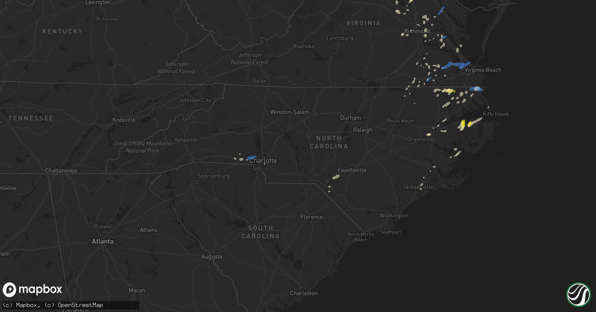
Hail Map in North Carolina on June 22, 2020
Get this storm
June 22 map
$229
one time, instant access
Download today. No call, no setup
Keep the $229
Bought the map and want the full workflow? Apply the entire $229 to a subscription within 7 days. None of it is wasted.
Every map, not just this one
This buys you this map. Subscription and you get every map we run, in the markets you choose from a few cities to whole states to nationwide. Plus real-time alerts the moment a storm fires.
Contact data
Name, contact info, occupancy, even credit band for addresses in the footprint. You go from where it hit to who to call.
Become the source they trust
Unlimited branding weather history reports on demand. You already have the documented answer ready for the property owner, and you are the one who showed up with it.
Property data and RoofTrace estimates
Pull up any address you have got, its value and the exact code rules for that jurisdiction, straight from One Click Code. Then RoofTrace estimates the squares, pitch, and roof value, priced the way you price.
Storm reports in North Carolina
North Carolina
| Date | Description |
|---|---|
| 06/22/20206:55 PM CDT | Numerous trees reported down across stanly county. |
| 06/22/20206:35 PM CDT | Awos station kukf north wilkesboro. |
| 06/22/20206:33 PM CDT | Tree down. |
| 06/22/20206:33 PM CDT | Tree down on airport road. |
| 06/22/20206:33 PM CDT | Tree down. |
| 06/22/20206:20 PM CDT | County official reported tree down near nc-200 & mount pleasant rd. Time estimated by radar. |
| 06/22/20206:01 PM CDT | Amateur radio reported down tree limb 8 inch diameter. |
| 06/22/20205:45 PM CDT | Public reported numerous large branches down along gum branch road. |
| 06/22/20205:40 PM CDT | Amateur radio reported trees and power line down in lowell nc. |
| 06/22/20205:20 PM CDT | Amateur radio reported broken tree limbs up to 3 inches in diameter on main st & n liberty st. |
| 06/22/20205:15 PM CDT | Amateur radio reported down tree limbs up to 6 inches in diameter. |
| 06/22/20205:10 PM CDT | Amateur radio reported trees down of 6 to 14 inches in diameter. Time estimated by radar. |
| 06/22/20204:40 PM CDT | Tree down on waterlilly rd. |
| 06/22/20203:50 PM CDT | Power lines and trees down. |
| 06/22/20203:50 PM CDT | Trees down along horseshoe rd. |
| 06/22/20203:45 PM CDT | Trees and power lines down. |
| 06/22/20203:26 PM CDT | Tree and power lines down. |
| 06/22/20203:20 PM CDT | Public reports trees down on newlands rd. Time estimated by radar. |
| 06/22/20203:15 PM CDT | Public reported trees down in multiple locations around creswell. Time estimated by radar. |
| 06/22/20202:20 PM CDT | Public reported nickel to quarter sized hail in bridgeton... Relayed via social media. Time based on radar. |
| 06/22/20201:51 PM CDT | Trees down on croatan lane and perrytown loop road. Time estimated by radar. |
| 06/22/20205:30 AM CDT | At 1030 PM EDT, a severe thunderstorm was located near Antioch, or near Raeford, moving east at 25 mph. HAZARD...60 mph wind gusts and penny size hail. SOURCE...Radar indicated. IMPACT...Expect damage to roofs, siding, and trees. Locations impacted include... Fayetteville, Raeford, Fort Bragg, Antioch, Pope AFB, Hope Mills, Spring Lake, Eastover, Stedman and Wade. |
| 06/22/20203:51 AM CDT | At 851 PM EDT, a severe thunderstorm was located 10 miles east of Ansonville, or 11 miles northeast of Wadesboro, moving northeast at 30 mph. HAZARD...60 mph wind gusts and penny size hail. SOURCE...Radar indicated. IMPACT...Expect damage to roofs, siding, and trees. Locations impacted include... Ellerbe, Norman, Covington, Derby, Blewett Falls Lake and Sandhills Game Land. |
| 06/22/20203:17 AM CDT | At 817 PM EDT, a severe thunderstorm was located near Pactolus, or 10 miles northwest of Washington, moving east at 15 mph. HAZARD...60 mph wind gusts and quarter size hail. SOURCE...Radar indicated. IMPACT...Hail damage to vehicles is expected. Expect wind damage to roofs, siding, and trees. Locations impacted include... Washington, Pinetown, Old Ford, Smithwick and Beargrass. |
| 06/22/20203:01 AM CDT | At 801 PM EDT, severe thunderstorms were located along a line extending from Badin Lake to near Plyler to 7 miles southwest of Troy, moving east at 35 mph. HAZARD...60 mph wind gusts. SOURCE...Radar indicated. IMPACT...Expect damage to roofs, siding, and trees. Locations impacted include... Asheboro, Southern Pines, Troy, Carthage, Badin Lake, North Carolina Zoo, Pinehurst, Biscoe, Seagrove and Whispering Pines. |
| 06/22/20202:53 AM CDT | At 752 PM EDT, a severe thunderstorm was located over Sturdivants, or 14 miles southeast of Monroe, moving east at 20 mph. HAZARD...60 mph wind gusts. SOURCE...Radar indicated. IMPACT...Expect damage to roofs, siding, and trees. Locations impacted include... Wadesboro, Polkton, Lilesville, Morven, Peachland, McFarlan, Blewett Falls Lake and White Store. |
| 06/22/20202:20 AM CDT | At 719 PM EDT, a severe thunderstorm was located over Mint Hill, or 13 miles north of Monroe, moving east at 20 mph. HAZARD...60 mph wind gusts. SOURCE...Radar indicated. IMPACT...Expect damage to roofs, siding, and trees. Locations impacted include... Albemarle, Wadesboro, Badin Lake, Ansonville, Plyler, Midland, Polkton, Locust, Norwood and Badin. |
| 06/21/202011:11 PM CDT | At 411 PM EDT, a severe thunderstorm was located over Woodley, or 20 miles east of Plymouth, moving northeast at 25 mph. HAZARD...60 mph wind gusts and quarter size hail. SOURCE...Radar indicated. IMPACT...Hail damage to vehicles is expected. Expect wind damage to roofs, siding, and trees. Locations impacted include... Columbia, Woodley, Newfoundland, Scuppernong and Creswell. |
| 06/21/20209:40 PM CDT | At 239 PM EDT, a severe thunderstorm was located over New Bern, moving northeast at 15 mph. HAZARD...60 mph wind gusts and quarter size hail. SOURCE...Radar indicated. IMPACT...Hail damage to vehicles is expected. Expect wind damage to roofs, siding, and trees. Locations impacted include... New Bern, James City, Trent Woods, Olympia, Grantsboro, Croatan, Riverdale, Merritt, Catfish Lake, Neuse Forest, Fairfield Harbour, Coastal Carolina Regional Airport, Bayboro, Alliance, Arapahoe, Aurora, Bridgeton and Stonewall. |
| 06/21/20208:14 PM CDT | Tree down in derby... Nc. |
| 06/21/20208:08 PM CDT | Tree down in ellerbe on hwy 73. |
| 06/21/20208:07 PM CDT | Tree down on bennett rd. |
| 06/21/20207:59 PM CDT | Tree down on nc24-27. |
| 06/21/20207:58 PM CDT | Tree down on old river rd and poplar st. |
| 06/21/20207:40 PM CDT | Martin co 911 center reported a large tree down on wildcat rd. |
| 06/21/20207:27 PM CDT | 911 center reported large tree limbs down on powerlines in beargrass. |
All States Impacted by Hail Map on June 22, 2020
Cities Impacted by Hail Map on June 22, 2020
- Aliceville, AL
- Perryton, TX
- Ansley, NE
- Lubbock, TX
- Wilson, TX
- Brownfield, TX
- Jacksonville, NC
- Milford, NE
- Silverton, TX
- Boise City, OK
- Stratford, TX
- Boswell, PA
- Ligonier, PA
- Laughlintown, PA
- Mullin, TX
- Sugar Land, TX
- Canadian, TX
- Odessa, TX
- Fordyce, NE
- Crofton, NE
- Lorenzo, TX
- Galesburg, IL
- East Galesburg, IL
- Knoxville, IL
- Cameron, IL
- Monmouth, IL
- Mechanicsville, VA
- Richmond, VA
- Bumpass, VA
- Mineral, VA
- Ewing, NE
- Perrin, TX
- Jacksboro, TX
- Bridgeport, TX
- Dublin, TX
- Gustine, TX
- Channing, TX
- Vega, TX
- Ozona, TX
- Cordell, OK
- Sentinel, OK
- Spearman, TX
- Brownwood, TX
- Melrose, NM
- Wildorado, TX
- Clayton, NM
- Brady, TX
- Rochelle, TX
- Richland Springs, TX
- Charles City, VA
- Comanche, TX
- Stinnett, TX
- Panhandle, TX
- Dumas, TX
- Cactus, TX
- Fritch, TX
- Amarillo, TX
- Borger, TX
- Sunray, TX
- Texhoma, OK
- Masterson, TX
- Columbia, NC
- Oviedo, FL
- Winter Springs, FL
- Casselberry, FL
- San Angelo, TX
- Clearwater, NE
- Henrietta, MO
- Lexington, MO
- Richmond, MO
- Goldsmith, TX
- Berkeley Springs, WV
- Midland, TX
- Big Lake, TX
- Versailles, IL
- Griggsville, IL
- Chambersburg, IL
- Kenney, IL
- Latham, IL
- Chestnut, IL
- Colonial Beach, VA
- King George, VA
- Moseley, VA
- Powhatan, VA
- Midlothian, VA
- Mertzon, TX
- Higgins, TX
- Leesburg, VA
- Hanover, VA
- Old Glory, TX
- Spur, TX
- Aspermont, TX
- Stephenville, TX
- Houston, TX
- Pearland, TX
- Graford, TX
- Hartington, NE
- Rocky, OK
- Whiteface, TX
- Parkston, SD
- Delmont, SD
- Rochester, TX
- Weinert, TX
- Henrico, VA
- Gates, NC
- Corapeake, NC
- Eure, NC
- Sunbury, NC
- Gatesville, NC
- Evant, TX
- Memphis, MO
- Saint Martinville, LA
- Grosse Tete, LA
- Haines City, FL
- Lake Wales, FL
- Hennepin, IL
- Putnam, IL
- Pawhuska, OK
- Bartlesville, OK
- Netawaka, KS
- Powhattan, KS
- Ramah, CO
- Morrisonville, IL
- Pawnee, IL
- Carrollton, MO
- Elberton, GA
- Dewy Rose, GA
- Wichita Falls, TX
- Foss, OK
- Moorefield, WV
- Orlando, FL
- Crown Point, IN
- Spencer, NE
- Maywood, IL
- Melrose Park, IL
- River Forest, IL
- Bellwood, IL
- River Grove, IL
- Elmwood Park, IL
- Petersburg, TX
- Rising Star, TX
- Cisco, TX
- Amherst, TX
- Purcellville, VA
- Hamilton, VA
- Rosenberg, TX
- Richmond, TX
- May, TX
- Cross Plains, TX
- Early, TX
- Vintondale, PA
- Homer City, PA
- Tripp, SD
- Kings Mountain, NC
- Bessemer City, NC
- Breckenridge, TX
- Knotts Island, NC
- Moyock, NC
- Arnett, OK
- Hebron, IN
- Graham, TX
- Olney, TX
- Loving, TX
- Goldthwaite, TX
- Garden City, TX
- Hallam, NE
- Girard, IL
- Henrietta, TX
- Holliday, TX
- Mingus, TX
- Frankfort, IL
- Manhattan, IL
- Stromsburg, NE
- Osceola, NE
- De Leon, TX
- Pierce, NE
- Osmond, NE
- Dalhart, TX
- New Lenox, IL
- Monee, IL
- Elwood, IL
- Joliet, IL
- King William, VA
- Mcalester, OK
- Ropesville, TX
- Meadow, TX
- Fluvanna, TX
- Carlsbad, TX
- Hayes, VA
- Old Fields, WV
- Warrensburg, IL
- Maroa, IL
- Williamston, NC
- Ranger, TX
- Tuscola, IL
- Fairbury, NE
- Carrsville, VA
- Windsor, NC
- Merkel, TX
- Tuscola, TX
- Liberty, TX
- Cleveland, TX
- McVeytown, PA
- Burtonsville, MD
- Fulton, MD
- Spencerville, MD
- Levelland, TX
- Pep, TX
- Cortland, NE
- Pickrell, NE
- Adams, NE
- Hart, TX
- Romney, WV
- Wakefield, VA
- Goodwell, OK
- Fairfax, OK
- Shattuck, OK
- Harpers Ferry, WV
- Quinton, VA
- Sandston, VA
- Andrews, TX
- Wingate, TX
- Winters, TX
- Gruver, TX
- Martell, NE
- Durham, OK
- Follett, TX
- Chantilly, VA
- Centreville, VA
- Fairfax, VA
- Herndon, VA
- Sterling, VA
- Providence Forge, VA
- Gotebo, OK
- Dimmitt, TX
- Nazareth, TX
- Haskell, TX
- Rule, TX
- Avoca, TX
- Stamford, TX
- Electra, TX
- Spotsylvania, VA
- Okeechobee, FL
- Moore Haven, FL
- Tulsa, OK
- Sand Springs, OK
- Capitan, NM
- Carlton, TX
- Hamilton, TX
- Culpeper, VA
- Immokalee, FL
- Hobart, IN
- Merrillville, IN
- Ralston, OK
- Lockney, TX
- Dayton, TX
- Hartley, TX
- Sterling City, TX
- Batavia, NY
- Gardendale, TX
- Hobart, OK
- Bowie, TX
- Slaton, TX
- Courtland, VA
- Mount Pulaski, IL
- Stanton, TX
- Johnson, VT
- Hyde Park, VT
- Randolph, NE
- Mclean, NE
- Mountain View, OK
- Gresham, NE
- Lanexa, VA
- Albany, TX
- Blum, TX
- Throckmorton, TX
- Strawn, TX
- Hico, TX
- Creswell, NC
- Kress, TX
- Hobbsville, NC
- Tyner, NC
- Booker, TX
- Crete, NE
- Pesotum, IL
- Yankton, SD
- Baileyville, KS
- Powells Point, NC
- Jarvisburg, NC
- East Waterford, PA
- Blairs Mills, PA
- Orbisonia, PA
- Newport News, VA
- Yorktown, VA
- Laurinburg, NC
- Channahon, IL
- Wilmington, IL
- Morris, IL
- Maxton, NC
- Tahoka, TX
- Wolfforth, TX
- Blandinsville, IL
- Newburg, MD
- Red Springs, NC
- Shannon, NC
- Raeford, NC
- Arcadia, FL
- Littlefield, TX
- Enning, SD
- Lowland, NC
- Farmersville, IL
- Tovey, IL
- Kincaid, IL
- Bulpitt, IL
- Skippers, VA
- Garysburg, NC
- Whiting, KS
- Beltsville, MD
- Tappahannock, VA
- Abilene, TX
- Atkinson, NE
- Stony Creek, VA
- Yale, VA
- Waverly, VA
- Aurora, NC
- Newsoms, VA
- Franklin, VA
- Labelle, FL
- Granville, IL
- McNabb, IL
- Lueders, TX
- Frostburg, MD
- Indian Lake Estates, FL
- Camden, NC
- South Mills, NC
- Sudan, TX
- Gatesville, TX
- Haymarket, VA
- Gainesville, VA
- Emporia, VA
- Camp Lejeune, NC
- Silver Creek, NE
- Waggoner, IL
- Mcalister, NM
- Cleburne, TX
- Hardesty, OK
- Balko, OK
- Ohiowa, NE
- Strang, NE
- Disputanta, VA
- Rhome, TX
- Newark, TX
- Boyd, TX
- Springtown, TX
- Quitaque, TX
- Cairo, GA
- Thomasville, GA
- Decatur, IL
- Bedford, IA
- New Market, IA
- Clarinda, IA
- Como, NC
- Blue Mound, IL
- Sedley, VA
- Odonnell, TX
- Jamesville, NC
- Plymouth, NC
- Sweetwater, TX
- Montpelier, VA
- Halifax, NC
- Roanoke Rapids, NC
- Crosby, TX
- Denton, NE
- Pleasant Dale, NE
- Morton, TX
- Enochs, TX
- Huntingdon, PA
- Petersburg, PA
- Clarks, NE
- Kissimmee, FL
- Strongstown, PA
- Twin Rocks, PA
- Ebensburg, PA
- Lone Wolf, OK
- Rappahannock Academy, VA
- Washington, NC
- Stokes, NC
- Greenville, NC
- Camden, SC
- Berkeley, IL
- Elmhurst, IL
- Genoa, NE
- Columbus, NE
- Table Rock, NE
- Gaithersburg, MD
- Suffolk, VA
- Gordon, TX
- Holley, NY
- Murfreesboro, NC
- Eufaula, OK
- Roper, NC
- Brookesmith, TX
- Star, TX
- Pavilion, NY
- Glenarm, IL
- Divernon, IL
- Good Hope, GA
- Monroe, GA
- Mason, TX
- Kahoka, MO
- Wayland, MO
- Firth, NE
- Weatherford, TX
- Adamstown, MD
- Macon, GA
- Ruther Glen, VA
- Woodford, VA
- Sedalia, MO
- Wellsville, NY
- Mokena, IL
- Brookeville, MD
- Dayton, MD
- Glenelg, MD
- Waterford, VA
- Silver Spring, MD
- Wagon Mound, NM
- Newcastle, TX
- Weldon, NC
- Jonesville, LA
- Jenks, OK
- Niantic, IL
- Petersburg, VA
- Gail, TX
- Alexandria, NE
- Tobias, NE
- Utica, NE
- Devers, TX
- Beaumont, TX
- Roca, NE
- Paradise, TX
- Poolville, TX
- Babson Park, FL
- Macomb, IL
- Sciota, IL
- Beaverdam, VA
- Woodson, TX
- Canton, GA
- Trent, TX
- Christoval, TX
- Scranton, NC
- Belhaven, NC
- Richland, GA
- Schererville, IN
- Griffith, IN
- Maysville, NC
- Hobbs, NM
- Lovington, NM
- Byron, NY
- Barnsdall, OK
- Elizabeth City, NC
- New Bern, NC
- Randallstown, MD
- Woodstock, MD
- Georgetown, SC
- Geddes, SD
- Cerro Gordo, IL
- Argenta, IL
- Platte, SD
- Shelby, NC
- Grover, NC
- Henryetta, OK
- Poolesville, MD
- Lipscomb, TX
- Livingston, AL
- Spring, TX
- Williamsburg, VA
- Trementina, NM
- Canyon, TX
- Happy, TX
- Hertford, NC
- Belvidere, NC
- Ovalo, TX
- Argyle, IA
- Farmington, IA
- Sturgis, SD
- Boyds, MD
- Dickerson, MD
- Barnesville, MD
- Mission Hill, SD
- Utica, SD
- White Post, VA
- Winchester, VA
- Buena Vista, GA
- Claude, TX
- Rosharon, TX
- Alvin, TX
- Locust Grove, VA
- Needville, TX
- Dexter, KS
- Alberta, VA
- Laurel, MD
- Missouri City, TX
- Filley, NE
- Dill City, OK
- Prue, OK
- Stevensburg, VA
- Elkwood, VA
- Hominy, OK
- Mounds, OK
- Bixby, OK
- Georgetown, DE
- Bridgeville, DE
- Stafford, TX
- Fisher, WV
- Post, TX
- Lake Placid, FL
- Mora, MO
- Snyder, TX
- Bristow, OK
- Naperville, IL
- Lisle, IL
- Addison, IL
- Wheaton, IL
- Lombard, IL
- Glen Ellyn, IL
- Bensenville, IL
- Wood Dale, IL
- Villa Park, IL
- Downers Grove, IL
- Gaston, NC
- Justiceburg, TX
- Ivor, VA
- Miami, TX
- Roy, NM
- Nolan, TX
- Norfolk, NE
- Peru, IL
- Kenansville, FL
- Glenpool, OK
- Kiefer, OK
- Winter Park, FL
- Quanah, TX
- Stephens City, VA
- Doss, TX
- Harper, TX
- Campo, CO
- Capron, VA
- Caddo, TX
- Aldie, VA
- Geneva, NE
- Frostproof, FL
- Watson, AR
- Fredericksburg, VA
- Pollocksville, NC
- Frederick, MD
- Tulia, TX
- Huffman, TX
- Seymour, TX
- Miles, TX
- Belle Glade, FL
- Walkerton, VA
- Saint Stephens Church, VA
- Bruington, VA
- Winton, NC
- Ahoskie, NC
- Verdigre, NE
- Gary, IN
- Valparaiso, IN
- Port Royal, VA
- Clarksville, MD
- Columbia, MD
- Highland, MD
- Ellicott City, MD
- Ashton, MD
- Colerain, NC
- Harrellsville, NC
- Hammon, OK
- Channelview, TX
- Luray, MO
- Plains, TX
- Tokio, TX
- Newville, PA
- Gordo, AL
- Smicksburg, PA
- Gastonia, NC
- Barry, IL
- Ochopee, FL
- Skiatook, OK
- South Bay, FL
- Clewiston, FL
- Braddyville, IA
- Haslet, TX
- Stonington, IL
- Danville, IA
- Niles, MI
- Dowagiac, MI
- Barnhart, TX
- Daykin, NE
- Manquin, VA
- Aylett, VA
- Sadorus, IL
- Charlotte, NC
- Hereford, TX
- Taylorville, IL
- Edinburg, IL
- Virden, IL
- Harvel, IL
- Aledo, TX
- Bellaire, TX
- Boykins, VA
- Bowen, IL
- Grantsville, MD
- Branchville, VA
- Dry Branch, GA
- Toano, VA
- Bishop, GA
- Chesapeake, VA
- Carrollton, VA
- Zuni, VA
- Smithfield, VA
- Windsor, VA
- Warsaw, VA
- Dunnsville, VA
- Great Falls, VA
- Portsmouth, VA
- Norfolk, VA
- Wayside, TX
- Lakeview, TX
- Hedley, TX
- Memphis, TX
- Lelia Lake, TX
- Wellington, TX
- Tell, TX
- Clarendon, TX
- Childress, TX
- Groom, TX
- Earth, TX
- Muleshoe, TX
- Olton, TX
- Friona, TX
- Springlake, TX
- Plainview, TX
- Fieldton, TX
- Hale Center, TX
- Shallowater, TX
- Smyer, TX
- Ackerly, TX
- Hermleigh, TX
- Welch, TX
- Tarzan, TX
- Lenorah, TX
- Lamesa, TX
- Ira, TX
- Colorado City, TX
- Westbrook, TX
- Moran, TX
- Clyde, TX
- Lawn, TX
- O'Brien, TX
- Baird, TX
- McAdenville, NC
- Mount Holly, NC
- Belmont, NC
- Cramerton, NC
- Lowell, NC
- Dansville, NY
- Coleridge, NE
- Clarkson, NE
- Howells, NE
- Scribner, NE
- North Bend, NE
- Cedar Bluffs, NE
- Ames, NE
- Dodge, NE
- Clatonia, NE
- Crab Orchard, NE
- Henry, IL
- Franklin Park, IL
- Hillside, IL
- Des Plaines, IL
- Arlington Heights, IL
- Elk Grove Village, IL
- Matteson, IL
- Richton Park, IL
- Auburn, IL
- Texhoma, TX
- Keyes, OK
- Farwell, TX
- Sundown, TX
- Maple, TX
- Dickens, TX
- Paducah, TX
- New London, IA
- Bourg, LA
- Theriot, LA
- Raceland, LA
- Lockport, LA
- Houma, LA
- Gheens, LA
- Tallulah, LA
- Solano, NM
- Clovis, NM
- Rogers, NM
- Portales, NM
- Ijamsville, MD
- Montgomery Village, MD
- Cooksville, MD
- Woodbine, MD
- Marriottsville, MD
- Sykesville, MD
- West Friendship, MD
- Glenwood, MD
- Gwynn Oak, MD
- Baltimore, MD
- Catonsville, MD
- Mangum, OK
- Honea Path, SC
- Belton, SC


