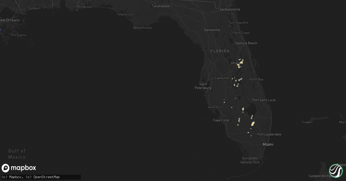
Hail Map in Florida on June 22, 2020
Get this storm
June 22 map
$229
one time, instant access
Download today. No call, no setup
Keep the $229
Bought the map and want the full workflow? Apply the entire $229 to a subscription within 7 days. None of it is wasted.
Every map, not just this one
This buys you this map. Subscription and you get every map we run, in the markets you choose from a few cities to whole states to nationwide. Plus real-time alerts the moment a storm fires.
Contact data
Name, contact info, occupancy, even credit band for addresses in the footprint. You go from where it hit to who to call.
Become the source they trust
Unlimited branding weather history reports on demand. You already have the documented answer ready for the property owner, and you are the one who showed up with it.
Property data and RoofTrace estimates
Pull up any address you have got, its value and the exact code rules for that jurisdiction, straight from One Click Code. Then RoofTrace estimates the squares, pitch, and roof value, priced the way you price.
Storm reports in Florida
Florida
| Date | Description |
|---|---|
| 06/22/20203:56 AM CDT | At 856 PM EDT, a severe thunderstorm was located over Lake Nona, or near Orlando International Airport, moving east at 20 mph. HAZARD...60 mph wind gusts and penny size hail. SOURCE...Radar indicated. IMPACT...Expect damage to roofs, siding, and trees. Locations impacted include... Orlando, Wedgefield, Orlando International Airport, Avalon Park and Conway. |
| 06/22/20203:07 AM CDT | At 807 PM EDT, a severe thunderstorm was located over Union Park, or over Goldenrod, moving northeast at 25 mph. HAZARD...60 mph wind gusts and nickel size hail. SOURCE...Radar indicated. IMPACT...Expect damage to roofs, siding, and trees. Locations impacted include... Orlando, Oviedo, Winter Park, University Of Central Florida and Azalea Park. |
| 06/22/20202:39 AM CDT | At 739 PM EDT, a severe thunderstorm was located over Lakeport, moving east at 5 mph. HAZARD...60 mph wind gusts and quarter size hail. SOURCE...Radar indicated. IMPACT...Hail damage to vehicles is expected. Expect wind damage to roofs, siding, and trees. Locations impacted include... Lakeport and Brighton Seminole Reservation. |
| 06/22/20201:46 AM CDT | At 646 PM EDT, a severe thunderstorm was located over Tallahassee, moving east at 20 mph. HAZARD...60 mph wind gusts. SOURCE...Radar indicated. IMPACT...Expect damage to roofs, siding, and trees. This severe thunderstorm will remain over mainly rural areas of northwestern Jefferson and northeastern Leon Counties, including the following locations... Ralford Greenway, Macon Community Park, Tallahassee Memorial Hosp, Miccosukee, Killearn Estates, Chaires, Lake Ella, Waukeenah, Tallahassee Mall and State Capital Complex. |
| 06/22/20201:39 AM CDT | At 639 PM EDT, a severe thunderstorm was located near Holey Land Wildlife Refuge, or 10 miles south of South Bay, moving north at 25 mph. HAZARD...60 mph wind gusts and half dollar size hail. SOURCE...Radar indicated. IMPACT...Hail damage to vehicles is expected. Expect wind damage to roofs, siding, and trees. Locations impacted include... Belle Glade, Clewiston, South Bay, Lake Harbor and Okeelanta. |
| 06/22/20201:20 AM CDT | At 620 PM EDT, a severe thunderstorm was located over Holey Land Wildlife Refuge, or 16 miles south of South Bay, moving northeast at 15 mph. HAZARD...60 mph wind gusts and quarter size hail. SOURCE...Radar indicated. IMPACT...Hail damage to vehicles is expected. Expect wind damage to roofs, siding, and trees. Locations impacted include... South Bay, Okeelanta, Holey Land Wildlife Refuge and Rotenberger Wildlife Refuge. |
| 06/22/202012:42 AM CDT | At 540 PM EDT, a severe thunderstorm was located 8 miles southeast of Southeast Arcadia, or 9 miles southeast of Arcadia, and is nearly stationary. HAZARD...60 mph wind gusts and quarter size hail. SOURCE...Radar indicated. IMPACT...Hail damage to vehicles is expected. Expect wind damage to roofs, siding, and trees. This severe thunderstorm will remain over mainly rural areas of northeastern Charlotte and southeastern DeSoto Counties. |
| 06/21/202011:42 PM CDT | At 442 PM EDT, a severe thunderstorm was located 10 miles northwest of Loop Road Ee Center, or 14 miles east of Chokoloskee, moving northeast at 15 mph. HAZARD...60 mph wind gusts and quarter size hail. SOURCE...Radar indicated. IMPACT...Hail damage to vehicles is expected. Expect wind damage to roofs, siding, and trees. Locations impacted include... Dade-Collier Training Airport and Big Cypress National Preserve. |
| 06/21/20209:20 PM CDT | Kxmr measured a wind gust of 60 mph/52 kt from the west. |
| 06/21/20207:21 PM CDT | Relayed from orange county fr of tree down near green meadow lane. |
| 06/21/20207:17 PM CDT | Relayed report from orange county fr reports tree down near curry ford road and chickasaw trail. |
| 06/21/20207:07 PM CDT | Orange county fire rescue reports tree down near the intersection of lake margaret and conway road. |
All States Impacted by Hail Map on June 22, 2020
Cities Impacted by Hail Map on June 22, 2020
- Aliceville, AL
- Perryton, TX
- Ansley, NE
- Lubbock, TX
- Wilson, TX
- Brownfield, TX
- Jacksonville, NC
- Milford, NE
- Silverton, TX
- Boise City, OK
- Stratford, TX
- Boswell, PA
- Ligonier, PA
- Laughlintown, PA
- Mullin, TX
- Sugar Land, TX
- Canadian, TX
- Odessa, TX
- Fordyce, NE
- Crofton, NE
- Lorenzo, TX
- Galesburg, IL
- East Galesburg, IL
- Knoxville, IL
- Cameron, IL
- Monmouth, IL
- Mechanicsville, VA
- Richmond, VA
- Bumpass, VA
- Mineral, VA
- Ewing, NE
- Perrin, TX
- Jacksboro, TX
- Bridgeport, TX
- Dublin, TX
- Gustine, TX
- Channing, TX
- Vega, TX
- Ozona, TX
- Cordell, OK
- Sentinel, OK
- Spearman, TX
- Brownwood, TX
- Melrose, NM
- Wildorado, TX
- Clayton, NM
- Brady, TX
- Rochelle, TX
- Richland Springs, TX
- Charles City, VA
- Comanche, TX
- Stinnett, TX
- Panhandle, TX
- Dumas, TX
- Cactus, TX
- Fritch, TX
- Amarillo, TX
- Borger, TX
- Sunray, TX
- Texhoma, OK
- Masterson, TX
- Columbia, NC
- Oviedo, FL
- Winter Springs, FL
- Casselberry, FL
- San Angelo, TX
- Clearwater, NE
- Henrietta, MO
- Lexington, MO
- Richmond, MO
- Goldsmith, TX
- Berkeley Springs, WV
- Midland, TX
- Big Lake, TX
- Versailles, IL
- Griggsville, IL
- Chambersburg, IL
- Kenney, IL
- Latham, IL
- Chestnut, IL
- Colonial Beach, VA
- King George, VA
- Moseley, VA
- Powhatan, VA
- Midlothian, VA
- Mertzon, TX
- Higgins, TX
- Leesburg, VA
- Hanover, VA
- Old Glory, TX
- Spur, TX
- Aspermont, TX
- Stephenville, TX
- Houston, TX
- Pearland, TX
- Graford, TX
- Hartington, NE
- Rocky, OK
- Whiteface, TX
- Parkston, SD
- Delmont, SD
- Rochester, TX
- Weinert, TX
- Henrico, VA
- Gates, NC
- Corapeake, NC
- Eure, NC
- Sunbury, NC
- Gatesville, NC
- Evant, TX
- Memphis, MO
- Saint Martinville, LA
- Grosse Tete, LA
- Haines City, FL
- Lake Wales, FL
- Hennepin, IL
- Putnam, IL
- Pawhuska, OK
- Bartlesville, OK
- Netawaka, KS
- Powhattan, KS
- Ramah, CO
- Morrisonville, IL
- Pawnee, IL
- Carrollton, MO
- Elberton, GA
- Dewy Rose, GA
- Wichita Falls, TX
- Foss, OK
- Moorefield, WV
- Orlando, FL
- Crown Point, IN
- Spencer, NE
- Maywood, IL
- Melrose Park, IL
- River Forest, IL
- Bellwood, IL
- River Grove, IL
- Elmwood Park, IL
- Petersburg, TX
- Rising Star, TX
- Cisco, TX
- Amherst, TX
- Purcellville, VA
- Hamilton, VA
- Rosenberg, TX
- Richmond, TX
- May, TX
- Cross Plains, TX
- Early, TX
- Vintondale, PA
- Homer City, PA
- Tripp, SD
- Kings Mountain, NC
- Bessemer City, NC
- Breckenridge, TX
- Knotts Island, NC
- Moyock, NC
- Arnett, OK
- Hebron, IN
- Graham, TX
- Olney, TX
- Loving, TX
- Goldthwaite, TX
- Garden City, TX
- Hallam, NE
- Girard, IL
- Henrietta, TX
- Holliday, TX
- Mingus, TX
- Frankfort, IL
- Manhattan, IL
- Stromsburg, NE
- Osceola, NE
- De Leon, TX
- Pierce, NE
- Osmond, NE
- Dalhart, TX
- New Lenox, IL
- Monee, IL
- Elwood, IL
- Joliet, IL
- King William, VA
- Mcalester, OK
- Ropesville, TX
- Meadow, TX
- Fluvanna, TX
- Carlsbad, TX
- Hayes, VA
- Old Fields, WV
- Warrensburg, IL
- Maroa, IL
- Williamston, NC
- Ranger, TX
- Tuscola, IL
- Fairbury, NE
- Carrsville, VA
- Windsor, NC
- Merkel, TX
- Tuscola, TX
- Liberty, TX
- Cleveland, TX
- McVeytown, PA
- Burtonsville, MD
- Fulton, MD
- Spencerville, MD
- Levelland, TX
- Pep, TX
- Cortland, NE
- Pickrell, NE
- Adams, NE
- Hart, TX
- Romney, WV
- Wakefield, VA
- Goodwell, OK
- Fairfax, OK
- Shattuck, OK
- Harpers Ferry, WV
- Quinton, VA
- Sandston, VA
- Andrews, TX
- Wingate, TX
- Winters, TX
- Gruver, TX
- Martell, NE
- Durham, OK
- Follett, TX
- Chantilly, VA
- Centreville, VA
- Fairfax, VA
- Herndon, VA
- Sterling, VA
- Providence Forge, VA
- Gotebo, OK
- Dimmitt, TX
- Nazareth, TX
- Haskell, TX
- Rule, TX
- Avoca, TX
- Stamford, TX
- Electra, TX
- Spotsylvania, VA
- Okeechobee, FL
- Moore Haven, FL
- Tulsa, OK
- Sand Springs, OK
- Capitan, NM
- Carlton, TX
- Hamilton, TX
- Culpeper, VA
- Immokalee, FL
- Hobart, IN
- Merrillville, IN
- Ralston, OK
- Lockney, TX
- Dayton, TX
- Hartley, TX
- Sterling City, TX
- Batavia, NY
- Gardendale, TX
- Hobart, OK
- Bowie, TX
- Slaton, TX
- Courtland, VA
- Mount Pulaski, IL
- Stanton, TX
- Johnson, VT
- Hyde Park, VT
- Randolph, NE
- Mclean, NE
- Mountain View, OK
- Gresham, NE
- Lanexa, VA
- Albany, TX
- Blum, TX
- Throckmorton, TX
- Strawn, TX
- Hico, TX
- Creswell, NC
- Kress, TX
- Hobbsville, NC
- Tyner, NC
- Booker, TX
- Crete, NE
- Pesotum, IL
- Yankton, SD
- Baileyville, KS
- Powells Point, NC
- Jarvisburg, NC
- East Waterford, PA
- Blairs Mills, PA
- Orbisonia, PA
- Newport News, VA
- Yorktown, VA
- Laurinburg, NC
- Channahon, IL
- Wilmington, IL
- Morris, IL
- Maxton, NC
- Tahoka, TX
- Wolfforth, TX
- Blandinsville, IL
- Newburg, MD
- Red Springs, NC
- Shannon, NC
- Raeford, NC
- Arcadia, FL
- Littlefield, TX
- Enning, SD
- Lowland, NC
- Farmersville, IL
- Tovey, IL
- Kincaid, IL
- Bulpitt, IL
- Skippers, VA
- Garysburg, NC
- Whiting, KS
- Beltsville, MD
- Tappahannock, VA
- Abilene, TX
- Atkinson, NE
- Stony Creek, VA
- Yale, VA
- Waverly, VA
- Aurora, NC
- Newsoms, VA
- Franklin, VA
- Labelle, FL
- Granville, IL
- McNabb, IL
- Lueders, TX
- Frostburg, MD
- Indian Lake Estates, FL
- Camden, NC
- South Mills, NC
- Sudan, TX
- Gatesville, TX
- Haymarket, VA
- Gainesville, VA
- Emporia, VA
- Camp Lejeune, NC
- Silver Creek, NE
- Waggoner, IL
- Mcalister, NM
- Cleburne, TX
- Hardesty, OK
- Balko, OK
- Ohiowa, NE
- Strang, NE
- Disputanta, VA
- Rhome, TX
- Newark, TX
- Boyd, TX
- Springtown, TX
- Quitaque, TX
- Cairo, GA
- Thomasville, GA
- Decatur, IL
- Bedford, IA
- New Market, IA
- Clarinda, IA
- Como, NC
- Blue Mound, IL
- Sedley, VA
- Odonnell, TX
- Jamesville, NC
- Plymouth, NC
- Sweetwater, TX
- Montpelier, VA
- Halifax, NC
- Roanoke Rapids, NC
- Crosby, TX
- Denton, NE
- Pleasant Dale, NE
- Morton, TX
- Enochs, TX
- Huntingdon, PA
- Petersburg, PA
- Clarks, NE
- Kissimmee, FL
- Strongstown, PA
- Twin Rocks, PA
- Ebensburg, PA
- Lone Wolf, OK
- Rappahannock Academy, VA
- Washington, NC
- Stokes, NC
- Greenville, NC
- Camden, SC
- Berkeley, IL
- Elmhurst, IL
- Genoa, NE
- Columbus, NE
- Table Rock, NE
- Gaithersburg, MD
- Suffolk, VA
- Gordon, TX
- Holley, NY
- Murfreesboro, NC
- Eufaula, OK
- Roper, NC
- Brookesmith, TX
- Star, TX
- Pavilion, NY
- Glenarm, IL
- Divernon, IL
- Good Hope, GA
- Monroe, GA
- Mason, TX
- Kahoka, MO
- Wayland, MO
- Firth, NE
- Weatherford, TX
- Adamstown, MD
- Macon, GA
- Ruther Glen, VA
- Woodford, VA
- Sedalia, MO
- Wellsville, NY
- Mokena, IL
- Brookeville, MD
- Dayton, MD
- Glenelg, MD
- Waterford, VA
- Silver Spring, MD
- Wagon Mound, NM
- Newcastle, TX
- Weldon, NC
- Jonesville, LA
- Jenks, OK
- Niantic, IL
- Petersburg, VA
- Gail, TX
- Alexandria, NE
- Tobias, NE
- Utica, NE
- Devers, TX
- Beaumont, TX
- Roca, NE
- Paradise, TX
- Poolville, TX
- Babson Park, FL
- Macomb, IL
- Sciota, IL
- Beaverdam, VA
- Woodson, TX
- Canton, GA
- Trent, TX
- Christoval, TX
- Scranton, NC
- Belhaven, NC
- Richland, GA
- Schererville, IN
- Griffith, IN
- Maysville, NC
- Hobbs, NM
- Lovington, NM
- Byron, NY
- Barnsdall, OK
- Elizabeth City, NC
- New Bern, NC
- Randallstown, MD
- Woodstock, MD
- Georgetown, SC
- Geddes, SD
- Cerro Gordo, IL
- Argenta, IL
- Platte, SD
- Shelby, NC
- Grover, NC
- Henryetta, OK
- Poolesville, MD
- Lipscomb, TX
- Livingston, AL
- Spring, TX
- Williamsburg, VA
- Trementina, NM
- Canyon, TX
- Happy, TX
- Hertford, NC
- Belvidere, NC
- Ovalo, TX
- Argyle, IA
- Farmington, IA
- Sturgis, SD
- Boyds, MD
- Dickerson, MD
- Barnesville, MD
- Mission Hill, SD
- Utica, SD
- White Post, VA
- Winchester, VA
- Buena Vista, GA
- Claude, TX
- Rosharon, TX
- Alvin, TX
- Locust Grove, VA
- Needville, TX
- Dexter, KS
- Alberta, VA
- Laurel, MD
- Missouri City, TX
- Filley, NE
- Dill City, OK
- Prue, OK
- Stevensburg, VA
- Elkwood, VA
- Hominy, OK
- Mounds, OK
- Bixby, OK
- Georgetown, DE
- Bridgeville, DE
- Stafford, TX
- Fisher, WV
- Post, TX
- Lake Placid, FL
- Mora, MO
- Snyder, TX
- Bristow, OK
- Naperville, IL
- Lisle, IL
- Addison, IL
- Wheaton, IL
- Lombard, IL
- Glen Ellyn, IL
- Bensenville, IL
- Wood Dale, IL
- Villa Park, IL
- Downers Grove, IL
- Gaston, NC
- Justiceburg, TX
- Ivor, VA
- Miami, TX
- Roy, NM
- Nolan, TX
- Norfolk, NE
- Peru, IL
- Kenansville, FL
- Glenpool, OK
- Kiefer, OK
- Winter Park, FL
- Quanah, TX
- Stephens City, VA
- Doss, TX
- Harper, TX
- Campo, CO
- Capron, VA
- Caddo, TX
- Aldie, VA
- Geneva, NE
- Frostproof, FL
- Watson, AR
- Fredericksburg, VA
- Pollocksville, NC
- Frederick, MD
- Tulia, TX
- Huffman, TX
- Seymour, TX
- Miles, TX
- Belle Glade, FL
- Walkerton, VA
- Saint Stephens Church, VA
- Bruington, VA
- Winton, NC
- Ahoskie, NC
- Verdigre, NE
- Gary, IN
- Valparaiso, IN
- Port Royal, VA
- Clarksville, MD
- Columbia, MD
- Highland, MD
- Ellicott City, MD
- Ashton, MD
- Colerain, NC
- Harrellsville, NC
- Hammon, OK
- Channelview, TX
- Luray, MO
- Plains, TX
- Tokio, TX
- Newville, PA
- Gordo, AL
- Smicksburg, PA
- Gastonia, NC
- Barry, IL
- Ochopee, FL
- Skiatook, OK
- South Bay, FL
- Clewiston, FL
- Braddyville, IA
- Haslet, TX
- Stonington, IL
- Danville, IA
- Niles, MI
- Dowagiac, MI
- Barnhart, TX
- Daykin, NE
- Manquin, VA
- Aylett, VA
- Sadorus, IL
- Charlotte, NC
- Hereford, TX
- Taylorville, IL
- Edinburg, IL
- Virden, IL
- Harvel, IL
- Aledo, TX
- Bellaire, TX
- Boykins, VA
- Bowen, IL
- Grantsville, MD
- Branchville, VA
- Dry Branch, GA
- Toano, VA
- Bishop, GA
- Chesapeake, VA
- Carrollton, VA
- Zuni, VA
- Smithfield, VA
- Windsor, VA
- Warsaw, VA
- Dunnsville, VA
- Great Falls, VA
- Portsmouth, VA
- Norfolk, VA
- Wayside, TX
- Lakeview, TX
- Hedley, TX
- Memphis, TX
- Lelia Lake, TX
- Wellington, TX
- Tell, TX
- Clarendon, TX
- Childress, TX
- Groom, TX
- Earth, TX
- Muleshoe, TX
- Olton, TX
- Friona, TX
- Springlake, TX
- Plainview, TX
- Fieldton, TX
- Hale Center, TX
- Shallowater, TX
- Smyer, TX
- Ackerly, TX
- Hermleigh, TX
- Welch, TX
- Tarzan, TX
- Lenorah, TX
- Lamesa, TX
- Ira, TX
- Colorado City, TX
- Westbrook, TX
- Moran, TX
- Clyde, TX
- Lawn, TX
- O'Brien, TX
- Baird, TX
- McAdenville, NC
- Mount Holly, NC
- Belmont, NC
- Cramerton, NC
- Lowell, NC
- Dansville, NY
- Coleridge, NE
- Clarkson, NE
- Howells, NE
- Scribner, NE
- North Bend, NE
- Cedar Bluffs, NE
- Ames, NE
- Dodge, NE
- Clatonia, NE
- Crab Orchard, NE
- Henry, IL
- Franklin Park, IL
- Hillside, IL
- Des Plaines, IL
- Arlington Heights, IL
- Elk Grove Village, IL
- Matteson, IL
- Richton Park, IL
- Auburn, IL
- Texhoma, TX
- Keyes, OK
- Farwell, TX
- Sundown, TX
- Maple, TX
- Dickens, TX
- Paducah, TX
- New London, IA
- Bourg, LA
- Theriot, LA
- Raceland, LA
- Lockport, LA
- Houma, LA
- Gheens, LA
- Tallulah, LA
- Solano, NM
- Clovis, NM
- Rogers, NM
- Portales, NM
- Ijamsville, MD
- Montgomery Village, MD
- Cooksville, MD
- Woodbine, MD
- Marriottsville, MD
- Sykesville, MD
- West Friendship, MD
- Glenwood, MD
- Gwynn Oak, MD
- Baltimore, MD
- Catonsville, MD
- Mangum, OK
- Honea Path, SC
- Belton, SC


