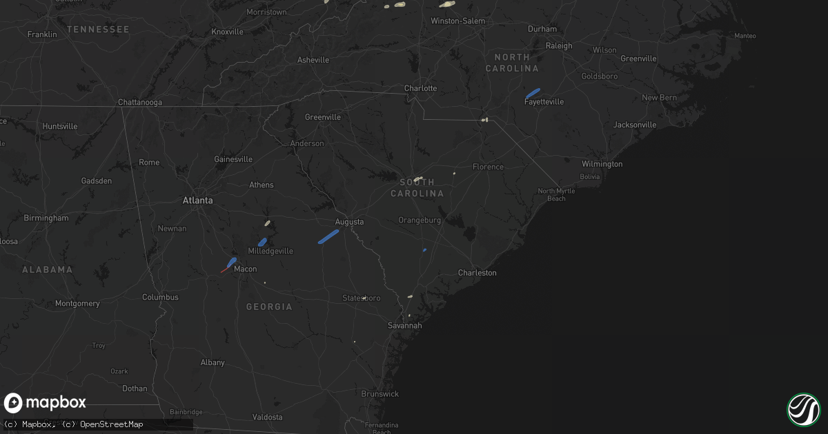
Hail Map in South Carolina on June 18, 2026
Get this storm
June 18 map
$229
one time, instant access
Download today. No call, no setup
Keep the $229
Bought the map and want the full workflow? Apply the entire $229 to a subscription within 7 days. None of it is wasted.
Every map, not just this one
This buys you this map. Subscription and you get every map we run, in the markets you choose from a few cities to whole states to nationwide. Plus real-time alerts the moment a storm fires.
Contact data
Name, contact info, occupancy, even credit band for addresses in the footprint. You go from where it hit to who to call.
Become the source they trust
Unlimited branding weather history reports on demand. You already have the documented answer ready for the property owner, and you are the one who showed up with it.
Property data and RoofTrace estimates
Pull up any address you have got, its value and the exact code rules for that jurisdiction, straight from One Click Code. Then RoofTrace estimates the squares, pitch, and roof value, priced the way you price.
Storm reports in South Carolina
South Carolina
| Date | Description |
|---|---|
| 06/18/20266:56 PM CDT | Scdps reported a tree down across i-20 near lugoff. Time estimated by radar. |
| 06/18/20266:54 PM CDT | Amateur radio operator relayed report from sumter fd that power lines were down with outages near arthur rd. Time estimated by radar. |
| 06/18/20266:53 PM CDT | Trained spotter reported a large oak tree down and multiple other trees down in the area near catchall rd. Time estimated by radar. |
| 06/18/20266:52 PM CDT | Trained spotter reports power outage and trees down in the area. |
| 06/18/20266:47 PM CDT | Richland em reported multiple downed trees on homes and several power lines arcing across richland county. Time estimated by radar. |
| 06/18/20266:41 PM CDT | Richland county emergency management reports trees down in southeastern richland county including 1228 vanboklen rd and 1515 wash level rd. Time estimated from radar. |
| 06/18/20266:36 PM CDT | Scdps reported a tree down across boney rd north of blythewood. Time estimated by radar. |
| 06/18/20266:25 PM CDT | Richland county emergency management reports trees down on powerlines and residence at truman st near calk st. |
| 06/18/20266:25 PM CDT | Richland county emergency management reports tree down on a residence at the 5000 block of knightner st. |
| 06/18/20266:19 PM CDT | Richland county emergency management reports trees down on residences at 838 adger rd and 620 howard st in columbia. Time estimated from radar. |
| 06/18/20266:18 PM CDT | Trained spotter sent image of 6-8 inch diameter branches down on garage of home on frink st in cayce. No injures reported. Time estimated by radar. |
| 06/18/20266:13 PM CDT | Scdps reported a tree down across i-26 near little mountain. Time estimated by radar. |
| 06/18/20266:07 PM CDT | Lexington 911 dispatch reported a tree on a vehicle near crown point rd and cabin creek ct. No injures reported. Time estimated by radar. |
| 06/18/20266:04 PM CDT | County official reported 11 trees down... 1 on house... But no injuries on sunview rd in prosperity. Time estimated by radar. |
| 06/18/20266:03 PM CDT | Minor tree damage reported with brief 60 mph wind gusts estimated. |
| 06/18/20265:51 PM CDT | Shared pictures of a large oak tree that fell along denny highway in saluda county. Time estimated by radar. |
| 06/18/20265:40 PM CDT | Aiken county em reports trees down on columbia hwy n at musketeer rd in monetta... And wire rd in batesburg. |
| 06/18/20265:36 PM CDT | Scdps reports tree down across plum branch rd northwest of edgefield. |
| 06/18/20265:17 PM CDT | Em reported a tree down at 13 26th avenue on isle of palms. Damage was likely associated with an outflow boundary. Time estimated from radar data. |
| 06/18/20265:14 PM CDT | Aiken county em reports multiple trees down around aiken... Including old friar rd... Crossroads park dr... And powderhouse rd at audubon dr se. Power pole snapped on p |
| 06/18/20265:14 PM CDT | Aiken county em reports tree down on stanley dr in new ellenton. |
| 06/18/20265:08 PM CDT | Aiken county em reports multiple trees down in the gloverville and warrenville areas... Including pine st at augusta rd... Flint dr at lee dr... Anthony dr at augusta r |
| 06/18/20265:08 PM CDT | Tree fell in front of police officers car at lee drive and janson st. Time estimated from radar. |
| 06/18/20265:06 PM CDT | Em reported power lines down at the 2100 block of falcon road. |
| 06/18/20265:03 PM CDT | Aiken county em reports multiple trees down in the beech island area... Including atomic rd at psa rd... Horsecreek rd... Storm branch rd... And willston rd at church r |
| 06/18/20265:03 PM CDT | North augusta police report tree fell across two cars and took out a power line at chalet n ct. |
| 06/18/20265:01 PM CDT | Dorchester county emergency management reported a tree down at appian way and lynn haven court. |
| 06/18/20265:00 PM CDT | Em reported a tree on powerlines at the 9500 block of dorchester road with power outages. Time estimated from radar data. |
| 06/18/20264:53 PM CDT | Em reported a tree down on campbell road near highway 61. Time estimated from radar data. |
| 06/18/20264:50 PM CDT | Power line reported down near at the 5800 block of chisolm road. Time estimated using radar data. |
| 06/18/20264:46 PM CDT | Em reported trees down near 6187 bears bluff road. Time estimated using radar data. |
| 06/18/20264:38 PM CDT | Tree down on rehoboth road and rhode drive. |
| 06/18/20264:38 PM CDT | 5-6 trees down near 1900 block of sunrise road. Tree down on house in the 3500 block of clatty farm. |
| 06/18/20264:20 PM CDT | South carolina highway patrol reported a tree down on confederate highway. |
| 06/18/20264:19 PM CDT | Emergency manager reported tree down at intersection of benton farm rd and hudson mill rd. Time estimated by radar. |
| 06/18/20264:17 PM CDT | Emergency manager reported tree down on power lines and blocking both lanes on hudson mill rd. Time estimated by radar. |
| 06/18/20264:17 PM CDT | Emergency manager reported tree down blocking both lanes on hudson mill rd. Time estimated by radar. |
| 06/18/20264:13 PM CDT | Emergency manager reported tree down blocking both lanes on bachelor hill rd. Time estimated by radar. |
| 06/18/20264:12 PM CDT | Emergency manager reported one tree down on dopson road. Time estimated by radar. |
| 06/18/20264:09 PM CDT | A tree was reported down near the interesection of cane branch road and lucky road blocking both lanes of traffic. Time determined from radar data. |
| 06/18/20264:03 PM CDT | Tree down at charleston hwy at river rd. |
| 06/18/20264:02 PM CDT | Tree fell on and damaged a vehicle on shelter cove ln. |
| 06/18/20264:02 PM CDT | Tree down on brickyard point rd s. |
| 06/18/20264:02 PM CDT | Tree down at attaway ln and sams point rd. |
| 06/18/20264:00 PM CDT | Tree down near the intersection of hendersonville highway and lowcountry highway. The tree was blocking one lane of traffic. Time determined from radar data. |
| 06/18/20263:57 PM CDT | Hampton county warning point reported a tree down at river road and le creuset road. |
| 06/18/20263:56 PM CDT | Tree and power lines down at stuart point rd at young cir. |
| 06/18/20263:55 PM CDT | Hampton county warning point reported a tree down at highway 21 near pocotaligo road. |
| 06/18/20263:55 PM CDT | Tree and wires down at hay st at n hermitage rd. |
| 06/18/20263:53 PM CDT | Tree down at 1501 ivy ln. |
| 06/18/20263:33 PM CDT | Tree down at 872 fording island rd. |
| 06/18/20263:32 PM CDT | Jasper county warning point reported a tree down at old house road and honey hill circle. |
| 06/18/20263:27 PM CDT | Tree fell on power lines causing a fire at the woodland terrace condos. |
| 06/18/20263:27 PM CDT | Tree down at buckwalter pkwy at shell hall dr. |
| 06/18/20263:27 PM CDT | Bluffton fire reported a tree down at 3090 bluffton parkway... Partially blocking the roadway. Time determined from radar data. |
| 06/18/20263:19 PM CDT | Jasper county warning point reported a tree down at the 10000 block of cotton hill road. |
| 06/18/20263:15 PM CDT | Reported top 1/3 of a mature pine tree down near the corner of meadowood rd and sylvan drive. Time estimated by radar. |
| 06/18/20262:20 PM CDT | Aiken em reported tree fell and downed power lines near the entrance to citizens park at woodvale ln. |
| 06/17/20267:15 PM CDT | Amateur radio operator relayed report that sumter fd reports removing large tree from the road. Time estimated by radar. |
All States Impacted by Hail Map on June 18, 2026
Cities Impacted by Hail Map on June 18, 2026
- Slidell, LA
- Medford, OK
- Piqua, KS
- Iola, KS
- Maple City, KS
- Wichita, KS
- Piedmont, KS
- Oxford, KS
- Shidler, OK
- Lamont, OK
- Deer Creek, OK
- Yates Center, KS
- Neosho Falls, KS
- Winfield, KS
- Tonkawa, OK
- Nash, OK
- Arkansas City, KS
- Pass Christian, MS
- Saucier, MS
- Wiggins, MS
- Pond Creek, OK
- Derby, KS
- Douglass, KS
- Mulvane, KS
- Ponca City, OK
- Marland, OK
- Dexter, KS
- Rock, KS
- Hunter, OK
- Rose Hill, KS
- Burden, KS
- Atlanta, KS
- Pawhuska, OK
- Bluff City, KS
- Belle Plaine, KS
- Wellington, KS
- Augusta, KS
- Caldwell, KS
- Haysville, KS
- Peck, KS
- Billings, OK
- Wakita, OK
- Amorita, OK
- Udall, KS
- Red Rock, OK
- Kingman, KS
- Cherokee, OK
- Spivey, KS
- Burlington, OK
- Copan, OK
- Manchester, OK
- Vinita, OK
- Delaware, OK
- Anthony, KS
- Lenapah, OK
- Wann, OK
- Nardin, OK
- S Coffeyville, OK
- Cambridge, KS
- Leon, KS
- Harper, KS
- Argonia, KS
- Jet, OK
- Conway Springs, KS
- Norwich, KS
- Cedar Vale, KS
- Mayfield, KS
- Blackwell, OK
- Milton, KS
- Milan, KS
- Clifton Park, NY
- Rexford, NY
- Mechanicville, NY
- Waterford, NY
- Sawyer, KS
- Isabel, KS
- Medicine Lodge, KS
- Dryden, VA
- Zenda, KS
- Nashville, KS
- Attica, KS
- Sharon, KS
- Ludowici, GA
- Glennville, GA
- Ocala, FL
- Waldron, KS
- Silver Springs, FL
- Danville, KS
- Springfield, VT
- Claremont, NH
- Windsor, VT
- Ascutney, VT
- Newport, NH
- South Haven, KS
- Burbank, OK
- Jeffersonville, GA
- Eatonton, GA
- Kaw City, OK
- Geuda Springs, KS
- Columbia, SC
- Ridgeland, SC
- Greensboro, GA
- Hardeeville, SC
- Sedan, KS
- Purlear, NC
- West Jefferson, NC
- Traphill, NC
- Millers Creek, NC
- McGrady, NC
- Hays, NC
- North Wilkesboro, NC
- Bartlesville, OK
- Grantham, NH
- Sunapee, NH
- New London, NH
- Springfield, NH
- Wilmot, NH
- Danbury, NH
- Grafton, NH
- Hill, NH
- Orford, NH
- Piermont, NH
- Wentworth, NH
- Warren, NH
- North Woodstock, NH
- Sumter, SC
- Viola, KS
- Pierson, FL
- Denmark, ME
- Bridgton, ME
- Bishopville, SC
- Clearwater, KS
- Pinnacle, NC
- Tobaccoville, NC
- Stapleton, GA
- Wrens, GA
- Blythe, GA
- Hephzibah, GA
- Matthews, GA
- Augusta, GA
- Smoaks, SC
- Daytona Beach, FL
- Van Buren, AR
- Fort Smith, AR
- McLain, MS
- Murdock, KS
- King, NC
- Johnson City, TN
- Cheney, KS
- Wallace, SC
- Bennettsville, SC
- Mount Airy, NC
- Ararat, NC
- Watauga, TN
- Piney Flats, TN
- Rockingham, NC
- Hamlet, NC
- Statesboro, GA
- Charleston, AR
- Santa Fe, NM
- Musella, GA
- Macon, GA
- Fort Bragg, NC
- Pope Army Airfield, NC
- Spring Lake, NC
- Bay Minette, AL
- Daphne, AL
- Mountainair, NM
- Ozona, TX
- Milledgeville, GA
- Forsyth, GA
- Juliette, GA
- Wingate, TX
- Tuscola, TX
- Newell, SD
- Faith, SD
- Union Center, SD
- Mud Butte, SD
- Nolan, TX
- Tahoe City, CA
- Blackwell, TX
- Gilford, NH
- Paron, AR
- Bronte, TX
- Dupree, SD
- Braman, OK
- Newkirk, OK
- Norton, TX
- Vernon, FL
- Ballinger, TX
- Miles, TX
- Soda Springs, CA
- Winters, TX
- Freeport, KS
- Beckwourth, CA
- Talpa, TX
- Coleman, TX
- Novice, TX
- Millry, AL
- Chelsea, OK
- Nowata, OK
- Seminary, MS
- Sumrall, MS
- Olney, TX
- Throckmorton, TX
- El Paso, TX
- Duke, OK
- Newcastle, TX
- Cordell, OK
- Silverton, TX
- De Leon, TX
- Sentinel, OK
- Gorman, TX
- Graham, TX
- Vernon, TX
- Dill City, OK
- Ranger, TX
- Desdemona, TX
- Gould, OK
- Tulia, TX
- Kress, TX
- Bryson, TX
- Hollis, OK
- Eldorado, OK
- Mountain Park, OK
- Graford, TX
- Strawn, TX
- Indiahoma, OK
- Childress, TX
- Tipton, OK
- Jacksboro, TX
- Snyder, OK
- Lawton, OK
- Faxon, OK
- Cache, OK
- Matador, TX
- Breckenridge, TX
- Walters, OK
- Dryden, TX
- Gordon, TX
- Palo Pinto, TX
- Dodson, TX
- Lone Wolf, OK
- Paducah, TX
- Mineral Wells, TX
- Chillicothe, TX
- Frederick, OK
- Roosevelt, OK
- Hobart, OK
- Santo, TX
- Crowell, TX
- Headrick, OK
- Chattanooga, OK
- Geronimo, OK
- Stephenville, TX
- Comstock, TX
- Weatherford, TX
- Millsap, TX
- Quanah, TX
- Loveland, OK
- Wichita Falls, TX
- Waurika, OK
- Sheppard Afb, TX
- Hollister, OK
- Bowie, TX
- Comanche, OK
- Odessa, TX
- Bellevue, TX
- Leesburg, GA
- Devol, OK
- Duncan, OK
- Grandfield, OK
- Perrin, TX
- Randlett, OK
- Temple, OK
- Bluff Dale, TX
- Carbon, TX
- Alvord, TX
- Tolar, TX
- Chico, TX
- Sunset, TX
- Decatur, TX
- Eastland, TX
- Fort Sill, OK
- Iowa Park, TX
- Krum, TX
- Sanger, TX
- Burkburnett, TX
- Rhome, TX
- Saint Jo, TX
- Montague, TX
- Justin, TX
- Era, TX
- Gainesville, TX
- Muenster, TX
- Poolville, TX
- Whitt, TX
- Forestburg, TX
- Rosston, TX
- Ponder, TX
- Bridgeport, TX
- Denton, TX
- Paradise, TX
- Davidson, OK
- Valley View, TX
- Lindsay, TX
- Aubrey, TX
- Harrold, TX
- Electra, TX
- Oklaunion, TX
- Lewisville, TX
- Little Elm, TX
- Pilot Point, TX
- Collinsville, TX
- Tioga, TX
- Broxton, GA
- Alma, GA
- Baxley, GA
- Douglas, GA
- Hazlehurst, GA
- Denton, GA
- Nicholls, GA
- West Green, GA
- Del Rio, TX
- Frisco, TX
- The Colony, TX
- Brownwood, TX
- Rising Star, TX
- Gunter, TX
- Sonora, TX
- Dallas, TX
- Van Alstyne, TX
- Howe, TX
- Mckinney, TX
- Celina, TX
- Fort Cobb, OK
- Westwego, LA
- Pearlington, MS
- Bay Saint Louis, MS
- New Orleans, LA
- Caddo, TX
- Woodstock, VT
- Vancleave, MS
- Gulfport, MS
- Biloxi, MS
- Diberville, MS
- Long Beach, MS
- Perkinston, MS
- McHenry, MS
- Lucedale, MS
- Poplarville, MS
- Picayune, MS
- Carriere, MS
- Ocean Springs, MS
- Waveland, MS
- Gautier, MS
- Cortland, NY
- Rock Stream, NY
- Burdett, NY
- Kiln, MS


