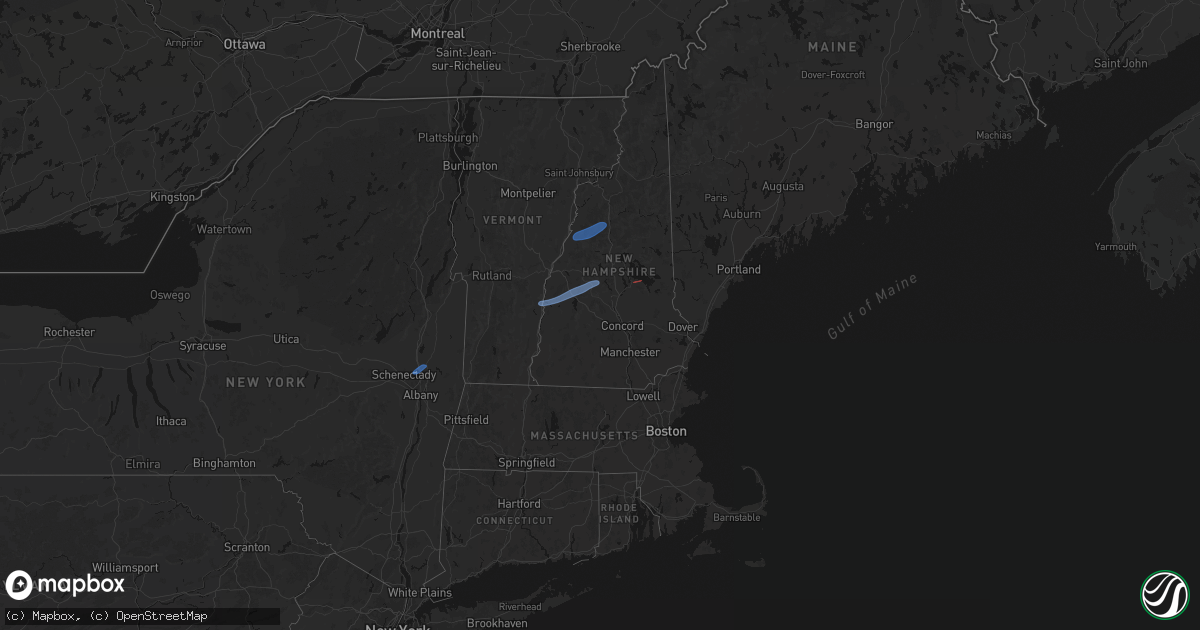
Hail Map in New Hampshire on June 18, 2026
Get this storm
June 18 map
$229
one time, instant access
Download today. No call, no setup
Keep the $229
Bought the map and want the full workflow? Apply the entire $229 to a subscription within 7 days. None of it is wasted.
Every map, not just this one
This buys you this map. Subscription and you get every map we run, in the markets you choose from a few cities to whole states to nationwide. Plus real-time alerts the moment a storm fires.
Contact data
Name, contact info, occupancy, even credit band for addresses in the footprint. You go from where it hit to who to call.
Become the source they trust
Unlimited branding weather history reports on demand. You already have the documented answer ready for the property owner, and you are the one who showed up with it.
Property data and RoofTrace estimates
Pull up any address you have got, its value and the exact code rules for that jurisdiction, straight from One Click Code. Then RoofTrace estimates the squares, pitch, and roof value, priced the way you price.
Storm reports in New Hampshire
New Hampshire
| Date | Description |
|---|---|
| 06/18/20264:17 PM CDT | Portsmouth fd responding to multiple calls for trees down blocking roads. Time estimated by radar. |
| 06/18/20264:05 PM CDT | 18-inch diameter white pine snapped and partially blocking corinthian drive and a driveway in salem. Time estimated by radar. |
| 06/18/20264:04 PM CDT | Tree down completely blocking north lowell road in the area of camelot road. Time estimated by radar. |
| 06/18/20263:55 PM CDT | Several trees and powerlines down in derry. Time estimated by radar. |
| 06/18/20263:53 PM CDT | Tree down blocking roberts road in strafford. Time estimated by radar. |
| 06/18/20263:47 PM CDT | Trees down blocking wilsons crossing road in auburn... Nh. Time estimated by radar. |
| 06/18/20263:36 PM CDT | Trees down on wires. Trees blocking road. |
| 06/18/20263:25 PM CDT | Tree down blocking nh-28 in the area of emerson drive in alton. Time estimated by radar. |
| 06/18/20263:25 PM CDT | Social media report of tree completely blocking the northbound lane of nh-13. Time estimated by radar. |
| 06/18/20263:23 PM CDT | Power lines down blocking nh-124. Time estimated by radar. |
| 06/18/20263:23 PM CDT | Tree and wires down on emery road. Time estimated by radar. |
| 06/18/20263:20 PM CDT | Tree and wires down blocking nh-129 in the area of nh-107 in gilmanton. Time estimated by radar. |
| 06/18/20263:11 PM CDT | *** 1 inj *** delayed report. One injury reported when a tree fell on a car waiting in a parking lot near the sandy island dock. The person refused medical attention. T |
| 06/18/20263:10 PM CDT | Trees and wires down. |
| 06/18/20263:08 PM CDT | Tree and wires down blocking nh-11 in gilford. Time estimated by radar. |
| 06/18/20263:05 PM CDT | Trees down in east sandwich. |
| 06/18/20263:03 PM CDT | Wires down blocking parade rd in meredith. Time estimated by radar. |
| 06/18/20263:00 PM CDT | Trees and wires down on west main street. |
| 06/18/20263:00 PM CDT | Trees and wires down blocking peverly rd in northfield. Time estimated by radar. |
| 06/18/20262:55 PM CDT | Large tree down. Barely missed a house. |
| 06/18/20262:55 PM CDT | Tree down blocking hunkins hill rd in sanbornton. Time estimated by radar. |
| 06/18/20262:55 PM CDT | Tree and wires down blocking bay rd in sanbornton. Time estimated by radar. |
| 06/18/20262:53 PM CDT | Wires down blocking nh-3a in franklin. Time estimated by radar. |
| 06/18/20262:50 PM CDT | Trees down. |
| 06/18/20262:50 PM CDT | Trees and power lines down on court st in keene. Time estimated by radar. |
| 06/18/20262:48 PM CDT | Several trees down on orchard lane in gilsum. Time estimated by radar. |
| 06/18/20262:45 PM CDT | Large tree down on cheshire rd. Time estimated from radar. |
| 06/18/20262:43 PM CDT | Tree and wires down blocking brook rd in new hampton. |
| 06/18/20262:43 PM CDT | Tree on house... Power lines down across the road. Time estimated from radar. |
| 06/18/20262:43 PM CDT | Bristol fire reporting multiple trees and powerlines down in the area of hemlock brook rd. Time estimated by radar. |
| 06/18/20262:37 PM CDT | Trees down cady lane. |
| 06/18/20262:35 PM CDT | Tree down blocking nh-103b in sunapee. |
| 06/18/20262:30 PM CDT | Wires down blocking old north groton road in rumney... Nh. |
| 06/18/20262:30 PM CDT | Trees and wires down blocking ryder corner road in the area of north road. |
| 06/18/20262:30 PM CDT | Trees down. |
| 06/18/20262:25 PM CDT | Trees and wires down. |
| 06/18/20262:20 PM CDT | Trees and wires down blocking dunham road. Time estimated by radar. |
| 06/18/20262:20 PM CDT | Tree down blocking chaffee lane in langdon... Nh. |
| 06/18/20262:20 PM CDT | Trees down on jabe meadow road. |
| 06/18/20262:15 PM CDT | Trees and wires down. Time estimated from radar. |
| 06/18/20262:10 PM CDT | Tree and wires down blocking west bath rd in the area of pettyboro rd in bath. Time estimated by radar. |
| 06/18/20262:10 PM CDT | Large tree down across moss flower rd. Time estimated from radar. |
| 06/18/20262:05 PM CDT | Trees and wires down. Time estimated from radar. |
| 06/18/20262:05 PM CDT | Multiple trees and power lines down on red water brook road in claremont. |
| 06/18/20262:05 PM CDT | Chaser measured recent wind gust of 64 mph in claremont on a handheld anemometer. |
All States Impacted by Hail Map on June 18, 2026
Cities Impacted by Hail Map on June 18, 2026
- Slidell, LA
- Medford, OK
- Piqua, KS
- Iola, KS
- Maple City, KS
- Wichita, KS
- Piedmont, KS
- Oxford, KS
- Shidler, OK
- Lamont, OK
- Deer Creek, OK
- Yates Center, KS
- Neosho Falls, KS
- Winfield, KS
- Tonkawa, OK
- Nash, OK
- Arkansas City, KS
- Pass Christian, MS
- Saucier, MS
- Wiggins, MS
- Pond Creek, OK
- Derby, KS
- Douglass, KS
- Mulvane, KS
- Ponca City, OK
- Marland, OK
- Dexter, KS
- Rock, KS
- Hunter, OK
- Rose Hill, KS
- Burden, KS
- Atlanta, KS
- Pawhuska, OK
- Bluff City, KS
- Belle Plaine, KS
- Wellington, KS
- Augusta, KS
- Caldwell, KS
- Haysville, KS
- Peck, KS
- Billings, OK
- Wakita, OK
- Amorita, OK
- Udall, KS
- Red Rock, OK
- Kingman, KS
- Cherokee, OK
- Spivey, KS
- Burlington, OK
- Copan, OK
- Manchester, OK
- Vinita, OK
- Delaware, OK
- Anthony, KS
- Lenapah, OK
- Wann, OK
- Nardin, OK
- S Coffeyville, OK
- Cambridge, KS
- Leon, KS
- Harper, KS
- Argonia, KS
- Jet, OK
- Conway Springs, KS
- Norwich, KS
- Cedar Vale, KS
- Mayfield, KS
- Blackwell, OK
- Milton, KS
- Milan, KS
- Clifton Park, NY
- Rexford, NY
- Mechanicville, NY
- Waterford, NY
- Sawyer, KS
- Isabel, KS
- Medicine Lodge, KS
- Dryden, VA
- Zenda, KS
- Nashville, KS
- Attica, KS
- Sharon, KS
- Ludowici, GA
- Glennville, GA
- Ocala, FL
- Waldron, KS
- Silver Springs, FL
- Danville, KS
- Springfield, VT
- Claremont, NH
- Windsor, VT
- Ascutney, VT
- Newport, NH
- South Haven, KS
- Burbank, OK
- Jeffersonville, GA
- Eatonton, GA
- Kaw City, OK
- Geuda Springs, KS
- Columbia, SC
- Ridgeland, SC
- Greensboro, GA
- Hardeeville, SC
- Sedan, KS
- Purlear, NC
- West Jefferson, NC
- Traphill, NC
- Millers Creek, NC
- McGrady, NC
- Hays, NC
- North Wilkesboro, NC
- Bartlesville, OK
- Grantham, NH
- Sunapee, NH
- New London, NH
- Springfield, NH
- Wilmot, NH
- Danbury, NH
- Grafton, NH
- Hill, NH
- Orford, NH
- Piermont, NH
- Wentworth, NH
- Warren, NH
- North Woodstock, NH
- Sumter, SC
- Viola, KS
- Pierson, FL
- Denmark, ME
- Bridgton, ME
- Bishopville, SC
- Clearwater, KS
- Pinnacle, NC
- Tobaccoville, NC
- Stapleton, GA
- Wrens, GA
- Blythe, GA
- Hephzibah, GA
- Matthews, GA
- Augusta, GA
- Smoaks, SC
- Daytona Beach, FL
- Van Buren, AR
- Fort Smith, AR
- McLain, MS
- Murdock, KS
- King, NC
- Johnson City, TN
- Cheney, KS
- Wallace, SC
- Bennettsville, SC
- Mount Airy, NC
- Ararat, NC
- Watauga, TN
- Piney Flats, TN
- Rockingham, NC
- Hamlet, NC
- Statesboro, GA
- Charleston, AR
- Santa Fe, NM
- Musella, GA
- Macon, GA
- Fort Bragg, NC
- Pope Army Airfield, NC
- Spring Lake, NC
- Bay Minette, AL
- Daphne, AL
- Mountainair, NM
- Ozona, TX
- Milledgeville, GA
- Forsyth, GA
- Juliette, GA
- Wingate, TX
- Tuscola, TX
- Newell, SD
- Faith, SD
- Union Center, SD
- Mud Butte, SD
- Nolan, TX
- Tahoe City, CA
- Blackwell, TX
- Gilford, NH
- Paron, AR
- Bronte, TX
- Dupree, SD
- Braman, OK
- Newkirk, OK
- Norton, TX
- Vernon, FL
- Ballinger, TX
- Miles, TX
- Soda Springs, CA
- Winters, TX
- Freeport, KS
- Beckwourth, CA
- Talpa, TX
- Coleman, TX
- Novice, TX
- Millry, AL
- Chelsea, OK
- Nowata, OK
- Seminary, MS
- Sumrall, MS
- Olney, TX
- Throckmorton, TX
- El Paso, TX
- Duke, OK
- Newcastle, TX
- Cordell, OK
- Silverton, TX
- De Leon, TX
- Sentinel, OK
- Gorman, TX
- Graham, TX
- Vernon, TX
- Dill City, OK
- Ranger, TX
- Desdemona, TX
- Gould, OK
- Tulia, TX
- Kress, TX
- Bryson, TX
- Hollis, OK
- Eldorado, OK
- Mountain Park, OK
- Graford, TX
- Strawn, TX
- Indiahoma, OK
- Childress, TX
- Tipton, OK
- Jacksboro, TX
- Snyder, OK
- Lawton, OK
- Faxon, OK
- Cache, OK
- Matador, TX
- Breckenridge, TX
- Walters, OK
- Dryden, TX
- Gordon, TX
- Palo Pinto, TX
- Dodson, TX
- Lone Wolf, OK
- Paducah, TX
- Mineral Wells, TX
- Chillicothe, TX
- Frederick, OK
- Roosevelt, OK
- Hobart, OK
- Santo, TX
- Crowell, TX
- Headrick, OK
- Chattanooga, OK
- Geronimo, OK
- Stephenville, TX
- Comstock, TX
- Weatherford, TX
- Millsap, TX
- Quanah, TX
- Loveland, OK
- Wichita Falls, TX
- Waurika, OK
- Sheppard Afb, TX
- Hollister, OK
- Bowie, TX
- Comanche, OK
- Odessa, TX
- Bellevue, TX
- Leesburg, GA
- Devol, OK
- Duncan, OK
- Grandfield, OK
- Perrin, TX
- Randlett, OK
- Temple, OK
- Bluff Dale, TX
- Carbon, TX
- Alvord, TX
- Tolar, TX
- Chico, TX
- Sunset, TX
- Decatur, TX
- Eastland, TX
- Fort Sill, OK
- Iowa Park, TX
- Krum, TX
- Sanger, TX
- Burkburnett, TX
- Rhome, TX
- Saint Jo, TX
- Montague, TX
- Justin, TX
- Era, TX
- Gainesville, TX
- Muenster, TX
- Poolville, TX
- Whitt, TX
- Forestburg, TX
- Rosston, TX
- Ponder, TX
- Bridgeport, TX
- Denton, TX
- Paradise, TX
- Davidson, OK
- Valley View, TX
- Lindsay, TX
- Aubrey, TX
- Harrold, TX
- Electra, TX
- Oklaunion, TX
- Lewisville, TX
- Little Elm, TX
- Pilot Point, TX
- Collinsville, TX
- Tioga, TX
- Broxton, GA
- Alma, GA
- Baxley, GA
- Douglas, GA
- Hazlehurst, GA
- Denton, GA
- Nicholls, GA
- West Green, GA
- Del Rio, TX
- Frisco, TX
- The Colony, TX
- Brownwood, TX
- Rising Star, TX
- Gunter, TX
- Sonora, TX
- Dallas, TX
- Van Alstyne, TX
- Howe, TX
- Mckinney, TX
- Celina, TX
- Fort Cobb, OK
- Westwego, LA
- Pearlington, MS
- Bay Saint Louis, MS
- New Orleans, LA
- Caddo, TX
- Woodstock, VT
- Vancleave, MS
- Gulfport, MS
- Biloxi, MS
- Diberville, MS
- Long Beach, MS
- Perkinston, MS
- McHenry, MS
- Lucedale, MS
- Poplarville, MS
- Picayune, MS
- Carriere, MS
- Ocean Springs, MS
- Waveland, MS
- Gautier, MS
- Cortland, NY
- Rock Stream, NY
- Burdett, NY
- Kiln, MS


