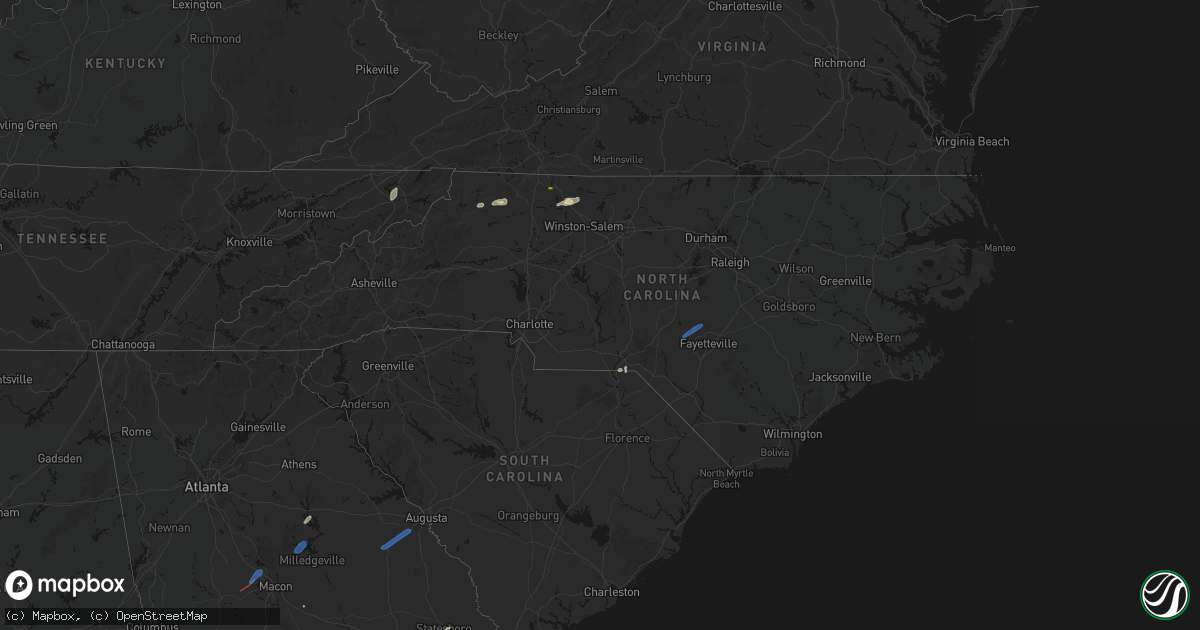
Hail Map in North Carolina on June 18, 2026
Get this storm
June 18 map
$229
one time, instant access
Download today. No call, no setup
Keep the $229
Bought the map and want the full workflow? Apply the entire $229 to a subscription within 7 days. None of it is wasted.
Every map, not just this one
This buys you this map. Subscription and you get every map we run, in the markets you choose from a few cities to whole states to nationwide. Plus real-time alerts the moment a storm fires.
Contact data
Name, contact info, occupancy, even credit band for addresses in the footprint. You go from where it hit to who to call.
Become the source they trust
Unlimited branding weather history reports on demand. You already have the documented answer ready for the property owner, and you are the one who showed up with it.
Property data and RoofTrace estimates
Pull up any address you have got, its value and the exact code rules for that jurisdiction, straight from One Click Code. Then RoofTrace estimates the squares, pitch, and roof value, priced the way you price.
Storm reports in North Carolina
North Carolina
| Date | Description |
|---|---|
| 06/18/20266:58 PM CDT | Tree fell on car at a whataburger on southern rd... Causing very minor damage. Also damaged a fence. |
| 06/18/20266:56 PM CDT | Tree in roadway cranes creek rd & us 1 hwy. |
| 06/18/20266:50 PM CDT | Tree down on n sycamore st & elm st. |
| 06/18/20266:25 PM CDT | Multiple trees down along hoffman rd... In marston... Nc. |
| 06/18/20266:25 PM CDT | Multiple trees down across marston... Nc. |
| 06/18/20266:12 PM CDT | Multiple trees down across the city of hamlet including tree on house. |
| 06/18/20266:08 PM CDT | Multiple trees down across the city of rockingham. |
| 06/18/20265:37 PM CDT | 911 call center reported a tree down at the 1800 block of mountain view road in stokes county north carolina. |
| 06/18/20265:37 PM CDT | 911 call center reported a tree down at the 1500 block of hawkins road in stokes county north carolina. |
| 06/18/20265:37 PM CDT | 911 call center reported a tree down in the 1300 block of north friendship road in stokes county virginia. |
| 06/18/20265:36 PM CDT | Video showing a tree laying on a power line on stokes school road. |
| 06/18/20265:19 PM CDT | 911 call center reported a tree that fell on a power line at the intersection of pinnacle hotel road and shoals road in surry county north carolina. |
| 06/18/20265:19 PM CDT | Corrects previous tstm wnd dmg report from 1 se roaring gap. 911 call center reported a tree down at the 6000 block of u.s. Highway 21 in wilkes county north carolina. |
| 06/18/20265:17 PM CDT | 911 call center reported a tree down across the highway at exit 27 on u.s. Highway 52 northbound near the pilot mountain state park area. |
| 06/18/20265:17 PM CDT | 911 call center reported a tree down across the highway at exit 24 on u.s. Highway 52 in the pilot mountain area of surry county north carolina. |
| 06/18/20265:15 PM CDT | 911 call center reported a treen hanging over the roadway north of elkin in surry county north carolina. |
| 06/18/20265:15 PM CDT | Tree was reported down by the 911 call center at the intersection of perch road and grassy creek road in surry county north carolina. |
| 06/18/20265:02 PM CDT | 911 call center reported a tree down off croom davis road in the dobson area of surry county north carolina. |
| 06/18/20264:32 PM CDT | 911 call center reported a tree down at the 6000 block of u.s. Highway 21 in wilkes county north carolina. |
| 06/18/20264:30 PM CDT | Tree down blocking both lanes of johnson road near siloam road. |
| 06/18/20264:23 PM CDT | Tree down blocking both lanes of belair drive. Time estimated from radar. |
| 06/18/20264:16 PM CDT | 911 call center reported a tree down at the intersection of rockford street and smith road in mount airy north carolina. |
| 06/18/20264:15 PM CDT | 911 call center reported a tree down at the intersection of rockford street and old highway 601 in the mount airy area. |
| 06/18/20264:15 PM CDT | 911 call center reported a tree down at the intersection of lambert farm trail and rockford street in mount airy north carolina. |
| 06/18/20264:10 PM CDT | 911 call center reported a tree down off of old county home road in the dobson area of north carolina. |
| 06/18/20264:10 PM CDT | 911 call center reported a tree down at the intersection of rockford street and old highway 601 in mount airy north carolina. |
| 06/18/20264:06 PM CDT | 911 call center reported a tree down off of old county home road in the dobson area of north carolina. |
| 06/18/20263:50 PM CDT | Tree down along powers lane. Time estimated from radar. |
| 06/18/20262:48 PM CDT | Tree down near the gates county line. |
| 06/18/20262:28 PM CDT | A large tree fell across middle swamp rd near the intersection of black mingle rd. |
| 06/17/20268:56 PM CDT | Tree down on firetower rd. |
| 06/17/20268:56 PM CDT | Tree down on nc hwy 56. |
| 06/17/20268:37 PM CDT | Tree down in roadway on treece rd. |
| 06/17/20268:36 PM CDT | Trees down on powerlines off old hwy 111. |
| 06/17/20268:35 PM CDT | Trees down on s best st. |
| 06/17/20268:34 PM CDT | Tree down on power lines on long st. |
| 06/17/20268:31 PM CDT | Tree down at nc-902 and powers country ln. |
| 06/17/20268:21 PM CDT | Trees down in road way near e nc 55 hwy/kelly springs rd. |
| 06/17/20268:20 PM CDT | Received about 20 reports of trees and power lines down throughout the county... Especially the southern and western parts of the county. |
| 06/17/20268:18 PM CDT | Tree down on powerlines on us 117. |
| 06/17/20268:00 PM CDT | Downed power pole along hodges chapel road. |
| 06/17/20267:55 PM CDT | A few trees down in the jordan road and u.s. 421 area. |
| 06/17/20267:45 PM CDT | A section of a hog house on the 1000 block of hollerin rd was severely damaged and the roof blown off. A home on hickory green ln also had its garage door partially pul |
| 06/17/20267:40 PM CDT | Tree on car in troy. |
| 06/17/20267:35 PM CDT | Tree down on roadway near spies rd in star. |
| 06/17/20267:30 PM CDT | Large tree down along lobelia rd. |
| 06/17/20267:26 PM CDT | Tree down near jasper rd. |
| 06/17/20267:25 PM CDT | Large tree down near e baltimore ave pinebluff. |
| 06/17/20267:20 PM CDT | Tree down near w rowan st. |
| 06/17/20267:16 PM CDT | Tree on house and roof caved in. Morganton rd. |
| 06/17/20267:14 PM CDT | Tree on house on coley dr. Injuries unk. |
| 06/17/20267:14 PM CDT | Tree down near blue st/ murchison rd. |
| 06/17/20267:13 PM CDT | Tree on power lines and trees in roadway... Near cranes creek rd in carthage. |
| 06/17/20267:13 PM CDT | Tree down on powerlines. |
| 06/17/20267:05 PM CDT | Large tree in roadway blocking road furr rd & pine dr vass. |
| 06/17/20267:03 PM CDT | Awos station kpob pope afb. |
All States Impacted by Hail Map on June 18, 2026
Cities Impacted by Hail Map on June 18, 2026
- Slidell, LA
- Medford, OK
- Piqua, KS
- Iola, KS
- Maple City, KS
- Wichita, KS
- Piedmont, KS
- Oxford, KS
- Shidler, OK
- Lamont, OK
- Deer Creek, OK
- Yates Center, KS
- Neosho Falls, KS
- Winfield, KS
- Tonkawa, OK
- Nash, OK
- Arkansas City, KS
- Pass Christian, MS
- Saucier, MS
- Wiggins, MS
- Pond Creek, OK
- Derby, KS
- Douglass, KS
- Mulvane, KS
- Ponca City, OK
- Marland, OK
- Dexter, KS
- Rock, KS
- Hunter, OK
- Rose Hill, KS
- Burden, KS
- Atlanta, KS
- Pawhuska, OK
- Bluff City, KS
- Belle Plaine, KS
- Wellington, KS
- Augusta, KS
- Caldwell, KS
- Haysville, KS
- Peck, KS
- Billings, OK
- Wakita, OK
- Amorita, OK
- Udall, KS
- Red Rock, OK
- Kingman, KS
- Cherokee, OK
- Spivey, KS
- Burlington, OK
- Copan, OK
- Manchester, OK
- Vinita, OK
- Delaware, OK
- Anthony, KS
- Lenapah, OK
- Wann, OK
- Nardin, OK
- S Coffeyville, OK
- Cambridge, KS
- Leon, KS
- Harper, KS
- Argonia, KS
- Jet, OK
- Conway Springs, KS
- Norwich, KS
- Cedar Vale, KS
- Mayfield, KS
- Blackwell, OK
- Milton, KS
- Milan, KS
- Clifton Park, NY
- Rexford, NY
- Mechanicville, NY
- Waterford, NY
- Sawyer, KS
- Isabel, KS
- Medicine Lodge, KS
- Dryden, VA
- Zenda, KS
- Nashville, KS
- Attica, KS
- Sharon, KS
- Ludowici, GA
- Glennville, GA
- Ocala, FL
- Waldron, KS
- Silver Springs, FL
- Danville, KS
- Springfield, VT
- Claremont, NH
- Windsor, VT
- Ascutney, VT
- Newport, NH
- South Haven, KS
- Burbank, OK
- Jeffersonville, GA
- Eatonton, GA
- Kaw City, OK
- Geuda Springs, KS
- Columbia, SC
- Ridgeland, SC
- Greensboro, GA
- Hardeeville, SC
- Sedan, KS
- Purlear, NC
- West Jefferson, NC
- Traphill, NC
- Millers Creek, NC
- McGrady, NC
- Hays, NC
- North Wilkesboro, NC
- Bartlesville, OK
- Grantham, NH
- Sunapee, NH
- New London, NH
- Springfield, NH
- Wilmot, NH
- Danbury, NH
- Grafton, NH
- Hill, NH
- Orford, NH
- Piermont, NH
- Wentworth, NH
- Warren, NH
- North Woodstock, NH
- Sumter, SC
- Viola, KS
- Pierson, FL
- Denmark, ME
- Bridgton, ME
- Bishopville, SC
- Clearwater, KS
- Pinnacle, NC
- Tobaccoville, NC
- Stapleton, GA
- Wrens, GA
- Blythe, GA
- Hephzibah, GA
- Matthews, GA
- Augusta, GA
- Smoaks, SC
- Daytona Beach, FL
- Van Buren, AR
- Fort Smith, AR
- McLain, MS
- Murdock, KS
- King, NC
- Johnson City, TN
- Cheney, KS
- Wallace, SC
- Bennettsville, SC
- Mount Airy, NC
- Ararat, NC
- Watauga, TN
- Piney Flats, TN
- Rockingham, NC
- Hamlet, NC
- Statesboro, GA
- Charleston, AR
- Santa Fe, NM
- Musella, GA
- Macon, GA
- Fort Bragg, NC
- Pope Army Airfield, NC
- Spring Lake, NC
- Bay Minette, AL
- Daphne, AL
- Mountainair, NM
- Ozona, TX
- Milledgeville, GA
- Forsyth, GA
- Juliette, GA
- Wingate, TX
- Tuscola, TX
- Newell, SD
- Faith, SD
- Union Center, SD
- Mud Butte, SD
- Nolan, TX
- Tahoe City, CA
- Blackwell, TX
- Gilford, NH
- Paron, AR
- Bronte, TX
- Dupree, SD
- Braman, OK
- Newkirk, OK
- Norton, TX
- Vernon, FL
- Ballinger, TX
- Miles, TX
- Soda Springs, CA
- Winters, TX
- Freeport, KS
- Beckwourth, CA
- Talpa, TX
- Coleman, TX
- Novice, TX
- Millry, AL
- Chelsea, OK
- Nowata, OK
- Seminary, MS
- Sumrall, MS
- Olney, TX
- Throckmorton, TX
- El Paso, TX
- Duke, OK
- Newcastle, TX
- Cordell, OK
- Silverton, TX
- De Leon, TX
- Sentinel, OK
- Gorman, TX
- Graham, TX
- Vernon, TX
- Dill City, OK
- Ranger, TX
- Desdemona, TX
- Gould, OK
- Tulia, TX
- Kress, TX
- Bryson, TX
- Hollis, OK
- Eldorado, OK
- Mountain Park, OK
- Graford, TX
- Strawn, TX
- Indiahoma, OK
- Childress, TX
- Tipton, OK
- Jacksboro, TX
- Snyder, OK
- Lawton, OK
- Faxon, OK
- Cache, OK
- Matador, TX
- Breckenridge, TX
- Walters, OK
- Dryden, TX
- Gordon, TX
- Palo Pinto, TX
- Dodson, TX
- Lone Wolf, OK
- Paducah, TX
- Mineral Wells, TX
- Chillicothe, TX
- Frederick, OK
- Roosevelt, OK
- Hobart, OK
- Santo, TX
- Crowell, TX
- Headrick, OK
- Chattanooga, OK
- Geronimo, OK
- Stephenville, TX
- Comstock, TX
- Weatherford, TX
- Millsap, TX
- Quanah, TX
- Loveland, OK
- Wichita Falls, TX
- Waurika, OK
- Sheppard Afb, TX
- Hollister, OK
- Bowie, TX
- Comanche, OK
- Odessa, TX
- Bellevue, TX
- Leesburg, GA
- Devol, OK
- Duncan, OK
- Grandfield, OK
- Perrin, TX
- Randlett, OK
- Temple, OK
- Bluff Dale, TX
- Carbon, TX
- Alvord, TX
- Tolar, TX
- Chico, TX
- Sunset, TX
- Decatur, TX
- Eastland, TX
- Fort Sill, OK
- Iowa Park, TX
- Krum, TX
- Sanger, TX
- Burkburnett, TX
- Rhome, TX
- Saint Jo, TX
- Montague, TX
- Justin, TX
- Era, TX
- Gainesville, TX
- Muenster, TX
- Poolville, TX
- Whitt, TX
- Forestburg, TX
- Rosston, TX
- Ponder, TX
- Bridgeport, TX
- Denton, TX
- Paradise, TX
- Davidson, OK
- Valley View, TX
- Lindsay, TX
- Aubrey, TX
- Harrold, TX
- Electra, TX
- Oklaunion, TX
- Lewisville, TX
- Little Elm, TX
- Pilot Point, TX
- Collinsville, TX
- Tioga, TX
- Broxton, GA
- Alma, GA
- Baxley, GA
- Douglas, GA
- Hazlehurst, GA
- Denton, GA
- Nicholls, GA
- West Green, GA
- Del Rio, TX
- Frisco, TX
- The Colony, TX
- Brownwood, TX
- Rising Star, TX
- Gunter, TX
- Sonora, TX
- Dallas, TX
- Van Alstyne, TX
- Howe, TX
- Mckinney, TX
- Celina, TX
- Fort Cobb, OK
- Westwego, LA
- Pearlington, MS
- Bay Saint Louis, MS
- New Orleans, LA
- Caddo, TX
- Woodstock, VT
- Vancleave, MS
- Gulfport, MS
- Biloxi, MS
- Diberville, MS
- Long Beach, MS
- Perkinston, MS
- McHenry, MS
- Lucedale, MS
- Poplarville, MS
- Picayune, MS
- Carriere, MS
- Ocean Springs, MS
- Waveland, MS
- Gautier, MS
- Cortland, NY
- Rock Stream, NY
- Burdett, NY
- Kiln, MS


