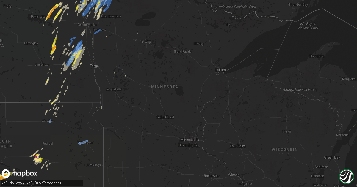
Hail Map in Minnesota on June 17, 2020
Get this storm
June 17 map
$229
one time, instant access
Download today. No call, no setup
Keep the $229
Bought the map and want the full workflow? Apply the entire $229 to a subscription within 7 days. None of it is wasted.
Every map, not just this one
This buys you this map. Subscription and you get every map we run, in the markets you choose from a few cities to whole states to nationwide. Plus real-time alerts the moment a storm fires.
Contact data
Name, contact info, occupancy, even credit band for addresses in the footprint. You go from where it hit to who to call.
Become the source they trust
Unlimited branding weather history reports on demand. You already have the documented answer ready for the property owner, and you are the one who showed up with it.
Property data and RoofTrace estimates
Pull up any address you have got, its value and the exact code rules for that jurisdiction, straight from One Click Code. Then RoofTrace estimates the squares, pitch, and roof value, priced the way you price.
Storm reports in Minnesota
Minnesota
| Date | Description |
|---|---|
| 06/17/20205:44 PM CDT | Numerous large tree branches and limbs were broken down around town. A few pine... Poplar... And oak trees were snapped. |
| 06/17/20205:40 PM CDT | Corrects previous hail report from greenbush. Time estimated from radar. |
| 06/17/20205:35 PM CDT | A local report indicates 1.00 inch wind near 6 W GREENBUSH |
| 06/17/20205:33 PM CDT | A tornado tracked intermittently for roughly 2 miles to around 3 sw of greenbush by 537 pm cdt. Several trees were snapped and numerous large branches and limbs were br |
| 06/17/20205:05 PM CDT | Numerous poplar trees were snapped in shelter belts and groves. Time estimated based on radar. |
| 06/17/20205:14 AM CDT | At 1014 PM CDT, severe thunderstorms were located along a line extending from near Northcote to near Karlstad, moving northeast at 50 mph. HAZARD...70 mph wind gusts and penny size hail. SOURCE...Radar indicated. IMPACT...Expect considerable tree damage. Damage is likely to mobile homes, roofs, and outbuildings. Severe thunderstorms will be near... Lancaster around 1025 PM CDT. Leo and Greenbush around 1030 PM CDT. Haug around 1040 PM CDT. |
| 06/17/20205:12 AM CDT | At 1012 PM CDT, a severe thunderstorm was located near Hunter, or 32 miles northwest of Fargo, moving northeast at 50 mph. HAZARD...70 mph wind gusts and penny size hail. SOURCE...Radar indicated. IMPACT...Expect considerable tree damage. Damage is likely to mobile homes, roofs, and outbuildings. This severe thunderstorm will be near... Blanchard around 1025 PM CDT. Kelso around 1030 PM CDT. Hillsboro around 1035 PM CDT. Cummings around 1040 PM CDT. Buxton around 1045 PM CDT.Other locations impacted by this severe thunderstorm include AmericanCrystal Sugar.This includes Interstate 29 between mile markers 88 and 124. |
| 06/17/20204:43 AM CDT | At 942 PM CDT, severe thunderstorms were located along a line extending from 8 miles southeast of Caribou to near Torfin, moving northeast at 45 mph. HAZARD...70 mph wind gusts and penny size hail. SOURCE...Radar indicated. IMPACT...Expect considerable tree damage. Damage is likely to mobile homes, roofs, and outbuildings. Severe thunderstorms will be near... Torfin, Casperson and Skime around 950 PM CDT. Wannaska and Hayes Lake State Park around 955 PM CDT. Pencer around 1000 PM CDT. Malung around 1005 PM CDT. Salol around 1015 PM CDT. |
| 06/17/20204:13 AM CDT | At 913 PM CDT, severe thunderstorms were located along a line extending from near Clifford to near Amenia, moving northeast at 40 mph. HAZARD...70 mph wind gusts and quarter size hail. SOURCE...Radar indicated. IMPACT...Hail damage to vehicles is expected. Expect considerable tree damage. Wind damage is also likely to mobile homes, roofs, and outbuildings. Severe thunderstorms will be near... Galesburg around 915 PM CDT. Clifford and Arthur around 920 PM CDT. Roseville around 925 PM CDT. Portland around 930 PM CDT. Gardner and Mayville around 935 PM CDT.Other locations impacted by these severe thunderstorms includeAmerican Crystal Sugar.This includes the following highways... Interstate 29 between mile markers 80 and 142. Interstate 94 in North Dakota between mile markers 326 and 327. |
| 06/17/20204:02 AM CDT | At 901 PM CDT, severe thunderstorms were located along a line extending from 15 miles north of Pinecreek to Ross to near Middle River, moving northeast at 50 mph. HAZARD...70 mph wind gusts and penny size hail. SOURCE...Radar indicated. IMPACT...Expect considerable tree damage. Damage is likely to mobile homes, roofs, and outbuildings. Locations impacted include... Roseau, Warroad, Karlstad, Greenbush, Badger, Springsteel Island and Strandquist. |
| 06/17/20203:58 AM CDT | At 857 PM CDT, a severe thunderstorm was located near Buffalo, or 25 miles east of Valley City, moving northeast at 40 mph. HAZARD...70 mph wind gusts and quarter size hail. SOURCE...Radar indicated. IMPACT...Hail damage to vehicles is expected. Expect considerable tree damage. Wind damage is also likely to mobile homes, roofs, and outbuildings. This severe thunderstorm will be near... Wheatland around 905 PM CDT. Absaraka around 910 PM CDT. Amenia around 915 PM CDT. Arthur around 925 PM CDT. Hunter around 935 PM CDT.This includes the following highways... Interstate 29 between mile markers 80 and 86. Interstate 94 in North Dakota between mile markers 314 and 327. |
| 06/17/20203:51 AM CDT | At 851 PM CDT, a severe thunderstorm was located 7 miles south of Holmes, or 23 miles southwest of Grand Forks, moving northeast at 45 mph. HAZARD...70 mph wind gusts and penny size hail. SOURCE...Radar indicated. IMPACT...Expect considerable tree damage. Damage is likely to mobile homes, roofs, and outbuildings. Locations impacted include... Grand Forks, East Grand Forks, Mayville, Thompson, Portland, Buxton and Reynolds.This includes Interstate 29 between mile markers 119 and 147. |
| 06/17/20203:10 AM CDT | At 809 PM CDT, a severe thunderstorm was located near Hillsboro, or 37 miles northwest of Fargo, moving northeast at 40 mph. HAZARD...70 mph wind gusts and penny size hail. SOURCE...Radar indicated. IMPACT...Expect considerable tree damage. Damage is likely to mobile homes, roofs, and outbuildings. Locations impacted include... Crookston, Hillsboro, Halstad, Fisher, Arthur, Buxton and Climax. This includes Interstate 29 between mile markers 90 and 120. |
| 06/16/202011:45 PM CDT | At 445 PM CDT, a severe thunderstorm was located over Englund, or 31 miles northwest of Thief River Falls, moving northeast at 35 mph. HAZARD...60 mph wind gusts and quarter size hail. SOURCE...Radar indicated. IMPACT...Hail damage to vehicles is expected. Expect wind damage to roofs, siding, and trees. Locations impacted include... Karlstad, Greenbush, Badger, Strandquist, Florian, Leo and Englund. |
| 06/16/202010:55 PM CDT | Third of three round of large hail which came through that evening. |
| 06/16/202010:15 PM CDT | Decent size tree brances down |
| 06/16/202010:00 PM CDT | Occassional tops snapped off of trees... With numerous smaller branches stripped off. |
| 06/16/20209:47 PM CDT | Extensive damage around the town of greenbush. Trampolines blown around... Multiple trees down... A few shingles on the ground... Some garage roofs damaged... And grain |
| 06/16/20209:35 PM CDT | Considerable tree damage in town. |
| 06/16/20209:25 PM CDT | A few large poplar trees were broken down in shelter belts from 2 to 4 miles east of alvarado. Time estimated based on radar. |
| 06/16/20209:20 PM CDT | A couple trees down in town. |
| 06/16/20209:10 PM CDT | A tornado was observed as it developed off the north end of a downburst corridor moving across dieter and ross townships. It tracked for about a mile and ended south of |
| 06/16/20209:06 PM CDT | Peak winds measured at the kittson raws station. Numeroud large tree bracnhes and limbs were broken down in and around karlstad over a several minute time period. |
| 06/16/20209:03 PM CDT | Peak wind measured at an ndawn station. |
| 06/16/20209:00 PM CDT | Numerous pine and polplar trees broken down across southern pohlitz township. Shingles were torn off a well house. |
| 06/16/20208:55 PM CDT | Peak wind measured at the crookston airport. |
| 06/16/20208:55 PM CDT | A local report indicates 62 MPH wind near CROOKSTON |
| 06/16/20208:53 PM CDT | Downburst winds blew across northern barto... Eastern soleer... And mosse townships from 850 pm through 9pm cdt. Numerous large trees were snapped in shelter belts and |
| 06/16/20208:49 PM CDT | This tornado snarled and snapped trees in multiple shelter belts along its roughly 4 mile path... Ending around 1 mile southeast of florian by 856 pm cdt. Peak winds es |
| 06/16/20208:46 PM CDT | Peak wind measured at an rwis station at 846 and 851 pm cdt. |
| 06/16/20208:44 PM CDT | Peak wind measured at an ndawn station. |
| 06/16/20208:42 PM CDT | A tornado likely touched down and tracked for less than a mile to around 4 ne warren by 844 pm cdt. The tornado snapped poplar trees in a shelter belt and pine trees at |
| 06/16/20208:24 PM CDT | A large 15k bushel steel grain bin was caved in and popped off its foundation... With its roof torn off and thrown downwind over a hundred yards. |
| 06/16/20208:20 PM CDT | Peak wind measured at an rwis station. |
| 06/16/20207:41 PM CDT | Mutliple trees uprooted. |
| 06/16/20207:29 PM CDT | Peak wind measured at an ndawn station. |
All States Impacted by Hail Map on June 17, 2020
Cities Impacted by Hail Map on June 17, 2020
- Karlstad, MN
- Strandquist, MN
- Greenbush, MN
- Buffalo, ND
- Tower City, ND
- Lamesa, TX
- Odonnell, TX
- Shallowater, TX
- Lubbock, TX
- Strathcona, MN
- Abernathy, TX
- Murdo, SD
- Grafton, ND
- Hallock, MN
- Kennedy, MN
- Presho, SD
- Kennebec, SD
- Draper, SD
- Vivian, SD
- Lower Brule, SD
- Levelland, TX
- Anton, TX
- Hale Center, TX
- Olton, TX
- Littlefield, TX
- Kilgore, NE
- Crookston, NE
- Cody, NE
- Valentine, NE
- Tahoka, TX
- Wilson, TX
- Saint Lawrence, SD
- Stephen, MN
- Page, ND
- Erie, ND
- Galesburg, ND
- Fort Stockton, TX
- Wheatland, ND
- White River, SD
- Frazee, MN
- Oacoma, SD
- Lakota, ND
- Lankin, ND
- Michigan, ND
- Park River, ND
- Lewellen, NE
- Oshkosh, NE
- Seagraves, TX
- Alvarado, MN
- Wessington, SD
- Miller, SD
- Stirum, ND
- Meadow, TX
- Ropesville, TX
- Groton, SD
- Dryden, TX
- Saint Francis, SD
- Plainview, TX
- Kress, TX
- Viking, MN
- Warren, MN
- Amherst, TX
- Sudan, TX
- Mission, SD
- Oakes, ND
- Lorenzo, TX
- Idalou, TX
- Hatton, ND
- Reynolds, ND
- Thompson, ND
- Brownfield, TX
- Sundown, TX
- Hope, ND
- Houghton, SD
- Hecla, SD
- Earth, TX
- Imperial, TX
- Brocket, ND
- Lawton, ND
- Virgil, SD
- Alpena, SD
- Wessington Springs, SD
- Ypsilanti, ND
- Petersburg, TX
- Dickey, ND
- Berlin, ND
- Edgeley, ND
- Argyle, MN
- Muleshoe, TX
- Gail, TX
- Hyannis, NE
- Merriman, NE
- Whitman, NE
- Marathon, TX
- Hartington, NE
- Fordyce, NE
- Sparks, NE
- Springview, NE
- Crary, ND
- Adams, ND
- Blanchard, ND
- Pep, TX
- Fordville, ND
- Gregory, SD
- Dallas, SD
- Minto, ND
- Newfolden, MN
- Wheaton, MN
- Justiceburg, TX
- Fluvanna, TX
- Crystal City, TX
- Randolph, NE
- Coleridge, NE
- Winner, SD
- Seminole, TX
- Lancaster, MN
- Cooperstown, ND
- Wimbledon, ND
- Dazey, ND
- Hannaford, ND
- Welch, TX
- Laurel, NE
- Belden, NE
- Valley City, ND
- Mekinock, ND
- Wolsey, SD
- Alliance, NE
- Westport, SD
- Verona, ND
- Fort Ransom, ND
- Wood, SD
- New Deal, TX
- Coyanosa, TX
- Frederick, SD
- Lake Bronson, MN
- Thedford, NE
- Finley, ND
- Drayton, ND
- Grandfalls, TX
- Gilby, ND
- Grand Forks, ND
- Sanderson, TX
- Columbia, SD
- Oriska, ND
- Kathryn, ND
- Post, TX
- Middle River, MN
- Perham, MN
- Loop, TX
- Ayr, ND
- Hunter, ND
- Manvel, ND
- Luverne, ND
- Beltrami, MN
- Barnard, SD
- Tulare, SD
- Clifford, ND
- Rosholt, SD
- East Grand Forks, MN
- Binford, ND
- Hemingford, NE
- Lisbon, ND
- Nome, ND
- Ellendale, ND
- Chamberlain, SD
- Norris, SD
- Okaton, SD
- Aneta, ND
- Jessie, ND
- Enderlin, ND
- Pelican Rapids, MN
- Detroit Lakes, MN
- Audubon, MN
- Pillsbury, ND
- Cogswell, ND
- Colome, SD
- Ashby, NE
- Badger, MN
- Amenia, ND
- Arthur, ND
- Warwick, ND
- Hillsboro, ND
- Euclid, MN
- Forest River, ND
- Donaldson, MN
- Absaraka, ND
- Fingal, ND
- Leola, SD
- Wynot, NE
- Harrold, SD
- Mcville, ND
- Pukwana, SD
- Carroll, NE
- Winside, NE
- Marion, ND
- Arthur, NE
- Dimmitt, TX
- Johnstown, NE
- Carrizo Springs, TX
- Edinburg, ND
- Hoskins, NE
- Pekin, ND
- Pisek, ND
- Dahlen, ND
- Petersburg, ND
- Wood Lake, NE
- Leonard, MN
- Snyder, TX
- Rogers, ND
- Sanborn, ND
- Shevlin, MN
- Fort Pierre, SD
- Ralls, TX
- Tulia, TX
- Slaton, TX
- Crosbyton, TX
- Portland, ND
- Mayville, ND
- Oslo, MN
- Climax, MN
- Crookston, MN
- Roseau, MN
- Aberdeen, SD
- Henry, SD
- Watertown, SD
- Hazel, SD


