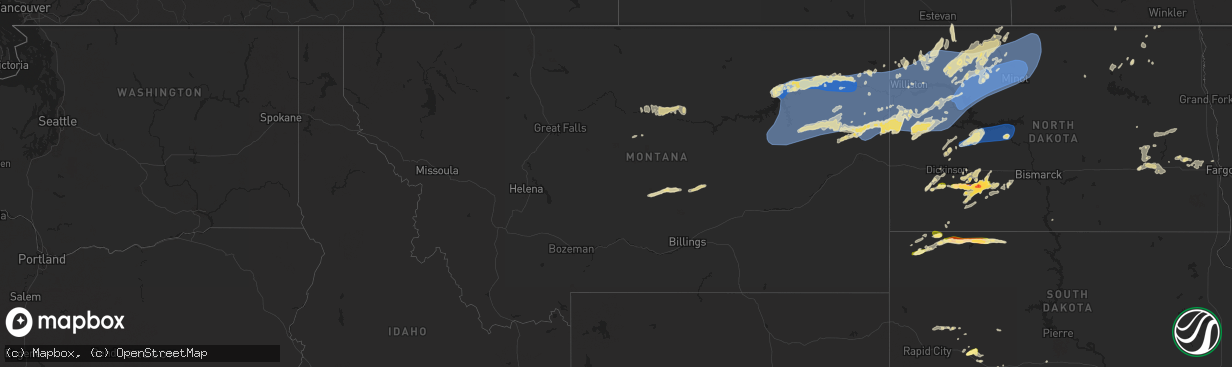
Hail Map in Montana on June 15, 2024
The weather event in Montana on June 15, 2024 includes Wind, Hail, and Tornado maps. 16 states and 625 cities were impacted and suffered possible damage. The total estimated number of properties impacted is 0.
Want more than just the map?
Turn this storm into a full workflow.
- Owner + property data so you know who to knock
- OnDemand branded weather history reports to win the "did we even have hail?" argument
- RoofTrace estimate so reps stop guessing numbers at the door
Bought this map? Upgrade within 7 days and we'll credit the $230. (10-15 min setup call)
Wind
Hail
Tornado
0
Estimated number of impacted properties by a 1.00" hail or larger0
Estimated number of impacted properties by a 1.75" hail or larger0
Estimated number of impacted properties by a 2.50" hail or largerStorm reports in Montana
Montana
| Date | Description |
|---|---|
| 06/15/20246:58 PM CDT | Asos station kjdn jordan. |
| 06/15/20246:45 PM CDT | Mesonet station mting 1.6 w ingomar |
| 06/15/20245:18 PM CDT | Mesonet station fblm8 fort belknap raws. |
| 06/15/20245:05 PM CDT | Mesonet station fblm8 fort belknap raws. Time estimated. Lightning in the area at 405 pm. |
| 06/15/20244:45 PM CDT | Mesonet station mthay 6.1 sw hays |
| 06/15/20244:11 PM CDT | Asos station klvm livingston. |
| 06/15/20241:15 PM CDT | Mesonet station mtm76 cascade e mda. |
| 06/14/20249:58 PM CDT | Meso net observation |
| 06/14/20249:54 PM CDT | Mtdot savage mt-16. |
| 06/14/20249:30 PM CDT | A local report indicates 60 MPH wind near 3 WSW Bainville |
| 06/14/20249:30 PM CDT | Measured at the blm glendive mesonet site. |
| 06/14/20249:00 PM CDT | Estimated from acurite weather sensor. |
| 06/14/20249:00 PM CDT | Meso net observation reported a thunderstorm wind gust of 60 mph. |
| 06/14/20248:53 PM CDT | Asos station kmls miles city. |
| 06/14/20248:30 PM CDT | Meso net site recorded a thunderstorm wind gust of 61 mph. |
| 06/14/20248:30 PM CDT | Lost power for 3 hours and blew trash cans off property. Report from facebook. |
| 06/14/20248:25 PM CDT | Meso net observation reported a thunde |
| 06/14/20248:25 PM CDT | Meso net observation reported a thunderstorm 61 mph gust. |
| 06/14/20247:52 PM CDT | Measured at the fort peck dam mesonet site. |
| 06/14/20247:49 PM CDT | Mesonet station ew1247 forsyth. |
| 06/14/20247:44 PM CDT | Also received 0.13 of rain. Knocked old small branches down. |
| 06/14/20247:30 PM CDT | Meso net site recorded a thunderstorm wind gust of 67 mph. |
| 06/14/20247:09 PM CDT | Strong thunderstorm winds pushed a trailed pontoon into a ditch near fort peck. |
| 06/14/20247:09 PM CDT | A cocorahs and storm spotter reported a davis measured thunderstorm wind gust to 79 mph. |
| 06/14/20247:00 PM CDT | Asos kbil. |
All States Impacted by Hail Map on June 15, 2024
Cities Impacted by Hail Map on June 15, 2024
- Birmingham, IA
- Fairfield, IA
- Stockport, IA
- Hillsboro, IA
- Donnellson, IA
- Salem, IA
- West Point, IA
- Highwood, MT
- Fort Benton, MT
- Nickerson, KS
- Abbyville, KS
- Conway, SC
- Partridge, KS
- Loris, SC
- Longs, SC
- Winter Garden, FL
- Clermont, FL
- Lyons, KS
- Little River, KS
- Republic, KS
- Sterling, KS
- Hutchinson, KS
- Byron, NE
- South Hutchinson, KS
- Ocala, FL
- Windermere, FL
- Oakland, FL
- Wildwood, FL
- The Villages, FL
- Hilger, MT
- Lloyd, MT
- Deshler, NE
- Fruitland Park, FL
- Leesburg, FL
- Lewistown, MT
- Denton, MT
- Yalaha, FL
- Lindsborg, KS
- Salina, KS
- Winifred, MT
- Hebron, NE
- Belleville, KS
- Buhler, KS
- Burrton, KS
- New Cambria, KS
- Belvidere, NE
- Clearwater, NE
- Chester, NE
- Hay Springs, NE
- Ingalls, KS
- Solomon, KS
- Stanton, ND
- Hazen, ND
- Lake City, SC
- Neligh, NE
- Hubbell, NE
- Munden, KS
- Petersburg, NE
- Albion, NE
- Dunnellon, FL
- Cimarron, KS
- Hope, KS
- Abilene, KS
- Gypsum, KS
- Enterprise, KS
- Gilead, NE
- Fairbury, NE
- Alexandria, NE
- Daykin, NE
- Amidon, ND
- New England, ND
- Scranton, SC
- Zortman, MT
- Swanton, NE
- Western, NE
- Plymouth, NE
- Wilber, NE
- Herington, KS
- Chapman, KS
- Woodbine, KS
- Morrowville, KS
- Washington, KS
- Plainview, NE
- Brunswick, NE
- Ryegate, MT
- Lavina, MT
- Tilden, NE
- Micanopy, FL
- De Witt, NE
- Wakefield, KS
- Clay Center, KS
- Junction City, KS
- Minneapolis, KS
- Newman Grove, NE
- Longford, KS
- Tobias, NE
- Belfield, ND
- Ness City, KS
- Meadow Grove, NE
- Green, KS
- Roundup, MT
- Hollenberg, KS
- White City, KS
- Platte Center, NE
- Creston, NE
- Columbus, NE
- South Heart, ND
- Greenleaf, KS
- Bazine, KS
- Odell, NE
- Diller, NE
- Ransom, KS
- Brownell, KS
- Fort Riley, KS
- Riley, KS
- Milford, KS
- Dwight, KS
- Manhattan, KS
- Olsburg, KS
- Ogden, KS
- Leonardville, KS
- Randolph, KS
- Westmoreland, KS
- Humphrey, NE
- Meade, KS
- Gate, OK
- Monroe, NE
- Norfolk, NE
- Madison, NE
- Wymore, NE
- Blue Springs, NE
- Steele City, NE
- Leigh, NE
- Saint George, KS
- Englewood, KS
- Jetmore, KS
- Dodge City, KS
- Battle Creek, NE
- Churchs Ferry, ND
- Cando, ND
- Pierce, NE
- Beatrice, NE
- Endicott, NE
- Hoskins, NE
- McCracken, KS
- Canadian, TX
- Osmond, NE
- Andrews, SC
- Stanton, NE
- Onaga, KS
- Starkweather, ND
- Forgan, OK
- Fort Peck, MT
- Lindsay, NE
- Wisner, NE
- Pilger, NE
- Wall, SD
- Unadilla, NE
- Palmyra, NE
- Weeping Water, NE
- Eagle, NE
- Murdock, NE
- Elmwood, NE
- Sturgis, SD
- Minneola, KS
- Burns, WY
- Cheyenne, WY
- Virginia, NE
- Miami, TX
- Hanover, KS
- Clarkson, NE
- Quinn, SD
- Buffalo, SD
- Corning, KS
- Havensville, KS
- Goff, KS
- Humboldt, NE
- Seneca, KS
- Du Bois, NE
- Frankfort, KS
- Oneida, KS
- Bern, KS
- Centralia, KS
- Baileyville, KS
- Table Rock, NE
- Pawnee City, NE
- Axtell, KS
- Vermillion, KS
- Marysville, KS
- Waterville, KS
- Blue Rapids, KS
- Beattie, KS
- Home, KS
- Summerfield, KS
- Burchard, NE
- Mullinville, KS
- Wayne, NE
- Pine Bluffs, WY
- New Underwood, SD
- Lewiston, NE
- Manley, NE
- Louisville, NE
- Howells, NE
- Durham, OK
- Quanah, TX
- Sweetwater, OK
- Reydon, OK
- Crowell, TX
- Seymour, TX
- Abilene, TX
- Rosston, OK
- Haskell, TX
- Laverne, OK
- Gould, OK
- Munday, TX
- Lueders, TX
- Weinert, TX
- Cheyenne, OK
- Erick, OK
- Mangum, OK
- Clyde, TX
- Eldorado, OK
- Shattuck, OK
- Stamford, TX
- Vinson, OK
- Coleman, TX
- Arnett, OK
- Sayre, OK
- Nashua, MT
- Coyanosa, TX
- Glasgow, MT
- Kingstree, SC
- Walton, NE
- Lincoln, NE
- Haven, KS
- Pretty Prairie, KS
- Marathon, TX
- Wetmore, KS
- Sabetha, KS
- Dawson, NE
- Morrill, KS
- Fairview, KS
- Salem, NE
- Verdon, NE
- Peru, NE
- Stella, NE
- Nemaha, NE
- Auburn, NE
- Shubert, NE
- Brownville, NE
- Wright, KS
- Hampden, ND
- Beemer, NE
- Fowler, KS
- Haviland, KS
- Kyle, SD
- Alsen, ND
- Netawaka, KS
- Powhattan, KS
- Rock Port, MO
- Falls City, NE
- Fairfax, MO
- Hiawatha, KS
- Craig, MO
- Watson, MO
- Regent, ND
- Lefor, ND
- Plattsmouth, NE
- Thurman, IA
- Hamburg, IA
- Sidney, IA
- Nebraska City, NE
- Percival, IA
- Pacific Junction, IA
- Nehawka, NE
- Syracuse, NE
- Dunbar, NE
- Union, NE
- Elk Creek, NE
- Cook, NE
- Brock, NE
- Tecumseh, NE
- Avoca, NE
- Murray, NE
- Johnson, NE
- Otoe, NE
- Julian, NE
- Sterling, NE
- Talmage, NE
- Steinauer, NE
- Lorton, NE
- Frazer, MT
- Enning, SD
- Pine Ridge, SD
- Gordon, NE
- Crab Orchard, NE
- Wanblee, SD
- Oglala, SD
- Wolf Point, MT
- Mott, ND
- Shenandoah, IA
- Northboro, IA
- Essex, IA
- Tarkio, MO
- Farragut, IA
- Red Oak, IA
- Coin, IA
- Riverton, IA
- Westboro, MO
- Imogene, IA
- Malvern, IA
- Randolph, IA
- Emerson, IA
- Glenwood, IA
- Tabor, IA
- Hastings, IA
- Bellevue, NE
- Council Bluffs, IA
- Silver City, IA
- Elmo, MO
- Blanchard, IA
- Rulo, NE
- Horton, KS
- Mound City, MO
- Whiting, KS
- Spearville, KS
- Langdon, ND
- Hanston, KS
- West Point, NE
- Bancroft, NE
- Plains, TX
- Levelland, TX
- Ralph, SD
- Circle, MT
- Hartley, IA
- Primghar, IA
- Liberty, NE
- Filley, NE
- Lodgepole, SD
- Skidmore, MO
- White Cloud, KS
- Maitland, MO
- Burlington Junction, MO
- Clarinda, IA
- Dickinson, ND
- Osnabrock, ND
- Macy, NE
- Decatur, NE
- Minden, IA
- McClelland, IA
- Underwood, IA
- Burdett, KS
- Poplar, MT
- Jordan, MT
- Cohagen, MT
- Vida, MT
- Brockway, MT
- Bloomfield, MT
- Richey, MT
- Lambert, MT
- Brockton, MT
- Richardton, ND
- Brownfield, TX
- Rozel, KS
- Sloan, IA
- Whiting, IA
- Walhalla, ND
- Lyons, NE
- Glendive, MT
- Savage, MT
- Fairview, MT
- Culbertson, MT
- Froid, MT
- Fort Stockton, TX
- Denver City, TX
- Hornick, IA
- Long Valley, SD
- Hebron, ND
- New Leipzig, ND
- Alexander, KS
- Lindsay, MT
- Carpenter, WY
- Lathrop, MO
- Ropesville, TX
- Meadow, TX
- Larned, KS
- Lemmon, SD
- Glen Ullin, ND
- Sidney, MT
- Crane, MT
- Bainville, MT
- Scandia, KS
- Courtland, KS
- Sanborn, IA
- Whiteface, TX
- Soldier, KS
- Loop, TX
- Lake Park, IA
- Sundown, TX
- Maryville, MO
- Spirit Lake, IA
- Graham, MO
- Seagraves, TX
- White River, SD
- Parmelee, SD
- Saint Francis, SD
- Norris, SD
- Okaton, SD
- Martin, SD
- Murdo, SD
- Cartwright, ND
- Grassy Butte, ND
- Williston, ND
- Alexander, ND
- Trenton, ND
- Woodrow, CO
- Otis, CO
- Yuma, CO
- Cope, CO
- Lindon, CO
- Anton, CO
- Akron, CO
- Brush, CO
- Offerle, KS
- Kinsley, KS
- Almont, ND
- Keldron, SD
- Kit Carson, CO
- Seminole, TX
- Watford City, ND
- Ray, ND
- Tioga, ND
- Arnegard, ND
- Epping, ND
- Wildrose, ND
- Alamo, ND
- Bennington, KS
- Ludlow, SD
- Scenic, SD
- Rushville, NE
- Morristown, SD
- Miltonvale, KS
- Mantorville, MN
- West Concord, MN
- Mcgregor, ND
- Reva, SD
- Merriman, NE
- White Earth, ND
- Crosby, ND
- Clyde, KS
- Concordia, KS
- Dagmar, MT
- Stanley, ND
- Powers Lake, ND
- Ross, ND
- Wasta, SD
- Pine Island, MN
- Bucklin, KS
- Keene, ND
- Noonan, ND
- Columbus, ND
- Ambrose, ND
- Lamesa, TX
- Tarzan, TX
- Zahl, ND
- Grenora, ND
- Lignite, ND
- Portal, ND
- Prairie City, SD
- Hettinger, ND
- Kenmare, ND
- Palermo, ND
- Mandaree, ND
- New Town, ND
- Killdeer, ND
- Morganville, KS
- Clifton, KS
- Bowbells, ND
- Agenda, KS
- Clearmont, MO
- Donnybrook, ND
- Palmer, KS
- Linn, KS
- Tolley, ND
- Manning, ND
- Berthold, ND
- Stanton, TX
- Plaza, ND
- Parshall, ND
- Roseglen, ND
- Lenorah, TX
- Taylor, ND
- Gladstone, ND
- Maxbass, ND
- Mohall, ND
- Fleming, CO
- Carpio, ND
- Burlington, ND
- Des Lacs, ND
- Makoti, ND
- Ryder, ND
- Minot, ND
- Minot Afb, ND
- Lansford, ND
- Glenburn, ND
- Surrey, ND
- Norwich, ND
- Deering, ND
- Newburg, ND
- Upham, ND
- Westhope, ND
- Owanka, SD
- Dodge, ND
- Halliday, ND
- Haddam, KS
- Manilla, IA
- Roswell, NM
- Kadoka, SD
- Eckley, CO
- Midland, SD
- Milesville, SD
- Interior, SD
- Golden Valley, ND
- Zap, ND
- Dunn Center, ND
- Beulah, ND
- Granville, ND
- Bantry, ND
- Souris, ND
- Kramer, ND
- Haxtun, CO
- Delphos, KS
- Philip, SD
- Schleswig, IA
- Riverdale, ND
- Underwood, ND
- Coleharbor, ND
- Ida Grove, IA
- Kiron, IA
- Denison, IA
- Norway, KS
- Jamestown, KS
- Bagley, IA
- Barnes, KS
- Elgin, ND
- Odebolt, IA
- Arcadia, IA
- Carroll, IA
- Breda, IA
- Cuba, KS
- Westside, IA
- Elida, NM
- Auburn, IA
- Birmingham, AL
- Fairfield, AL
- Lake City, IA
- Watauga, SD
- Tokio, TX
- Narka, KS
- Mahaska, KS
- Lake View, IA
- Alta Vista, KS
- Charter Oak, IA
- Jefferson, IA
- Alma, KS
- Arthur, IA
- Wall Lake, IA
- Strasburg, ND
- Sac City, IA
- Rockwell City, IA
- Lytton, IA
- Scott City, KS
- New Salem, ND
- Carson, ND
- Fairdale, ND
- Jamestown, ND
- Sanborn, ND
- Spiritwood, ND
- Arapaho, OK
- Tampa, KS
- Ramona, KS
- Lone Tree, IA
- Lost Springs, KS
- Durham, KS
- Rocky, OK
- Valley City, ND
- Dazey, ND
- Wimbledon, ND
- Sarles, ND
- Hannaford, ND
- Cooperstown, ND
- Wamego, KS
- Marion, KS
- Talmage, KS
- Sentinel, OK
- Dill City, OK
- Cordell, OK
- Custer City, OK
- Taloga, OK
- Corn, OK
- Clinton, OK
- Courtenay, ND
- Winona, KS
- Hobart, OK
- Gotebo, OK
- Ayr, ND
- Buffalo, ND
- Tower City, ND
- Wheatland, ND
- Casselton, ND
- Amenia, ND
- Galva, KS
- Finley, ND
- Luverne, ND
- Putnam, OK
- Canton, KS
- Harwood, ND
- Lehigh, KS
- Hillsboro, KS
- Mchenry, ND
- Sherwood, ND
- Rugby, ND
- Edmore, ND
- Butler, OK
- Foss, OK


