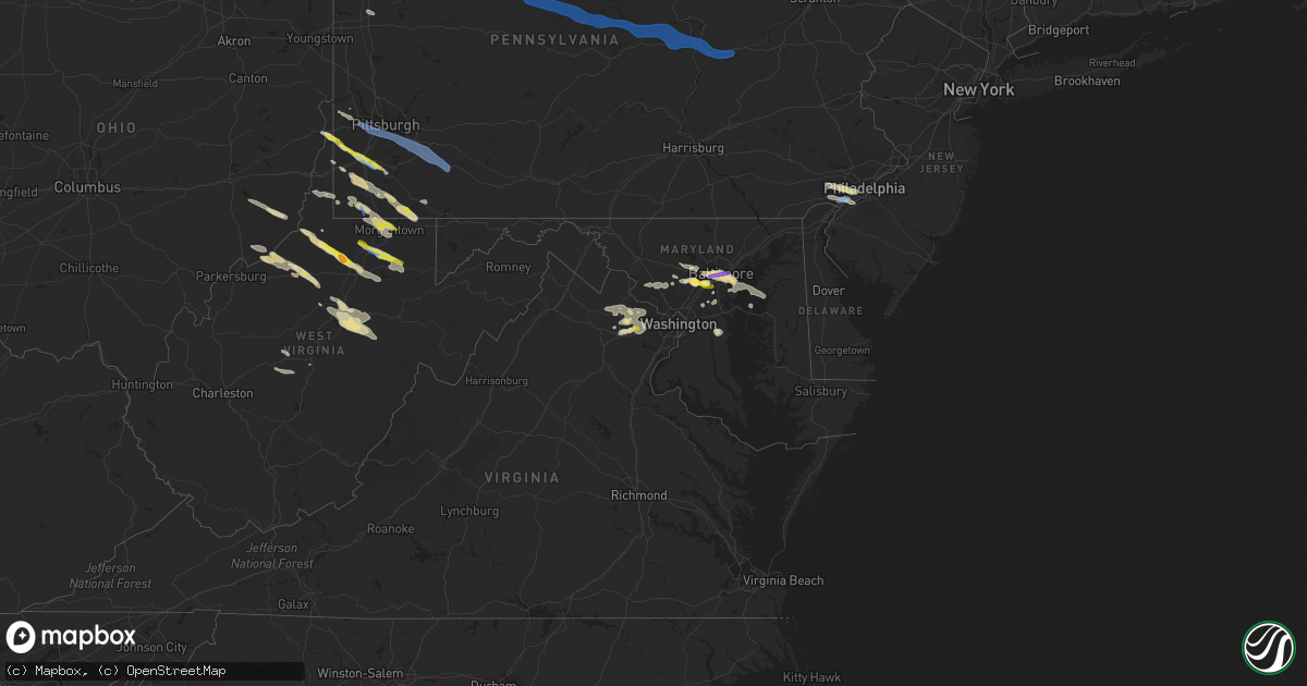
Hail Map in Maryland on June 14, 2021
Get this storm
June 14 map
$229
one time, instant access
Download today. No call, no setup
Keep the $229
Bought the map and want the full workflow? Apply the entire $229 to a subscription within 7 days. None of it is wasted.
Every map, not just this one
This buys you this map. Subscription and you get every map we run, in the markets you choose from a few cities to whole states to nationwide. Plus real-time alerts the moment a storm fires.
Contact data
Name, contact info, occupancy, even credit band for addresses in the footprint. You go from where it hit to who to call.
Become the source they trust
Unlimited branding weather history reports on demand. You already have the documented answer ready for the property owner, and you are the one who showed up with it.
Property data and RoofTrace estimates
Pull up any address you have got, its value and the exact code rules for that jurisdiction, straight from One Click Code. Then RoofTrace estimates the squares, pitch, and roof value, priced the way you price.
Storm reports in Maryland
Maryland
| Date | Description |
|---|---|
| 06/14/20216:51 AM CDT | At 1150 PM EDT, severe thunderstorms were located along a line extending from near Hazlettville to near Sandtown to near Ridgely, moving east at 30 mph. HAZARD...70 mph wind gusts and quarter size hail. SOURCE...Radar indicated. IMPACT...Minor damage to vehicles is possible. Expect considerable tree damage. Wind damage is also likely to mobile homes, roofs, and outbuildings. Locations impacted include... Dover, Georgetown, Milford, Denton, Harrington, Camden, Bridgeville, Greensboro, Ridgely, Cheswold, Ellendale, Bowers, Goldsboro, Woodside, Viola, Hartly, Rising Sun-Lebanon, Hazlettville, Dover Base Housing and Dover Speedway. |
| 06/14/20216:42 AM CDT | At 1142 PM EDT, severe thunderstorms were located along a line extending from near Rosenhayn to Newport Meadows to Green Spring, moving east at 20 mph. HAZARD...60 mph wind gusts and quarter size hail. SOURCE...Radar indicated. IMPACT...Minor damage to vehicles is possible. Wind damage to roofs, siding, trees, and power lines is possible. Locations impacted include... Vineland, Millville, Bridgeton, Middletown, Cumberland, Pleasantville, Smyrna, Absecon, Buena, Laurel Lake, Clayton, Weymouth, Estell Manor, Newfield, Greenwich, Shiloh, Newport, Woodland Beach, Hancocks Bridge and Dorothy.This includes the following highways... Garden State Parkway between mile markers 37 and 38. Atlantic City Expressway between mile markers 7 and 13. |
| 06/14/20216:23 AM CDT | At 1123 PM EDT, a severe thunderstorm was located near Rhode River, moving east at 30 mph. HAZARD...60 mph wind gusts and quarter size hail. SOURCE...Radar indicated. IMPACT...Damaging winds will cause some trees and large branches to fall. This could injure those outdoors, as well as damage homes and vehicles. Roadways may become blocked by downed trees. Localized power outages are possible. Unsecured light objects may become projectiles. Locations impacted include... Mayo, Shady Side, Deale, Rhode River, South River, Londontowne, Edgewater, Riva, Galesville, Highland Beach, Harwood, Hillsmere Shores, West River, Tracys Landing, Lothian, Davidsonville and Bay Ridge. |
| 06/14/20215:23 AM CDT | At 1023 PM EDT, a severe thunderstorm was located over Millers Island, moving east at 20 mph. HAZARD...Ping pong ball size hail and 60 mph wind gusts. SOURCE...Radar indicated. IMPACT...People and animals outdoors will be injured. Expect hail damage to roofs, siding, windows, and vehicles. Wind damage to roofs, siding, trees, and power lines is possible. Locations impacted include... Chestertown, Rock Hall, Newtown, Overton, Morgnec, Old Town, Kennedyville, Langford and Kingstown. |
| 06/14/20215:16 AM CDT | At 1016 PM EDT, a severe thunderstorm was located over Pumphrey, or over Baltimore-Washington Airport, moving east at 35 mph. HAZARD...60 mph wind gusts and quarter size hail. SOURCE...Radar indicated. IMPACT...Damaging winds will cause some trees and large branches to fall. This could injure those outdoors, as well as damage homes and vehicles. Roadways may become blocked by downed trees. Localized power outages are possible. Unsecured light objects may become projectiles. Locations impacted include... Baltimore, Severn, Riviera Beach, Baltimore-Washington Airport, North Point State Park, Sparrows Point, Fort Smallwood State Park, Pinehurst, Gibson Island, Sillery Bay, Bodkin Point, Millers Island, Dobbins Island, Glen Burnie, Dundalk, Severna Park, Pasadena, Arbutus, Lake Shore and Ferndale. |
| 06/14/20215:12 AM CDT | At 1012 PM EDT, a severe thunderstorm was located over Back River, moving east at 25 mph. HAZARD...60 mph wind gusts and half dollar size hail. SOURCE...Radar indicated. IMPACT...Damaging winds will cause some trees and large branches to fall. This could injure those outdoors, as well as damage homes and vehicles. Roadways may become blocked by downed trees. Localized power outages are possible. Unsecured light objects may become projectiles. Locations impacted include... Middle River, Riviera Beach, Fort Smallwood State Park, North Point State Park, Sparrows Point, Back River, Millers Island, Dundalk, Essex, Bowleys Quarters, Edgemere, Fort Howard and Martin State Airport. |
| 06/14/20214:56 AM CDT | At 956 PM EDT, a severe thunderstorm was located over Historic Ellicott City, moving east at 35 mph. HAZARD...60 mph wind gusts and quarter size hail. SOURCE...Radar indicated. IMPACT...Damaging winds will cause some trees and large branches to fall. This could injure those outdoors, as well as damage homes and vehicles. Roadways may become blocked by downed trees. Localized power outages are possible. Unsecured light objects may become projectiles. Locations impacted include... Baltimore, Columbia, Severn, Elkridge, Baltimore-Washington Airport, Historic Ellicott City, Glen Burnie, Ellicott City, Catonsville, Woodlawn, Arbutus, Ferndale, Brooklyn Park, Fort Meade, Savage-guilford, South Gate, Pumphrey, Scaggsville, Ilchester and Linthicum. |
| 06/14/20214:55 AM CDT | At 955 PM EDT, a severe thunderstorm was located over Broadlands, moving east at 25 mph. HAZARD...60 mph wind gusts and quarter size hail. SOURCE...Radar indicated. IMPACT...Damaging winds will cause some trees and large branches to fall. This could injure those outdoors, as well as damage homes and vehicles. Roadways may become blocked by downed trees. Localized power outages are possible. Unsecured light objects may become projectiles. Locations impacted include... Rockville, Reston, South Riding, Herndon, Vienna, Broadlands, Lansdowne, Lowes Island, Brambleton, Pimmit Hills, Dulles International Airport, Potomac, Ashburn, Oakton, Sterling, North Potomac, Tysons Corner, Wolf Trap, Great Falls and Merrifield. |
| 06/14/20214:29 AM CDT | At 929 PM EDT, severe thunderstorms were located along a line extending from Towson to near Baltimore to Catonsville, moving east at 45 mph. HAZARD...60 mph wind gusts and quarter size hail. SOURCE...Radar indicated. IMPACT...Damaging winds will cause some trees and large branches to fall. This could injure those outdoors, as well as damage homes and vehicles. Roadways may become blocked by downed trees. Localized power outages are possible. Unsecured light objects may become projectiles. Locations impacted include... Baltimore, Middle River, Riviera Beach, North Point State Park, Sparrows Point, Fort Smallwood State Park, Back River, Millers Island, Glen Burnie, Dundalk, Towson, Essex, Parkville, Carney, Perry Hall, Pasadena, Rosedale, Ferndale, Rossville and Brooklyn Park. |
| 06/14/20214:22 AM CDT | At 922 PM EDT, a severe thunderstorm was located over Boyds, or near Germantown, moving east at 30 mph. HAZARD...60 mph wind gusts and quarter size hail. SOURCE...Radar indicated. IMPACT...Damaging winds will cause some trees and large branches to fall. This could injure those outdoors, as well as damage homes and vehicles. Roadways may become blocked by downed trees. Localized power outages are possible. Unsecured light objects may become projectiles. Locations impacted include... Germantown, Rockville, Gaithersburg, Olney, Damascus, Poolesville, Aspen Hill, Montgomery Village, North Potomac, Redland, Colesville, Boyds, Rossmoor, Wheaton-Glenmont, Cloverly, Clarksburg, Glenmont, Burtonsville, Darnestown and Derwood. |
| 06/14/20214:02 AM CDT | At 902 PM EDT, a severe thunderstorm was located over Sykesville, or 12 miles northeast of Damascus, moving east at 25 mph. HAZARD...60 mph wind gusts and quarter size hail. SOURCE...Radar indicated. IMPACT...Damaging winds will cause some trees and large branches to fall. This could injure those outdoors, as well as damage homes and vehicles. Roadways may become blocked by downed trees. Localized power outages are possible. Unsecured light objects may become projectiles. Locations impacted include... Baltimore, Pikesville, Cockeysville, Historic Ellicott City, Ellicott City, Towson, Catonsville, Woodlawn, Randallstown, Owings Mills, Eldersburg, Milford Mill, Reisterstown, Lochearn, Arbutus, Mays Chapel, Timonium, Sykesville, Oakland and Gamber. |
| 06/14/20212:27 AM CDT | At 727 PM EDT, a severe thunderstorm was located 8 miles northwest of Thomas, moving southeast at 45 mph. HAZARD...Wind gusts to 60 mph. SOURCE...Radar. IMPACT...Expect damage to trees and power lines, resulting in some power outages. Locations impacted include... Parsons... Terra Alta... Davis... Thomas... Rowlesburg... Hendricks... Hambleton... Hannahsville... Elk... Canaan Valley State Park... Pheasant Run... Aurora... |
| 06/14/20211:51 AM CDT | At 651 PM EDT, severe thunderstorms were located along a line extending from Brookhaven to near Winfield, moving southeast at 45 mph. HAZARD...Wind gusts to 60 mph and quarter-size hail. SOURCE...Emergency management. IMPACT...Minor hail damage to vehicles is possible. Expect wind damage to trees and power lines, resulting in some power outages. Locations impacted include... Morgantown... Fairmont... Kingwood... Terra Alta... Rowlesburg... Pleasant Valley... Winfield... Monongah... Newburg... Brookhaven... Reedsville... Masontown...This includes the following highways... Interstate 68 in West Virginia between mile markers 1 and 7, and between mile markers 11 and 15. Interstate 79 in West Virginia between mile markers 132 and 150. |
| 06/14/202112:41 AM CDT | At 541 PM EDT, a severe thunderstorm was located 9 miles southwest of Farmington, or 10 miles south of Uniontown, moving southeast at 35 mph. HAZARD...Wind gusts to 60 mph and quarter-size hail. SOURCE...Radar. IMPACT...Minor hail damage to vehicles is possible. Expect wind damage to trees and power lines, resulting in some power outages. Locations impacted include... Kingwood... Terra Alta... Albright... Brandonville... Bruceton Mills... Valley Point... Laurel Run... Hazelton... Cranesville... Clifton Mills...This includes Interstate 68 in West Virginia between mile markers 15and 31. |
| 06/13/202111:04 PM CDT | Several reports of power lines down and numerous outages in portions of the easton area. Time estimated from radar. |
| 06/13/202111:02 PM CDT | Downed wires near maiden point court. Time estimated from radar. |
| 06/13/202110:13 PM CDT | Downed tree limbs on state highway 289 near johnsontown road. Time estimated from radar. |
| 06/13/202110:13 PM CDT | Several reports of power lines down and widespread power outages in the worton area. Time estimated from radar. |
| 06/13/20219:49 PM CDT | Downed limbs on state highway 20 at rock hall avenue. Time estimated from radar. |
| 06/13/20219:40 PM CDT | Tree blocking down the west/southbound side of lockridge drive. |
| 06/13/20219:18 PM CDT | A couple of trees down in the edgemere/north point state park area. |
| 06/13/20219:16 PM CDT | Multiple branches snapped off trees near the intersection of ruth ave and lodge farm road. |
| 06/13/20219:15 PM CDT | A local report indicates 1.00 inch wind near 2 ESE ROSEDALE |
| 06/13/20219:08 PM CDT | A local report indicates 1.00 inch wind near ELKRIDGE |
| 06/13/20219:06 PM CDT | Baltimore key bridge |
| 06/13/20219:05 PM CDT | Tree down onto structure near lincoln avenue and shady grove circle. |
| 06/13/20219:05 PM CDT | Tree down onto structure near lincoln avenue and shady grove circle. |
| 06/13/20219:03 PM CDT | A local report indicates 1.75 inch wind near 3 ENE COLUMBIA |
| 06/13/20218:55 PM CDT | A local report indicates 1.00 inch wind near 1 SSE BALTIMORE |
| 06/13/20218:43 PM CDT | Tree down on kessler road. |
| 06/13/20218:43 PM CDT | A local report indicates 1.00 inch wind near 2 N ARBUTUS |
| 06/13/20218:41 PM CDT | A local report indicates 1.00 inch wind near 2 ENE CATONSVILLE |
| 06/13/20218:38 PM CDT | Two trees down near joh ave and coolidge ave. |
| 06/13/20218:38 PM CDT | Trees down near residence on south beechfield avenue near ridge drive. |
All States Impacted by Hail Map on June 14, 2021
Cities Impacted by Hail Map on June 14, 2021
- Hamlin, TX
- McCaulley, TX
- Roscoe, TX
- Sylvester, TX
- Sweetwater, TX
- Rotan, TX
- Roby, TX
- Aladdin, WY
- Verbena, AL
- Prattville, AL
- Marbury, AL
- Raleigh, MS
- Moccasin, MT
- Montgomery, AL
- Crowley, TX
- Fort Worth, TX
- Dundalk, MD
- Curtis Bay, MD
- Sparrows Point, MD
- Catonsville, MD
- Baltimore, MD
- Brooklyn, MD
- Gwynn Oak, MD
- Halethorpe, MD
- Sheffield, TX
- Iraan, TX
- Fort Deposit, AL
- Franklin, GA
- Evant, TX
- Star, TX
- Goldthwaite, TX
- Port Lavaca, TX
- Custer, SD
- Wallis, TX
- Sealy, TX
- Roy, MT
- Saint Matthews, SC
- Swansea, SC
- Sonora, TX
- Waynesburg, PA
- Graysville, PA
- Claysville, PA
- West Finley, PA
- Prosperity, PA
- Nineveh, PA
- Sycamore, PA
- Amity, PA
- Mather, PA
- McClellandtown, PA
- Nemacolin, PA
- Ronco, PA
- Carmichaels, PA
- Greensboro, PA
- Clarksville, PA
- Jefferson, PA
- Masontown, PA
- Delanson, NY
- Esperance, NY
- Schoharie, NY
- Lewisville, OH
- Woodsfield, OH
- Horner, WV
- Rock Cave, WV
- Buckhannon, WV
- Adrian, WV
- Walkersville, WV
- Crawford, WV
- French Creek, WV
- Weston, WV
- San Saba, TX
- Lometa, TX
- Lancaster, SC
- Winnsboro, SC
- Great Falls, SC
- Blackstock, SC
- Richburg, SC
- Fort Lawn, SC
- Oral, SD
- Lowndesboro, AL
- Madison, NC
- Walnut Cove, NC
- Victoria, TX
- Bombay, NY
- Moira, NY
- Spraggs, PA
- Mount Morris, PA
- Union Grove, NC
- Harmony, NC
- Juliette, GA
- Forsyth, GA
- Miles, TX
- San Angelo, TX
- Chantilly, VA
- Aldie, VA
- Weston, OR
- Dayton, WA
- Pomeroy, WA
- Waitsburg, WA
- Walla Walla, WA
- Milton Freewater, OR
- Colliers, WV
- Follansbee, WV
- Columbia, MD
- Ellicott City, MD
- Newcastle, WY
- Christoval, TX
- Vancourt, TX
- Weimar, TX
- Hallettsville, TX
- Godley, TX
- Columbia, AL
- Abbeville, AL
- Avella, PA
- Washington, PA
- Lothian, MD
- Harwood, MD
- Saint John, WA
- Endicott, WA
- Brasher Falls, NY
- Roanoke, AL
- Wedowee, AL
- Woodland, AL
- Fort Stockton, TX
- Folsom, WV
- Lumberport, WV
- Jacksonburg, WV
- Wallace, WV
- Smithfield, WV
- Hamilton, TX
- Hico, TX
- Holbrook, PA
- Clarksburg, WV
- Reader, WV
- Pine Grove, WV
- Rushville, NE
- Hay Springs, NE
- Winnett, MT
- Sand Springs, MT
- Roundup, MT
- Mosby, MT
- Ingomar, MT
- Pelzer, SC
- Williamston, SC
- Meridian, TX
- Morgan, TX
- Pine Ridge, SD
- Oelrichs, SD
- Rapid City, SD
- Gainesville, VA
- Catharpin, VA
- Manassas, VA
- Centreville, VA
- Haymarket, VA
- Westford, NY
- Worcester, NY
- Cherry Valley, NY
- Schenevus, NY
- Richfield Springs, NY
- Springfield Center, NY
- Jordanville, NY
- Van Hornesville, NY
- Colton, WA
- Steubenville, OH
- Weirton, WV
- Burgettstown, PA
- Hot Springs, SD
- Cokeburg, PA
- Eighty Four, PA
- Scenery Hill, PA
- Medina, TX
- West Union, WV
- Pennsboro, WV
- Hill City, SD
- Dawsonville, GA
- Smithwick, SD
- Richland Springs, TX
- Headland, AL
- Joshua, TX
- Junction City, GA
- Butler, GA
- Mullin, TX
- Rochelle, TX
- Brookeville, MD
- Glenwood, MD
- Woodbine, MD
- Crawfordville, GA
- Union Point, GA
- Ozona, TX
- Dryden, TX
- Blacksburg, SC
- Kings Mountain, NC
- Cleburne, TX
- Farmington, WV
- Fairmont, WV
- Grafton, WV
- Independence, WV
- Tallmansville, WV
- Preston, GA
- Chadron, NE
- Comstock, TX
- Mohawk, NY
- Maryneal, TX
- Saint Marys, WV
- Newport, OH
- Iredell, TX
- Magee, MS
- Mendenhall, MS
- Baldwin, GA
- Cornelia, GA
- Mount Airy, GA
- Rockwood, TX
- Buffalo Gap, SD
- Barksdale, TX
- Ashburn, VA
- Hookstown, PA
- Clinton, PA
- Rio Vista, TX
- Alvarado, TX
- Grandview, TX
- Covington, TX
- Brandon, MS
- Pelahatchie, MS
- Dale, TX
- Lockhart, TX
- Red Rock, TX
- Morgantown, WV
- Maidsville, WV
- Osage, WV
- Granville, WV
- Pursglove, WV
- Montgomery Village, MD
- Boyds, MD
- Germantown, MD
- Gaithersburg, MD
- Dickerson, MD
- Camden, WV
- Bryan, TX
- Duck, WV
- Rosedale, WV
- Chloe, WV
- Thomaston, AL
- Catherine, AL
- Ernul, NC
- Media, PA
- Glenolden, PA
- Folcroft, PA
- West Chester, PA
- Glen Mills, PA
- Springfield, PA
- Holmes, PA
- Morton, PA
- Drexel Hill, PA
- Malvern, PA
- Clifton Heights, PA
- Broomall, PA
- Lansdowne, PA
- Sharon Hill, PA
- Havertown, PA
- Newtown Square, PA
- Philadelphia, PA
- Darby, PA
- Central, SC
- Loganville, GA
- Conyers, GA
- Oxford, GA
- Elgin, OR
- Autaugaville, AL
- Rock Hall, MD
- Decatur, GA
- Sterling, VA
- Lead, SD
- Sturgis, SD
- Whitewood, SD
- Deadwood, SD
- Spearfish, SD
- Social Circle, GA
- Mansfield, GA
- Bethany, WV
- Valley Grove, WV
- West Alexander, PA
- Laurel, MD
- Bowie, MD
- Selma, AL
- Covington, GA
- Elkridge, MD
- Wind Ridge, PA
- Vineland, NJ
- Bandera, TX
- Homer, GA
- Odenville, AL
- Woodstock, MD
- Marriottsville, MD
- Garwood, TX
- Cameron, WV
- Dallas, WV
- Moundsville, WV
- Lagrange, GA
- Cooperstown, NY
- East Springfield, NY
- Kingston, ID
- Roseboom, NY
- Jane Lew, WV
- Shorter, AL
- Marietta, OH
- New Matamoras, OH
- Reno, OH
- Whipple, OH
- Morton, MS
- Center Point, TX
- Cranfills Gap, TX
- Bruceton Mills, WV
- Farmington, PA
- Gibbon Glade, PA
- Lake Lynn, PA
- Smithfield, PA
- Easley, SC
- Liberty, SC
- Leakey, TX
- Rio Frio, TX
- Stoneboro, PA
- Mercer, PA
- Jackson Center, PA
- Kellogg, ID
- Ellsworth, NE
- Tallassee, AL
- Eclectic, AL
- Sylacauga, AL
- Friendly, WV
- Mocksville, NC
- Clarksville, MD
- Glen Easton, WV
- Millersville, MD
- Odenton, MD
- Gambrills, MD
- Meadville, MS
- Kerrville, TX
- Gilbertown, AL
- Colfax, WA
- Thornton, WA
- Middlebourne, WV
- New Milton, WV
- Dayton, MD
- Commerce, GA
- Carnesville, GA
- Brushton, NY
- Severn, MD
- Del Rio, TX
- Wadley, AL
- Daviston, AL
- Ellenboro, WV
- Bastrop, TX
- Arlington, TX
- Bingham, NE
- Jonesboro, TX
- Uniontown, AL
- Faunsdale, AL
- Sunset, SC
- Graham, AL
- Bowdon, GA
- Roopville, GA
- Billingsley, AL
- Conover, NC
- Stedman, NC
- Wade, NC
- Goliad, TX
- Adger, AL
- Gainesville, GA
- Howes Cave, NY
- Marianna, PA
- Gouldbusk, TX
- Littleton, WV
- Jacksons Gap, AL
- Bluffton, GA
- Cuba, AL
- Ilion, NY
- Fort Plain, NY
- West Winfield, NY
- Crum Lynne, PA
- Woodlyn, PA
- Chester, PA
- Brookhaven, PA
- Gibbstown, NJ
- Barrackville, WV
- Minter, AL
- Ohiopyle, PA
- Chalk Hill, PA
- Comfort, TX
- Imperial, PA
- Forest City, NC
- Mooresboro, NC
- Rutherfordton, NC
- Gillette, WY
- Hayneville, AL
- Cayce, SC
- West Columbia, SC
- Columbia, SC
- Hopkins, SC
- Gaston, SC
- Richland, NJ
- Buena, NJ
- Sutton, WV
- Central Bridge, NY
- Rock Hill, SC
- Hanover, MD
- Lincolnton, GA
- Cobleskill, NY
- Robert Lee, TX
- Clarkesville, GA
- Long Creek, SC
- McCall Creek, MS
- Saint Regis Falls, NY
- Trent, TX
- Lohn, TX
- Glen Burnie, MD
- Pasadena, MD
- Chestertown, MD
- Fort Howard, MD
- Musella, GA
- Macon, GA
- Wallowa, OR
- Stevensville, MD
- Blacksville, WV
- Fairview, WV
- Rogersville, PA
- Dilliner, PA
- Edgemoor, SC
- Catawba, SC
- Aliquippa, PA
- Cooksville, MD
- Sykesville, MD
- Newton, NC
- Claremont, NC
- Brevard, NC
- Rosman, NC
- Gillsville, GA
- Trenton, SC
- Aiken, SC
- Toxey, AL
- Elk, WA
- Newborn, GA
- Blum, TX
- Newhebron, MS
- Sikes, LA
- Osage, WY
- Temple, TX
- New Martinsville, WV
- Shinnston, WV
- Bridgeport, WV
- Meadowbrook, WV
- Porters Falls, WV
- Spelter, WV
- Flemington, WV
- Hepzibah, WV
- Philippi, WV
- Yadkinville, NC
- Booth, AL
- Wesson, MS
- Newville, AL
- Shorterville, AL
- Clarkston, WA
- Granbury, TX
- Salem, SC
- Tamassee, SC
- Walhalla, SC
- Clanton, AL
- Windsor Mill, MD
- Six Mile, SC
- Richmondville, NY
- Lamont, WA
- Hampton, GA
- Locust Grove, GA
- Glenelg, MD
- Eagle Lake, TX
- Cheney, WA
- Tunnelton, WV
- Newburg, WV
- Thornton, WV
- Goodwater, AL
- Toccoa, GA
- Palacios, TX
- Helvetia, WV
- Purcellville, VA
- Leesburg, VA
- Herndon, VA
- Clifton, VA
- Middleburg, VA
- Fairfax, VA
- Doole, TX
- Nordman, ID
- Grass Range, MT
- Atlanta, GA
- Fairburn, GA
- Ward, AL
- Summerfield, OH
- Senecaville, OH
- Columbus, TX
- Robstown, TX
- Chattaroy, WA
- Bronte, TX
- Fulshear, TX
- Coal Center, PA
- Bentleyville, PA
- Daisytown, PA
- Ellsworth, PA
- Hickory, PA
- Crystal Springs, MS
- Harrisville, MS
- Florence, MS
- Sloansville, NY
- Davenport, WA
- Newport, WA
- Thornton, PA
- Swedesboro, NJ
- Essington, PA
- Chester Heights, PA
- Wallingford, PA
- Ridley Park, PA
- Garnet Valley, PA
- Aston, PA
- Alum Bridge, WV
- Ivydale, WV
- Clay, WV
- Wallback, WV
- Hulett, WY
- Arvada, WY
- Recluse, WY
- Ormond Beach, FL
- Bunnell, FL
- Palm Coast, FL
- Flagler Beach, FL
- Linthicum Heights, MD
- Austwell, TX
- Tivoli, TX
- Seadrift, TX
- Canajoharie, NY
- Saint Marys, PA
- Northumberland, PA
- Driftwood, PA
- Allenwood, PA
- Bloomsburg, PA
- Kersey, PA
- New Columbia, PA
- Weedville, PA
- Mifflinburg, PA
- Williamsport, PA
- Riverside, PA
- Jersey Shore, PA
- Mill Hall, PA
- Benezett, PA
- Beech Creek, PA
- Loganton, PA
- Lock Haven, PA
- White Deer, PA
- Pottersdale, PA
- Watsontown, PA
- McEwensville, PA
- Danville, PA
- Sinnamahoning, PA
- Linden, PA
- Karthaus, PA
- Westport, PA
- Lewisburg, PA
- Renovo, PA
- Milton, PA
- Avis, PA
- Mount Pleasant, PA
- Buena Vista, PA
- Madison, PA
- Glassport, PA
- McDonald, PA
- Acme, PA
- Jones Mills, PA
- Coraopolis, PA
- Adamsburg, PA
- Elizabeth, PA
- Dravosburg, PA
- Stahlstown, PA
- Carnegie, PA
- West Newton, PA
- Yukon, PA
- West Mifflin, PA
- Arona, PA
- Irwin, PA
- Greenock, PA
- New Stanton, PA
- Bridgeville, PA
- Youngwood, PA
- Champion, PA
- Tarrs, PA
- Donegal, PA
- Bethel Park, PA
- Darragh, PA
- Oakdale, PA
- Rillton, PA
- Jeannette, PA
- Pittsburgh, PA
- Clairton, PA
- Presto, PA
- Herminie, PA
- Ruffs Dale, PA
- Hunker, PA
- Mckeesport, PA
- Greensburg, PA
- Swarthmore, PA
- Marcus Hook, PA
- Folsom, PA


