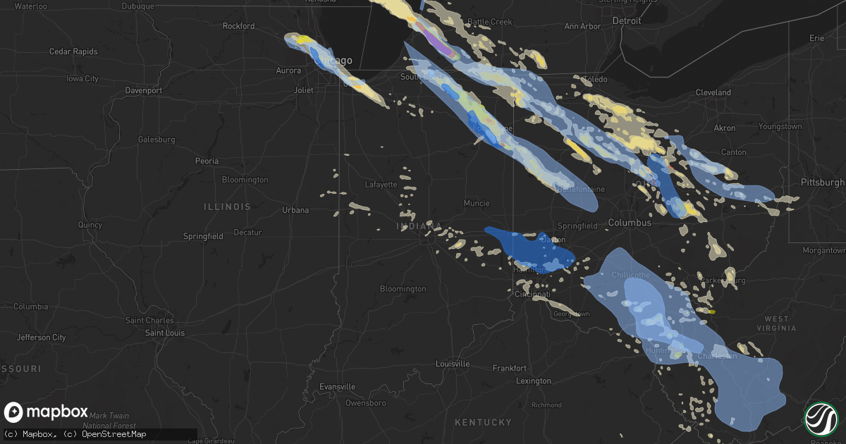
Hail Map in Indiana on June 13, 2022
Get this storm
June 13 map
$229
one time, instant access
Download today. No call, no setup
Keep the $229
Bought the map and want the full workflow? Apply the entire $229 to a subscription within 7 days. None of it is wasted.
Every map, not just this one
This buys you this map. Subscription and you get every map we run, in the markets you choose from a few cities to whole states to nationwide. Plus real-time alerts the moment a storm fires.
Contact data
Name, contact info, occupancy, even credit band for addresses in the footprint. You go from where it hit to who to call.
Become the source they trust
Unlimited branding weather history reports on demand. You already have the documented answer ready for the property owner, and you are the one who showed up with it.
Property data and RoofTrace estimates
Pull up any address you have got, its value and the exact code rules for that jurisdiction, straight from One Click Code. Then RoofTrace estimates the squares, pitch, and roof value, priced the way you price.
Storm reports in Indiana
Indiana
| Date | Description |
|---|---|
| 06/13/20224:40 PM CDT | Trees down. |
| 06/13/20224:36 PM CDT | Large tree downed at hillcrest golf club in batesville. Took down power lines as well. Time estimated from radar. |
| 06/13/20224:31 PM CDT | Trees and power lines down. Time estimated from radar. |
| 06/13/20224:27 PM CDT | Power pole down. Time estimated from radar. |
| 06/13/20224:26 PM CDT | Large limb down. Power lines down. Time estimated from radar. |
| 06/13/20224:12 PM CDT | A local report indicates 58 MPH wind near KRID RICHMOND APT |
| 06/13/20224:08 PM CDT | Trees and ppwer lines down. Time is estimated from radar. |
| 06/13/20224:00 PM CDT | Trees and power lines downed. |
| 06/13/20223:48 PM CDT | Tree down across the roadway at 2592 e 1100 n in roanoke. Time estimated from radar. |
| 06/13/20223:10 PM CDT | Time estimated from radar. Relayed via social media. |
| 06/13/20222:57 PM CDT | Several tree limbs of unknown size downed in russiaville. Time estimated from radar. |
| 06/13/20222:33 PM CDT | Along sr29 north of michigantown. Time estimated from radar. |
| 06/13/20224:54 AM CDT | At 953 PM EDT/853 PM CDT/, a severe thunderstorm was located near Culver, or 8 miles southeast of Knox, moving southeast at 50 mph. HAZARD...60 mph wind gusts. SOURCE...Radar indicated. IMPACT...Expect damage to roofs, siding, and trees. Locations impacted include... Rochester, Culver, Akron, Walnut, Oak Grove, Fulton, Monterey, Macy, Leiters Ford, Ober, Nyena Lake, Hibbard, Winona, Delong, Tiosa, Lake Manitou, Talma, Rutland, Burr Oak and Maxinkuckee. |
| 06/13/20224:50 AM CDT | At 949 PM EDT, severe thunderstorms were located along a line extending from near Albion to 8 miles northwest of Tri-lakes to near North Webster, moving southeast at 55 mph. THESE ARE DESTRUCTIVE STORMS! HAZARD...80 mph wind gusts. SOURCE...Radar indicated. IMPACT...Flying debris will be dangerous to those caught without shelter. Mobile homes will be heavily damaged. Expect considerable damage to roofs, windows, and vehicles. Extensive tree damage and power outages are likely. Locations impacted include... Fort Wayne, New Haven, Columbia City, Tri-lakes, Huntertown, Albion, Churubusco, Woodburn, North Webster, Pierceton, Aboite, Leo-cedarville, Swan, Roanoke, Etna, Zanesville, Cromwell, Larwill, Yoder and Blue Lake.This includes the following highways... Interstate 469 between mile markers 0 and 30. Interstate 69 in Indiana between mile markers 294 and 321. |
| 06/13/20224:46 AM CDT | Report from mping: 3-inch tree limbs broken; power poles broken. |
| 06/13/20224:25 AM CDT | At 925 PM EDT, severe thunderstorms were located along a line extending from Goshen to near Wakarusa, moving southeast at 50 mph. HAZARD...70 mph wind gusts and penny size hail. SOURCE...Radar indicated. IMPACT...Expect considerable tree damage. Damage is likely to mobile homes, roofs, and outbuildings. Locations impacted include... Goshen, Nappanee, Ligonier, Syracuse, Albion, Wakarusa, Milford, North Webster, Millersburg, New Paris, Benton, Cromwell, Big Barbee Lake, Ridinger Lake, Irish Lake, Foraker, Lake Wawasee, Gravelton, Waterford Mills and Bear Lake. |
| 06/13/20224:18 AM CDT | At 917 PM EDT/817 PM CDT/, a severe thunderstorm was located over Wanatah, or near Malden, moving southeast at 50 mph. HAZARD...70 mph wind gusts and quarter size hail. SOURCE...Radar indicated. IMPACT...Hail damage to vehicles is expected. Expect considerable tree damage. Wind damage is also likely to mobile homes, roofs, and outbuildings. Locations impacted include... Knox, North Judson, Wanatah, La Crosse, Oak Grove, Hanna, Thomaston, Lomax, Ober, English Lake, South Wanatah, Denham, Brems, Toto, Winona, Bass Lake and Haskell. |
| 06/13/20223:10 AM CDT | At 809 PM CDT, a severe thunderstorm was located near Valparaiso, moving southeast at 40 mph. HAZARD...70 mph wind gusts and quarter size hail. SOURCE...Radar indicated. IMPACT...Hail damage to vehicles is expected. Expect considerable tree damage. Wind damage is also likely to mobile homes, roofs, and outbuildings. Locations impacted include... Valparaiso, Kouts, Malden, Dunns Bridge and Boone Grove. This includes... Porter County Fairgrounds. |
| 06/13/202212:44 AM CDT | At 544 PM EDT, a severe thunderstorm was located over Monfort Heights, moving southeast at 40 mph. HAZARD...70 mph wind gusts. SOURCE...Radar indicated. IMPACT...Expect considerable tree damage. Damage is likely to mobile homes, roofs, and outbuildings. Locations impacted include... Covington, Florence, Independence, Erlanger, Edgewood, Alexandria, Elsmere, Fort Mitchell, Villa Hills, Taylor Mill, Fort Wright, Crescent Springs, Walton, Crestview Hills, Lakeside Park, Rising Sun, Oakbrook, Burlington, Claryville and Union.This includes the following Interstates... I-71 in Kentucky between mile markers 63 and 77. I-75 in Kentucky between mile markers 160 and 186. |
| 06/13/202212:08 AM CDT | At 508 PM EDT, a severe thunderstorm was located near Liberty, moving east at 20 mph. HAZARD...60 mph wind gusts and penny size hail. SOURCE...Radar indicated. IMPACT...Expect damage to trees and power lines. Locations impacted include... Hamilton, Fairfield, Oxford, Eaton, Ross, Camden, West Alexandria, Gratis, Seven Mile, Darrtown, Dunlap, Reily, Millville, Scipio, College Corner, Somerville, West Elkton, Jacksonburg, Collinsville and Morning Sun. |
| 06/13/202212:04 AM CDT | At 503 PM EDT, a severe thunderstorm was located near Monon, or 7 miles north of Monticello, moving east at 30 mph. HAZARD...60 mph wind gusts and penny size hail. SOURCE...Radar indicated. IMPACT...Expect damage to roofs, siding, and trees. Locations impacted include... Monticello, Burnettsville, Indiana Beach, Norway, Idaville, Sitka, Headlee, Bell Center and Buffalo. |
| 06/13/202212:03 AM CDT | At 501 PM EDT, a severe thunderstorm was located near Centerville, moving east at 35 mph. HAZARD...60 mph wind gusts and penny size hail. SOURCE...Radar indicated. IMPACT...Expect damage to trees and power lines. Locations impacted include... Richmond, Greenville, Eaton, Arcanum, Lewisburg, New Paris, West Alexandria, New Madison, Fountain City, Wayne Lakes, Eldorado, Verona, West Manchester, Pitsburg, Spring Grove, Bethel, Hollansburg, Gordon, Palestine and Boston.This includes the following Interstates... I-70 in Indiana between mile markers 149 and 156. I-70 in Ohio between mile markers 0 and 17. |
| 06/13/202212:02 AM CDT | At 502 PM EDT, severe thunderstorms were located along a line extending from near Glenwood to 8 miles northwest of Rushville, moving southeast at 30 mph. HAZARD...60 mph wind gusts and nickel size hail. SOURCE...Radar indicated. IMPACT...Expect damage to roofs, siding, and trees. Severe thunderstorms will be near... Glenwood around 510 PM EDT.Other locations in the path of these severe thunderstorms includeMoscow, Milroy, New Salem, Sandusky, Clarksburg, Lake Santee andNewpoint.This includes Interstate 74 between mile markers 125 and 144. |
| 06/12/202211:37 PM CDT | At 437 PM EDT, a severe thunderstorm was located over Greenfield, or 17 miles north of Shelbyville, moving southeast at 35 mph. HAZARD...60 mph wind gusts and quarter size hail. SOURCE...Radar indicated. IMPACT...Hail damage to vehicles is expected. Expect wind damage to roofs, siding, and trees. This severe thunderstorm will be near... Morristown and Carthage around 450 PM EDT.Other locations in the path of this severe thunderstorm includeArlington and Rushville.This includes Interstate 70 between mile markers 103 and 111. |
| 06/12/202211:35 PM CDT | At 434 PM EDT, a severe thunderstorm was located near Huntington, moving east at 35 mph. HAZARD...60 mph wind gusts and quarter size hail. SOURCE...Radar indicated. IMPACT...Hail damage to vehicles is expected. Expect wind damage to roofs, siding, and trees. Locations impacted include... Markle, Aboite, Roanoke, Zanesville, Bowerstown, Mahon and Goblesville.This includes the following highways... Interstate 469 between mile markers 7 and 8. Interstate 69 in Indiana between mile markers 286 and 300. |
| 06/12/202210:59 PM CDT | At 359 PM EDT, a severe thunderstorm was located 9 miles southeast of Greenfield, or 10 miles northeast of Shelbyville, moving east at 25 mph. HAZARD...60 mph wind gusts and quarter size hail. SOURCE...Radar indicated. IMPACT...Hail damage to vehicles is expected. Expect wind damage to roofs, siding, and trees. This severe thunderstorm will be near... Arlington around 410 PM EDT.Other locations in the path of this severe thunderstorm includeCarthage and Knightstown.This includes Interstate 70 between mile markers 113 and 117. |
| 06/12/202210:38 PM CDT | At 337 PM EDT, a severe thunderstorm was located 13 miles west of Kokomo, moving east at 35 mph. HAZARD...60 mph wind gusts and quarter size hail. SOURCE...Radar indicated. IMPACT...Hail damage to vehicles is expected. Expect wind damage to roofs, siding, and trees. This severe thunderstorm will be near... Russiaville around 345 PM EDT.Other locations in the path of this severe thunderstorm includeKokomo and Indian Heights. |
| 06/12/202210:27 PM CDT | At 326 PM EDT, a severe thunderstorm was located near Lebanon, or 17 miles southeast of Frankfort, moving east at 20 mph. HAZARD...60 mph wind gusts and quarter size hail. SOURCE...Radar indicated. IMPACT...Hail damage to vehicles is expected. Expect wind damage to roofs, siding, and trees. Locations impacted include... Sheridan and Westfield. |
| 06/12/202210:19 PM CDT | At 318 PM EDT, a severe thunderstorm was located 9 miles northeast of Frankfort, moving east at 20 mph. HAZARD...60 mph wind gusts and quarter size hail. SOURCE...Radar indicated. IMPACT...Hail damage to vehicles is expected. Expect wind damage to roofs, siding, and trees. Locations impacted include... Russiaville. |
| 06/12/20229:56 PM CDT | At 255 PM EDT, a severe thunderstorm was located over Lebanon, or 14 miles south of Frankfort, moving east at 20 mph. HAZARD...60 mph wind gusts and quarter size hail. SOURCE...Radar indicated. IMPACT...Hail damage to vehicles is expected. Expect wind damage to roofs, siding, and trees. This severe thunderstorm will be near... Lebanon and Ulen around 305 PM EDT.Other locations in the path of this severe thunderstorm includeSheridan and Kirklin.This includes Interstate 65 between mile markers 136 and 144. |
| 06/12/20229:51 PM CDT | Multiple trees down. Also electrical fire from power pole. |
| 06/12/20229:48 PM CDT | Report from mping: quarter |
| 06/12/20229:48 PM CDT | Report from mping. |
| 06/12/20229:45 PM CDT | Large limbs down... Tree split. |
| 06/12/20229:45 PM CDT | Tree down and blocking the road along the wells/allen county line along 1200 n and highway 1. Time estimated by radar. |
| 06/12/20229:45 PM CDT | Asos station kfwa fort wayne international ap. |
| 06/12/20229:45 PM CDT | Several tree limbs estimated to be 6-12 inches in diameter snapped off tree and fell into the intersection of 500 e and 1150 n. Time estimated from radar. |
| 06/12/20229:40 PM CDT | Trained spotter reports measured 76 mph gusts near yoder in allen county indiana. |
| 06/12/20229:40 PM CDT | Healthy 2 foot diameter oak tree snapped off about 20 feet above the ground. |
| 06/12/20229:39 PM CDT | Multiple trees down on multiple houses... 2700 block of fairbrook court. |
| 06/12/20229:39 PM CDT | Asos station kfwa fort wayne international ap. |
| 06/12/20229:39 PM CDT | 2 ft diameter tree snapped in half. Healthy tree. |
| 06/12/20229:39 PM CDT | Corrects time on previous tstm wnd gst report from 2 ene nine mile. Asos station kfwa fort wayne international ap. |
| 06/12/20229:39 PM CDT | Significant structural damage to the skywest airlines building at fort wayne int. Ap. 98 mph wind gust reported at the airport. |
| 06/12/20229:35 PM CDT | Numerous trees down or uprooted... Powerlines down... And roof damage to the willows of coventry apartments complex. Time estimated from radar. |
| 06/12/20229:35 PM CDT | Multiple trees snapped and down at the park center state street campus in fort wayne. Estimated to be around 6-12 inches in diameter. Time estimated from radar. |
| 06/12/20229:35 PM CDT | Trained spotter reported estimated wind gusts around 80 mph and large trees broken in southwest fort wayne in allen county indiana. Power was also lost at the location. |
| 06/12/20229:33 PM CDT | Uprooted 36 inch diameter mature oak tree into shed. |
| 06/12/20229:30 PM CDT | Public reported that the local fire department had evacuated 10 structures |
| 06/12/20229:30 PM CDT | Mesonet station pdu05 northeast purdue agricultural ce. |
| 06/12/20229:30 PM CDT | Ema reports widespread damage throughout allen co... But especially in arcola. Multiple homes damaged and destroyed. Most roads in the area are impassable due to downed |
| 06/12/20229:29 PM CDT | Multiple trees down. Dupont and coldwater. |
| 06/12/20229:28 PM CDT | Specific location unknown... But 2 trees onto cars on 700 n from ema. |
| 06/12/20229:28 PM CDT | Multiple power poles down in road. Aboite center rd near homestead hs. |
| 06/12/20229:28 PM CDT | Amy biggs said mark as damage point... Waiting on details. |
| 06/12/20229:28 PM CDT | Unknown specific location of 2 trees onto cars on 700 n from ema. |
| 06/12/20229:26 PM CDT | A local report indicates 1.75 inch wind near 1 SW HUNTERTOWN |
| 06/12/20229:25 PM CDT | 2 foot tree onto house. Person trapped in the bella vista neighborhood. |
| 06/12/20229:25 PM CDT | Multiple trees down at covington and county line road. |
| 06/12/20229:23 PM CDT | Multiple trees down. |
| 06/12/20229:20 PM CDT | 2 large trees down in roanoke. Also several smaller tree limbs down... Including one onto sheriff deputy vehicle with minor damage. |
| 06/12/20229:20 PM CDT | Multiple trees snapped. Time estimated from radar. |
| 06/12/20229:20 PM CDT | Power lines knocked down along westbound illinois road... Near the intersection with scott road. Time estimated from radar. |
| 06/12/20229:18 PM CDT | Train blown off the tracks near bass road. Time estimated from radar. |
| 06/12/20229:15 PM CDT | Social media report of large estimated 24 inch diameter tree limb snapped off near rolling hills in allen county indiana. |
| 06/12/20229:15 PM CDT | Multiple trees uprooted. |
| 06/12/20229:12 PM CDT | Tree through house... Between us 30 and washington center... Near the allen/ whitley county line. |
| 06/12/20229:05 PM CDT | Off duty nws employee reported siding in his yard. |
| 06/12/20229:00 PM CDT | Two trees snapped outside of blue ridge estates and in the roadway |
| 06/12/20229:00 PM CDT | Multiple trees down... Some on power lines. |
| 06/12/20229:00 PM CDT | Tree onto car. Person trapped in car. Lines also down. Sr 109 and cr 400 n. |
| 06/12/20229:00 PM CDT | Tree down into house. Person trapped in house. |
| 06/12/20228:57 PM CDT | Report from mping: trees uprooted or snapped; roof blown off. |
| 06/12/20228:55 PM CDT | Enchanted hills subdivision between syracuse and cromwell... In. 18 inch diameter tree branch down across and into a mobile home. Next house to the east has a 12 inch d |
| 06/12/20228:50 PM CDT | Multiple trees down along w county road 200 n near the intersection with us-5. Time estimated from radar. |
| 06/12/20228:50 PM CDT | Public report of thunderstorm wind damage of 2 large |
| 06/12/20228:50 PM CDT | Corrects previous tstm wnd dmg report from 1 nne sechrist lake. Large tree uprooted and fell into a house near 500 n and 700 e. |
| 06/12/20228:50 PM CDT | Ema reports widespread damage in sw noble county. Multiple trees down across roads... Trees on vehicles... Trees on several houses... Trees in power lines... Small barn |
| 06/12/20228:46 PM CDT | Corrects previous tstm wnd dmg report from goshen. Report from mping: 3-inch tree limbs broken; power poles broken. |
| 06/12/20228:46 PM CDT | 1 ft diameter healthy limb down at the ligonier public library. |
| 06/12/20228:45 PM CDT | Numerous tree limbs down along sr 13 in and south of n webster. |
| 06/12/20228:45 PM CDT | Shed destroyed. |
| 06/12/20228:40 PM CDT | Tree down over road near madison elementary. |
| 06/12/20228:40 PM CDT | Wind gusts estimated to at least 60 mph. |
| 06/12/20228:40 PM CDT | 6 to 8 inch tree limb down. |
| 06/12/20228:40 PM CDT | Picture of large tree down on hatchery road on south side of lake wawasee. |
| 06/12/20228:40 PM CDT | Large tree down across t34c lane. Power lines down. |
| 06/12/20228:40 PM CDT | Large tree snapped and blocking the roadway along n 850 e. Multiple powerlines down too. Time estimated from radar. |
| 06/12/20228:38 PM CDT | Trees reported down on morrison island on east side of lake wawasee. |
| 06/12/20228:30 PM CDT | Numerous trees down... Some over roads. |
| 06/12/20228:30 PM CDT | Nws employee reported a large tree snapped 20 feet up and fell onto a house with possible damage to a vehicle in goshen in elkhart county indiana . No injuries. Pea siz |
| 06/12/20228:30 PM CDT | Multiple trees down near lake george. |
| 06/12/20228:25 PM CDT | Corrects previous tstm wnd dmg report from wanatah. Large tree downed across the road near the center of town. |
| 06/12/20228:25 PM CDT | Multiple trees snapped along redspire blvd. Estimated to be around 6-12 inches in diameter. Time estimated from radar. |
| 06/12/20228:20 PM CDT | Report from mping: 3-inch tree limbs broken; power poles broken. |
| 06/12/20228:19 PM CDT | Multiple trees downed along cr-28. Time estimated by radar. |
| 06/12/20228:16 PM CDT | Report from mping: 3-inch tree limbs broken; power poles broken. |
| 06/12/20228:15 PM CDT | Report from mping. |
| 06/12/20228:15 PM CDT | Report from mping: quarter |
| 06/12/20228:10 PM CDT | Two 30 inch diameter trees broken at base of trunk. |
| 06/12/20228:05 PM CDT | Social media report of quarter sized hail |
| 06/12/20227:56 PM CDT | A local report indicates 1.50 inch wind near 3 SW NEW CHICAGO |
| 06/12/20227:56 PM CDT | A local report indicates 1.00 inch wind near 3 NNW LAKE STATION |
| 06/12/20227:55 PM CDT | Reports of roof collapse and partial removal. |
| 06/12/20227:53 PM CDT | Report of a tree down on a house... Relayed by em official. |
| 06/12/20227:39 PM CDT | A local report indicates 72 MPH wind near 3 NE EAST CHICAGO |
| 06/12/20227:38 PM CDT | A local report indicates 59 MPH wind near GARY AIRPORT |
| 06/12/20227:25 PM CDT | Large tree downed across the road near the center of town. |
All States Impacted by Hail Map on June 13, 2022
Cities Impacted by Hail Map on June 13, 2022
- Fredonia, ND
- Kulm, ND
- Aneta, ND
- Killdeer, ND
- Rugby, ND
- Pingree, ND
- Saint Michael, ND
- Cresco, IA
- Lime Springs, IA
- Courtenay, ND
- Roseau, MN
- Goodrich, ND
- Lawler, IA
- West Concord, MN
- Custer, SD
- West Olive, MI
- Fairmont, MN
- Spring Grove, MN
- Manitowoc, WI
- New Hampton, IA
- Elma, IA
- Mauston, WI
- Lyndon Station, WI
- Cashton, WI
- Westby, WI
- Kendall, WI
- Elroy, WI
- Norwalk, WI
- Ontario, WI
- Wilton, WI
- Newcastle, WY
- Niles, MI
- Buchanan, MI
- Greenwood, IN
- Amherstdale, WV
- Rushville, IN
- Berlin, ND
- Lamoure, ND
- Augusta, ME
- Windsor, ME
- Flora, IN
- Michigantown, IN
- Frankfort, IN
- Forest, IN
- Walkerton, IN
- Findlay, OH
- Valley City, ND
- Fairfield, ND
- Denhoff, ND
- Drake, ND
- Mercer, ND
- Butte, ND
- Turtle Lake, ND
- Anamoose, ND
- Mcclusky, ND
- Martin, ND
- Washburn, ND
- Harvey, ND
- Maddock, ND
- Fingal, ND
- Marion, ND
- Sanborn, ND
- Rogers, ND
- Dickey, ND
- Litchville, ND
- Luverne, ND
- Dazey, ND
- Hannaford, ND
- Pine Ridge, SD
- Oriska, ND
- Tower City, ND
- Muskegon, MI
- Shawano, WI
- Leopolis, WI
- Marion, WI
- Wilton, ND
- Wall, SD
- York, ND
- Minnesota City, MN
- Clear Lake, IA
- Thornton, IA
- Reedsville, WI
- Manville, WY
- Faulkton, SD
- Bowdon, ND
- Robinson, ND
- Woodworth, ND
- Medina, ND
- Sheyenne, ND
- Cathay, ND
- Fessenden, ND
- Sykeston, ND
- Tappen, ND
- Oberon, ND
- Pettibone, ND
- New Rockford, ND
- Carrington, ND
- Badger, MN
- Greenbush, MN
- Ipswich, SD
- Mound City, SD
- Page, ND
- Sauk City, WI
- Prairie Du Sac, WI
- Sibley, IA
- Bigelow, MN
- Worthington, MN
- Ocheyedan, IA
- Rothbury, MI
- Charlotte, MI
- Ada, MI
- Sunfield, MI
- Mulliken, MI
- Nashville, MI
- Ionia, MI
- Lake Odessa, MI
- Freeport, MI
- Clarksville, MI
- Vermontville, MI
- Portland, MI
- Lowell, MI
- Saranac, MI
- Alto, MI
- Woodland, MI
- Roscoe, SD
- Linton, ND
- Kintyre, ND
- Napoleon, ND
- Finley, ND
- Bangor, WI
- Fort Pierre, SD
- Quincy, MI
- Macatawa, MI
- Holland, MI
- Roseglen, ND
- Montpelier, ND
- Hoven, SD
- Edinburg, ND
- Hope, ND
- Westport, SD
- Agar, SD
- Onida, SD
- Spiritwood, ND
- Wimbledon, ND
- Mountain Lake, MN
- Devils Lake, ND
- Faribault, MN
- Edgeley, ND
- Wishek, ND
- Streeter, ND
- Onalaska, WI
- Gackle, ND
- Buchanan, ND
- Cleveland, ND
- Jud, ND
- Jamestown, ND
- Kathryn, ND
- Nome, ND
- Prairie City, SD
- Mud Butte, SD
- Bison, SD
- Kents Hill, ME
- Mount Vernon, ME
- Readfield, ME
- Wayne, ME
- Ulen, MN
- Hawley, MN
- Hampden, ND
- Berkey, OH
- Swanton, OH
- Holland, OH
- Uhrichsville, OH
- Tippecanoe, OH
- Gnadenhutten, OH
- Port Washington, OH
- Jay Em, WY
- Lusk, WY
- Stryker, OH
- Bryan, OH
- West Unity, OH
- Alvin, IL
- Rossville, IL
- Emmitsburg, MD
- Osage, IA
- Rockford, IA
- Nora Springs, IA
- Orchard, IA
- Charles City, IA
- Rudd, IA
- Floyd, IA
- Vermillion, SD
- Marion, OH
- Morral, OH
- Wharton, OH
- Forest, OH
- Chesterville, OH
- Benton Ridge, OH
- Bucyrus, OH
- Rawson, OH
- Harpster, OH
- Fredericktown, OH
- Galion, OH
- McComb, OH
- Kirby, OH
- Cardington, OH
- Mount Blanchard, OH
- Jenera, OH
- Nevada, OH
- Caledonia, OH
- Leipsic, OH
- Arcadia, OH
- Arlington, OH
- Mount Cory, OH
- Upper Sandusky, OH
- Mount Gilead, OH
- Carey, OH
- Edison, OH
- Houston, MN
- West Lafayette, OH
- Newcomerstown, OH
- Coshocton, OH
- Kimbolton, OH
- Kyle, SD
- London, OH
- Elgin, MN
- Waterloo, OH
- Proctorville, OH
- Oak Hill, OH
- South Webster, OH
- Pedro, OH
- Wheelersburg, OH
- Scottown, OH
- Lesage, WV
- Patriot, OH
- Crown City, OH
- Willow Wood, OH
- Gallipolis, OH
- Kitts Hill, OH
- Lance Creek, WY
- Douglas, WY
- Conklin, MI
- Ravenna, MI
- Grant, MI
- Twin Lake, MI
- Holton, MI
- Fremont, MI
- Casnovia, MI
- Whitehall, MI
- Montague, MI
- Sabina, OH
- Murdo, SD
- White River, SD
- Wood, SD
- Draper, SD
- Bourbon, IN
- Etna Green, IN
- Goshen, OH
- Decatur, IN
- Minford, OH
- Lucasville, OH
- Beaver, OH
- Jackson, OH
- Morristown, MN
- Waterville, MN
- Wellington, IL
- Milford, IL
- Sod, WV
- Yawkey, WV
- Griffithsville, WV
- Fort Dodge, IA
- Badger, IA
- Claremont, MN
- Union Mills, IN
- Shawboro, NC
- Camden, NC
- Shiloh, NC
- Fayette, OH
- Alvordton, OH
- Whitehouse, OH
- Waterville, OH
- Grand Rapids, OH
- Bringhurst, IN
- Cutler, IN
- Coldwater, MI
- Grayson, KY
- Argillite, KY
- Greenup, KY
- Milford, OH
- Cincinnati, OH
- Camp Dennison, OH
- Lynchburg, OH
- Martinsville, OH
- New Vienna, OH
- Thorntown, IN
- Stewart, OH
- Guysville, OH
- Alkol, WV
- Dresden, OH
- Conesville, OH
- Adamsville, OH
- Dingess, WV
- Alexandria, OH
- Granville, OH
- Newark, OH
- Johnstown, OH
- Danville, IL
- Westville, IL
- Elizabethton, TN
- Hillsboro, IN
- Waynetown, IN
- Veedersburg, IN
- Covington, IN
- Pomeroy, OH
- Racine, OH
- Cheshire, OH
- Bidwell, OH
- Point Pleasant, WV
- West Chester, OH
- Indianapolis, IN
- New Marshfield, OH
- McArthur, OH
- Raysal, WV
- Paynesville, WV
- Iaeger, WV
- North Adams, MI
- Hillsdale, MI
- Hudson, MI
- Pittsford, MI
- Roan Mountain, TN
- Tazewell, VA
- Tannersville, VA
- Fortville, IN
- Ceres, VA
- Letart, WV
- Terrell, NC
- Sherrills Ford, NC
- Coinjock, NC
- Barco, NC
- Bronson, MI
- Lagrange, IN
- Pleasant Lake, IN
- Burr Oak, MI
- Fremont, IN
- Mark Center, OH
- Shipshewana, IN
- Hicksville, OH
- Sturgis, MI
- Hamilton, IN
- Orland, IN
- Howe, IN
- Edgerton, OH
- Montpelier, OH
- Butler, IN
- Edon, OH
- Angola, IN
- Saltville, VA
- Marion, VA
- Chilhowie, VA
- Gobles, MI
- Paw Paw, MI
- Kalamazoo, MI
- Mattawan, MI
- Amboy, MN
- Delavan, MN
- Good Thunder, MN
- Winnebago, MN
- Minnesota Lake, MN
- Mapleton, MN
- Waseca, MN
- Owatonna, MN
- Fairburn, SD
- Buffalo Gap, SD
- Tomah, WI
- Camp Douglas, WI
- Edgemont, SD
- Hot Springs, SD
- Spring Green, WI
- Lone Rock, WI
- Presho, SD
- Holabird, SD
- Pierre, SD
- Vivian, SD
- Harrold, SD
- Highmore, SD
- Blunt, SD
- Ellendale, ND
- Hosmer, SD
- Windom, MN
- Max, ND
- Fredericksburg, OH
- Sugarcreek, OH
- Millersburg, OH
- Wilmot, OH
- Dundee, OH
- Ligonier, IN
- Cromwell, IN
- Kimmell, IN
- Wooster, OH
- Philip, SD
- Quinn, SD
- Kadoka, SD
- Scenic, SD
- Leonidas, MI
- Mendon, MI
- Chatfield, OH
- New Washington, OH
- Shelby, OH
- Bloomville, OH
- Sycamore, OH
- Crestline, OH
- Tiro, OH
- Goshen, IN
- Van Wert, OH
- Ohio City, OH
- Wanblee, SD
- Interior, SD
- Leola, SD
- Piketon, OH
- Granada, MN
- Kirklin, IN
- Clendenin, WV
- Procious, WV
- Bomont, WV
- Lizemores, WV
- Glen, WV
- Indore, WV
- Annapolis, MD
- Wilmington, OH
- Shade, OH
- Coolville, OH
- Reedsville, OH
- Dillonvale, OH
- Cadiz, OH
- Adena, OH
- Williamstown, WV
- Mineral Wells, WV
- Saint Marys, WV
- Parkersburg, WV
- Reno, OH
- Marietta, OH
- Waverly, WV
- Walker, WV
- Vienna, WV
- Davisville, WV
- Martins Ferry, OH
- Bellaire, OH
- Wheeling, WV
- Bridgeport, OH
- Saint Clairsville, OH
- Connersville, IN
- New Paris, OH
- Richmond, IN
- Eaton, OH
- Glade Spring, VA
- Bandy, VA
- North Tazewell, VA
- Mountain Rest, SC
- Salem, SC
- Tamassee, SC
- Cashiers, NC
- Midland, SD
- Java, SD
- Eagle Butte, SD
- Selby, SD
- Gettysburg, SD
- Napoleon, OH
- Defiance, OH
- Holgate, OH
- Hamilton, OH
- Goodell, IA
- Kanawha, IA
- Britt, IA
- Garner, IA
- Lawrence, MI
- Kilkenny, MN
- Three Rivers, MI
- Centreville, MI
- Williams, IA
- Dows, IA
- Blairsburg, IA
- Bellevue, OH
- Jackson Center, OH
- Lewistown, OH
- Edwardsburg, MI
- Bristol, IN
- Anna, OH
- Larwill, IN
- Arcola, IN
- Monroe, IN
- Rome City, IN
- Minster, OH
- Venedocia, OH
- Rockford, OH
- Syracuse, IN
- New Paris, IN
- Monroeville, IN
- Russells Point, OH
- Osceola, IN
- South Bend, IN
- Willshire, OH
- Avilla, IN
- New Knoxville, OH
- Pierceton, IN
- Yoder, IN
- Topeka, IN
- Albion, IN
- Mishawaka, IN
- Hoagland, IN
- Millersburg, IN
- Notre Dame, IN
- New Carlisle, IN
- Quincy, OH
- Columbia City, IN
- Bellefontaine, OH
- Lakeview, OH
- Huntertown, IN
- Convoy, OH
- Granger, IN
- Mendon, OH
- Botkins, OH
- Wapakoneta, OH
- Fort Wayne, IN
- Kendallville, IN
- Wren, OH
- Churubusco, IN
- Ossian, IN
- Middlebury, IN
- Sidney, OH
- Elkhart, IN
- Galien, MI
- Wawaka, IN
- Saint Marys, OH
- Laotto, IN
- New Bremen, OH
- Celina, OH
- Maplewood, OH
- De Graff, OH
- Spencerville, OH
- New Haven, IN
- Willard, OH
- Republic, OH
- Wayne, OH
- Burgoon, OH
- Walhonding, OH
- Dunbridge, OH
- McCutchenville, OH
- Pemberville, OH
- Shiloh, OH
- Loudonville, OH
- Bellville, OH
- Lucas, OH
- Plymouth, OH
- Bloomdale, OH
- West Millgrove, OH
- Bascom, OH
- Clyde, OH
- Bettsville, OH
- Perrysville, OH
- Danville, OH
- Bradner, OH
- Fremont, OH
- Green Springs, OH
- Ashland, OH
- Warsaw, OH
- New Riegel, OH
- Mansfield, OH
- Haskins, OH
- Bowling Green, OH
- Fostoria, OH
- Luckey, OH
- Glenmont, OH
- Lindsey, OH
- Gibsonburg, OH
- Woodville, OH
- Butler, OH
- Monroeville, OH
- Tiffin, OH
- Old Fort, OH
- North Fairfield, OH
- Perrysburg, OH
- Helena, OH
- Brinkhaven, OH
- Portage, OH
- Attica, OH
- Risingsun, OH
- Alvada, OH
- Kansas, OH
- Killbuck, OH
- Peebles, OH
- Bainbridge, OH
- Waverly, OH
- Hillsboro, OH
- Latham, OH
- Bath, IN
- Brookville, IN
- Garrison, KY
- Sunbury, OH
- Marengo, OH
- Croton, OH
- Centerburg, OH
- Corning, OH
- Shawnee, OH
- New Lexington, OH
- Highlands, NC
- Minot, ND
- Sawyer, ND
- Douglas, ND
- Ryder, ND
- Garrison, ND
- Chesapeake, VA
- Virginia Beach, VA
- Butterfield, MN
- Grassy Butte, ND
- Hammond, IN
- Chesterton, IN
- Valparaiso, IN
- Hobart, IN
- Portage, IN
- Lake Station, IN
- East Chicago, IN
- Gary, IN
- Bensenville, IL
- Huntley, IL
- Belvidere, SD
- Okaton, SD
- Hayes, SD
- Long Valley, SD
- Porcupine, SD
- Ashley, OH
- Maineville, OH
- Franklin, OH
- Culver, IN
- Gilbert, WV
- Man, WV
- Camden, IN
- Whitestown, IN
- Lebanon, IN
- Norway, IA
- Atkins, IA
- Newhall, IA
- Amana, IA
- Harrison, OH
- Cleves, OH
- East Leroy, MI
- Climax, MI
- Ceresco, MI
- Battle Creek, MI
- Galesburg, MI
- Pittsboro, IN
- Lizton, IN
- Mount Vernon, OH
- Utica, OH
- Swiss, WV
- Dayton, OH
- New Lebanon, OH
- Brookville, OH
- Vinton, OH
- Scaly Mountain, NC
- Dillard, GA
- Otto, NC
- Rabun Gap, GA
- Plymouth, IN
- Argos, IN
- Wilkinson, IN
- Charlottesville, IN
- Greenfield, IN
- Moyock, NC
- Lore City, OH
- Freeport, OH
- Mccordsville, IN
- Henderson, WV
- Southside, WV
- Leon, WV
- Gallipolis Ferry, WV
- Dakota, MN
- Squire, WV
- Carmel, IN
- Knotts Island, NC
- Albany, OH
- Frederick, SD
- Hermosa, SD
- Mercersburg, PA
- Big Cove Tannery, PA
- Warfordsburg, PA
- Needmore, PA
- Blue Creek, OH
- Vandalia, MI
- South Haven, MI
- Jones, MI
- Dowagiac, MI
- Covert, MI
- Coloma, MI
- Hartford, MI
- Watervliet, MI
- Cassopolis, MI
- Marcellus, MI
- Decatur, MI
- Bangor, MI
- Genoa, WV
- Fort Gay, WV
- Fullerton, ND
- Mooresville, NC
- Honaker, VA
- Raven, VA
- Swords Creek, VA
- Damascus, VA
- Big Prairie, OH
- Shreve, OH
- Chicago, IL
- Wanatah, IN
- Whiting, IN
- Saint James, MN
- Dover, OH
- Bolivar, OH
- Strasburg, OH
- Manning, ND
- Mandaree, ND
- Vernon Center, MN
- Garden City, MN
- Madelia, MN
- Easton, MN
- Pemberton, MN
- Waldorf, MN
- Lewisville, MN
- Medford, MN
- Janesville, MN
- New Richland, MN
- Truman, MN
- Kenyon, MN
- Farmington, ME
- Wellsburg, WV
- Washington, PA
- Hickory, PA
- Avella, PA
- Brilliant, OH
- West Alexander, PA
- Claysville, PA
- Beech Bottom, WV
- Bethany, WV
- Rayland, OH
- Evans, WV
- Summersville, WV
- Glenwood, WV
- Benedict, ND
- Meadowview, VA
- Sapphire, NC
- Lake Toxaway, NC
- Milesville, SD
- New Underwood, SD
- Onaka, SD
- Tolstoy, SD
- Bowdle, SD
- Caputa, SD
- Hurdsfield, ND
- Vienna, ME
- New Sharon, ME
- Wonewoc, WI
- Hillsboro, WI
- Monon, IN
- Cedar Rapids, IA
- Fairfax, IA
- Long Bottom, OH
- Portland, OH
- Belleville, WV
- Ravenswood, WV
- Centreville, VA
- Clifton, VA
- Manassas, VA
- Bim, WV
- Clothier, WV
- Twilight, WV
- Lewisburg, OH
- West Alexandria, OH
- Lawrenceburg, IN
- Wayne, WV
- East Lynn, WV
- Hamler, OH
- Mount Victory, OH
- Millville, WV
- Purcellville, VA
- Harpers Ferry, WV
- Lovettsville, VA
- Greensburg, IN
- Laurel, IN
- Baltic, OH
- Fresno, OH
- Paulding, OH
- Walhalla, SC
- La Crescent, MN
- Forbes, ND
- Columbus Grove, OH
- Ashley, IN
- Dunkirk, OH
- Colon, MI
- Plainwell, MI
- Ottawa, OH
- Otsego, MI
- Ada, OH
- Alger, OH
- Fulton, MI
- Allegan, MI
- Athens, MI
- Deshler, OH
- Grand Junction, MI
- Corunna, IN
- Scotts, MI
- Saint Joe, IN
- Pandora, OH
- Sherwood, OH
- Ney, OH
- Pullman, MI
- Dola, OH
- Portage, MI
- Fennville, MI
- Vicksburg, MI
- Cecil, OH
- Malinta, OH
- Schoolcraft, MI
- Harrod, OH
- Bloomingdale, MI
- Kenton, OH
- Bluffton, OH
- Constantine, MI
- Waterloo, IN
- Sherwood, MI
- Hudson, IN
- White Pigeon, MI
- Oakwood, OH
- Union City, MI
- Huntington, IN
- Roanoke, IN
- Reading, MI
- Camden, MI
- Montgomery, MI
- Goodland, IN
- Kentland, IN
- Caldwell, OH
- Dexter City, OH
- Leesburg, OH
- Dickerson, MD
- Sparta, OH
- New Plymouth, OH
- Oakwood, VA
- Grundy, VA
- Hardy, VA
- Upton, WY
- Osage, WY
- Baroda, MI
- Vanlue, OH
- Verner, WV
- Heron Lake, MN
- Piedmont, OH
- Sparta, WI
- Ladoga, IN
- Delbarton, WV
- Matewan, WV
- Ironton, OH
- South Point, OH
- Hardy, IA
- Thor, IA
- Klemme, IA
- Goldfield, IA
- Renwick, IA
- Eagle Grove, IA
- Mount Perry, OH
- Somerset, OH
- Roseville, OH
- White Cottage, OH
- Zanesville, OH
- Washington, WV
- Riceville, IA
- Greenfield, OH
- Oronoco, MN
- Pine Island, MN
- Zumbro Falls, MN
- Rochester, MN
- Norwich, OH
- Nashport, OH
- Hopewell, OH
- Saint Louisville, OH
- Trinway, OH
- Frazeysburg, OH
- Heath, OH
- Friendship, WI
- Browntown, WI
- Monroe, WI
- Argyle, WI
- Pataskala, OH
- Valley Grove, WV
- Hamlet, IN
- West Lebanon, IN
- Williamsport, IN
- Monroe, OH
- Clarksville, OH
- Morrow, OH
- Lebanon, OH
- Middletown, OH
- Waynesville, OH
- Oregonia, OH
- South Lebanon, OH
- Blanchester, OH
- Liberty, IN
- Amigo, WV
- Mullens, WV
- Herndon, WV
- Itmann, WV
- Elizabeth City, NC
- Crooksville, OH
- Batavia, OH
- Mohawk, WV
- Panther, WV
- Eastover, SC
- Gadsden, SC
- Fulda, MN
- Westbrook, MN
- Newell, SD
- Holmesville, OH
- Blue Earth, MN
- Saugatuck, MI
- Collison, IL
- Potomac, IL
- Shelbyville, IN
- Manilla, IN
- Black Earth, WI
- Cross Plains, WI
- Mazomanie, WI
- Cottage Grove, WI
- Waterloo, WI
- Marshall, WI
- Windsor, WI
- Madison, WI
- Sun Prairie, WI
- Deerfield, WI
- Deforest, WI
- Quinwood, WV
- Sullivan, WI
- Oconomowoc, WI
- Helenville, WI
- Dousman, WI
- North Spring, WV
- Ikes Fork, WV
- Mcconnelsville, OH
- Lowell, OH
- Beverly, OH
- Hatton, ND
- Caledonia, MN
- Hokah, MN
- Litchfield, MI
- Allen, MI
- Jonesville, MI
- Osseo, MI
- Morenci, MI
- Jerome, MI
- Sullivan, OH
- Nova, OH
- Newport, KY
- Fort Thomas, KY
- Latonia, KY
- Hamersville, OH
- Ripley, OH
- Russellville, OH
- Georgetown, OH
- Covington, KY
- Melbourne, KY
- Amelia, OH
- New Richmond, OH
- Bethel, OH
- Silver Grove, KY
- Lyburn, WV
- Omar, WV
- Holden, WV
- Logan, WV
- Stollings, WV
- Switzer, WV
- West College Corner, IN
- Pleasant Plain, OH
- Cottageville, WV
- Ripley, WV
- Millwood, WV
- Rutland, OH
- Langsville, OH
- Logan, OH
- Madison, WV
- Milroy, IN
- Carpentersville, IL
- Palatine, IL
- Elmwood Park, IL
- Oak Park, IL
- Forest Park, IL
- Elmhurst, IL
- Arlington Heights, IL
- Des Plaines, IL
- Berwyn, IL
- River Forest, IL
- Cicero, IL
- Wood Dale, IL
- Mount Prospect, IL
- River Grove, IL
- Park Ridge, IL
- Schiller Park, IL
- Elk Grove Village, IL
- Barrington, IL
- Bellwood, IL
- Franklin Park, IL
- Prospect Heights, IL
- Rolling Meadows, IL
- Hoffman Estates, IL
- Melrose Park, IL
- Harwood Heights, IL
- Stone Park, IL
- Maywood, IL
- Schaumburg, IL
- Muskego, WI
- Franklin, WI
- Dane, WI
- Lake Mills, WI
- Hartland, WI
- Jefferson, WI
- Waunakee, WI
- Delafield, WI
- Ixonia, WI
- Wales, WI
- Brookfield, WI
- North Prairie, WI
- Cambridge, WI
- Watertown, WI
- South Milwaukee, WI
- Middleton, WI
- Fort Atkinson, WI
- Palmyra, WI
- Oak Creek, WI
- Waukesha, WI
- Cudahy, WI
- New Berlin, WI
- Hales Corners, WI
- Nashotah, WI
- Pewaukee, WI
- Big Bend, WI
- Mukwonago, WI
- Greendale, WI
- Johnson Creek, WI
- Milwaukee, WI
- Eagle, WI
- Morristown, IN
- Carthage, IN
- Arlington, IN
- Caledonia, WI
- Lodi, WI
- Elm Grove, WI
- Lawton, MI
- Okauchee, WI
- Columbus, WI
- Stoughton, WI
- Mcfarland, WI
- Saint Francis, WI
- Racine, WI
- Kent City, MI
- Sparta, MI
- Hartington, NE
- Fordyce, NE
- Sylvania, OH
- Toledo, OH
- Maumee, OH
- New Philadelphia, OH
- Mineral City, OH
- Apple Creek, OH
- Lakeville, OH
- Beach City, OH
- Storden, MN
- Jeffers, MN
- Bingham Lake, MN
- Prichard, WV
- Winona, MN
- Rushford, MN
- Lewiston, MN
- Shell Rock, IA
- Roselle, IL
- Itasca, IL
- Gilberts, IL
- Berkeley, IL
- Riverside, IL
- Broadview, IL
- Wheeling, IL
- Glenview, IL
- Fox River Grove, IL
- Lake In The Hills, IL
- Lincolnwood, IL
- Hanover Park, IL
- Westchester, IL
- Algonquin, IL
- Dundee, IL
- Elgin, IL
- Hanna, IN
- Hines, IL
- Addison, IL
- La Crosse, IN
- Niles, IL
- Streamwood, IL
- Medinah, IL
- Hillside, IL
- Tekonsha, MI
- Enderlin, ND
- Cozad, NE
- Jeromesville, OH
- Glenwood, IN
- Leeds, ME
- Gwynneville, IN
- Fountaintown, IN
- Miamisburg, OH
- Germantown, OH
- Knox, IN
- Grovertown, IN
- Danville, WV
- Cumberland, OH
- Chandlersville, OH
- Stockport, OH
- Coal Run, OH
- Macksburg, OH
- Blue Rock, OH
- Waterford, OH
- Emmalena, KY
- Hazard, KY
- Ary, KY
- Continental, OH
- New Bavaria, OH
- Middleport, OH
- West Columbia, WV
- Mason, WV
- Wilkesville, OH
- Cyclone, WV
- Clear Fork, WV
- Simon, WV
- Coal Mountain, WV
- Davin, WV
- Milton, WV
- Branchland, WV
- Hurricane, WV
- Salt Rock, WV
- Chesapeake, OH
- Ona, WV
- Huntington, WV
- West Hamlin, WV
- Hamlin, WV
- Barboursville, WV
- Culloden, WV
- South Charleston, WV
- Elkview, WV
- Tad, WV
- Dunbar, WV
- Charleston, WV
- Concord, NC
- Huntersville, NC
- Davidson, NC
- Phelps, KY
- Hurley, VA
- Stopover, KY
- North Monmouth, ME
- Plain, WI
- Gotham, WI
- Winthrop, ME
- Hoopeston, IL
- Henning, IL
- La Rue, OH
- Ridgeway, OH
- Wallback, WV
- Maysel, WV
- Clay, WV
- Wharncliffe, WV
- Dennison, OH
- Tuscarawas, OH
- Mason City, IA
- Polk, OH
- West Salem, OH
- Shepherdstown, WV
- Sharpsburg, MD
- Oakes, ND
- Eureka, SD
- Aberdeen, SD
- Oral, SD
- Callaway, NE
- Liberty Center, OH
- Hewett, WV
- Turtle Creek, WV
- Pioneer, OH
- Philo, OH
- Russell, KY
- Flatwoods, KY
- Oxford, OH
- Trenton, OH
- Johnson City, TN
- Yolyn, WV
- Goodview, VA
- Vassalboro, ME
- Belgrade, ME
- Ellendale, MN
- Mindoro, WI
- Trempealeau, WI
- Holmen, WI
- La Crosse, WI
- West Salem, WI
- Greenwich, OH
- Stone Creek, OH
- Nelsonville, OH
- Great Falls, VA
- Poolesville, MD
- Sterling, VA
- Stout, OH
- Vanceburg, KY
- Berwind, WV
- Pounding Mill, VA
- Cedar Bluff, VA
- Richlands, VA
- Springer, OK
- Morton Grove, IL
- Fort Totten, ND
- Crary, ND
- Warwick, ND
- Verona, ND
- Middle River, MN
- Thief River Falls, MN
- Inkster, ND
- Dahlen, ND
- Grafton, ND
- Saint Thomas, ND
- Strandquist, MN
- Fisher, MN
- Viking, MN
- Stephen, MN
- Hoople, ND
- Saint Vincent, MN
- Portland, ND
- Gilby, ND
- Mayville, ND
- Lancaster, MN
- Binford, ND
- Warren, MN
- Pisek, ND
- Forest River, ND
- Alvarado, MN
- Clifford, ND
- Kennedy, MN
- Grygla, MN
- Karlstad, MN
- Pembina, ND
- Lisbon, ND
- Goodridge, MN
- Fort Ransom, ND
- Buffalo, ND
- Grand Forks, ND
- Bathgate, ND
- Donaldson, MN
- Mcville, ND
- Reynolds, ND
- Oslo, MN
- Lakota, ND
- Gatzke, MN
- Thompson, ND
- Lake Bronson, MN
- Mchenry, ND
- Arvilla, ND
- Wannaska, MN
- Sharon, ND
- Drayton, ND
- Strathcona, MN
- Michigan, ND
- Niagara, ND
- Park River, ND
- Argyle, MN
- Manvel, ND
- Fordville, ND
- Crystal, ND
- East Grand Forks, MN
- Jessie, ND
- Mekinock, ND
- Larimore, ND
- Ypsilanti, ND
- Glasston, ND
- Grand Forks Afb, ND
- Cooperstown, ND
- Halma, MN
- Pekin, ND
- Pillsbury, ND
- Newfolden, MN
- Humboldt, MN
- Petersburg, ND
- Hamilton, ND
- Northwood, ND
- Minto, ND
- Sutton, ND
- Lankin, ND
- Emerado, ND
- Gwinner, ND
- Hallock, MN
- Viborg, SD
- Gayville, SD
- Centerville, SD
- Beresford, SD
- Irene, SD
- Saint Helena, NE
- Wakonda, SD
- Worthing, SD
- Yankton, SD
- Canton, SD
- Lennox, SD
- Volin, SD
- Davis, SD
- Mission Hill, SD
- Corwith, IA
- Harrison, NE
- Sandyville, WV
- South Elgin, IL
- Bartlett, IL
- Bloomingdale, IL
- Lyons, IL
- La Grange, IL
- Skokie, IL
- Summit Argo, IL
- Burbank, IL
- Brookfield, IL
- La Grange Park, IL
- Verona, WI
- Archbold, OH
- Wauseon, OH
- Hoytville, OH
- Van Buren, OH
- Waldron, MI
- North Baltimore, OH
- Wolcottville, IN
- Miller City, OH
- Custar, OH
- Ridgeville Corners, OH
- Cygnet, OH
- Williamstown, OH
- Evansport, OH
- Buckland, OH
- Pemberton, OH
- Belle Center, OH
- West Liberty, OH
- Saint Paris, OH
- Nappanee, IN
- New Hampshire, OH
- Rosewood, OH
- Uniopolis, OH
- Wakarusa, IN
- Milford, IN
- North Webster, IN
- Marysville, OH
- Huntsville, OH
- Zanesfield, OH
- Lima, OH
- Leesburg, IN
- Middle Point, OH
- Woodstock, OH
- Mechanicsburg, OH
- Mingo, OH
- Port Jefferson, OH
- Waynesfield, OH
- Milford Center, OH
- North Lewisburg, OH
- Conover, OH
- East Liberty, OH
- Urbana, OH
- Warsaw, IN
- Rushsylvania, OH
- Delphos, OH
- Cable, OH
- Hopedale, OH
- Scio, OH
- Jewett, OH
- Bloomingdale, OH
- Flushing, OH
- Smithfield, OH
- Bowerston, OH
- Artie, WV
- Alderson, WV
- Lerona, WV
- Tornado, WV
- Red House, WV
- Frankfort, OH
- New Richmond, WV
- Mount Carbon, WV
- Dorothy, WV
- Ashland, KY
- Pond Gap, WV
- Brenton, WV
- Catlettsburg, KY
- Athens, WV
- Nettie, WV
- Washington Court House, OH
- Londonderry, OH
- Maben, WV
- Matheny, WV
- Canvas, WV
- Colcord, WV
- Blount, WV
- Fayetteville, WV
- Crab Orchard, WV
- Victor, WV
- Rainelle, WV
- East Bank, WV
- Racine, WV
- Glen White, WV
- Meadow Bridge, WV
- Jumping Branch, WV
- Oceana, WV
- Whitesville, WV
- Layland, WV
- Powellton, WV
- Mount Nebo, WV
- Pence Springs, WV
- Camp Creek, WV
- Orgas, WV
- Handley, WV
- Winfield, WV
- Arnett, WV
- Nellis, WV
- Portsmouth, OH
- Costa, WV
- Princewick, WV
- Pool, WV
- Montgomery, WV
- McDermott, OH
- Miami, WV
- Fenwick, WV
- Hico, WV
- Otway, OH
- Glen Fork, WV
- Hansford, WV
- Ghent, WV
- South Salem, OH
- Belva, WV
- Asbury, WV
- Ravencliff, WV
- Crawley, WV
- Saint Albans, WV
- Saulsville, WV
- Ashford, WV
- Rhodell, WV
- Nitro, WV
- Seth, WV
- Beckley, WV
- Clear Creek, WV
- Pineville, WV
- Pratt, WV
- Lavalette, WV
- Jesse, WV
- Friendship, OH
- Glen Daniel, WV
- Green Sulphur Springs, WV
- Laurelville, OH
- Fairdale, WV
- Drennen, WV
- Beaver, WV
- Ansted, WV
- Richmond Dale, OH
- Scarbro, WV
- South Shore, KY
- Saxon, WV
- Spanishburg, WV
- Rock, WV
- Rupert, WV
- Surveyor, WV
- Stephenson, WV
- Meadow Creek, WV
- Cedar Grove, WV
- Drybranch, WV
- Poca, WV
- Worthington, KY
- Shady Spring, WV
- Kincaid, WV
- Rock Creek, WV
- Thurmond, WV
- Odd, WV
- Bolt, WV
- London, WV
- Wellston, OH
- Sophia, WV
- Coalton, OH
- Rush, KY
- Pipestem, WV
- Midway, WV
- Princeton, WV
- Given, WV
- Talcott, WV
- Grassy Meadows, WV
- South Bloomingville, OH
- Kenna, WV
- Naoma, WV
- Cool Ridge, WV
- Ceredo, WV
- Danese, WV
- Lookout, WV
- Williamsport, OH
- Circleville, OH
- Scott Depot, WV
- Mount Hope, WV
- Wharton, WV
- Gallagher, WV
- Eskdale, WV
- Glasgow, WV
- Rio Grande, OH
- Lashmeet, WV
- Daniels, WV
- Sylvester, WV
- Cabin Creek, WV
- Glen Jean, WV
- Winifrede, WV
- Hinton, WV
- Liberty, WV
- Spring Dale, WV
- Coal City, WV
- Mount Lookout, WV
- Belle, WV
- Rarden, OH
- Thurman, OH
- Nimitz, WV
- Apple Grove, WV
- Lester, WV
- Peytona, WV
- Quincy, KY
- Buffalo, WV
- Bloomingrose, WV
- Oak Hill, WV
- Matoaka, WV
- Mount Sterling, OH
- Dixie, WV
- Eleanor, WV
- Gauley Bridge, WV
- Hernshaw, WV
- Foster, WV
- Comfort, WV
- Ray, OH
- Nallen, WV
- Ashton, WV
- Charmco, WV
- New Holland, OH
- Beeson, WV
- Ridgeview, WV
- Lansing, WV
- Leivasy, WV
- Kanawha Falls, WV
- Wyoming, WV
- Smithers, WV
- South Portsmouth, KY
- Kingston, OH
- Chillicothe, OH
- Fraziers Bottom, WV
- Sumerco, WV
- Hugheston, WV
- West Portsmouth, OH
- Clarksburg, OH
- Smoot, WV
- Richwood, WV
- Sandstone, WV
- Glen Rogers, WV
- Kenova, WV
- Flat Top, WV
- Edmond, WV
- Kimberly, WV
- Robson, WV
- White Oak, WV
- Alum Creek, WV
- Dry Creek, WV
- Slab Fork, WV
- Mammoth, WV
- Franklin Furnace, OH
- Josephine, WV
- Hamden, OH
- Greens Fork, IN
- College Corner, OH
- Camden, OH
- Kings Mills, OH
- Seven Mile, OH
- Brownsville, IN
- Xenia, OH
- Cambridge City, IN
- Milton, IN
- Harveysburg, OH
- Springboro, OH
- New Castle, IN
- Clayton, OH
- Spring Valley, OH
- Farmersville, OH
- Boston, IN
- Centerville, IN
- Straughn, IN
- Hagerstown, IN
- Mason, OH
- Bellbrook, OH
- Somerville, OH
- Gambier, OH
- Martinsburg, OH
- Howard, OH


