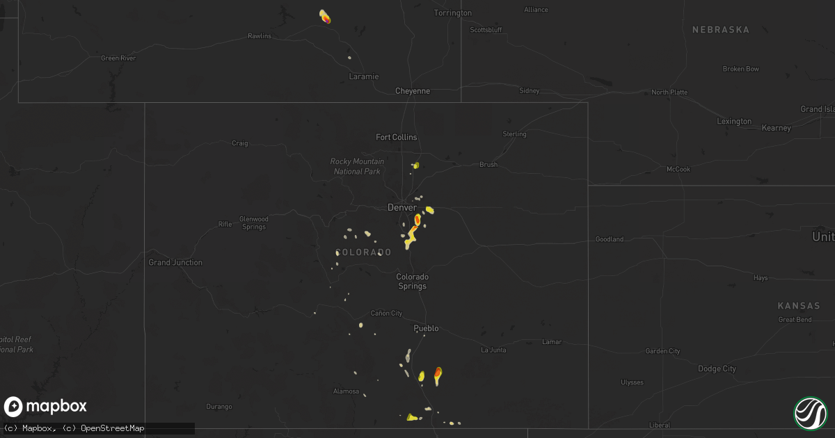
Hail Map on June 9, 2024
Get this storm
June 9 map
$229
one time, instant access
Download today. No call, no setup
Keep the $229
Bought the map and want the full workflow? Apply the entire $229 to a subscription within 7 days. None of it is wasted.
Every map, not just this one
This buys you this map. Subscription and you get every map we run, in the markets you choose from a few cities to whole states to nationwide. Plus real-time alerts the moment a storm fires.
Contact data
Name, contact info, occupancy, even credit band for addresses in the footprint. You go from where it hit to who to call.
Become the source they trust
Unlimited branding weather history reports on demand. You already have the documented answer ready for the property owner, and you are the one who showed up with it.
Property data and RoofTrace estimates
Pull up any address you have got, its value and the exact code rules for that jurisdiction, straight from One Click Code. Then RoofTrace estimates the squares, pitch, and roof value, priced the way you price.
States Impacted by Hail Map on June 9, 2024
Storm reports
South Carolina
| Date | Description |
|---|---|
| 06/08/202410:55 PM CDT | Several trees down and power outage. |
| 06/08/20249:38 PM CDT | Reported a broken tree limb off a large oak tree on the property. |
| 06/08/20249:10 PM CDT | Sumter county dispatch reported trees down along oswego highway and elsewhere along the lee county border. Time estimated by radar. |
| 06/08/20248:45 PM CDT | Kershaw county dispatch reported numerous trees down across the county. |
| 06/08/20248:10 PM CDT | Sc highway patrol reported several trees down in the roadway along new hope and jb denton roads. Time estimated by radar. |
| 06/08/20248:09 PM CDT | Reported a tree in the roadway near the intersection of jb denton road and major evans road. |
| 06/08/20248:06 PM CDT | Lancaster county dispatch reported numerous trees down across roadways south of the city of lancaster... Extending towards great falls. Time estimated by radar. |
| 06/08/20248:05 PM CDT | Gas station canopy blown off and onto a vehicle. Time estimated from radar. |
| 06/08/20248:04 PM CDT | Gas station canopy blown over. Time estimated from radar. |
| 06/08/20247:54 PM CDT | Trees blocking i-77 southbound. |
Colorado
| Date | Description |
|---|---|
| 06/09/20246:52 PM CDT | Report from mping: half dollar |
| 06/09/20246:35 PM CDT | A local report indicates 1.00 inch wind near 2 S Fairplay |
| 06/09/20246:13 PM CDT | A local report indicates 1.00 inch wind near Platteville |
| 06/09/20246:12 PM CDT | A local report indicates 1.00 inch wind near 4 E Foxfield |
| 06/09/20246:10 PM CDT | A local report indicates 1.75 inch wind near 1 S Parker |
| 06/09/20245:45 PM CDT | A local report indicates 1.25 inch wind near 2 NE Foxfield |
| 06/09/20245:44 PM CDT | Report from mping: ping pong ball |
| 06/09/20245:40 PM CDT | Report from mping: half dollar |
| 06/09/20245:34 PM CDT | Report from mping: ping pong ball |
| 06/09/20245:33 PM CDT | Report from mping: quarter |
| 06/09/20244:09 PM CDT | A local report indicates 1.00 inch wind near 3 SE Watkins |
Mississippi
| Date | Description |
|---|---|
| 06/09/20246:25 PM CDT | A local report indicates 1.00 inch wind near Smithville |
| 06/09/20246:13 PM CDT | Nettleton police department reported half dollar sized hail. |
| 06/09/20246:08 PM CDT | A local report indicates 1.50 inch wind near 1 WNW Shannon |
| 06/09/20245:52 PM CDT | Quarter-sized hail reported off of county road 900 in the palmetto community. |
| 06/09/20245:51 PM CDT | Mping report. |
| 06/09/20245:40 PM CDT | A local report indicates 1.50 inch wind near 1 SE Pontotoc |
| 06/09/20245:38 PM CDT | Broadcast media reports tennis ball sized hail on black zion road in pontotoc county. |
| 06/09/20245:37 PM CDT | Social media post shows half dollar size hail falling in pontotoc... Ms. |
| 06/08/20248:25 PM CDT | Half-dollar-sized hail in the ozark community. |
| 06/08/20248:06 PM CDT | Golf ball-sized hail reported on county road 1305. |
| 06/08/20248:00 PM CDT | Saltillo county fire department reports major damage across the city of saltillo. Numerous trees and power lines are down... Resulting in power being out across a major |
| 06/08/20248:00 PM CDT | Social media report received of 2 inch hail in saltillo... Ms. |
| 06/08/20247:57 PM CDT | Report received from social media of tennis ball sized hail in the saltillo area around 7:57 pm. |
| 06/08/20247:55 PM CDT | Reports of at least golf ball sized hail from the 911 call center in saltillo... Ms. |
| 06/08/20247:55 PM CDT | Trained spotter in the fire department reports hail to size of golf balls in saltillo... Ms. |
| 06/08/20247:55 PM CDT | Corrects previous tstm wnd dmg report from 1 se saltillo. Social media reports several trees were down in saltillo ms. |
Texas
| Date | Description |
|---|---|
| 06/09/20246:07 PM CDT | A local report indicates 67 MPH wind near KLBB |
| 06/09/20246:07 PM CDT | A local report indicates 1.00 inch wind near Ralls |
| 06/09/20245:45 PM CDT | Photos of damage to a shed or outbuilding... As well as tree limbs down. Report relayed by local media. |
| 06/09/20244:53 PM CDT | Asos station kink wink. |
| 06/09/20246:45 AM CDT | Picture of a small tree down and a two other trees with large fallen tree branches via social media. |
| 06/09/20244:55 AM CDT | Awos station kuva garner field airport. |
| 06/09/20244:21 AM CDT | Multiple mesquite trees down just north of utopia. |
| 06/08/20247:30 PM CDT | Mesonet station 64 big lake. |
Tennessee
| Date | Description |
|---|---|
| 06/09/20245:25 PM CDT | Trees and powerlines down along round mountain rd. Time approximate. |
| 06/09/20245:15 PM CDT | Multiple trees down at gsmnp relayed from n |
| 06/09/20245:15 PM CDT | Multiple trees down at gsmnp relayed from nws employee providing on-site decision support services. Location and timing approximate. |
| 06/09/20245:10 PM CDT | Multiple trees down at gsmnp 4 miles from entrance of cades cove relayed from nws employee providing on-site decision support services. Location and timing approximate. |
| 06/09/20245:03 PM CDT | Multiple trees and powerlines down. |
| 06/09/20244:55 PM CDT | Corrects previous tstm wnd dmg report from 4 nne chestnut hill. Multiple trees and powerlines down at the intersection of indian creek rd and upper rinehart rd. Time ap |
Arkansas
| Date | Description |
|---|---|
| 06/09/20246:32 PM CDT | Large tree branches blown down... Shingles removed from a home. |
| 06/09/20246:21 PM CDT | Tree blown down in jacksonville. |
| 06/09/20246:13 PM CDT | Tree down in cato. |
| 06/09/20246:09 PM CDT | A local report indicates 1.00 inch wind near Morgan |
| 06/09/20245:03 PM CDT | This is a delayed report. Social media post shows a tree uprooted onto a pool. |
| 06/09/20244:50 PM CDT | A local report indicates 1.25 inch wind near Greenbrier |
| 06/09/20244:46 PM CDT | A local report indicates 1.00 inch wind near Greenbrier |
| 06/09/20244:30 PM CDT | Damage to a shed in altus. Photos shared via local broadcast media. |
North Carolina
| Date | Description |
|---|---|
| 06/09/20246:25 PM CDT | On sunnyside drive... A neighbors tree fell onto a nearby house causing some damage to the back of the house. |
| 06/09/20245:30 PM CDT | One tree reported to be blown down in the storm near marshall. |
| 06/09/20245:25 PM CDT | One tree reported blown down in the storm near mars hill. |
Idaho
| Date | Description |
|---|---|
| 06/09/20246:50 PM CDT | Idaho power reports over 100 customers without power across the area. |
| 06/09/20246:33 PM CDT | Reported via social media. Time estimated based on radar. |
| 06/09/20246:25 PM CDT | Asos station kpih - pocatello regional airport. |
| 06/09/20245:57 PM CDT | Idaho power reports over 100 customers without power in and just northeast of american falls. |
| 06/09/20245:54 PM CDT | 2 inches of rain... Estimated 1 inch hail... And estimated 60 mph winds reported on sunset ln. Time estimated based on radar. |
| 06/09/20245:54 PM CDT | 2 inches of rain... Estimated 1 inch hail... And estimated 60 mph winds reported on sunset ln. Time estimated based on radar. |
| 06/09/20245:53 PM CDT | Tree snapped off in the area of fort hall ave and madison st. Report and photo received via social media. Time estimated based on radar and nearby reports. |
| 06/09/20245:50 PM CDT | Portion of a tree and wires down in the area of bannock ave and sunbeam rd. Report and photos received via social media. Time estimated based on radar. |
| 06/09/20245:50 PM CDT | Additional large tree uprooted and down in a yard. Report and photo received via social media. Time estimated based on radar and surrounding reports. |
| 06/09/20245:48 PM CDT | Large tree several feet in diameter uprooted and down on top of a house along van buren st. Road also flooded. Time estimated based on radar. |
| 06/09/20245:05 PM CDT | Mesonet station mon. |
| 06/09/20245:00 PM CDT | Report and photo received via social media of a tree down in monteview. A nearby mesonet station recorded a wind gust to 62 mph with the same storm. |
| 06/08/20248:26 PM CDT | Rocky mountain power reports approximately 700 customers without power near and southeast of bancroft. |
| 06/08/20247:12 PM CDT | Idaho power reports over 80 customers without power in the us-91 corridor between blackfoot and fort hall. |
| 06/08/20247:12 PM CDT | Idaho power reports over 80 custome |
Missouri
| Date | Description |
|---|---|
| 06/09/202410:02 AM CDT | A local report indicates 1.00 inch wind near Cardwell |
| 06/09/20247:18 AM CDT | Tree over road. |
Utah
| Date | Description |
|---|---|
| 06/09/20243:40 PM CDT | Mesonet station utsla i-70 at salina. |
Georgia
| Date | Description |
|---|---|
| 06/09/20244:50 AM CDT | Burke county em reported trees down on allen chapel road. |
| 06/09/20244:45 AM CDT | Burke county em reported a down tree blocking river road near hwy 80. |
| 06/09/20244:38 AM CDT | Two trees reported down on poor robin rd and highway 24. 700 people reported without power. |
| 06/09/20244:07 AM CDT | Thunderstorm wind gust downed a tree in the city limits of millen. The tree fell on some nearby power lines and transformer. Time estimated from radar data. |
| 06/09/20244:06 AM CDT | Tree reported down on transformer at 489 s. Gray street in millen. |
| 06/09/20243:45 AM CDT | Two trees down across 700 block of milledgeville rd. |
| 06/09/20243:45 AM CDT | Tree down across possum point dr. |
| 06/09/20243:45 AM CDT | Tree down across pea ridge rd. |
| 06/09/20243:45 AM CDT | Tree down across pine knoll ct. |
| 06/09/20243:40 AM CDT | Tree down across 500 block of dennis station rd. |
| 06/09/20243:40 AM CDT | Tree down across twin bridges rd. |
| 06/09/20243:38 AM CDT | Burke county dispatch reports multiple trees down on hwy 56 near frank farmer rd. Time estimated from kclx radar. |
Wyoming
| Date | Description |
|---|---|
| 06/08/20249:58 PM CDT | A local report indicates 2.00 inch wind near 4 NE Medicine Bow |
| 06/08/20249:21 PM CDT | Report relayed via social media. |
Alabama
| Date | Description |
|---|---|
| 06/08/20248:07 PM CDT | Trees and power lines were blown down on shore drive in ashville. |
| 06/08/20247:55 PM CDT | A large tree was blown down and blocking both lanes of traffic on washington valley road. |
| 06/08/20247:51 PM CDT | Ping pong ball size hail. |
| 06/08/20247:48 PM CDT | Golf ball size hail reported in allgood with pictures. |
| 06/08/20247:45 PM CDT | Corrects previous hail report from 1 s oneonta. Ping pong ball size hail. |
| 06/08/20247:45 PM CDT | A local report indicates 1.75 inch wind near 2 E Allgood |
| 06/08/20247:42 PM CDT | Corrects previous hail report from 1 ne allgood. Golf ball size hail reported in allgood with pictures. |
| 06/08/20247:42 PM CDT | Picture of estimated 2 inch hail. Car windows broken out and car bodys dented. |
| 06/08/20247:22 PM CDT | Trees were blown down on cr 11 in nectar. |
Oklahoma
| Date | Description |
|---|---|
| 06/08/20247:15 PM CDT | A local report indicates 1.00 inch wind near 3 NW Ardmore |
Cities Impacted by Hail Map on June 9, 2024
- Paragould, AR
- Cardwell, MO
- Arbyrd, MO
- West Plains, MO
- Mammoth Spring, AR
- Thayer, MO
- Koshkonong, MO
- Salem, AR
- Williford, AR
- Hardy, AR
- Ravenden, AR
- Ravenden Springs, AR
- Pocahontas, AR
- Beech Grove, AR
- Marmaduke, AR
- Leachville, AR
- Senath, MO
- Hornersville, MO
- Manila, AR
- Fort McKavett, TX
- Mason, TX
- Westcliffe, CO
- Pettigrew, AR
- Deer, AR
- Sedalia, CO
- Roswell, NM
- San Angelo, TX
- Christoval, TX
- Castle Rock, CO
- Stonewall, OK
- Hagarville, AR
- Howard, CO
- Cotopaxi, CO
- Tupelo, OK
- Allen, OK
- Mcalester, OK
- Idalou, TX
- Muleshoe, TX
- Shawnee, CO
- Centrahoma, OK
- Bennett, CO
- Atkins, AR
- Jerusalem, AR
- Bailey, CO
- Abernathy, TX
- Hector, AR
- Lorenzo, TX
- Jackpot, NV
- Carson, NM
- Springfield, AR
- Portales, NM
- Earth, TX
- Savanna, OK
- Watkins, CO
- Hattieville, AR
- Greenbrier, AR
- Damascus, AR
- Hansen, ID
- Stuart, OK
- Wardville, OK
- Lubbock, TX
- Ozark, AR
- Socorro, NM
- Kiowa, OK
- Ojo Caliente, NM
- Russellville, AR
- Declo, ID
- Rupert, ID
- Coalgate, OK
- Elida, NM
- Sudan, TX
- Artesia, NM
- Eldorado, TX
- Albuquerque, NM
- Burley, ID
- Oakley, ID
- Murtaugh, ID
- Ocate, NM
- Farwell, TX
- Robert Lee, TX
- Cleveland, AR
- Menard, TX
- Hagerman, NM
- Texico, NM
- Center Ridge, AR
- Bovina, TX
- Morrilton, AR
- Clovis, NM
- Conway, AR
- Vilonia, AR
- Paris, AR
- Eupora, MS
- Hale Center, TX
- Littlefield, TX
- Amherst, TX
- Pontotoc, MS
- Rogers, NM
- Sterling City, TX
- Fieldton, TX
- Parker, CO
- Garden City, TX
- Plumerville, AR
- Jefferson, CO
- Mantee, MS
- Aurora, CO
- Floyd, NM
- Clarksville, AR
- Los Alamos, NM
- Maben, MS
- Kirtland Afb, NM
- Slaton, TX
- Big Lake, TX
- Midland, TX
- Shannon, MS
- Tupelo, MS
- Cabot, AR
- Thaxton, MS
- Taiban, NM
- Bee Branch, AR
- Lamar, AR
- Melrose, NM
- Denver, CO
- Commerce City, CO
- Belden, MS
- Mathiston, MS
- Plantersville, MS
- American Falls, ID
- Blanca, CO
- Olton, TX
- Pocatello, ID
- North Little Rock, AR
- Platteville, CO
- Jordan Valley, OR
- Fort Lupton, CO
- Ralls, TX
- Solgohachia, AR
- Lonoke, AR
- Oxford, MS
- Taylor, MS
- Enochs, TX
- Junction, TX
- Maumelle, AR
- Wilburton, OK
- Nettleton, MS
- Ecru, MS
- Blue Springs, MS
- Littleton, CO
- Mayflower, AR
- La Salle, CO
- Fairplay, CO
- Water Valley, MS
- Hazen, AR
- Riverside, OR
- Sonora, TX
- Amory, MS
- Magazine, AR
- Fulton, MS
- Springlake, TX
- Smithville, MS
- Fort Sumner, NM
- Stuttgart, AR
- De Valls Bluff, AR
- Mill Creek, OK
- Hamilton, AL
- Santa Rosa, NM
- Cerrillos, NM
- Randolph, MS
- Houlka, MS
- Okolona, MS
- Greenwood Springs, MS
- Morton, TX
- Ririe, ID
- Rexburg, ID
- Tishomingo, OK
- Scott, AR
- Aliceville, AL
- Guin, AL
- Firth, ID
- Wister, OK
- Lone Tree, CO
- Trinidad, CO
- Weston, CO
- Hartshorne, OK
- Boligee, AL
- House, NM
- Franktown, CO
- Friona, TX
- Larkspur, CO
- Princeton, OR
- Ardmore, OK
- Oneonta, AL
- Cleveland, AL
- Trinchera, CO
- Model, CO
- Walsenburg, CO
- Mannsville, OK
- Lamy, NM
- Saltillo, MS
- Hayden, AL
- Moffat, CO
- Little Rock, AR
- Golden, MS
- Cuervo, NM
- Guntown, MS
- Baldwyn, MS
- Snyder, TX
- Mantachie, MS
- Tucumcari, NM
- Brilliant, AL
- Ashville, AL
- Iowa Park, TX
- Madill, OK
- Denio, NV
- Sulphur, OK
- Marietta, MS
- Aspermont, TX
- Old Glory, TX
- Red Oak, OK
- Pueblo, CO
- Girard, TX
- Jayton, TX
- Rye, CO
- Byers, TX
- Temple, OK
- Carrollton, AL
- Hastings, OK
- Spur, TX
- Springer, OK
- Vardaman, MS
- Ryan, OK
- Inkom, ID
- Paducah, TX
- Arley, AL
- Medicine Bow, WY
- Winfield, AL
- Electra, TX
- Fayette, AL
- Eldridge, AL
- Springville, AL
- Knox City, TX
- Carlisle, AR
- England, AR
- Lone Grove, OK
- Almira, WA
- Dickens, TX
- Bankston, AL
- Sherwood, AR
- Jacksonville, AR
- Wilbur, WA
- Odessa, WA
- Wilson, OK
- Marietta, OK
- Overbrook, OK
- Waurika, OK
- Burneyville, OK
- Attalla, AL
- Gallant, AL
- Weinert, TX
- Odessa, TX
- Barnhart, TX
- Roosevelt, TX
- Helotes, TX
- San Antonio, TX
- Bigelow, AR
- Victor, ID
- Goldsmith, TX
- Crowell, TX
- Goree, TX
- Scotland, TX
- Windthorst, TX
- Munday, TX
- Rochester, TX
- Holliday, TX
- Jbsa Lackland, TX
- Atascosa, TX
- Rule, TX
- Happy, TX
- Von Ormy, TX
- Mountain Home, TX
- Maxwell, NM
- Midkiff, TX
- Pavillion, WY
- Leakey, TX
- Ringling, OK
- Justiceburg, TX
- Grandfalls, TX
- Gadsden, AL
- Wellington, AL
- Jacksonville, AL
- Odonnell, TX
- Utopia, TX
- Crane, TX
- Haskell, TX
- Post, TX
- Tahoka, TX
- McCamey, TX
- Seymour, TX
- Beaverton, AL
- Hackleburg, AL
- Carbon Hill, AL
- Stanton, TX
- Jasper, AL
- Townley, AL
- Rocksprings, TX
- Davisboro, GA
- Bartow, GA
- Wadley, GA
- Ozona, TX
- Midville, GA
- Swainsboro, GA
- Louisville, GA
- Pawleys Island, SC
- Georgetown, SC
- Millen, GA
- Fort Stockton, TX
- Comstock, TX
- Hunt, TX
- Sparta, GA
- Blytheville, AR
- Milledgeville, GA
- Harper, TX
- Franklin, GA
- Hogansville, GA
- Talladega, AL
- Munford, AL
- Del Rio, TX
- Sandersville, GA
- Rocky Ford, GA
- Sylvania, GA
- Uvalde, TX
- Hondo, TX
- Allendale, SC
- Martin, SC
- Natalia, TX
- Devine, TX
- Castroville, TX
- La Coste, TX
- Moore, TX
- Mico, TX
- Fairfax, SC
- Ulmer, SC
- Lytle, TX
- Poteet, TX
- Bigfoot, TX
- Somerset, TX
- Camp Wood, TX