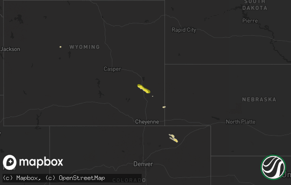
Hail Map in Wyoming on June 8, 2018
The weather event in Wyoming on June 8, 2018 includes Hail map. 23 states and 626 cities were impacted and suffered possible damage. The total estimated number of properties impacted is 546.

Hail
546
Estimated number of impacted properties by a 1.00" hail or larger0
Estimated number of impacted properties by a 1.75" hail or larger0
Estimated number of impacted properties by a 2.50" hail or largerStorm reports in Wyoming
Wyoming
| Date | Description |
|---|---|
| 06/08/20183:30 AM CDT | At 829 PM MDT, a severe thunderstorm was located near Devils Tower Junction, or 14 miles west of Sundance, moving east at 20 mph. HAZARD...Quarter size hail. SOURCE...Radar indicated. IMPACT...Damage to vehicles is expected. Locations impacted include... Sundance, Pine Haven, Carlile, Moskee, Inyan Kara Mountain, Warren Peak, Cook Lake, Devils Tower Junction and Keyhole Reservoir.This Includes Interstate 90 in Wyoming between Mile Markers 162 and193. |
| 06/08/20182:41 AM CDT | At 740 PM MDT, a severe thunderstorm was located 7 miles northeast of Rozet, or 19 miles northeast of Gillette, moving southeast at 25 mph. HAZARD...Ping pong ball size hail. SOURCE...Radar indicated. IMPACT...People and animals outdoors will be injured. Expect damage to roofs, siding, windows, and vehicles. Locations impacted include... Moorcroft, Pine Haven, Rozet and Keyhole Reservoir. This Includes Interstate 90 in Wyoming between Mile Markers 140 and166. |
| 06/08/20182:33 AM CDT | At 733 PM MDT, a severe thunderstorm was located over Carlile, or 23 miles west of Sundance, moving southeast at 10 mph. HAZARD...Ping pong ball size hail. SOURCE...Radar indicated. IMPACT...People and animals outdoors will be injured. Expect damage to roofs, siding, windows, and vehicles. Locations impacted include... Pine Haven, Carlile and Keyhole Reservoir. This Includes Interstate 90 in Wyoming between Mile Markers 156 and160. |
| 06/08/20181:11 AM CDT | At 611 PM MDT, a severe thunderstorm was located 15 miles northwest of Fort Reno Historical Site, or 17 miles northeast of Kaycee, moving northeast at 25 mph. HAZARD...Quarter size hail. SOURCE...Radar indicated. IMPACT...Damage to vehicles is expected. This severe thunderstorm will remain over mainly rural areas of east central Johnson County. |
| 06/08/20181:07 AM CDT | At 606 PM MDT, a severe thunderstorm was located over Hulett, or 20 miles northwest of Sundance, moving southeast at 15 mph. HAZARD...Golf ball size hail. SOURCE...Radar indicated. IMPACT...People and animals outdoors will be injured. Expect damage to roofs, siding, windows, and vehicles. Locations impacted include... Hulett, Alva, Devils Tower National Monument, Warren Peak, Bear Lodge Campground, Cook Lake and Devils Tower Junction. |
| 06/08/201812:25 AM CDT | At 524 PM MDT, a severe thunderstorm was located near Kaycee, moving northeast at 25 mph. HAZARD...60 mph wind gusts and half dollar size hail. SOURCE...Radar indicated. IMPACT...Hail damage to vehicles is expected. Expect wind damage to roofs, siding, and trees. This severe thunderstorm will remain over mainly rural areas of south central Johnson County.This includes Interstate 25 between mile markers 251 and 267. |
| 06/07/201810:00 PM CDT | At 300 PM MDT, a severe thunderstorm was located 9 miles west of Wyoming Boys School, or 12 miles west of Worland, moving east at 20 mph. HAZARD...60 mph wind gusts and half dollar size hail. SOURCE...Radar indicated. IMPACT...Hail damage to vehicles is expected. Expect wind damage to roofs, siding, and trees. This severe thunderstorm will be near... Wyoming Boys School around 325 PM MDT. Worland and Worland Municipal Airport around 330 PM MDT.Other locations impacted by this severe thunderstorm include WashakieCounty Fairgrounds. |
| 06/07/20188:55 PM CDT | A local report indicates 1.00 inch wind near 1 SSE CARLILE |
| 06/07/20187:40 PM CDT | A local report indicates 1.00 inch wind near 1 WNW HULETT |
All States Impacted by Hail Map on June 8, 2018
Cities Impacted by Hail Map on June 8, 2018
- Petersburg, NE
- Oakdale, NE
- Muncie, IN
- Selma, IN
- Mooreland, IN
- Hot Springs Village, AR
- Jessieville, AR
- Clinton, IA
- Camanche, IA
- Madison, NE
- Humphrey, NE
- Wapakoneta, OH
- Harrod, OH
- Waynesfield, OH
- Lima, OH
- Colby, KS
- Atalissa, IA
- Tryon, NE
- Rapid City, SD
- Black Hawk, SD
- Piedmont, SD
- Sturgis, SD
- Benedict, NE
- New Cambria, MO
- Salem, MO
- Raymondville, MO
- Hulett, WY
- Yankton, SD
- Gayville, SD
- Mission Hill, SD
- Mountainburg, AR
- Reva, SD
- Browning, MO
- Linneus, MO
- Chula, MO
- Humphreys, MO
- Laredo, MO
- Purdin, MO
- Taylor Ridge, IL
- Hebron, NE
- Gilead, NE
- Martin, SD
- Norris, SD
- Grenville, NM
- Belfield, ND
- South Heart, ND
- Fort Wayne, IN
- Morganville, KS
- Dimock, SD
- Parkston, SD
- Delmont, SD
- Wagner, SD
- Avon, SD
- Ethan, SD
- Tripp, SD
- Hammond, MT
- Ekalaka, MT
- Alzada, MT
- Capitol, MT
- Stapleton, NE
- Wister, OK
- Clovis, NM
- Lake City, FL
- Troy, OH
- Englewood, OH
- West Milton, OH
- Tipp City, OH
- Vandalia, OH
- Tucumcari, NM
- Wanblee, SD
- Kadoka, SD
- Long Valley, SD
- Interior, SD
- Yellville, AR
- Flippin, AR
- Central City, NE
- Archer, NE
- Lacon, IL
- Mazeppa, MN
- Zumbro Falls, MN
- Lake City, MN
- Eminence, MO
- Douglas, WY
- Buffalo, ND
- Tower City, ND
- Walcott, ND
- Davenport, ND
- Kindred, ND
- Mission, SD
- Houston, AR
- South Amana, IA
- Williamsburg, IA
- Marengo, IA
- Kanorado, KS
- Burlington, CO
- Goodland, KS
- Saint Francis, KS
- Idalia, CO
- Tuthill, SD
- Deadwood, SD
- Ebro, FL
- Panama City, FL
- New Castle, IN
- Decker, MT
- Beltrami, MN
- Crookston, MN
- Gary, MN
- Keystone, SD
- Kimball, SD
- Burke, SD
- Alexandria, NE
- Gillette, WY
- Charlotte, IA
- De Witt, IA
- Quinn, SD
- Wall, SD
- McCausland, IA
- Long Grove, IA
- Princeton, IA
- Eldridge, IA
- Davenport, IA
- Wood, SD
- Laurel, NE
- Wayne, NE
- Concord, NE
- Hyannis, NE
- Purdum, NE
- Genoa, NE
- Albion, NE
- Newman Grove, NE
- Milan, MO
- Conchas Dam, NM
- New Effington, SD
- Presho, SD
- Shelby, NE
- Bellville, OH
- Butler, OH
- Mansfield, OH
- Lucas, OH
- Pecos, TX
- Mentone, TX
- Round Lake, MN
- Lake Park, IA
- Lakefield, MN
- Spirit Lake, IA
- Fort Smith, AR
- Cody, NE
- Oriska, ND
- Elwood, IN
- Alexandria, IN
- Frankton, IN
- Rushville, NE
- Hermosa, SD
- Nemo, SD
- Wheatland, ND
- Winigan, MO
- Richmond, IN
- Greens Fork, IN
- Webster, IN
- Fountain City, IN
- Centerville, IN
- Williamsburg, IN
- Harrison, AR
- Greenwood, AR
- Neligh, NE
- Bonesteel, SD
- Zwingle, IA
- La Motte, IA
- Delmar, IA
- Maquoketa, IA
- Clarksburg, OH
- New Holland, OH
- Philip, SD
- German Valley, IL
- Leaf River, IL
- Baileyville, IL
- Forreston, IL
- Illinois City, IL
- Butte, NE
- Oxford, IA
- Reynolds, IL
- Merriman, NE
- Hankinson, ND
- Erie, IL
- Ashton, NE
- Carleton, NE
- Urbana, OH
- Brewster, NE
- Heavener, OK
- Sundance, WY
- Poteau, OK
- Lithia, FL
- Burwell, NE
- Gordon, NE
- Bingham, NE
- Saint Francis, SD
- Clarks Hill, IN
- Lafayette, IN
- Morrow, OH
- Maineville, OH
- Broadview, NM
- Perry, AR
- Morrilton, AR
- Adona, AR
- Springfield, OH
- Taylor, NE
- Tilden, NE
- Meadow Grove, NE
- Murdo, SD
- Fairburn, SD
- Winner, SD
- Low Moor, IA
- Morrison, IL
- Port Byron, IL
- Hampton, IL
- Bryant, IA
- Le Claire, IA
- Fulton, IL
- Bettendorf, IA
- Cordova, IL
- Welton, IA
- Goose Lake, IA
- Calamus, IA
- Donahue, IA
- Pleasant Valley, IA
- Albany, IL
- East Moline, IL
- Grand Mound, IA
- Rapids City, IL
- Ashville, OH
- Orient, OH
- Buchanan, GA
- Moorcroft, WY
- Fort Davis, TX
- Andalusia, IL
- Aledo, IL
- Joy, IL
- Rozet, WY
- Tabor, SD
- Vale, SD
- Ponsford, MN
- Arnold, NE
- Elba, NE
- Greenville, OH
- Arcanum, OH
- New Madison, OH
- Williamsport, OH
- Mount Sterling, OH
- Circleville, OH
- Valley City, ND
- Stigler, OK
- Dardanelle, AR
- Delaware, AR
- Jonesboro, IN
- Fairmount, IN
- Kilgore, NE
- Crookston, NE
- Dalhart, TX
- Spiro, OK
- Arkoma, OK
- Pocola, OK
- Arcadia, NE
- Greenfield, OH
- Washington Court House, OH
- Frankfort, OH
- Bridgewater, SD
- Dixon, IA
- Wheatland, IA
- Stockton, IA
- Walcott, IA
- New Liberty, IA
- Thedford, NE
- Seneca, NE
- Westpoint, IN
- Mankato, KS
- Liberty, IN
- Carthage, AR
- Cable, OH
- Milesville, SD
- Crofton, NE
- Saint Helena, NE
- Milan, IL
- Glenmont, OH
- Lakeville, OH
- Wyoming, IA
- Holgate, OH
- Grove City, OH
- Lockbourne, OH
- Umpire, AR
- Russellville, AR
- London, AR
- Channing, TX
- Fort Lauderdale, FL
- Lake Andes, SD
- Springfield, SD
- Dante, SD
- Bartlett, NE
- Spalding, NE
- Odebolt, IA
- Hamilton, OH
- Kaycee, WY
- Mountain Home, AR
- Franklin, OH
- White River, SD
- Parmelee, SD
- Allen, SD
- Nenzel, NE
- Thornfield, MO
- Isabella, MO
- Newport, NE
- Bassett, NE
- Midland, SD
- Elgin, NE
- Chambers, NE
- Amelia, NE
- Sargent, NE
- Gore, OK
- Cairo, GA
- Whigham, GA
- Armour, SD
- North Lewisburg, OH
- Mingo, OH
- Winslow, AR
- Reynolds, GA
- Mount Morris, IL
- Spencer, IA
- Milford, IA
- Canistota, SD
- Laura, OH
- Pleasant Hill, OH
- Grady, NM
- Romney, IN
- Belden, NE
- Gurdon, AR
- Mountain View, MO
- Stuart, NE
- New Blaine, AR
- Amity, AR
- Sheffield, IA
- Latimer, IA
- North Loup, NE
- Strawberry Point, IA
- Milford, OH
- Lucedale, MS
- Custer, SD
- Melrose, NM
- Mcalister, NM
- Willow Springs, MO
- Trementina, NM
- Lovell, WY
- Circle, MT
- Chatfield, MN
- Alma, AR
- Plumerville, AR
- Lost Nation, IA
- Ada, MN
- Zanesfield, OH
- West Liberty, OH
- Valentine, NE
- Devils Tower, WY
- Fort Meade, SD
- West Mansfield, OH
- Gassville, AR
- Red Wing, MN
- Goodhue, MN
- Farwell, NE
- Lead, SD
- Summitville, IN
- Anderson, IN
- Lindsay, NE
- Roberta, GA
- Colome, SD
- Broken Bow, NE
- Ansley, NE
- Shannon, IL
- Winnebago, IL
- Dierks, AR
- Middletown, OH
- Everly, IA
- Fort Recovery, OH
- Mulberry, AR
- Twin Valley, MN
- Elkader, IA
- Volga, IA
- Mullen, NE
- Moline, IL
- Rochester, IN
- Lindsay, MT
- Bloomfield, MT
- Shakopee, MN
- Carver, MN
- Chaska, MN
- Camp Dennison, OH
- Loveland, OH
- Summerville, GA
- Clarksville, OH
- Lebanon, OH
- Pomona, MO
- Hay Springs, NE
- Alliance, NE
- Mapleton, ND
- Anselmo, NE
- Champaign, IL
- Baldwin, IA
- Draper, SD
- Tyndall, SD
- Quitman, GA
- Dixie, GA
- Boston, GA
- Ellsworth, NE
- Fayetteville, AR
- Bluffton, AR
- Floyd, NM
- Titusville, FL
- Buffalo, SD
- Hill City, SD
- Mena, AR
- Fostoria, IA
- Okoboji, IA
- Mount Victory, OH
- Ridgeway, OH
- Rushsylvania, OH
- Raymond, OH
- Sidney, OH
- New Carlisle, OH
- North Hampton, OH
- Dallas, SD
- Gregory, SD
- Concordia, KS
- Wall Lake, IA
- Napoleon, OH
- Malinta, OH
- Box Elder, SD
- Ord, NE
- Clearwater, NE
- Connersville, IN
- Waco, NE
- Fort Pierre, SD
- North Judson, IN
- San Pierre, IN
- White Springs, FL
- Belle Center, OH
- Eyota, MN
- Kiron, IA
- Hot Springs National Park, AR
- Dunning, NE
- Pierce, NE
- Columbia City, IN
- Alexandria, SD
- Medaryville, IN
- Leonard, ND
- Christine, ND
- Eufaula, OK
- Myakka City, FL
- Parrish, FL
- Mahaska, KS
- Letcher, SD
- Monmouth, IA
- Oxford Junction, IA
- Bagley, WI
- Lorida, FL
- Columbus, NE
- Creston, NE
- Paris, AR
- Subiaco, AR
- Iliff, CO
- Elyria, NE
- Rutledge, MO
- Newell, SD
- Van Wert, OH
- Ethel, MO
- Pecatonica, IL
- Lanark, IL
- Conroy, IA
- Rushville, IN
- Rock Island, IL
- Cedarville, AR
- Bay Minette, AL
- Prairie Du Chien, WI
- Norfolk, NE
- Lowell, IN
- Belvidere, NE
- Ludlow Falls, OH
- Pitsburg, OH
- New Paris, OH
- Bradford, OH
- Princeton, IL
- Chester, AR
- Eldon, IA
- Scotia, NE
- Sunburg, MN
- Seward, NE
- Columbus, OH
- Perryville, AR
- Van Horn, TX
- Knightstown, IN
- Charlottesville, IN
- Logan, NM
- Atkinson, IL
- San Jon, NM
- Climax, MN
- Bainbridge, GA
- Brinson, GA
- Francesville, IN
- Rensselaer, IN
- Booneville, AR
- Huntington, AR
- Charleston, AR
- Plant City, FL
- Ridgeville, IN
- Winchester, IN
- Park Hill, OK
- Edson, KS
- Lamont, FL
- Gas City, IN
- Oden, AR
- Chipley, FL
- Bernard, IA
- Loxley, AL
- Chamberlain, SD
- Early, IA
- Ewing, NE
- New Boston, MO
- Robertsdale, AL
- Kenton, OH
- Richwood, OH
- Bellwood, NE
- Westerville, NE
- Stapleton, AL
- Narka, KS
- Kennebec, SD
- Loup City, NE
- Maumelle, AR
- North Little Rock, AR
- Nelson, NE
- Holy Cross, IA
- Milroy, IN
- Lavaca, AR
- Fort McCoy, FL
- Leigh, NE
- Stanton, NE
- Clarkson, NE
- Pukwana, SD
- Mayville, ND
- Hatton, ND
- Ackley, IA
- Wray, CO
- Morrowville, KS
- West Branch, IA
- Eatonton, GA
- Fertile, MN
- Foley, AL
- Bloomfield, IA
- Mount Ida, AR
- Story, AR
- Ratcliff, AR
- Branch, AR
- Ozark, AR
- Durant, IA
- Wilton, IA
- Marysville, OH
- West Liberty, IA
- Greeley, NE
- Tahlequah, OK
- Hulbert, OK
- Howe, OK
- Van Buren, AR
- Reliance, SD
- Lower Brule, SD
- Fenton, IL
- Saint Paul, NE
- Silvis, IL
- Pierre, SD
- Alger, OH
- Royal, AR
- McAlpin, FL
- Wolbach, NE
- Palmer, NE
- Cecil, AR
- Greenville, FL
- Arcadia, FL
- Thomson, IL
- Brookville, IN
- Saint Paris, OH
- Mosquero, NM
- Homestead, FL
- Arnolds Park, IA
- Weston, WY
- Springboro, OH
- Germantown, OH
- Bradford, IL
- Lamar, AR
- Newkirk, NM
- Arriba, CO
- Summerdale, AL
- Merna, NE
- Fairfax, SD
- Garnavillo, IA
- Glen Haven, WI
- New Boston, IL
- Green City, MO
- Magazine, AR
- Fairbury, NE
- Hubbell, NE
- Reynolds, NE
- Silver Creek, NE
- Osceola, NE
- Lowden, IA
- Clarence, IA
- Ashby, NE
- Waldron, AR
- Follansbee, WV
- Mingo Junction, OH
- Monroe, NE
- Ottumwa, IA
- Gainesville, MO
- Lockney, TX
- Ona, FL
- Bowling Green, FL
- Peel, AR
- Whitewood, SD
- Hobbs, NM
- Fingal, ND
- Horace, ND
- Lake View, IA
- Knoxville, GA


