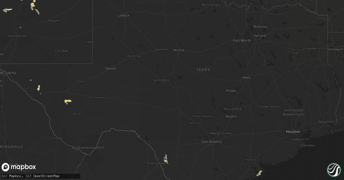
Hail Map in Texas on June 7, 2013
Get this storm
June 7 map
$229
one time, instant access
Download today. No call, no setup
Keep the $229
Bought the map and want the full workflow? Apply the entire $229 to a subscription within 7 days. None of it is wasted.
Every map, not just this one
This buys you this map. Subscription and you get every map we run, in the markets you choose from a few cities to whole states to nationwide. Plus real-time alerts the moment a storm fires.
Contact data
Name, contact info, occupancy, even credit band for addresses in the footprint. You go from where it hit to who to call.
Become the source they trust
Unlimited branding weather history reports on demand. You already have the documented answer ready for the property owner, and you are the one who showed up with it.
Property data and RoofTrace estimates
Pull up any address you have got, its value and the exact code rules for that jurisdiction, straight from One Click Code. Then RoofTrace estimates the squares, pitch, and roof value, priced the way you price.
Storm reports in Texas
Texas
| Date | Description |
|---|---|
| 06/07/20136:37 PM CDT | City of lyford p.d. Reports wind gust estimated to 60 mph in lyford. |
| 06/07/20136:32 PM CDT | Received public report relayed through mission p.d. Of several car ports damaged or destroyed in the 800 block of east 21st street near golf course in mission. |
| 06/07/20136:15 PM CDT | Found partially melted hail on pinto canyon road |
| 06/07/20136:15 PM CDT | Amateur radio spotter reported nickle to golfball sized hail on fm 2810 7 miles wsw of marfa. Spotter also reported dime to nickle sized hail at 625 pm cdt on u.s. 67 1 |
| 06/07/20135:56 PM CDT | A local report indicates 58 MPH wind near EDINBURG |
| 06/07/20135:40 PM CDT | Public report of several tree limbs blown down. Limb diameters were from 3 to 5 inches. |
| 06/07/20135:26 PM CDT | Trees blown down and blocking santa fe. Time est from radar. |
| 06/07/20133:30 PM CDT | A local report indicates 1.00 inch wind near 4 S SPEARMAN |
| 06/07/20133:28 PM CDT | A local report indicates 1.00 inch wind near REALITOS |
| 06/07/20133:03 PM CDT | Intersection of del mar and mcpherson. |
| 06/07/20133:00 PM CDT | Near mcpherson/delmar |
| 06/07/20132:59 PM CDT | Quarter size hail with near zero visibility from heavy rain. |
| 06/07/20132:56 PM CDT | Powerlines down on south side of laredo. |
| 06/06/20139:15 PM CDT | A local report indicates 61 MPH wind near 3 W DUMAS |
| 06/06/20139:06 PM CDT | A local report indicates 61 MPH wind near 3 W DUMAS |
| 06/06/20138:55 PM CDT | A local report indicates 81 MPH wind near 3 W DUMAS |
| 06/06/20138:20 PM CDT | Power lines down along desert bloom st in montana vista. |
| 06/06/20137:51 PM CDT | Wind was from passing thunderstorm outflow boundary. |
| 06/06/20137:50 PM CDT | Hail 2 inches deep...ranging from quarter to golf ball size...covering the road |
| 06/06/20137:23 PM CDT | A local report indicates 1.75 inch wind near 6 N SKELLYTOWN |
| 06/06/20137:18 PM CDT | A local report indicates 1.75 inch wind near 10 N SKELLYTOWN |
| 06/06/20137:05 PM CDT | Found partially melted hail on pinto canyon road |
All States Impacted by Hail Map on June 7, 2013
Cities Impacted by Hail Map on June 7, 2013
- Socorro, NM
- Harlingen, TX
- Roma, TX
- Rio Grande City, TX
- Hardesty, OK
- Balko, OK
- Arenas Valley, NM
- Silver City, NM
- Capitan, NM
- Borger, TX
- Norman Park, GA
- Moultrie, GA
- Linn, TX
- Edinburg, TX
- Fort Davis, TX
- Ocate, NM
- Levant, KS
- Boise City, OK
- Felt, OK
- Clayton, NM
- Fort Hancock, TX
- Colby, KS
- Seadrift, TX
- Jacksonville, GA
- Corona, NM
- Selden, KS
- Melrose, NM
- Clovis, NM
- Floyd, NM
- Portales, NM
- Mora, NM
- Turner, MT
- Garita, NM
- Santa Rosa, NM
- Laredo, TX
- Simla, CO
- Encino, TX
- Rolla, KS
- Monticello, FL
- Stinnett, TX
- Morse, TX
- Shell, WY
- Manderson, WY
- Winston, NM
- Eagle Pass, TX
- Rockport, TX
- Alice, TX
- Trementina, NM
- Spearman, TX
- Elbert, CO
- Ramah, CO
- Limon, CO
- Calhan, CO
- Matheson, CO
- Cataula, GA
- Scott City, KS
- Concepcion, TX
- Realitos, TX
- Cohagen, MT
- Brewster, KS
- Goodland, KS
- Edson, KS
- Gem, KS
- Lovell, WY
- Logan, NM
- Jordan, MT
- Valmora, NM
- Watrous, NM
- Kenton, OK
- Grenville, NM
- Wagon Mound, NM
- Hebbronville, TX
- Dalhart, TX
- Hazlehurst, GA
- Baxley, GA
- Broxton, GA
- Las Vegas, NM
- Stratford, TX
- Elkhart, KS
- Goodwell, OK
- Perryton, TX
- Nara Visa, NM
- Vaughn, NM
- Anton Chico, NM
- Ashford, AL
- Dothan, AL
- Soperton, GA
- Moorcroft, WY
- Malta, MT
- Dodson, MT
- Cleveland, NM
- Penitas, TX
- Mission, TX
- Sullivan City, TX
- Grulla, TX
- Bent, NM
- Mescalero, NM
- Booker, TX
- Skellytown, TX
- Syracuse, KS
- Slocomb, AL
- Cottonwood, AL
- Potter, NE
- Kendall, KS
- Sierra Blanca, TX
- Corpus Christi, TX
- Midland, GA
- Upatoi, GA
- Ellerslie, GA
- Waverly Hall, GA
- Kingsville, TX
- La Joya, TX
- Denton, GA
- Fort Sumner, NM
- Carrizozo, NM
- Loring, MT
- Hanover, NM
- Santa Clara, NM
- Greybull, WY
- Buena Vista, NM
- Raton, NM
- Powell, WY
- Cadwell, GA
- Hurley, NM
- Holly, CO
- Sapello, NM
- Dix, NE
- Sidney, NE
- Miami, TX
- Port O'Connor, TX
- Adel, GA
- San Isidro, TX
- Santa Elena, TX
- Falfurrias, TX
- Rexford, KS
- Texline, TX
- Eastman, GA
- Weston, CO
- San Benito, TX
- Brooklet, GA
- Lyford, TX
- Rainsville, NM
- Conchas Dam, NM
- Chauncey, GA
- Gruver, TX
- Robstown, TX
- Manter, KS
- Springfield, GA
- Raymondville, TX
- Lumber City, GA
- Ashburn, GA
- Sycamore, GA
- Quemado, TX


