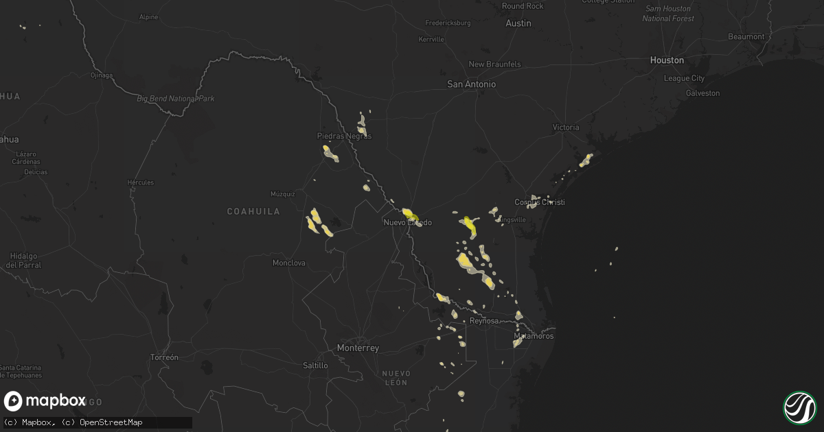
Hail Map on June 7, 2013
Get this storm
June 7 map
$229
one time, instant access
Download today. No call, no setup
Keep the $229
Bought the map and want the full workflow? Apply the entire $229 to a subscription within 7 days. None of it is wasted.
Every map, not just this one
This buys you this map. Subscription and you get every map we run, in the markets you choose from a few cities to whole states to nationwide. Plus real-time alerts the moment a storm fires.
Contact data
Name, contact info, occupancy, even credit band for addresses in the footprint. You go from where it hit to who to call.
Become the source they trust
Unlimited branding weather history reports on demand. You already have the documented answer ready for the property owner, and you are the one who showed up with it.
Property data and RoofTrace estimates
Pull up any address you have got, its value and the exact code rules for that jurisdiction, straight from One Click Code. Then RoofTrace estimates the squares, pitch, and roof value, priced the way you price.
States Impacted by Hail Map on June 7, 2013
Storm reports
Colorado
| Date | Description |
|---|---|
| 06/07/20134:21 PM CDT | A local report indicates 1.75 inch wind near 4 W LIMON |
| 06/07/20134:18 PM CDT | A local report indicates 1.00 inch wind near 5 ENE MATHESON |
Tennessee
| Date | Description |
|---|---|
| 06/07/20133:55 PM CDT | Damage to awning at mapco station on neelys bend road |
Montana
| Date | Description |
|---|---|
| 06/06/20138:43 PM CDT | Estimated 1 inch hail. Heavy rain still falling. |
Kansas
| Date | Description |
|---|---|
| 06/07/20135:42 PM CDT | A local report indicates 1.00 inch wind near 7 E SHALLOW WATER |
| 06/07/20134:37 PM CDT | A local report indicates 1.00 inch wind near 5 W KENDALL |
South Carolina
| Date | Description |
|---|---|
| 06/07/20134:48 PM CDT | Multiple trees blown down across roadways and into power lines on conneticut ave and north church street. |
| 06/07/20134:02 PM CDT | Tree down on highway 14. |
North Carolina
| Date | Description |
|---|---|
| 06/07/20135:07 PM CDT | Six trees were blown down in this area. |
| 06/07/20135:05 PM CDT | A large tree down in the road in the sugar ridge community. |
| 06/07/20133:15 PM CDT | Trees blown down in the 600 block of otis burrows road. Time estimated. |
| 06/07/20133:15 PM CDT | Trees blown down in the 5500 block of highway 56. Time estimated. |
New Mexico
| Date | Description |
|---|---|
| 06/07/20134:45 PM CDT | White rock. |
| 06/06/201310:10 PM CDT | A local report indicates 70 MPH wind near 2 SW DORA |
| 06/06/20139:30 PM CDT | Sections of fence blown down on property. |
| 06/06/20137:47 PM CDT | A local report indicates 2.75 inch wind near ARABELA |
Texas
| Date | Description |
|---|---|
| 06/07/20136:37 PM CDT | City of lyford p.d. Reports wind gust estimated to 60 mph in lyford. |
| 06/07/20136:32 PM CDT | Received public report relayed through mission p.d. Of several car ports damaged or destroyed in the 800 block of east 21st street near golf course in mission. |
| 06/07/20136:15 PM CDT | Found partially melted hail on pinto canyon road |
| 06/07/20136:15 PM CDT | Amateur radio spotter reported nickle to golfball sized hail on fm 2810 7 miles wsw of marfa. Spotter also reported dime to nickle sized hail at 625 pm cdt on u.s. 67 1 |
| 06/07/20135:56 PM CDT | A local report indicates 58 MPH wind near EDINBURG |
| 06/07/20135:40 PM CDT | Public report of several tree limbs blown down. Limb diameters were from 3 to 5 inches. |
| 06/07/20135:26 PM CDT | Trees blown down and blocking santa fe. Time est from radar. |
| 06/07/20133:30 PM CDT | A local report indicates 1.00 inch wind near 4 S SPEARMAN |
| 06/07/20133:28 PM CDT | A local report indicates 1.00 inch wind near REALITOS |
| 06/07/20133:03 PM CDT | Intersection of del mar and mcpherson. |
| 06/07/20133:00 PM CDT | Near mcpherson/delmar |
| 06/07/20132:59 PM CDT | Quarter size hail with near zero visibility from heavy rain. |
| 06/07/20132:56 PM CDT | Powerlines down on south side of laredo. |
| 06/06/20139:15 PM CDT | A local report indicates 61 MPH wind near 3 W DUMAS |
| 06/06/20139:06 PM CDT | A local report indicates 61 MPH wind near 3 W DUMAS |
| 06/06/20138:55 PM CDT | A local report indicates 81 MPH wind near 3 W DUMAS |
| 06/06/20138:20 PM CDT | Power lines down along desert bloom st in montana vista. |
| 06/06/20137:51 PM CDT | Wind was from passing thunderstorm outflow boundary. |
| 06/06/20137:50 PM CDT | Hail 2 inches deep...ranging from quarter to golf ball size...covering the road |
| 06/06/20137:23 PM CDT | A local report indicates 1.75 inch wind near 6 N SKELLYTOWN |
| 06/06/20137:18 PM CDT | A local report indicates 1.75 inch wind near 10 N SKELLYTOWN |
| 06/06/20137:05 PM CDT | Found partially melted hail on pinto canyon road |
Georgia
| Date | Description |
|---|---|
| 06/07/20136:30 PM CDT | Multiple trees down across southern laurens county. Time is based on radar. |
| 06/07/20136:02 PM CDT | Dodge county skywarn coordinator is relaying spotter reports of several trees down just northeast of eastman dodge county airport. Time based on radar. |
| 06/07/20135:35 PM CDT | Public reported trees down along gay road between william tinley road and highway 305. Also numerous limbs down along with pea size hail. |
| 06/07/20135:10 PM CDT | Several trees were blown down in the ellerslie area. |
| 06/07/20134:06 PM CDT | Social media relayed reports of numerous trees down in alpharetta. Time is based on radar. |
| 06/07/20134:05 PM CDT | Broadcast media relayed a report of a tree down in alpharetta. Numerous public phone calls to the the wfo reported large tree branches down. |
| 06/06/20138:15 PM CDT | Large tree down on power lines and crossing east old savannah rd. Numerous power outages also reported across southern jenkins county. |
| 06/06/20137:42 PM CDT | Emanuel county 911 relayed a report of multiple trees down throught the county. |
Maryland
| Date | Description |
|---|---|
| 06/07/20134:15 PM CDT | Minor damage to roof at chicken farm along route 313 |
Alabama
| Date | Description |
|---|---|
| 06/07/20132:57 PM CDT | Wtvy-tv submitted a picture of a piece of wood embedded in the roof of a structure in the ashford area with other debris scattered around the area. |
| 06/07/20132:52 PM CDT | Public estimated 65 to 70 mph winds near avon. Reported via social media. |
| 06/07/20132:50 PM CDT | Trees and power lines down about 2 miles from cottonwood. Reported via social media. |
| 06/07/20132:47 PM CDT | Awning blown off cowarts creek church along with a fence and tree down. Reported via social media. |
| 06/07/20132:46 PM CDT | Trees down with barns and trailers damaged on cottonwood road and gene terry road. Reported via social media. |
| 06/07/20132:46 PM CDT | Trees down along hall road and coot fowler road including one on a house across from briar creek veterinary clinic. Reported via social media. |
| 06/07/20132:43 PM CDT | Trees down on willie varnum road between county road 33 and harper joy road. Reported via social media. |
| 06/07/20132:40 PM CDT | Trees down on middleton road from flournoy moore road to eugene west road. Reported via social media. |
| 06/07/20132:38 PM CDT | Relayed report of several pine trees snapped on golf course. Time estimated by radar. |
| 06/07/20132:36 PM CDT | Several trees and powerlines reported down around rehobeth. Time estimated by radar. |
| 06/07/20132:35 PM CDT | Dothan eagle newspaper showed a picture of power lines down on skipper road. Delayed report from june 7th storm. |
| 06/07/20132:32 PM CDT | Dothan eagle showed a picture of a tree across the road near the intersection of atwell road and new hope road and stated several trees were down along new hope road. D |
| 06/07/20132:32 PM CDT | Trees and powerlines reported down around malvern. Debris in the road. |
| 06/07/20132:30 PM CDT | Dothan eagle newspaper article reported trees down along providence road. Delayed report from june 7th storm. |
| 06/07/20132:25 PM CDT | Trees down around fadette |
Cities Impacted by Hail Map on June 7, 2013
- Socorro, NM
- Harlingen, TX
- Roma, TX
- Rio Grande City, TX
- Hardesty, OK
- Balko, OK
- Arenas Valley, NM
- Silver City, NM
- Capitan, NM
- Borger, TX
- Norman Park, GA
- Moultrie, GA
- Linn, TX
- Edinburg, TX
- Fort Davis, TX
- Ocate, NM
- Levant, KS
- Boise City, OK
- Felt, OK
- Clayton, NM
- Fort Hancock, TX
- Colby, KS
- Seadrift, TX
- Jacksonville, GA
- Corona, NM
- Selden, KS
- Melrose, NM
- Clovis, NM
- Floyd, NM
- Portales, NM
- Mora, NM
- Turner, MT
- Garita, NM
- Santa Rosa, NM
- Laredo, TX
- Simla, CO
- Encino, TX
- Rolla, KS
- Monticello, FL
- Stinnett, TX
- Morse, TX
- Shell, WY
- Manderson, WY
- Winston, NM
- Eagle Pass, TX
- Rockport, TX
- Alice, TX
- Trementina, NM
- Spearman, TX
- Elbert, CO
- Ramah, CO
- Limon, CO
- Calhan, CO
- Matheson, CO
- Cataula, GA
- Scott City, KS
- Concepcion, TX
- Realitos, TX
- Cohagen, MT
- Brewster, KS
- Goodland, KS
- Edson, KS
- Gem, KS
- Lovell, WY
- Logan, NM
- Jordan, MT
- Valmora, NM
- Watrous, NM
- Kenton, OK
- Grenville, NM
- Wagon Mound, NM
- Hebbronville, TX
- Dalhart, TX
- Hazlehurst, GA
- Baxley, GA
- Broxton, GA
- Las Vegas, NM
- Stratford, TX
- Elkhart, KS
- Goodwell, OK
- Perryton, TX
- Nara Visa, NM
- Vaughn, NM
- Anton Chico, NM
- Ashford, AL
- Dothan, AL
- Soperton, GA
- Moorcroft, WY
- Malta, MT
- Dodson, MT
- Cleveland, NM
- Penitas, TX
- Mission, TX
- Sullivan City, TX
- Grulla, TX
- Bent, NM
- Mescalero, NM
- Booker, TX
- Skellytown, TX
- Syracuse, KS
- Slocomb, AL
- Cottonwood, AL
- Potter, NE
- Kendall, KS
- Sierra Blanca, TX
- Corpus Christi, TX
- Midland, GA
- Upatoi, GA
- Ellerslie, GA
- Waverly Hall, GA
- Kingsville, TX
- La Joya, TX
- Denton, GA
- Fort Sumner, NM
- Carrizozo, NM
- Loring, MT
- Hanover, NM
- Santa Clara, NM
- Greybull, WY
- Buena Vista, NM
- Raton, NM
- Powell, WY
- Cadwell, GA
- Hurley, NM
- Holly, CO
- Sapello, NM
- Dix, NE
- Sidney, NE
- Miami, TX
- Port O'Connor, TX
- Adel, GA
- San Isidro, TX
- Santa Elena, TX
- Falfurrias, TX
- Rexford, KS
- Texline, TX
- Eastman, GA
- Weston, CO
- San Benito, TX
- Brooklet, GA
- Lyford, TX
- Rainsville, NM
- Conchas Dam, NM
- Chauncey, GA
- Gruver, TX
- Robstown, TX
- Manter, KS
- Springfield, GA
- Raymondville, TX
- Lumber City, GA
- Ashburn, GA
- Sycamore, GA
- Quemado, TX