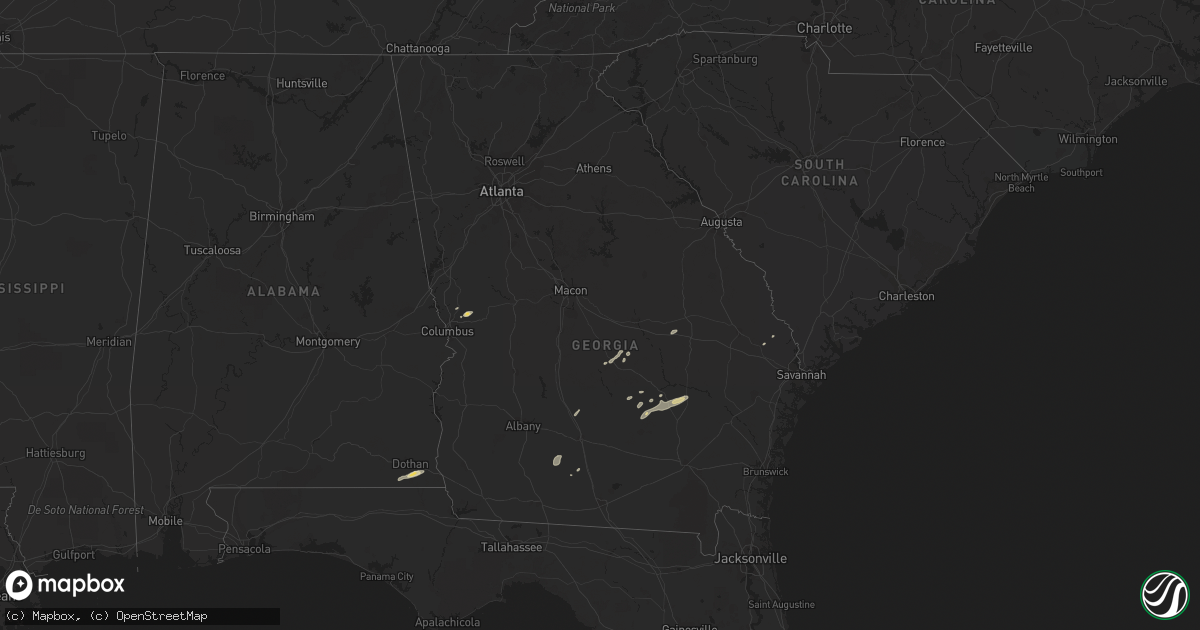
Hail Map in Georgia on June 7, 2013
Get this storm
June 7 map
$229
one time, instant access
Download today. No call, no setup
Keep the $229
Bought the map and want the full workflow? Apply the entire $229 to a subscription within 7 days. None of it is wasted.
Every map, not just this one
This buys you this map. Subscription and you get every map we run, in the markets you choose from a few cities to whole states to nationwide. Plus real-time alerts the moment a storm fires.
Contact data
Name, contact info, occupancy, even credit band for addresses in the footprint. You go from where it hit to who to call.
Become the source they trust
Unlimited branding weather history reports on demand. You already have the documented answer ready for the property owner, and you are the one who showed up with it.
Property data and RoofTrace estimates
Pull up any address you have got, its value and the exact code rules for that jurisdiction, straight from One Click Code. Then RoofTrace estimates the squares, pitch, and roof value, priced the way you price.
Storm reports in Georgia
Georgia
| Date | Description |
|---|---|
| 06/07/20136:30 PM CDT | Multiple trees down across southern laurens county. Time is based on radar. |
| 06/07/20136:02 PM CDT | Dodge county skywarn coordinator is relaying spotter reports of several trees down just northeast of eastman dodge county airport. Time based on radar. |
| 06/07/20135:35 PM CDT | Public reported trees down along gay road between william tinley road and highway 305. Also numerous limbs down along with pea size hail. |
| 06/07/20135:10 PM CDT | Several trees were blown down in the ellerslie area. |
| 06/07/20134:06 PM CDT | Social media relayed reports of numerous trees down in alpharetta. Time is based on radar. |
| 06/07/20134:05 PM CDT | Broadcast media relayed a report of a tree down in alpharetta. Numerous public phone calls to the the wfo reported large tree branches down. |
| 06/06/20138:15 PM CDT | Large tree down on power lines and crossing east old savannah rd. Numerous power outages also reported across southern jenkins county. |
| 06/06/20137:42 PM CDT | Emanuel county 911 relayed a report of multiple trees down throught the county. |
All States Impacted by Hail Map on June 7, 2013
Cities Impacted by Hail Map on June 7, 2013
- Socorro, NM
- Harlingen, TX
- Roma, TX
- Rio Grande City, TX
- Hardesty, OK
- Balko, OK
- Arenas Valley, NM
- Silver City, NM
- Capitan, NM
- Borger, TX
- Norman Park, GA
- Moultrie, GA
- Linn, TX
- Edinburg, TX
- Fort Davis, TX
- Ocate, NM
- Levant, KS
- Boise City, OK
- Felt, OK
- Clayton, NM
- Fort Hancock, TX
- Colby, KS
- Seadrift, TX
- Jacksonville, GA
- Corona, NM
- Selden, KS
- Melrose, NM
- Clovis, NM
- Floyd, NM
- Portales, NM
- Mora, NM
- Turner, MT
- Garita, NM
- Santa Rosa, NM
- Laredo, TX
- Simla, CO
- Encino, TX
- Rolla, KS
- Monticello, FL
- Stinnett, TX
- Morse, TX
- Shell, WY
- Manderson, WY
- Winston, NM
- Eagle Pass, TX
- Rockport, TX
- Alice, TX
- Trementina, NM
- Spearman, TX
- Elbert, CO
- Ramah, CO
- Limon, CO
- Calhan, CO
- Matheson, CO
- Cataula, GA
- Scott City, KS
- Concepcion, TX
- Realitos, TX
- Cohagen, MT
- Brewster, KS
- Goodland, KS
- Edson, KS
- Gem, KS
- Lovell, WY
- Logan, NM
- Jordan, MT
- Valmora, NM
- Watrous, NM
- Kenton, OK
- Grenville, NM
- Wagon Mound, NM
- Hebbronville, TX
- Dalhart, TX
- Hazlehurst, GA
- Baxley, GA
- Broxton, GA
- Las Vegas, NM
- Stratford, TX
- Elkhart, KS
- Goodwell, OK
- Perryton, TX
- Nara Visa, NM
- Vaughn, NM
- Anton Chico, NM
- Ashford, AL
- Dothan, AL
- Soperton, GA
- Moorcroft, WY
- Malta, MT
- Dodson, MT
- Cleveland, NM
- Penitas, TX
- Mission, TX
- Sullivan City, TX
- Grulla, TX
- Bent, NM
- Mescalero, NM
- Booker, TX
- Skellytown, TX
- Syracuse, KS
- Slocomb, AL
- Cottonwood, AL
- Potter, NE
- Kendall, KS
- Sierra Blanca, TX
- Corpus Christi, TX
- Midland, GA
- Upatoi, GA
- Ellerslie, GA
- Waverly Hall, GA
- Kingsville, TX
- La Joya, TX
- Denton, GA
- Fort Sumner, NM
- Carrizozo, NM
- Loring, MT
- Hanover, NM
- Santa Clara, NM
- Greybull, WY
- Buena Vista, NM
- Raton, NM
- Powell, WY
- Cadwell, GA
- Hurley, NM
- Holly, CO
- Sapello, NM
- Dix, NE
- Sidney, NE
- Miami, TX
- Port O'Connor, TX
- Adel, GA
- San Isidro, TX
- Santa Elena, TX
- Falfurrias, TX
- Rexford, KS
- Texline, TX
- Eastman, GA
- Weston, CO
- San Benito, TX
- Brooklet, GA
- Lyford, TX
- Rainsville, NM
- Conchas Dam, NM
- Chauncey, GA
- Gruver, TX
- Robstown, TX
- Manter, KS
- Springfield, GA
- Raymondville, TX
- Lumber City, GA
- Ashburn, GA
- Sycamore, GA
- Quemado, TX


