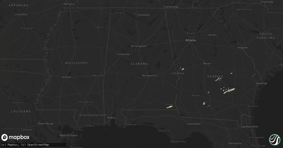
Hail Map in Alabama on June 7, 2013
Get this storm
June 7 map
$229
one time, instant access
Download today. No call, no setup
Keep the $229
Bought the map and want the full workflow? Apply the entire $229 to a subscription within 7 days. None of it is wasted.
Every map, not just this one
This buys you this map. Subscription and you get every map we run, in the markets you choose from a few cities to whole states to nationwide. Plus real-time alerts the moment a storm fires.
Contact data
Name, contact info, occupancy, even credit band for addresses in the footprint. You go from where it hit to who to call.
Become the source they trust
Unlimited branding weather history reports on demand. You already have the documented answer ready for the property owner, and you are the one who showed up with it.
Property data and RoofTrace estimates
Pull up any address you have got, its value and the exact code rules for that jurisdiction, straight from One Click Code. Then RoofTrace estimates the squares, pitch, and roof value, priced the way you price.
Storm reports in Alabama
Alabama
| Date | Description |
|---|---|
| 06/07/20132:57 PM CDT | Wtvy-tv submitted a picture of a piece of wood embedded in the roof of a structure in the ashford area with other debris scattered around the area. |
| 06/07/20132:52 PM CDT | Public estimated 65 to 70 mph winds near avon. Reported via social media. |
| 06/07/20132:50 PM CDT | Trees and power lines down about 2 miles from cottonwood. Reported via social media. |
| 06/07/20132:47 PM CDT | Awning blown off cowarts creek church along with a fence and tree down. Reported via social media. |
| 06/07/20132:46 PM CDT | Trees down with barns and trailers damaged on cottonwood road and gene terry road. Reported via social media. |
| 06/07/20132:46 PM CDT | Trees down along hall road and coot fowler road including one on a house across from briar creek veterinary clinic. Reported via social media. |
| 06/07/20132:43 PM CDT | Trees down on willie varnum road between county road 33 and harper joy road. Reported via social media. |
| 06/07/20132:40 PM CDT | Trees down on middleton road from flournoy moore road to eugene west road. Reported via social media. |
| 06/07/20132:38 PM CDT | Relayed report of several pine trees snapped on golf course. Time estimated by radar. |
| 06/07/20132:36 PM CDT | Several trees and powerlines reported down around rehobeth. Time estimated by radar. |
| 06/07/20132:35 PM CDT | Dothan eagle newspaper showed a picture of power lines down on skipper road. Delayed report from june 7th storm. |
| 06/07/20132:32 PM CDT | Dothan eagle showed a picture of a tree across the road near the intersection of atwell road and new hope road and stated several trees were down along new hope road. D |
| 06/07/20132:32 PM CDT | Trees and powerlines reported down around malvern. Debris in the road. |
| 06/07/20132:30 PM CDT | Dothan eagle newspaper article reported trees down along providence road. Delayed report from june 7th storm. |
| 06/07/20132:25 PM CDT | Trees down around fadette |
All States Impacted by Hail Map on June 7, 2013
Cities Impacted by Hail Map on June 7, 2013
- Socorro, NM
- Harlingen, TX
- Roma, TX
- Rio Grande City, TX
- Hardesty, OK
- Balko, OK
- Arenas Valley, NM
- Silver City, NM
- Capitan, NM
- Borger, TX
- Norman Park, GA
- Moultrie, GA
- Linn, TX
- Edinburg, TX
- Fort Davis, TX
- Ocate, NM
- Levant, KS
- Boise City, OK
- Felt, OK
- Clayton, NM
- Fort Hancock, TX
- Colby, KS
- Seadrift, TX
- Jacksonville, GA
- Corona, NM
- Selden, KS
- Melrose, NM
- Clovis, NM
- Floyd, NM
- Portales, NM
- Mora, NM
- Turner, MT
- Garita, NM
- Santa Rosa, NM
- Laredo, TX
- Simla, CO
- Encino, TX
- Rolla, KS
- Monticello, FL
- Stinnett, TX
- Morse, TX
- Shell, WY
- Manderson, WY
- Winston, NM
- Eagle Pass, TX
- Rockport, TX
- Alice, TX
- Trementina, NM
- Spearman, TX
- Elbert, CO
- Ramah, CO
- Limon, CO
- Calhan, CO
- Matheson, CO
- Cataula, GA
- Scott City, KS
- Concepcion, TX
- Realitos, TX
- Cohagen, MT
- Brewster, KS
- Goodland, KS
- Edson, KS
- Gem, KS
- Lovell, WY
- Logan, NM
- Jordan, MT
- Valmora, NM
- Watrous, NM
- Kenton, OK
- Grenville, NM
- Wagon Mound, NM
- Hebbronville, TX
- Dalhart, TX
- Hazlehurst, GA
- Baxley, GA
- Broxton, GA
- Las Vegas, NM
- Stratford, TX
- Elkhart, KS
- Goodwell, OK
- Perryton, TX
- Nara Visa, NM
- Vaughn, NM
- Anton Chico, NM
- Ashford, AL
- Dothan, AL
- Soperton, GA
- Moorcroft, WY
- Malta, MT
- Dodson, MT
- Cleveland, NM
- Penitas, TX
- Mission, TX
- Sullivan City, TX
- Grulla, TX
- Bent, NM
- Mescalero, NM
- Booker, TX
- Skellytown, TX
- Syracuse, KS
- Slocomb, AL
- Cottonwood, AL
- Potter, NE
- Kendall, KS
- Sierra Blanca, TX
- Corpus Christi, TX
- Midland, GA
- Upatoi, GA
- Ellerslie, GA
- Waverly Hall, GA
- Kingsville, TX
- La Joya, TX
- Denton, GA
- Fort Sumner, NM
- Carrizozo, NM
- Loring, MT
- Hanover, NM
- Santa Clara, NM
- Greybull, WY
- Buena Vista, NM
- Raton, NM
- Powell, WY
- Cadwell, GA
- Hurley, NM
- Holly, CO
- Sapello, NM
- Dix, NE
- Sidney, NE
- Miami, TX
- Port O'Connor, TX
- Adel, GA
- San Isidro, TX
- Santa Elena, TX
- Falfurrias, TX
- Rexford, KS
- Texline, TX
- Eastman, GA
- Weston, CO
- San Benito, TX
- Brooklet, GA
- Lyford, TX
- Rainsville, NM
- Conchas Dam, NM
- Chauncey, GA
- Gruver, TX
- Robstown, TX
- Manter, KS
- Springfield, GA
- Raymondville, TX
- Lumber City, GA
- Ashburn, GA
- Sycamore, GA
- Quemado, TX


