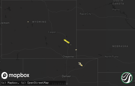
Hail Map in Wyoming on June 5, 2021
The weather event in Wyoming on June 5, 2021 includes Hail and Wind maps. 11 states and 204 cities were impacted and suffered possible damage. The total estimated number of properties impacted is 0.

Hail
Wind
0
Estimated number of impacted properties by a 1.00" hail or larger0
Estimated number of impacted properties by a 1.75" hail or larger0
Estimated number of impacted properties by a 2.50" hail or largerStorm reports in Wyoming
Wyoming
| Date | Description |
|---|---|
| 06/05/20215:58 PM CDT | Shirley rim wydot site. |
| 06/05/20212:16 AM CDT | At 716 PM MDT, a severe thunderstorm was located 7 miles southeast of Two Moon Campground, or 27 miles north of Wheatland, moving northeast at 35 mph. HAZARD...60 mph wind gusts and nickel size hail. SOURCE...Radar indicated. IMPACT...Expect damage to roofs, siding, and trees. Locations impacted include... Guernsey, Jay Em, Guernsey Campground, Rawhide Buttes, Glendo Reservoir, Two Moon Campground and Hartville. |
| 06/04/20218:10 PM CDT | Wind gusts above 60 mph from 654 pm to 710 pm. Heavy rainfall reported. |
All States Impacted by Hail Map on June 5, 2021
Cities Impacted by Hail Map on June 5, 2021
- Calvin, ND
- Munich, ND
- Dade City, FL
- Summerville, SC
- New England, ND
- Shepherd, MT
- Dickinson, ND
- Langdon, ND
- Osnabrock, ND
- Walhalla, ND
- Roundup, MT
- Capitan, NM
- Pembina, ND
- Bathgate, ND
- Castle Rock, CO
- Rice, TX
- Newcastle, WY
- Ridgeville, SC
- Cross, SC
- Victoria, TX
- Gladstone, ND
- Dassel, MN
- Hempstead, TX
- Bellville, TX
- Devils Lake, ND
- Belfield, ND
- New Braunfels, TX
- Bowman, ND
- Caldwell, TX
- Milano, TX
- Richardton, ND
- Franklin, TX
- Hearne, TX
- South Heart, ND
- Taylor, ND
- Penn, ND
- Beulah, ND
- Amidon, ND
- Hazen, ND
- Wellington, CO
- Las Vegas, NM
- Valmora, NM
- Wagon Mound, NM
- Trementina, NM
- Saint Thomas, ND
- Stephenville, TX
- Athens, TX
- Edmore, ND
- Fairdale, ND
- Edgemont, SD
- Custer, SD
- Hebron, ND
- Goose Creek, SC
- Worden, MT
- Annandale, MN
- Twin City, GA
- Granbury, TX
- Hamilton, ND
- Ladson, SC
- Custer, MT
- Mart, TX
- Underwood, ND
- Bridgeport, TX
- Paradise, TX
- Lavina, MT
- Nordheim, TX
- Runge, TX
- Hoople, ND
- Crystal, ND
- Manning, ND
- Ekalaka, MT
- Rhame, ND
- Porter, TX
- Conroe, TX
- Spring, TX
- Livermore, CO
- Halliday, ND
- Sedalia, CO
- Sunset, TX
- Alvord, TX
- Plano, TX
- Fort Sumner, NM
- Cavalier, ND
- Neche, ND
- Saint Vincent, MN
- Wales, ND
- Cuero, TX
- Chatfield, TX
- Powell, TX
- Ennis, TX
- Medora, ND
- Bryan, TX
- Edinburg, ND
- Lancaster, MN
- Hensel, ND
- Leesville, TX
- Gonzales, TX
- Drayton, ND
- Nemo, SD
- Halma, MN
- Lake Bronson, MN
- Dodge, ND
- Badger, MN
- Charleston, SC
- Socorro, NM
- Golden Valley, ND
- Kemp, TX
- Webster, ND
- Islandton, SC
- Max, ND
- Mercer, ND
- Zap, ND
- Garrison, ND
- Douglas, ND
- Glen Ullin, ND
- Wing, ND
- Turtle Lake, ND
- Benedict, ND
- Center, ND
- New Salem, ND
- Wilton, ND
- Riverdale, ND
- Butte, ND
- Regan, ND
- Washburn, ND
- Coleharbor, ND
- Stanton, ND
- Ruso, ND
- Denhoff, ND
- Mcclusky, ND
- Carpio, ND
- Minot, ND
- Minot Afb, ND
- Glenburn, ND
- Donnybrook, ND
- Deering, ND
- Surrey, ND
- Towner, ND
- Lansford, ND
- Des Lacs, ND
- Granville, ND
- Norwich, ND
- Berthold, ND
- Burlington, ND
- Willow City, ND
- Rugby, ND
- Upham, ND
- Bantry, ND
- Balfour, ND
- Park River, ND
- Alsen, ND
- Maddock, ND
- Fort Totten, ND
- Mylo, ND
- Crary, ND
- Cando, ND
- Oberon, ND
- Anamoose, ND
- Karlsruhe, ND
- Adams, ND
- Drake, ND
- Esmond, ND
- Milton, ND
- Warwick, ND
- Brocket, ND
- Knox, ND
- Nekoma, ND
- Wolford, ND
- Rocklake, ND
- Fessenden, ND
- Lawton, ND
- Churchs Ferry, ND
- Glasston, ND
- Hampden, ND
- Lankin, ND
- Perth, ND
- Mountain, ND
- Sheyenne, ND
- Agate, ND
- Egeland, ND
- Saint Michael, ND
- Bisbee, ND
- York, ND
- Harvey, ND
- Voltaire, ND
- Leeds, ND
- Balta, ND
- Lakota, ND
- Starkweather, ND
- Martin, ND
- Minnewaukan, ND
- Hannah, ND
- Angela, MT
- Rosebud, MT
- Cohagen, MT
- Volborg, MT
- Kinsey, MT
- Terry, MT
- Fallon, MT
- Miles City, MT
- Glendive, MT
- Brockway, MT
- Ismay, MT
- Forsyth, MT


