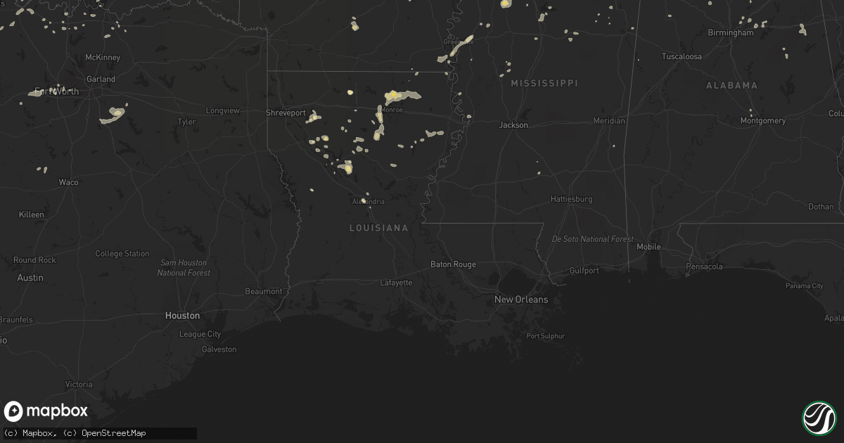
Hail Map in Louisiana on June 5, 2013
Get this storm
June 5 map
$229
one time, instant access
Download today. No call, no setup
Keep the $229
Bought the map and want the full workflow? Apply the entire $229 to a subscription within 7 days. None of it is wasted.
Every map, not just this one
This buys you this map. Subscription and you get every map we run, in the markets you choose from a few cities to whole states to nationwide. Plus real-time alerts the moment a storm fires.
Contact data
Name, contact info, occupancy, even credit band for addresses in the footprint. You go from where it hit to who to call.
Become the source they trust
Unlimited branding weather history reports on demand. You already have the documented answer ready for the property owner, and you are the one who showed up with it.
Property data and RoofTrace estimates
Pull up any address you have got, its value and the exact code rules for that jurisdiction, straight from One Click Code. Then RoofTrace estimates the squares, pitch, and roof value, priced the way you price.
Storm reports in Louisiana
Louisiana
| Date | Description |
|---|---|
| 06/05/20136:00 AM CDT | A large tree fell adjacent to the old antoons restaurant on washington street...damaging a corner of the building. A canopy was also blown off a building on south dr. N |
| 06/05/20135:50 AM CDT | Several large pecan trees were blown down at the oakland plantation within the cane river creole national historic park in the bermuda community. |
| 06/05/20135:38 AM CDT | Trees down on 471 and litle horseshoe road |
| 06/05/20135:25 AM CDT | Numerous trees downed near the verda community in extreme northwest grant parish. |
| 06/05/20135:20 AM CDT | Numerous trees down south of atlanta in extreme southwest winn parish. |
| 06/05/20132:20 AM CDT | A local report indicates 1.00 inch wind near ALEXANDRIA |
| 06/05/20132:15 AM CDT | Wind estimated by public of 60 to 70 mph near airport. |
| 06/05/20131:58 AM CDT | Wind measured at aex asos. |
All States Impacted by Hail Map on June 5, 2013
Cities Impacted by Hail Map on June 5, 2013
- Encino, NM
- Sweetwater, TX
- Trent, TX
- Merkel, TX
- Rule, TX
- Amory, MS
- Smithville, MS
- Charleston, MS
- Tutwiler, MS
- Vaughn, NM
- Conchas Dam, NM
- Mosquero, NM
- Hollandale, MS
- Atlanta, GA
- Andrews, TX
- Friona, TX
- Broadview, NM
- Texico, NM
- Garden City, TX
- Baldwyn, MS
- Muleshoe, TX
- Albany, TX
- Courtland, MS
- Batesville, MS
- Aberdeen, MS
- Ringling, OK
- Healdton, OK
- Dubach, LA
- Sterling City, TX
- Big Lake, TX
- Tarzan, TX
- Stanton, TX
- Stanley, NM
- Rotan, TX
- Aspermont, TX
- Jayton, TX
- Abilene, TX
- Stamford, TX
- Big Spring, TX
- Coahoma, TX
- West Memphis, AR
- Earle, AR
- Crawfordsville, AR
- Turrell, AR
- Marion, AR
- Hermleigh, TX
- Heflin, LA
- McCaulley, TX
- Hamlin, TX
- Roby, TX
- Roy, NM
- Moran, TX
- Fort Stockton, TX
- Valley Mills, TX
- Springlake, TX
- Earth, TX
- Tyronza, AR
- Grady, NM
- Holly Springs, MS
- Waterford, MS
- West Monroe, LA
- Calhoun, LA
- Eros, LA
- Bard, NM
- Nauvoo, AL
- Lynn, AL
- Justiceburg, TX
- Post, TX
- Hampton, AR
- Camden, AR
- Portales, NM
- Oakland, MS
- Cisco, TX
- Midkiff, TX
- Ozona, TX
- Raton, NM
- Olton, TX
- Newellton, LA
- Corona, NM
- Tiptonville, TN
- Union City, TN
- Jonesboro, AR
- Oneonta, AL
- Blountsville, AL
- Altoona, AL
- Colorado City, TX
- Westbrook, TX
- Gleason, TN
- Dresden, TN
- Manchester, TN
- Winnsboro, LA
- Des Moines, NM
- Alexandria, LA
- Santa Fe, NM
- Rochester, TX
- Spur, TX
- Sardis, MS
- O'Brien, TX
- Saline, LA
- Ashland, LA
- Castor, LA
- Farwell, TX
- Logan, NM
- San Jon, NM
- Dimmitt, TX
- Tucumcari, NM
- Plainview, TX
- Hart, TX
- Hereford, TX
- Hale Center, TX
- Bovina, TX
- Fieldton, TX
- Saint Jo, TX
- Knox City, TX
- Munday, TX
- Cascilla, MS
- Haleyville, AL
- Double Springs, AL
- Fisher, AR
- Cherry Valley, AR
- Weiner, AR
- Harrisburg, AR
- Anson, TX
- Sylvester, TX
- Willard, NM
- Coushatta, LA
- Denison, TX
- Solano, NM
- Hawley, TX
- Clovis, NM
- Grenada, MS
- Duck Hill, MS
- McCarley, MS
- Ryan, OK
- Loop, TX
- Brownfield, TX
- Pell City, AL
- Odenville, AL
- Ruston, LA
- Kaufman, TX
- Roscoe, TX
- Fluvanna, TX
- Natchitoches, LA
- Cherokee, AL
- Avoca, TX
- Ragland, AL
- Scurry, TX
- Loraine, TX
- Maryneal, TX
- Haltom City, TX
- Fort Worth, TX
- Weinert, TX
- Coffeeville, MS
- Haskell, TX
- Ira, TX
- Las Vegas, NM
- Sapello, NM
- Naval Air Station Jrb, TX
- Taiban, NM
- Hamilton, AL
- Detroit, AL
- Nolan, TX
- Crosbyton, TX
- Athens, TN
- Riceville, TN
- Winnfield, LA
- Talbott, TN
- Jefferson City, TN
- Potts Camp, MS
- Ocate, NM
- Enid, MS
- Lambert, MS
- Gobler, MO
- Steele, MO
- Readyville, TN
- Woodbury, TN
- Christiana, TN
- Bradyville, TN
- Beechgrove, TN
- Tuscumbia, AL
- Atlanta, LA
- Booneville, MS
- Eunice, NM
- Menlo, GA
- Throckmorton, TX
- Normandy, TN
- Wartrace, TN
- Tullahoma, TN
- Amherst, TX
- Sudan, TX
- Ringgold, LA
- Gainesville, TX
- Memphis, TN
- Tupelo, MS
- Newport, AR
- Tuckerman, AR
- West Point, MS
- Prairie, MS
- Breckenridge, TX
- Whitesboro, TX
- Stuttgart, AR
- Slaton, TX
- Denver City, TX
- Ralls, TX
- Mertzon, TX
- Columbia, LA
- Muenster, TX
- Forestburg, TX
- Farmerville, LA
- Sterlington, LA
- Bastrop, LA
- Monroe, LA
- Collinston, LA
- Fayette, AL
- Snyder, TX
- Amagon, AR
- Cash, AR
- Natchez, LA
- Cosby, TN
- Florien, LA
- Lindsay, TX
- Prattville, AL
- Magee, MS
- Colfax, LA
- Montgomery, LA
- Quitman, LA
- Water Valley, MS
- Midland, TX
- Trementina, NM
- Savoy, TX
- Nettleton, MS
- Florence, AL
- Mathiston, MS
- Eupora, MS
- Mer Rouge, LA
- Marietta, MS
- Sunflower, MS
- Doddsville, MS
- Wichita Falls, TX
- Holliday, TX
- Olla, LA
- Moriarty, NM
- Petrolia, TX
- Tchula, MS
- Belzoni, MS
- Henrietta, TX
- Lorenzo, TX
- Ransom Canyon, TX
- San Angelo, TX
- Nocona, TX
- Fort Sumner, NM
- Rolling Fork, MS
- Oak Ridge, LA
- Piedmont, AL
- Leesburg, AL
- Gadsden, AL
- Centre, AL
- Lake Providence, LA
- Lake Village, AR
- Eudora, AR
- Tremont, MS
- Greenwood Springs, MS
- Birmingham, AL
- Arlington, TX
- Byhalia, MS
- Tillatoba, MS
- Sherman, TX
- Van Alstyne, TX
- Whitewright, TX
- Heflin, AL
- Steens, MS
- Horton, AL
- Guntersville, AL
- Russellville, AL
- Bellevue, TX
- Chatham, LA
- Sikes, LA
- Grayson, LA
- Geraldine, AL
- Rociada, NM
- Madisonville, TN
- Sweetwater, TN
- Kingston, OK
- Monett, MO
- Sevierville, TN
- Cedarbluff, MS
- Pheba, MS
- Hickman, KY
- Troy, TN
- Summerville, GA
- Pinson, AL
- Trussville, AL
- Jasper, AL
- Tahoka, TX
- Thackerville, OK
- Blackwell, TX
- Seagraves, TX
- Aledo, TX
- Weatherford, TX
- Carlsbad, TX
- Ackerman, MS
- Kemp, TX
- Ennis, TX
- Rosser, TX
- Etowah, TN
- Humphrey, AR
- Pontotoc, MS
- Red Banks, MS
- Lamar, MS
- Lewisburg, TN
- Shelbyville, TN
- Iraan, TX
- Winona, MS
- Bell Buckle, TN
- Woodson, TX
- Elm Grove, LA
- Dubberly, LA
- Jamestown, LA
- Sibley, LA
- Gladstone, NM
- Leland, MS
- Vicksburg, MS
- Guadalupita, NM
- Seymour, TX
- Pecos, NM
- Greenville, MS
- Moody, AL
- Bells, TX
- Lexington, MS
- Pope, MS
- Aliceville, AL
- Brookland, AR
- Bono, AR
- Wentworth, MO
- Estill Springs, TN
- Winchester, TN
- Sadler, TX
- Pottsboro, TX
- Clifton, TX
- Crenshaw, MS
- Delhi, LA
- Hazen, AR
- Jonesboro, LA
- Dodson, LA
- Bearden, AR
- Bienville, LA
- Iowa Park, TX
- Mead, OK
- Lubbock, TX
- Delta, AL
- Shannon, MS
- Talladega, AL
- Maryville, TN
- Vernon, TX
- Jones, LA
- Ringgold, TX
- Pineville, LA
- Ashland, AL
- Okolona, MS
- Houlka, MS
- Shaw, MS
- Signal Mountain, TN
- Star City, AR
- Monticello, KY
- Cimarron, NM
- Bonham, TX
- Tye, TX
- Yazoo City, MS
- Hamburg, AR
- Campti, LA
- Thorn Hill, TN
- Plantersville, MS
- Verona, MS
- Fackler, AL
- Stevenson, AL
- Bridgeport, AL
- Prentiss, MS
- Mount Olive, MS
- Santa Rosa, NM
- Vina, AL
- Red Bay, AL
- Pine Bluff, AR
- Montezuma, NM
- Rockford, TN
- Jasper, TN
- Sequatchie, TN
- Whitwell, TN
- Gaylesville, AL
- Mentone, AL
- Quitman, MS
- Jena, LA
- Gilmore, AR
- Lueders, TX


