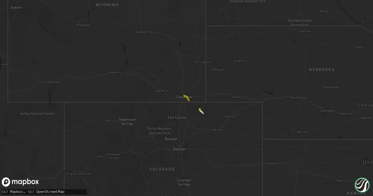
Hail Map on June 4, 2025
Get this storm
June 4 map
$229
one time, instant access
Download today. No call, no setup
Keep the $229
Bought the map and want the full workflow? Apply the entire $229 to a subscription within 7 days. None of it is wasted.
Every map, not just this one
This buys you this map. Subscription and you get every map we run, in the markets you choose from a few cities to whole states to nationwide. Plus real-time alerts the moment a storm fires.
Contact data
Name, contact info, occupancy, even credit band for addresses in the footprint. You go from where it hit to who to call.
Become the source they trust
Unlimited branding weather history reports on demand. You already have the documented answer ready for the property owner, and you are the one who showed up with it.
Property data and RoofTrace estimates
Pull up any address you have got, its value and the exact code rules for that jurisdiction, straight from One Click Code. Then RoofTrace estimates the squares, pitch, and roof value, priced the way you price.
Storm reports
Colorado
| Date | Description |
|---|---|
| 06/04/20256:05 PM CDT | A tornado |
| 06/03/20258:02 PM CDT | A local report indicates a tornado near 18 WNW Two Buttes |
Wyoming
| Date | Description |
|---|---|
| 06/04/20253:10 PM CDT | Nws employee measured 1 inch hail and amongst the accumulating peas and pennies. |
| 06/04/20253:06 PM CDT | Report from mping: quarter |
New Mexico
| Date | Description |
|---|---|
| 06/04/20256:55 PM CDT | Post-event report. Occurred between mile markers 28 and 29 on u.s. Highway 84. |
| 06/04/20255:20 PM CDT | A local report indicates 1.00 inch wind near 3 SSW Jarales |
| 06/04/20254:35 PM CDT | A local report indicates 1.00 inch wind near 4 N Isleta Pueblo |
| 06/03/20259:00 PM CDT | Overturned semi reported along i-40 at mile marker 366. |
| 06/03/20258:34 PM CDT | Corrects previous hail report from 4 n quay. Delayed report; from icechip field research program. Stone measured with caliper at 35.6mm. |
| 06/03/20258:28 PM CDT | Delayed report; from icechip field research program. Stone measured with caliper at 24.1 mm. |
| 06/03/20258:28 PM CDT | Report from mping: quarter |
| 06/03/20258:15 PM CDT | Dime to ping pong size hail accumulated several inches. |
| 06/03/20257:08 PM CDT | Delayed report; from icechip field research program. |
| 06/03/20257:07 PM CDT | Report from mping: quarter |
Florida
| Date | Description |
|---|---|
| 06/04/20251:15 PM CDT | [delayed report] us space force wind sensor at tower 0002 measured a wind gust of 58mph/50kts from the south at 2:15 pm. Sensor elevation 54 feet. |
| 06/04/20251:00 PM CDT | Emergency management reports crane collapsed at the new cape canaveral hospital construction site at borman and sr-520. Storm outflow... Producing wind gusts of around |
| 06/04/20251:00 PM CDT | *** 2 fatal *** updates previous tstm wnd dmg report from 1 e merritt island. Emergency management reports crane collapsed at the new cape canaveral hospital constructi |
Arizona
| Date | Description |
|---|---|
| 06/04/202511:50 AM CDT | Corrects previous tornado report from 5 nne springerville. Large landspout tornado reported by several people on social media... Over rural area ne of springerville. No |
South Carolina
| Date | Description |
|---|---|
| 06/04/20252:44 AM CDT | Emergency manager reported tree and powerlines down near intersection of waddell rd and battery creek rd. Time was estimated via radar data. |
Texas
| Date | Description |
|---|---|
| 06/04/202512:23 AM CDT | Also gusted to 61 mph at 1222 am and 60 mph at 1224 am. Mesonet station 22 tulia 2ne. |
| 06/04/202512:21 AM CDT | Wind |
| 06/04/202512:02 AM CDT | Fm 1424 impassable due to downed power poles. Time estimated. Relayed by tv media. |
| 06/03/202511:39 PM CDT | Mainly penny size hail with a few hailstones up to golf ball size. |
| 06/03/202511:05 PM CDT | Pictures of several hail stones of 1.5 to 1.75 inches with at least one stone just over 2 inches in diameter measured with a ruler on the west side of canyon. |
| 06/03/202511:05 PM CDT | Pictures of several hail stones of |
| 06/03/202510:48 PM CDT | Canyon fire department report of windshield broken by golf ball size hail along hwy 60 between umbarger and canyon. Also received public reports with pictures of golf b |
| 06/03/202510:05 PM CDT | Mostly quarter size to ping pong ball size hail. But there were some rogue 2 inch to tennis ball sized mixed in. |
| 06/03/20259:49 PM CDT | A local report indicates 1.50 inch wind near Simms |
Missouri
| Date | Description |
|---|---|
| 06/04/20252:51 PM CDT | Report of large trees snapped... A roof or side of a garage heavily damaged... And debris strewn. |
| 06/04/20252:50 PM CDT | Nws storm survey found that an ef-1 tornado formed just east of hwy 109 in wildwood at 2:50pm and tracked northeastward. It dissipated in the chesterfield valley just s |
Cities Impacted by Hail Map on June 4, 2025
- Saint Johns, AZ
- Fence Lake, NM
- Laguna, NM
- Wildwood, MO
- Chesterfield, MO
- Cheyenne, WY
- Saint Louis, MO
- Ballwin, MO
- Saint Charles, MO
- Maryland Heights, MO
- Bridgeton, MO
- Hazelwood, MO
- Earth City, MO
- La Veta, CO
- Saint Ann, MO
- Florissant, MO
- Magdalena, NM
- Bosque Farms, NM
- Grover, CO
- Nunn, CO
- Weston, CO
- Rusk, TX
- Isleta, NM
- Albuquerque, NM
- Peralta, NM
- Trinidad, CO
- Tijeras, NM
- Bosque, NM
- Tierra Amarilla, NM
- Jarales, NM
- Belen, NM
- Briggsdale, CO
- Huntsville, TX
- Santa Rosa, NM
- Moriarty, NM
- Cuervo, NM
- Tucumcari, NM
- House, NM
- Las Animas, CO
- Fort Davis, TX
- Alpine, TX
- Logan, NM
- San Jon, NM
- Anton Chico, NM
- Bard, NM
- Marathon, TX
- Springfield, CO
- Adrian, TX
- Hereford, TX
- Mcalister, NM
- Conroe, TX
- Melrose, NM
- Vega, TX
- Wildorado, TX
- Clovis, NM
- Canyon, TX
- Amarillo, TX
- Harrisburg, IL
- Herod, IL
- Dimmitt, TX
- Summerfield, TX
- Texico, NM
- Happy, TX
- Nazareth, TX
- Bovina, TX
- Farwell, TX
- Claude, TX
- Tulia, TX
- Eddyville, IL
- Carrier Mills, IL
- Stonefort, IL
- Silverton, TX
- Equality, IL
- Eldorado, IL
- Ridgway, IL
- Omaha, IL
- Clarendon, TX
- Quitaque, TX
- Lakeview, TX
- Childress, TX
- Turkey, TX
- Memphis, TX
- Crosbyton, TX
- Ralls, TX
- Crowell, TX
- Dickens, TX
- Mcadoo, TX
- Chillicothe, TX
- Paducah, TX
- Seymour, TX
- Old Glory, TX
- Knox City, TX
- O'Brien, TX
- Rochester, TX
- Weinert, TX
- Kress, TX