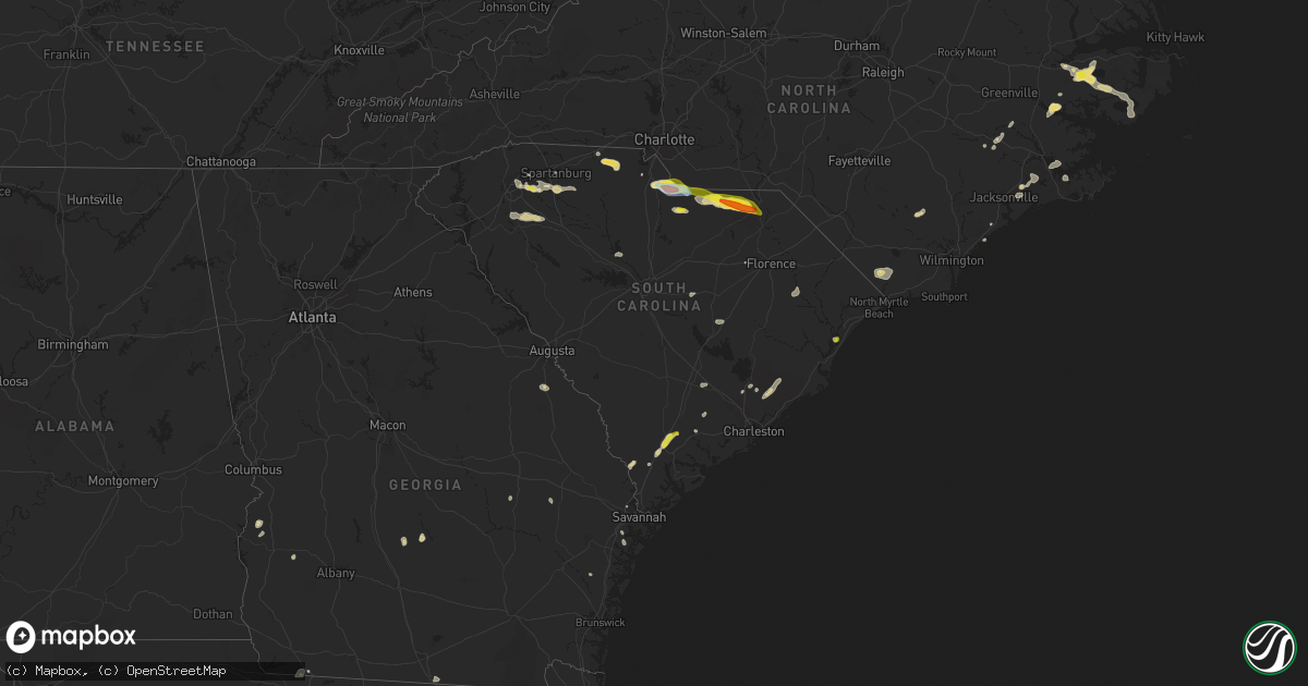
Hail Map in South Carolina on June 3, 2022
Get this storm
June 3 map
$229
one time, instant access
Download today. No call, no setup
Keep the $229
Bought the map and want the full workflow? Apply the entire $229 to a subscription within 7 days. None of it is wasted.
Every map, not just this one
This buys you this map. Subscription and you get every map we run, in the markets you choose from a few cities to whole states to nationwide. Plus real-time alerts the moment a storm fires.
Contact data
Name, contact info, occupancy, even credit band for addresses in the footprint. You go from where it hit to who to call.
Become the source they trust
Unlimited branding weather history reports on demand. You already have the documented answer ready for the property owner, and you are the one who showed up with it.
Property data and RoofTrace estimates
Pull up any address you have got, its value and the exact code rules for that jurisdiction, straight from One Click Code. Then RoofTrace estimates the squares, pitch, and roof value, priced the way you price.
Storm reports in South Carolina
South Carolina
| Date | Description |
|---|---|
| 06/03/20224:57 PM CDT | Tree down blocking the roadway. Time estimated from radar. |
| 06/03/20224:27 PM CDT | Sc state highway patrol reported a tree down in the roadway at the intersection of u.s. Routes 21 and 17a. Time was estimated from radar data. |
| 06/03/20224:27 PM CDT | Sc state highway patrol reported a tree down in the roadway at the intersection of hendersonville highway and jonesville avenue. Time was estimated from radar data. |
| 06/03/20224:25 PM CDT | 1 inch hail reported and tree limbs down. Power out for a short time. |
| 06/03/20224:25 PM CDT | 1 inch hail reported and tree limbs down. Power out for a short time. |
| 06/03/20224:25 PM CDT | Public reported quarter sized hail and tree limbs down just north of yemassee. Time was estimated from report and from radar data. |
| 06/03/20224:24 PM CDT | Sc state highway patrol reported a tree down in the roadway at the intersection of castle hall road and old sheldon church road. Time was estimated from radar data. |
| 06/03/20224:15 PM CDT | Sc state highway patrol reported a tree down in the roadway along nuna rock road. Time was estimated from radar data. |
| 06/03/20224:11 PM CDT | Uprooted pine tree at e. Elizabeth street and douglass street. |
| 06/03/20224:10 PM CDT | Sc state highway patrol reported a tree down in the roadway along interstate 95 near mile marker 28. Time was estimated from radar data. |
| 06/03/20224:10 PM CDT | Two broken power poles on west elizabeth street in jefferson. Winds estimated of 50-60 mph. Picture of damage received through social media. |
| 06/03/20224:07 PM CDT | Sc state highway patrol reported a tree down along u.s. Route 321 south of tarboro road. Time was estimated from radar data. |
| 06/03/20223:46 PM CDT | Large number of trees down in many portions of northern lancaster county. |
| 06/03/20223:40 PM CDT | Estimated 60 mph wind gust. |
| 06/03/20223:34 PM CDT | A local report indicates 1.00 inch wind near 4 N LANCASTER |
| 06/03/20223:30 PM CDT | Half dollar to golf ball sized hail. Lots of trees down and power poles snapped in the vicinity as well. Pictures forwarded on social media. Time estimated from radar. |
| 06/03/20223:27 PM CDT | Also very strong winds... But no estimate on speed. |
| 06/03/20223:25 PM CDT | Several trees down by highway 5 and riverside road. |
| 06/03/20223:15 PM CDT | Broadcast media relayed via social media a picture of quarter sized hail which fell in thomas corner in berkeley county. Time was estimated from radar data. |
| 06/03/20223:10 PM CDT | Sc highway patrol reported a tree in roadway at the intersection of sc 14 and nehemiah dr. Time estimated from radar. |
| 06/03/20223:00 PM CDT | Tree in the road along reservation rd. |
| 06/03/20222:55 PM CDT | York county emergency management reported multiple trees down at the 4600 block of curenton ferry rd. Time estimated from radar. |
| 06/03/20222:50 PM CDT | York county emergency management reported multiple trees down near the intersection of hall spencer rd and collins rd. Time estimated from radar. |
| 06/03/20222:50 PM CDT | Sc highway patrol reported a tree in roadway at the intersection of hillside church rd and bowater pass. Time estimated from radar. |
| 06/03/20222:30 PM CDT | York county emergency management reported multiple trees down near the marshall rd and dalene ave intersection. Time estimated from radar. |
| 06/03/20222:20 PM CDT | Broadcast media reported a large tree fell on two parked cars in a residential driveway in the crossing neighborhood. Time estimated from radar. |
| 06/03/20222:15 PM CDT | York county emergency management reported multiple trees down on daves rd near mcconnells. Time estimated from radar. |
| 06/03/20222:10 PM CDT | Sc highway patrol reported a tree blocking all lanes at the intersection of sc 215 and west rd. Time estimated from radar. |
| 06/03/20222:05 PM CDT | Resident on murph rd reported dozens of trees down across their property... With several blocking the driveway. Several large trees were uprooted and several more trees |
| 06/03/20222:05 PM CDT | Broadcast media reported a large tree snapped into multiple pieces in pauline. Time estimated from radar. |
| 06/03/20222:00 PM CDT | York county emergency management reported multiple trees down on powerlines on liberty st in york. Time estimated from radar. |
| 06/03/20222:00 PM CDT | York county emergency management reported multiple trees down on california rd near york. Time estimated from radar. |
| 06/03/20221:55 PM CDT | York county emergency management reported multiple trees down blocking the intersection of black hwy and windy hill rd. Time estimated from radar. |
| 06/03/20221:50 PM CDT | York county emergency management reported multiple trees down on cedar grove rd. Time estimated from radar. |
| 06/03/20221:50 PM CDT | Sc highway patrol reported a tree in roadway near the intersection of us 221 on hobbysville rd. Time estimated from radar. |
| 06/03/20221:45 PM CDT | York county emergency management reported multiple trees down on s beersheba rd. Time estimated from radar. |
| 06/03/20221:40 PM CDT | York county emergency management reported a tree fell on a roof on propst rd. Time estimated from radar. |
| 06/03/20221:30 PM CDT | Sc highway patrol reported a tree in roadway at the intersection of trammel rd and sc 146. Time estimated from radar. |
| 06/03/20221:28 PM CDT | A local report indicates 1.00 inch wind near 4 S GREENVILLE-SPARTANB |
| 06/03/202212:56 PM CDT | Social media video of a large tree limb on power line. |
| 06/03/202212:55 PM CDT | Sc highway patrol reported a tree down blocking the roadway on blacks dr near the intersection with rolling green circle. Time estimated from radar. |
| 06/03/202212:51 AM CDT | At 551 PM EDT, a severe thunderstorm was located over Cheraw State Park, or near Cheraw, moving east at 30 mph. HAZARD...60 mph wind gusts and penny size hail. SOURCE...Radar indicated. IMPACT...Expect wind damage to trees and power lines. Locations impacted include... Bennettsville, Hartsville, Darlington, Mccoll, Clio, North Hartsville, Dovesville, Mont Clare, Darlington Raceway, Auburn, Wallace, Mechanicsville, Chavistown, Floyd, Florence Darlington Technical College Main Campus, Society Hill, Blenheim and Tatum. |
| 06/03/202212:47 AM CDT | At 546 PM EDT, a severe thunderstorm was located near Shaw Air Base, moving east at 10 mph. HAZARD...60 mph wind gusts and quarter size hail. SOURCE...Radar indicated. IMPACT...Hail damage to vehicles is expected. Expect wind damage to trees and powerlines. Locations impacted include... Sumter, South Sumter, Shaw Air Base, Mulberry, Oakland, Sumter County Airport, Millwood, Cane Savannah, Oswego, Dalzell, Lakewood, Wedgewood, East Sumter, Cherryvale, Stateburg and Privateer. |
| 06/03/202212:24 AM CDT | At 523 PM EDT, a severe thunderstorm was located over Pocotaligo, moving northeast at 20 mph. HAZARD...60 mph wind gusts and half dollar size hail. SOURCE...Radar indicated. IMPACT...Minor hail damage to vehicles is possible. Expect wind damage to trees and powerlines. Locations impacted include: Yemassee, Coosawhatchie, Gardens Corner, Sheldon, Early Branch, McPhersonville and Pocotaligo.This warning includes I-95 in South Carolina between mile markers 26and 50. |
| 06/03/202212:04 AM CDT | At 504 PM EDT, a severe thunderstorm was located over Pageland, or 19 miles southeast of Monroe, moving east at 15 mph. HAZARD...60 mph wind gusts and quarter size hail. SOURCE...Radar indicated. IMPACT...Hail damage to vehicles is expected. Expect wind damage to trees and powerlines. Locations impacted include... Cheraw, Pageland, Kershaw, Chesterfield, Cheraw State Park, Northeastern Technical College, Cheraw Municipal Airport, Carolina Sandhills Wildlife Refuge, Mt Pisgah, Mcbee, Jefferson, Ruby, Patrick, Bethune, Mount Croghan, Chesterfield Ruby Middle School, North Central High School, Cheraw Fish Hatchery, Middendorf and Central High School. |
| 06/02/202211:16 PM CDT | At 416 PM EDT, a severe thunderstorm was located 8 miles north of Lancaster, or near Andrew Jackson State Park, moving east at 20 mph. HAZARD...Golf ball size hail and 60 mph wind gusts. SOURCE...Radar indicated. IMPACT...People and animals outdoors will be injured. Expect hail damage to roofs, siding, windows, and vehicles. Expect wind damage to trees and power lines. Locations impacted include... Waxhaw, Mineral Springs, Sturdivants, Jaars, Trinity, Marshville, Wingate and Monroe. |
| 06/02/202211:14 PM CDT | At 414 PM EDT, a severe thunderstorm was located 7 miles northeast of Huger, moving northeast at 20 mph. HAZARD...60 mph wind gusts and quarter size hail. SOURCE...Radar indicated. IMPACT...Minor hail damage to vehicles is possible. Expect wind damage to trees and powerlines. Locations impacted include: Jamestown and Huger. |
| 06/02/202211:01 PM CDT | At 401 PM EDT, severe thunderstorms were located along a line extending from near Indian Land to near Fort Lawn, moving east at 15 mph. HAZARD...60 mph wind gusts and quarter size hail. SOURCE...Radar indicated. IMPACT...Hail damage to vehicles is expected. Expect wind damage to trees and powerlines. Locations impacted include... Lancaster, Indian Land, Elgin, Andrew Jackson State Park, USC Lancaster, Van Wyck, Irwin, Buford, Arrowood Estates, Tradesville, Camp Creek Fire Station, Community of Almond Glen, Antioch, Kirk Air Base, Forty Acre Rock Preserve, Taxahaw, Unity Fire Station, Lancaster Mill, Carolina Commons Shopping Center and McWhirter Airfield. |
| 06/02/202211:01 PM CDT | At 400 PM EDT, a severe thunderstorm was located over Murrells Inlet, moving southeast at 10 mph. HAZARD...60 mph wind gusts and penny size hail. SOURCE...Radar indicated. IMPACT...Expect wind damage to trees and power lines. Locations impacted include... Surfside Beach, Garden City, Murrells Inlet, Litchfield Beach, Burgess and Waccamaw Community Hospital. |
| 06/02/202210:36 PM CDT | At 336 PM EDT, a severe thunderstorm was located 18 miles east of Anderson, or 8 miles east of Williamston, moving east at 15 mph. HAZARD...60 mph wind gusts and quarter size hail. SOURCE...Radar indicated. IMPACT...Minor hail damage to vehicles is expected. Expect wind damage to trees and power lines. Locations impacted include... Gray Court, Fork Shoals, Princeton, Hickory Tavern, Fountain Inn and Laurens. |
| 06/02/202210:16 PM CDT | At 316 PM EDT, a severe thunderstorm was located 10 miles southeast of Spartanburg, or 4 miles south of Croft State Park, moving east at 20 mph. HAZARD...60 mph wind gusts and half dollar size hail. SOURCE...Radar indicated. IMPACT...Minor hail damage to vehicles is expected. Expect wind damage to trees and power lines. Locations impacted include... Union, Pacolet, Monarch Mill, Buffalo, Jonesville, Croft State Park, Pauline, Adamsburg, Santuc and Lockhart. |
| 06/02/20229:30 PM CDT | At 230 PM EDT, a severe thunderstorm was located 14 miles east of Greenville Downtown, or near Reidville, moving east at 20 mph. HAZARD...60 mph wind gusts and quarter size hail. SOURCE...Radar indicated. IMPACT...Minor hail damage to vehicles is expected. Expect wind damage to trees and power lines. Locations impacted include... Five Forks, Woodruff, Roebuck, Reidville, Moore, Croft State Park, Pauline, Cross Anchor, Enoree and Pacolet. |
| 06/02/20229:16 PM CDT | At 216 PM EDT, a severe thunderstorm was located 7 miles east of Gaffney, or over Blacksburg, moving east at 15 mph. HAZARD...60 mph wind gusts and penny size hail. SOURCE...Radar indicated. IMPACT...Expect damage to trees and power lines. Locations impacted include... York, Clover, Blacksburg, Grover, Sharon, Hickory Grove, Smyrna, Kings Mountain State Park, Crowders and Cherokee Falls. |
| 06/02/20228:42 PM CDT | At 141 PM EDT, a severe thunderstorm was located near Greenville Downtown, or over Cherrydale Point, moving southeast at 15 mph. HAZARD...60 mph wind gusts and penny size hail. SOURCE...Radar indicated. IMPACT...Expect damage to trees and power lines. Locations impacted include... Greenville Downtown, Greenville Eastside, West Greenville, Mauldin, Taylors, Simpsonville, Berea, Five Forks, Welcome and Travelers Rest. |
All States Impacted by Hail Map on June 3, 2022
Cities Impacted by Hail Map on June 3, 2022
- Wray, CO
- Glenrock, WY
- Johnstown, NE
- Wheatland, WY
- Townsend, GA
- Champion, NE
- Kit Carson, CO
- Florissant, CO
- Grant, NE
- Venango, NE
- North Platte, NE
- Brady, NE
- Merna, NE
- Arnold, NE
- Anselmo, NE
- Stapleton, NE
- Douglas, WY
- Conchas Dam, NM
- Rock Hill, SC
- Georgetown, SC
- Eads, CO
- New Bern, NC
- Maysville, NC
- Logan, NM
- Bard, NM
- San Jon, NM
- Amherst, CO
- Otter, MT
- Torrington, WY
- Vona, CO
- Flagler, CO
- Seibert, CO
- Arapahoe, NE
- Yuma, CO
- Holyoke, CO
- Hugo, CO
- Harrison, NE
- Garden City, TX
- Weldona, CO
- Fort Morgan, CO
- Wiggins, CO
- Van Horn, TX
- Hershey, NE
- Ogallala, NE
- Paxton, NE
- Sutherland, NE
- Nara Visa, NM
- Amistad, NM
- Casper, WY
- Batesland, SD
- Joes, CO
- Akron, CO
- Brewster, NE
- Purdum, NE
- Imperial, NE
- Julesburg, CO
- Garrett, WY
- Haxtun, CO
- Pine Bluffs, WY
- Boone, CO
- Ordway, CO
- Olney Springs, CO
- Ryegate, MT
- Shawmut, MT
- Kinston, NC
- Deep Run, NC
- Burdett, KS
- Kendall, KS
- Lakin, KS
- Crawford, NE
- Pomaria, SC
- Jenkinsville, SC
- Karval, CO
- Wedgefield, SC
- Richmond Hill, GA
- Bushnell, NE
- Buffalo, WY
- Whitney, NE
- Stratton, CO
- Fleming, CO
- Otis, CO
- Sterling, CO
- Kaycee, WY
- Padroni, CO
- Edgerton, WY
- Midwest, WY
- Van Tassell, WY
- Lusk, WY
- Lingle, WY
- Idalia, CO
- Eckley, CO
- Vernon, CO
- Hillrose, CO
- Walsh, CO
- Lancaster, SC
- Heath Springs, SC
- Kershaw, SC
- Goodland, KS
- Burlington, CO
- Kanorado, KS
- Martin, SD
- Wiley, CO
- Arlington, CO
- Haswell, CO
- Sugar City, CO
- Las Animas, CO
- Alcova, WY
- Keller, WA
- Ewing, NE
- Capitan, NM
- Ulysses, KS
- Hickory Grove, SC
- York, SC
- Sharon, SC
- Blacksburg, SC
- Smyrna, SC
- Clover, SC
- Fountain Inn, SC
- Honea Path, SC
- Pelzer, SC
- Laurens, SC
- Belton, SC
- Gray Court, SC
- Athol, ID
- Dorchester, SC
- Clarkston, WA
- Pomeroy, WA
- Kirk, CO
- Kim, CO
- Trinidad, CO
- Ridgeland, SC
- Yemassee, SC
- Coosawhatchie, SC
- Mentone, TX
- Wink, TX
- Jal, NM
- Kermit, TX
- Jamestown, SC
- Huger, SC
- Campo, CO
- Keyes, OK
- Boise City, OK
- Salt Flat, TX
- Moriarty, NM
- Beeville, TX
- Tatum, NM
- Dalhart, TX
- Wagon Mound, NM
- Midland, TX
- Tarzan, TX
- Stanton, TX
- Midkiff, TX
- McCamey, TX
- Moncks Corner, SC
- Chipley, FL
- Walterboro, SC
- Woodruff, SC
- Moore, SC
- Cottondale, FL
- Tivoli, TX
- Whiteville, NC
- Clarendon, NC
- Tabor City, NC
- Nakina, NC
- Fort Stockton, TX
- Yeso, NM
- Fort Sumner, NM
- Vaughn, NM
- Waxhaw, NC
- Lumpkin, GA
- Goliad, TX
- Harrells, NC
- Ivanhoe, NC
- Pinetown, NC
- Washington, NC
- Bath, NC
- Blounts Creek, NC
- Chocowinity, NC
- Lake Park, GA
- Burnet, TX
- Oakley, KS
- Merriman, NE
- Goodwell, OK
- Fort Davis, TX
- Sublette, KS
- Satanta, KS
- Monahans, TX
- Balmorhea, TX
- Cuthbert, GA
- Morris, GA
- Roswell, NM
- Bertram, TX
- Gove, KS
- Parks, NE
- Garden City, KS
- Decker, MT
- Orchard, CO
- Balko, OK
- Hooker, OK
- Turpin, OK
- Elkhart, KS
- Simpsonville, SC
- Greer, SC
- Greenville, SC
- Jonesville, SC
- Roebuck, SC
- Taylors, SC
- Duncan, SC
- Spartanburg, SC
- Pauline, SC
- Catawba, SC
- Monroe, NC
- Alpine, TX
- Bethune, CO
- Lovington, NM
- Hobbs, NM
- Walsenburg, CO
- Novice, TX
- Coleman, TX
- Grantsboro, NC
- Arapahoe, NC
- Aguilar, CO
- Cheraw, SC
- Mount Croghan, SC
- Jefferson, SC
- Patrick, SC
- Ruby, SC
- Chesterfield, SC
- Pageland, SC
- Pantego, NC
- Swanquarter, NC
- Roper, NC
- Plymouth, NC
- Belhaven, NC
- Jamesville, NC
- Fairfield, NC
- Engelhard, NC
- Creswell, NC
- Rochelle, GA
- Rebecca, GA
- Attapulgus, GA
- Georgetown, TX
- Artesia, NM
- Dover, NC
- Pecos, TX
- Coyanosa, TX
- Odessa, TX
- Tinnie, NM
- Savannah, GA
- Tillman, SC
- Garnett, SC
- Hanston, KS
- Johnsonville, SC
- Pamplico, SC
- Thibodaux, LA
- Trenton, NC
- Waynesboro, GA
- Keysville, GA
- Carlsbad, NM
- Quincy, FL
- Shellman, GA
- Sheridan Lake, CO
- Grinnell, KS
- Wakeeney, KS
- Claxton, GA
- Grifton, NC
- Cordesville, SC
- Hampstead, NC
- Holly Ridge, NC
- Havelock, NC
- Santa Rosa, NM
- Ralls, TX
- Lorenzo, TX
- Branson, CO
- Trementina, NM
- Vidalia, GA
- Milton, FL
- Opp, AL
- Cottageville, SC
- Ridgeville, SC
- Jacksonville, NC
- Manning, SC
- Elida, NM
- Florala, AL
- Holcomb, KS
- Lamar, SC
- Timmonsville, SC
- Lenorah, TX
- Abbeville, GA
- Edgemoor, SC
- Deerfield, KS
- Big Lake, TX
- Crane, TX
- Rankin, TX
- Murrells Inlet, SC
- Copeland, KS
- Montezuma, KS
- Johnson, KS
- Ingalls, KS
- Cheyenne Wells, CO
- Leoti, KS
- Arapahoe, CO
- Tribune, KS
- Saint Francis, KS
- Haigler, NE
- Loving, NM
- Solano, NM
- Hope, NM


