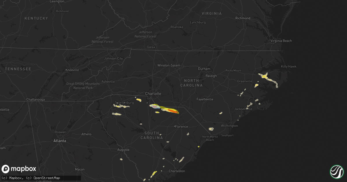
Hail Map in North Carolina on June 3, 2022
Get this storm
June 3 map
$229
one time, instant access
Download today. No call, no setup
Keep the $229
Bought the map and want the full workflow? Apply the entire $229 to a subscription within 7 days. None of it is wasted.
Every map, not just this one
This buys you this map. Subscription and you get every map we run, in the markets you choose from a few cities to whole states to nationwide. Plus real-time alerts the moment a storm fires.
Contact data
Name, contact info, occupancy, even credit band for addresses in the footprint. You go from where it hit to who to call.
Become the source they trust
Unlimited branding weather history reports on demand. You already have the documented answer ready for the property owner, and you are the one who showed up with it.
Property data and RoofTrace estimates
Pull up any address you have got, its value and the exact code rules for that jurisdiction, straight from One Click Code. Then RoofTrace estimates the squares, pitch, and roof value, priced the way you price.
Storm reports in North Carolina
North Carolina
| Date | Description |
|---|---|
| 06/03/20223:20 PM CDT | Resident on dapple ridge rd reported dime-size hail and multiple utility poles down. Time estimated from radar. |
| 06/03/20222:05 PM CDT | A few trees down in jamesville. Near swinson road and grey farm road. Time estimated by radar. |
| 06/03/20221:25 PM CDT | Several trees blown down. Pickup truck blown over. Crops damaged. Railroad bed road was closed for a time due to tree damage. Possible tornado. Time estimated based on |
| 06/03/202212:46 AM CDT | At 546 PM EDT, a severe thunderstorm was located over Goose Creek State Park, or near River Road, moving northeast at 25 mph. HAZARD...60 mph wind gusts and half dollar size hail. SOURCE...Radar indicated. IMPACT...Hail damage to vehicles is expected. Expect wind damage to roofs, siding, and trees. Locations impacted include... Washington, River Road, Belhaven, Sladesville, Pinetown, Ransomville, Pungo, Bunyan, Pike Road, Winsteadville, Core Point, Bayview, Sidney Crossroads, Terra Ceia, Yeatesville, Goose Creek State Park, Bayview Ferry Terminal, Long Acre VFD, Washington Park and Sydney Crossroads. |
| 06/02/202210:12 PM CDT | At 311 PM EDT, a severe thunderstorm was located over Alligator Lake, or 28 miles southeast of Plymouth, moving southeast at 30 mph. HAZARD...60 mph wind gusts and quarter size hail. SOURCE...Radar indicated. IMPACT...Hail damage to vehicles is expected. Expect wind damage to roofs, siding, and trees. Locations impacted include... Kilkenny, Killkenny, Fairfield, Gull Rock, New Holland, Nebraska, Lake Landing, Middletown, Fort Landing, Lake Mattamuskeet and Alligator Lake. |
| 06/02/202210:00 PM CDT | At 259 PM EDT, a severe thunderstorm was located near York, moving east at 20 mph. HAZARD...60 mph wind gusts and quarter size hail. SOURCE...Radar indicated. IMPACT...Minor hail damage to vehicles is expected. Expect wind damage to trees and power lines. Locations impacted include... Rock Hill, York, Fort Mill, Tega Cay, Newport, Lesslie, Sharon, Catawba, Edgemoor and Lake Wylie. |
| 06/02/20229:48 PM CDT | At 247 PM EDT, a severe thunderstorm was located 7 miles northwest of Hinson, or 8 miles west of Plymouth, moving east at 20 mph. HAZARD...60 mph wind gusts and quarter size hail. SOURCE...Radar indicated. IMPACT...Hail damage to vehicles is expected. Expect wind damage to roofs, siding, and trees. Locations impacted include... Plymouth, Wenona, Hinson, Roper, Jamesville and Dardens. |
All States Impacted by Hail Map on June 3, 2022
Cities Impacted by Hail Map on June 3, 2022
- Wray, CO
- Glenrock, WY
- Johnstown, NE
- Wheatland, WY
- Townsend, GA
- Champion, NE
- Kit Carson, CO
- Florissant, CO
- Grant, NE
- Venango, NE
- North Platte, NE
- Brady, NE
- Merna, NE
- Arnold, NE
- Anselmo, NE
- Stapleton, NE
- Douglas, WY
- Conchas Dam, NM
- Rock Hill, SC
- Georgetown, SC
- Eads, CO
- New Bern, NC
- Maysville, NC
- Logan, NM
- Bard, NM
- San Jon, NM
- Amherst, CO
- Otter, MT
- Torrington, WY
- Vona, CO
- Flagler, CO
- Seibert, CO
- Arapahoe, NE
- Yuma, CO
- Holyoke, CO
- Hugo, CO
- Harrison, NE
- Garden City, TX
- Weldona, CO
- Fort Morgan, CO
- Wiggins, CO
- Van Horn, TX
- Hershey, NE
- Ogallala, NE
- Paxton, NE
- Sutherland, NE
- Nara Visa, NM
- Amistad, NM
- Casper, WY
- Batesland, SD
- Joes, CO
- Akron, CO
- Brewster, NE
- Purdum, NE
- Imperial, NE
- Julesburg, CO
- Garrett, WY
- Haxtun, CO
- Pine Bluffs, WY
- Boone, CO
- Ordway, CO
- Olney Springs, CO
- Ryegate, MT
- Shawmut, MT
- Kinston, NC
- Deep Run, NC
- Burdett, KS
- Kendall, KS
- Lakin, KS
- Crawford, NE
- Pomaria, SC
- Jenkinsville, SC
- Karval, CO
- Wedgefield, SC
- Richmond Hill, GA
- Bushnell, NE
- Buffalo, WY
- Whitney, NE
- Stratton, CO
- Fleming, CO
- Otis, CO
- Sterling, CO
- Kaycee, WY
- Padroni, CO
- Edgerton, WY
- Midwest, WY
- Van Tassell, WY
- Lusk, WY
- Lingle, WY
- Idalia, CO
- Eckley, CO
- Vernon, CO
- Hillrose, CO
- Walsh, CO
- Lancaster, SC
- Heath Springs, SC
- Kershaw, SC
- Goodland, KS
- Burlington, CO
- Kanorado, KS
- Martin, SD
- Wiley, CO
- Arlington, CO
- Haswell, CO
- Sugar City, CO
- Las Animas, CO
- Alcova, WY
- Keller, WA
- Ewing, NE
- Capitan, NM
- Ulysses, KS
- Hickory Grove, SC
- York, SC
- Sharon, SC
- Blacksburg, SC
- Smyrna, SC
- Clover, SC
- Fountain Inn, SC
- Honea Path, SC
- Pelzer, SC
- Laurens, SC
- Belton, SC
- Gray Court, SC
- Athol, ID
- Dorchester, SC
- Clarkston, WA
- Pomeroy, WA
- Kirk, CO
- Kim, CO
- Trinidad, CO
- Ridgeland, SC
- Yemassee, SC
- Coosawhatchie, SC
- Mentone, TX
- Wink, TX
- Jal, NM
- Kermit, TX
- Jamestown, SC
- Huger, SC
- Campo, CO
- Keyes, OK
- Boise City, OK
- Salt Flat, TX
- Moriarty, NM
- Beeville, TX
- Tatum, NM
- Dalhart, TX
- Wagon Mound, NM
- Midland, TX
- Tarzan, TX
- Stanton, TX
- Midkiff, TX
- McCamey, TX
- Moncks Corner, SC
- Chipley, FL
- Walterboro, SC
- Woodruff, SC
- Moore, SC
- Cottondale, FL
- Tivoli, TX
- Whiteville, NC
- Clarendon, NC
- Tabor City, NC
- Nakina, NC
- Fort Stockton, TX
- Yeso, NM
- Fort Sumner, NM
- Vaughn, NM
- Waxhaw, NC
- Lumpkin, GA
- Goliad, TX
- Harrells, NC
- Ivanhoe, NC
- Pinetown, NC
- Washington, NC
- Bath, NC
- Blounts Creek, NC
- Chocowinity, NC
- Lake Park, GA
- Burnet, TX
- Oakley, KS
- Merriman, NE
- Goodwell, OK
- Fort Davis, TX
- Sublette, KS
- Satanta, KS
- Monahans, TX
- Balmorhea, TX
- Cuthbert, GA
- Morris, GA
- Roswell, NM
- Bertram, TX
- Gove, KS
- Parks, NE
- Garden City, KS
- Decker, MT
- Orchard, CO
- Balko, OK
- Hooker, OK
- Turpin, OK
- Elkhart, KS
- Simpsonville, SC
- Greer, SC
- Greenville, SC
- Jonesville, SC
- Roebuck, SC
- Taylors, SC
- Duncan, SC
- Spartanburg, SC
- Pauline, SC
- Catawba, SC
- Monroe, NC
- Alpine, TX
- Bethune, CO
- Lovington, NM
- Hobbs, NM
- Walsenburg, CO
- Novice, TX
- Coleman, TX
- Grantsboro, NC
- Arapahoe, NC
- Aguilar, CO
- Cheraw, SC
- Mount Croghan, SC
- Jefferson, SC
- Patrick, SC
- Ruby, SC
- Chesterfield, SC
- Pageland, SC
- Pantego, NC
- Swanquarter, NC
- Roper, NC
- Plymouth, NC
- Belhaven, NC
- Jamesville, NC
- Fairfield, NC
- Engelhard, NC
- Creswell, NC
- Rochelle, GA
- Rebecca, GA
- Attapulgus, GA
- Georgetown, TX
- Artesia, NM
- Dover, NC
- Pecos, TX
- Coyanosa, TX
- Odessa, TX
- Tinnie, NM
- Savannah, GA
- Tillman, SC
- Garnett, SC
- Hanston, KS
- Johnsonville, SC
- Pamplico, SC
- Thibodaux, LA
- Trenton, NC
- Waynesboro, GA
- Keysville, GA
- Carlsbad, NM
- Quincy, FL
- Shellman, GA
- Sheridan Lake, CO
- Grinnell, KS
- Wakeeney, KS
- Claxton, GA
- Grifton, NC
- Cordesville, SC
- Hampstead, NC
- Holly Ridge, NC
- Havelock, NC
- Santa Rosa, NM
- Ralls, TX
- Lorenzo, TX
- Branson, CO
- Trementina, NM
- Vidalia, GA
- Milton, FL
- Opp, AL
- Cottageville, SC
- Ridgeville, SC
- Jacksonville, NC
- Manning, SC
- Elida, NM
- Florala, AL
- Holcomb, KS
- Lamar, SC
- Timmonsville, SC
- Lenorah, TX
- Abbeville, GA
- Edgemoor, SC
- Deerfield, KS
- Big Lake, TX
- Crane, TX
- Rankin, TX
- Murrells Inlet, SC
- Copeland, KS
- Montezuma, KS
- Johnson, KS
- Ingalls, KS
- Cheyenne Wells, CO
- Leoti, KS
- Arapahoe, CO
- Tribune, KS
- Saint Francis, KS
- Haigler, NE
- Loving, NM
- Solano, NM
- Hope, NM


