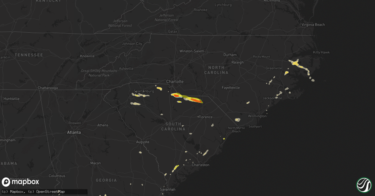
Hail Map on June 3, 2022
Get this storm
June 3 map
$229
one time, instant access
Download today. No call, no setup
Keep the $229
Bought the map and want the full workflow? Apply the entire $229 to a subscription within 7 days. None of it is wasted.
Every map, not just this one
This buys you this map. Subscription and you get every map we run, in the markets you choose from a few cities to whole states to nationwide. Plus real-time alerts the moment a storm fires.
Contact data
Name, contact info, occupancy, even credit band for addresses in the footprint. You go from where it hit to who to call.
Become the source they trust
Unlimited branding weather history reports on demand. You already have the documented answer ready for the property owner, and you are the one who showed up with it.
Property data and RoofTrace estimates
Pull up any address you have got, its value and the exact code rules for that jurisdiction, straight from One Click Code. Then RoofTrace estimates the squares, pitch, and roof value, priced the way you price.
States Impacted by Hail Map on June 3, 2022
Storm reports
Georgia
| Date | Description |
|---|---|
| 06/03/20225:29 PM CDT | Delayed report. Tree down over railroad tracks near the intersection of hopkins break rd and hwy 27. |
| 06/03/20223:04 AM CDT | At 804 PM EDT, a severe thunderstorm was located near Havana, moving south at 5 mph. HAZARD...60 mph wind gusts and penny size hail. SOURCE...Radar indicated. IMPACT...Expect damage to roofs, siding, and trees. Locations impacted include... Quincy, Havana, Attapulgus, Freemont, Littman, Darsey, Florence, Concord, Scotland, Jamieson, Gibson, Laingkat, Santa Clara, Shady Rest, Amsterdam, Quincy Airport, Branchville, Hinson and Dogtown. |
| 06/03/20221:04 AM CDT | At 604 PM EDT, a severe thunderstorm was located over Gardi, moving northeast at 5 mph. HAZARD...60 mph wind gusts and penny size hail. SOURCE...Radar indicated. IMPACT...Expect damage to roofs, siding, and trees. Locations impacted include... Gardi. |
| 06/03/202212:07 AM CDT | At 506 PM EDT, a severe thunderstorm was located over Tarboro, moving northeast at 20 mph. HAZARD...60 mph wind gusts and quarter size hail. SOURCE...Radar indicated. IMPACT...Minor hail damage to vehicles is possible. Expect wind damage to trees and powerlines. Locations impacted include: Ridgeland, Grahamville, Coosawhatchie, Old House, Pineland, Tillman, Tarboro, Gillisonville, Robertville and Switzerland.This warning includes I-95 in South Carolina between mile markers 18and 32. |
| 06/02/202211:48 PM CDT | At 448 PM EDT, a severe thunderstorm was located near Rochelle, or 11 miles southwest of Abbeville, moving northeast at 15 mph. HAZARD...60 mph wind gusts and penny size hail. SOURCE...Radar indicated. IMPACT...Expect damage to roofs, siding, and trees. Locations impacted include... Rebecca. |
| 06/02/202211:30 PM CDT | At 429 PM EDT, a severe thunderstorm was located near Shellman, or 7 miles southwest of Dawson, moving northeast at 10 mph. HAZARD...60 mph wind gusts and penny size hail. SOURCE...Radar indicated. IMPACT...Expect damage to roofs, siding, and trees. Locations impacted include... Dawson, Shellman, Bronwood, Parrott, Bridges Crossroad, Herod, Yeomans, Clarks Mill, Dawson Municipal A/P, Graves, Oakville, Chambliss, Martins Crossroads and Doverel. |
| 06/02/202210:59 PM CDT | At 358 PM EDT, a severe thunderstorm was located over Mystic, or 7 miles west of Ocilla, moving north at 25 mph. HAZARD...60 mph wind gusts and penny size hail. SOURCE...Radar indicated. IMPACT...Expect damage to roofs, siding, and trees. Locations impacted include... Fitzgerald, Ocilla, Mystic, Lulaville, Waterloo, Pinetta, Irwinville, Fitzgerald Municipal A/P, Irwinville Airport, Bowens Mill, Arp, Abba and Queensland. |
| 06/02/20227:20 PM CDT | Tree down on watauga road |
Idaho
| Date | Description |
|---|---|
| 06/03/202212:05 AM CDT | At 504 PM PDT, a severe thunderstorm was located near Athol, or 16 miles southeast of Priest River, moving northeast at 25 mph. HAZARD...Quarter size hail. SOURCE...Radar indicated. IMPACT...Damage to vehicles is expected. Locations impacted include... Athol, Clark Fork, East Hope, Hope, Cocolalla, Laclede, Bayview, Careywood and Granite.This includes U.S. Highway 95 in Idaho between mile markers 446 and462. |
Oklahoma
| Date | Description |
|---|---|
| 06/03/20223:21 AM CDT | At 820 PM CDT, severe thunderstorms were located along a line extending from near Walsh to 6 miles southeast of Stonington to 9 miles west of Elkhart, moving east at 25 mph. HAZARD...60 mph wind gusts and penny size hail. SOURCE...Radar indicated. IMPACT...Expect damage to roofs, siding, and trees. Locations impacted include... Elkhart, The Saunders Elevator, Richfield, Manter and Wilburton. |
New Mexico
| Date | Description |
|---|---|
| 06/03/20226:49 PM CDT | A local report indicates 1.75 inch wind near 2 ENE HALFWAY |
| 06/03/20226:36 PM CDT | A local report indicates 1.75 inch wind near YESO |
| 06/03/20226:18 PM CDT | A local report indicates 1.00 inch wind near 3 WSW SEVEN RIVERS |
| 06/03/20223:55 PM CDT | Quarter size hail along u.s. 82. |
| 06/03/20223:16 AM CDT | At 816 PM MDT, severe thunderstorms were located along a line extending from 22 miles south of Taiban to 19 miles northeast of Mesa, moving east at 25 mph. HAZARD...60 mph wind gusts and quarter size hail. SOURCE...Radar indicated. IMPACT...Hail damage to vehicles is expected. Expect wind damage to roofs, siding, and trees. These severe thunderstorms will remain over mainly rural areas of west central Roosevelt, southeastern De Baca and north central Chaves Counties. |
| 06/03/20223:11 AM CDT | At 810 PM CDT, a severe thunderstorm was located 14 miles southwest of Red Bluff Reservoir, or 34 miles west of Mentone, moving east at 15 mph. HAZARD...60 mph wind gusts and half dollar size hail. SOURCE...Radar indicated. IMPACT...Hail damage to vehicles is expected. Expect wind damage to roofs, siding, and trees. Locations impacted include... Red Bluff Reservoir, Orla and Red Bluff. |
| 06/03/20222:14 AM CDT | At 714 PM MDT, a severe thunderstorm was located 8 miles west of Yeso, or 29 miles west of Fort Sumner, moving east at 20 mph. HAZARD...60 mph wind gusts and quarter size hail. SOURCE...Radar indicated. IMPACT...Hail damage to vehicles is expected. Expect wind damage to roofs, siding, and trees. Locations impacted include... Fort Sumner and Yeso. This includes Highway 60 between Mile Markers 292 and 337. |
| 06/03/20221:12 AM CDT | At 611 PM MDT, a severe thunderstorm was located 10 miles southwest of Fort Sumner, moving southeast at 20 mph. HAZARD...60 mph wind gusts and quarter size hail. SOURCE...Radar indicated. IMPACT...Hail damage to vehicles is expected. Expect wind damage to roofs, siding, and trees. Locations impacted include... Fort Sumner, Yeso, Taiban, Sumner Lake State Park and Sumner Lake. This includes Highway 60 between Mile Markers 286 and 345. |
| 06/03/202212:55 AM CDT | At 555 PM MDT, a severe thunderstorm was located 24 miles south of Maljamar, or 31 miles east of Carlsbad, moving south at 15 mph. HAZARD...Golf ball size hail and 60 mph wind gusts. SOURCE...Radar indicated. IMPACT...People and animals outdoors will be injured. Expect hail damage to roofs, siding, windows, and vehicles. Expect wind damage to roofs, siding, and trees. Locations impacted include... Halfway. |
| 06/03/202212:42 AM CDT | At 542 PM MDT, a severe thunderstorm was located 11 miles southwest of Brantley Lake State Park, or 14 miles west of Carlsbad, moving southeast at 15 mph. HAZARD...60 mph wind gusts and half dollar size hail. SOURCE...Radar indicated. IMPACT...Hail damage to vehicles is expected. Expect wind damage to roofs, siding, and trees. Locations impacted include... Carlsbad, Loving, Whites City, Carlsbad Caverns National Park, Otis, Cavern City Air Terminal and Living Desert State Park. |
| 06/03/202212:14 AM CDT | At 514 PM MDT, a severe thunderstorm was located 12 miles northwest of Yeso, or 25 miles east of Vaughn, moving east at 15 mph. HAZARD...60 mph wind gusts and quarter size hail. SOURCE...Radar indicated. IMPACT...Hail damage to vehicles is expected. Expect wind damage to roofs, siding, and trees. Locations impacted include... Vaughn, Yeso, Sumner Lake State Park and Sumner Lake. This includes the following highways... Highway 285 between Mile Markers 198 and 204. Highway 60 between Mile Markers 272 and 319. |
| 06/03/202212:10 AM CDT | At 510 PM MDT, a severe thunderstorm was located 10 miles south of Maljamar, or 27 miles southwest of Lovington, moving southeast at 15 mph. HAZARD...Tennis ball size hail and 60 mph wind gusts. SOURCE...Radar indicated. IMPACT...People and animals outdoors will be injured. Expect hail damage to roofs, siding, windows, and vehicles. Expect wind damage to roofs, siding, and trees. Locations impacted include... Halfway. |
| 06/03/202212:04 AM CDT | At 504 PM MDT, a severe thunderstorm was located 8 miles northeast of Wagon Mound, moving east at 20 mph. HAZARD...60 mph wind gusts and quarter size hail. SOURCE...Radar indicated. IMPACT...Hail damage to vehicles is expected. Expect wind damage to roofs, siding, and trees. Locations impacted include... Wagon Mound and Mills. This includes Interstate 25 between Mile Markers 383 and 401. |
| 06/03/202212:00 AM CDT | At 500 PM MDT, a severe thunderstorm was located 11 miles west of Seven Rivers Airport, or 18 miles south of Hope, moving southeast at 15 mph. HAZARD...60 mph wind gusts and quarter size hail. SOURCE...Radar indicated. IMPACT...Hail damage to vehicles is expected. Expect wind damage to roofs, siding, and trees. Locations impacted include... Avalon, Brantley Lake State Park, Seven Rivers Airport, Lake Avalon and Living Desert State Park. |
| 06/02/202211:59 PM CDT | At 459 PM MDT, a severe thunderstorm was located 9 miles southeast of Bueyeros, or 21 miles west of Amistad, moving east at 20 mph. HAZARD...60 mph wind gusts and quarter size hail. SOURCE...Radar indicated. IMPACT...Hail damage to vehicles is expected. Expect wind damage to roofs, siding, and trees. Locations impacted include... Amistad, Hayden and Rosebud. |
| 06/02/202211:28 PM CDT | At 428 PM MDT, a severe thunderstorm was located near Maljamar, or 28 miles west of Lovington, moving southeast at 15 mph. HAZARD...Ping pong ball size hail and 60 mph wind gusts. SOURCE...Radar indicated. IMPACT...People and animals outdoors will be injured. Expect hail damage to roofs, siding, windows, and vehicles. Expect wind damage to roofs, siding, and trees. Locations impacted include... Maljamar. |
| 06/02/202211:14 PM CDT | At 413 PM MDT, a severe thunderstorm was located near Pastura, or 18 miles northeast of Vaughn, moving east at 15 mph. HAZARD...60 mph wind gusts and quarter size hail. SOURCE...Radar indicated. IMPACT...Hail damage to vehicles is expected. Expect wind damage to roofs, siding, and trees. Locations impacted include... Santa Rosa, Vaughn, Puerto De Luna, Pastura and Pintada. This includes the following highways... Highway 285 between Mile Markers 201 and 204. Highway 60 between Mile Markers 272 and 300. |
| 06/02/202210:45 PM CDT | At 345 PM MDT, a severe thunderstorm was located 14 miles west of Maljamar, or 25 miles east of Artesia, moving east at 20 mph. HAZARD...60 mph wind gusts and half dollar size hail. SOURCE...Radar indicated. IMPACT...Hail damage to vehicles is expected. Expect wind damage to roofs, siding, and trees. Locations impacted include... Maljamar, Lea County Zip Franklin Memorial Airport and Loco Hills. |
| 06/02/202210:23 PM CDT | At 323 PM MDT, a severe thunderstorm was located near Pastura, or 15 miles northeast of Vaughn, moving east at 20 mph. HAZARD...60 mph wind gusts and quarter size hail. SOURCE...Radar indicated. IMPACT...Hail damage to vehicles is expected. Expect wind damage to roofs, siding, and trees. Locations impacted include... Pastura. |
| 06/02/202210:12 PM CDT | At 312 PM MDT, a severe thunderstorm was located 13 miles southwest of Trujillo, or 27 miles southeast of Las Vegas, moving east at 20 mph. HAZARD...60 mph wind gusts and half dollar size hail. SOURCE...Radar indicated. IMPACT...Hail damage to vehicles is expected. Expect wind damage to roofs, siding, and trees. Locations impacted include... Variadero and Trementina. This includes State Road 104 between Mile Markers 34 and 56. |
| 06/02/20229:20 PM CDT | At 219 PM MDT, a severe thunderstorm was located near Dunken, or 24 miles west of Hope, moving southeast at 15 mph. HAZARD...60 mph wind gusts. SOURCE...Trained weather spotters. IMPACT...Expect damage to roofs, siding, and trees. Locations impacted include... Dunken. |
| 06/02/20228:27 PM CDT | At 127 PM MDT, a severe thunderstorm was located over Lincoln State Monument, or 20 miles northeast of Ruidoso, moving east at 10 mph. HAZARD...60 mph wind gusts and quarter size hail. SOURCE...Radar indicated. IMPACT...Hail damage to vehicles is expected. Expect wind damage to roofs, siding, and trees. Locations impacted include... Lincoln, Capitan, Glencoe, Hondo, Arabela, Fort Stanton, Lincoln State Monument, Smokey Bear Historical Park and San Patricio.This includes Highway 380 between Mile Markers 83 and 107. |
| 06/02/20228:15 PM CDT | Mesonet station fw9688 jal. |
| 06/02/20227:38 PM CDT | Report from mping: hen egg |
| 06/02/20227:05 PM CDT | Mesonet station mlcn5 mills 4 wsw |
Alabama
| Date | Description |
|---|---|
| 06/03/20223:57 PM CDT | Tree down along county road 112 near mount zion church. |
| 06/02/202210:54 PM CDT | At 354 PM CDT, a severe thunderstorm was located near Midland City, or near Headland, moving north at 10 mph. HAZARD...60 mph wind gusts and penny size hail. SOURCE...Radar indicated. IMPACT...Expect damage to roofs, siding, and trees. Locations impacted include... Headland, Dothan, Midland City, Kinsey, Newton, Pinckard, Grimes, Newville, Napier Field, Sylvan Grove, Kirkland Crossroads, Blackwood, Kelly Springs, Headland Municipal A/P, W. Main/brannon St, Currytown and Goldberg Field. |
Montana
| Date | Description |
|---|---|
| 06/03/20225:04 PM CDT | Mesonet station ylwm8 yellow mule raws. Time estimated. Gust occurred sometime during the previous hour. Station elevation: 9200 ft. |
| 06/02/20228:45 PM CDT | A local report indicates 63 MPH wind near 20 NNW POMPEYS PILLAR |
Washington
| Date | Description |
|---|---|
| 06/03/20223:25 PM CDT | Colville tribe reports debris on road near the intersection of sr 21 and silver creek rd. Not impeding travel. |
| 06/03/20227:58 AM CDT | At 1257 PM PDT, a severe thunderstorm was located 11 miles south of Pomeroy, or 19 miles east of Dayton, moving northeast at 20 mph. HAZARD...Quarter size hail. SOURCE...Radar indicated. IMPACT...Damage to vehicles is expected. Torrential rainfall is occurring with this storm, and may lead to flash flooding. Do not drive your vehicle through flooded roadways. Locations impacted include... Peola and Alder Thicket Campground. |
| 06/02/20229:44 PM CDT | At 243 PM PDT, a severe thunderstorm was located 21 miles west of Chewelah, or 49 miles northwest of Spokane, moving northeast at 25 mph. HAZARD...Half dollar size hail. SOURCE...Radar indicated. IMPACT...Damage to vehicles is expected. Locations impacted include... Cedonia, Gifford, Inchelium, Addy and Rice. |
| 06/02/20229:15 PM CDT | At 213 PM PDT, a severe thunderstorm was located near Clarkston Heights-Vineland, or near Clarkston, moving east at 15 mph. HAZARD...Quarter size hail. SOURCE...Radar indicated. IMPACT...Damage to vehicles is expected. Locations impacted include... Lewiston, Clarkston, Clarkston Heights-Vineland, West Clarkston-Highland, Asotin, Clarkston Heights and Jerry.People attending NAIA World Series should seek safe shelterimmediately!This includes the following highways... U.S. Highway 95 in Idaho between mile markers 305 and 325, andbetween mile markers 327 and 328. U.S. Highway 12 in Idaho between mile markers 0 and 3. |
| 06/02/20228:10 PM CDT | At 110 PM PDT, a severe thunderstorm was located 15 miles southeast of Nespelem Community, or 44 miles southeast of Omak, moving north at 15 mph. HAZARD...Quarter size hail. SOURCE...Radar indicated. IMPACT...Damage to vehicles is expected. Locations impacted include... Keller. |
Florida
| Date | Description |
|---|---|
| 06/03/20226:25 PM CDT | 911 call center reported a tree down on river street. |
| 06/03/20224:35 PM CDT | Wind damage to a home on beaver dam rd. Trees down... Plus small hail reported. |
| 06/03/20224:30 PM CDT | A large tree fell on a mobile home in pompano beach... Displacing 5 people living in the home. This was associated with a band of gusty showers and thunderstorms... And |
| 06/03/20224:10 PM CDT | Fire department relayed a report of several trees down near the intersection of poverty creek road and county road 393. |
| 06/03/20223:18 AM CDT | At 818 PM EDT, a severe thunderstorm was located near Suwannee Springs, moving north at 10 mph. HAZARD...60 mph wind gusts and penny size hail. SOURCE...Radar indicated. IMPACT...Expect damage to roofs, siding, and trees. Locations impacted include... Jasper, White Springs, Suwannee Springs and Houston. |
| 06/03/20221:18 AM CDT | At 618 PM EDT/518 PM CDT/, a severe thunderstorm was located over Blountstown, moving north at 15 mph. HAZARD...60 mph wind gusts and quarter size hail. SOURCE...Radar indicated. IMPACT...Hail damage to vehicles is expected. Expect wind damage to roofs, siding, and trees. Locations impacted include... Blountstown, Bristol, Kennys Mill, Rock Bluff, Nettle Ridge, Selman, Sharpstown, Woods, Torreya State Park and Hugh Creek. |
| 06/03/202212:27 AM CDT | At 527 PM CDT, a severe thunderstorm was located 7 miles west of Marianna, moving southeast at 10 mph. HAZARD...60 mph wind gusts and quarter size hail. SOURCE...Radar indicated. IMPACT...Hail damage to vehicles is expected. Expect wind damage to roofs, siding, and trees. Locations impacted include... Marianna, Cottondale, Kynesville and Cottondale Airport. |
| 06/02/202210:50 PM CDT | At 349 PM CDT, a severe thunderstorm was located 9 miles northwest of Wright, and is nearly stationary. HAZARD...60 mph wind gusts and quarter size hail. SOURCE...Radar indicated. IMPACT...Hail damage to vehicles is expected. Expect wind damage to roofs, siding, and trees. This severe thunderstorm will remain over mainly rural areas of southwestern Okaloosa and east central Santa Rosa Counties. |
Colorado
| Date | Description |
|---|---|
| 06/03/20226:53 PM CDT | Spotter reported hail beginning with pea... Increasing to a few quarters in size. Hail is now back down to pea with heavy rain falling. |
| 06/03/20226:43 PM CDT | Photo evidence of a tornado associated with the occlusion of the circulation south of the earlier bent county tornadic circulation. Tornado lasted approximately 5 minut |
| 06/03/20226:33 PM CDT | Dispatch relayed a report of heavy rain with hail up to the size of quarters around mile marker 129 on highway 287. |
| 06/03/20226:30 PM CDT | A local report indicates 1.50 inch wind near 3 WNW REIRADON HILL |
| 06/03/20226:23 PM CDT | Corrects previous tornado report from 4 n fort lyon. A tornado was confirmed by an induvial who was picked up in a truck... Rotated 120 degrees... Had his windows blown |
| 06/03/20226:22 PM CDT | A local report indicates 1.00 inch wind near LAS ANIMAS |
| 06/03/20226:12 PM CDT | A local report indicates 1.00 inch wind near 1 WNW LAS ANIMAS |
| 06/03/20226:01 PM CDT | Storm chaser reported via spotter network. |
| 06/03/20226:00 PM CDT | Landspout. Initial updrafts of developing thunderstorms interacted with an outflow boundary and produced a landspout tornado... Which was on the ground for approximatel |
| 06/03/20222:09 AM CDT | At 708 PM MDT, a severe thunderstorm was located 13 miles southwest of Stonington, or 24 miles west of Elkhart, moving east at 45 mph. HAZARD...60 mph wind gusts and quarter size hail. SOURCE...Radar indicated. IMPACT...Hail damage to vehicles is expected. Expect wind damage to roofs, siding, and trees. This severe thunderstorm will remain over mainly rural areas of southeastern Baca County. |
| 06/03/20221:54 AM CDT | At 654 PM MDT, severe thunderstorms were located along a line extending from 6 miles south of Weskan to 6 miles east of Towner, moving east at 25 mph. HAZARD...70 mph wind gusts and quarter size hail. SOURCE...Radar indicated. IMPACT...Hail damage to vehicles is expected. Expect considerable tree damage. Wind damage is also likely to mobile homes, roofs, and outbuildings. Locations impacted include... Horace and Tribune. |
| 06/03/20221:28 AM CDT | At 628 PM MDT/728 PM CDT/, a severe thunderstorm was located 11 miles southeast of Bonny Reservoir, moving northeast at 25 mph. HAZARD...60 mph wind gusts and quarter size hail. SOURCE...Radar indicated. IMPACT...Hail damage to vehicles is expected. Expect wind damage to roofs, siding, and trees. This severe thunderstorm will remain over mainly rural areas of southeastern Yuma County in northeastern Colorado, northeastern Kit Carson County in east central Colorado, southwestern Cheyenne and northwestern Sherman Counties in northwestern Kansas, including the following locations... Hale.This includes Interstate 70 in Kansas near mile marker 2. |
| 06/03/20221:17 AM CDT | At 617 PM MDT, a severe thunderstorm was located over Pritchett, or 14 miles west of Springfield, moving northeast at 30 mph. HAZARD...60 mph wind gusts and quarter size hail. SOURCE...Radar indicated. IMPACT...Hail damage to vehicles is expected. Expect wind damage to roofs, siding, and trees. Locations impacted include... Springfield, Pritchett, Vilas, Campo and Two Buttes Reservoir. |
| 06/03/20221:14 AM CDT | At 613 PM MDT, severe thunderstorms were located along a line extending from 12 miles north of Sheridan Lake to 11 miles northwest of Bristol to 17 miles southwest of Lamar, moving southeast at 55 mph. HAZARD...70 mph wind gusts and ping pong ball size hail. SOURCE...Radar indicated. IMPACT...People and animals outdoors will be injured. Expect hail damage to roofs, siding, windows, and vehicles. Expect considerable tree damage. Wind damage is also likely to mobile homes, roofs, and outbuildings. Locations impacted include... Holly, Granada, Sheridan Lake, Hartman, Towner and Bristol. |
| 06/03/20221:10 AM CDT | At 610 PM MDT, severe thunderstorms were located along a line extending from near Lone Star to 9 miles northwest of Elba, or along a line extending from 19 miles north of Yuma to 9 miles southwest of Akron, moving east at 30 mph. HAZARD...60 mph wind gusts and quarter size hail. SOURCE...Radar indicated. IMPACT...Expect damage to roofs, siding, and trees. Hail damage to vehicles is expected. Severe thunderstorms will be near... Lone Star around 615 PM MDT. |
| 06/03/202212:58 AM CDT | At 558 PM MDT/658 PM CDT/, a severe thunderstorm was located 9 miles north of Burlington, moving northeast at 40 mph. HAZARD...60 mph wind gusts and quarter size hail. SOURCE...Radar indicated. IMPACT...Hail damage to vehicles is expected. Expect wind damage to roofs, siding, and trees. Locations impacted include... Bonny Reservoir.This includes the following highways... Interstate 70 in Colorado between mile markers 435 and 448. Highway 385 between mile markers 184 and 217. |
| 06/03/202212:55 AM CDT | At 555 PM MDT, severe thunderstorms were located along a line extending from near Cheyenne Wells to 12 miles north of Brandon, moving east at 25 mph. HAZARD...60 mph wind gusts and quarter size hail. SOURCE...Radar indicated. IMPACT...Hail damage to vehicles is expected. Expect wind damage to roofs, siding, and trees. Severe thunderstorms will be near... Cheyenne Wells around 600 PM MDT.This includes Highway 385 between mile markers 136 and 159. |
| 06/03/202212:53 AM CDT | At 553 PM MDT, severe thunderstorms were located along a line extending from 6 miles southwest of Fleming to 9 miles north of Akron, moving southeast at 25 mph. HAZARD...60 mph wind gusts and half dollar size hail. SOURCE...Trained weather spotters. IMPACT...Hail damage to vehicles is expected. Expect wind damage to roofs, siding, and trees. Locations impacted include... Yuma.This includes Highway 385 between mile markers 268 and 270. |
| 06/03/202212:52 AM CDT | At 552 PM MDT, a severe thunderstorm was located 12 miles west of Pritchett, or 25 miles west of Springfield, moving east at 30 mph. HAZARD...60 mph wind gusts and quarter size hail. SOURCE...Radar indicated. IMPACT...Hail damage to vehicles is expected. Expect wind damage to roofs, siding, and trees. Locations impacted include... Pritchett and Kim. |
| 06/03/202212:44 AM CDT | At 544 PM MDT, severe thunderstorms were located along a line extending from near Sweetwater Reservoir to 15 miles east of Higbee, moving east at 25 mph. HAZARD...Golf ball size hail and 70 mph wind gusts. SOURCE...Trained spotters reported large hail with this activity, which earlier produced tornadoes. These storms have already produced severe weather. IMPACT...People and animals outdoors will be injured. Expect hail damage to roofs, siding, windows, and vehicles. Expect considerable tree damage. Wind damage is also likely to mobile homes, roofs, and outbuildings. Locations impacted include... Lamar, Wiley, McClave, Hasty, John Martin Reservoir, Fort Lyon and Caddoa. |
| 06/03/202212:36 AM CDT | At 536 PM MDT, severe thunderstorms were located along a line extending from 12 miles northeast of Eads to 10 miles north of Hasty, moving east at 35 mph. HAZARD...Golf ball size hail and 70 mph wind gusts. SOURCE...Radar indicated. IMPACT...People and animals outdoors will be injured. Expect hail damage to roofs, siding, windows, and vehicles. Expect considerable tree damage. Wind damage is also likely to mobile homes, roofs, and outbuildings. Severe thunderstorms will be near... Neegronda Reservoir and Sweetwater Reservoir around 555 PM MDT.Other locations in the path of these severe thunderstorms includeNeeoshe Reservoir and Queens Reservoir. |
| 06/03/202212:31 AM CDT | At 531 PM MDT, a severe thunderstorm was located near Bethune, or 9 miles west of Burlington, moving northeast at 20 mph. HAZARD...Golf ball size hail and 60 mph wind gusts. SOURCE...Radar indicated. IMPACT...People and animals outdoors will be injured. Expect hail damage to roofs, siding, windows, and vehicles. Expect wind damage to roofs, siding, and trees. This severe thunderstorm will remain over mainly rural areas of northeastern Kit Carson County.This includes Highway 385 between mile markers 192 and 200. |
| 06/03/202212:26 AM CDT | At 525 PM MDT, a severe thunderstorm was located 6 miles south of Sterling, moving east at 15 mph. HAZARD...60 mph wind gusts and half dollar size hail. SOURCE...Radar indicated. IMPACT...Expect damage to roofs, siding, and trees. Hail damage to vehicles is expected. This severe thunderstorm will remain over mainly rural areas of south central Logan County, including the following locations... Reiradon Hill. |
| 06/03/202212:18 AM CDT | At 517 PM MDT, severe thunderstorms were located along a line extending from 4 miles east of Antelope Springs to near Adena School, or along a line extending from 26 miles southwest of Sterling to 9 miles south of Fort Morgan, moving southeast at 35 mph. HAZARD...70 mph wind gusts. SOURCE...Radar indicated. IMPACT...Expect considerable tree damage. Damage is likely to mobile homes, roofs, and outbuildings. Severe thunderstorms will be near... Brush around 525 PM MDT. Hillrose and Gary around 535 PM MDT. |
| 06/03/202212:13 AM CDT | At 513 PM MDT, severe thunderstorms were located along a line extending from near Las Animas to 10 miles northeast of Higbee, moving southeast at 35 mph. HAZARD...Golf ball size hail and 70 mph wind gusts. SOURCE...Radar indicated. IMPACT...People and animals outdoors will be injured. Expect hail damage to roofs, siding, windows, and vehicles. Expect considerable tree damage. Wind damage is also likely to mobile homes, roofs, and outbuildings. Locations impacted include... Las Animas, Hasty, McClave, John Martin Reservoir, Fort Lyon and Caddoa. |
| 06/03/202212:09 AM CDT | At 509 PM MDT, a severe thunderstorm was located near Kim, or 40 miles northeast of Des Moines, moving southeast at 15 mph. HAZARD...70 mph wind gusts and ping pong ball size hail. SOURCE...Radar indicated. IMPACT...People and animals outdoors will be injured. Expect hail damage to roofs, siding, windows, and vehicles. Expect considerable tree damage. Wind damage is also likely to mobile homes, roofs, and outbuildings. Locations impacted include... Kim. |
| 06/02/202211:59 PM CDT | At 459 PM MDT, severe thunderstorms were located along a line extending from 4 miles south of Vona to 9 miles northwest of Eads, moving east at 30 mph. HAZARD...60 mph wind gusts and quarter size hail. SOURCE...Radar indicated. IMPACT...Hail damage to vehicles is expected. Expect wind damage to roofs, siding, and trees. Severe thunderstorms will be near... Stratton around 515 PM MDT.Other locations in the path of these severe thunderstorms includeBethune and Burlington.This includes the following highways... Interstate 70 in Colorado between mile markers 411 and 442. Highway 385 between mile markers 136 and 191. |
| 06/02/202211:57 PM CDT | At 457 PM MDT, a severe thunderstorm was located near Aguilar, or 20 miles northwest of Trinidad, moving east at 25 mph. HAZARD...60 mph wind gusts and half dollar size hail. SOURCE...Radar indicated. IMPACT...Hail damage to vehicles is expected. Expect wind damage to roofs, siding, and trees. This severe thunderstorm will be near... Aguilar around 510 PM MDT. |
| 06/02/202211:48 PM CDT | At 447 PM MDT, severe thunderstorms were located along a line extending from 10 miles northeast of Haswell to 10 miles west of Arlington, moving east at 30 mph. THESE ARE DESTRUCTIVE STORMS FOR EADS, ARLINGTON, AND HASWELL. HAZARD...Baseball size hail and 70 mph wind gusts. SOURCE...Radar indicated. IMPACT...People and animals outdoors will be severely injured. Expect shattered windows, extensive damage to roofs, siding, and vehicles. Locations impacted include... Eads, Haswell, Blue Lake and Arlington. |
| 06/02/202211:45 PM CDT | At 444 PM MDT, severe thunderstorms were located over northwest Morgan County, moving southeast at 20 mph. HAZARD...60 mph wind gusts and quarter size hail. SOURCE...Radar indicated. IMPACT...Expect damage to roofs, siding, and trees. Hail damage to vehicles is expected. Severe thunderstorms will be near... Antelope Springs around 455 PM MDT.Other locations in the path of these severe thunderstorms includeFort Morgan, Log Lane Village and Brush. |
| 06/02/202211:42 PM CDT | At 441 PM MDT, a severe thunderstorm was located 11 miles northwest of Kim, or 41 miles northeast of Des Moines, moving east at 20 mph. HAZARD...Two inch hail and 70 mph wind gusts. SOURCE...Radar indicated. IMPACT...People and animals outdoors will be injured. Expect hail damage to roofs, siding, windows, and vehicles. Expect considerable tree damage. Wind damage is also likely to mobile homes, roofs, and outbuildings. Locations impacted include... Kim. |
| 06/02/202211:25 PM CDT | At 425 PM MDT, severe thunderstorms were located along a line extending from 8 miles southeast of Wild Horse Point to near Crowley, moving east at 35 mph. HAZARD...Two inch hail and 70 mph wind gusts. SOURCE...Radar indicated. IMPACT...People and animals outdoors will be injured. Expect hail damage to roofs, siding, windows, and vehicles. Expect considerable tree damage. Wind damage is also likely to mobile homes, roofs, and outbuildings. Locations impacted include... La Junta, North La Junta, Rocky Ford, Las Animas, Swink, Cheraw, Haswell, Blue Lake, Arlington, John Martin Reservoir and Fort Lyon. |
| 06/02/202210:54 PM CDT | At 353 PM MDT, severe thunderstorms were located along a line extending from 6 miles south of Flagler to 8 miles southwest of Wild Horse Point, moving east at 30 mph. HAZARD...60 mph wind gusts and quarter size hail. SOURCE...Radar indicated. IMPACT...Hail damage to vehicles is expected. Expect wind damage to roofs, siding, and trees. Severe thunderstorms will be near... Flagler around 400 PM MDT.Other locations in the path of these severe thunderstorms includeSeibert, Vona, Stratton and Bethune.This includes Interstate 70 in Colorado between mile markers 391 and431. |
| 06/02/202210:52 PM CDT | At 352 PM MDT, severe thunderstorms were located along a line extending from 11 miles west of Kim to 13 miles north of Branson to near Model, moving northwest at 10 mph. HAZARD...60 mph wind gusts and half dollar size hail. SOURCE...Radar indicated. IMPACT...Hail damage to vehicles is expected. Expect wind damage to roofs, siding, and trees. These severe thunderstorms will remain over mainly rural areas of southeastern Las Animas County. |
| 06/02/202210:48 PM CDT | At 348 PM MDT, developing severe thunderstorms were located along a line extending from 13 miles south of Forder to 7 miles east of Boone, moving east at 35 mph. HAZARD...60 mph wind gusts and quarter size hail. SOURCE...Radar indicated. IMPACT...Hail damage to vehicles is expected. Expect wind damage to roofs, siding, and trees. Locations impacted include... La Junta, Rocky Ford, Fowler, Ordway, Swink, Manzanola, Olney Springs, Sugar City and Crowley. |
| 06/02/202210:46 PM CDT | At 346 PM MDT, severe thunderstorms were located along a line extending from 9 miles north of Boyero to 9 miles northeast of Karval to 6 miles south of Forder, or along a line extending from 18 miles southwest of Flagler to 69 miles southwest of Burlington to 41 miles north of North La Junta, moving southeast at 30 mph. HAZARD...60 mph wind gusts and quarter size hail. SOURCE...Radar indicated. IMPACT...Expect damage to roofs, siding, and trees. Hail damage to vehicles is expected. Severe thunderstorms will be near... Wild Horse Point around 405 PM MDT. |
| 06/02/202210:12 PM CDT | At 311 PM MDT, a cluster of developing severe thunderstorms was located over southern Pueblo County and east central Custer County, moving northeast at 30 mph. HAZARD...60 mph wind gusts and quarter size hail. SOURCE...Radar indicated. IMPACT...Hail damage to vehicles is expected. Expect wind damage to roofs, siding, and trees. Locations impacted include... Pueblo, Boone, Salt Creek, Blende, Avondale, Pueblo Depot, Greenhorn Mountain, Rye, Beulah, San Isabel and Colorado City. |
| 06/02/202210:01 PM CDT | At 300 PM MDT, severe thunderstorms were located along a line extending from 9 miles northwest of Hoehne to near Boncarbo, moving southeast at 30 mph. HAZARD...60 mph wind gusts and quarter size hail. SOURCE...Radar indicated. IMPACT...Hail damage to vehicles is expected. Expect wind damage to roofs, siding, and trees. Locations impacted include... Trinidad, Cokedale, Starkville, Boncarbo, Model, Hoehne and Tyrone. |
| 06/02/20228:44 PM CDT | Site 385n21956rws1sec. |
| 06/02/20228:40 PM CDT | Delayed report of a landspout observed looking south from the intersection of us-36 and us-385. Exact location of landspout unknown. Media personnel estimated it was ro |
| 06/02/20228:34 PM CDT | Mesonet station co047 385n220 idalia. |
| 06/02/20228:17 PM CDT | Site welp farms. |
| 06/02/20228:15 PM CDT | Caller reported a rope funnel that briefly touched the ground a few miles west of the town of wray. Tornado was not on the ground as of the call. |
| 06/02/20227:58 PM CDT | Delayed report. Weak tornado spotted beginning at roughly 6:58pm. Persisted for approximately 8 minutes with a visible ground circulation and funnel. |
| 06/02/20227:37 PM CDT | Reported 60 mph gust on personal station. |
| 06/02/20227:37 PM CDT | Reported hail growing from pea to quarter sized. Still falling as of the call. |
| 06/02/20227:25 PM CDT | Dispatch relayed a report of near zero visibility in rain with estimated 60 to 70 mph wind gusts. |
| 06/02/20227:03 PM CDT | Mesonet station ew7755 akron. |
Texas
| Date | Description |
|---|---|
| 06/03/20227:56 AM CDT | At 1255 AM CDT, a severe thunderstorm was located 9 miles northwest of Sundown, or 13 miles west of Levelland, moving east at 15 mph. HAZARD...60 mph wind gusts and quarter size hail. SOURCE...Radar indicated. IMPACT...Hail damage to vehicles is expected. Expect wind damage to roofs, siding, and trees. Locations impacted include... Levelland, Sundown and Whitharral. |
| 06/03/20227:07 AM CDT | At 1206 AM CDT, a severe thunderstorm was located 9 miles northwest of Plains, moving east at 30 mph. HAZARD...60 mph wind gusts and nickel size hail. SOURCE...Radar indicated. IMPACT...Expect damage to roofs, siding, and trees. Locations impacted include... Levelland, Denver City, Plains, Sundown, Bronco, Tokio and Wellman. |
| 06/03/20226:25 AM CDT | At 1125 PM CDT, a severe thunderstorm was located 8 miles north of Plains, moving southeast at 40 mph. HAZARD...60 mph wind gusts and quarter size hail. SOURCE...Radar indicated. IMPACT...Hail damage to vehicles is expected. Expect wind damage to roofs, siding, and trees. Locations impacted include... Brownfield, Denver City, Plains, Tokio and Wellman. |
| 06/03/20226:09 AM CDT | At 1108 PM CDT, severe thunderstorms were located along a line extending from 18 miles north of Big Lake to 10 miles west of Reagan County Airport to 10 miles southwest of Rankin, moving east at 65 mph. HAZARD...70 mph wind gusts and quarter size hail. SOURCE...Radar indicated. IMPACT...Hail damage to vehicles is expected. Expect considerable tree damage. Wind damage is also likely to mobile homes, roofs, and outbuildings. Locations impacted include... Big Lake, McCamey, Rankin, Reagan County Airport, Stiles, Best and Upton County Airport. |
| 06/03/20225:36 AM CDT | At 1035 PM CDT, severe thunderstorms were located along a line extending from 19 miles southwest of Garden City to 13 miles north of Rankin to near Crane, moving southeast at 40 mph. HAZARD...70 mph wind gusts and nickel size hail. SOURCE...West Texas Mesonet. IMPACT...Expect considerable tree damage. Damage is likely to mobile homes, roofs, and outbuildings. Locations impacted include... Crane, McCamey, Rankin, Stiles, Midkiff, Crane County Airport, Best, Upton County Airport, Saint Lawrence, King Mountain and Spraberry. |
| 06/03/20225:22 AM CDT | 60 mph gust measured by the asos located at burnet municipal airport. |
| 06/03/20224:11 AM CDT | At 911 PM CDT, a severe thunderstorm was located over Wink, moving southeast at 15 mph. HAZARD...Golf ball size hail and 60 mph wind gusts. SOURCE...Radar indicated. IMPACT...People and animals outdoors will be injured. Expect hail damage to roofs, siding, windows, and vehicles. Expect wind damage to roofs, siding, and trees. Locations impacted include... Monahans, Kermit, Wink, Thorntonville, Pyote, Wickett, Roy Hurd Memorial Airport, Monahans Sandhills State Park and Winkler County Airport.This includes Interstate 20 between mile markers 67 and 88. |
| 06/03/20223:39 AM CDT | At 838 PM CDT, a severe thunderstorm was located 14 miles west of Lenorah, or 21 miles north of Midland, moving southeast at 25 mph. HAZARD...60 mph wind gusts and half dollar size hail. SOURCE...Radar indicated. IMPACT...Hail damage to vehicles is expected. Expect wind damage to roofs, siding, and trees. Locations impacted include... Midland, Greenwood, Stanton, Lenorah, Tarzan, Courtney and Stanton Municipal Aiport.This includes Interstate 20 between mile markers 140 and 161. |
| 06/03/20223:26 AM CDT | At 826 PM CDT, severe thunderstorms were located along a line extending from 11 miles south of Campo to 13 miles north of Keyes to 10 miles southeast of Stonington, moving southeast at 25 mph. HAZARD...60 mph wind gusts and penny size hail. SOURCE...Radar indicated. IMPACT...Minor damage to roofs, siding, and trees is possible. Locations impacted include... Guymon, Boise City, Goodwell, Texhoma, Keyes, Eva, Hough, Griggs and Sturgis. |
| 06/03/20223:13 AM CDT | At 813 PM CDT/713 PM MDT/, a severe thunderstorm was located 15 miles southwest of Jal, moving southeast at 30 mph. HAZARD...70 mph wind gusts and half dollar size hail. SOURCE...Radar indicated. IMPACT...Hail damage to vehicles is expected. Expect considerable tree damage. Wind damage is also likely to mobile homes, roofs, and outbuildings. Locations impacted include... Kermit, Wink and Winkler County Airport. |
| 06/03/20222:50 AM CDT | Del rio asos. |
| 06/03/20222:45 AM CDT | At 744 PM CDT, a severe thunderstorm was located 7 miles southeast of Charco, or 8 miles west of Goliad, moving northeast at 15 mph. HAZARD...60 mph wind gusts and quarter size hail. SOURCE...Radar indicated. IMPACT...Hail damage to vehicles is expected. Expect wind damage to roofs, siding, and trees. Locations impacted include... Goliad, Weesatche, Weser and Ander. This includes the following highways... US Highway 183 between mile markers 628 and 646. US Highway 59 between mile markers 660 and 676. |
| 06/03/20222:37 AM CDT | At 737 PM CDT/637 PM MDT/, a severe thunderstorm was located 20 miles west of Jal, moving southeast at 30 mph. HAZARD...Ping pong ball size hail and 60 mph wind gusts. SOURCE...Radar indicated. IMPACT...People and animals outdoors will be injured. Expect hail damage to roofs, siding, windows, and vehicles. Expect wind damage to roofs, siding, and trees. Locations impacted include... Jal and Bennett. |
| 06/03/20222:29 AM CDT | At 729 PM CDT, a severe thunderstorm was located 15 miles southwest of Toyah, moving southeast at 20 mph. HAZARD...60 mph wind gusts and quarter size hail. SOURCE...Radar indicated. IMPACT...Hail damage to vehicles is expected. Expect wind damage to roofs, siding, and trees. Locations impacted include... Balmorhea and Saragosa. This includes the following highways... Interstate 10 between mile markers 179 and 210. Interstate 20 between mile markers 0 and 18. |
| 06/03/20222:26 AM CDT | At 726 PM CDT/626 PM MDT/, a severe thunderstorm was located 10 miles south of Whites City, or 26 miles south of Carlsbad, moving east at 10 mph. HAZARD...60 mph wind gusts and half dollar size hail. SOURCE...Radar indicated. IMPACT...Hail damage to vehicles is expected. Expect wind damage to roofs, siding, and trees. Locations impacted include... Loving, Malaga, Whites City, Carlsbad Caverns National Park and Cavern City Air Terminal. |
| 06/03/20222:20 AM CDT | At 719 PM CDT, a severe thunderstorm was located over Berclair, or 14 miles northeast of Beeville, moving northeast at 10 mph. HAZARD...60 mph wind gusts and quarter size hail. SOURCE...Radar indicated. IMPACT...Hail damage to vehicles is expected. Expect wind damage to roofs, siding, and trees. Locations impacted include... Pettus, Charco and Berclair. This includes the following highways... US Highway 181 near mile marker 576. US Highway 183 between mile markers 644 and 648. US Highway 59 between mile markers 668 and 686. |
| 06/03/20221:53 AM CDT | At 652 PM CDT, severe thunderstorms were located along a line extending from 4 miles west of Romero to 10 miles north of Glenrio, moving northeast at 25 mph. HAZARD...60 mph wind gusts and half dollar size hail. SOURCE...Radar indicated. IMPACT...Minor damage to roofs, siding, and trees is possible. Hail damage to vehicles is expected. Locations impacted include... Dalhart, Hartley, Adrian and Romero. |
| 06/03/20221:41 AM CDT | At 640 PM CDT, a severe thunderstorm was located over Beeville, moving east at 10 mph. HAZARD...60 mph wind gusts and quarter size hail. SOURCE...Radar indicated. IMPACT...Hail damage to vehicles is expected. Expect wind damage to roofs, siding, and trees. Locations impacted include... Beeville, Skidmore, Mineral, Normanna, Berclair and Tuleta. This includes the following highways... US Highway 181 between mile markers 580 and 600. US Highway 59 between mile markers 682 and 702. |
| 06/03/20221:13 AM CDT | At 612 PM CDT, a severe thunderstorm was located near McFaddin, and is nearly stationary. HAZARD...60 mph wind gusts and quarter size hail. SOURCE...Radar indicated. IMPACT...Hail damage to vehicles is expected. Expect wind damage to roofs, siding, and trees. Locations impacted include... Tivoli. |
| 06/03/202212:20 AM CDT | At 520 PM MDT, a severe thunderstorm was located near San Jon, or 19 miles east of Tucumcari, moving east at 25 mph. HAZARD...60 mph wind gusts and quarter size hail. SOURCE...Radar indicated. IMPACT...Hail damage to vehicles is expected. Expect wind damage to roofs, siding, and trees. Locations impacted include... San Jon, Glenrio and Bard. This includes Interstate 40 between Mile Markers 347 and 373. |
| 06/02/202211:53 PM CDT | At 452 PM MDT, a severe thunderstorm was located 7 miles southeast of Logan, or 23 miles southwest of Nara Visa, moving east at 20 mph. HAZARD...60 mph wind gusts and quarter size hail. SOURCE...Radar indicated. IMPACT...Hail damage to vehicles is expected. Expect wind damage to roofs, siding, and trees. Locations impacted include... Logan. |
| 06/02/202211:35 PM CDT | 1 wnw big lake awos. |
| 06/02/202210:20 PM CDT | At the crane mesonet. |
| 06/02/20229:01 PM CDT | A local report indicates 66 MPH wind near 3 NW WINK |
| 06/02/20228:31 PM CDT | At 130 AM CDT/1230 AM MDT/, a severe thunderstorm was located 21 miles west of Jal, moving east at 25 mph. HAZARD...60 mph wind gusts and half dollar size hail. SOURCE...Radar indicated. IMPACT...Hail damage to vehicles is expected. Expect wind damage to roofs, siding, and trees. Locations impacted include... Jal, Jal Airport and Bennett. |
| 06/02/20228:12 PM CDT | A local report indicates 1.00 inch wind near 15 W ORLA |
| 06/02/20228:09 PM CDT | A local report indicates 59 MPH wind near 4 WNW STRATFORD |
| 06/02/20228:09 PM CDT | Asos station kdht dalhart |
| 06/02/20227:39 PM CDT | Spotter reported multiple large trees snapped near fm 883. Small hail was also reported. |
South Carolina
| Date | Description |
|---|---|
| 06/03/20224:57 PM CDT | Tree down blocking the roadway. Time estimated from radar. |
| 06/03/20224:27 PM CDT | Sc state highway patrol reported a tree down in the roadway at the intersection of u.s. Routes 21 and 17a. Time was estimated from radar data. |
| 06/03/20224:27 PM CDT | Sc state highway patrol reported a tree down in the roadway at the intersection of hendersonville highway and jonesville avenue. Time was estimated from radar data. |
| 06/03/20224:25 PM CDT | Public reported quarter sized hail and tree limbs down just north of yemassee. Time was estimated from report and from radar data. |
| 06/03/20224:25 PM CDT | 1 inch hail reported and tree limbs down. Power out for a short time. |
| 06/03/20224:25 PM CDT | 1 inch hail reported and tree limbs down. Power out for a short time. |
| 06/03/20224:24 PM CDT | Sc state highway patrol reported a tree down in the roadway at the intersection of castle hall road and old sheldon church road. Time was estimated from radar data. |
| 06/03/20224:15 PM CDT | Sc state highway patrol reported a tree down in the roadway along nuna rock road. Time was estimated from radar data. |
| 06/03/20224:11 PM CDT | Uprooted pine tree at e. Elizabeth street and douglass street. |
| 06/03/20224:10 PM CDT | Two broken power poles on west elizabeth street in jefferson. Winds estimated of 50-60 mph. Picture of damage received through social media. |
| 06/03/20224:10 PM CDT | Sc state highway patrol reported a tree down in the roadway along interstate 95 near mile marker 28. Time was estimated from radar data. |
| 06/03/20224:07 PM CDT | Sc state highway patrol reported a tree down along u.s. Route 321 south of tarboro road. Time was estimated from radar data. |
| 06/03/20223:46 PM CDT | Large number of trees down in many portions of northern lancaster county. |
| 06/03/20223:40 PM CDT | Estimated 60 mph wind gust. |
| 06/03/20223:34 PM CDT | A local report indicates 1.00 inch wind near 4 N LANCASTER |
| 06/03/20223:30 PM CDT | Half dollar to golf ball sized hail. Lots of trees down and power poles snapped in the vicinity as well. Pictures forwarded on social media. Time estimated from radar. |
| 06/03/20223:27 PM CDT | Also very strong winds... But no estimate on speed. |
| 06/03/20223:25 PM CDT | Several trees down by highway 5 and riverside road. |
| 06/03/20223:15 PM CDT | Broadcast media relayed via social media a picture of quarter sized hail which fell in thomas corner in berkeley county. Time was estimated from radar data. |
| 06/03/20223:10 PM CDT | Sc highway patrol reported a tree in roadway at the intersection of sc 14 and nehemiah dr. Time estimated from radar. |
| 06/03/20223:00 PM CDT | Tree in the road along reservation rd. |
| 06/03/20222:55 PM CDT | York county emergency management reported multiple trees down at the 4600 block of curenton ferry rd. Time estimated from radar. |
| 06/03/20222:50 PM CDT | Sc highway patrol reported a tree in roadway at the intersection of hillside church rd and bowater pass. Time estimated from radar. |
| 06/03/20222:50 PM CDT | York county emergency management reported multiple trees down near the intersection of hall spencer rd and collins rd. Time estimated from radar. |
| 06/03/20222:30 PM CDT | York county emergency management reported multiple trees down near the marshall rd and dalene ave intersection. Time estimated from radar. |
| 06/03/20222:20 PM CDT | Broadcast media reported a large tree fell on two parked cars in a residential driveway in the crossing neighborhood. Time estimated from radar. |
| 06/03/20222:15 PM CDT | York county emergency management reported multiple trees down on daves rd near mcconnells. Time estimated from radar. |
| 06/03/20222:10 PM CDT | Sc highway patrol reported a tree blocking all lanes at the intersection of sc 215 and west rd. Time estimated from radar. |
| 06/03/20222:05 PM CDT | Broadcast media reported a large tree snapped into multiple pieces in pauline. Time estimated from radar. |
| 06/03/20222:05 PM CDT | Resident on murph rd reported dozens of trees down across their property... With several blocking the driveway. Several large trees were uprooted and several more trees |
| 06/03/20222:00 PM CDT | York county emergency management reported multiple trees down on powerlines on liberty st in york. Time estimated from radar. |
| 06/03/20222:00 PM CDT | York county emergency management reported multiple trees down on california rd near york. Time estimated from radar. |
| 06/03/20221:55 PM CDT | York county emergency management reported multiple trees down blocking the intersection of black hwy and windy hill rd. Time estimated from radar. |
| 06/03/20221:50 PM CDT | Sc highway patrol reported a tree in roadway near the intersection of us 221 on hobbysville rd. Time estimated from radar. |
| 06/03/20221:50 PM CDT | York county emergency management reported multiple trees down on cedar grove rd. Time estimated from radar. |
| 06/03/20221:45 PM CDT | York county emergency management reported multiple trees down on s beersheba rd. Time estimated from radar. |
| 06/03/20221:40 PM CDT | York county emergency management reported a tree fell on a roof on propst rd. Time estimated from radar. |
| 06/03/20221:30 PM CDT | Sc highway patrol reported a tree in roadway at the intersection of trammel rd and sc 146. Time estimated from radar. |
| 06/03/20221:28 PM CDT | A local report indicates 1.00 inch wind near 4 S GREENVILLE-SPARTANB |
| 06/03/202212:56 PM CDT | Social media video of a large tree limb on power line. |
| 06/03/202212:55 PM CDT | Sc highway patrol reported a tree down blocking the roadway on blacks dr near the intersection with rolling green circle. Time estimated from radar. |
| 06/03/202212:51 AM CDT | At 551 PM EDT, a severe thunderstorm was located over Cheraw State Park, or near Cheraw, moving east at 30 mph. HAZARD...60 mph wind gusts and penny size hail. SOURCE...Radar indicated. IMPACT...Expect wind damage to trees and power lines. Locations impacted include... Bennettsville, Hartsville, Darlington, Mccoll, Clio, North Hartsville, Dovesville, Mont Clare, Darlington Raceway, Auburn, Wallace, Mechanicsville, Chavistown, Floyd, Florence Darlington Technical College Main Campus, Society Hill, Blenheim and Tatum. |
| 06/03/202212:47 AM CDT | At 546 PM EDT, a severe thunderstorm was located near Shaw Air Base, moving east at 10 mph. HAZARD...60 mph wind gusts and quarter size hail. SOURCE...Radar indicated. IMPACT...Hail damage to vehicles is expected. Expect wind damage to trees and powerlines. Locations impacted include... Sumter, South Sumter, Shaw Air Base, Mulberry, Oakland, Sumter County Airport, Millwood, Cane Savannah, Oswego, Dalzell, Lakewood, Wedgewood, East Sumter, Cherryvale, Stateburg and Privateer. |
| 06/03/202212:24 AM CDT | At 523 PM EDT, a severe thunderstorm was located over Pocotaligo, moving northeast at 20 mph. HAZARD...60 mph wind gusts and half dollar size hail. SOURCE...Radar indicated. IMPACT...Minor hail damage to vehicles is possible. Expect wind damage to trees and powerlines. Locations impacted include: Yemassee, Coosawhatchie, Gardens Corner, Sheldon, Early Branch, McPhersonville and Pocotaligo.This warning includes I-95 in South Carolina between mile markers 26and 50. |
| 06/03/202212:04 AM CDT | At 504 PM EDT, a severe thunderstorm was located over Pageland, or 19 miles southeast of Monroe, moving east at 15 mph. HAZARD...60 mph wind gusts and quarter size hail. SOURCE...Radar indicated. IMPACT...Hail damage to vehicles is expected. Expect wind damage to trees and powerlines. Locations impacted include... Cheraw, Pageland, Kershaw, Chesterfield, Cheraw State Park, Northeastern Technical College, Cheraw Municipal Airport, Carolina Sandhills Wildlife Refuge, Mt Pisgah, Mcbee, Jefferson, Ruby, Patrick, Bethune, Mount Croghan, Chesterfield Ruby Middle School, North Central High School, Cheraw Fish Hatchery, Middendorf and Central High School. |
| 06/02/202211:16 PM CDT | At 416 PM EDT, a severe thunderstorm was located 8 miles north of Lancaster, or near Andrew Jackson State Park, moving east at 20 mph. HAZARD...Golf ball size hail and 60 mph wind gusts. SOURCE...Radar indicated. IMPACT...People and animals outdoors will be injured. Expect hail damage to roofs, siding, windows, and vehicles. Expect wind damage to trees and power lines. Locations impacted include... Waxhaw, Mineral Springs, Sturdivants, Jaars, Trinity, Marshville, Wingate and Monroe. |
| 06/02/202211:14 PM CDT | At 414 PM EDT, a severe thunderstorm was located 7 miles northeast of Huger, moving northeast at 20 mph. HAZARD...60 mph wind gusts and quarter size hail. SOURCE...Radar indicated. IMPACT...Minor hail damage to vehicles is possible. Expect wind damage to trees and powerlines. Locations impacted include: Jamestown and Huger. |
| 06/02/202211:01 PM CDT | At 401 PM EDT, severe thunderstorms were located along a line extending from near Indian Land to near Fort Lawn, moving east at 15 mph. HAZARD...60 mph wind gusts and quarter size hail. SOURCE...Radar indicated. IMPACT...Hail damage to vehicles is expected. Expect wind damage to trees and powerlines. Locations impacted include... Lancaster, Indian Land, Elgin, Andrew Jackson State Park, USC Lancaster, Van Wyck, Irwin, Buford, Arrowood Estates, Tradesville, Camp Creek Fire Station, Community of Almond Glen, Antioch, Kirk Air Base, Forty Acre Rock Preserve, Taxahaw, Unity Fire Station, Lancaster Mill, Carolina Commons Shopping Center and McWhirter Airfield. |
| 06/02/202211:01 PM CDT | At 400 PM EDT, a severe thunderstorm was located over Murrells Inlet, moving southeast at 10 mph. HAZARD...60 mph wind gusts and penny size hail. SOURCE...Radar indicated. IMPACT...Expect wind damage to trees and power lines. Locations impacted include... Surfside Beach, Garden City, Murrells Inlet, Litchfield Beach, Burgess and Waccamaw Community Hospital. |
| 06/02/202210:36 PM CDT | At 336 PM EDT, a severe thunderstorm was located 18 miles east of Anderson, or 8 miles east of Williamston, moving east at 15 mph. HAZARD...60 mph wind gusts and quarter size hail. SOURCE...Radar indicated. IMPACT...Minor hail damage to vehicles is expected. Expect wind damage to trees and power lines. Locations impacted include... Gray Court, Fork Shoals, Princeton, Hickory Tavern, Fountain Inn and Laurens. |
| 06/02/202210:16 PM CDT | At 316 PM EDT, a severe thunderstorm was located 10 miles southeast of Spartanburg, or 4 miles south of Croft State Park, moving east at 20 mph. HAZARD...60 mph wind gusts and half dollar size hail. SOURCE...Radar indicated. IMPACT...Minor hail damage to vehicles is expected. Expect wind damage to trees and power lines. Locations impacted include... Union, Pacolet, Monarch Mill, Buffalo, Jonesville, Croft State Park, Pauline, Adamsburg, Santuc and Lockhart. |
| 06/02/20229:30 PM CDT | At 230 PM EDT, a severe thunderstorm was located 14 miles east of Greenville Downtown, or near Reidville, moving east at 20 mph. HAZARD...60 mph wind gusts and quarter size hail. SOURCE...Radar indicated. IMPACT...Minor hail damage to vehicles is expected. Expect wind damage to trees and power lines. Locations impacted include... Five Forks, Woodruff, Roebuck, Reidville, Moore, Croft State Park, Pauline, Cross Anchor, Enoree and Pacolet. |
| 06/02/20229:16 PM CDT | At 216 PM EDT, a severe thunderstorm was located 7 miles east of Gaffney, or over Blacksburg, moving east at 15 mph. HAZARD...60 mph wind gusts and penny size hail. SOURCE...Radar indicated. IMPACT...Expect damage to trees and power lines. Locations impacted include... York, Clover, Blacksburg, Grover, Sharon, Hickory Grove, Smyrna, Kings Mountain State Park, Crowders and Cherokee Falls. |
| 06/02/20228:42 PM CDT | At 141 PM EDT, a severe thunderstorm was located near Greenville Downtown, or over Cherrydale Point, moving southeast at 15 mph. HAZARD...60 mph wind gusts and penny size hail. SOURCE...Radar indicated. IMPACT...Expect damage to trees and power lines. Locations impacted include... Greenville Downtown, Greenville Eastside, West Greenville, Mauldin, Taylors, Simpsonville, Berea, Five Forks, Welcome and Travelers Rest. |
North Carolina
| Date | Description |
|---|---|
| 06/03/20223:20 PM CDT | Resident on dapple ridge rd reported dime-size hail and multiple utility poles down. Time estimated from radar. |
| 06/03/20222:05 PM CDT | A few trees down in jamesville. Near swinson road and grey farm road. Time estimated by radar. |
| 06/03/20221:25 PM CDT | Several trees blown down. Pickup truck blown over. Crops damaged. Railroad bed road was closed for a time due to tree damage. Possible tornado. Time estimated based on |
| 06/03/202212:46 AM CDT | At 546 PM EDT, a severe thunderstorm was located over Goose Creek State Park, or near River Road, moving northeast at 25 mph. HAZARD...60 mph wind gusts and half dollar size hail. SOURCE...Radar indicated. IMPACT...Hail damage to vehicles is expected. Expect wind damage to roofs, siding, and trees. Locations impacted include... Washington, River Road, Belhaven, Sladesville, Pinetown, Ransomville, Pungo, Bunyan, Pike Road, Winsteadville, Core Point, Bayview, Sidney Crossroads, Terra Ceia, Yeatesville, Goose Creek State Park, Bayview Ferry Terminal, Long Acre VFD, Washington Park and Sydney Crossroads. |
| 06/02/202210:12 PM CDT | At 311 PM EDT, a severe thunderstorm was located over Alligator Lake, or 28 miles southeast of Plymouth, moving southeast at 30 mph. HAZARD...60 mph wind gusts and quarter size hail. SOURCE...Radar indicated. IMPACT...Hail damage to vehicles is expected. Expect wind damage to roofs, siding, and trees. Locations impacted include... Kilkenny, Killkenny, Fairfield, Gull Rock, New Holland, Nebraska, Lake Landing, Middletown, Fort Landing, Lake Mattamuskeet and Alligator Lake. |
| 06/02/202210:00 PM CDT | At 259 PM EDT, a severe thunderstorm was located near York, moving east at 20 mph. HAZARD...60 mph wind gusts and quarter size hail. SOURCE...Radar indicated. IMPACT...Minor hail damage to vehicles is expected. Expect wind damage to trees and power lines. Locations impacted include... Rock Hill, York, Fort Mill, Tega Cay, Newport, Lesslie, Sharon, Catawba, Edgemoor and Lake Wylie. |
| 06/02/20229:48 PM CDT | At 247 PM EDT, a severe thunderstorm was located 7 miles northwest of Hinson, or 8 miles west of Plymouth, moving east at 20 mph. HAZARD...60 mph wind gusts and quarter size hail. SOURCE...Radar indicated. IMPACT...Hail damage to vehicles is expected. Expect wind damage to roofs, siding, and trees. Locations impacted include... Plymouth, Wenona, Hinson, Roper, Jamesville and Dardens. |
Nebraska
| Date | Description |
|---|---|
| 06/03/20225:00 AM CDT | At 1000 PM CDT, a severe thunderstorm was located 13 miles southwest of Stapleton, moving east at 35 mph. HAZARD...Ping pong ball size hail. SOURCE...Radar indicated. IMPACT...People and animals outdoors will be injured. Expect damage to roofs, siding, windows, and vehicles. Locations impacted include... Gandy and Logan. This includes the following highways... Highway 92 between mile markers 233 and 245. Highway 83 between mile markers 94 and 110. |
| 06/03/20222:39 AM CDT | At 739 PM MDT/839 PM CDT/, severe thunderstorms were located along a line extending from 6 miles northeast of Wray to 13 miles east of Cope, moving southeast at 30 mph. HAZARD...70 mph wind gusts and half dollar size hail. SOURCE...Radar indicated. IMPACT...Hail damage to vehicles is expected. Expect considerable tree damage. Wind damage is also likely to mobile homes, roofs, and outbuildings. Locations impacted include... Haigler.This includes the following highways... Interstate 70 in Kansas between mile markers 0 and 10. Interstate 70 in Colorado between mile markers 429 and 450. Highway 385 between mile markers 177 and 207, and near mile marker211. |
| 06/03/20222:05 AM CDT | At 705 PM MDT, a severe thunderstorm was located 9 miles south of Brule, or 10 miles northwest of Grant, moving northeast at 25 mph. HAZARD...Ping pong ball size hail and 60 mph wind gusts. SOURCE...Radar indicated. IMPACT...People and animals outdoors will be injured. Expect hail damage to roofs, siding, windows, and vehicles. Expect wind damage to roofs, siding, and trees. Locations impacted include... Ogallala and Roscoe. This includes the following highways... Highway 61 between mile markers 73 and 96. Interstate 80 in Nebraska between mile markers 118 and 138. |
| 06/03/20222:03 AM CDT | At 702 PM MDT, a severe thunderstorm was located near Champion, or 7 miles southwest of Imperial, moving northeast at 30 mph. HAZARD...60 mph wind gusts and half dollar size hail. SOURCE...Radar indicated. IMPACT...Hail damage to vehicles is expected. Expect wind damage to roofs, siding, and trees. Locations impacted include... Imperial, Champion, Crete, Chase and Wanamaker State Wildfire Management Area.This includes Highway 61 between mile markers 41 and 53. |
| 06/02/202211:17 PM CDT | At 417 PM MDT, a severe thunderstorm was located near Lingle, or near Torrington, moving east at 30 mph. HAZARD...60 mph wind gusts and quarter size hail. SOURCE...Radar indicated. IMPACT...Hail damage to vehicles is expected. Expect wind damage to roofs, siding, and trees. Locations impacted include... Torrington and Lingle. |
| 06/02/202210:02 PM CDT | A local report indicates 1.50 inch wind near 13 SW STAPLETON |
| 06/02/20228:08 PM CDT | A local report indicates 1.25 inch wind near 5 NW CHAMPION |
Wyoming
| Date | Description |
|---|---|
| 06/03/20224:26 PM CDT | A local report indicates 1.00 inch wind near PINE BLUFFS |
| 06/03/20223:06 AM CDT | At 804 PM MDT, a severe thunderstorm was located around Midwest. One inch hail has been reported weather spotter at 800 pm. Another severe thunderstorms was located about 11 miles west of Midwest, moving east at 20 mph. HAZARD...Quarter size hail. SOURCE...Trained weather spotters. IMPACT...Damage to vehicles is expected. Locations impacted include... Midwest and Edgerton.This includes Interstate 25 between mile markers 219 and 234. |
| 06/02/202210:24 PM CDT | At 323 PM MDT, severe thunderstorms were located along a line extending from 7 miles northwest of Oliver Campground to 6 miles southeast of Pine Bluffs to near Hereford, moving east at 30 mph. HAZARD...60 mph wind gusts and half dollar size hail. SOURCE...Radar indicated. IMPACT...Hail damage to vehicles is expected. Expect wind damage to roofs, siding, and trees. Locations impacted include... Kimball, Pine Bluffs, Oliver Campground, Oliver Reservoir, Kimball Airport, Panorama Point and Bushnell.This includes the following highways... Interstate 80 in Wyoming between mile markers 399 and 402. Interstate 80 in Nebraska between mile markers 1 and 26. |
| 06/02/20229:05 PM CDT | A trained spotter reported quarter size hail. There are also numerous reports on nickel size hail around midwest and edgerton. |
Kansas
| Date | Description |
|---|---|
| 06/03/20224:44 AM CDT | At 944 PM CDT, severe thunderstorms were located along a line extending from near Friend to near Big Bow, moving east at 30 mph. HAZARD...60 mph wind gusts and nickel size hail. SOURCE...Radar indicated. IMPACT...Expect damage to roofs, siding, and trees. Severe thunderstorms will be near... Friend around 950 PM CDT.Other locations in the path of these severe thunderstorms includeUlysses, Hickok and Ryus. |
| 06/03/20223:48 AM CDT | At 848 PM CDT/748 PM MDT/, severe thunderstorms were located along a line extending from 16 miles south of Leoti to near Kendall to 7 miles north of The Saunders Elevator, moving east at 40 mph. HAZARD...60 mph wind gusts. SOURCE...Radar indicated. IMPACT...Expect damage to roofs, siding, and trees. Severe thunderstorms will be near... Kendall around 755 PM MDT.Other locations in the path of these severe thunderstorms includeJohnson City, Lakin, Deerfield, Big Bow, Friend and Ulysses. |
| 06/03/20222:53 AM CDT | At 753 PM CDT/653 PM MDT/, severe thunderstorms were located along a line extending from 7 miles northwest of Horace to 16 miles south of Granada, moving southeast at 30 mph. HAZARD...60 mph wind gusts and penny size hail. SOURCE...Radar indicated. IMPACT...Expect damage to roofs, siding, and trees. These severe thunderstorms will remain over mainly rural areas of Hamilton and northwestern Stanton Counties. |
| 06/03/20222:25 AM CDT | At 725 PM MDT/825 PM CDT/, severe thunderstorms were located along a line extending from 12 miles southeast of Sharon Springs to 14 miles south of Tribune, moving east at 35 mph. HAZARD...60 mph wind gusts and penny size hail. SOURCE...Radar indicated. IMPACT...Expect damage to roofs, siding, and trees. These severe thunderstorms will remain over mainly rural areas of western Wichita, southeastern Wallace, southwestern Logan and Greeley Counties, including the following locations... Selkirk. |
| 06/03/20221:46 AM CDT | At 645 PM MDT/745 PM CDT/, a severe thunderstorm was located 13 miles east of Bonny Reservoir, moving northeast at 35 mph. HAZARD...60 mph wind gusts and quarter size hail. SOURCE...Radar indicated. IMPACT...Hail damage to vehicles is expected. Expect wind damage to roofs, siding, and trees. This severe thunderstorm will remain over mainly rural areas of southeastern Yuma County in northeastern Colorado, southwestern Cheyenne and northwestern Sherman Counties in northwestern Kansas, including the following locations... Hale. |
| 06/03/20221:44 AM CDT | At 644 PM MDT, severe thunderstorms were located along a line extending from 6 miles southeast of Highland Center to 10 miles southwest of Yuma, moving southeast at 35 mph. HAZARD...70 mph wind gusts and quarter size hail. SOURCE...Radar indicated. IMPACT...Hail damage to vehicles is expected. Expect considerable tree damage. Wind damage is also likely to mobile homes, roofs, and outbuildings. Locations impacted include... Wray and Bonny Reservoir.This includes Highway 385 between mile markers 207 and 210, andbetween mile markers 212 and 269. |
| 06/03/20221:30 AM CDT | At 630 PM MDT, a severe thunderstorm was located 10 miles southeast of Cheyenne Wells, moving east at 30 mph. HAZARD...60 mph wind gusts and quarter size hail. SOURCE...Radar indicated. IMPACT...Hail damage to vehicles is expected. Expect wind damage to roofs, siding, and trees. This severe thunderstorm will remain over mainly rural areas of southeastern Cheyenne County in east central Colorado, southwestern Wallace and northwestern Greeley Counties in west central Kansas, including the following locations... Arapahoe.This includes Highway 385 between mile markers 146 and 148. |
| 06/03/20221:14 AM CDT | At 614 PM MDT, a severe thunderstorm was located 16 miles northwest of Bonny Reservoir, moving southeast at 10 mph. HAZARD...60 mph wind gusts and quarter size hail. SOURCE...Radar indicated. IMPACT...Hail damage to vehicles is expected. Expect wind damage to roofs, siding, and trees. This severe thunderstorm will remain over mainly rural areas of southeastern Yuma County, including the following locations... Beecher Island and Vernon.This includes Highway 385 between mile markers 217 and 233. |
| 06/03/202212:13 AM CDT | At 513 PM MDT, a severe thunderstorm was located 15 miles south of Wray, moving northeast at 5 mph. HAZARD...60 mph wind gusts and quarter size hail. SOURCE...Radar indicated. IMPACT...Hail damage to vehicles is expected. Expect wind damage to roofs, siding, and trees. This severe thunderstorm will remain over mainly rural areas of southeastern Yuma County, including the following locations... Beecher Island and Vernon.This includes Highway 385 between mile markers 218 and 240. |
| 06/02/202211:15 PM CDT | At 415 PM MDT, a severe thunderstorm was located 13 miles northwest of Bonny Reservoir, moving northeast at 15 mph. HAZARD...60 mph wind gusts and half dollar size hail. SOURCE...Radar indicated. IMPACT...Hail damage to vehicles is expected. Expect wind damage to roofs, siding, and trees. This severe thunderstorm will remain over mainly rural areas of southeastern Yuma County, including the following locations... Idalia, Vernon and Beecher Island.This includes Highway 385 between mile markers 214 and 242. |
Cities Impacted by Hail Map on June 3, 2022
- Wray, CO
- Glenrock, WY
- Johnstown, NE
- Wheatland, WY
- Townsend, GA
- Champion, NE
- Kit Carson, CO
- Florissant, CO
- Grant, NE
- Venango, NE
- North Platte, NE
- Brady, NE
- Merna, NE
- Arnold, NE
- Anselmo, NE
- Stapleton, NE
- Douglas, WY
- Conchas Dam, NM
- Rock Hill, SC
- Georgetown, SC
- Eads, CO
- New Bern, NC
- Maysville, NC
- Logan, NM
- Bard, NM
- San Jon, NM
- Amherst, CO
- Otter, MT
- Torrington, WY
- Vona, CO
- Flagler, CO
- Seibert, CO
- Arapahoe, NE
- Yuma, CO
- Holyoke, CO
- Hugo, CO
- Harrison, NE
- Garden City, TX
- Weldona, CO
- Fort Morgan, CO
- Wiggins, CO
- Van Horn, TX
- Hershey, NE
- Ogallala, NE
- Paxton, NE
- Sutherland, NE
- Nara Visa, NM
- Amistad, NM
- Casper, WY
- Batesland, SD
- Joes, CO
- Akron, CO
- Brewster, NE
- Purdum, NE
- Imperial, NE
- Julesburg, CO
- Garrett, WY
- Haxtun, CO
- Pine Bluffs, WY
- Boone, CO
- Ordway, CO
- Olney Springs, CO
- Ryegate, MT
- Shawmut, MT
- Kinston, NC
- Deep Run, NC
- Burdett, KS
- Kendall, KS
- Lakin, KS
- Crawford, NE
- Pomaria, SC
- Jenkinsville, SC
- Karval, CO
- Wedgefield, SC
- Richmond Hill, GA
- Bushnell, NE
- Buffalo, WY
- Whitney, NE
- Stratton, CO
- Fleming, CO
- Otis, CO
- Sterling, CO
- Kaycee, WY
- Padroni, CO
- Edgerton, WY
- Midwest, WY
- Van Tassell, WY
- Lusk, WY
- Lingle, WY
- Idalia, CO
- Eckley, CO
- Vernon, CO
- Hillrose, CO
- Walsh, CO
- Lancaster, SC
- Heath Springs, SC
- Kershaw, SC
- Goodland, KS
- Burlington, CO
- Kanorado, KS
- Martin, SD
- Wiley, CO
- Arlington, CO
- Haswell, CO
- Sugar City, CO
- Las Animas, CO
- Alcova, WY
- Keller, WA
- Ewing, NE
- Capitan, NM
- Ulysses, KS
- Hickory Grove, SC
- York, SC
- Sharon, SC
- Blacksburg, SC
- Smyrna, SC
- Clover, SC
- Fountain Inn, SC
- Honea Path, SC
- Pelzer, SC
- Laurens, SC
- Belton, SC
- Gray Court, SC
- Athol, ID
- Dorchester, SC
- Clarkston, WA
- Pomeroy, WA
- Kirk, CO
- Kim, CO
- Trinidad, CO
- Ridgeland, SC
- Yemassee, SC
- Coosawhatchie, SC
- Mentone, TX
- Wink, TX
- Jal, NM
- Kermit, TX
- Jamestown, SC
- Huger, SC
- Campo, CO
- Keyes, OK
- Boise City, OK
- Salt Flat, TX
- Moriarty, NM
- Beeville, TX
- Tatum, NM
- Dalhart, TX
- Wagon Mound, NM
- Midland, TX
- Tarzan, TX
- Stanton, TX
- Midkiff, TX
- McCamey, TX
- Moncks Corner, SC
- Chipley, FL
- Walterboro, SC
- Woodruff, SC
- Moore, SC
- Cottondale, FL
- Tivoli, TX
- Whiteville, NC
- Clarendon, NC
- Tabor City, NC
- Nakina, NC
- Fort Stockton, TX
- Yeso, NM
- Fort Sumner, NM
- Vaughn, NM
- Waxhaw, NC
- Lumpkin, GA
- Goliad, TX
- Harrells, NC
- Ivanhoe, NC
- Pinetown, NC
- Washington, NC
- Bath, NC
- Blounts Creek, NC
- Chocowinity, NC
- Lake Park, GA
- Burnet, TX
- Oakley, KS
- Merriman, NE
- Goodwell, OK
- Fort Davis, TX
- Sublette, KS
- Satanta, KS
- Monahans, TX
- Balmorhea, TX
- Cuthbert, GA
- Morris, GA
- Roswell, NM
- Bertram, TX
- Gove, KS
- Parks, NE
- Garden City, KS
- Decker, MT
- Orchard, CO
- Balko, OK
- Hooker, OK
- Turpin, OK
- Elkhart, KS
- Simpsonville, SC
- Greer, SC
- Greenville, SC
- Jonesville, SC
- Roebuck, SC
- Taylors, SC
- Duncan, SC
- Spartanburg, SC
- Pauline, SC
- Catawba, SC
- Monroe, NC
- Alpine, TX
- Bethune, CO
- Lovington, NM
- Hobbs, NM
- Walsenburg, CO
- Novice, TX
- Coleman, TX
- Grantsboro, NC
- Arapahoe, NC
- Aguilar, CO
- Cheraw, SC
- Mount Croghan, SC
- Jefferson, SC
- Patrick, SC
- Ruby, SC
- Chesterfield, SC
- Pageland, SC
- Pantego, NC
- Swanquarter, NC
- Roper, NC
- Plymouth, NC
- Belhaven, NC
- Jamesville, NC
- Fairfield, NC
- Engelhard, NC
- Creswell, NC
- Rochelle, GA
- Rebecca, GA
- Attapulgus, GA
- Georgetown, TX
- Artesia, NM
- Dover, NC
- Pecos, TX
- Coyanosa, TX
- Odessa, TX
- Tinnie, NM
- Savannah, GA
- Tillman, SC
- Garnett, SC
- Hanston, KS
- Johnsonville, SC
- Pamplico, SC
- Thibodaux, LA
- Trenton, NC
- Waynesboro, GA
- Keysville, GA
- Carlsbad, NM
- Quincy, FL
- Shellman, GA
- Sheridan Lake, CO
- Grinnell, KS
- Wakeeney, KS
- Claxton, GA
- Grifton, NC
- Cordesville, SC
- Hampstead, NC
- Holly Ridge, NC
- Havelock, NC
- Santa Rosa, NM
- Ralls, TX
- Lorenzo, TX
- Branson, CO
- Trementina, NM
- Vidalia, GA
- Milton, FL
- Opp, AL
- Cottageville, SC
- Ridgeville, SC
- Jacksonville, NC
- Manning, SC
- Elida, NM
- Florala, AL
- Holcomb, KS
- Lamar, SC
- Timmonsville, SC
- Lenorah, TX
- Abbeville, GA
- Edgemoor, SC
- Deerfield, KS
- Big Lake, TX
- Crane, TX
- Rankin, TX
- Murrells Inlet, SC
- Copeland, KS
- Montezuma, KS
- Johnson, KS
- Ingalls, KS
- Cheyenne Wells, CO
- Leoti, KS
- Arapahoe, CO
- Tribune, KS
- Saint Francis, KS
- Haigler, NE
- Loving, NM
- Solano, NM
- Hope, NM