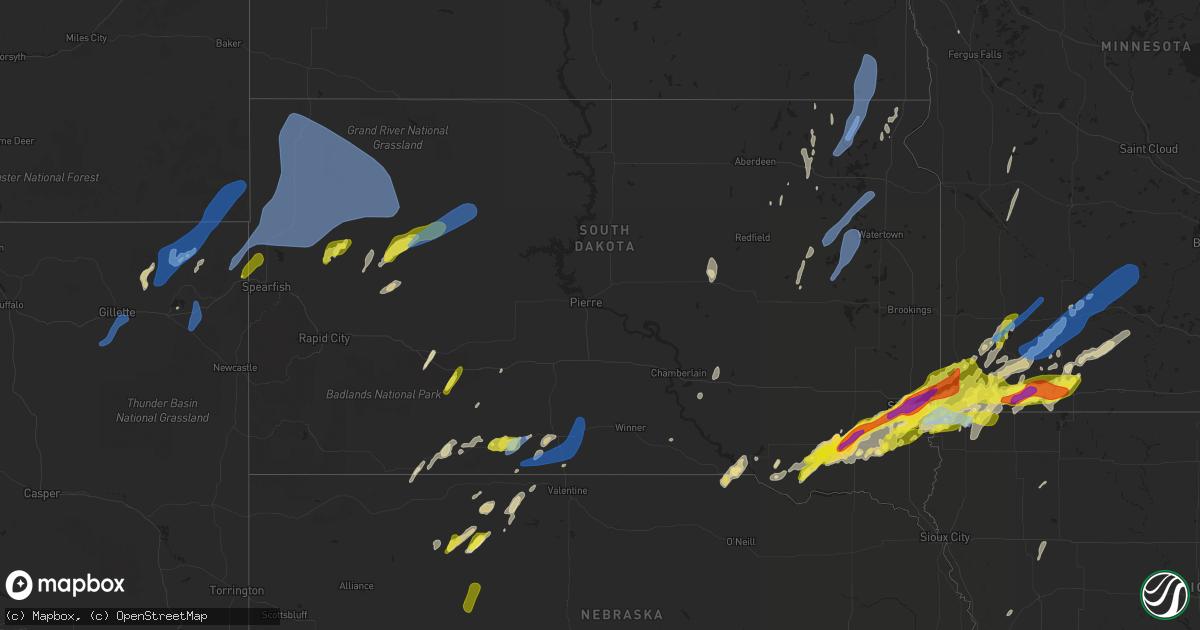
Hail Map in South Dakota on May 28, 2022
Get this storm
May 28 map
$229
one time, instant access
Download today. No call, no setup
Keep the $229
Bought the map and want the full workflow? Apply the entire $229 to a subscription within 7 days. None of it is wasted.
Every map, not just this one
This buys you this map. Subscription and you get every map we run, in the markets you choose from a few cities to whole states to nationwide. Plus real-time alerts the moment a storm fires.
Contact data
Name, contact info, occupancy, even credit band for addresses in the footprint. You go from where it hit to who to call.
Become the source they trust
Unlimited branding weather history reports on demand. You already have the documented answer ready for the property owner, and you are the one who showed up with it.
Property data and RoofTrace estimates
Pull up any address you have got, its value and the exact code rules for that jurisdiction, straight from One Click Code. Then RoofTrace estimates the squares, pitch, and roof value, priced the way you price.
Storm reports in South Dakota
South Dakota
| Date | Description |
|---|---|
| 05/28/20226:56 PM CDT | A local report indicates 64 MPH wind near 27 WNW CASTLE ROCK |
| 05/28/20226:46 PM CDT | A local report indicates 63 MPH wind near 8 N REDIG |
| 05/28/20226:42 PM CDT | A local report indicates 65 MPH wind near 7 WSW HOOVER |
| 05/28/20225:51 PM CDT | A local report indicates 64 MPH wind near 13 NW BELLE FOURCHE |
| 05/28/20224:17 AM CDT | Report via social media. |
| 05/28/20224:15 AM CDT | Corrects previous non-tstm wnd gst report from 1 nne harrisburg. Winds estimated 60 - 70 mph. Some vegetation damage noted due to wind driven pea sized hail. |
| 05/28/20224:12 AM CDT | Report from mping: golf ball |
| 05/28/20224:05 AM CDT | At 905 PM CDT, a severe thunderstorm was located 3 miles south of Antelope, or 4 miles southeast of Mission, moving northeast at 35 mph. HAZARD...70 mph wind gusts and nickel size hail. SOURCE...Radar indicated. IMPACT...Expect considerable tree damage. Damage is likely to mobile homes, roofs, and outbuildings. This severe thunderstorm will be near... Haystack Butte around 915 PM CDT. Hidden Timber around 920 PM CDT.Other locations in the path of this severe thunderstorm includeOkreek, Carter, Mosher and Witten. |
| 05/28/20224:04 AM CDT | Report from mping: hen egg+ |
| 05/28/20224:00 AM CDT | A local report indicates 2.00 inch wind near 2 W SIOUX FALLS |
| 05/28/20223:56 AM CDT | Report from mping: hen egg |
| 05/28/20223:55 AM CDT | A local report indicates 2.00 inch wind near 4 WSW SIOUX FALLS |
| 05/28/20223:30 AM CDT | Mesonet station 310 sd rwis parker. |
| 05/28/20223:29 AM CDT | At 828 PM CDT, severe thunderstorms were located along a line extending from 3 miles north of Parmelee to 3 miles north of Grass Mountain to 5 miles northwest of Kilgore, moving east at 20 mph. HAZARD...60 mph wind gusts and quarter size hail. SOURCE...Radar indicated. IMPACT...Hail damage to vehicles is expected. Expect wind damage to roofs, siding, and trees. Severe thunderstorms will be near... Two Strike around 835 PM CDT. Soldier Creek around 840 PM CDT. Rosebud and Fairgrounds Housing around 845 PM CDT.Other locations in the path of these severe thunderstorms includeRing Thunder, Lakeview, Mission and Antelope. |
| 05/28/20223:05 AM CDT | Mostly nickel sized but a few ping pong sized. |
| 05/28/20222:53 AM CDT | At 752 PM CDT/652 PM MDT/, a severe thunderstorm was located over Medicine Lake, or 32 miles southeast of Martin, moving northeast at 25 mph. HAZARD...Ping pong ball size hail and 60 mph wind gusts. SOURCE...Radar indicated. IMPACT...People and animals outdoors will be injured. Expect hail damage to roofs, siding, windows, and vehicles. Expect wind damage to roofs, siding, and trees. Locations impacted include... Cody, Kilgore, Nenzel, Medicine Lake, Cody Lake, Eli, Steer Creek Campground and Schoolhouse Lake.This includes Highway 20 between mile markers 146 and 178. |
| 05/28/20222:51 AM CDT | At 751 PM MDT, severe thunderstorms were located along a line extending from 7 miles east of Meadow to 2 miles east of Arrow Head Buttes to 6 miles west of Red Scaffold, moving east at 35 mph. HAZARD...60 mph wind gusts and quarter size hail. SOURCE...Radar indicated. IMPACT...Hail damage to vehicles is expected. Expect wind damage to roofs, siding, and trees. Severe thunderstorms will be near... Red Scaffold around 800 PM MDT. Iron Lightning around 805 PM MDT.Other locations in the path of these severe thunderstorms includeThunder Butte, Intersection of Cherry Creek and Sunnybrook Roads,Intersection of Highway 63 and BIA Road 8 and South Eagle Butte. |
| 05/28/20222:40 AM CDT | Report via social media. |
| 05/28/20222:32 AM CDT | Mesonet station 2 lake city |
| 05/28/20222:25 AM CDT | At 721 PM MDT, a severe thunderstorm was located 6 miles southeast of Opal, or 22 miles southwest of Faith, moving northeast at 35 mph. HAZARD...60 mph wind gusts and quarter size hail. SOURCE...Radar indicated. IMPACT...Hail damage to vehicles is expected. Expect wind damage to roofs, siding, and trees. Locations impacted include... Durkee Lake. |
| 05/28/20221:34 AM CDT | Storage building damaged... Hail bailers tipped over... Small branch damage. |
| 05/28/20221:34 AM CDT | Mesonet station 174 clark |
| 05/28/20221:34 AM CDT | 1-inch tree limbs broken; shingles blown off. |
| 05/28/20221:29 AM CDT | At 629 PM MDT/729 PM CDT/, a severe thunderstorm was located 3 miles northeast of Vetal, or 21 miles east of Martin, moving northeast at 25 mph. HAZARD...60 mph wind gusts and quarter size hail. SOURCE...Radar indicated. IMPACT...Hail damage to vehicles is expected. Expect wind damage to roofs, siding, and trees. Locations impacted include... Upper Cut Meat, He Dog, Parmelee and Soldier Creek. |
| 05/28/20221:27 AM CDT | Mesonet station 262 sd rwis bryant se corner sd25/sd28. |
| 05/28/20221:26 AM CDT | At 625 PM MDT, severe thunderstorms were located along a line extending from 6 miles southwest of Ladner to 8 miles southwest of Ralph, moving northeast at 45 mph. HAZARD...60 mph wind gusts and penny size hail. SOURCE...Radar indicated. IMPACT...Expect damage to roofs, siding, and trees. Locations impacted include... Bowman, Hettinger and Scranton. |
| 05/28/20221:20 AM CDT | Storage garage/shed destroyed. Time estimated. Relayed via social media. |
| 05/28/20221:16 AM CDT | At 616 PM MDT, severe thunderstorms were located along a line extending from 4 miles southwest of Ladner to 4 miles southwest of Ralph, moving northeast at 45 mph. HAZARD...70 mph wind gusts and quarter size hail. SOURCE...Radar indicated. IMPACT...Hail damage to vehicles is expected. Expect considerable tree damage. Wind damage is also likely to mobile homes, roofs, and outbuildings. Severe thunderstorms will be near... Ralph around 620 PM MDT. Table Mountain around 630 PM MDT. |
| 05/28/20221:13 AM CDT | At 613 PM MDT, severe thunderstorms were located along a line extending from 3 miles southeast of Slim Buttes to Zeona to 7 miles south of Mud Butte, moving northeast at 40 mph. HAZARD...70 mph wind gusts and quarter size hail. SOURCE...Radar indicated. IMPACT...Hail damage to vehicles is expected. Expect considerable tree damage. Wind damage is also likely to mobile homes, roofs, and outbuildings. Severe thunderstorms will be near... Reva and Sorum around 625 PM MDT.Other locations in the path of these severe thunderstorms includeMaurine, Date, Prairie City, Owen Lake and Bison. |
| 05/28/20221:08 AM CDT | A metal outbuilding was badly damaging from a strong wind gust causing it to collapse. |
| 05/28/202212:57 AM CDT | At 557 PM MDT, a severe thunderstorm was located 7 miles southeast of Cactus Flat, or 13 miles west of Kadoka, moving northeast at 30 mph. HAZARD...60 mph wind gusts and quarter size hail. SOURCE...Radar indicated. IMPACT...Hail damage to vehicles is expected. Expect wind damage to roofs, siding, and trees. Locations impacted include... Kadoka and Nowlin.This includes Interstate 90 in South Dakota between Mile Markers 134and 154. |
| 05/28/202212:45 AM CDT | Mesonet station 6 sd rwis forestburg. |
| 05/28/202212:28 AM CDT | At 528 PM MDT, a severe thunderstorm was located 5 miles west of LaCreek North Housing, or 5 miles northwest of Martin, moving northeast at 35 mph. HAZARD...60 mph wind gusts and quarter size hail. SOURCE...Radar indicated. IMPACT...Hail damage to vehicles is expected. Expect wind damage to roofs, siding, and trees. Locations impacted include... Hisle, Eagle Nest Butte and Long Valley. |
| 05/28/202212:12 AM CDT | Mesonet station 214 sd rwis plankinton. |
| 05/28/202212:08 AM CDT | Corrects previous tstm wnd gst report from 5 w plankinton. Mesonet station 214 sd rwis plankinton. |
| 05/27/202211:04 PM CDT | At 404 PM MDT, severe thunderstorms were located along a line extending from 6 miles southwest of Rockypoint to 4 miles southwest of New Haven to 7 miles southwest of Sundance, moving northeast at 45 mph. HAZARD...60 mph wind gusts and half dollar size hail. SOURCE...Radar indicated. IMPACT...Hail damage to vehicles is expected. Expect wind damage to roofs, siding, and trees. Severe thunderstorms will be near... New Haven around 410 PM MDT. Rockypoint around 415 PM MDT. Lightning Flat and Warren Peak around 420 PM MDT.Other locations in the path of these severe thunderstorms includeCook Lake, Aladdin, Bear Lodge Campground and Colony.This includes Interstate 90 in Wyoming between Mile Markers 170 and201. |
| 05/27/20228:55 PM CDT | A local report indicates 68 MPH wind near 7 ESE ROSEBUD |
| 05/27/20228:35 PM CDT | A local report indicates 59 MPH wind near 7 SSE MEADOW |
| 05/27/20228:32 PM CDT | 50 to 60 mph winds... Pea sized hail |
| 05/27/20228:15 PM CDT | A local report indicates 72 MPH wind near 6 W PARMELEE |
| 05/27/20227:35 PM CDT | A local report indicates 1.00 inch wind near 1 W VETAL |
| 05/27/20227:03 PM CDT | A local report indicates 75 MPH wind near 1 N BUFFALO |
All States Impacted by Hail Map on May 28, 2022
Cities Impacted by Hail Map on May 28, 2022
- Forman, ND
- Hawley, MN
- Mission, SD
- Sisseton, SD
- Saint Francis, SD
- Hulett, WY
- Devils Tower, WY
- Sleepy Eye, MN
- Morgan, MN
- Springfield, MN
- Clements, MN
- Erskine, MN
- Winger, MN
- Gary, MN
- Twin Valley, MN
- Mahnomen, MN
- Ulen, MN
- Fertile, MN
- Mcintosh, MN
- Fosston, MN
- Bejou, MN
- Mentor, MN
- Cody, NE
- Beulah, WY
- Aspermont, TX
- Girard, TX
- Old Glory, TX
- Jayton, TX
- Bingham Lake, MN
- Windom, MN
- Wagner, SD
- Adrian, MN
- Rushmore, MN
- Jackson, MN
- Mountain Lake, MN
- Okeechobee, FL
- Fairfax, SD
- Newell, SD
- Viborg, SD
- Hurley, SD
- Sioux Falls, SD
- Tea, SD
- Harrisburg, SD
- Canton, SD
- Thornwood, NY
- Pleasantville, NY
- Miller, SD
- Ellsworth, MN
- Martin, SD
- Lamberton, MN
- Sanborn, MN
- Parmelee, SD
- Tuthill, SD
- Raymond, SD
- Carpenter, SD
- Andover, SD
- Britton, SD
- Whitman, NE
- Chancellor, SD
- Hialeah, FL
- Miami, FL
- Batesland, SD
- George, IA
- Rock Rapids, IA
- Edgerton, MN
- Hardwick, MN
- Menno, SD
- Irene, SD
- Freeman, SD
- Yale, SD
- Mellette, SD
- Union Center, SD
- Rothsay, MN
- Wanblee, SD
- Milnor, ND
- Belvidere, SD
- New Effington, SD
- Quinn, SD
- Bristol, SD
- Kilgore, NE
- Larchwood, IA
- Platte, SD
- Altus, OK
- Worthing, SD
- Lennox, SD
- Valley Springs, SD
- Renner, SD
- Garretson, SD
- Hartford, SD
- Brandon, SD
- Marion, SD
- Nenzel, NE
- Kenneth, MN
- Wilmont, MN
- Lismore, MN
- Brewster, MN
- Worthington, MN
- Moorcroft, WY
- Gordon, NE
- Gwinner, ND
- Saint Lawrence, SD
- Sundance, WY
- Kadoka, SD
- Weston, WY
- Rozet, WY
- Duke, OK
- Hills, MN
- Butterfield, MN
- Saint James, MN
- Cogswell, ND
- Lake Park, MN
- Waubun, MN
- Slayton, MN
- Woodstock, MN
- Tracy, MN
- Balaton, MN
- Lake Wilson, MN
- Garvin, MN
- Chandler, MN
- Howes, SD
- Wasta, SD
- Enning, SD
- White Owl, SD
- Gregory, SD
- Butte, NE
- Lake Andes, SD
- Spencer, NE
- Huron, SD
- Sebring, FL
- Corinne, UT
- Parker, SD
- Okabena, MN
- Lakefield, MN
- Reading, MN
- Conde, SD
- Merriman, NE
- Allen, SD
- Haledon, NJ
- Paterson, NJ
- Wayne, NJ
- Tyndall, SD
- Avon, SD
- Scotland, SD
- Seymour, TX
- Paducah, TX
- Crowell, TX
- Inwood, IA
- Robinson, KS
- Highland, KS
- Kanaranzi, MN
- Luverne, MN
- Magnolia, MN
- Labelle, FL
- Langford, SD
- Hitterdal, MN
- Centerville, SD
- Heron Lake, MN
- Bigelow, MN
- Little Rock, IA
- Leota, MN
- Humboldt, SD
- Fulda, MN
- Sibley, IA
- Utica, SD
- Jeffers, MN
- Lesterville, SD
- Beaver Creek, MN
- Kaylor, SD
- Lester, IA
- Hanska, MN
- Pipestone, MN
- Iona, MN
- Jasper, MN
- Westbrook, MN
- Olivet, SD
- Davis, SD
- Springfield, SD
- Avoca, MN
- Madelia, MN
- Ocheyedan, IA
- Storden, MN
- Steen, MN
- Round Lake, MN
- Alvord, IA
- Tripp, SD
- Doon, IA
- Ashby, NE
- Mud Butte, SD
- Faith, SD
- Rotan, TX
- Interior, SD
- South Bay, FL
- Montevideo, MN
- Benson, MN
- Schaller, IA
- Arthur, IA
- Galva, IA
- Odebolt, IA
- Starbuck, MN
- Peterson, IA
- Kimball, SD
- Hancock, MN
- Clontarf, MN
- Dante, SD
- Norwalk, CT
- Westport, CT
- Clewiston, FL
- Valentine, NE
- Lake Wales, FL
- Frostproof, FL
- Sturgis, SD
- Belle Fourche, SD
- Quanah, TX
- Dunlap, IA
- Gillette, WY
- Upton, WY
- Ludlow, SD
- Prairie City, SD
- Meadow, SD
- Buffalo, SD
- Bison, SD
- Aladdin, WY
- Reva, SD
- Alzada, MT
- Dupree, SD
- Okreek, SD
- Wood, SD
- Vienna, SD
- Garden City, SD
- Clark, SD
- Henry, SD
- Willow Lake, SD
- Bryant, SD
- Hazel, SD
- Ortley, SD
- Waubay, SD
- Wallace, SD
- Florence, SD
- Webster, SD
- Eden, SD
- Pierpont, SD
- Lake City, SD
- Roslyn, SD
- Wyndmere, ND
- Veblen, SD
- Cayuga, ND
- Lidgerwood, ND
- Dell Rapids, SD
- Crooks, SD
- Baltic, SD
- Beresford, SD
- Hyannis, NE
- Stewart, MN
- Comfrey, MN
- Brownton, MN
- Winthrop, MN
- Fairfax, MN
- Gibbon, MN
- Lafayette, MN
- New Ulm, MN
- Walnut Grove, MN
- Wabasso, MN
- Lucan, MN
- Electra, TX
- Altus Afb, OK


